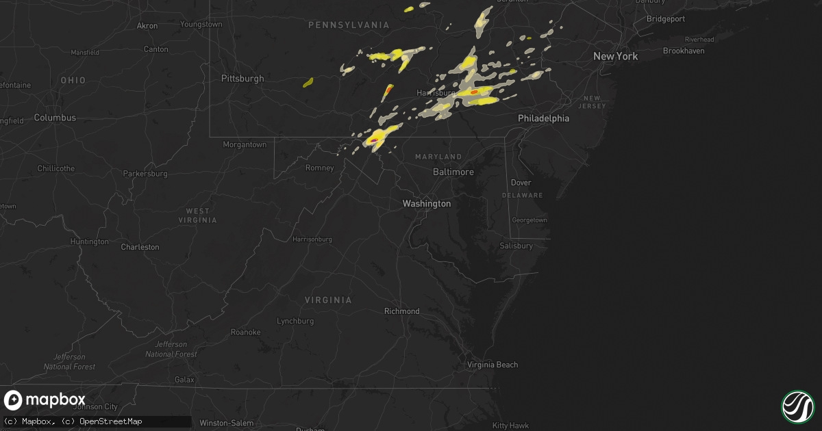
Hail Map in Maryland on May 19, 2019
Get this storm
May 19 map
$229
one time, instant access
Download today. No call, no setup
Keep the $229
Bought the map and want the full workflow? Apply the entire $229 to a subscription within 7 days. None of it is wasted.
Every map, not just this one
This buys you this map. Subscription and you get every map we run, in the markets you choose from a few cities to whole states to nationwide. Plus real-time alerts the moment a storm fires.
Contact data
Name, contact info, occupancy, even credit band for addresses in the footprint. You go from where it hit to who to call.
Become the source they trust
Unlimited branding weather history reports on demand. You already have the documented answer ready for the property owner, and you are the one who showed up with it.
Property data and RoofTrace estimates
Pull up any address you have got, its value and the exact code rules for that jurisdiction, straight from One Click Code. Then RoofTrace estimates the squares, pitch, and roof value, priced the way you price.
Storm reports in Maryland
Maryland
| Date | Description |
|---|---|
| 05/19/20193:08 PM CDT | Several large branches down from strong winds. |
| 05/19/20192:19 PM CDT | A local report indicates 1.00 inch wind near STATE LINE |
| 05/19/20192:18 PM CDT | Updated report |
| 05/19/20192:16 PM CDT | Half dollar size hail |
| 05/19/20192:15 PM CDT | Tree down along broadfording road. |
| 05/19/20192:07 PM CDT | A local report indicates 1.75 inch wind near 2 SSW WARRENTON |
| 05/19/20191:57 PM CDT | A local report indicates 2.00 inch wind near 3 ENE CLEAR SPRING |
| 05/19/20191:53 PM CDT | Tree down along mercersburg road. |
| 05/19/20191:51 PM CDT | A local report indicates 1.50 inch wind near 1 NNE CLEAR SPRING |
| 05/19/20191:47 PM CDT | A local report indicates 1.00 inch wind near 2 W CLEAR SPRING |
| 05/19/201912:07 AM CDT | At 506 PM EDT, a severe thunderstorm was located near Cashtown, moving northeast at 30 mph. Another thunderstorm was developing near Greencastle. HAZARD...60 mph wind gusts and quarter size hail. SOURCE...Radar indicated. IMPACT...Hail damage to vehicles is expected. Expect wind damage to trees, roofs, and siding. Locations impacted include... Waynesboro, Greencastle, Hampton, Guilford, Fayetteville, Lake Meade, Wayne Heights, Mont Alto, Marion, Cashtown, Aspers, Orrtanna, Pine Grove Furnace, State Line, Biglerville, Arendtsville, York Springs, Heidlersburg, Bendersville and Hunterstown.This includes Interstate 81 from mile markers 0 to 11. |
| 05/18/201911:35 PM CDT | At 435 PM EDT, a severe thunderstorm was located over Greencastle, moving northeast at 25 mph. HAZARD...60 mph wind gusts and half dollar size hail. SOURCE...Radar indicated. IMPACT...Hail damage to vehicles is expected. Expect wind damage to trees, roofs, and siding. Locations impacted include... Chambersburg, Waynesboro, Shippensburg, Greencastle, Guilford, Fayetteville, Wayne Heights, Mont Alto, Scotland, Marion, State Line, Quincy, Williamson, Upton and Penn State Mont Alto.This includes Interstate 81 from mile markers 1 to 25. |
| 05/18/201911:07 PM CDT | At 406 PM EDT, a severe thunderstorm was located near Claylick, moving east northeast at 35 mph. HAZARD...70 mph wind gusts and ping pong ball size hail. SOURCE...Radar indicated. IMPACT...People and animals outdoors will be injured. Expect hail damage to roofs, siding, windows, and vehicles. Expect considerable tree damage. Wind damage is also likely to mobile homes, roofs, and outbuildings. This severe thunderstorm will be near... Waynesboro, Greencastle, Wayne Heights and Marion around 420 PM EDT. Mont Alto and Rouzerville around 430 PM EDT.Other locations impacted by this severe thunderstorm include Upton,State Line, Quincy, Penn State Mont Alto and Whitetail Ski Area.This includes Interstate 81 from mile markers 1 to 9. |
| 05/18/201911:00 PM CDT | At 400 PM EDT, a severe thunderstorm was located near Wilson-Conococheague, or 11 miles west of Hagerstown, moving northeast at 25 mph. HAZARD...60 mph wind gusts and quarter size hail. SOURCE...Radar indicated. IMPACT...Damaging winds will cause some trees and large branches to fall. This could injure those outdoors, as well as damage homes and vehicles. Roadways may become blocked by downed trees. Localized power outages are possible. Unsecured light objects may become projectiles. Locations impacted include... Hagerstown, Fountainhead-Orchard Hills, Paramount-Long Meadow, Wilson-Conococheague, Long Meadow, Maugansville, Leitersburg, Clear Spring, Ringgold, Big Spring, Middleburg and Warrenton. |
| 05/18/201910:23 PM CDT | At 323 PM EDT, a severe thunderstorm was located near Greencastle, moving northeast at 20 mph. HAZARD...60 mph wind gusts and half dollar size hail. SOURCE...Radar indicated. IMPACT...Hail damage to vehicles is expected. Expect wind damage to trees, roofs, and siding. This severe thunderstorm will be near... Waynesboro, Wayne Heights and Rouzerville around 340 PM EDT. Mont Alto around 350 PM EDT.Other locations impacted by this severe thunderstorm include StateLine, Quincy and Penn State Mont Alto.This includes Interstate 81 from mile markers 0 to 9. |
| 05/18/20199:42 PM CDT | At 242 PM EDT, a severe thunderstorm was located 7 miles southwest of Claylick, moving northeast at 30 mph. HAZARD...70 mph wind gusts and ping pong ball size hail. SOURCE...Radar indicated. IMPACT...People and animals outdoors will be injured. Expect hail damage to roofs, siding, windows, and vehicles. Expect considerable tree damage. Wind damage is also likely to mobile homes, roofs, and outbuildings. This severe thunderstorm will be near... Claylick and Mercersburg around 300 PM EDT. Greencastle around 310 PM EDT. Waynesboro and Marion around 320 PM EDT. Chambersburg, Fayetteville, Guilford, Mont Alto and Scotland around 330 PM EDT.Other locations impacted by this severe thunderstorm includeWilliamson, Upton, State Line, Quincy, Penn State Mont Alto andWhitetail Ski Area.This includes Interstate 81 from mile markers 1 to 21. |
| 05/18/20199:27 PM CDT | At 227 PM EDT, a severe thunderstorm was located near Warfordsburg, moving northeast at 35 mph. HAZARD...60 mph wind gusts and quarter size hail. SOURCE...Radar indicated. IMPACT...Hail damage to vehicles is expected. Expect wind damage to trees, roofs, and siding. This severe thunderstorm will be near... Needmore around 230 PM EDT. Big Cove Tannery and Claylick around 240 PM EDT. Fort Loudon, McConnellsburg and Mercersburg around 250 PM EDT. St. Thomas around 300 PM EDT.Other locations impacted by this severe thunderstorm includeWilliamson and Whitetail Ski Area.This includes the following Interstates... Interstate 70 from mile markers 166 to 170. The Pennsylvania Turnpike between mile markers 177 and 183...andfrom mile markers 187 to 192. |
| 05/18/20199:07 PM CDT | One tree down on warner rd and one tree down on nicholson rd near ladiesburg |
| 05/18/20198:20 PM CDT | Large tree branch down along woodburn court |
All States Impacted by Hail Map on May 19, 2019
Cities Impacted by Hail Map on May 19, 2019
- Mercersburg, PA
- Mosquero, NM
- Logan, NM
- San Jon, NM
- Caroga Lake, NY
- Corinth, NY
- Northville, NY
- Greenfield Center, NY
- Hadley, NY
- Lake Luzerne, NY
- Queensbury, NY
- Fort Edward, NY
- South Glens Falls, NY
- Gloversville, NY
- Gansevoort, NY
- Wellsboro, PA
- Spearman, TX
- Granville Summit, PA
- Towanda, PA
- Monroeton, PA
- Canton, PA
- Troy, PA
- Jersey Shore, PA
- Lititz, PA
- Manheim, PA
- Lake Charles, LA
- Westlake, LA
- El Dorado, AR
- Stinnett, TX
- Minersville, PA
- Tremont, PA
- Tower City, PA
- Pottsville, PA
- Muir, PA
- Branchdale, PA
- Hegins, PA
- Pine Grove, PA
- Camden, NY
- Shippensburg, PA
- Deridder, LA
- Halifax, PA
- Conchas Dam, NM
- Trinity, TX
- Altoona, PA
- Marietta, PA
- Elizabethtown, PA
- Mount Joy, PA
- Newton, TX
- Wiergate, TX
- Tucumcari, NM
- Eagle Pass, TX
- Lewisberry, PA
- Dover, PA
- Wellsville, PA
- Mcalister, NM
- Elverson, PA
- Pottstown, PA
- Annville, PA
- Taberg, NY
- Rome, NY
- Ava, NY
- Blossvale, NY
- Lee Center, NY
- Wolcott, NY
- York, PA
- East Stroudsburg, PA
- Tamiment, PA
- Bushkill, PA
- Buchanan, VA
- Quemado, TX
- Mifflin, PA
- Mifflintown, PA
- McClure, PA
- Eagle Rock, VA
- Lexington, VA
- Camillus, NY
- Warners, NY
- Syracuse, NY
- Liverpool, NY
- Stratford, CA
- Reading, PA
- Huron, CA
- Adrian, TX
- Huntingdon, PA
- Stafford Springs, CT
- Mont Alto, PA
- Greencastle, PA
- Waynesboro, PA
- State Line, PA
- Clear Spring, MD
- Williamsport, MD
- Big Pool, MD
- Hagerstown, MD
- Fayetteville, PA
- Liberty, PA
- Berwick, PA
- Shickshinny, PA
- Danville, PA
- Chambersburg, PA
- Saint Thomas, PA
- Belvidere, NJ
- Bangor, PA
- Rohwer, AR
- Falls, PA
- Lowville, NY
- Copenhagen, NY
- Crossett, AR
- Hermitage, AR
- Beavertown, PA
- Reedsville, PA
- Milroy, PA
- Beaver Springs, PA
- Holland Patent, NY
- Clinton, LA
- State College, PA
- Pennsylvania Furnace, PA
- Petersburg, PA
- Merryville, LA
- Lovington, IL
- Bethany, IL
- Perryton, TX
- Bethel, PA
- Quincy, PA
- Maugansville, MD
- Orrtanna, PA
- Martinsburg, WV
- Falling Waters, WV
- Hedgesville, WV
- Hartley, TX
- Dumas, TX
- Dalhart, TX
- Stratford, TX
- Leesville, LA
- Manchester, PA
- York Haven, PA
- Wapwallopen, PA
- Hunlock Creek, PA
- Durhamville, NY
- Canastota, NY
- Verona Beach, NY
- Allentown, PA
- Whitehall, PA
- Saint Martinville, LA
- Miami, TX
- Morse, TX
- Booker, TX
- East Waterford, PA
- Blain, PA
- Doylesburg, PA
- Bard, NM
- Bethlehem, PA
- Hellertown, PA
- Hallsville, TX
- Evans, LA
- Kennard, TX
- Greensburg, LA
- Lebanon, PA
- Jim Thorpe, PA
- Lehighton, PA
- Warfordsburg, PA
- Strong, AR
- Spearsville, LA
- Marion, LA
- Terre Hill, PA
- Denver, PA
- Narvon, PA
- New Holland, PA
- Ephrata, PA
- Akron, PA
- East Earl, PA
- Leola, PA
- Stevens, PA
- Birdsboro, PA
- Smithsburg, MD
- Myersville, MD
- Provencal, LA
- Warriors Mark, PA
- Tyrone, PA
- Emerson, AR
- Castorland, NY
- Cogan Station, PA
- Linden, PA
- Trout Run, PA
- Elbridge, NY
- Memphis, NY
- Remsen, NY
- Hershey, PA
- Palmyra, PA
- Newton, NJ
- Frenchtown, NJ
- Milford, NJ
- Erwinna, PA
- Upper Black Eddy, PA
- Myerstown, PA
- Fredericksburg, PA
- Alligator, MS
- Crumrod, AR
- Westernville, NY
- Jasper, TX
- Zavalla, TX
- Shoemakersville, PA
- Girardville, PA
- Ashland, PA
- Newmanstown, PA
- Mount Gretna, PA
- Middletown, PA
- Reinholds, PA
- Robesonia, PA
- Wernersville, PA
- Schaefferstown, PA
- Grady, NM
- Melrose, NM
- Burkeville, TX
- Verona, NY
- Cold Brook, NY
- Hollidaysburg, PA
- Dillsburg, PA
- Mechanicsburg, PA
- Grantham, PA
- Huntington, TX
- Milton, PA
- Great Cacapon, WV
- Bainbridge, PA
- Williamstown, PA
- Mar Lin, PA
- Morgantown, PA
- York Springs, PA
- Richland, PA
- Mount Wolf, PA
- Rehrersburg, PA
- Oley, PA
- Womelsdorf, PA
- Mohnton, PA
- Schuylkill Haven, PA
- Mohrsville, PA
- Ringtown, PA
- Hummelstown, PA
- Fleetwood, PA
- East Berlin, PA
- Hamburg, PA
- Temple, PA
- Bernville, PA
- Etters, PA
- Seltzer, PA
- East Petersburg, PA
- Aspers, PA
- Gardners, PA
- Adamstown, PA
- Boyertown, PA
- Thomasville, PA
- New Cumberland, PA
- Leesport, PA
- Jonestown, PA
- Emigsville, PA
- Bechtelsville, PA
- Stony Creek, NY
- North Ferrisburgh, VT
- Bristol, VT
- Hinesburg, VT
- Charlotte, VT
- Phoenix, NY
- Clay, NY
- Baldwinsville, NY
- Chittenango, NY
- Kirkville, NY
- Middleburg, PA
- Colmesneil, TX
- Croghan, NY
- Quakertown, PA
- Kintnersville, PA
- Richlandtown, PA
- Kaplan, LA
- Diboll, TX
- Spring, TX
- Magnolia, TX
- Port Matilda, PA
- Vega, TX
- Jordan, NY
- Warrensburg, NY
- Belleville, PA
- Berkeley Springs, WV
- Poland, NY
- Big Cove Tannery, PA
- Needmore, PA
- Hancock, MD
- Sunray, TX
- Iowa, LA
- Sulphur, LA
- Boonsboro, MD
- Huntsville, TX
- Kutztown, PA
- Macungie, PA
- Mertztown, PA
- Lyon Station, PA
- Topton, PA
- Breinigsville, PA
- Blandon, PA
- Alburtis, PA
- Lufkin, TX
- Balko, OK
- Floyd, NM
- Taiban, NM
- Wells, NY
- Port Royal, PA
- McAlisterville, PA
- Richfield, PA
- Pine Grove Mills, PA
- Spring Mills, PA
- Boalsburg, PA
- Schnecksville, PA
- Coplay, PA
- Bon Wier, TX
- Tamaqua, PA
- Wakarusa, IN
- Elkhart, IN
- Goshen, IN
- Dauphin, PA
- McGehee, AR
- Gruver, TX
- Pulaski, NY
- Sandy Creek, NY
- Summerdale, PA
- Marysville, PA
- Enola, PA
- Harrisburg, PA
- Biglerville, PA
- Woodstock, NY
- Saugerties, NY
- Nazareth, PA
- Bath, PA
- Sugarloaf, PA
- Bloomsburg, PA
- Nescopeck, PA
- Rock Glen, PA
- Nanticoke, PA
- Zion Grove, PA
- Glen Lyon, PA
- Shavertown, PA
- Dallas, PA
- Carlisle, PA
- Boiceville, NY
- Blossburg, PA
- Earth, TX
- East Syracuse, NY
- Minoa, NY
- Auburn, PA
- Morris Run, PA
- Dry Run, PA
- Concord, PA
- Spring Run, PA
- Paw Paw, WV
- Apple Springs, TX
- Northampton, PA
- Wind Gap, PA
- Danielsville, PA
- Boonville, NY
- Cleveland, NY
- Stittville, NY
- Kunkletown, PA
- Effort, PA
- Kempton, PA
- Lenhartsville, PA
- Orwigsburg, PA
- Beaver, OK
- Coopersburg, PA
- Riegelsville, PA
- Perkasie, PA
- East Greenville, PA
- Palm, PA
- Pennsburg, PA
- Ottsville, PA
- New Iberia, LA
- Selinsgrove, PA
- Ponchatoula, LA
- Jeanerette, LA
- New Tripoli, PA
- Plain Dealing, LA
- Patterson, LA
- Abbeville, LA
- Blairstown, NJ
- Columbia, NJ
- Stroudsburg, PA
- Mount Bethel, PA
- Breaux Bridge, LA
- Livingston Manor, NY
- Parksville, NY
- Benton, LA
- Neelyton, PA
- McConnellsburg, PA
- Fort Loudon, PA
- Fannettsburg, PA
- Athol, NY
- Windham, NY
- Prattsville, NY
- Jewett, NY
- Ashland, NY
- Hensonville, NY
- East Jewett, NY
- Hunter, NY
- Middlebury, IN
- Alba, PA
- Mineral Point, PA
- Johnstown, PA
- Brownstown, PA
- Brodheadsville, PA
- Saylorsburg, PA


