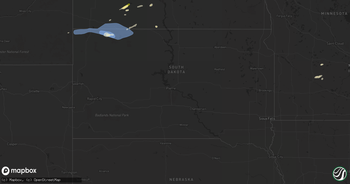
Hail Map in South Dakota on May 17, 2024
Get this storm
May 17 map
$229
one time, instant access
Download today. No call, no setup
Keep the $229
Bought the map and want the full workflow? Apply the entire $229 to a subscription within 7 days. None of it is wasted.
Every map, not just this one
This buys you this map. Subscription and you get every map we run, in the markets you choose from a few cities to whole states to nationwide. Plus real-time alerts the moment a storm fires.
Contact data
Name, contact info, occupancy, even credit band for addresses in the footprint. You go from where it hit to who to call.
Become the source they trust
Unlimited branding weather history reports on demand. You already have the documented answer ready for the property owner, and you are the one who showed up with it.
Property data and RoofTrace estimates
Pull up any address you have got, its value and the exact code rules for that jurisdiction, straight from One Click Code. Then RoofTrace estimates the squares, pitch, and roof value, priced the way you price.
Storm reports in South Dakota
South Dakota
| Date | Description |
|---|---|
| 05/17/20246:40 PM CDT | A local report indicates 69 MPH wind near 10 S Hot Springs |
| 05/17/20246:35 PM CDT | A local report indicates 60 MPH wind near 7 SW Oral |
| 05/17/20246:20 PM CDT | A local report indicates 67 MPH wind near 7 S Shadehill |
| 05/17/20246:18 PM CDT | A local report indicates 75 MPH wind near Shadehill |
| 05/17/20246:10 PM CDT | A local report indicates 70 MPH wind near 10 W Edgemont |
| 05/17/20245:42 PM CDT | A local report indicates 78 MPH wind near 7 NNE Ralph |
| 05/17/20245:40 PM CDT | A local report indicates 72 MPH wind near 14 WNW Lodgepole |
| 05/17/20245:35 PM CDT | A local report indicates 69 MPH wind near 14 WNW Lodgepole |
| 05/17/20245:32 PM CDT | A local report indicates 85 MPH wind near 7 NNE Ralph |
| 05/17/20245:27 PM CDT | A local report indicates 83 MPH wind near 7 NNE Ralph |
| 05/17/20245:22 PM CDT | A local report indicates 74 MPH wind near 7 NNE Ralph |
| 05/17/20244:45 PM CDT | A local report indicates 68 MPH wind near 1 ESE Ladner |
| 05/16/20249:50 PM CDT | Grain bins crumpled. Time estimated based on radar. |
| 05/16/20249:50 PM CDT | Zero visibility in the farm field. |
| 05/16/20249:35 PM CDT | A local report indicates 60 MPH wind near Frederick |
| 05/16/20249:30 PM CDT | A local report indicates 61 MPH wind near 5 NNW Bunker |
| 05/16/20249:25 PM CDT | A local report indicates 58 MPH wind near 1 NW Ipswich |
| 05/16/20249:19 PM CDT | Reported via facebook. |
| 05/16/20249:11 PM CDT | A local report indicates 63 MPH wind near 5 SSW Spring Creek Colo |
| 05/16/20249:02 PM CDT | Mesonet station 216 bowdle |
| 05/16/20248:58 PM CDT | A local report indicates 61 MPH wind near 9 SW Long Lake |
| 05/16/20248:58 PM CDT | A local report indicates 62 MPH wind near 3 E Philip |
| 05/16/20248:55 PM CDT | A local report indicates 59 MPH wind near 1 SW Bowdle |
| 05/16/20248:47 PM CDT | A local report indicates 61 MPH wind near 5 SE Selby |
| 05/16/20248:47 PM CDT | (ab |
| 05/16/20248:47 PM CDT | Shingles torn off a roof. |
| 05/16/20248:47 PM CDT | A local report indicates 65 MPH wind near 4 SE Eureka |
| 05/16/20248:33 PM CDT | A local report indicates 59 MPH wind near 6 W Cottonwood |
| 05/16/20248:23 PM CDT | A local report indicates 63 MPH wind near 2 S Herreid |
| 05/16/20248:22 PM CDT | Asos station kmbg mobridge muni ap. |
| 05/16/20248:15 PM CDT | A local report indicates 68 MPH wind near 4 NW Artas |
| 05/16/20247:40 PM CDT | Mesonet station 293 timber lake |
| 05/16/20247:15 PM CDT | Mesonet station grrs2 bullhead 10 s. Time estimated based on radar. |
| 05/16/20247:02 PM CDT | Trailerhouse rolled over |
| 05/16/20247:01 PM CDT | A local report indicates 58 MPH wind near 12 E Oelrichs |
| 05/16/20247:00 PM CDT | Strongest winds lasted about 10 minutes. |
All States Impacted by Hail Map on May 17, 2024
Cities Impacted by Hail Map on May 17, 2024
- Mathis, TX
- Encinal, TX
- George West, TX
- Sandia, TX
- Rio Grande City, TX
- Laredo, TX
- Beeville, TX
- Hebbronville, TX
- La Joya, TX
- Skidmore, TX
- Penitas, TX
- Mission, TX
- Sullivan City, TX
- San Ygnacio, TX
- Zapata, TX
- Encino, TX
- Woodsboro, TX
- Hidalgo, TX
- Mcallen, TX
- Pharr, TX
- Realitos, TX
- Donna, TX
- San Juan, TX
- Alamo, TX
- Weslaco, TX
- Falfurrias, TX
- Concepcion, TX
- Premont, TX
- Riviera, TX
- Kingsville, TX
- Corpus Christi, TX
- Billings, MT
- Mercedes, TX
- Edinburg, TX
- Progreso, TX
- Brockton, MT
- Lambert, MT
- Fairview, MT
- Curran, MI
- Stanley, ND
- Brewton, AL
- Bad Axe, MI
- Sidney, MT
- Saginaw, MI
- Kenmare, ND
- Culbertson, MT
- Andalusia, AL
- Cartwright, ND
- Bruni, TX
- Mott, ND
- New Leipzig, ND
- Calliham, TX
- Alexander, ND
- Center, ND
- Elgin, ND
- Florala, AL
- Laurel Hill, FL
- Lockhart, AL
- Defuniak Springs, FL
- Arnegard, ND
- Watford City, ND
- Mohall, ND
- Antler, ND
- Maxbass, ND
- Westhope, ND
- Newburg, ND
- Souris, ND
- Samson, AL
- Silverwood, MI
- Mayville, MI
- Ekalaka, MT
- Columbiaville, MI
- Otter Lake, MI
- Caro, MI
- Kingston, MI
- Deford, MI
- Mobile, AL
- Keene, ND
- Theodore, AL
- Lapeer, MI
- Cosmos, MN
- Camp Crook, SD
- Buffalo, SD
- Ludlow, SD
- Brusett, MT
- Sand Springs, MT
- Jordan, MT
- Cohagen, MT
- Hettinger, ND
- Litchfield, MN
- Atwater, MN
- Grove City, MN
- Bird Island, MN
- Fostoria, MI
- Millington, MI
- Carson, ND
- Davison, MI
- Geneva, AL
- Olivia, MN
- Denhoff, ND
- Lodgepole, SD
- Ralph, SD
- Bowman, ND
- Flasher, ND
- Hector, MN
- Bonifay, FL
- Gerald, MO
- Flint, MI
- Lemmon, SD
- Mandaree, ND
- New Town, ND
- Parshall, ND
- Sullivan, MO
- Rosebud, MO
- Remer, MN
- Shepherd, MT
- Grand Blanc, MI
- Goodrich, MI
- Atlas, MI
- Swatara, MN
- Hill City, MN
- Eveleth, MN
- Metamora, MI
- Saint Anthony, ND
- Graceville, FL
- Scranton, ND
- Reeder, ND
- Fairfax, MN
- Gibbon, MN
- Selfridge, ND
- Meigs, GA
- Pelham, GA
- Meadow, SD
- Holly, MI
- Marianna, FL
- Cottondale, FL
- Campbellton, FL
- Ortonville, MI
- Morristown, SD
- Keldron, SD
- Greenwood, FL
- Rolla, MO
- Rocksprings, TX
- Wheeler, MI
- Ithaca, MI
- Ozark, AR
- Junction, TX
- Comstock, TX
- Mulberry, AR
- Grand Ridge, FL
- Moultrie, GA
- Berlin, GA
- Ray City, GA
- Lakeland, GA
- Nashville, GA
- Vassar, MI
- Fenton, MI
- Del Rio, TX
- Lancaster, MN
- Lake Bronson, MN
- Gillette, WY
- Mountain Home, TX
- Palermo, ND
- Berthold, ND
- Moorcroft, WY
- Saint George, GA
- Hilliard, FL
- Callahan, FL
- Lometa, TX
- San Saba, TX
- Lampasas, TX
- Hope Hull, AL
- Montgomery, AL
- McIntosh, AL
- Helena, AR
- Dundee, MS
- Hoxie, AR
- Repton, AL
- Walnut Ridge, AR
- Marianna, AR
- Castleberry, AL
- Lenox, AL
- Evergreen, AL
- Tunica, MS
- Somerville, TN
- Brickeys, AR
- Heth, AR
- Bono, AR
- Cut Off, LA
- Barataria, LA
- Hornsby, TN
- Selmer, TN
- Bethel Springs, TN
- Stantonville, TN
- Adamsville, TN


