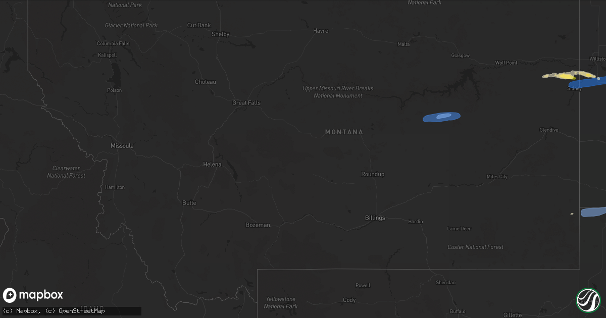
Hail Map in Montana on May 17, 2024
Get this storm
May 17 map
$229
one time, instant access
Download today. No call, no setup
Keep the $229
Bought the map and want the full workflow? Apply the entire $229 to a subscription within 7 days. None of it is wasted.
Every map, not just this one
This buys you this map. Subscription and you get every map we run, in the markets you choose from a few cities to whole states to nationwide. Plus real-time alerts the moment a storm fires.
Contact data
Name, contact info, occupancy, even credit band for addresses in the footprint. You go from where it hit to who to call.
Become the source they trust
Unlimited branding weather history reports on demand. You already have the documented answer ready for the property owner, and you are the one who showed up with it.
Property data and RoofTrace estimates
Pull up any address you have got, its value and the exact code rules for that jurisdiction, straight from One Click Code. Then RoofTrace estimates the squares, pitch, and roof value, priced the way you price.
Storm reports in Montana
Montana
| Date | Description |
|---|---|
| 05/17/20245:05 PM CDT | Dialed into the jordan asos and confirmed a wind observation of 40 kts gusting 64 kts |
| 05/17/20243:30 PM CDT | A local report indicates 60 MPH wind near 1 NNE Sidney |
| 05/17/20243:15 PM CDT | A local report indicates 60 MPH wind near 10 SSE Red Lodge |
| 05/17/20243:05 PM CDT | Mainly quarter size hail with some up to the size of half dollars. Winds gusts no more than 40 mph. Precipitation measured 0.20 inch. |
| 05/17/20242:00 PM CDT | A local report indicates 58 MPH wind near 7 N Busby |
All States Impacted by Hail Map on May 17, 2024
Cities Impacted by Hail Map on May 17, 2024
- Mathis, TX
- Encinal, TX
- George West, TX
- Sandia, TX
- Rio Grande City, TX
- Laredo, TX
- Beeville, TX
- Hebbronville, TX
- La Joya, TX
- Skidmore, TX
- Penitas, TX
- Mission, TX
- Sullivan City, TX
- San Ygnacio, TX
- Zapata, TX
- Encino, TX
- Woodsboro, TX
- Hidalgo, TX
- Mcallen, TX
- Pharr, TX
- Realitos, TX
- Donna, TX
- San Juan, TX
- Alamo, TX
- Weslaco, TX
- Falfurrias, TX
- Concepcion, TX
- Premont, TX
- Riviera, TX
- Kingsville, TX
- Corpus Christi, TX
- Billings, MT
- Mercedes, TX
- Edinburg, TX
- Progreso, TX
- Brockton, MT
- Lambert, MT
- Fairview, MT
- Curran, MI
- Stanley, ND
- Brewton, AL
- Bad Axe, MI
- Sidney, MT
- Saginaw, MI
- Kenmare, ND
- Culbertson, MT
- Andalusia, AL
- Cartwright, ND
- Bruni, TX
- Mott, ND
- New Leipzig, ND
- Calliham, TX
- Alexander, ND
- Center, ND
- Elgin, ND
- Florala, AL
- Laurel Hill, FL
- Lockhart, AL
- Defuniak Springs, FL
- Arnegard, ND
- Watford City, ND
- Mohall, ND
- Antler, ND
- Maxbass, ND
- Westhope, ND
- Newburg, ND
- Souris, ND
- Samson, AL
- Silverwood, MI
- Mayville, MI
- Ekalaka, MT
- Columbiaville, MI
- Otter Lake, MI
- Caro, MI
- Kingston, MI
- Deford, MI
- Mobile, AL
- Keene, ND
- Theodore, AL
- Lapeer, MI
- Cosmos, MN
- Camp Crook, SD
- Buffalo, SD
- Ludlow, SD
- Brusett, MT
- Sand Springs, MT
- Jordan, MT
- Cohagen, MT
- Hettinger, ND
- Litchfield, MN
- Atwater, MN
- Grove City, MN
- Bird Island, MN
- Fostoria, MI
- Millington, MI
- Carson, ND
- Davison, MI
- Geneva, AL
- Olivia, MN
- Denhoff, ND
- Lodgepole, SD
- Ralph, SD
- Bowman, ND
- Flasher, ND
- Hector, MN
- Bonifay, FL
- Gerald, MO
- Flint, MI
- Lemmon, SD
- Mandaree, ND
- New Town, ND
- Parshall, ND
- Sullivan, MO
- Rosebud, MO
- Remer, MN
- Shepherd, MT
- Grand Blanc, MI
- Goodrich, MI
- Atlas, MI
- Swatara, MN
- Hill City, MN
- Eveleth, MN
- Metamora, MI
- Saint Anthony, ND
- Graceville, FL
- Scranton, ND
- Reeder, ND
- Fairfax, MN
- Gibbon, MN
- Selfridge, ND
- Meigs, GA
- Pelham, GA
- Meadow, SD
- Holly, MI
- Marianna, FL
- Cottondale, FL
- Campbellton, FL
- Ortonville, MI
- Morristown, SD
- Keldron, SD
- Greenwood, FL
- Rolla, MO
- Rocksprings, TX
- Wheeler, MI
- Ithaca, MI
- Ozark, AR
- Junction, TX
- Comstock, TX
- Mulberry, AR
- Grand Ridge, FL
- Moultrie, GA
- Berlin, GA
- Ray City, GA
- Lakeland, GA
- Nashville, GA
- Vassar, MI
- Fenton, MI
- Del Rio, TX
- Lancaster, MN
- Lake Bronson, MN
- Gillette, WY
- Mountain Home, TX
- Palermo, ND
- Berthold, ND
- Moorcroft, WY
- Saint George, GA
- Hilliard, FL
- Callahan, FL
- Lometa, TX
- San Saba, TX
- Lampasas, TX
- Hope Hull, AL
- Montgomery, AL
- McIntosh, AL
- Helena, AR
- Dundee, MS
- Hoxie, AR
- Repton, AL
- Walnut Ridge, AR
- Marianna, AR
- Castleberry, AL
- Lenox, AL
- Evergreen, AL
- Tunica, MS
- Somerville, TN
- Brickeys, AR
- Heth, AR
- Bono, AR
- Cut Off, LA
- Barataria, LA
- Hornsby, TN
- Selmer, TN
- Bethel Springs, TN
- Stantonville, TN
- Adamsville, TN


