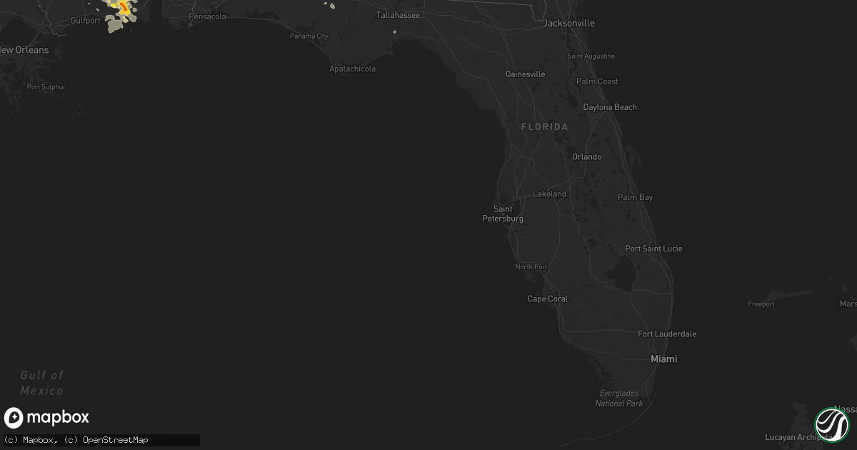
Hail Map in Florida on May 17, 2018
Get this storm
May 17 map
$229
one time, instant access
Download today. No call, no setup
Keep the $229
Bought the map and want the full workflow? Apply the entire $229 to a subscription within 7 days. None of it is wasted.
Every map, not just this one
This buys you this map. Subscription and you get every map we run, in the markets you choose from a few cities to whole states to nationwide. Plus real-time alerts the moment a storm fires.
Contact data
Name, contact info, occupancy, even credit band for addresses in the footprint. You go from where it hit to who to call.
Become the source they trust
Unlimited branding weather history reports on demand. You already have the documented answer ready for the property owner, and you are the one who showed up with it.
Property data and RoofTrace estimates
Pull up any address you have got, its value and the exact code rules for that jurisdiction, straight from One Click Code. Then RoofTrace estimates the squares, pitch, and roof value, priced the way you price.
Storm reports in Florida
Florida
| Date | Description |
|---|---|
| 05/17/20182:28 PM CDT | Tree down on powerlines on williams road just south of apalachee parkway. Time estimated by radar. |
| 05/17/20182:23 PM CDT | Powerlines down across apalachee parkway near harrison hill. Time estimated by radar. |
| 05/17/20182:03 PM CDT | Tree down on shadeville highway. |
| 05/17/20181:57 PM CDT | Trees and powerlines down on sr-267. Time estimated by radar. |
| 05/16/201810:14 PM CDT | At 314 PM EDT, a severe thunderstorm was located near Florida A And M, or 7 miles north of Woodville, moving east at 20 mph. HAZARD...60 mph wind gusts. SOURCE...Radar indicated. IMPACT...Expect damage to roofs, siding, and trees. Locations impacted include... Tallahassee, Ralford Greenway, Apalachee Regional Park, Cody, Chaires Crossroads, Thomas City, Capitola, Fallschase, Chaires, Southwood, Wacissa, Lloyd, Wacissa Springs and Tom Brown Park. |
| 05/16/20189:52 PM CDT | At 252 PM EDT, a severe thunderstorm was located over Crawfordville, moving east at 25 mph. HAZARD...60 mph wind gusts. SOURCE...Radar indicated. IMPACT...Expect damage to roofs, siding, and trees. Locations impacted include... Crawfordville, Woodville, St. Marks, Wakulla, Newport, Shadeville, Leon Sinks, Hyde Park, Wakulla Springs, Vereen, Plum Orchard, Port Leon, Fanlew, Bethel, Natural Bridge and Eight Mile Pond. |
| 05/16/20189:29 PM CDT | At 229 PM CDT, a severe thunderstorm was located 4 miles northeast of Axis, or 7 miles northeast of Creola, moving east at 25 mph. HAZARD...60 mph wind gusts and quarter size hail. SOURCE...Radar indicated. IMPACT...Hail damage to vehicles is expected. Expect wind damage to roofs, siding, and trees. Locations impacted include... Bay Minette, Creola, Stockton, Axis, Movico and I65 And AL 225. |
| 05/16/20189:25 PM CDT | At 225 PM EDT, a severe thunderstorm was located near Pittman, or near Paisley, moving north at 30 mph. HAZARD...60 mph wind gusts and quarter size hail. SOURCE...Radar indicated. IMPACT...Hail damage to vehicles is expected. Expect wind damage to roofs, siding, and trees. Locations impacted include... Eustis, Tavares, Mount Dora, Paisley and Mid Florida Lakes. |
All States Impacted by Hail Map on May 17, 2018
Cities Impacted by Hail Map on May 17, 2018
- McLaughlin, SD
- Borger, TX
- Dimmitt, TX
- Hart, TX
- Arthur, NE
- Paxton, NE
- Sutherland, NE
- Atmore, AL
- Brewton, AL
- Bullhead, SD
- Heidelberg, MS
- Vossburg, MS
- Shubuta, MS
- Laurel, MS
- Diana, TX
- Whitewood, SD
- Lubbock, TX
- Idalou, TX
- Snyder, TX
- Wilson, TX
- Tahoka, TX
- Slaton, TX
- Colony, OK
- Corn, OK
- Masterson, TX
- Otter, MT
- Olive, MT
- Broadus, MT
- Selby, SD
- Eagle Butte, SD
- Leola, SD
- Eureka, SD
- Hosmer, SD
- Glenham, SD
- Ashley, ND
- Bowdle, SD
- Akaska, SD
- Java, SD
- Mound City, SD
- Long Lake, SD
- Dumas, TX
- Channing, TX
- Winchester, TN
- Estill Springs, TN
- Fort Pierre, SD
- Hayes, SD
- Midland, SD
- Quitman, MS
- Padroni, CO
- Leakesville, MS
- State Line, MS
- Hobbs, NM
- Hedley, TX
- Denver City, TX
- Brownfield, TX
- Jal, NM
- Rayville, MO
- Excelsior Springs, MO
- Sanderson, TX
- Dryden, TX
- Odonnell, TX
- Forgan, OK
- Belle Fourche, SD
- Sidney, NE
- Gurley, NE
- Wilmer, AL
- Paducah, KY
- Skellytown, TX
- Stinnett, TX
- Fritch, TX
- Lemmon, SD
- Pierre, SD
- Justiceburg, TX
- Lucedale, MS
- Grand Bay, AL
- Chunchula, AL
- McLain, MS
- Neely, MS
- Semmes, AL
- Citronelle, AL
- Perkinston, MS
- Moss Point, MS
- Gautier, MS
- Pascagoula, MS
- Mobile, AL
- Eight Mile, AL
- Vancleave, MS
- Circle, MT
- Wolf Point, MT
- Silas, AL
- Beaver, OK
- Laverne, OK
- Auburn, KY
- Russellville, KY
- Edgemont, SD
- Custer, SD
- Olton, TX
- Plainview, TX
- Post, TX
- Bay Minette, AL
- Perdido, AL
- Milton, FL
- Potter, NE
- Vale, SD
- Sturgis, SD
- Butler, AL
- Jachin, AL
- Lisman, AL
- Newcastle, WY
- Hot Springs, SD
- Ellendale, ND
- Caputa, SD
- Adairville, KY
- Dalton, NE
- Bellevue, TX
- Kimball, NE
- Selfridge, ND
- New Underwood, SD
- Union Center, SD
- Buffalo, SD
- Newell, SD
- Meadow, SD
- Sikeston, MO
- Clarendon, TX
- Lakeview, TX
- Paducah, TX
- Kress, TX
- Tulia, TX
- Petersburg, TX
- Abernathy, TX
- Lockney, TX
- Hale Center, TX
- Saint Onge, SD
- Goree, TX
- Fort Stockton, TX
- Ridgeview, SD
- Flomot, TX
- Matador, TX
- Waynesboro, MS
- Floydada, TX
- Hermleigh, TX
- Blunt, SD
- Mud Butte, SD
- Turkey, TX
- Rotan, TX
- Harleton, TX
- McIntosh, AL
- Bighorn, MT
- Fredericktown, MO
- Saint Mary, MO
- Perryville, MO
- Guymon, OK
- Olney, TX
- Millry, AL
- Seymour, TX
- Abilene, TX
- Follett, TX
- Taft, TX
- Faith, SD
- Chadron, NE
- Childress, TX
- Cee Vee, TX
- Anadarko, OK
- Fort Cobb, OK
- Century, FL
- McDavid, FL
- Bison, SD
- Friendship, TN
- Arapaho, OK
- Clinton, OK
- Goldsmith, TX
- Carnegie, OK
- Flomaton, AL
- Levelland, TX
- Keystone, SD
- Hermosa, SD
- Sunray, TX
- Wishek, ND
- Zeeland, ND
- Volborg, MT
- Alliance, NE
- Bowie, TX
- Wakpala, SD
- Sweetwater, TX
- Wolfforth, TX
- Spearfish, SD
- Kaycee, WY
- Custer City, OK
- Oelrichs, SD
- Fredonia, ND
- Harrold, SD
- Melvin, AL
- Gilbertown, AL
- Hysham, MT
- Muenster, TX
- Cyril, OK
- Towner, ND
- Fluvanna, TX
- Buckatunna, MS
- Altha, FL
- Marianna, FL
- Higgins, TX
- Vida, MT
- Farmington, KY
- Sedalia, KY
- Mentone, TX
- Fort Peck, MT
- Alamo, TN
- Trenton, TN
- Quail, TX
- Pelican Rapids, MN
- De Kalb, MS
- Fruitdale, AL
- Chatom, AL
- Foss, OK
- Canute, OK
- Jefferson, TX
- Vinegar Bend, AL
- Ropesville, TX
- Oshkosh, NE
- Custer, MT
- Quitaque, TX
- Fletcher, OK
- Strasburg, ND
- Lakeside, NE
- Grass Range, MT
- Dix, NE
- Lemoyne, NE
- Balko, OK
- Quanah, TX
- Arnett, OK
- Solen, ND
- Hereford, TX
- Roundup, MT
- Musselshell, MT
- Bridgeport, NE
- Hydro, OK
- Jay, FL
- Crawfordville, FL
- Booker, TX
- Timber Lake, SD
- Morristown, SD
- Hershey, NE
- Frankville, AL
- Chaffee, MO
- Knox City, TX
- Graham, TX
- Keystone, NE
- Lauderdale, MS
- Toomsuba, MS
- Cuba, AL
- Meridian, MS
- Henrietta, TX
- Flasher, ND
- Camp Crook, SD
- Black Oak, AR
- Lake City, AR
- Monette, AR
- Meadow, TX
- Aspermont, TX
- Franklin, KY
- Hillsboro, TN
- Trail City, SD
- Murdo, SD
- Linton, ND
- Stapleton, NE
- Collinsville, TX
- Gainesville, TX
- Tell, TX
- Crowell, TX
- Silverton, TX
- Roby, TX
- Saucier, MS
- Canadian, TX
- Wichita Falls, TX
- Gothenburg, NE
- O'Brien, TX
- Wanblee, SD
- Kearney, MO
- Wellfleet, NE
- Gadsden, TN
- Bells, TN
- Scenic, SD
- Lavina, MT
- Gering, NE
- Lexington, NE
- Harrisburg, NE
- Elk City, OK
- Albany, TX
- Richton, MS
- Needham, AL
- Toxey, AL
- Muleshoe, TX
- Anson, TX
- Leroy, AL
- Jacksboro, TX
- McIntosh, SD
- Enning, SD
- Plains, KS
- Gordon, NE
- Rushville, NE
- Whitney, NE
- Claude, TX
- Dupree, SD
- Keldron, SD
- Brady, NE
- Kermit, TX
- Alford, FL
- Shallowater, TX
- Isabel, SD
- Eustis, NE
- Cozad, NE
- Dalhart, TX
- Moorefield, NE
- Maxwell, NE
- Curtis, NE
- Mountain View, OK
- Lewistown, MT
- Hamer, ID
- Bushnell, NE
- Tryon, NE
- Lewisburg, KY
- Hemingford, NE
- Wink, TX
- Mount Vernon, AL
- Little River, AL
- Ellsworth, NE
- Stringer, MS
- Bay Springs, MS
- Diberville, MS
- Minatare, NE
- Chappell, NE
- Sherman, TX
- Paragould, AR
- Bono, AR
- Axis, AL
- Stockton, AL
- Mclean, TX
- Oran, MO
- Lehr, ND
- Hamlin, TX
- Caraway, AR
- Rochester, TX
- Hardesty, OK
- Lodgepole, NE
- Broadwater, NE
- Minter City, MS
- Munday, TX
- Friona, TX
- Maywood, NE
- Hammon, OK
- Batesland, SD
- Overton, NE
- Apache, OK
- Gettysburg, SD
- Lewellen, NE
- Kyle, SD
- Shattuck, OK
- Hazelton, ND
- Troy, AL
- Banks, AL
- Pocatello, ID
- Raleigh, MS
- Louin, MS
- Fort Yates, ND
- Cement, OK
- Chickasha, OK
- Sunset, TX
- Valley View, TX
- Portageville, MO
- Lance Creek, WY
- Daleville, MS
- Notrees, TX
- North Platte, NE
- East Prairie, MO
- Ocean Springs, MS
- Manila, AR
- Merriman, NE
- Hooker, OK
- Plains, TX
- Tokio, TX
- Amarillo, TX
- New Raymer, CO
- Stoneham, CO
- Spring Creek, NV
- Nisland, SD
- Little Eagle, SD
- Richmond, MO
- Lawson, MO
- Hinsdale, MT
- Recluse, WY


