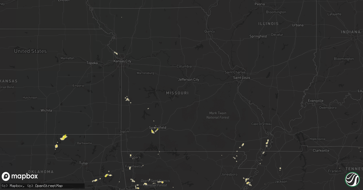
Hail Map in Missouri on May 16, 2018
Get this storm
May 16 map
$229
one time, instant access
Download today. No call, no setup
Keep the $229
Bought the map and want the full workflow? Apply the entire $229 to a subscription within 7 days. None of it is wasted.
Every map, not just this one
This buys you this map. Subscription and you get every map we run, in the markets you choose from a few cities to whole states to nationwide. Plus real-time alerts the moment a storm fires.
Contact data
Name, contact info, occupancy, even credit band for addresses in the footprint. You go from where it hit to who to call.
Become the source they trust
Unlimited branding weather history reports on demand. You already have the documented answer ready for the property owner, and you are the one who showed up with it.
Property data and RoofTrace estimates
Pull up any address you have got, its value and the exact code rules for that jurisdiction, straight from One Click Code. Then RoofTrace estimates the squares, pitch, and roof value, priced the way you price.
Storm reports in Missouri
Missouri
| Date | Description |
|---|---|
| 05/16/20186:39 PM CDT | Pea to quarter size hail reported near primrose and jefferson by local radio media. |
| 05/16/20182:52 AM CDT | At 751 PM CDT, a severe thunderstorm was located over Republic, and is nearly stationary. HAZARD...60 mph wind gusts and quarter size hail. SOURCE...Radar indicated. IMPACT...Hail damage to vehicles is expected. Expect wind damage to roofs, siding, and trees. Locations impacted include... Republic... Battlefield... Clever... Billings... Brookline... Boaz...This includes Interstate 44 near mile marker 69. |
| 05/16/20182:30 AM CDT | Late report. Two large trees uprooted. Time approximate. |
| 05/16/20182:14 AM CDT | At 714 PM CDT, a severe thunderstorm was located near Nixa, and is nearly stationary. HAZARD...60 mph wind gusts and quarter size hail. SOURCE...Radar indicated. IMPACT...Hail damage to vehicles is expected. Expect wind damage to roofs, siding, and trees. Locations impacted include... Nixa... Ozark... Clever... Highlandville... Fremont Hills... Hurley... Boaz... |
| 05/16/20181:39 AM CDT | At 638 PM CDT, a severe thunderstorm was located near Battlefield, moving southwest at 5 mph. HAZARD...60 mph wind gusts and quarter size hail. SOURCE...Radar indicated. IMPACT...Hail damage to vehicles is expected. Expect wind damage to roofs, siding, and trees. Locations impacted include... Southern Springfield... Nixa... Ozark... Battlefield... Fremont Hills... Brookline... Galloway... |
| 05/15/20189:24 PM CDT | At 224 PM CDT, a severe thunderstorm was located near East Prairie, moving south at 15 mph. HAZARD...60 mph wind gusts and quarter size hail. SOURCE...Radar indicated. IMPACT...Hail damage to vehicles is expected. Expect wind damage to roofs, siding, and trees. Locations impacted include... East Prairie. |
| 05/15/20189:09 PM CDT | At 209 PM CDT, a severe thunderstorm was located over Big Oak Tree State Park, moving south at 10 mph. HAZARD...60 mph wind gusts and quarter size hail. SOURCE...Radar indicated. IMPACT...Hail damage to vehicles is expected. Expect wind damage to roofs, siding, and trees. Locations impacted include... Big Oak Tree State Park and Dorena. |
| 05/15/20187:57 PM CDT | Video and pictures from social media indicated nickel to quarter size hail on south side of republic. |
All States Impacted by Hail Map on May 16, 2018
Cities Impacted by Hail Map on May 16, 2018
- Grenora, ND
- Humansville, MO
- Stockton, MO
- Gallion, AL
- Oark, AR
- Dover, AR
- Sturgis, SD
- Piedmont, SD
- Big Spring, TX
- Miami, TX
- Clarksville, AR
- Ozona, TX
- Louin, MS
- Lawrence, MS
- Pampa, TX
- Yerington, NV
- Wilson, AR
- Blue Springs, MS
- New Albany, MS
- Fort Gibson, OK
- Monticello, KY
- Brownsville, TN
- Calhoun, LA
- Farmington, AR
- Prairie Grove, AR
- Ward, AL
- Butler, AL
- Jachin, AL
- Church Point, LA
- Hattieville, AR
- Atkins, AR
- Osceola, AR
- Oktaha, OK
- Muskogee, OK
- Scooba, MS
- Shuqualak, MS
- Deadwood, SD
- Libby, MT
- Tiptonville, TN
- Charleston, AR
- Lavaca, AR
- Rapid City, SD
- Whitewood, SD
- Spearfish, SD
- Nemo, SD
- Greensboro, AL
- Sweet Water, AL
- Humnoke, AR
- Damascus, AR
- Springfield, AR
- Semmes, AL
- Canadian, TX
- Thomaston, AL
- Faunsdale, AL
- Catherine, AL
- Uniontown, AL
- Camden, AL
- Camden, AR
- Fairview, MT
- Heth, AR
- Pittsburg, KS
- Sterling City, TX
- Garden City, TX
- Barnhart, TX
- Mertzon, TX
- Moss Point, MS
- Lucedale, MS
- Rich Hill, MO
- Hume, MO
- Ponca City, OK
- Ozark, AR
- West Point, MS
- Republic, MO
- Clever, MO
- Billings, MO
- Twin Falls, ID
- Tunica, MS
- Theodore, AL
- Mobile, AL
- Ramer, TN
- Mena, AR
- Sledge, MS
- Foley, AL
- Havre, MT
- Garnett, KS
- Summersville, KY
- Magnolia, KY
- Shidler, OK
- Kaw City, OK
- Louisville, MS
- Macon, MS
- Richton, MS
- State Line, MS
- Leakesville, MS
- Neely, MS
- American Falls, ID
- Cecil, AR
- Broseley, MO
- Fisk, MO
- Toxey, AL
- Needham, AL
- Gilbertown, AL
- Chunchula, AL
- Wilmer, AL
- Eight Mile, AL
- Pocahontas, TN
- Selmer, TN
- Hornsby, TN
- Valentine, NE
- Greenbrier, AR
- Baileyville, KS
- Hettinger, ND
- Trenton, TN
- Centreville, AL
- Charleston, MO
- Tahlequah, OK
- Park Hill, OK
- Guntown, MS
- Wamego, KS
- Box Elder, MT
- Onaga, KS
- Cedarbluff, MS
- Starkville, MS
- Pall Mall, TN
- Aberdeen, ID
- Pocatello, ID
- Akron, AL
- Clarendon, AR
- Jay, FL
- Brewton, AL
- Flomaton, AL
- Century, FL
- Gulf Shores, AL
- Laurel, MS
- Pawnee City, NE
- Carbondale, IL
- Corinth, MS
- Michie, TN
- Crawford, TN
- Wilder, TN
- Hulbert, OK
- Bolivar, TN
- Henning, TN
- Drummonds, TN
- Hernando, MS
- Tompkinsville, KY
- Cleveland, AR
- Grand Bay, AL
- Irvington, AL
- Mountainburg, AR
- Glasgow, KY
- Keiser, AR
- Pocahontas, AR
- Maynard, AR
- Pompano Beach, FL
- Westmoreland, KS
- Preston, ID
- Vancleave, MS
- Centerton, AR
- Bentonville, AR
- Platte City, MO
- Kansas City, MO
- Nortonville, KS
- Memphis, TX
- Mulberry, AR
- Chester, AR
- Bethel Springs, TN
- Boise City, OK
- Citronelle, AL
- East Prairie, MO
- Brooksville, MS
- Tallulah, LA
- Greensburg, KY
- Felt, OK
- Huntsville, AR
- Wesley, AR
- Byhalia, MS
- Olive Branch, MS
- West Wendover, NV
- Knob Lick, KY
- Edmonton, KY
- Dyersburg, TN
- Sallisaw, OK
- Oden, AR
- Pencil Bluff, AR
- Brierfield, AL
- Jackson, AL
- Lakeview, TX
- Richards, MO
- Arkadelphia, AR
- Duson, LA
- Scott, LA
- Rayne, LA
- Little River, AL
- New Madrid, MO
- Lancaster, KS
- Saint Onge, SD
- Center, KY
- Raleigh, MS
- Springfield, MO
- Lafayette, TN
- Lafe, AR
- Milan, TN
- Pontotoc, MS
- Safford, AL
- Bay Springs, MS
- Stanberry, MO
- Vermillion, KS
- Hagarville, AR
- Ridgely, TN
- Belle Fourche, SD
- Nixa, MO
- Brookline, MO
- Rogers, AR
- Silas, AL
- Cartwright, ND
- Williston, ND
- Booneville, MS
- Ripley, MS
- Dumas, MS
- Rogersville, AL
- Killen, AL
- Malvern, AR
- Beaumont, MS
- Walker, MO
- Rector, AR
- Piggott, AR
- Antioch, TN
- Pollard, AR
- Asheboro, NC
- Ellisville, MS
- Marland, OK
- Austin, NV
- Canmer, KY
- Hardyville, KY
- Mount Sherman, KY
- Westville, OK
- Big Lake, TX
- Norman, AR
- Mount Ida, AR
- Cullman, AL
- Walnut, MS
- Boynton, OK
- Council Hill, OK
- Saraland, AL
- Middleton, TN
- Magazine, AR
- Havana, AR
- Effingham, KS
- Guntersville, AL
- Carlisle, AR
- Poplar Bluff, MO
- Qulin, MO
- Lamar, AR
- Forkland, AL
- Northport, WA
- Wagarville, AL
- Stuttgart, AR
- Golden Meadow, LA
- Linden, AL
- Danville, AR
- Hampton, AR
- Omaha, AR
- Knobel, AR
- Marmaduke, AR
- Royal, AR
- Graysville, AL
- Caddo Gap, AR
- Glenwood, AR
- Repton, AL
- Goff, KS
- Leroy, AL
- Saint Stephens, AL
- Willard, MO
- Center Ridge, AR
- Axtell, KS
- Kenton, OK
- Montello, NV
- Chinook, MT
- Baker, MT
- Ekalaka, MT
- Box Elder, SD


