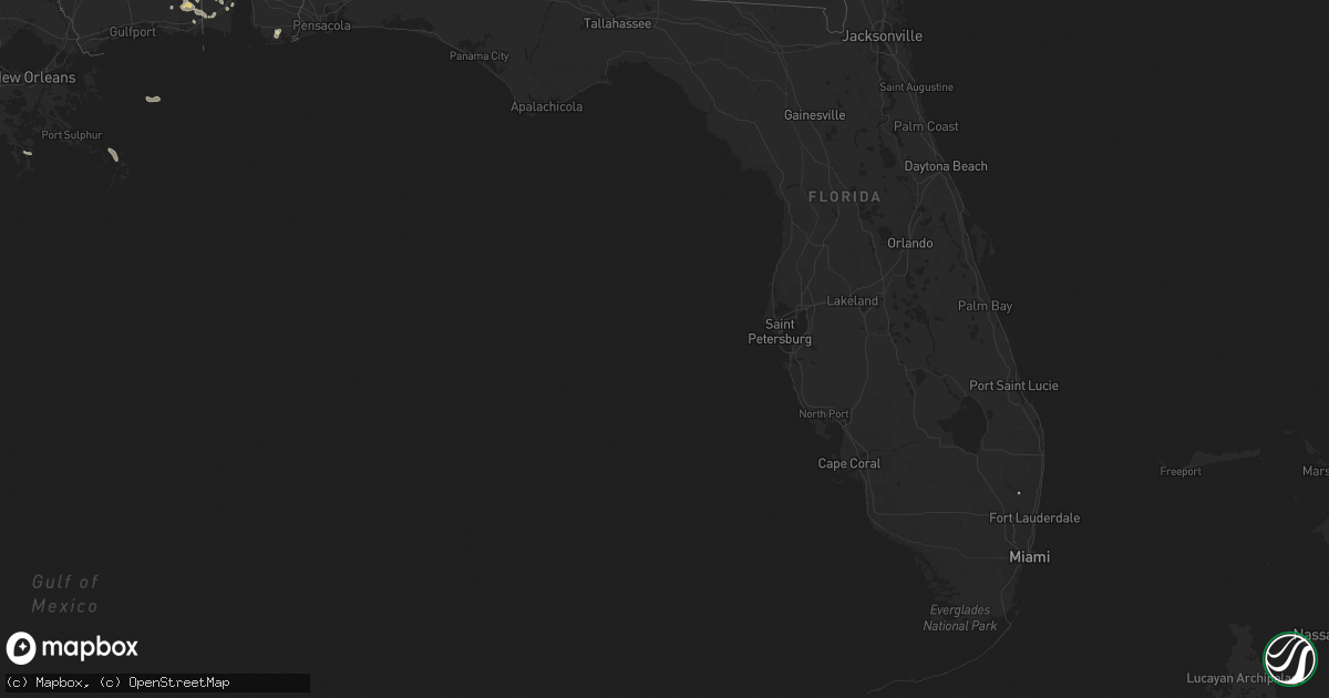
Hail Map in Florida on May 16, 2018
Get this storm
May 16 map
$229
one time, instant access
Download today. No call, no setup
Keep the $229
Bought the map and want the full workflow? Apply the entire $229 to a subscription within 7 days. None of it is wasted.
Every map, not just this one
This buys you this map. Subscription and you get every map we run, in the markets you choose from a few cities to whole states to nationwide. Plus real-time alerts the moment a storm fires.
Contact data
Name, contact info, occupancy, even credit band for addresses in the footprint. You go from where it hit to who to call.
Become the source they trust
Unlimited branding weather history reports on demand. You already have the documented answer ready for the property owner, and you are the one who showed up with it.
Property data and RoofTrace estimates
Pull up any address you have got, its value and the exact code rules for that jurisdiction, straight from One Click Code. Then RoofTrace estimates the squares, pitch, and roof value, priced the way you price.
Storm reports in Florida
Florida
| Date | Description |
|---|---|
| 05/16/20184:50 PM CDT | Billboard sign was blown down near i-95 and old kings road. The time given was based on radar. |
| 05/16/20184:30 PM CDT | Ema relayed report from citizen of downburst straight line winds producing multiple downed tree limbs and tore section of metal roof with parts of rafters attached from |
| 05/16/20184:25 PM CDT | Emergency manager relayed report from southern flagler county relay wildlife management area trained spotter estimated winds of 55 mph and multiple tree limbs downed. |
| 05/16/20183:45 PM CDT | Tree fell across international golf parkway about 1 mile west of u.s 1. Time estimated from radar. |
| 05/16/201812:43 AM CDT | At 543 PM EDT, a severe thunderstorm was located over Bunnell, moving northeast at 45 mph. HAZARD...60 mph wind gusts. SOURCE...Radar indicated. IMPACT...Expect damage to roofs, siding, and trees. Locations impacted include... Palm Coast, Flagler Beach, Bunnell, Marineland, Beverly Beach and Espanola. |
| 05/16/201812:19 AM CDT | At 518 PM EDT, a severe thunderstorm was located 7 miles east of Pierson, moving north at 45 mph. HAZARD...60 mph wind gusts. SOURCE...Radar indicated. IMPACT...Expect damage to roofs, siding, and trees. Locations impacted include... Flagler Beach, Bunnell and Beverly Beach. |
| 05/16/201812:14 AM CDT | At 513 PM EDT, a severe thunderstorm was located near DeLeon Springs, moving northeast at 30 mph. HAZARD...60 mph wind gusts. SOURCE...Radar indicated. IMPACT...Expect damage to roofs, siding, and trees. Locations impacted include... Daytona Beach, Pierson, Barberville, DeLeon Springs and Ormond-By-the-Sea. |
| 05/15/201811:31 PM CDT | At 431 PM EDT, a severe thunderstorm was located 7 miles northeast of Federal Point, or 7 miles northeast of Hastings, moving northeast at 50 mph. HAZARD...60 mph wind gusts. SOURCE...Radar indicated. IMPACT...Expect damage to roofs, siding, and trees. Locations impacted include... Saint Augustine, Hastings, East Palatka, Federal Point, Saint Augustine Shores, Orange Mills, Butler Beach, Saint Augustine South, Vilano Beach and Spuds. |
| 05/15/201810:37 PM CDT | At 335 PM EDT, severe thunderstorms were located along a line extending from 13 miles northwest of Coral Springs to near Miccosukee Resort, moving east at 15 mph. HAZARD...60 mph wind gusts and quarter size hail. SOURCE...Radar indicated. IMPACT...Hail damage to vehicles is expected. Expect wind damage to roofs, siding, and trees. Locations impacted include... Miami, Hialeah, Pembroke Pines, Miramar and Coral Springs. |
| 05/15/201810:21 PM CDT | At 321 PM EDT, a severe thunderstorm was located near Starke, moving northeast at 30 mph. HAZARD...60 mph wind gusts. SOURCE...Radar indicated. IMPACT...Expect damage to roofs, siding, and trees. Locations impacted include... Starke, Keystone Heights, Kingsley, New River, Lake Geneva, Sampson, Camp Blanding, Lawtey and Hampton. |
All States Impacted by Hail Map on May 16, 2018
Cities Impacted by Hail Map on May 16, 2018
- Grenora, ND
- Humansville, MO
- Stockton, MO
- Gallion, AL
- Oark, AR
- Dover, AR
- Sturgis, SD
- Piedmont, SD
- Big Spring, TX
- Miami, TX
- Clarksville, AR
- Ozona, TX
- Louin, MS
- Lawrence, MS
- Pampa, TX
- Yerington, NV
- Wilson, AR
- Blue Springs, MS
- New Albany, MS
- Fort Gibson, OK
- Monticello, KY
- Brownsville, TN
- Calhoun, LA
- Farmington, AR
- Prairie Grove, AR
- Ward, AL
- Butler, AL
- Jachin, AL
- Church Point, LA
- Hattieville, AR
- Atkins, AR
- Osceola, AR
- Oktaha, OK
- Muskogee, OK
- Scooba, MS
- Shuqualak, MS
- Deadwood, SD
- Libby, MT
- Tiptonville, TN
- Charleston, AR
- Lavaca, AR
- Rapid City, SD
- Whitewood, SD
- Spearfish, SD
- Nemo, SD
- Greensboro, AL
- Sweet Water, AL
- Humnoke, AR
- Damascus, AR
- Springfield, AR
- Semmes, AL
- Canadian, TX
- Thomaston, AL
- Faunsdale, AL
- Catherine, AL
- Uniontown, AL
- Camden, AL
- Camden, AR
- Fairview, MT
- Heth, AR
- Pittsburg, KS
- Sterling City, TX
- Garden City, TX
- Barnhart, TX
- Mertzon, TX
- Moss Point, MS
- Lucedale, MS
- Rich Hill, MO
- Hume, MO
- Ponca City, OK
- Ozark, AR
- West Point, MS
- Republic, MO
- Clever, MO
- Billings, MO
- Twin Falls, ID
- Tunica, MS
- Theodore, AL
- Mobile, AL
- Ramer, TN
- Mena, AR
- Sledge, MS
- Foley, AL
- Havre, MT
- Garnett, KS
- Summersville, KY
- Magnolia, KY
- Shidler, OK
- Kaw City, OK
- Louisville, MS
- Macon, MS
- Richton, MS
- State Line, MS
- Leakesville, MS
- Neely, MS
- American Falls, ID
- Cecil, AR
- Broseley, MO
- Fisk, MO
- Toxey, AL
- Needham, AL
- Gilbertown, AL
- Chunchula, AL
- Wilmer, AL
- Eight Mile, AL
- Pocahontas, TN
- Selmer, TN
- Hornsby, TN
- Valentine, NE
- Greenbrier, AR
- Baileyville, KS
- Hettinger, ND
- Trenton, TN
- Centreville, AL
- Charleston, MO
- Tahlequah, OK
- Park Hill, OK
- Guntown, MS
- Wamego, KS
- Box Elder, MT
- Onaga, KS
- Cedarbluff, MS
- Starkville, MS
- Pall Mall, TN
- Aberdeen, ID
- Pocatello, ID
- Akron, AL
- Clarendon, AR
- Jay, FL
- Brewton, AL
- Flomaton, AL
- Century, FL
- Gulf Shores, AL
- Laurel, MS
- Pawnee City, NE
- Carbondale, IL
- Corinth, MS
- Michie, TN
- Crawford, TN
- Wilder, TN
- Hulbert, OK
- Bolivar, TN
- Henning, TN
- Drummonds, TN
- Hernando, MS
- Tompkinsville, KY
- Cleveland, AR
- Grand Bay, AL
- Irvington, AL
- Mountainburg, AR
- Glasgow, KY
- Keiser, AR
- Pocahontas, AR
- Maynard, AR
- Pompano Beach, FL
- Westmoreland, KS
- Preston, ID
- Vancleave, MS
- Centerton, AR
- Bentonville, AR
- Platte City, MO
- Kansas City, MO
- Nortonville, KS
- Memphis, TX
- Mulberry, AR
- Chester, AR
- Bethel Springs, TN
- Boise City, OK
- Citronelle, AL
- East Prairie, MO
- Brooksville, MS
- Tallulah, LA
- Greensburg, KY
- Felt, OK
- Huntsville, AR
- Wesley, AR
- Byhalia, MS
- Olive Branch, MS
- West Wendover, NV
- Knob Lick, KY
- Edmonton, KY
- Dyersburg, TN
- Sallisaw, OK
- Oden, AR
- Pencil Bluff, AR
- Brierfield, AL
- Jackson, AL
- Lakeview, TX
- Richards, MO
- Arkadelphia, AR
- Duson, LA
- Scott, LA
- Rayne, LA
- Little River, AL
- New Madrid, MO
- Lancaster, KS
- Saint Onge, SD
- Center, KY
- Raleigh, MS
- Springfield, MO
- Lafayette, TN
- Lafe, AR
- Milan, TN
- Pontotoc, MS
- Safford, AL
- Bay Springs, MS
- Stanberry, MO
- Vermillion, KS
- Hagarville, AR
- Ridgely, TN
- Belle Fourche, SD
- Nixa, MO
- Brookline, MO
- Rogers, AR
- Silas, AL
- Cartwright, ND
- Williston, ND
- Booneville, MS
- Ripley, MS
- Dumas, MS
- Rogersville, AL
- Killen, AL
- Malvern, AR
- Beaumont, MS
- Walker, MO
- Rector, AR
- Piggott, AR
- Antioch, TN
- Pollard, AR
- Asheboro, NC
- Ellisville, MS
- Marland, OK
- Austin, NV
- Canmer, KY
- Hardyville, KY
- Mount Sherman, KY
- Westville, OK
- Big Lake, TX
- Norman, AR
- Mount Ida, AR
- Cullman, AL
- Walnut, MS
- Boynton, OK
- Council Hill, OK
- Saraland, AL
- Middleton, TN
- Magazine, AR
- Havana, AR
- Effingham, KS
- Guntersville, AL
- Carlisle, AR
- Poplar Bluff, MO
- Qulin, MO
- Lamar, AR
- Forkland, AL
- Northport, WA
- Wagarville, AL
- Stuttgart, AR
- Golden Meadow, LA
- Linden, AL
- Danville, AR
- Hampton, AR
- Omaha, AR
- Knobel, AR
- Marmaduke, AR
- Royal, AR
- Graysville, AL
- Caddo Gap, AR
- Glenwood, AR
- Repton, AL
- Goff, KS
- Leroy, AL
- Saint Stephens, AL
- Willard, MO
- Center Ridge, AR
- Axtell, KS
- Kenton, OK
- Montello, NV
- Chinook, MT
- Baker, MT
- Ekalaka, MT
- Box Elder, SD


