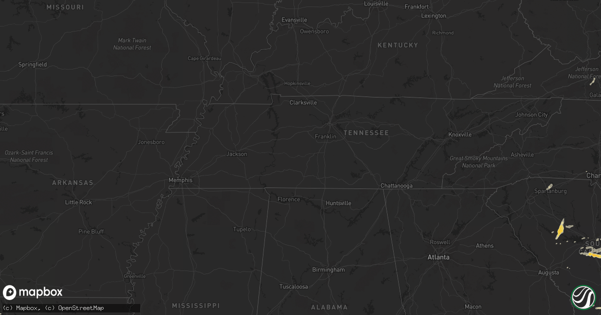
Hail Map in South Carolina on May 15, 2012
Get this storm
May 15 map
$229
one time, instant access
Download today. No call, no setup
Keep the $229
Bought the map and want the full workflow? Apply the entire $229 to a subscription within 7 days. None of it is wasted.
Every map, not just this one
This buys you this map. Subscription and you get every map we run, in the markets you choose from a few cities to whole states to nationwide. Plus real-time alerts the moment a storm fires.
Contact data
Name, contact info, occupancy, even credit band for addresses in the footprint. You go from where it hit to who to call.
Become the source they trust
Unlimited branding weather history reports on demand. You already have the documented answer ready for the property owner, and you are the one who showed up with it.
Property data and RoofTrace estimates
Pull up any address you have got, its value and the exact code rules for that jurisdiction, straight from One Click Code. Then RoofTrace estimates the squares, pitch, and roof value, priced the way you price.
Storm reports in South Carolina
South Carolina
| Date | Description |
|---|---|
| 05/15/20126:01 PM CDT | Highway patrol reported trees down near the intersection of seymour road and sargent road. |
| 05/15/20125:57 PM CDT | Highway patrol reported trees down along highway 261 and catchall road. |
| 05/15/20125:44 PM CDT | Dorchester county 911 relayed report from firefighter of dime to quarter size hail and gusty winds. |
| 05/15/20125:21 PM CDT | Highway patrol reported trees down screaming eagle road and hwy 601. |
| 05/15/20125:18 PM CDT | Highway patrol reported trees down near the intersection of screaming eagle road and koon road. |
| 05/15/20125:10 PM CDT | Highway patrol reported trees down along interstate 95 between mile marker 107 and mile marker 109. |
| 05/15/20125:04 PM CDT | Public reported quarter size hail west of newberry from the cell that produced golf ball size hail in silverstreet earlier. |
| 05/15/20125:00 PM CDT | Public reported nickel to quarter size hail near santee. |
| 05/15/20124:46 PM CDT | Highway patrol reported trees down in silverstreet along highway 34 and also along werts road and deadfall road. |
| 05/15/20124:42 PM CDT | A local report indicates 1.75 inch wind near SILVERSTREET |
| 05/15/20123:43 PM CDT | Highway patrol reported trees down near bachman chapel road and interstate 26. |
| 05/15/20123:41 PM CDT | Public reported quarter size hail along griffin road. |
| 05/15/20122:24 PM CDT | Tree down blocking sandy ford road near the intersection with country oak road. Time estimated by radar. |
| 05/15/20122:20 PM CDT | Hail ranging in size from dime to quarter sized fell from parris bridge road to around hidden springs drive with some of the larger hail around taft drive in the storm |
| 05/15/20122:05 PM CDT | Hail to the size of quarters was reported. The hail lasted for 10 minutes. |
| 05/15/20121:25 PM CDT | A local report indicates 1.00 inch wind near 2 NNE CONWAY |
| 05/15/20121:05 PM CDT | Nickel to quarter size hail fell at plantersville elementary school |
| 05/14/20128:18 PM CDT | Public reported hail up to quarter size that covered the ground. |
| 05/14/20127:58 PM CDT | Public reported quarter size hail along boone lane. |
| 05/14/20127:45 PM CDT | Public reported quarter to golf ball size. |
| 05/14/20127:38 PM CDT | Public reported nickel to quarter size hail that partially covered the ground on tiverton church road. |
| 05/14/20127:24 PM CDT | Quarter size hail reported along north williston road. |
All States Impacted by Hail Map on May 15, 2012
Cities Impacted by Hail Map on May 15, 2012
- Saint Francis, WI
- Cudahy, WI
- Woodsboro, TX
- Bayside, TX
- Jacksonville, FL
- Gilmer, TX
- Roanoke Rapids, NC
- Windsor, VA
- Townsend, GA
- Riceboro, GA
- Springfield, GA
- Lumberton, NC
- Saint Augustine, FL
- Palm Coast, FL
- Brookfield, WI
- Richmond Hill, GA
- Jefferson, TX
- Spartanburg, SC
- Boiling Springs, SC
- Aransas Pass, TX
- Rockport, TX
- Port Aransas, TX
- New Smyrna Beach, FL
- De Kalb, TX
- Simms, TX
- Longview, TX
- Swansea, SC
- Gaston, SC
- Saint Matthews, SC
- Princeton, NC
- Smithfield, NC
- Four Oaks, NC
- Chesnee, SC
- Vivian, LA
- Mooringsport, LA
- Lexington, SC
- Fernandina Beach, FL
- Conway, SC
- White Oak, GA
- Sarita, TX
- Armstrong, TX
- Newberry, SC
- Silverstreet, SC
- Santee, SC
- Wedgefield, SC
- Georgetown, SC
- Andrews, SC
- Hilliard, FL
- Columbia, SC
- Parrish, FL
- Lithia, FL
- Wilson, NC
- Lucama, NC
- Milwaukee, WI
- Kinards, SC
- Patrick Afb, FL
- Merritt Island, FL
- Walterboro, SC
- Blounts Creek, NC
- Jesup, GA
- Irmo, SC
- Wytheville, VA
- Max Meadows, VA
- Saluda, SC
- Dillon, SC
- Brownsboro, TX
- Daytona Beach, FL
- Stafford, VA
- Lake Placid, FL
- Edgewater, FL
- Oak Hill, FL
- Osteen, FL
- Taft, TX
- Eastover, SC
- Gadsden, SC
- Hazlehurst, GA
- Saint George, SC
- Boston, GA
- Tallahassee, FL
- Thomasville, GA
- Monticello, FL
- New Windsor, IL
- Summerton, SC
- Gladewater, TX
- Winona, TX
- Savannah, GA
- Hardeeville, SC
- Pooler, GA
- Port Wentworth, GA
- Ridgeland, SC
- Florence, SC
- Woodbine, GA
- Mount Gilead, NC
- Louisburg, NC
- Youngsville, NC
- Harleyville, SC
- Dorchester, SC
- Darlington, SC
- Saint George, GA
- Brunswick, GA
- Waukesha, WI
- Blenheim, SC
- Loris, SC
- Rincon, GA
- Fairmont, NC
- Wake Forest, NC
- Holton, MI
- Middleburg, FL
- Doerun, GA
- Titusville, FL
- Mims, FL
- Whiteville, NC
- Latta, SC
- Sellers, SC
- Sedley, VA
- Whitmire, SC
- Clinton, NC
- Faison, NC
- Nichols, SC
- Orrum, NC
- Waldo, FL
- Gainesville, FL
- Pewaukee, WI
- Ivanhoe, VA
- Orange Grove, TX
- San Diego, TX
- George West, TX
- Hastings, FL
- Caret, VA
- Windsor, SC
- Bunnell, FL
- Flagler Beach, FL
- Hughesville, MD
- Bryantown, MD
- Tyler, TX
- Smithfield, VA
- Pomaria, SC
- Charlotte Hall, MD
- Starke, FL
- Fredericksburg, VA
- Fort Stewart, GA
- Holly Hill, SC
- Vance, SC
- Orlando, FL
- West Columbia, SC
- Hopkins, SC
- Pelion, SC
- Galveston, TX
- Spotsylvania, VA
- Richardsville, VA
- Hallsboro, NC
- Lawtey, FL
- Hemingway, SC
- Gladwin, MI
- Callahan, FL
- Yulee, FL
- Melrose, FL
- Hawthorne, FL
- Waverly, GA
- Alma, GA
- Nicholls, GA
- Baxley, GA
- Elkton, FL
- Ridgeville, SC
- Summerville, SC
- Hesperia, MI
- Green Sea, SC
- Mechanicsville, MD
- Sebring, FL
- Yemassee, SC
- Varnville, SC
- Lugoff, SC
- Rembert, SC
- Gordonsville, VA
- Louisa, VA
- Folkston, GA
- Chappells, SC
- Society Hill, SC
- Lake Butler, FL
- Raiford, FL
- Ormond Beach, FL
- Sylvester, GA
- Darien, GA
- Hortense, GA
- Okeechobee, FL
- Riegelwood, NC
- Newburg, MD
- Carrsville, VA
- Franklin, VA
- Prosperity, SC
- Montague, MI
- Whitehall, MI
- Waynesville, GA
- Hart, MI
- Pentwater, MI
- Elloree, SC
- Walkerville, MI
- Ludowici, GA
- Oviedo, FL
- Salters, SC
- Bitely, MI
- Nanjemoy, MD
- Newton Grove, NC
- Gilbert, SC
- Leesville, SC
- Carrollton, VA
- Aiken, SC
- Gastonia, NC
- Lake Waccamaw, NC
- Sumter, SC


