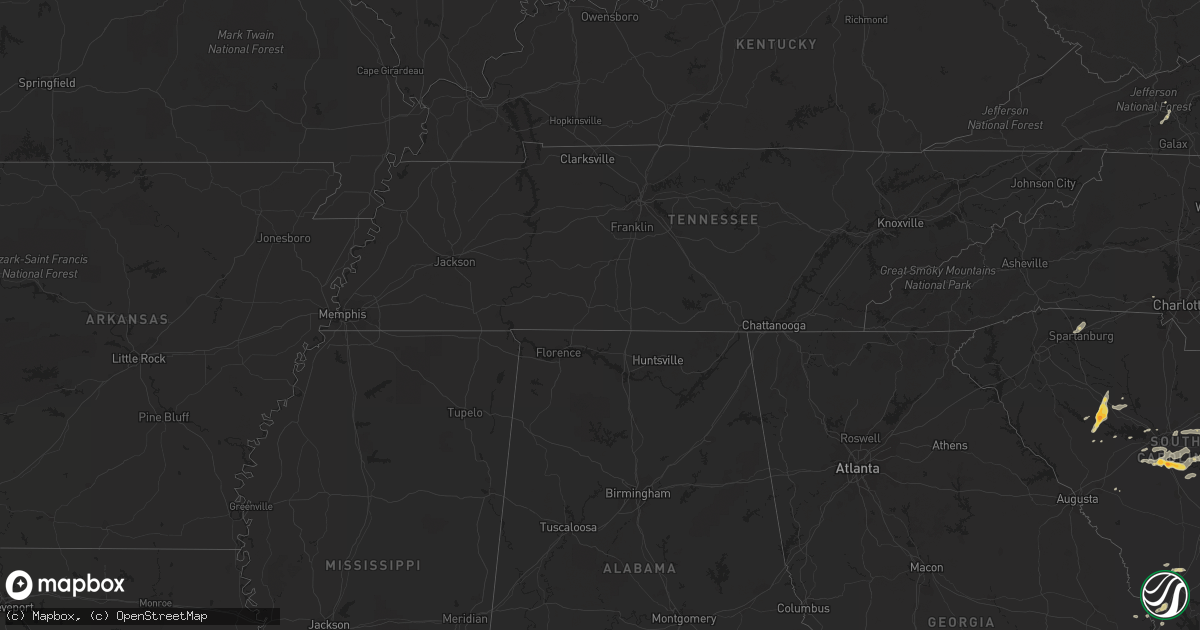
Hail Map on May 15, 2012
Get this storm
May 15 map
$229
one time, instant access
Download today. No call, no setup
Keep the $229
Bought the map and want the full workflow? Apply the entire $229 to a subscription within 7 days. None of it is wasted.
Every map, not just this one
This buys you this map. Subscription and you get every map we run, in the markets you choose from a few cities to whole states to nationwide. Plus real-time alerts the moment a storm fires.
Contact data
Name, contact info, occupancy, even credit band for addresses in the footprint. You go from where it hit to who to call.
Become the source they trust
Unlimited branding weather history reports on demand. You already have the documented answer ready for the property owner, and you are the one who showed up with it.
Property data and RoofTrace estimates
Pull up any address you have got, its value and the exact code rules for that jurisdiction, straight from One Click Code. Then RoofTrace estimates the squares, pitch, and roof value, priced the way you price.
States Impacted by Hail Map on May 15, 2012
Storm reports
North Carolina
| Date | Description |
|---|---|
| 05/15/20126:50 PM CDT | A franklin county airport employee reports that a strong thunderstorm wind gust...estimated up to 60 mph...blew a parked aircraft off its pad and displaced it several f |
| 05/15/20124:56 PM CDT | Quarter size hail was reported along airport blvd near merch rd. |
| 05/15/20124:09 PM CDT | Quarter size hail reported at kornegay farm. |
| 05/15/20123:50 PM CDT | State park employee observed trees down along boys camp road. |
| 05/15/20123:20 PM CDT | Dime to quarter size hail fell for about 5 minutes and briefly covered the ground |
| 05/15/201212:30 PM CDT | Dime to quarter size hail fell for approximately 2 minutes |
| 05/15/201212:22 AM CDT | Large branches broken off tree. |
| 05/15/201212:22 AM CDT | Trees and powerlines down on vance street and sherry lane. |
South Carolina
| Date | Description |
|---|---|
| 05/15/20126:01 PM CDT | Highway patrol reported trees down near the intersection of seymour road and sargent road. |
| 05/15/20125:57 PM CDT | Highway patrol reported trees down along highway 261 and catchall road. |
| 05/15/20125:44 PM CDT | Dorchester county 911 relayed report from firefighter of dime to quarter size hail and gusty winds. |
| 05/15/20125:21 PM CDT | Highway patrol reported trees down screaming eagle road and hwy 601. |
| 05/15/20125:18 PM CDT | Highway patrol reported trees down near the intersection of screaming eagle road and koon road. |
| 05/15/20125:10 PM CDT | Highway patrol reported trees down along interstate 95 between mile marker 107 and mile marker 109. |
| 05/15/20125:04 PM CDT | Public reported quarter size hail west of newberry from the cell that produced golf ball size hail in silverstreet earlier. |
| 05/15/20125:00 PM CDT | Public reported nickel to quarter size hail near santee. |
| 05/15/20124:46 PM CDT | Highway patrol reported trees down in silverstreet along highway 34 and also along werts road and deadfall road. |
| 05/15/20124:42 PM CDT | A local report indicates 1.75 inch wind near SILVERSTREET |
| 05/15/20123:43 PM CDT | Highway patrol reported trees down near bachman chapel road and interstate 26. |
| 05/15/20123:41 PM CDT | Public reported quarter size hail along griffin road. |
| 05/15/20122:24 PM CDT | Tree down blocking sandy ford road near the intersection with country oak road. Time estimated by radar. |
| 05/15/20122:20 PM CDT | Hail ranging in size from dime to quarter sized fell from parris bridge road to around hidden springs drive with some of the larger hail around taft drive in the storm |
| 05/15/20122:05 PM CDT | Hail to the size of quarters was reported. The hail lasted for 10 minutes. |
| 05/15/20121:25 PM CDT | A local report indicates 1.00 inch wind near 2 NNE CONWAY |
| 05/15/20121:05 PM CDT | Nickel to quarter size hail fell at plantersville elementary school |
| 05/14/20128:18 PM CDT | Public reported hail up to quarter size that covered the ground. |
| 05/14/20127:58 PM CDT | Public reported quarter size hail along boone lane. |
| 05/14/20127:45 PM CDT | Public reported quarter to golf ball size. |
| 05/14/20127:38 PM CDT | Public reported nickel to quarter size hail that partially covered the ground on tiverton church road. |
| 05/14/20127:24 PM CDT | Quarter size hail reported along north williston road. |
Florida
| Date | Description |
|---|---|
| 05/15/20126:30 PM CDT | 60 mph gust measure from home weather station. Also had penny sized hail at time. |
| 05/15/20126:20 PM CDT | Usaf 54 ft wind tower number 62 measured wind gust of 56 kt/64 mph |
| 05/15/20126:15 PM CDT | Usaf 54 ft wind tower number 819 measured wind gust of 54 kt/62 mph |
| 05/15/20126:15 PM CDT | Tree blown down at intersection of westwood drive and bryn mawr drive. Briefly blocked the road. |
| 05/15/20126:15 PM CDT | Usaf 54 ft wind tower number 108 measured wind gust of 55 kt/63 mph |
| 05/15/20126:10 PM CDT | Tree blown down across highway 46. Briefly caused road closure. Delayed report from brevard county em director. |
| 05/15/20124:40 PM CDT | 3 downed trees and a blown over screen enclosure. Event time estimated by radar. |
| 05/15/20123:25 PM CDT | Winds pushed a window off its track at the fire station at 320 south flagler. Trained spotter estimated winds to be 70 mph. |
| 05/15/20123:15 PM CDT | Hail of at least quarter sized fell between 415 pm and 430 pm. Many cars pulled off u.s. Highway 1 into the buford grove baptist church parking lot. |
| 05/15/20123:08 PM CDT | Large tree down at 1365 state road 206 |
| 05/15/20122:30 PM CDT | The jacksonville electric authority reported widespread powerline damage across arlington and near craig airfield where trees and debris were blown into power lines fro |
| 05/15/20121:40 PM CDT | Powerlines were damaged due to thunderstorm winds blowing trees and debris into the lines. There were also reports of some lightning strikes damaging the powerlines. Cu |
| 05/15/20121:39 PM CDT | Media relayed a public report of golfball sized hail at north main street and busch drive. |
| 05/15/20121:00 PM CDT | Clay electric reported trees were blown down into powerlines in the clay hill area. |
Georgia
| Date | Description |
|---|---|
| 05/15/20124:00 PM CDT | Quarter sized hail occurred in waverly between 5 pm and 515 pm. |
| 05/15/20123:55 PM CDT | Golfball size hail on bonney road. |
| 05/15/20123:55 PM CDT | A local report indicates 1.75 inch wind near 1 E GARDEN CITY |
| 05/15/20123:55 PM CDT | Trained spotter reported quarter size hail that fell for 2 minutes. |
| 05/15/20123:53 PM CDT | Trained spotter reported quarter size hail at the savannah airport. |
| 05/15/20123:52 PM CDT | Quarter size hail covering the ground. |
| 05/15/20123:52 PM CDT | Golfball size hail fell on foundation drive. |
| 05/15/20123:51 PM CDT | A local report indicates 1.50 inch wind near 1 SSE SAVANNAH AIRPORT |
| 05/15/20123:47 PM CDT | Trained spotter reported quarter size hail at berwick plantation. |
| 05/15/20123:45 PM CDT | Trained spotter at the savannah airport reported two minutes of hail up to the size of golf balls. |
| 05/15/20123:23 PM CDT | Trained spotter reported quarter size hail in keller. |
| 05/15/20123:05 PM CDT | Liberty county warning point relayed a report of a tree down across highway 119 and highway 17. |
| 05/15/20123:05 PM CDT | Liberty county warning point reported a tree down at the intersection of big oak and oak creek road. Time estimated by radar. |
| 05/15/20122:42 PM CDT | Law enforcement relayed quarter size hail along highway 57. |
Texas
| Date | Description |
|---|---|
| 05/15/20126:45 PM CDT | Spotter reports quarter size hail in eastern longview...along harrison/gregg county line. |
| 05/15/20122:30 PM CDT | A local report indicates 1.75 inch wind near 3 SSW ROCKPORT |
| 05/15/20122:22 PM CDT | A local report indicates 1.00 inch wind near 6 SW ROCKPORT |
Maryland
| Date | Description |
|---|---|
| 05/14/20128:31 PM CDT | Twelve inch diameter tree and several smaller trees were uprooted near the intersection of pierce road and delight court. |
Michigan
| Date | Description |
|---|---|
| 05/15/20126:33 PM CDT | Two rotten trees down near green and 8st. |
| 05/15/20126:33 PM CDT | Two rotten trees down near green and 8st. |
| 05/15/20126:15 PM CDT | A couple of trees down. Half inch diameter hail also fell. Time estimated from radar. |
| 05/14/20128:45 PM CDT | Several trees down on lake and elmwood drive. Wind gust of 51 mph was measured near there. |
| 05/14/20127:21 PM CDT | A local report indicates 1.00 inch wind near 1 SW MANISTEE |
Tennessee
| Date | Description |
|---|---|
| 05/15/20125:20 PM CDT | A local report indicates 1.00 inch wind near 5 N NEWPORT |
Nevada
| Date | Description |
|---|---|
| 05/14/20127:45 PM CDT | A local report indicates 61 MPH wind near SUTCLIFFE |
Illinois
| Date | Description |
|---|---|
| 05/15/20126:20 PM CDT | Time estimated. 5 inch tree limb down in rock island. |
| 05/15/20126:20 PM CDT | Time estimated - in hilltop area 4 to 5 inch mulberry tree branches downed by thunderstorm wind gust |
| 05/14/20127:50 PM CDT | 5 inch diameter tree limbs down. Nickel size hail also occurred with the storm. |
| 05/14/20127:40 PM CDT | Road sign blown over. |
| 05/14/20127:15 PM CDT | Wind speed e60 mph. 3 inch tree limbs down. Delayed report. |
Iowa
| Date | Description |
|---|---|
| 05/15/20126:17 PM CDT | Time estimated. 3 to 4 inch tree limb down at the quad city times. |
Virginia
| Date | Description |
|---|---|
| 05/15/20126:58 PM CDT | A local report indicates 1.00 inch wind near 1 SE GLENDIE |
| 05/15/20126:58 PM CDT | Uprooted tree |
| 05/15/20126:57 PM CDT | A local report indicates 1.25 inch wind near 1 SSE GLENDIE |
| 05/15/20126:57 PM CDT | A local report indicates 1.00 inch wind near 1 SSE GLENDIE |
| 05/15/20126:56 PM CDT | Trees and branches down |
| 05/15/20126:56 PM CDT | Most hail was nickel-size with a few stones larger |
| 05/15/20126:55 PM CDT | A local report indicates 1.00 inch wind near 1 SSE GLENDIE |
| 05/15/20126:24 PM CDT | One tree down on guilford road |
| 05/15/20125:55 PM CDT | Power poles down just south of fort chiswell. |
| 05/15/20125:52 PM CDT | Quarter size hail on lots gap road close to danner road...covered the ground to an inch in depth |
| 05/14/20127:05 PM CDT | 2 trees down near intersection of jefferson davis highway and perchwood road. |
Cities Impacted by Hail Map on May 15, 2012
- Saint Francis, WI
- Cudahy, WI
- Woodsboro, TX
- Bayside, TX
- Jacksonville, FL
- Gilmer, TX
- Roanoke Rapids, NC
- Windsor, VA
- Townsend, GA
- Riceboro, GA
- Springfield, GA
- Lumberton, NC
- Saint Augustine, FL
- Palm Coast, FL
- Brookfield, WI
- Richmond Hill, GA
- Jefferson, TX
- Spartanburg, SC
- Boiling Springs, SC
- Aransas Pass, TX
- Rockport, TX
- Port Aransas, TX
- New Smyrna Beach, FL
- De Kalb, TX
- Simms, TX
- Longview, TX
- Swansea, SC
- Gaston, SC
- Saint Matthews, SC
- Princeton, NC
- Smithfield, NC
- Four Oaks, NC
- Chesnee, SC
- Vivian, LA
- Mooringsport, LA
- Lexington, SC
- Fernandina Beach, FL
- Conway, SC
- White Oak, GA
- Sarita, TX
- Armstrong, TX
- Newberry, SC
- Silverstreet, SC
- Santee, SC
- Wedgefield, SC
- Georgetown, SC
- Andrews, SC
- Hilliard, FL
- Columbia, SC
- Parrish, FL
- Lithia, FL
- Wilson, NC
- Lucama, NC
- Milwaukee, WI
- Kinards, SC
- Patrick Afb, FL
- Merritt Island, FL
- Walterboro, SC
- Blounts Creek, NC
- Jesup, GA
- Irmo, SC
- Wytheville, VA
- Max Meadows, VA
- Saluda, SC
- Dillon, SC
- Brownsboro, TX
- Daytona Beach, FL
- Stafford, VA
- Lake Placid, FL
- Edgewater, FL
- Oak Hill, FL
- Osteen, FL
- Taft, TX
- Eastover, SC
- Gadsden, SC
- Hazlehurst, GA
- Saint George, SC
- Boston, GA
- Tallahassee, FL
- Thomasville, GA
- Monticello, FL
- New Windsor, IL
- Summerton, SC
- Gladewater, TX
- Winona, TX
- Savannah, GA
- Hardeeville, SC
- Pooler, GA
- Port Wentworth, GA
- Ridgeland, SC
- Florence, SC
- Woodbine, GA
- Mount Gilead, NC
- Louisburg, NC
- Youngsville, NC
- Harleyville, SC
- Dorchester, SC
- Darlington, SC
- Saint George, GA
- Brunswick, GA
- Waukesha, WI
- Blenheim, SC
- Loris, SC
- Rincon, GA
- Fairmont, NC
- Wake Forest, NC
- Holton, MI
- Middleburg, FL
- Doerun, GA
- Titusville, FL
- Mims, FL
- Whiteville, NC
- Latta, SC
- Sellers, SC
- Sedley, VA
- Whitmire, SC
- Clinton, NC
- Faison, NC
- Nichols, SC
- Orrum, NC
- Waldo, FL
- Gainesville, FL
- Pewaukee, WI
- Ivanhoe, VA
- Orange Grove, TX
- San Diego, TX
- George West, TX
- Hastings, FL
- Caret, VA
- Windsor, SC
- Bunnell, FL
- Flagler Beach, FL
- Hughesville, MD
- Bryantown, MD
- Tyler, TX
- Smithfield, VA
- Pomaria, SC
- Charlotte Hall, MD
- Starke, FL
- Fredericksburg, VA
- Fort Stewart, GA
- Holly Hill, SC
- Vance, SC
- Orlando, FL
- West Columbia, SC
- Hopkins, SC
- Pelion, SC
- Galveston, TX
- Spotsylvania, VA
- Richardsville, VA
- Hallsboro, NC
- Lawtey, FL
- Hemingway, SC
- Gladwin, MI
- Callahan, FL
- Yulee, FL
- Melrose, FL
- Hawthorne, FL
- Waverly, GA
- Alma, GA
- Nicholls, GA
- Baxley, GA
- Elkton, FL
- Ridgeville, SC
- Summerville, SC
- Hesperia, MI
- Green Sea, SC
- Mechanicsville, MD
- Sebring, FL
- Yemassee, SC
- Varnville, SC
- Lugoff, SC
- Rembert, SC
- Gordonsville, VA
- Louisa, VA
- Folkston, GA
- Chappells, SC
- Society Hill, SC
- Lake Butler, FL
- Raiford, FL
- Ormond Beach, FL
- Sylvester, GA
- Darien, GA
- Hortense, GA
- Okeechobee, FL
- Riegelwood, NC
- Newburg, MD
- Carrsville, VA
- Franklin, VA
- Prosperity, SC
- Montague, MI
- Whitehall, MI
- Waynesville, GA
- Hart, MI
- Pentwater, MI
- Elloree, SC
- Walkerville, MI
- Ludowici, GA
- Oviedo, FL
- Salters, SC
- Bitely, MI
- Nanjemoy, MD
- Newton Grove, NC
- Gilbert, SC
- Leesville, SC
- Carrollton, VA
- Aiken, SC
- Gastonia, NC
- Lake Waccamaw, NC
- Sumter, SC