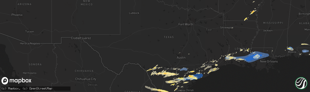
Hail Map in Texas on May 13, 2024
The weather event in Texas on May 13, 2024 includes Hail, Wind, and Tornado maps. 14 states and 458 cities were impacted and suffered possible damage. The total estimated number of properties impacted is 48,467.
Want more than just the map?
Turn this storm into a full workflow.
- Owner + property data so you know who to knock
- OnDemand branded weather history reports to win the "did we even have hail?" argument
- RoofTrace estimate so reps stop guessing numbers at the door
Bought this map? Upgrade within 7 days and we'll credit the $230. (10-15 min setup call)
Hail
Wind
Tornado
48,467
Estimated number of impacted properties by a 1.00" hail or larger18,365
Estimated number of impacted properties by a 1.75" hail or larger1,021
Estimated number of impacted properties by a 2.50" hail or largerStorm reports in Texas
Texas
| Date | Description |
|---|---|
| 05/13/20246:12 PM CDT | Photos of hail up to golf ball size. |
| 05/13/20246:10 PM CDT | A local report indicates 1.75 inch wind near 2 N Mccook |
| 05/13/20246:05 PM CDT | A local report indicates 1.00 inch wind near 2 NW Kerrville |
| 05/13/20246:02 PM CDT | Social media photo of nickel to quarter size hail in rios. |
| 05/13/20246:00 PM CDT | A local report indicates 1.00 inch wind near Mccook |
| 05/13/20246:00 PM CDT | A local report indicates 2.75 inch wind near 2 SE Mccook |
| 05/13/20245:50 PM CDT | Relayed through zapata s.o. |
| 05/13/20245:35 PM CDT | Nickel to quarter sized hail near st. Gertrudes catholic church. |
| 05/13/20245:09 PM CDT | Mesonet station xlev levee. |
| 05/13/20245:00 PM CDT | Public photo of 2 inch hail. |
| 05/13/20244:29 PM CDT | A local report indicates 1.00 inch wind near 10 NNE Orvil |
| 05/13/20244:22 PM CDT | A local report indicates 1.00 inch wind near 15 NNW Aguilares |
| 05/13/20244:18 PM CDT | A local report indicates 1.75 inch wind near 4 ESE Columbia Bridge |
| 05/13/20244:15 PM CDT | Near golf ball sized hail for nearly 10 minutes. |
| 05/13/20244:00 PM CDT | Mesonet station emat2 18 s bay city. |
| 05/13/20244:00 PM CDT | Gust at sensor 8773146 - matagorda city... Tx. |
| 05/13/20244:00 PM CDT | Video of hail up to quarter size at mile 13. |
| 05/13/20243:32 PM CDT | Psx reported 61 mph wind gust. |
| 05/13/20243:29 PM CDT | Awos station kpsx palacios. |
| 05/13/20243:21 PM CDT | A local report indicates 1.00 inch wind near 1 ENE Columbia Bridge |
| 05/13/20243:05 PM CDT | *** 2 inj *** em confirms at least 9 rvs flipped with two confirmed injuries. Time estimated from radar and surrounding observations. |
| 05/13/20243:00 PM CDT | A local report indicates 58 MPH wind near 1 SSE Kamay |
| 05/13/20242:49 PM CDT | Personal weather station. |
| 05/13/20242:36 PM CDT | Report from mping: quarter |
| 05/13/20242:35 PM CDT | A local report indicates 1.75 inch wind near 1 ENE Victoria |
| 05/13/20242:31 PM CDT | Estimated 50-60 mph with some small limbs down. |
| 05/13/20242:30 PM CDT | Videos sent from em. |
| 05/13/20241:59 PM CDT | Numerous trees and branches reported down; some power outages as well... Across lavaca country between shiner and hallettsville. |
| 05/13/20241:59 PM CDT | Numerous trees and branches reported down; some power outages as well... Across lavaca country between shiner and hallettsville. |
| 05/13/20241:57 PM CDT | A local report indicates 1.00 inch wind near 3 N Pettus |
| 05/13/20241:49 PM CDT | Small branches down. Dime sized hail and estimated 60-70 mph winds. |
| 05/13/20241:42 PM CDT | Tree snapped halfway up the trunk in gonzales. |
| 05/13/20241:42 PM CDT | Tree snapped halfway up the |
| 05/13/20241:42 PM CDT | Tree snapped halfway up the trunk in gonzales. |
| 05/13/20241:14 PM CDT | A trained spotter reported multiple large tree limbs down. |
| 05/13/20241:14 PM CDT | A trained spotter reported multiple large tree limbs down. |
| 05/13/20241:07 PM CDT | There is a report of trees down in the smiley and nixon area from the county emergency manager. |
| 05/13/20241:07 PM CDT | There is a report of trees down in the smiley and nixon area from the county emergency manager. |
| 05/13/202412:24 PM CDT | A local report indicates 1.00 inch wind near 7 SW POTH |
| 05/13/202412:24 PM CDT | A local report indicates 1.00 inch wind near 7 SW Poth |
| 05/13/202412:04 PM CDT | A local report indicates 1.50 inch wind near Devine |
| 05/13/202412:04 PM CDT | A local report indicates 1.50 inch wind near DEVINE |
| 05/13/202411:52 AM CDT | Tree uprooted on avenue i in poteet. |
| 05/13/202411:52 AM CDT | Tree uprooted on avenue i in poteet. |
| 05/13/202411:50 AM CDT | A local report indicates 1.00 inch wind near Poteet |
| 05/13/202411:50 AM CDT | A local report indicates 1.00 inch wind near POTEET |
| 05/13/202411:42 AM CDT | Time estimated via radar. |
| 05/13/202411:42 AM CDT | Time estimated via radar. |
| 05/13/202411:41 AM CDT | Scattered wind damage with downed powerlines and structural damage... Across portions of poteet along state highway 16. Time estimated via radar. |
| 05/13/202411:41 AM CDT | Scattered wind damage with downed powerlines and structural damage... Across portions of poteet along state highway 16. Time estimated via radar. |
| 05/13/202411:24 AM CDT | Large tree branches snapped with quarter size hail reported in moore... Tx. |
| 05/13/202411:24 AM CDT | Large tree branches snapped with quarter size hail reported in moore... Tx. |
| 05/13/202411:23 AM CDT | A local report indicates 1.00 inch wind near Bigfoot |
| 05/13/202411:23 AM CDT | A local report indicates 1.00 inch wind near BIGFOOT |
| 05/13/202411:15 AM CDT | Half dollar size hail occurring in moore... Texas. Ongoing for past 15 minutes. |
| 05/13/202411:15 AM CDT | Half dollar size hail occurring in moore... Texas. Ongoing for past 15 minutes. |
| 05/13/202410:45 AM CDT | Corrugated metal roof blown off of building south of the hwy 57 and i-35 intersection. |
| 05/13/202410:45 AM CDT | Corrugated metal roof blown off of building south of the hwy 57 and i-35 intersection. |
| 05/13/20249:34 AM CDT | Video of nickel to quarter size hail near yancey. Time estimated via radar. |
| 05/13/20249:34 AM CDT | Video of nickel to quarter size hail near yancey. Time estimated via radar. |
| 05/13/20249:30 AM CDT | A local report indicates 1.00 inch wind near 8 N BATESVILLE |
| 05/13/20249:30 AM CDT | A local report indicates 1.00 inch wind near 8 N Batesville |
| 05/13/20249:30 AM CDT | A local report indicates 1.75 inch wind near BRACKETTVILLE |
| 05/13/20249:30 AM CDT | A local report indicates 1.75 inch wind near Brackettville |
| 05/13/20249:05 AM CDT | . |
| 05/13/20249:05 AM CDT | . |
| 05/12/20248:40 PM CDT | At least 3 power poles reported down along east of i-69e between rancho viejo and olimito. |
| 05/12/20248:40 PM CDT | At least 3 power poles reported down along east of i-69e between rancho vie |
| 05/12/20248:31 PM CDT | A local report indicates 59 MPH wind near Bayview |
| 05/12/20247:34 PM CDT | Psx reported wind gust of 61 mph. |
| 05/12/20247:30 PM CDT | Web report: unknow how far north of rio grande city. |
| 05/12/20247:30 PM CDT | Web report along fm 490 near faysville. |
| 05/12/20247:25 PM CDT | Web report. Along fm 755 north of town. |
All States Impacted by Hail Map on May 13, 2024
Cities Impacted by Hail Map on May 13, 2024
- State Line, MS
- Fruitdale, AL
- Chatom, AL
- Deer Park, AL
- Tibbie, AL
- Wagarville, AL
- Brewton, AL
- Castleberry, AL
- Evergreen, AL
- Andalusia, AL
- Eagle Pass, TX
- Quemado, TX
- La Pryor, TX
- Brackettville, TX
- Batesville, TX
- Wilmer, AL
- Citronelle, AL
- Lucedale, MS
- Chunchula, AL
- Saraland, AL
- Crystal City, TX
- Wanette, OK
- Lexington, OK
- Sabinal, TX
- Byars, OK
- Eight Mile, AL
- Axis, AL
- Semmes, AL
- Creola, AL
- Uvalde, TX
- Asher, OK
- Franklinton, LA
- Satsuma, AL
- Mobile, AL
- D Hanis, TX
- Daphne, AL
- Hondo, TX
- Yancey, TX
- Devine, TX
- Concan, TX
- Bigfoot, TX
- Pearsall, TX
- Milton, FL
- Utopia, TX
- Holt, FL
- Baker, FL
- Jay, FL
- Rio Frio, TX
- Cantonment, FL
- Pensacola, FL
- Leakey, TX
- Moore, TX
- Crestview, FL
- Eglin Afb, FL
- Castroville, TX
- Natalia, TX
- Poteet, TX
- San Antonio, TX
- Niceville, FL
- Valparaiso, FL
- Charlotte, TX
- Jourdanton, TX
- Pleasanton, TX
- Cuero, TX
- Floresville, TX
- Falls City, TX
- Converse, TX
- Saint Hedwig, TX
- Dilley, TX
- Adkins, TX
- La Vernia, TX
- Yoakum, TX
- Seguin, TX
- Stockdale, TX
- Eagle Lake, TX
- Hobson, TX
- Karnes City, TX
- Hallettsville, TX
- Calliham, TX
- Edna, TX
- Nixon, TX
- Smiley, TX
- Gonzales, TX
- Wrightsboro, TX
- Cost, TX
- Louise, TX
- Three Rivers, TX
- Whitsett, TX
- East Bernard, TX
- Beasley, TX
- Garwood, TX
- El Campo, TX
- Lexington, TX
- Rockdale, TX
- Thorndale, TX
- Rosenberg, TX
- Campbellton, TX
- Kenedy, TX
- Plainfield, IL
- Beeville, TX
- Cotulla, TX
- Houston, TX
- Seneca, IL
- Marseilles, IL
- Katy, TX
- Richmond, TX
- Fulshear, TX
- Sugar Land, TX
- Joliet, IL
- Shiner, TX
- Goliad, TX
- Leander, TX
- Georgetown, TX
- Yorktown, TX
- Dayton, TX
- Baytown, TX
- New Berlin, WI
- Waukesha, WI
- Crest Hill, IL
- Romeoville, IL
- Brookfield, WI
- Lockport, IL
- Meyersville, TX
- Fresno, TX
- Rosharon, TX
- Pearland, TX
- Needville, TX
- Damon, TX
- Boling, TX
- Liberty, TX
- Victoria, TX
- Tilden, TX
- Fowlerton, TX
- Missouri City, TX
- Crosby, TX
- Manvel, TX
- Inez, TX
- Refugio, TX
- Poth, TX
- Sour Lake, TX
- Alvin, TX
- Humble, TX
- Bloomington, TX
- La Salle, TX
- Lytle, TX
- Kountze, TX
- Placedo, TX
- Port Lavaca, TX
- Vanderbilt, TX
- Lolita, TX
- Devers, TX
- George West, TX
- Buna, TX
- Lumberton, TX
- Lakeland, FL
- Auburndale, FL
- Beaumont, TX
- Woodsboro, TX
- Webster, TX
- Friendswood, TX
- Pasadena, TX
- Polk City, FL
- Lake Alfred, FL
- Haines City, FL
- Winter Haven, FL
- Davenport, FL
- Santa Fe, TX
- Havre, MT
- Laredo, TX
- League City, TX
- Silsbee, TX
- Malta, MT
- Winamac, IN
- Palacios, TX
- Ganado, TX
- Markham, TX
- Midfield, TX
- Blessing, TX
- Bay City, TX
- Elmaton, TX
- Anahuac, TX
- Hitchcock, TX
- Wallisville, TX
- Dequincy, LA
- Texas City, TX
- La Marque, TX
- Wharton, TX
- Kemah, TX
- Matagorda, TX
- Singer, LA
- Essex, IL
- Realitos, TX
- Lake Jackson, TX
- Clute, TX
- Longville, LA
- Wilmington, IL
- Starks, LA
- Deweyville, TX
- Angleton, TX
- Concepcion, TX
- Sweeny, TX
- Brazoria, TX
- Orange, TX
- Freeport, TX
- Merryville, LA
- Bridge City, TX
- Galveston, TX
- Liverpool, TX
- Van Vleck, TX
- Kissimmee, FL
- Mountain City, NV
- Ragley, LA
- Ville Platte, LA
- Mamou, LA
- Lake Wales, FL
- Conifer, CO
- Guy, TX
- Kinder, LA
- Hammond, LA
- Vinton, LA
- Oakdale, LA
- Dundee, FL
- Bay Minette, AL
- Port Bolivar, TX
- Danbury, TX
- Manteno, IL
- Mittie, LA
- Stockton, AL
- Mount Vernon, AL
- Waverly, FL
- Alice, TX
- Sulphur, LA
- Lake Charles, LA
- Westlake, LA
- San Ygnacio, TX
- Reeves, LA
- Zapata, TX
- Kenansville, FL
- Iowa, LA
- San Diego, TX
- Premont, TX
- Kingsville, TX
- Tivoli, TX
- Hebbronville, TX
- Bell City, LA
- Mirando City, TX
- Welsh, LA
- Orange Grove, TX
- Jennings, LA
- Roanoke, LA
- Lake Arthur, LA
- Plaucheville, LA
- Simmesport, LA
- Oilton, TX
- Guerra, TX
- Sandia, TX
- Lacassine, LA
- Cameron, LA
- Washington, LA
- Mathis, TX
- Evangeline, LA
- Egan, LA
- Morse, LA
- Mermentau, LA
- Batchelor, LA
- Lettsworth, LA
- Estherwood, LA
- Crowley, LA
- Roggen, CO
- Gueydan, LA
- Bishop, TX
- Bunkie, LA
- Rayne, LA
- Kaplan, LA
- Lake Placid, FL
- Lorida, FL
- Frostproof, FL
- Lake Hamilton, FL
- Roma, TX
- Santa Elena, TX
- Encino, TX
- Robstown, TX
- Maurice, LA
- Duson, LA
- Scott, LA
- Breaux Bridge, LA
- Lafayette, LA
- Carencro, LA
- Arnaudville, LA
- Church Point, LA
- New Iberia, LA
- Abbeville, LA
- Youngsville, LA
- Saint Martinville, LA
- Broussard, LA
- Rio Grande City, TX
- Palmetto, LA
- Sinton, TX
- Odem, TX
- Port Barre, LA
- San Isidro, TX
- Armstrong, TX
- Okeechobee, FL
- Heflin, LA
- Linn, TX
- Melville, LA
- Sarita, TX
- Riviera, TX
- Fordoche, LA
- Ladonia, TX
- Windom, TX
- Bonham, TX
- Erath, LA
- Delcambre, LA
- Ventress, LA
- Jarreau, LA
- New Roads, LA
- Livonia, LA
- Grosse Tete, LA
- Lottie, LA
- Krotz Springs, LA
- Oscar, LA
- Loreauville, LA
- Maringouin, LA
- Lakeland, LA
- Rosedale, LA
- Addis, LA
- Rougon, LA
- Jeanerette, LA
- Plaquemine, LA
- Brusly, LA
- White Castle, LA
- Port Allen, LA
- Erwinville, LA
- Belle Fourche, SD
- Opheim, MT
- Hinsdale, MT
- Reno, NV
- Redstone, MT
- Dubberly, LA
- New Raymer, CO
- Morganza, LA
- Edinburg, TX
- Mission, TX
- Shorewood, IL
- Glynn, LA
- Baton Rouge, LA
- Sunshine, LA
- Sibley, LA
- Richland, MT
- Grulla, TX
- Falfurrias, TX
- Saint Gabriel, LA
- Carville, LA
- Garciasville, TX
- Labelle, FL
- Moore Haven, FL
- Baker, LA
- Ethel, LA
- Saint Francisville, LA
- Jackson, LA
- Zachary, LA
- Slaughter, LA
- Geismar, LA
- Gonzales, LA
- Darrow, LA
- Prairieville, LA
- Sorrento, LA
- Donaldsonville, LA
- Greenwell Springs, LA
- Denham Springs, LA
- Walker, LA
- Livingston, LA
- Pride, LA
- French Settlement, LA
- Buffalo, SD
- Saint Amant, LA
- Clewiston, FL
- Maurepas, LA
- Pine Grove, LA
- Holden, LA
- Springfield, LA
- Albany, LA
- Independence, LA
- Newell, SD
- Hargill, TX
- San Perlita, TX
- Tickfaw, LA
- Ponchatoula, LA
- Raymondville, TX
- Port Mansfield, TX
- Weslaco, TX
- Edcouch, TX
- Elsa, TX
- Robert, LA
- Madisonville, LA
- La Place, LA
- Covington, LA
- Folsom, LA
- Loranger, LA
- Marion, LA
- Huttig, AR
- Bogalusa, LA
- La Villa, TX
- Mercedes, TX
- La Feria, TX
- Lyford, TX
- Harlingen, TX
- Combes, TX
- Santa Rosa, TX
- Crossett, AR
- Poplarville, MS
- Carriere, MS
- Scobey, MT
- Peerless, MT
- Rio Hondo, TX
- Mandeville, LA
- Abita Springs, LA
- Dermott, AR
- Hamburg, AR
- Monticello, AR
- Poplar, MT
- Los Fresnos, TX
- Port Isabel, TX
- Tillar, AR
- McGehee, AR
- Glendive, MT
- Brockton, MT
- Cohagen, MT
- Watson, AR
- Almyra, AR
- Homosassa, FL
- De Witt, AR
- Donna, TX
- Rohwer, AR
- Alligator, MS
- Iota, LA
- Branch, LA
- Sunset, LA
- Shalimar, FL
- Defuniak Springs, FL
- Port Saint Joe, FL
- Wewahitchka, FL
- Clarksville, FL
- Panama City, FL
- Youngstown, FL
- Panama City Beach, FL
- Lynn Haven, FL
- Chipley, FL
- Inlet Beach, FL
- Fountain, FL
- Marianna, FL
- Alford, FL
- Altha, FL
- Blountstown, FL
- Grand Ridge, FL
- Bristol, FL
- Bruni, TX


