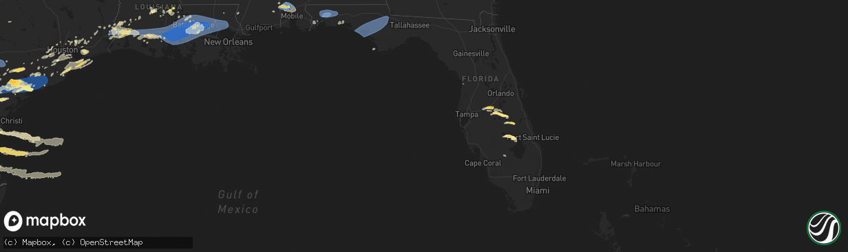
Hail Map in Florida on May 13, 2024
The weather event in Florida on May 13, 2024 includes Hail, Wind, and Tornado maps. 14 states and 458 cities were impacted and suffered possible damage. The total estimated number of properties impacted is 15,136.
Want more than just the map?
Turn this storm into a full workflow.
- Owner + property data so you know who to knock
- OnDemand branded weather history reports to win the "did we even have hail?" argument
- RoofTrace estimate so reps stop guessing numbers at the door
Bought this map? Upgrade within 7 days and we'll credit the $230. (10-15 min setup call)
Hail
Wind
Tornado
15,136
Estimated number of impacted properties by a 1.00" hail or larger6,940
Estimated number of impacted properties by a 1.75" hail or larger0
Estimated number of impacted properties by a 2.50" hail or largerStorm reports in Florida
Florida
| Date | Description |
|---|---|
| 05/13/20244:13 PM CDT | Report from mping: trees uprooted or snapped. |
| 05/13/20243:34 PM CDT | Another social media picture of golf ball sized hail was posted from haines city. Time estimated from radar. |
| 05/13/20243:30 PM CDT | A picture of hail was posted on a social media page of hail up to the size of golf balls... Stating a location of lake alfred. Time was estimated from radar. |
| 05/13/202412:14 PM CDT | Emergency manager reported a tree down on powerlines along highway 173 northeast of bonifay. |
| 05/13/202411:44 AM CDT | Media forwarded webcam video of a waterspout moving onshore just off us 331 bridge at north beach social. Time estimated by radar. |
| 05/13/202411:43 AM CDT | Report from mping: 1-inch tree limbs broken; shingles blown off. |
| 05/13/202411:41 AM CDT | Emergency manager reported a tree down on some power lines and cables. |
| 05/13/202410:23 AM CDT | Downed trees and power lines at indian ford road and petey lane in munson. Time estimated on radar. |
| 05/13/202410:14 AM CDT | Knse awos reported a wind gust of 71 kts. |
| 05/13/202410:10 AM CDT | Downed trees and power lines on penton road in allentown. Time estimated on radar. |
| 05/13/20245:12 AM CDT | Tree down at the intersection of lovett road and partridge way in madison county florida. |
| 05/13/20245:12 AM CDT | Tree down at the intersection of sw state road 14 and county road 360 in madison county florida. |
| 05/13/20244:15 AM CDT | A downed oak tree was reported across the road. |
| 05/13/20243:53 AM CDT | Ambient station gusting to 62 mph. |
All States Impacted by Hail Map on May 13, 2024
Cities Impacted by Hail Map on May 13, 2024
- State Line, MS
- Fruitdale, AL
- Chatom, AL
- Deer Park, AL
- Tibbie, AL
- Wagarville, AL
- Brewton, AL
- Castleberry, AL
- Evergreen, AL
- Andalusia, AL
- Eagle Pass, TX
- Quemado, TX
- La Pryor, TX
- Brackettville, TX
- Batesville, TX
- Wilmer, AL
- Citronelle, AL
- Lucedale, MS
- Chunchula, AL
- Saraland, AL
- Crystal City, TX
- Wanette, OK
- Lexington, OK
- Sabinal, TX
- Byars, OK
- Eight Mile, AL
- Axis, AL
- Semmes, AL
- Creola, AL
- Uvalde, TX
- Asher, OK
- Franklinton, LA
- Satsuma, AL
- Mobile, AL
- D Hanis, TX
- Daphne, AL
- Hondo, TX
- Yancey, TX
- Devine, TX
- Concan, TX
- Bigfoot, TX
- Pearsall, TX
- Milton, FL
- Utopia, TX
- Holt, FL
- Baker, FL
- Jay, FL
- Rio Frio, TX
- Cantonment, FL
- Pensacola, FL
- Leakey, TX
- Moore, TX
- Crestview, FL
- Eglin Afb, FL
- Castroville, TX
- Natalia, TX
- Poteet, TX
- San Antonio, TX
- Niceville, FL
- Valparaiso, FL
- Charlotte, TX
- Jourdanton, TX
- Pleasanton, TX
- Cuero, TX
- Floresville, TX
- Falls City, TX
- Converse, TX
- Saint Hedwig, TX
- Dilley, TX
- Adkins, TX
- La Vernia, TX
- Yoakum, TX
- Seguin, TX
- Stockdale, TX
- Eagle Lake, TX
- Hobson, TX
- Karnes City, TX
- Hallettsville, TX
- Calliham, TX
- Edna, TX
- Nixon, TX
- Smiley, TX
- Gonzales, TX
- Wrightsboro, TX
- Cost, TX
- Louise, TX
- Three Rivers, TX
- Whitsett, TX
- East Bernard, TX
- Beasley, TX
- Garwood, TX
- El Campo, TX
- Lexington, TX
- Rockdale, TX
- Thorndale, TX
- Rosenberg, TX
- Campbellton, TX
- Kenedy, TX
- Plainfield, IL
- Beeville, TX
- Cotulla, TX
- Houston, TX
- Seneca, IL
- Marseilles, IL
- Katy, TX
- Richmond, TX
- Fulshear, TX
- Sugar Land, TX
- Joliet, IL
- Shiner, TX
- Goliad, TX
- Leander, TX
- Georgetown, TX
- Yorktown, TX
- Dayton, TX
- Baytown, TX
- New Berlin, WI
- Waukesha, WI
- Crest Hill, IL
- Romeoville, IL
- Brookfield, WI
- Lockport, IL
- Meyersville, TX
- Fresno, TX
- Rosharon, TX
- Pearland, TX
- Needville, TX
- Damon, TX
- Boling, TX
- Liberty, TX
- Victoria, TX
- Tilden, TX
- Fowlerton, TX
- Missouri City, TX
- Crosby, TX
- Manvel, TX
- Inez, TX
- Refugio, TX
- Poth, TX
- Sour Lake, TX
- Alvin, TX
- Humble, TX
- Bloomington, TX
- La Salle, TX
- Lytle, TX
- Kountze, TX
- Placedo, TX
- Port Lavaca, TX
- Vanderbilt, TX
- Lolita, TX
- Devers, TX
- George West, TX
- Buna, TX
- Lumberton, TX
- Lakeland, FL
- Auburndale, FL
- Beaumont, TX
- Woodsboro, TX
- Webster, TX
- Friendswood, TX
- Pasadena, TX
- Polk City, FL
- Lake Alfred, FL
- Haines City, FL
- Winter Haven, FL
- Davenport, FL
- Santa Fe, TX
- Havre, MT
- Laredo, TX
- League City, TX
- Silsbee, TX
- Malta, MT
- Winamac, IN
- Palacios, TX
- Ganado, TX
- Markham, TX
- Midfield, TX
- Blessing, TX
- Bay City, TX
- Elmaton, TX
- Anahuac, TX
- Hitchcock, TX
- Wallisville, TX
- Dequincy, LA
- Texas City, TX
- La Marque, TX
- Wharton, TX
- Kemah, TX
- Matagorda, TX
- Singer, LA
- Essex, IL
- Realitos, TX
- Lake Jackson, TX
- Clute, TX
- Longville, LA
- Wilmington, IL
- Starks, LA
- Deweyville, TX
- Angleton, TX
- Concepcion, TX
- Sweeny, TX
- Brazoria, TX
- Orange, TX
- Freeport, TX
- Merryville, LA
- Bridge City, TX
- Galveston, TX
- Liverpool, TX
- Van Vleck, TX
- Kissimmee, FL
- Mountain City, NV
- Ragley, LA
- Ville Platte, LA
- Mamou, LA
- Lake Wales, FL
- Conifer, CO
- Guy, TX
- Kinder, LA
- Hammond, LA
- Vinton, LA
- Oakdale, LA
- Dundee, FL
- Bay Minette, AL
- Port Bolivar, TX
- Danbury, TX
- Manteno, IL
- Mittie, LA
- Stockton, AL
- Mount Vernon, AL
- Waverly, FL
- Alice, TX
- Sulphur, LA
- Lake Charles, LA
- Westlake, LA
- San Ygnacio, TX
- Reeves, LA
- Zapata, TX
- Kenansville, FL
- Iowa, LA
- San Diego, TX
- Premont, TX
- Kingsville, TX
- Tivoli, TX
- Hebbronville, TX
- Bell City, LA
- Mirando City, TX
- Welsh, LA
- Orange Grove, TX
- Jennings, LA
- Roanoke, LA
- Lake Arthur, LA
- Plaucheville, LA
- Simmesport, LA
- Oilton, TX
- Guerra, TX
- Sandia, TX
- Lacassine, LA
- Cameron, LA
- Washington, LA
- Mathis, TX
- Evangeline, LA
- Egan, LA
- Morse, LA
- Mermentau, LA
- Batchelor, LA
- Lettsworth, LA
- Estherwood, LA
- Crowley, LA
- Roggen, CO
- Gueydan, LA
- Bishop, TX
- Bunkie, LA
- Rayne, LA
- Kaplan, LA
- Lake Placid, FL
- Lorida, FL
- Frostproof, FL
- Lake Hamilton, FL
- Roma, TX
- Santa Elena, TX
- Encino, TX
- Robstown, TX
- Maurice, LA
- Duson, LA
- Scott, LA
- Breaux Bridge, LA
- Lafayette, LA
- Carencro, LA
- Arnaudville, LA
- Church Point, LA
- New Iberia, LA
- Abbeville, LA
- Youngsville, LA
- Saint Martinville, LA
- Broussard, LA
- Rio Grande City, TX
- Palmetto, LA
- Sinton, TX
- Odem, TX
- Port Barre, LA
- San Isidro, TX
- Armstrong, TX
- Okeechobee, FL
- Heflin, LA
- Linn, TX
- Melville, LA
- Sarita, TX
- Riviera, TX
- Fordoche, LA
- Ladonia, TX
- Windom, TX
- Bonham, TX
- Erath, LA
- Delcambre, LA
- Ventress, LA
- Jarreau, LA
- New Roads, LA
- Livonia, LA
- Grosse Tete, LA
- Lottie, LA
- Krotz Springs, LA
- Oscar, LA
- Loreauville, LA
- Maringouin, LA
- Lakeland, LA
- Rosedale, LA
- Addis, LA
- Rougon, LA
- Jeanerette, LA
- Plaquemine, LA
- Brusly, LA
- White Castle, LA
- Port Allen, LA
- Erwinville, LA
- Belle Fourche, SD
- Opheim, MT
- Hinsdale, MT
- Reno, NV
- Redstone, MT
- Dubberly, LA
- New Raymer, CO
- Morganza, LA
- Edinburg, TX
- Mission, TX
- Shorewood, IL
- Glynn, LA
- Baton Rouge, LA
- Sunshine, LA
- Sibley, LA
- Richland, MT
- Grulla, TX
- Falfurrias, TX
- Saint Gabriel, LA
- Carville, LA
- Garciasville, TX
- Labelle, FL
- Moore Haven, FL
- Baker, LA
- Ethel, LA
- Saint Francisville, LA
- Jackson, LA
- Zachary, LA
- Slaughter, LA
- Geismar, LA
- Gonzales, LA
- Darrow, LA
- Prairieville, LA
- Sorrento, LA
- Donaldsonville, LA
- Greenwell Springs, LA
- Denham Springs, LA
- Walker, LA
- Livingston, LA
- Pride, LA
- French Settlement, LA
- Buffalo, SD
- Saint Amant, LA
- Clewiston, FL
- Maurepas, LA
- Pine Grove, LA
- Holden, LA
- Springfield, LA
- Albany, LA
- Independence, LA
- Newell, SD
- Hargill, TX
- San Perlita, TX
- Tickfaw, LA
- Ponchatoula, LA
- Raymondville, TX
- Port Mansfield, TX
- Weslaco, TX
- Edcouch, TX
- Elsa, TX
- Robert, LA
- Madisonville, LA
- La Place, LA
- Covington, LA
- Folsom, LA
- Loranger, LA
- Marion, LA
- Huttig, AR
- Bogalusa, LA
- La Villa, TX
- Mercedes, TX
- La Feria, TX
- Lyford, TX
- Harlingen, TX
- Combes, TX
- Santa Rosa, TX
- Crossett, AR
- Poplarville, MS
- Carriere, MS
- Scobey, MT
- Peerless, MT
- Rio Hondo, TX
- Mandeville, LA
- Abita Springs, LA
- Dermott, AR
- Hamburg, AR
- Monticello, AR
- Poplar, MT
- Los Fresnos, TX
- Port Isabel, TX
- Tillar, AR
- McGehee, AR
- Glendive, MT
- Brockton, MT
- Cohagen, MT
- Watson, AR
- Almyra, AR
- Homosassa, FL
- De Witt, AR
- Donna, TX
- Rohwer, AR
- Alligator, MS
- Iota, LA
- Branch, LA
- Sunset, LA
- Shalimar, FL
- Defuniak Springs, FL
- Port Saint Joe, FL
- Wewahitchka, FL
- Clarksville, FL
- Panama City, FL
- Youngstown, FL
- Panama City Beach, FL
- Lynn Haven, FL
- Chipley, FL
- Inlet Beach, FL
- Fountain, FL
- Marianna, FL
- Alford, FL
- Altha, FL
- Blountstown, FL
- Grand Ridge, FL
- Bristol, FL
- Bruni, TX


