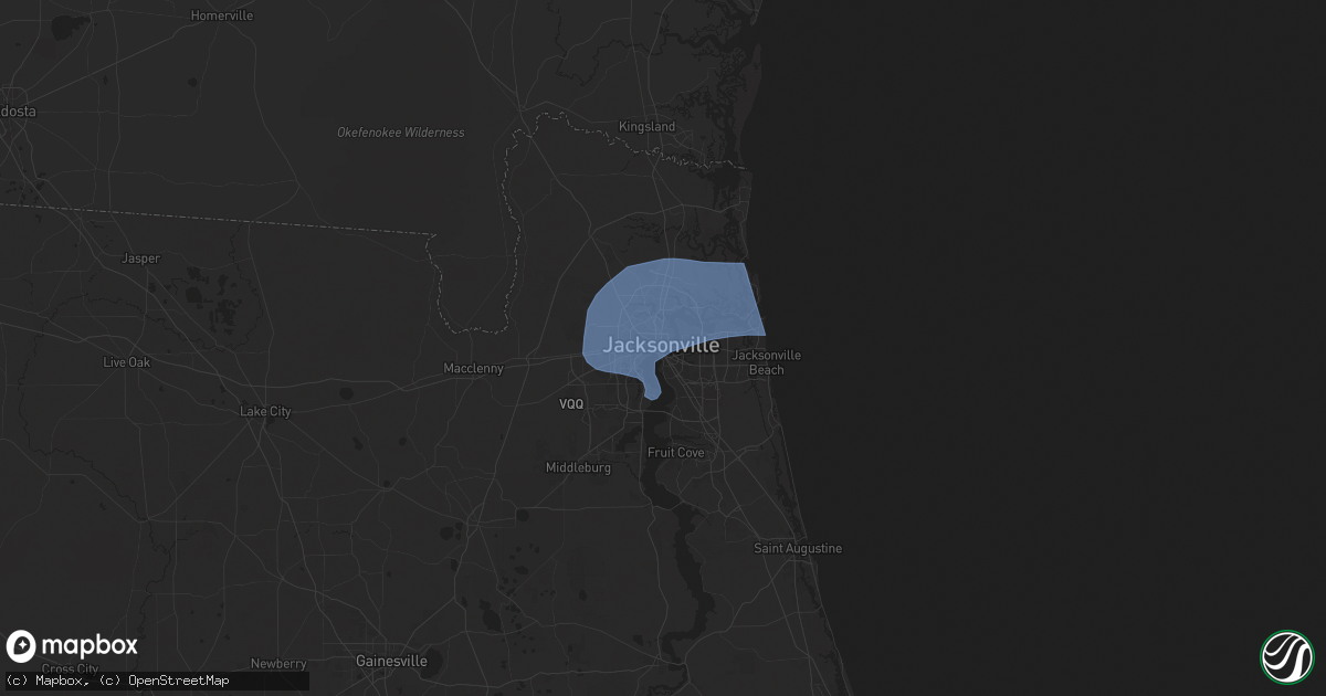
Hail Map in Jacksonville, FL on May 10, 2024
Get this storm
May 10 map
$229
one time, instant access
Download today. No call, no setup
Keep the $229
Bought the map and want the full workflow? Apply the entire $229 to a subscription within 7 days. None of it is wasted.
Every map, not just this one
This buys you this map. Subscription and you get every map we run, in the markets you choose from a few cities to whole states to nationwide. Plus real-time alerts the moment a storm fires.
Contact data
Name, contact info, occupancy, even credit band for addresses in the footprint. You go from where it hit to who to call.
Become the source they trust
Unlimited branding weather history reports on demand. You already have the documented answer ready for the property owner, and you are the one who showed up with it.
Property data and RoofTrace estimates
Pull up any address you have got, its value and the exact code rules for that jurisdiction, straight from One Click Code. Then RoofTrace estimates the squares, pitch, and roof value, priced the way you price.
Storm reports in Jacksonville, FL
Jacksonville, FL
| Date | Description |
|---|---|
| 05/10/20249:30 AM CDT | Reports of 11 schools without power in duval county. Trees down county wide... With some having fallen on homes. |
| 05/10/20248:53 AM CDT | Asos station kcrg jacksonvil craig. |
| 05/10/20248:44 AM CDT | Mesonet station xjak jacksonville. |
| 05/10/20248:40 AM CDT | Mesonet station 1483w fswn jfrd station 40. |
| 05/10/20248:40 AM CDT | Mesonet station 1323w 1.3 se jacksonville |
| 05/10/20248:30 AM CDT | Mesonet station blif1 1 wnw fort caroline. |
| 05/10/20248:24 AM CDT | Awos station knip jacksonville nas. |
| 05/10/20248:20 AM CDT | Asos station kjax jacksonville intl airport. |
| 05/10/20248:20 AM CDT | Video of roof damage to business. Time based off kjax wind gust reading of 64 mph. |
All States Impacted by Hail Map on May 10, 2024
All Cities Impacted by Hail Map on May 10, 2024
- Enterprise, MS
- Meridian, MS
- Vossburg, MS
- Paulding, MS
- Pachuta, MS
- Quitman, MS
- Heidelberg, MS
- Rose Hill, MS
- McDavid, FL
- Century, FL
- Bay Minette, AL
- Baker, FL
- Laurel Hill, FL
- Jay, FL
- Crestview, FL
- Milton, FL
- Molino, FL
- Defuniak Springs, FL
- Waynesville, GA
- Waverly, GA
- White Oak, GA
- Gulfport, MS
- Fountain, FL
- Alford, FL
- Cantonment, FL
- Robertsdale, AL
- Perry, FL
- Mayo, FL
- Day, FL
- Jasper, FL
- White Springs, FL
- Jacksonville, FL
- Atlantic Beach, FL
- Pensacola, FL
- Biloxi, MS
- Diberville, MS
- Ocean Springs, MS
- Gulf Breeze, FL
- Hosford, FL
- Carrabelle, FL
- Sopchoppy, FL
- Panacea, FL
- Vancourt, TX
- Waxhaw, NC
- Monroe, NC
- Pacolet, SC
- Gaffney, SC
- Marshville, NC
- Pageland, SC
- Hickory Grove, SC
- Sharon, SC
- Crawfordville, FL
- Jonesville, SC
- Lancaster, SC
- Maryneal, TX
- Mount Croghan, SC
- McConnells, SC
- Chester, SC
- Ruby, SC
- Chesterfield, SC
- Blackwell, TX
- Shannon, NC
- Red Springs, NC
- Wadesboro, NC
- York, SC
- Rock Hill, SC
- Cheraw, SC
- Polkton, NC
- Peachland, NC
- Morven, NC
- Rockingham, NC
- Wingate, TX
- Richburg, SC
- San Saba, TX
- Fredonia, TX
- Catawba, SC
- Saint Pauls, NC
- Lumber Bridge, NC
- Jefferson, SC
- Cherokee, TX
- Fort Lawn, SC
- Wallace, SC
- Farmville, NC
- Snow Hill, NC
- Kershaw, SC
- Bennettsville, SC
- Clio, SC
- Edgemoor, SC
- Heath Springs, SC
- Tar Heel, NC
- White Oak, NC
- Greenville, NC
- Ayden, NC
- Winterville, NC
- Carthage, NC
- Pontotoc, TX
- Valley Spring, TX
- McBee, SC
- Vass, NC
- Fort Bragg, NC
- Southern Pines, NC
- Cameron, NC
- Patrick, SC
- Fayetteville, NC
- Eldorado, TX
- Union, SC
- Black Creek, NC
- Wilson, NC
- Elizabethtown, NC
- Garland, NC
- Spring Lake, NC
- Pope Army Airfield, NC
- Hartsville, SC
- Lampasas, TX
- McColl, SC
- Little Rock, SC
- Bethune, SC
- Harrells, NC
- Society Hill, SC
- Stantonsburg, NC
- Charles City, VA
- Providence Forge, VA
- Walstonburg, NC
- Carlisle, SC
- Washington, NC
- Blackstock, SC
- Rose Hill, NC
- Pikeville, NC
- Fremont, NC
- Stedman, NC
- Spring Grove, VA
- New Kent, VA
- Fairmont, NC
- Orrum, NC
- Blenheim, SC
- Wallace, NC
- Lumberton, NC
- Fountain, NC
- Latta, SC
- Menard, TX
- Willard, NC
- Great Falls, SC
- Darlington, SC
- Goldsboro, NC
- La Grange, NC
- Ivanhoe, NC
- Grimesland, NC
- Camden, SC
- Vanceboro, NC
- Chocowinity, NC
- Lometa, TX
- Bend, TX
- Evergreen, NC
- Maple Hill, NC
- Cassatt, SC
- Westville, SC
- Blounts Creek, NC
- Kelly, NC
- Brady, TX
- Edward, NC
- Engelhard, NC
- Fairfield, NC
- Bishopville, SC
- Columbia, SC
- Aurora, NC
- Hopkins, SC
- Lamar, SC
- Cerro Gordo, NC
- Chadbourn, NC
- Bath, NC
- Hobucken, NC
- Saint Matthews, SC
- Florence, SC
- Lowland, NC
- Gadsden, SC
- Bayboro, NC
- Pinewood, SC
- Loris, SC
- Aynor, SC
- Lilesville, NC
- Gresham, SC
- Marion, SC
- Summerton, SC
- Galivants Ferry, SC
- Eastover, SC
- Cameron, SC
- Hamlet, NC
- Conway, SC
- Little River, SC
- Prosperity, SC
- Leesville, SC
- Chapin, SC
- Little Mountain, SC
- Clinton, NC
- Gilbert, SC
- Rowland, NC
- Lake View, SC
- Moriarty, NM
- Creswell, NC
- Belhaven, NC
- Orlando, FL


