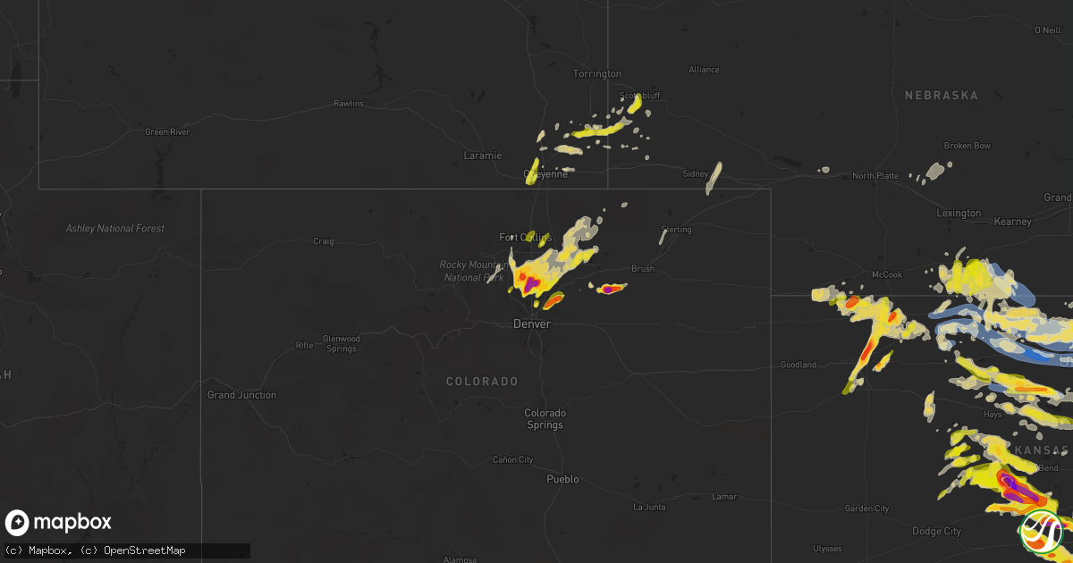
Hail Map on May 9, 2023
Get this storm
May 9 map
$229
one time, instant access
Download today. No call, no setup
Keep the $229
Bought the map and want the full workflow? Apply the entire $229 to a subscription within 7 days. None of it is wasted.
Every map, not just this one
This buys you this map. Subscription and you get every map we run, in the markets you choose from a few cities to whole states to nationwide. Plus real-time alerts the moment a storm fires.
Contact data
Name, contact info, occupancy, even credit band for addresses in the footprint. You go from where it hit to who to call.
Become the source they trust
Unlimited branding weather history reports on demand. You already have the documented answer ready for the property owner, and you are the one who showed up with it.
Property data and RoofTrace estimates
Pull up any address you have got, its value and the exact code rules for that jurisdiction, straight from One Click Code. Then RoofTrace estimates the squares, pitch, and roof value, priced the way you price.
States Impacted by Hail Map on May 9, 2023
Storm reports
North Carolina
| Date | Description |
|---|---|
| 05/09/20236:35 PM CDT | Nws employee reported trees uprooted and snapped on hwy 33 w north of falkland. |
| 05/09/20236:24 PM CDT | Public report of quarter sized hail in williamston... Relayed through social media. |
| 05/09/20236:22 PM CDT | Power poles down on nc 33 near edgecombe/pitt county line. |
| 05/09/20236:15 PM CDT | Roof damage to a mobile home. |
| 05/09/20236:10 PM CDT | Report of tree down shortly after 7pm. |
| 05/09/20236:07 PM CDT | Spotter reported quarter sized hail in farmville... Nc. |
| 05/09/20235:45 PM CDT | 911 center reports numerous trees downed across the county... With the greatest amount of damage starting in the battleboro area... Which then spread southeastward acro |
| 05/09/20235:45 PM CDT | Located at nc 42 and bridgersville rd. |
| 05/09/20235:38 PM CDT | Trees down on power lines. |
| 05/09/20235:33 PM CDT | A local report indicates 1.00 inch wind near SHARPSBURG |
| 05/09/20235:15 PM CDT | Carteret-craven electric cooperative reported limbs on powerlines at the intersection of barnes dr. And sound dr. In emerald isle. |
| 05/09/20235:03 PM CDT | Trees down in the macon area. |
| 05/09/20234:46 PM CDT | Public reported quarter sized hail in beaufort. |
| 05/09/20234:41 PM CDT | Mping report of quarter sized hail. |
| 05/09/20234:36 PM CDT | Multiple trees down on broad creek road. |
| 05/09/20234:35 PM CDT | A local report indicates 1.00 inch wind near 3 NW CRAB POINT VILLAGE |
| 05/09/20234:30 PM CDT | Public measured 73 mph gust. |
| 05/09/20234:22 PM CDT | Corrects location and time of previous tstm wnd dmg report from 1 e river road. Multiple trees down on broad creek road. |
| 05/09/20234:21 PM CDT | Large pine tree snapped in fairfield harbor. Time estimated from radar. |
| 05/09/20234:14 PM CDT | ~160 trees down at harbour pointe golf club. Time estimated from radar. |
| 05/09/20234:12 PM CDT | Trees down on power lines. |
| 05/09/20234:10 PM CDT | Public report of 1 inch hail. Time estimated from radar. |
| 05/09/20234:07 PM CDT | Public reported quarter sized hail in havelock... Relayed through social media. Time based on radar. |
| 05/09/20234:01 PM CDT | Trained spotter reports wind gusts around 60-65 mph and penny size hail near the intersection of hwy 17 and state rd 43. Extensive tree debris in the area. |
| 05/09/20233:51 PM CDT | Public sent picture of quarter sized hail. Time estimated from radar. |
| 05/09/20233:48 PM CDT | Significant amount of wind blown hail fell... Causing significant damage to siding. Pictures submitted via facebook. |
| 05/09/20233:45 PM CDT | Wind driven hail damage to several mobile homes along bear hole road in vanceboro. Additionally... A nearby barn was blown apart... And several large trees were uproote |
| 05/09/20233:25 PM CDT | Public report of quarter size hail in ayden. |
| 05/09/20233:21 PM CDT | Delayed report. Significant amount of accumulated hail fell. The hail damaged siding and vehicles. Report via twitter. Time estimated based on radar. |
| 05/09/20233:18 PM CDT | Delayed report. Numerous trees uprooted. Trailers reported flipped on speight seed farm road in the ballards cross roads area. Quarter size hail reported for 10 minutes |
| 05/09/20233:12 PM CDT | Picture submitted of quarter size hail off chinquapin rd east of farmville. Time estimated from radar. |
| 05/09/20233:10 PM CDT | Delayed report. Power lines blown down in the bell arthur area. Reported via the reflector. Time estimated based on radar. |
| 05/09/20233:00 PM CDT | Public report of multiple tree limbs down. Tree limbs had a a diameter of 3 1/2 inches. Also reports of damage to outdoor structures from tstm wind gusts. |
| 05/09/20232:52 PM CDT | A local report indicates 1.00 inch wind near 1 ESE MICRO |
| 05/08/20238:05 PM CDT | Public reported large limbs down in the trent woods area. |
| 05/08/20237:36 PM CDT | Report of tree down across nc 118 near butler ford rd. |
| 05/08/20237:02 PM CDT | Public report of ping pong sized hail in simpson... Nc. |
Colorado
| Date | Description |
|---|---|
| 05/09/20232:09 AM CDT | A local report indicates 1.00 inch wind near KERSEY |
| 05/09/20231:02 AM CDT | W1654. |
| 05/09/202312:50 AM CDT | From twitter... With picture. Car windows broken. |
| 05/09/202312:33 AM CDT | A local report indicates 2.00 inch wind near 2 NW FREDERICK |
| 05/09/202312:20 AM CDT | A local report indicates 1.25 inch wind near 2 NW FREDERICK |
| 05/09/202312:20 AM CDT | W1187. |
| 05/09/202312:18 AM CDT | Report from mping: hen egg |
| 05/09/202312:17 AM CDT | Report from mping: hen egg |
| 05/09/202312:10 AM CDT | From twitter... With pictures. |
| 05/09/202312:10 AM CDT | A local report indicates 1.75 inch wind near 3 N ERIE |
| 05/09/202312:10 AM CDT | Front windshield smashed... Rear window gone... Trees stripped... Roof damage. |
| 05/08/202311:51 PM CDT | Report from mping: golf ball |
| 05/08/202311:45 PM CDT | Co-bo-143. |
| 05/08/202311:38 PM CDT | A local report indicates 1.00 inch wind near 1 WNW NIWOT |
| 05/08/202311:35 PM CDT | A local report indicates 1.00 inch wind near 2 SSE HYGIENE |
| 05/08/202311:35 PM CDT | A local report indicates 1.00 inch wind near 3 N NIWOT |
| 05/08/202310:50 PM CDT | Between golf ball to tennis ball. |
| 05/08/20238:55 PM CDT | From twitter. |
| 05/08/20238:35 PM CDT | From twitter. |
| 05/08/20238:23 PM CDT | Ad1150?. |
| 05/08/20238:10 PM CDT | Via spotternetwork.org... Not the largest stone. |
| 05/08/20237:12 PM CDT | From twitter... With photo. |
Wyoming
| Date | Description |
|---|---|
| 05/09/20234:02 PM CDT | Spotter reported lots of hail up to quarter size. |
| 05/08/202310:00 PM CDT | A local report indicates 1.00 inch wind near 10 W CHEYENNE |
| 05/08/20239:54 PM CDT | A local report indicates 1.00 inch wind near 5 SSE LA GRANGE |
| 05/08/20239:30 PM CDT | Received via facebook. |
| 05/08/20238:30 PM CDT | A local report indicates 1.00 inch wind near ALBIN |
| 05/08/20237:52 PM CDT | A local report indicates 1.00 inch wind near 6 NNE GUN BARREL |
Alabama
| Date | Description |
|---|---|
| 05/09/20232:40 PM CDT | Several reports of trees and power lines down north and east of alexander city. |
| 05/09/20232:38 PM CDT | Tree on an unoccupied house on 6th st extension. |
| 05/09/20232:37 PM CDT | Tree reported down at jefferson st and 11th ave. |
| 05/09/20231:55 PM CDT | Multiple reports of trees and power lines down around sylacauga. |
| 05/09/20231:20 PM CDT | Tree down on grist mill rd near alpine post office. |
| 05/09/202312:53 PM CDT | Trees down renfroe rd/dial rd. One tree on car. |
| 05/09/202312:38 PM CDT | Trees down along joe lee rd. |
North Dakota
| Date | Description |
|---|---|
| 05/09/20236:25 PM CDT | Public reported pea to golf ball size hail covering the ground. |
| 05/09/20236:00 PM CDT | A local report indicates 1.75 inch wind near 10 N HEBRON |
| 05/08/202311:45 PM CDT | Via broadcast media. Quarter to golf ball size hail observed. |
| 05/08/20239:20 PM CDT | Social media reported with picture of nickel and quarter sized hail. |
| 05/08/20238:50 PM CDT | Nickel to quarter size hail reported by nws employee in bismarck. |
| 05/08/20238:45 PM CDT | Hail lasted from 845 pm to 905 pm. The largest hail stones were quarter size... But most were smaller than that. 1.05 inches of rain also reported. |
| 05/08/20238:40 PM CDT | Hail lasted 10 minutes. Report came from social media. |
| 05/08/20238:30 PM CDT | A local report indicates 1.50 inch wind near 1 N MANDAN |
| 05/08/20238:11 PM CDT | Golf ball size hail. |
Kansas
| Date | Description |
|---|---|
| 05/09/20236:59 PM CDT | The hail was pea size to quarter size. |
| 05/09/20236:53 PM CDT | Pea to quarter size hail was reported through social media. |
| 05/09/20236:50 PM CDT | Tree down with powerlines down in the 100 block of west jefferson in pittsburg. |
| 05/09/20236:44 PM CDT | Report from mping: half dollar |
| 05/09/20236:40 PM CDT | Large tree limb down on house in girard. |
| 05/09/20236:35 PM CDT | A local report indicates 60 MPH wind near 3 S PRATT |
| 05/09/20236:30 PM CDT | The hail was quarter to golf ball size. |
| 05/09/20236:27 PM CDT | Report of wind gusts of 60 to 65 mph in the town the of chautauqua. |
| 05/09/20236:24 PM CDT | A local report indicates 58 MPH wind near 3 ENE DODGE CITY |
| 05/09/20236:07 PM CDT | Reported though social media. |
| 05/09/20236:06 PM CDT | Reported through social media. |
| 05/09/20235:54 PM CDT | 50 to 60 mph winds. |
| 05/09/20235:51 PM CDT | A local report indicates 2.00 inch wind near 5 N SAINT JOHN |
| 05/09/20235:50 PM CDT | Ks mesonet station at uniontown ks. |
| 05/09/20235:42 PM CDT | A local report indicates 1.50 inch wind near 2 W OSAWATOMIE |
| 05/09/20235:30 PM CDT | A local report indicates 65 MPH wind near PARKER |
| 05/09/20235:26 PM CDT | A local report indicates 60 MPH wind near OSAWATOMIE |
| 05/09/20235:19 PM CDT | Public reports to 911 of tree fell on house 400th block and 15th street north wichita. No injuries reported. |
| 05/09/20235:15 PM CDT | Delayed report. |
| 05/09/20235:15 PM CDT | Report of 60+ mph winds reported by cl203. |
| 05/09/20235:14 PM CDT | A local report indicates 70 MPH wind near 6 SE OVERBROOK |
| 05/09/20235:10 PM CDT | A local report indicates 60 MPH wind near 5 E SEVERY |
| 05/09/20235:05 PM CDT | Reported through social media. |
| 05/09/20234:55 PM CDT | A local report indicates 2.00 inch wind near LARNED |
| 05/09/20234:47 PM CDT | Trees blown onto houses in the 1300 block n forest and 400 block n erie. Person trapped on second floor of house with rescue in progress. |
| 05/09/20234:47 PM CDT | Tree damage reported with wind gusts. |
| 05/09/20234:46 PM CDT | Minor tree damage and numerous 3-4 inch diameter limbs down. Delayed report. |
| 05/09/20234:45 PM CDT | Reported though social media. |
| 05/09/20234:42 PM CDT | Large trees knocked down and snapped in half. |
| 05/09/20234:40 PM CDT | A local report indicates 4.00 inch wind near 5 SSE ASH VALLEY |
| 05/09/20234:38 PM CDT | Spotter id: bt124. |
| 05/09/20234:35 PM CDT | Measured at the eureka airport. Strong outflow out ahead of the line. |
| 05/09/20234:34 PM CDT | A local report indicates 2.00 inch wind near 5 SE ASH VALLEY |
| 05/09/20234:34 PM CDT | A local report indicates 60 MPH wind near 5 SSE SCRANTON |
| 05/09/20234:30 PM CDT | A local report indicates 1.00 inch wind near 5 N LARNED |
| 05/09/20234:25 PM CDT | Corrects time from previous report. Public report to dispatch of a tree fell that on a house in the 400th block and 15th street. No injuries reported. Time is estimated |
| 05/09/20234:24 PM CDT | A local report indicates 60 MPH wind near 4 SW HAMILTON |
| 05/09/20234:24 PM CDT | Three-inch live tree limbs blown down. Time estimated from radar data. Delayed report. |
| 05/09/20234:20 PM CDT | Unconfirmed report to 911 that power lines are down around the 2300 block s victoria... Wichita. Lines were down on a yard. Delayed report. |
| 05/09/20234:20 PM CDT | A local report indicates 2.50 inch wind near 5 ESE ASH VALLEY |
| 05/09/20234:12 PM CDT | A local report indicates 65 MPH wind near 4 NW LEBO |
| 05/09/20234:10 PM CDT | 11 inch limb blown down. |
| 05/09/20234:10 PM CDT | Large tree branch down on a truck and 2 houses in el dorado. Both houses have damage to them. Delayed report via twitter picture. |
| 05/09/20234:03 PM CDT | A local report indicates 1.00 inch wind near OSAGE CITY |
| 05/09/20233:52 PM CDT | Estimated wind gusts 50-60 mph. Time estimated. |
| 05/09/20233:48 PM CDT | Powerlines were reported down. |
| 05/09/20233:41 PM CDT | 1 inch hail reported outside of allen. |
| 05/09/20233:25 PM CDT | A local report indicates 1.00 inch wind near ELMDALE |
| 05/09/20233:22 PM CDT | Relayed through social media. |
| 05/09/20233:15 PM CDT | A local report indicates 1.00 inch wind near 1 ESE BISON |
| 05/09/20233:15 PM CDT | Delayed report. |
| 05/09/20233:12 PM CDT | Trained spotter estimated 50 to 60 mph winds with pea sized hail. |
| 05/09/20233:00 PM CDT | Vehicle-mounted anemometer measured 55 to 60 mph winds. Delayed report. |
| 05/09/20233:00 PM CDT | A local report indicates 1.50 inch wind near 4 NW BISON |
| 05/09/20232:57 PM CDT | A local report indicates 1.25 inch wind near 3 ENE LA CROSSE |
| 05/09/20232:52 PM CDT | Wind gusts of 70 to 75 reported as well. |
| 05/09/20232:52 PM CDT | Wind gusts of 70 to 75 reported as well. |
| 05/09/20232:52 PM CDT | Winds ranged from 70 to 75 mph on vehicle anemometer. Quarter sized hail reported too. |
| 05/09/20232:52 PM CDT | Winds ranged from 70 to 75 mph on vehicle anemometer. |
| 05/09/20232:50 PM CDT | Hail ranged from pea-size to 1 inch. |
| 05/09/20232:43 PM CDT | A local report indicates 1.00 inch wind near HERINGTON |
| 05/09/20232:32 PM CDT | Dk 101 reported hail up to quarters in diameter. |
| 05/09/20232:30 PM CDT | A local report indicates 1.00 inch wind near HOPE |
| 05/09/20232:22 PM CDT | Spotter used calibrated wind anemometer and measured winds gust ranging from 70 to max 75mph. |
| 05/09/20232:17 PM CDT | A local report indicates 60 MPH wind near FORT RILEY |
| 05/09/20232:15 PM CDT | A local report indicates 1.00 inch wind near 7 ENE LORRAINE |
| 05/09/20232:10 PM CDT | Large tree with trunk about 18 to 24 inches in diameter snapped off. |
| 05/09/20232:05 PM CDT | A local report indicates 76 MPH wind near 2 SE MILFORD |
| 05/09/20232:01 PM CDT | No reported damage. |
| 05/09/20232:00 PM CDT | Spotter estimating 60-65 mph wind gusts. |
| 05/09/20231:57 PM CDT | A local report indicates 1.00 inch wind near 1 W ABILENE |
| 05/09/20231:57 PM CDT | A local report indicates 1.00 inch wind near 4 SSW ABILENE |
| 05/09/20231:30 PM CDT | Spotter estimated winds about 60-65 mph winds. Time estimated. |
| 05/09/20231:30 PM CDT | Spotter estimated winds about 60-65 mph winds. Time estimated. |
| 05/09/20231:25 PM CDT | Brief quarter sized hail via twitter video. |
| 05/09/20231:14 PM CDT | Reported structural damage at the fairgrounds... Damage to a building off hwy 81... And damage to 2-3 inch tree limbs. |
| 05/09/20231:14 PM CDT | A local report indicates 76 MPH wind near 2 SSE CONCORDIA |
| 05/09/20231:07 PM CDT | A local report indicates 1.00 inch wind near 3 SW MILTONVALE |
| 05/09/20231:07 PM CDT | Trained spotter reported a brief tornado 5 miles south/southwest of miltonvale... Quarter-sized hail and 60 mph wind gusts. |
| 05/09/202312:55 PM CDT | Delayed report. Six inch healthy tree limbs torn off trees. |
| 05/09/202312:45 PM CDT | A local report indicates 1.00 inch wind near 9 NNE GLASCO |
| 05/09/202312:35 PM CDT | Reported just west of glasco. |
| 05/09/202312:34 PM CDT | A local report indicates 1.00 inch wind near 2 S SIMPSON |
| 05/09/202312:30 PM CDT | A local report indicates 1.50 inch wind near LURAY |
| 05/09/202312:30 PM CDT | A local report indicates 1.50 inch wind near LURAY |
| 05/09/202312:22 PM CDT | A local report indicates 1.50 inch wind near WALDO |
| 05/09/202312:20 PM CDT | Davis weatherlink station. Time estimated from radar. |
| 05/09/202312:16 PM CDT | Report via mping. |
| 05/09/202312:16 PM CDT | Report from mping: half dollar |
| 05/09/202312:16 PM CDT | Report via mping. |
| 05/09/202312:05 PM CDT | Report via facebook... Time est. From radar. |
| 05/09/202312:03 PM CDT | 2 inch diameter limbs down. |
| 05/09/202312:02 PM CDT | A local report indicates 65 MPH wind near 5 W PARADISE |
| 05/09/202312:01 PM CDT | Quarters with hail covering the ground. Hail lasted about 7 min. |
| 05/09/202311:59 AM CDT | Ksu mesonet site wsw of beloit. |
| 05/09/202311:50 AM CDT | Ambient weather station - cawker weather. |
| 05/09/202311:50 AM CDT | A local report indicates 66 MPH wind near 2 N CAWKER CITY |
| 05/09/202311:42 AM CDT | A local report indicates 1.00 inch wind near 1 NE CODELL |
| 05/09/202311:29 AM CDT | A local report indicates 58 MPH wind near 2 N CAWKER CITY |
| 05/09/202311:22 AM CDT | Received report from kake of possible damage on the nnw side of osborne near hospital... Confirmed with county dispatch that 3 power poles were broken in that area. Rep |
| 05/09/202311:22 AM CDT | A local report indicates 81 MPH wind near 1 NNW OSBORNE |
| 05/09/202311:18 AM CDT | Quarter size hail reported 5n of plainville on hwy 183... Relayed via county dispatch. |
| 05/09/202311:12 AM CDT | Quarter size hail at hwy 18 and 14 rd... Relayed via county dispatch. |
| 05/09/202310:58 AM CDT | Report via spotter network. |
| 05/09/202310:55 AM CDT | A local report indicates 59 MPH wind near SMITH CENTER AIRPORT |
| 05/09/202310:55 AM CDT | Quarter to half dollar size hail reported. |
| 05/09/202310:53 AM CDT | Hail up to tennis ball size reported on the northeast side of mankato. |
| 05/09/20239:23 AM CDT | Delayed report via social media. 42 foot grain trailer moved about 100 feet and blown onto its side. |
| 05/09/20239:20 AM CDT | Social media report of a wind gusts as the storm moved in around 60 mph. |
| 05/09/20239:20 AM CDT | Trained spotter estimated winds around 65 mph. |
| 05/09/20238:55 AM CDT | Hail ranging from pea to golf ball sized with picture of hail covering the ground. |
| 05/09/20238:50 AM CDT | Social media report with picture of ping pong ball sized hail. |
| 05/09/20238:47 AM CDT | Social media report with picture and video of hail around half dollar in size. |
| 05/09/20238:45 AM CDT | Social media report of golf ball sized hail. |
| 05/09/20238:25 AM CDT | Hail up to slightly larger than 1 inch. Lasted 5 minutes. |
| 05/09/20238:20 AM CDT | Social media report with picture of quarter sized hail. |
| 05/09/20238:10 AM CDT | Relayed report of ping pong ball sized hail in menlo. |
| 05/09/20238:00 AM CDT | Relayed via dispatch. Hail ranged from nickel to quarter in size. |
| 05/09/20238:00 AM CDT | A local report indicates 1.00 inch wind near 4 SSW ABILENE |
| 05/09/20237:38 AM CDT | Late report. Found picture on local media website. |
| 05/09/20237:35 AM CDT | A local report indicates 1.25 inch wind near ENTERPRISE |
| 05/09/20237:35 AM CDT | Social media report of hail from quarter to golf ball in size with pictures. Hail started around 1230z. |
| 05/09/20237:30 AM CDT | Estimated dime to nickel sized hail between 7:30 and 8 am ct. The hail turned the ground white. Estimated time of report. |
| 05/08/202310:25 PM CDT | A local report indicates 62 MPH wind near WICHITA EISENHOWER AIR |
| 05/08/202310:24 PM CDT | Nws storm survey revealed snapped branches off of a bradford pear tree and damage to another tree. Time is based on nearby airport observation. |
| 05/08/20239:06 PM CDT | A local report indicates 2.00 inch wind near 2 NNE ZOOK |
| 05/08/20238:30 PM CDT | Photo on social media. |
| 05/08/20238:29 PM CDT | A local report indicates 1.50 inch wind near 2 E NASHVILLE |
| 05/08/20238:25 PM CDT | A local report indicates 1.25 inch wind near 3 S BAZINE |
| 05/08/20238:25 PM CDT | Photo on social media. |
| 05/08/20238:16 PM CDT | A local report indicates 1.00 inch wind near BAZINE |
| 05/08/20238:10 PM CDT | Accumulating hail. Dimes to quarters. |
| 05/08/20238:04 PM CDT | A local report indicates 1.25 inch wind near ROZEL |
| 05/08/20237:50 PM CDT | A local report indicates 1.00 inch wind near 5 SE PRATT |
| 05/08/20237:49 PM CDT | Reported by social media. |
| 05/08/20237:44 PM CDT | A local report indicates 1.50 inch wind near 5 NNW LARNED |
| 05/08/20237:43 PM CDT | A local report indicates 1.50 inch wind near PRATT |
| 05/08/20237:38 PM CDT | A local report indicates 1.00 inch wind near 4 NNE BURDETT |
| 05/08/20237:35 PM CDT | A tree took down a power line when it fell. The report is via social media. |
| 05/08/20237:30 PM CDT | This report is from a davis system. Dv100392. The time was based on radar. |
| 05/08/20237:26 PM CDT | This report was via social media. |
| 05/08/20237:24 PM CDT | A local report indicates 2.00 inch wind near TURON |
| 05/08/20237:20 PM CDT | A local report indicates 1.50 inch wind near TURON |
| 05/08/20237:00 PM CDT | Reported by social media. |
| 05/08/20237:00 PM CDT | A local report indicates 1.00 inch wind near 1 N KINSLEY |
Minnesota
| Date | Description |
|---|---|
| 05/09/20233:45 PM CDT | Relayed from dispatch. |
| 05/09/20232:50 PM CDT | A local report indicates 1.00 inch wind near 4 WSW WATSON |
Nebraska
| Date | Description |
|---|---|
| 05/09/20236:15 PM CDT | Trained storm spotter reported 60 mph gusts. Time estimated from radar. |
| 05/09/20236:05 PM CDT | Trained spotter reported very strong wind gusts while driving. Time estimated from radar. |
| 05/09/20239:06 AM CDT | Pea to quarter size hail reported. |
| 05/09/20238:35 AM CDT | Hail stopped briefly then returned... Sizes again anywhere from nickel to half dollar. |
| 05/09/20238:24 AM CDT | Penny to half dollar size hail reported by fire chief. |
| 05/09/20234:30 AM CDT | Mesonet station fw8225 sidney. |
| 05/09/20233:15 AM CDT | Spotter reported marble sized hail with a few bigger stones. Hail remained on the ground until the following morning. |
| 05/09/202312:50 AM CDT | A local report indicates 1.00 inch wind near GERING |
| 05/09/202312:24 AM CDT | Hail at least 2 inches deep in places. Relayed by broadcast media. |
Texas
| Date | Description |
|---|---|
| 05/09/20236:54 PM CDT | Mesonet station 72 big bend np/brewster county. |
| 05/09/20235:16 PM CDT | Landspout: a photo of an apparent landspout tornado near saragosa was shared on social media. The exact location and time are estimated by radar. There was no reported |
| 05/09/20232:05 PM CDT | Delayed report forwarded via local media of a 1 foot diameter elm tree snapped 2 miles north of burnet... Consistent with an area of higher winds evident on kgrk radar. |
| 05/08/20237:53 PM CDT | A local report indicates 1.00 inch wind near 7 WSW GEORGE WEST |
Georgia
| Date | Description |
|---|---|
| 05/09/20235:06 PM CDT | Nickel to quarter size hail reported by public. |
| 05/09/20234:08 PM CDT | *** 1 inj *** a tree fell on a person and injured them. |
| 05/09/20234:08 PM CDT | *** 1 inj *** a tree fell on a person and injured them. |
| 05/09/20231:50 PM CDT | Quarter sized hail at the intersection of hwy 34 and ebenezer church road. |
| 05/09/20231:46 PM CDT | Nickel to quarter sized hail in the summergrove and eastlake neighborhoods. |
| 05/09/20231:20 PM CDT | Trained spotter reported quarter to ping pong sized hail off of hwy 27 between powell road and armstrong mill road. |
Virginia
| Date | Description |
|---|---|
| 05/09/20234:50 PM CDT | Time estimated from radar. |
| 05/09/20234:45 PM CDT | Tree knocked down along robinson ferry rd near white plains. Time estimated from radar. |
| 05/09/20234:30 PM CDT | Tree knocked down along allgoods lane. Time estimated from radar. |
| 05/09/20234:15 PM CDT | Tree knocked down blocking the road at sweetwater ln and country club dr. Time estimated from radar. |
Oklahoma
| Date | Description |
|---|---|
| 05/08/20238:04 PM CDT | Measured at tulsa int'l airport. |
South Dakota
| Date | Description |
|---|---|
| 05/08/20237:10 PM CDT | Lots of pea sized hail with a few as large as quarters. Very little wind. Radar estimated time. |
Missouri
| Date | Description |
|---|---|
| 05/09/20236:18 PM CDT | Electric company reporting storm damage to electrical lines near richards. |
| 05/09/20234:40 PM CDT | Report of hail to at least golf ball size in urbana. |
| 05/09/20234:13 PM CDT | Pictures of two inch hail near highway hh and highway 64 south of rimby. Time estimated from radar. |
| 05/09/20233:47 PM CDT | Delayed report. House pillar blown of front porch. Picture via social media. |
| 05/09/20233:43 PM CDT | Downtown bolivar. |
| 05/09/20233:42 PM CDT | Golf ball size hail in bolivar. Time estimated from radar. |
| 05/09/20233:25 PM CDT | Pictures of hail at least half dollar size in brighton. |
| 05/09/20233:04 PM CDT | Half dollar size hail reported via mping. Time estimated from radar. |
| 05/09/20232:52 PM CDT | Observed at the nws office by staff on duty. |
| 05/08/20238:50 PM CDT | Electric company reporting storm damage across power lines due to wind across service area including northern stone county. |
| 05/08/20238:46 PM CDT | Report from mping: half dollar |
| 05/08/20238:45 PM CDT | Several trees and limbs down across powerlines in multiple locations throughout springfield. |
| 05/08/20238:31 PM CDT | Sgf asos measured 78 mph wind gust at springfield airport. |
| 05/08/20238:30 PM CDT | 911 had reports of down trees in willard. |
| 05/08/20238:25 PM CDT | Trees and powerlines down on highway 14. |
| 05/08/20238:24 PM CDT | A local report indicates 1.00 inch wind near 1 W REPUBLIC |
| 05/08/20238:19 PM CDT | At least golf ball size hail with damage to vehicles. |
| 05/08/20238:15 PM CDT | Picture of estimated golf ball size hail or slightly larger near highway 174 and farm road 43. |
| 05/08/20238:09 PM CDT | A local report indicates 1.00 inch wind near WALNUT GROVE |
| 05/08/20237:51 PM CDT | Report from mping: quarter |
| 05/08/20237:48 PM CDT | A local report indicates 1.00 inch wind near 1 S NIXA |
| 05/08/20237:45 PM CDT | Picture of hail 4 miles west of republic. |
| 05/08/20237:41 PM CDT | Report from mping: quarter 1.00 in. |
| 05/08/20237:40 PM CDT | Via social media picture. Delayed report. |
| 05/08/20237:40 PM CDT | Public report of numerous trees down in carthage. |
| 05/08/20237:20 PM CDT | Picture of hail from the highlandville area around 720pm. |
| 05/08/20237:20 PM CDT | North heights in joplin... Large tree down off pearl st. |
| 05/08/20237:10 PM CDT | Electric company reporting widespread outages due to tree damage across southern barton county and near jasper. |
| 05/08/20237:10 PM CDT | Several outages due to tree damage along powerlines across eastern vernon and western cedar counties. |
| 05/08/20237:05 PM CDT | Local business lost one third of roof. |
| 05/08/20237:00 PM CDT | Phone pole down in harwood. |
South Carolina
| Date | Description |
|---|---|
| 05/09/20235:53 PM CDT | Hail up to the size of quarters fell at the lakeview golf course. There was also strong wind which blew down small limbs and debris. |
| 05/09/20235:45 PM CDT | A local report indicates 1.00 inch wind near 3 SW SIMPSONVILLE |
| 05/09/20235:45 PM CDT | Approximately 20 trees down on property. |
| 05/09/20235:45 PM CDT | A local report indicates 1.00 inch wind near 5 WSW MAULDIN |
| 05/09/20234:54 PM CDT | A local report indicates 1.00 inch wind near 3 WSW GRAY COURT |
| 05/09/20234:50 PM CDT | A local report indicates 1.00 inch wind near 1 NE MAULDIN |
| 05/09/20234:50 PM CDT | A local report indicates 1.00 inch wind near 1 NE MAULDIN |
| 05/09/20234:26 PM CDT | A local report indicates 1.50 inch wind near 2 S TAYLORS |
| 05/09/20234:22 PM CDT | A local report indicates 2.00 inch wind near 2 N DOWNTOWN GREENVILLE |
| 05/09/20234:15 PM CDT | A local report indicates 2.00 inch wind near 3 NE DOWNTOWN GREENVILL |
| 05/09/20234:10 PM CDT | A local report indicates 1.00 inch wind near 3 WSW GREENVILLE-SPARTA |
| 05/09/20234:08 PM CDT | Walnut size hail...approx 1.5 inch...reported on dexter dr |
| 05/09/20234:05 PM CDT | A local report indicates 1.25 inch wind near 4 SSE TAYLORS |
| 05/09/20234:05 PM CDT | A local report indicates 1.25 inch wind near 2 SW TAYLORS |
| 05/09/20234:04 PM CDT | A local report indicates 1.25 inch wind near 2 NNE DOWNTOWN GREENVIL |
| 05/09/20234:01 PM CDT | A local report indicates 1.00 inch wind near FOUNTAIN INN |
| 05/09/20234:00 PM CDT | A local report indicates 1.00 inch wind near 3 SSE PARIS MOUNTAIN ST |
| 05/09/20233:56 PM CDT | A local report indicates 1.00 inch wind near 1 ENE DOWNTOWN GREENVIL |
| 05/09/20233:55 PM CDT | Measured up to 2.25 inch hail on riviera dr |
| 05/09/20233:46 PM CDT | Quarter sized hail. Hail nearly covered the ground. |
| 05/09/20233:42 PM CDT | A local report indicates 1.00 inch wind near 3 S TAYLORS |
| 05/09/20233:42 PM CDT | A local report indicates 1.00 inch wind near 3 S TAYLORS |
| 05/08/20238:05 PM CDT | Most of a large tree down due to thunderstorm winds. Time estimated from radar. |
| 05/08/20237:48 PM CDT | A nws employee reported a tree down on south aviation avenue. |
| 05/08/20237:13 PM CDT | Charleston county dispatch reported tree down at 7th avenue and 5th street |
| 05/08/20237:13 PM CDT | Report from charleston branch pilot office of winds 55 to 60 knots with gusts to 69 knots on roof of the building. |
| 05/08/20237:12 PM CDT | Charleston harbor tide gauge reported a 65 knot or 75 mph wind gust. |
| 05/08/20237:11 PM CDT | Tree down on hobcaw drive. |
| 05/08/20237:10 PM CDT | Public reported quarter size hail near long point road and belle station. |
| 05/08/20237:07 PM CDT | Several trailored sailboats were tossed around and one large oak tree was reported blown down. |
Cities Impacted by Hail Map on May 9, 2023
- El Dorado, AR
- Horatio, AR
- De Queen, AR
- Dixon, KY
- Sebree, KY
- Slaughters, KY
- Manitou, KY
- Saint Francis, KS
- McDonald, KS
- Winona, KS
- Monument, KS
- Colby, KS
- Scott City, KS
- Atwood, KS
- Abilene, KS
- Enterprise, KS
- Ludell, KS
- Herndon, KS
- Gem, KS
- Rexford, KS
- Selden, KS
- Oberlin, KS
- Hoxie, KS
- Beaver City, NE
- Oxford, NE
- Edison, NE
- Arapahoe, NE
- Orleans, NE
- Hendley, NE
- Jennings, KS
- Dresden, KS
- Stamford, NE
- Norcatur, KS
- Alma, NE
- Norton, KS
- Lenora, KS
- Almena, KS
- Prairie View, KS
- Long Island, KS
- Phillipsburg, KS
- Republican City, NE
- Hill City, KS
- Logan, KS
- Naponee, NE
- Bloomington, NE
- Kensington, KS
- Agra, KS
- Kirwin, KS
- Glade, KS
- Riverton, NE
- Franklin, NE
- Smith Center, KS
- Gaylord, KS
- Cedar, KS
- Athol, KS
- Portis, KS
- Osborne, KS
- Alton, KS
- Stockton, KS
- Woodston, KS
- Bogue, KS
- Damar, KS
- Palco, KS
- Plainville, KS
- Mankato, KS
- Lebanon, KS
- Downs, KS
- Webber, KS
- Esbon, KS
- Cawker City, KS
- Glen Elder, KS
- Natoma, KS
- Tipton, KS
- Beloit, KS
- Randall, KS
- Jewell, KS
- Ellis, KS
- Catharine, KS
- Victoria, KS
- Paradise, KS
- Formoso, KS
- Waldo, KS
- Russell, KS
- Luray, KS
- Norway, KS
- Courtland, KS
- Jamestown, KS
- Concordia, KS
- Simpson, KS
- Glasco, KS
- Lucas, KS
- Scandia, KS
- Delphos, KS
- Miltonvale, KS
- Aurora, KS
- Clyde, KS
- Minneapolis, KS
- Clay Center, KS
- Bunker Hill, KS
- Bloomington, TX
- Victoria, TX
- Benkelman, NE
- Bird City, KS
- Max, NE
- Stratton, NE
- Bertrand, NE
- Trenton, NE
- Paxton, NE
- Chapman, KS
- Holbrook, NE
- Burr Oak, KS
- New Orleans, LA
- Arnaudville, LA
- Belleville, KS
- Wilsonville, NE
- Lincoln, AL
- Riverside, AL
- Kermit, WV
- Wilsondale, WV
- Crum, WV
- Louise, TX
- Clayton, KS
- Penokee, KS
- Lolita, TX
- Oakley, KS
- Cambridge, NE
- Holdrege, NE
- Hays, KS
- Sylvan Grove, KS
- Clifton, KS
- Morganville, KS
- Longford, KS
- Palmer, KS
- Solomon, KS
- Dorrance, KS
- Bennington, KS
- Talmage, KS
- Green, KS
- Wakefield, KS
- Wilson, KS
- Junction City, KS
- Riley, KS
- Leonardville, KS
- Milford, KS
- Fort Riley, KS
- Woodbine, KS
- Randolph, KS
- Manhattan, KS
- Ogden, KS
- Roopville, GA
- Franklin, GA
- Ellsworth, KS
- Newnan, GA
- Sharpsburg, GA
- Peachtree City, GA
- Lorraine, KS
- Herington, KS
- Tampa, KS
- Ramona, KS
- White City, KS
- Gypsum, KS
- Hope, KS
- Alta Vista, KS
- Dwight, KS
- Council Grove, KS
- Springfield, MO
- Republic, MO
- Brookline, MO
- Lost Springs, KS
- Burdick, KS
- Willard, MO
- Saint George, KS
- Alma, KS
- Wilsey, KS
- Lincolnville, KS
- La Crosse, KS
- Bison, KS
- Strong City, KS
- Marion, KS
- Elmdale, KS
- Wamego, KS
- Olsburg, KS
- Pleasant Hope, MO
- Brighton, MO
- Walnut Grove, MO
- Rush Center, KS
- Otis, KS
- Dawson, MN
- Boyd, MN
- Montevideo, MN
- Paxico, KS
- Allen, KS
- McFarland, KS
- Belvue, KS
- Kellyton, AL
- Alexander City, AL
- Jacksons Gap, AL
- Morrisville, MO
- Aldrich, MO
- Selma, NC
- Kenly, NC
- Wilson, NC
- Elm City, NC
- Saint Marys, KS
- Maple Hill, KS
- Eskridge, KS
- Admire, KS
- Cottonwood Falls, KS
- Americus, KS
- Emporia, KS
- Cedar Point, KS
- Olpe, KS
- Matfield Green, KS
- Farmville, NC
- Fountain, NC
- Walstonburg, NC
- Greenville, NC
- Winterville, NC
- Ayden, NC
- Harveyville, KS
- Topeka, KS
- Reading, KS
- Grifton, NC
- Vanceboro, NC
- Grimesland, NC
- Bolivar, MO
- Larned, KS
- Albert, KS
- Great Bend, KS
- Half Way, MO
- Polk, MO
- Taylors, SC
- Greenville, SC
- Greer, SC
- Burlingame, KS
- Osage City, KS
- Ernul, NC
- New Bern, NC
- Louisburg, MO
- Grantsboro, NC
- Cartersville, GA
- Simpsonville, SC
- Auburn, KS
- Neosho Rapids, KS
- Hartford, KS
- Pawnee Rock, KS
- Urbana, MO
- Hermitage, MO
- Buffalo, MO
- Deep Run, NC
- Kinston, NC
- Trenton, NC
- Tuskegee, AL
- Eureka, KS
- Madison, KS
- Hamilton, KS
- Vassar, KS
- Lyndon, KS
- Quenemo, KS
- Overbrook, KS
- Pomona, KS
- Burlington, KS
- Virgil, KS
- Scranton, KS
- Melvern, KS
- Waverly, KS
- Gridley, KS
- Lebo, KS
- Yates Center, KS
- Williamsburg, KS
- Neosho Falls, KS
- Toronto, KS
- Princeton, KS
- Colony, KS
- Garnett, KS
- Ottawa, KS
- Westphalia, KS
- Le Roy, KS
- Richmond, KS
- Welda, KS
- Neal, KS
- Mauldin, SC
- Carbondale, KS
- Baldwin City, KS
- Preston, MO
- Sheldon, MO
- Lamar, MO
- Rome, GA
- Wellsville, KS
- St John, KS
- Gray Court, SC
- Fountain Inn, SC
- Enoree, SC
- La Crosse, VA
- South Hill, VA
- Woodruff, SC
- Bracey, VA
- Laurens, SC
- Baskerville, VA
- Boydton, VA
- Macon, NC
- Warrenton, NC
- Littleton, NC
- Greeley, KS
- Edgerton, KS
- Paola, KS
- Lane, KS
- Rantoul, KS
- Osawatomie, KS
- Moran, KS
- Kincaid, KS
- Norlina, NC
- Jerico Springs, MO
- El Dorado Springs, MO
- Walker, MO
- Harwood, MO
- Calico Rock, AR
- Piedmont, SC
- Nashville, NC
- Rocky Mount, NC
- Pinetops, NC
- Hollister, NC
- Enfield, NC
- Schell City, MO
- Whitakers, NC
- Bronson, KS
- Mapleton, KS
- Centerville, KS
- Parker, KS
- Mound City, KS
- La Cygne, KS
- Fulton, KS
- Blue Mound, KS
- Fontana, KS
- Prescott, KS
- Spring Hill, KS
- Beulah, ND
- Hebron, ND
- Battleboro, NC
- Macclesfield, NC
- Lewiston Woodville, NC
- Windsor, NC
- Hudson, KS
- Rozel, KS
- Macksville, KS
- Pleasanton, KS
- Louisburg, KS
- Uniontown, KS
- Fort Scott, KS
- Redfield, KS
- Stafford, KS
- La Grange, NC
- Goldsboro, NC
- Grenora, ND
- Williston, ND
- Mountain Home, AR
- Montgomery, LA
- Salina, KS
- Millerville, AL
- Clontarf, MN
- Benson, MN
- Gorham, KS
- Cross Timbers, MO
- Zachary, LA
- Pride, LA
- Lincoln, KS
- Roxie, MS
- Morehead City, NC
- Newport, NC
- Taft, TX
- Tibbie, AL
- Deer Park, AL
- Stantonsburg, NC
- Macon, GA
- Jeffersonville, GA
- Danville, GA
- Bushton, KS
- McIntosh, AL
- Realitos, TX
- Pell City, AL
- Talladega, AL
- Aransas Pass, TX
- Ingleside, TX
- Tyrone, GA
- Fayetteville, GA
- Beaufort, NC
- Dadeville, AL
- Dry Branch, GA
- Tuskegee Institute, AL
- Hancock, MN
- Gladys, VA
- Colfax, LA
- Lafayette, AL
- Five Points, AL
- Roanoke, AL
- Goodwater, AL
- Camp Hill, AL
- Hays, MT
- Harlem, MT
- Shields, ND
- Sylacauga, AL
- Walker, KS
- Bois D Arc, MO
- Ash Grove, MO
- Kanopolis, KS
- Chase City, VA
- Woodland, AL
- Cheyenne, WY
- Revere, MN
- Walnut Grove, MN
- Lamberton, MN
- Havelock, NC
- Burns, WY
- Kenbridge, VA
- Victoria, VA
- Lunenburg, VA
- Freer, TX
- Portland, TX
- Corpus Christi, TX
- Wilmington, NC
- Kilgore, TX
- Wedowee, AL
- Bingham Lake, MN
- Windom, MN
- Claflin, KS
- Pearl River, LA
- Perdido, AL
- Watson, MN
- White, GA
- Jonesboro, LA
- Liebenthal, KS
- Nekoma, KS
- McCracken, KS
- El Dorado, KS
- Agenda, KS
- Natchez, MS
- Florien, LA
- Snow Hill, NC
- Many, LA
- Hoisington, KS
- Alpine, AL
- Rockford, AL
- Notasulga, AL
- Lena, LA
- Wagarville, AL
- Lizella, GA
- Shelby, AL
- Minneota, MN
- Clarkfield, MN
- Tescott, KS
- Picayune, MS
- Hampstead, NC
- Childersburg, AL
- Zwolle, LA
- Rayville, LA
- Clever, MO
- Billings, MO
- Garrison, TX
- Tow, TX
- Wadley, AL
- Iuka, KS
- Glen Ullin, ND
- Turon, KS
- Burdett, KS
- Hanston, KS
- Ness City, KS
- Jetmore, KS
- Byers, KS
- Pratt, KS
- Bronaugh, MO
- Liberal, MO
- Amsterdam, MO
- Drexel, MO
- Butler, MO
- Adrian, MO
- Amoret, MO
- Foster, MO
- Hume, MO
- Lewis, KS
- Kinsley, KS
- Garfield, KS
- New Salem, ND
- Hazen, ND
- Chocowinity, NC
- Bath, NC
- Pinetown, NC
- Sawyer, KS
- Charleston, SC
- Mount Pleasant, SC
- North Charleston, SC
- Sullivans Island, SC
- Denver, CO
- Thornton, CO
- Brighton, CO
- Belpre, KS
- Fort Lupton, CO
- Mandan, ND
- Center, ND
- Isabel, KS
- Medicine Lodge, KS
- Commerce City, CO
- Everton, MO
- Nixa, MO
- Ozark, MO
- Bismarck, ND
- Hudson, CO
- George West, TX
- Sandia, TX
- Three Rivers, TX
- Marionville, MO
- Aurora, MO
- Mount Vernon, MO
- Alexander, KS
- Albin, WY
- Meriden, WY
- Bazine, KS
- Windsor, CO
- Eaton, CO
- Severance, CO
- Greeley, CO
- Ault, CO
- Nashville, KS
- Wasta, SD
- Morrill, NE
- Smithwick, SD
- Mitchell, NE
- Selfridge, ND
- Crawford, NE
- Watauga, SD
- Lyman, NE
- McIntosh, SD
- Howes, SD
- Faith, SD
- Harrison, NE
- Owanka, SD
- Flasher, ND
- Oelrichs, SD
- Oral, SD
- Dupree, SD
- Saint Anthony, ND
- Pine Ridge, SD
- Calliham, TX
- Brownell, KS
- Fort Collins, CO
- Timnath, CO
- Ransom, KS
- Henderson, CO
- Orange Grove, TX
- Wiggins, CO
- Harrisburg, NE
- Goddard, KS
- Wichita, KS
- Fort Morgan, CO
- Boulder, CO
- Longmont, CO
- Niwot, CO
- Steele, ND
- Dawson, ND
- Tappen, ND
- Erie, CO
- Lafayette, CO
- Berthoud, CO
- Mead, CO
- Dacono, CO
- Firestone, CO
- Johnstown, CO
- Platteville, CO
- Milliken, CO
- Frederick, CO
- Gering, NE
- Atlantic Beach, NC
- Scottsbluff, NE
- Starbuck, MN
- La Salle, CO
- Kersey, CO
- Garland, KS
- Deerfield, MO
- Richards, MO
- Milo, MO
- Moundville, MO
- Nevada, MO
- Rockville, MO
- Rich Hill, MO
- Lockwood, MO
- Golden City, MO
- Humansville, MO
- Greenfield, MO
- Stockton, MO
- Arcola, MO
- Fair Play, MO
- Dadeville, MO
- Collins, MO
- South Greenfield, MO
- Jasper, MO
- Fair Grove, MO
- Strafford, MO
- Dunnegan, MO
- Miller, MO
- Halltown, MO
- Rogersville, MO
- Gilcrest, CO
- Williamston, NC
- Jamesville, NC
- Ladson, SC
- West Blocton, AL
- Centreville, AL
- Windyville, MO
- Huger, SC
- Collyer, KS
- Quinter, KS
- Driscoll, ND
- Richardton, ND
- Roggen, CO
- Goose Creek, SC
- Ellendale, ND
- Johns Island, SC
- Lansford, ND
- Highlandville, MO
- Chatham, LA
- Coats, KS
- Zenda, KS
- Cunningham, KS
- Spivey, KS
- Washington, NC
- Mountain View, AR
- Duncanville, AL
- Tuscaloosa, AL
- Lyons, CO
- Berthold, ND
- Carpio, ND
- Marathon, TX
- Plevna, KS
- Pierpont, SD
- Andover, SD
- Groton, SD
- Glenburn, ND
- Loveland, CO
- Calhoun, MO
- Clinton, MO
- Menoken, ND
- Sterling, ND
- Waterloo, SC
- Pelzer, SC
- Lagrange, WY
- Windsor, MO
- Solen, ND
- Dodge, ND
- Hillsdale, WY
- Faulkton, SD
- Maben, MS
- Pheba, MS
- Appleton City, MO
- Napoleon, ND
- Hawk Springs, WY
- Elloree, SC
- Santee, SC
- Osceola, MO
- Montrose, MO
- McCalla, AL
- Eutawville, SC
- Runge, TX
- Pine Bluffs, WY
- Oronogo, MO
- Medina, ND
- Tarboro, NC
- Mountainburg, AR
- La Russell, MO
- Lumpkin, GA
- Sarcoxie, MO
- Fort Stockton, TX
- Tilden, TX
- Clayton, AL
- Alice, TX
- Roseglen, ND
- Ryder, ND
- Reeds, MO
- Carthage, MO
- Merino, CO
- Mathis, TX
- Brent, AL
- Silver Creek, GA
- Flaxton, ND
- Arlington, KS
- Cottondale, AL
- Mize, MS
- Taylorsville, MS
- Castalia, NC
- Wakeeney, KS
- Helena, AL
- Montevallo, AL
- Brierfield, AL
- Regan, ND
- Lowry City, MO
- Brooksville, MS
- McDavid, FL
- Century, FL
- Kenedy, TX
- Aiken, SC
- Garrison, ND
- Cordesville, SC
- Arcadia, KS
- Beeville, TX
- Abbyville, KS
- Refugio, TX
- Charleston Afb, SC
- Palacios, TX
- Port Lavaca, TX
- Birmingham, AL
- Goliad, TX
- Wing, ND
- Pfeifer, KS
- Walnut, KS
- Cove City, NC
- Bushnell, NE
- Keysville, VA
- Greenville, AL
- Portal, ND
- Bowman, SC
- Stark, KS
- Crane, MO
- Galena, MO
- Zapata, TX
- New Brockton, AL
- Awendaw, SC
- Howard, KS
- Cape Fair, MO
- Northport, AL
- Alabaster, AL
- Bessemer, AL
- Utica, KS
- Easley, SC
- Flemington, MO
- Wheatland, MO
- Atmore, AL
- Humboldt, KS
- Iola, KS
- Rutledge, AL
- Stokes, NC
- Arapahoe, NC
- Bethel, NC
- Plain Dealing, LA
- Dix, NE
- Kimball, NE
- Mapleton, ND
- Tuttle, ND
- Oconto, NE
- Callaway, NE
- Woodworth, ND
- Cleveland, ND
- Jamestown, ND
- Evansville, MN
- Fullerton, ND
- Gothenburg, NE
- Gill, CO
- Galeton, CO
- Briggsdale, CO
- Lodgepole, NE
- Winslow, AR
- Halliday, ND
- Sidney, NE
- Crook, CO
- Moncks Corner, SC
- Cameron, SC
- Evans, CO
- Wyndmere, ND
- Milnor, ND
- Bay City, TX
- Brookneal, VA
- Blessing, TX
- Plaza, ND
- Sterling, CO
- Matagorda, TX
- Placedo, TX
- Holly Hill, SC
- Grover, CO
- Verona, MO
- Robinson, ND
- Rockport, TX
- Sabin, MN
- Barnesville, MN
- Port O'Connor, TX
- Tivoli, TX