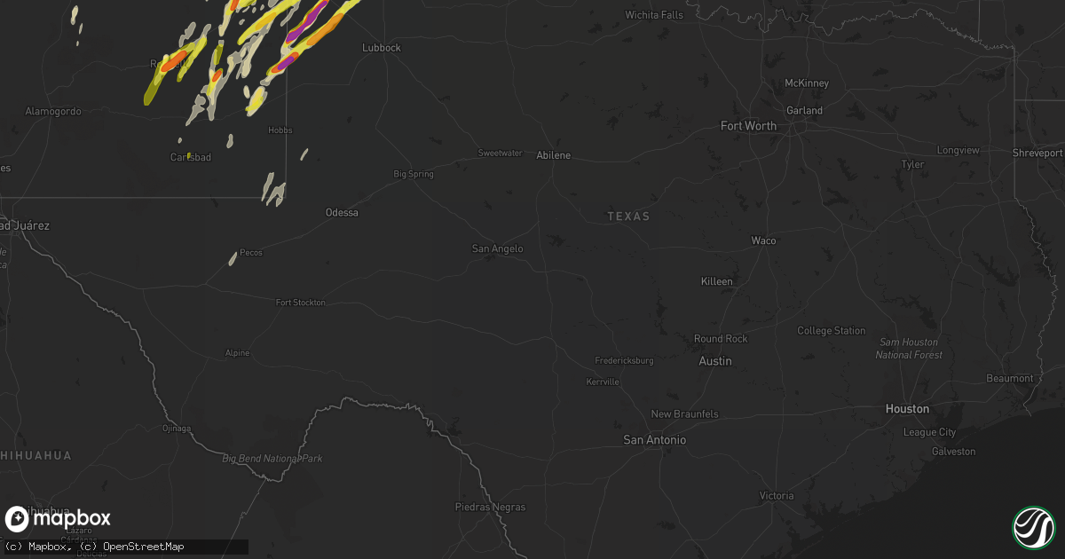
Hail Map in Texas on May 9, 2017
Get this storm
May 9 map
$229
one time, instant access
Download today. No call, no setup
Keep the $229
Bought the map and want the full workflow? Apply the entire $229 to a subscription within 7 days. None of it is wasted.
Every map, not just this one
This buys you this map. Subscription and you get every map we run, in the markets you choose from a few cities to whole states to nationwide. Plus real-time alerts the moment a storm fires.
Contact data
Name, contact info, occupancy, even credit band for addresses in the footprint. You go from where it hit to who to call.
Become the source they trust
Unlimited branding weather history reports on demand. You already have the documented answer ready for the property owner, and you are the one who showed up with it.
Property data and RoofTrace estimates
Pull up any address you have got, its value and the exact code rules for that jurisdiction, straight from One Click Code. Then RoofTrace estimates the squares, pitch, and roof value, priced the way you price.
Storm reports in Texas
Texas
| Date | Description |
|---|---|
| 05/09/20174:47 AM CDT | Trained spotter reported lots of golfball size hail mixed with lots of pea size hail through 0448 am cdt. |
| 05/09/20174:47 AM CDT | Trained spotter reported lots of golfball size hail mixed with lots of pea size hail through 0458 am cdt. |
| 05/09/20174:17 AM CDT | Late report...half dollar sized hail reported. |
| 05/09/20174:01 AM CDT | Torndo touched down around 401 am 2 miles wsw of lake mcclellan. Tornado moved ne and was on ground for 2.7 miles and around 8 minutes. The tornado was 50 yards wide an |
| 05/09/20173:51 AM CDT | Measured by west texas mesonet. |
| 05/09/20173:49 AM CDT | Late report from facebook...time estimated from radar. |
| 05/09/20173:36 AM CDT | Late report of hail ranging from golf ball to slightly larger than baseballs in size. |
| 05/09/20173:27 AM CDT | Tornado touched down around 327 am cdt 4 miles ene of goodnight. Tornado moved ne and was on the ground for 2.8 miles and around 9 minutes. The tornado was 180 yards wi |
| 05/09/20173:11 AM CDT | Late report...time estimated from radar. |
| 05/08/201711:20 PM CDT | A local report indicates 1.00 inch wind near 5 ENE FIELDTON |
| 05/08/201710:54 PM CDT | Heavy rainfall along with quarter size hail. |
| 05/08/201710:51 PM CDT | Hail slightly bigger than a quarter. |
| 05/08/201710:47 PM CDT | Lots of quarter and smaller hail. Largest golf ball size. Pictures and report via sm. |
| 05/08/20179:32 PM CDT | Rope tornado just west of location... West of 214. |
| 05/08/20178:45 PM CDT | Estimated from photo shared on sm. |
| 05/08/20178:45 PM CDT | Brief touchdown of only a few seconds. Report vis sm. |
| 05/08/20178:18 PM CDT | A local report indicates 2.00 inch wind near 6 NNE BULA |
| 05/08/20178:03 PM CDT | A local report indicates 1.00 inch wind near 3 W BOOTLEG |
| 05/08/20177:46 PM CDT | Brief tornado east of enochs. Several photos by storm chasers vi sm. |
| 05/08/20177:31 PM CDT | Hail stacked up on roof. |
| 05/08/20177:30 PM CDT | A local report indicates 2.50 inch wind near 4 S ENOCHS |
| 05/08/20177:30 PM CDT | A local report indicates 1.25 inch wind near 5 S ENOCHS |
All States Impacted by Hail Map on May 9, 2017
Cities Impacted by Hail Map on May 9, 2017
- Roswell, NM
- Sheridan Lake, CO
- Eads, CO
- Kanorado, KS
- Corona, NM
- Gallup, NM
- Morton, TX
- Amherst, TX
- Pep, TX
- Tatum, NM
- Whiteface, TX
- Sudan, TX
- Muleshoe, TX
- Enochs, TX
- Littlefield, TX
- Levelland, TX
- Fieldton, TX
- Elida, NM
- Portales, NM
- Clovis, NM
- Arapahoe, CO
- Tucumcari, NM
- Milnesand, NM
- Crossroads, NM
- Happy, TX
- Hart, TX
- Floyd, NM
- Doniphan, NE
- Selden, KS
- Oberlin, KS
- Farwell, TX
- Bovina, TX
- Las Vegas, NM
- Inavale, NE
- Blue Hill, NE
- Red Cloud, NE
- Brewster, KS
- Canadian, TX
- Naponee, NE
- Erick, OK
- Riverton, NE
- Bladen, NE
- Campbell, NE
- Atwood, KS
- Estancia, NM
- Friona, TX
- Hereford, TX
- Summerfield, TX
- Sharon Springs, KS
- Texico, NM
- Wallace, KS
- Edson, KS
- Goodland, KS
- Sugar City, CO
- Stanley, NM
- Dimmitt, TX
- Nazareth, TX
- Phillips, NE
- Moriarty, NM
- Algodones, NM
- Bethune, CO
- Bird City, KS
- Burlington, CO
- Saint Francis, KS
- Ponderosa, NM
- Clarendon, TX
- Canyon, TX
- San Ysidro, NM
- Weskan, KS
- Rocky Ford, CO
- Rio Rancho, NM
- Corrales, NM
- Hanna, WY
- Amarillo, TX
- Cerrillos, NM
- Santa Fe, NM
- Pampa, TX
- Blanco, NM
- Mobeetie, TX
- Wheeler, TX
- Panhandle, TX
- Claude, TX
- Wagon Mound, NM
- Crawford, OK
- Reydon, OK
- Sandia Park, NM
- Tulia, TX
- Plainview, TX
- Kress, TX
- Oxford, NE
- Phillipsburg, KS
- Agra, KS
- Carleton, NE
- Davenport, NE
- Colby, KS
- Hobbs, NM
- McDonald, KS
- Santo Domingo Pueblo, NM
- Pena Blanca, NM
- Lovington, NM
- Mcdonald, NM
- Las Animas, CO
- Placitas, NM
- Glade Spring, VA
- Pecos, NM
- Vaughn, NM
- Tohatchi, NM
- Shiprock, NM
- Lamar, CO
- Miami, TX
- Groom, TX
- Cimarron, NM
- Ribera, NM
- San Jose, NM
- Lexington, NE
- Jemez Pueblo, NM
- Lewis, IA
- Griswold, IA
- Atlantic, IA
- Grenville, NM
- Ordway, CO
- Santa Rosa, NM
- Smith Center, KS
- Casper, WY
- Tierra Amarilla, NM
- Trementina, NM
- Bloomington, NE
- Elwood, NE
- Levant, KS
- Gem, KS
- Encino, NM
- Gallina, NM
- Rogers, NM
- Pep, NM
- Oak, NE
- Nelson, NE
- Kensington, KS
- Herndon, KS
- Kim, CO
- Capitan, NM
- Meadowview, VA
- Damascus, VA
- Trumbull, NE
- La Loma, NM
- Anton Chico, NM
- Edgewood, NM
- Broadview, NM
- Hagerman, NM
- Earth, TX
- Cheyenne Wells, CO
- Grady, NM
- Artesia, NM
- Bertrand, NE
- Manzanola, CO
- Hastings, NE
- Jal, NM
- Edgar, NE
- Guide Rock, NE
- Melrose, NM
- Springlake, TX
- Causey, NM
- Andrews, TX
- Kermit, TX
- Republican City, NE
- Trinchera, CO
- Jemez Springs, NM
- Conchas Dam, NM
- Clayton, NM
- Carrizozo, NM
- White Deer, TX
- Tobias, NE
- Espanola, NM
- Hale Center, TX
- Wayside, TX
- Briscoe, TX
- Olton, TX
- Maple, TX
- Pecos, TX
- Glorieta, NM
- Ohiowa, NE
- Mosquero, NM
- Grand Island, NE
- Aurora, NE
- Karval, CO
- Farmington, NM
- Waterflow, NM
- Aztec, NM
- Bloomfield, NM
- Tererro, NM
- Dexter, NM
- Adrian, TX
- Carlsbad, NM
- San Jon, NM


