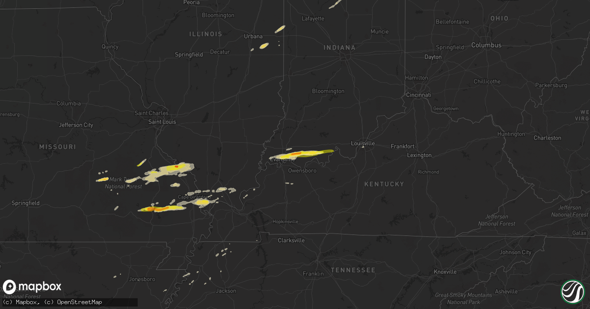
Hail Map on May 9, 2014
Get this storm
May 9 map
$229
one time, instant access
Download today. No call, no setup
Keep the $229
Bought the map and want the full workflow? Apply the entire $229 to a subscription within 7 days. None of it is wasted.
Every map, not just this one
This buys you this map. Subscription and you get every map we run, in the markets you choose from a few cities to whole states to nationwide. Plus real-time alerts the moment a storm fires.
Contact data
Name, contact info, occupancy, even credit band for addresses in the footprint. You go from where it hit to who to call.
Become the source they trust
Unlimited branding weather history reports on demand. You already have the documented answer ready for the property owner, and you are the one who showed up with it.
Property data and RoofTrace estimates
Pull up any address you have got, its value and the exact code rules for that jurisdiction, straight from One Click Code. Then RoofTrace estimates the squares, pitch, and roof value, priced the way you price.
States Impacted by Hail Map on May 9, 2014
Storm reports
Indiana
| Date | Description |
|---|---|
| 05/09/20146:52 PM CDT | Lots of hail up to the size of quarters. At intersection of old and new us 24 |
| 05/09/20145:40 PM CDT | Also reported pea size hail |
| 05/09/20145:40 PM CDT | 50 to 60 mph estimated wind gusts and pea size hail. No signs of damage. |
| 05/09/20145:11 PM CDT | Tree down blocking one lane of state route 5 between 900 and 1000 north. |
| 05/09/20145:03 PM CDT | Tree down in 300 block of n main street. Unknown conditions or size of the tree. |
| 05/09/20145:00 PM CDT | Extensive wind damage in area near the high school. Larger trees down - est 5 ft dia oak and many smaller ones - hail on ground - quarter size. |
| 05/09/20145:00 PM CDT | Extensive wind damage...large trees down... 4 to 5 ft dia oaks. Structural damage to some houses...barns...and a warehouse. One grain silo destroyed. |
| 05/09/20144:55 PM CDT | Oak tree snapped and fell on house. Several trees snapped. Winds estimated at 75 mph along with hail up to a half dollar in size. |
| 05/09/20144:44 PM CDT | A sweet gum tree down on the spotters house. Numerous tree limbs down. |
| 05/09/20144:38 PM CDT | Winds sustained at 48 mph gusting to 67 mph |
| 05/09/20144:36 PM CDT | Evansville regional airport tower personnel recorded a 77 knot - or 89 mph - wind gust at 436 pm cdt. The traffic control tower was briefly evacuated during the wind ev |
| 05/09/20144:35 PM CDT | Several trees and wires down |
| 05/09/20144:34 PM CDT | Shingles blown off. Shutter blown off. |
| 05/09/20144:32 PM CDT | Trained spotter estimated 65 mph gust on northeast side of evansville. Transformers blowing. Also dime size hail in evansville. |
| 05/09/20144:31 PM CDT | Siding blown off homes and several trees down on west side of evansville |
| 05/09/20144:28 PM CDT | Shingles blown off. Shutter blown off. |
| 05/09/20144:10 PM CDT | ...late report...several trees uprooted and power poles snapped off and broken on bell road and telephone road. A farm at telephone road and epworth road had damage to |
| 05/09/20142:53 PM CDT | Tree down on a car at 4th and division. One person trapped inside. |
| 05/09/20142:35 PM CDT | Roof partially removed from large metal building near int of oak grove rd and epworth rd |
Louisiana
| Date | Description |
|---|---|
| 05/09/20146:48 PM CDT | A local report indicates 1.00 inch wind near OIL CITY |
| 05/09/20146:35 PM CDT | Quarter size hail was reported in the north highland area of shreveport. |
| 05/09/20146:35 PM CDT | Several trees down...some on homes in the north highland area of shreveport. |
| 05/09/20145:47 PM CDT | A local report indicates 1.75 inch wind near MOORINGSPORT |
Kentucky
| Date | Description |
|---|---|
| 05/09/20143:32 PM CDT | Tin roof blown off ag building near intersection of highway p and highway 91. Large tree down on highway 25 near advance. |
Texas
| Date | Description |
|---|---|
| 05/09/20146:50 PM CDT | A local report indicates 1.00 inch wind near HALLSBURG |
| 05/09/20146:42 PM CDT | 5 minutes of nickel to quarter hail near purtis creek state park |
| 05/09/20146:35 PM CDT | Roof of a bakery partially removed and blown onto highway 83. |
| 05/09/20146:20 PM CDT | A local report indicates 1.00 inch wind near REDWATER |
| 05/09/20146:13 PM CDT | A local report indicates 1.25 inch wind near CARL'S CORNER |
| 05/09/20145:56 PM CDT | Quarter sized hail reported by spotter at dps office. |
| 05/09/20145:50 PM CDT | Nickel to quarter at palestine high school |
| 05/09/20145:42 PM CDT | Tractor trailer flipped on mines road in north laredo. |
| 05/09/20145:41 PM CDT | Laredo asos report wind gusts to 66 mph |
| 05/09/20145:40 PM CDT | Nickel to quarter fm 320 and 425 |
| 05/09/20144:46 PM CDT | A local report indicates 1.00 inch wind near 16 NE MARSHALL |
| 05/09/20144:45 PM CDT | Ping pong ball sized hail on the southwest side of karnack along hwy. 43. |
| 05/09/20143:50 PM CDT | Quarter sized hail on highway 105 at the washington grimes county line. |
| 05/09/20143:04 PM CDT | A local report indicates 1.00 inch wind near 13 N HALLSVILLE |
| 05/09/20142:31 PM CDT | Ping pong ball sized hail at fort mckavett state park |
| 05/09/20141:30 PM CDT | Top half of a large healthy pecan tree blown down by thunderstorm wind gusts |
| 05/09/20141:15 PM CDT | 6-8 inch diameter tree down along with multiple full trash cans blown over. |
| 05/09/201412:30 PM CDT | Also...wind gusts to e55 mph |
| 05/09/201412:30 PM CDT | Thunderstorm wind gusts blew the roof off an 80 x 200 foot section of an office building at the continental test track. Winds were observed to be straight line. |
| 05/09/201412:19 PM CDT | A local report indicates 1.00 inch wind near 4 W BERGHEIM |
| 05/09/201410:35 AM CDT | Putting vehicles under carports to protect from large hail |
| 05/09/20149:30 AM CDT | Thunderstorm wind gusts blowing from 50 to 60 mph |
| 05/09/20149:30 AM CDT | Hail coming down hard and fast |
| 05/09/20149:18 AM CDT | Hail covering the ground |
| 05/08/20149:13 PM CDT | Spotter estimates 55 to 60 mph winds in edcouch. |
| 05/08/20148:59 PM CDT | Trees down in lyford. Semi truck blown over at highway 1015 and 186. |
| 05/08/20148:34 PM CDT | Several reports of trees and powerlines downed in mission and sullivan. |
| 05/08/20148:26 PM CDT | Signs blown down on the expressway...highway 83...interstate 2 in palmview. |
| 05/08/20148:10 PM CDT | Several power poles down and power line tangled in trees throughout the city of edinburg. |
| 05/08/20148:10 PM CDT | Trees down on hwy 43 and hwy 125 |
| 05/08/20148:10 PM CDT | A local report indicates 1.00 inch wind near NASH |
| 05/08/20148:00 PM CDT | Large limb off mesquite tree...approximately 130 pounds. |
| 05/08/20147:59 PM CDT | Several power lines downed in falfurrias and in the county on highway 223. Trees down at highway 219 and 206 |
| 05/08/20147:50 PM CDT | A local report indicates 1.00 inch wind near BETTIE |
| 05/08/20147:42 PM CDT | Multiple large tree limbs down on fm 735. |
| 05/08/20147:20 PM CDT | Law enforcement reported a tree in the road on fm 716 west of premont. |
| 05/08/20147:08 PM CDT | Wind damage to trailers and trees in the south fork estates at the intersection of farm to market 3073 and highway 16. |
| 05/08/20147:04 PM CDT | A local report indicates 1.25 inch wind near 3 E ITASCA |
| 05/08/20147:01 PM CDT | Powerlines down over the roadway in hebbronville. |
Arkansas
| Date | Description |
|---|---|
| 05/09/20146:40 PM CDT | A local report indicates 1.00 inch wind near 2 N NASHVILLE |
| 05/09/20146:40 PM CDT | A local report indicates 1.75 inch wind near NASHVILLE |
| 05/09/20146:35 PM CDT | A local report indicates 2.00 inch wind near 5 N NASHVILLE |
| 05/09/20145:10 PM CDT | A local report indicates 1.75 inch wind near ROSSTON |
| 05/09/20144:28 PM CDT | A local report indicates 1.00 inch wind near HOXIE |
North Carolina
| Date | Description |
|---|---|
| 05/09/20144:45 PM CDT | Two powerlines down. One on hagers rd intersection with mccord rd and one on mcilwaine rd. |
| 05/09/20142:35 PM CDT | Spotter reports dime to quarter size hail. |
New York
| Date | Description |
|---|---|
| 05/09/20144:36 PM CDT | Line blown down |
| 05/09/20144:27 PM CDT | Powerline down |
| 05/09/20144:06 PM CDT | Wires down on clark street |
| 05/09/20143:43 PM CDT | Trees down on buffalo street |
South Carolina
| Date | Description |
|---|---|
| 05/09/20143:35 PM CDT | Public report of numerous small limbs down with estimated 50 mph gust. |
| 05/09/20143:25 PM CDT | Limbs up to 6 inches in diameter blown off the tops of several trees. |
Illinois
| Date | Description |
|---|---|
| 05/09/20142:20 PM CDT | Trees across road south and west of ava |
Michigan
| Date | Description |
|---|---|
| 05/09/20141:19 PM CDT | Power lines and poles down. Radar estimated time |
| 05/09/20141:16 PM CDT | Power lines and poles down. Radar estimated time |
| 05/09/201412:52 PM CDT | Power lines and poles down. Radar time estimated |
| 05/09/201412:25 PM CDT | Power line down on building. Radar estimated time |
| 05/09/201412:15 PM CDT | Radar estimated time |
| 05/09/201412:01 PM CDT | Power lines down at wixom and potter roads. Radar estimated time. |
| 05/09/201412:01 PM CDT | A local report indicates 65 MPH wind near 5 SE MILFORD |
| 05/09/201411:37 AM CDT | Numerous large tree limbs down at the university of michigan golf course. Radar estimated time |
Ohio
| Date | Description |
|---|---|
| 05/09/20146:10 PM CDT | Few trees were blown down. On county road t218 between t143 and t149. |
| 05/09/20145:47 PM CDT | Several medium to large limbs down |
| 05/08/20147:25 PM CDT | Several medium to large limbs down |
Missouri
| Date | Description |
|---|---|
| 05/09/20145:30 PM CDT | A local report indicates 1.00 inch wind near 1 SSW FARMINGTON |
| 05/09/20143:32 PM CDT | Tin roof blown off ag building near intersection of highway p and highway 91. Large tree down on highway 25 near advance. |
| 05/09/20143:12 PM CDT | Quarter sized hail 1 mi s of zalma. |
| 05/09/20143:00 PM CDT | Tree limbs down and damage to camper awnings at the old greenville campground. Unconfirmed report of funnel cloud associated with damage. Damage path estimated around o |
| 05/09/20142:53 PM CDT | Several trees down - 9 in dia - branches broken - satelite antenna damaged - minor road flooding. |
| 05/09/20141:44 PM CDT | Quarter mile south of state highway 8...two miles south of mineral point. |
| 05/09/20141:44 PM CDT | Hail from quarter to half dollar size. |
| 05/09/20141:35 PM CDT | Roof completely blown off a 2 story home. Numerous trees down. A small barn blown across highway 61. Light structural damage to other homes in the area. |
| 05/09/20141:35 PM CDT | Trees down on u.s. Highway 61 |
| 05/09/20141:20 PM CDT | Several trees down or uprooted. One old barn collapsed. Reported by sheriffs deputy. |
| 05/09/201411:30 AM CDT | Picture from social media showed ping pong sized hail |
| 05/08/20149:05 PM CDT | A local report indicates 1.00 inch wind near SEDGEWICKVILLE |
Cities Impacted by Hail Map on May 9, 2014
- Leakey, TX
- Karnack, TX
- Vivian, LA
- Mooringsport, LA
- Jefferson, TX
- Belcher, LA
- Oil City, LA
- Boerne, TX
- Boonville, IN
- Chandler, IN
- Tennyson, IN
- Mineral Springs, AR
- Saratoga, AR
- Laredo, TX
- Realitos, TX
- Larue, TX
- Salem, MO
- Hebbronville, TX
- Grandview, TX
- Barksdale, TX
- Itasca, TX
- Jackson, MO
- Cape Girardeau, MO
- Grapeland, TX
- Advance, MO
- Gipsy, MO
- McGee, MO
- Sturdivant, MO
- Zalma, MO
- Texarkana, TX
- Marble Hill, MO
- Sedgewickville, MO
- Uvalde, TX
- Quemado, TX
- Brackettville, TX
- Knippa, TX
- Sabinal, TX
- La Pryor, TX
- Ozan, AR
- Lockesburg, AR
- Nashville, AR
- Shreveport, LA
- Gilmer, TX
- Charlotte, TX
- Jourdanton, TX
- Lovelady, TX
- Palmer, TX
- Trinity, TX
- Mineral Point, MO
- Potosi, MO
- Kenedy, TX
- Marshall, TX
- Gentryville, IN
- Evansville, IN
- Lamar, IN
- Saint Meinrad, IN
- Tell City, IN
- Evanston, IN
- Chrisney, IN
- Newburgh, IN
- Santa Claus, IN
- Paige, TX
- Concepcion, TX
- Blanchard, LA
- Tamms, IL
- Thebes, IL
- Olive Branch, IL
- Dilley, TX
- Canton, TX
- New Boston, TX
- Bismarck, AR
- Amity, AR
- Tilden, TX
- Prescott, AR
- Medina, TX
- Utopia, TX
- Tarpley, TX
- Lockhart, TX
- Dale, TX
- Brownwood, MO
- Greenville, MO
- Wappapello, MO
- Oran, MO
- Daingerfield, TX
- Grand Saline, TX
- Vienna, IL
- Buncombe, IL
- Vanderpool, TX
- Navasota, TX
- Mount Vernon, IN
- Mill Spring, MO
- Saint Mary, MO
- Perryville, MO
- Menard, TX
- Alamo, TN
- Mertens, TX
- Bynum, TX
- Hillsboro, TX
- Milford, TX
- Harleton, TX
- Rosston, AR
- Hooks, TX
- Ashdown, AR
- Salem, KY
- Hampton, KY
- Princeton, LA
- Bismarck, IL
- Alvin, IL
- Danville, IL
- West Lebanon, IN
- San Antonio, TX
- Williamsville, MO
- Piedmont, MO
- Ellsinore, MO
- Cotulla, TX
- Fort McKavett, TX
- San Diego, TX
- Freer, TX
- Karnes City, TX
- Gillett, TX
- Zapata, TX
- Guerra, TX
- San Ygnacio, TX
- Camden, IN
- Logansport, IN
- Hammond, LA
- La Center, KY
- Helotes, TX
- Waskom, TX
- Palestine, TX
- Cuero, TX
- Yorktown, TX
- Montgomery, TX
- Covington, TX
- Camp Wood, TX
- Frankston, TX
- Flint, TX
- Chandler, TX
- New Braunfels, TX
- Bulverde, TX
- Homer, IL
- Longview, IL
- Allerton, IL
- Broadlands, IL
- Jonesboro, AR
- Haughton, LA
- Chester, IL
- Ironton, MO
- Fredericktown, MO
- Sainte Genevieve, MO
- Rockwood, IL
- Farmington, MO
- Doe Run, MO
- Jacob, IL
- Jbsa Lackland, TX
- Atascosa, TX
- Kingsville, TX
- Wilson, AR
- Dyess, AR
- Frohna, MO
- Rocksprings, TX
- Hallsville, TX
- Longview, TX
- Bossier City, LA
- Diana, TX
- Concan, TX
- Mabank, TX
- Eustace, TX
- Kemp, TX
- Millersville, MO
- Daisy, MO
- Patton, MO
- Oak Ridge, MO
- New Waverly, TX
- Sonora, TX
- Forney, TX
- Terrell, TX
- Watson, OK
- Cove, AR
- Spring Branch, TX
- Rio Frio, TX
- Peru, IN
- Galveston, IN
- Walton, IN
- Waelder, TX
- Golconda, IL
- Simpson, IL
- Elkhart, TX
- Henderson, KY
- Kendalia, TX
- Rosanky, TX
- Linden, TX
- Dongola, IL
- Jonesboro, IL
- Anna, IL
- Pipe Creek, TX
- Martin, TN
- Bellville, TX
- Pilot Knob, MO
- Bismarck, MO
- Ava, IL
- Middle Brook, MO
- Campbell Hill, IL
- Arcadia, MO
- Park Hills, MO
- Del Rio, TX
- Christine, TX
- Pleasanton, TX
- Maud, TX
- Falls City, TX
- Avinger, TX
- Crockett, TX
- Kennard, TX
- Marion, KY
- Wimberley, TX
- San Marcos, TX
- Villa Ridge, IL
- Pulaski, IL
- Scott City, MO
- Mounds, IL
- Hawkins, TX
- Eldorado, TX
- Waco, TX
- Riesel, TX
- Corsicana, TX
- Brenham, TX
- Washington, TX
- Canyon Lake, TX
- Rattan, OK
- Lesterville, MO
- Black, MO
- Belleview, MO
- Woodburn, IN
- Montalba, TX
- Bremond, TX
- Franklin, TX
- Fischer, TX
- Ogden, AR
- Encinal, TX
- Queen City, TX
- Emmet, AR
- Hope, AR
- De Kalb, TX
- McClure, IL
- Karnak, IL
- Lowndes, MO
- Miller City, IL
- Grand Chain, IL
- Whitewater, MO
- Cairo, IL
- Chaffee, MO
- Olmsted, IL
- Comstock, TX
- Smithville, TX
- Tuscola, IL
- Pesotum, IL
- Elberfeld, IN
- Bandera, TX
- Pittsburg, TX
- Red Rock, TX
- Sharon, TN
- Crystal City, TX
- Clubb, MO
- Slaughters, KY
- Sebree, KY
- Ida, MI
- Petersburg, MI
- Gonzales, TX
- West Point, TX
- Muldoon, TX
- Premont, TX
- Alice, TX
- Halls, TN
- Big Sandy, TX
- Ripley, TN
- Athens, TX
- Coldspring, TX
- Giddings, TX
- Trenton, TN
- Atlanta, TX
- Kenton, TN
- Rives, TN
- Waldron, MI
- Saffell, AR
- Cord, AR
- Powell, TX
- Kerens, TX
- Bivins, TX
- Leopold, IN
- Silva, MO
- Willis, TX
- Encino, TX
- Winona, MO
- Anderson, TX
- Monroe, IN
- Fairmount, IL
- Santa Elena, TX
- Ullin, IL
- Ferris, TX
- Ennis, TX
- Waxahachie, TX
- Texarkana, AR
- Crandall, TX
- Dresden, TN
- Haworth, OK
- Rio Vista, TX
- Blum, TX
- Bonne Terre, MO
- D Hanis, TX
- Perrysville, IN
- Flatonia, TX
- Antwerp, OH
- Westhoff, TX
- La Grange, TX
- Axtell, TX
- Stockdale, TX
- Troup, TX
- Georgetown, IL
- Ridge Farm, IL
- Cushing, TX
- Laneville, TX
- Lone Star, TX
- Smithville, OK
- Louisville, KY
- Delight, AR
- Murfreesboro, AR
- New Concord, KY
- Bergheim, TX
- McCaskill, AR
- Blanco, TX
- Henderson, TX
- Brownsville, TN
- Deerfield, MI
- Blissfield, MI
- Cypress, IL
- Goreville, IL
- Rumsey, KY
- Luling, TX
- Batesville, TX
- Pearsall, TX
- Kosse, TX
- Fulton, AR
- Simms, TX
- College Station, TX
- Plantersville, TX
- Payne, OH
- New Waverly, IN
- Bristow, IN
- Grandview, IN
- Branchville, IN
- Leavenworth, IN
- Cannelton, IN
- Battletown, KY
- Troy, IN