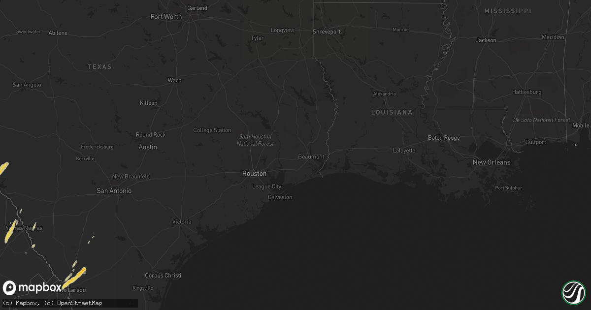
Hail Map on May 9, 2012
Get this storm
May 9 map
$229
one time, instant access
Download today. No call, no setup
Keep the $229
Bought the map and want the full workflow? Apply the entire $229 to a subscription within 7 days. None of it is wasted.
Every map, not just this one
This buys you this map. Subscription and you get every map we run, in the markets you choose from a few cities to whole states to nationwide. Plus real-time alerts the moment a storm fires.
Contact data
Name, contact info, occupancy, even credit band for addresses in the footprint. You go from where it hit to who to call.
Become the source they trust
Unlimited branding weather history reports on demand. You already have the documented answer ready for the property owner, and you are the one who showed up with it.
Property data and RoofTrace estimates
Pull up any address you have got, its value and the exact code rules for that jurisdiction, straight from One Click Code. Then RoofTrace estimates the squares, pitch, and roof value, priced the way you price.
States Impacted by Hail Map on May 9, 2012
Storm reports
Arizona
| Date | Description |
|---|---|
| 05/09/20126:38 PM CDT | Small trees and large limbs down over roadway. Ray and cooper. |
| 05/09/20126:35 PM CDT | Mobile homes off foundations. Power lines down. Germain and ironwood. |
| 05/08/20128:15 PM CDT | Tree downed that blocked traffic on pima rd and highway 85. Construction debris from interstate 8 and bypass 85 route strewn around. Most of the town of gila bend witho |
| 05/08/20127:10 PM CDT | A local report indicates 58 MPH wind near 4 N MARICOPA |
| 05/08/20127:00 PM CDT | A local report indicates 58 MPH wind near 4 N MARICOPA |
Florida
| Date | Description |
|---|---|
| 05/09/20125:35 PM CDT | One tree down on hampton springs road. Corrected time of event. |
| 05/09/20123:10 PM CDT | Public reported hail up to 1.25 in diameter near downtown miami. |
| 05/09/20123:10 PM CDT | Media reported one inch hail near miami beach. |
| 05/09/20122:35 PM CDT | One tree down on hampton springs road. |
Georgia
| Date | Description |
|---|---|
| 05/09/20123:50 PM CDT | The call center reported 2 trees down blocking the roadways near bennett still highway. The time given was based on radar. |
| 05/09/20123:35 PM CDT | Oak tree down. Time estimated from radar. Report relayed by broadcast media. |
| 05/09/20123:05 PM CDT | Trained spotter reported a tree down on pooler pkwy at s morgan pkwy. |
| 05/09/20122:57 PM CDT | Reports of multiple trees down around the city of bainbridge. One tree fell on a house and another fell on a car. Trees were reported across the road on lord avenue...a |
South Carolina
| Date | Description |
|---|---|
| 05/09/20122:47 PM CDT | Law enforcement reported one tree down along bennetts point road. |
| 05/09/20122:45 PM CDT | Tree down on north aylesbury road. Time estimated based on radar data. |
| 05/09/20122:40 PM CDT | 3 trees down in moncks corner. |
| 05/09/20122:38 PM CDT | 1 tree down at laurel bay road and stanley farm road. Time estimated from radar. |
| 05/09/20122:33 PM CDT | Law enforcement reported a tree down on lincolnville road. |
| 05/09/20122:25 PM CDT | 2 trees down in cross. |
| 05/09/20122:25 PM CDT | Law enforcement reported one tree down on big estate road. |
| 05/09/20122:02 PM CDT | Trees down and quarter size hail on william brunson rd. |
| 05/09/20121:27 PM CDT | 1 tree down on lowcountry highway at community ave. |
| 05/09/20121:04 PM CDT | 1 tree down on broxton bridge hwy at bachman rd. |
| 05/09/201211:30 AM CDT | Emergency manager reported several trees down in the nicholson village area east of aiken. A tin roof was also taken off a building and underpinning of some mobile home |
Louisiana
| Date | Description |
|---|---|
| 05/09/20122:40 PM CDT | Waterspout moved onshore. Nws survey determined ef-1 damage with winds 86 to 89 mph. Total loss of mobile home roof from one structure. Some roof debris thrown 30 yards |
North Carolina
| Date | Description |
|---|---|
| 05/09/20124:55 PM CDT | Two trees down. |
| 05/09/20124:25 PM CDT | Four trees were blown down around clinton between 525 pm and 537 pm edt. |
| 05/09/20124:00 PM CDT | Two trees down. |
| 05/09/20123:42 PM CDT | Tree in the road near timber drive and highway 50 |
| 05/09/20123:35 PM CDT | Sever small trees and branches were blown down or snapped on the eagle ridge golf course. A vending mahcine and patio furniture was also blown over. |
| 05/09/20123:23 PM CDT | Tree on house at 1119 ralph drive. |
| 05/09/20123:15 PM CDT | Tree down near old oxford road and red mill road |
| 05/09/20123:14 PM CDT | Large oak tree in the road at jenks carpenter and fryar creek roads. |
| 05/09/20123:10 PM CDT | Tree down in the 100 block of west knox street |
| 05/09/20123:08 PM CDT | 3 trees down near high gate drive and hurdle court |
| 05/09/20123:04 PM CDT | Tree reported down on wootens store rd. |
| 05/09/20123:03 PM CDT | Tree reported down on bill hooks rd. |
| 05/09/20123:00 PM CDT | Tree reported down across chadbourn hwy near peacock rd. |
| 05/09/20123:00 PM CDT | One 4 inch diameter tree snapped in half and partially blocking manning drive in chapel hill. |
| 05/09/20122:57 PM CDT | Several trees down in chapel hill |
| 05/09/20122:47 PM CDT | One tree across the road near the intersection of orange grove road and dairyland road |
| 05/09/20122:43 PM CDT | One tree down near the intersection of vernon road and oak grove church road |
| 05/09/20122:14 PM CDT | Tree down on power line near liberty grove road and richland church road |
| 05/09/20122:09 PM CDT | Few trees down near the intersection of us highway 421 and old liberty road |
| 05/09/20122:03 PM CDT | Few trees down near the intersection of new salem road and bethel church road |
Texas
| Date | Description |
|---|---|
| 05/09/20126:20 AM CDT | Large hail covered the ground |
| 05/09/20126:05 AM CDT | A local report indicates 1.00 inch wind near 5 NNW COMSTOCK |
| 05/09/20126:05 AM CDT | A local report indicates 60 MPH wind near 5 NNW COMSTOCK |
| 05/08/201210:45 PM CDT | Willacy county emergency manager reports golfball-size hail 2 miles south of raymondville. |
| 05/08/201210:35 PM CDT | Trained spotter reports softball sized hail falling in sebastian for last five minutes. Happening right now...from willacy em. |
| 05/08/201210:33 PM CDT | Border patrol checkpoint 15 miles south of sarita reports predominantly nickel-size hail with embedded quarter-size hail. |
| 05/08/20129:46 PM CDT | Spotter reported hail had busted her windows in in edcouch. Was not confident of exact hail size. |
| 05/08/20129:40 PM CDT | Hiidalgo em reports two mobile homes destroyed and home under renovation severely damaged. Outbuildings and other structures also damaged near doolittle. No injuries. |
| 05/08/20129:30 PM CDT | Hidalgo em reports two mobile homes destroyed and home under renovation severely damaged. Outbuildings and other structures also damaged near doolittle. Winds estimated |
Cities Impacted by Hail Map on May 9, 2012
- Laredo, TX
- Harlingen, TX
- Lyford, TX
- Cotulla, TX
- Early Branch, SC
- Del Rio, TX
- Eagle Pass, TX
- Lake Park, GA
- Hahira, GA
- Moody Afb, GA
- Valdosta, GA
- Naylor, GA
- Lakeland, GA
- Edcouch, TX
- Santa Rosa, TX
- Encinal, TX
- Marathon, TX
- Ridgeland, SC
- Key Biscayne, FL
- Miami, FL
- Miami Beach, FL
- Edinburg, TX
- Hargill, TX
- Comstock, TX
- Sheldon, SC
- Seabrook, SC
- Fernandina Beach, FL
- Hialeah, FL
- Eglin Afb, FL
- Monticello, FL
- San Simon, AZ
- Rodeo, NM
- Rio Rico, AZ
- Bluffton, SC
- Alma, GA
- Fairfax, SC
- La Villa, TX
- Swainsboro, GA
- Adrian, GA
- Lamont, FL
- Estill, SC
- Yemassee, SC
- Chadbourn, NC
- Allendale, SC
- Douglas, GA
- Rincon, GA
- Daufuskie Island, SC
- Bisbee, AZ
- Statesboro, GA
- Cottageville, SC
- Ridgeville, SC
- Dorchester, SC
- Holt, FL
- Fort Stockton, TX
- Greenville, FL
- Perry, FL
- Aiken, SC
- Armstrong, TX
- Brunson, SC
- Elsa, TX
- Baxley, GA
- Whiteville, NC
- Summerton, SC
- Tubac, AZ
- Ray City, GA
- Hardeeville, SC
- Ozona, TX
- Bainbridge, GA
- Varnville, SC
- Glenwood, GA
- Summerville, SC
- Ravenel, SC
- Bennettsville, SC
- Hilton Head Island, SC
- Okatie, SC
- Quemado, TX
- Germanton, NC
- Millen, GA
- Rocky Ford, GA
- Luray, SC
- Moultrie, GA
- Douglas, AZ
- Beaufort, SC
- Edisto Island, SC
- Adams Run, SC
- Ulmer, SC