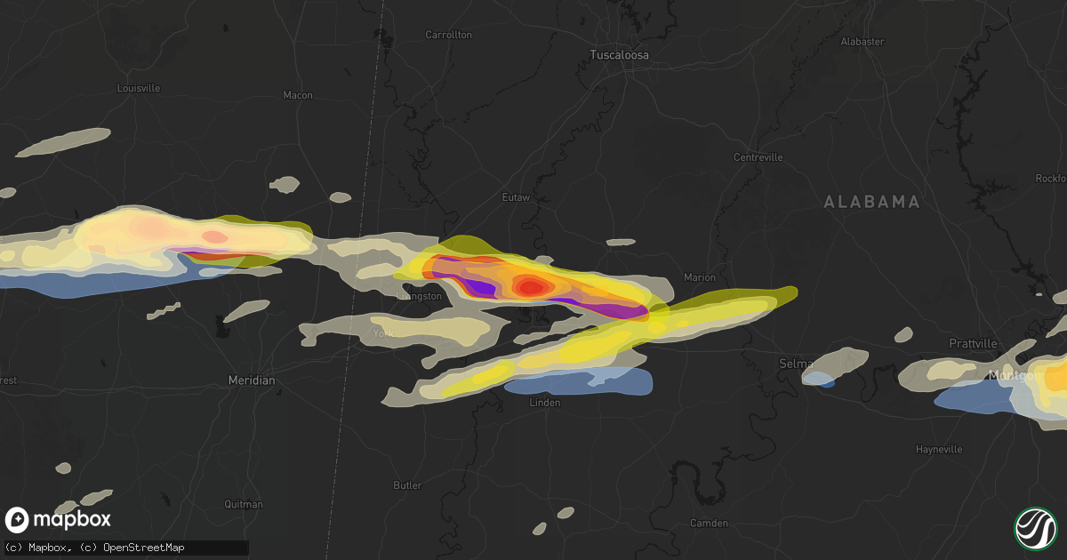
Hail Map in Forkland, AL on May 6, 2026
Get this storm
May 6 map
$229
one time, instant access
Download today. No call, no setup
Keep the $229
Bought the map and want the full workflow? Apply the entire $229 to a subscription within 7 days. None of it is wasted.
Every map, not just this one
This buys you this map. Subscription and you get every map we run, in the markets you choose from a few cities to whole states to nationwide. Plus real-time alerts the moment a storm fires.
Contact data
Name, contact info, occupancy, even credit band for addresses in the footprint. You go from where it hit to who to call.
Become the source they trust
Unlimited branding weather history reports on demand. You already have the documented answer ready for the property owner, and you are the one who showed up with it.
Property data and RoofTrace estimates
Pull up any address you have got, its value and the exact code rules for that jurisdiction, straight from One Click Code. Then RoofTrace estimates the squares, pitch, and roof value, priced the way you price.
Storm reports in Forkland, AL
Forkland, AL
| Date | Description |
|---|---|
| 05/05/20267:13 PM CDT | Photo submitted by the public of baseball sized hail along u.s. Highway 43 in greene county. Time and location approximate. |
| 05/05/20267:11 PM CDT | Public submitted photo of ping pong ball sized hail in forkland. |
| 05/05/20267:11 PM CDT | Broadcast media relayed viewer report of at least golf ball hail covering the ground... Backyard garden destroyed. |
| 05/05/20267:10 PM CDT | Report of ping pong ball sized hail at forkland campground. |
All Cities Impacted by Hail Map on May 6, 2026
- Sonora, TX
- Ozona, TX
- Junction, TX
- Menard, TX
- London, TX
- Roosevelt, TX
- Mason, TX
- Art, TX
- Castell, TX
- Llano, TX
- Buchanan Dam, TX
- Doss, TX
- Harper, TX
- Burnet, TX
- Kingsland, TX
- Fredericksburg, TX
- Bluffton, TX
- Willow City, TX
- Bertram, TX
- Round Mountain, TX
- Johnson City, TX
- Spicewood, TX
- Ward, AL
- York, AL
- Jachin, AL
- Demopolis, AL
- Deville, LA
- Linden, AL
- Gallion, AL
- Faunsdale, AL
- Thomaston, AL
- Uniontown, AL
- Safford, AL
- Jonesville, LA
- Monterey, LA
- Vidalia, LA
- Selma, AL
- Tyler, AL
- Natchez, MS
- Double Springs, AL
- Prattville, AL
- Addison, AL
- Houston, AL
- Autaugaville, AL
- Canton, MS
- Lowndesboro, AL
- Hope Hull, AL
- Montgomery, AL
- Meadville, MS
- Camden, MS
- Logan, AL
- Arley, AL
- Cullman, AL
- Vinemont, AL
- Bentonia, MS
- Bude, MS
- Carthage, MS
- Pike Road, AL
- Lena, MS
- Walnut Grove, MS
- McCall Creek, MS
- Brookhaven, MS
- Kentwood, LA
- Greensburg, LA
- Shorter, AL
- Union, MS
- Philadelphia, MS
- Hardaway, AL
- Cecil, AL
- Fitzpatrick, AL
- Jena, LA
- Effie, LA
- Magnolia, MS
- Osyka, MS
- Harrisonburg, LA
- Center Point, LA
- Tuskegee, AL
- Mccomb, MS
- Mathews, AL
- Union Springs, AL
- Clayton, LA
- Tylertown, MS
- Collinsville, MS
- De Kalb, MS
- Hurtsboro, AL
- Midway, AL
- Marksville, LA
- Thomasville, AL
- Fort Davis, AL
- Summit, MS
- Jayess, MS
- Hazlehurst, MS
- Crystal Springs, MS
- Ellijay, GA
- Vicksburg, MS
- Monticello, MS
- Porterville, MS
- Scooba, MS
- Foxworth, MS
- Columbia, MS
- Oak Vale, MS
- Silver Creek, MS
- Florence, MS
- Prentiss, MS
- Kokomo, MS
- Crosby, MS
- Epes, AL
- Emelle, AL
- Newhebron, MS
- Carson, MS
- Harrisville, MS
- Downsville, LA
- Sandy Hook, MS
- Roxie, MS
- Talking Rock, GA
- Acme, LA
- Woodville, MS
- Gloster, MS
- Sumrall, MS
- Helen, GA
- Sautee Nacoochee, GA
- Mize, MS
- Magee, MS
- Mount Olive, MS
- Livingston, AL
- Boligee, AL
- Wetumpka, AL
- Collins, MS
- Gainesville, AL
- Braxton, MS
- Farmerville, LA
- Sterlington, LA
- Lumberton, MS
- Columbia, LA
- Purvis, MS
- Hattiesburg, MS
- Forkland, AL
- Eclectic, AL
- Millbrook, AL
- New Augusta, MS
- Petal, MS
- Richton, MS
- Greensboro, AL
- Newbern, AL
- Hineston, LA
- Tallassee, AL
- Elmer, LA
- Sawyerville, AL
- Bogue Chitto, MS
- Beaumont, MS
- Lauderdale, MS
- Toomsuba, MS
- Mangham, LA
- Marion, AL
- Smithdale, MS
- Cuba, AL
- Leakesville, MS
- Neely, MS
- Noxapater, MS
- Pineville, LA
- Kosciusko, MS
- State Line, MS
- McCool, MS
- Louisville, MS
- Tuskegee Institute, AL
- Ruth, MS
- Little Rock, MS
- Redwood, MS
- Alexander City, AL
- Kellyton, AL
- Sontag, MS
- Goodwater, AL
- McLain, MS
- Bellamy, AL
- Vinegar Bend, AL
- Fruitdale, AL
- Hatchechubbee, AL
- Daleville, MS
- Tibbie, AL
- Deer Park, AL
- McIntosh, AL
- Seale, AL
- Pittsview, AL
- Tallulah, LA
- Sunflower, AL
- Fort Mitchell, AL
- Wagarville, AL
- Seminary, MS
- Cusseta, GA
- Omaha, GA
- Edwards, MS
- Richland, GA
- Jackson, AL
- Lumpkin, GA
- Americus, GA
- Buena Vista, GA
- Preston, GA
- Ellaville, GA
- Laurel, MS
- Shubuta, MS
- Evergreen, AL
- Repton, AL
- Bailey, MS
- Meridian, MS
- Waynesboro, MS
- Plains, GA
- Soso, MS
- Preston, MS
- Taylorsville, MS
- Brantley, AL
- Rutledge, AL
- Luverne, AL
- Greenville, AL
- Bassfield, MS
- Heidelberg, MS
- Louin, MS
- Bay Springs, MS
- Rose Hill, MS
- Citronelle, AL
- Little River, AL
- Uriah, AL
- Mount Vernon, AL
- Stockton, AL
- Lisman, AL
- Atmore, AL
- Brewton, AL
- Marion Junction, AL
- Castleberry, AL
- Woodland, MS
- Houston, MS
- Daviston, AL
- Brooklyn, MS
- Dozier, AL
- Frisco City, AL
- Glenwood, AL
- Monroeville, AL
- Lenox, AL
- Range, AL
- Ariton, AL
- Brundidge, AL
- Bay Minette, AL
- Perdido, AL
- McDavid, FL
- Andalusia, AL


