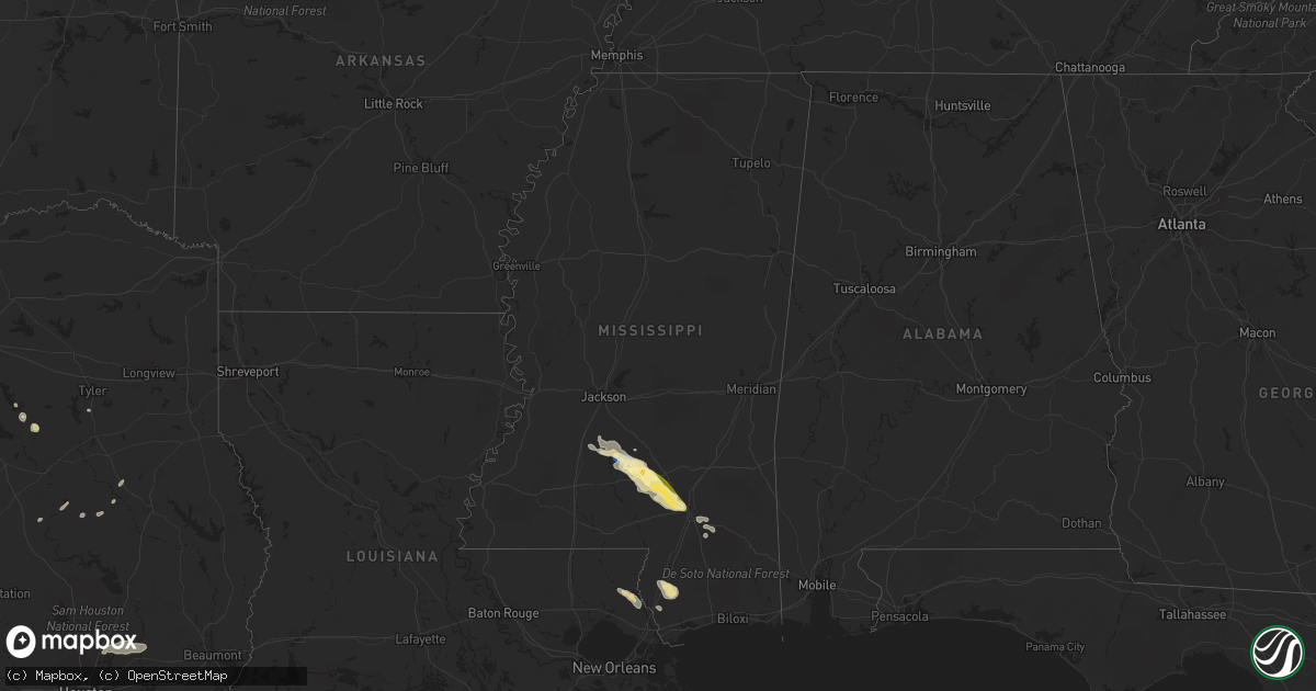
Hail Map in Mississippi on May 5, 2023
Get this storm
May 5 map
$229
one time, instant access
Download today. No call, no setup
Keep the $229
Bought the map and want the full workflow? Apply the entire $229 to a subscription within 7 days. None of it is wasted.
Every map, not just this one
This buys you this map. Subscription and you get every map we run, in the markets you choose from a few cities to whole states to nationwide. Plus real-time alerts the moment a storm fires.
Contact data
Name, contact info, occupancy, even credit band for addresses in the footprint. You go from where it hit to who to call.
Become the source they trust
Unlimited branding weather history reports on demand. You already have the documented answer ready for the property owner, and you are the one who showed up with it.
Property data and RoofTrace estimates
Pull up any address you have got, its value and the exact code rules for that jurisdiction, straight from One Click Code. Then RoofTrace estimates the squares, pitch, and roof value, priced the way you price.
Storm reports in Mississippi
Mississippi
| Date | Description |
|---|---|
| 05/05/20234:17 PM CDT | Emergency management reported structural damage to a luxury inn outside hattiesburg. |
| 05/05/20233:52 PM CDT | Tree reported down blocking the highway on ms highway 13 at landrum cemetery road in pearl river county. Time estimated by radar. |
| 05/05/20233:41 PM CDT | Emergency management reported multiple trees down across covington county. A tree fell on a car due to the strong thunderstorm winds... However no injuries were reporte |
| 05/05/20233:36 PM CDT | Pictures from social media via twitter show a tree down on a home near king rd in hattiesburg. |
| 05/05/20233:36 PM CDT | Emergency management reported multiple trees down all across forrest county. |
| 05/05/20233:23 PM CDT | Trees down on epley rd. |
| 05/05/20233:22 PM CDT | Reports of multiple trees down near mitchell hudson rd. |
| 05/05/20233:19 PM CDT | Emergency management reported numerous trees and powerlines down near partman cemetery in nw jefferson davis county. |
| 05/05/20233:15 PM CDT | Multiple trees down. |
| 05/05/20233:06 PM CDT | Emergency management reported structural damage to a house near ridge rd along with several trees down. |
| 05/05/20233:03 PM CDT | Emergency management reported minor structural damage to a house along with several trees down near blackjack rd. |
| 05/05/20233:00 PM CDT | Tree down in town... 3 homes damaged from this tree. |
| 05/05/20232:59 PM CDT | Photographs show ground covering hail in sumrall. The majority of the hail was small... But some stones reached one inch in diameter. |
| 05/05/20232:59 PM CDT | Trees down across hwy 589. |
| 05/05/20232:59 PM CDT | Tree down at n bryant and rocky branch rd. |
| 05/05/20232:20 PM CDT | Multiple trees down across the nw part of the county. |
| 05/05/20232:17 PM CDT | Trees down. |
| 05/05/20232:15 PM CDT | A local report indicates 1.00 inch wind near NEW HEBRON |
| 05/05/20232:15 PM CDT | Trees down and damage to a cafeteria... More damage exists... But details to come later. |
| 05/05/20232:13 PM CDT | Trees down on hwy 42 and 43. |
| 05/05/20232:13 PM CDT | Reports of several trees down near nelson rd. |
| 05/05/20231:54 PM CDT | Reports of several trees and powerlines down near jackson ave right outside georgetown. |
| 05/05/20231:51 PM CDT | Reports of multiple trees down near hwy 51. |
| 05/05/20231:51 PM CDT | Multiple trees down near poplar springs rd. |
| 05/05/20231:48 PM CDT | Public reports of a few trees and powerlines down near great southern rd. |
| 05/05/20231:48 PM CDT | Public reports of multiple trees down near hwy 51 near south wesson. |
| 05/05/20231:45 PM CDT | Reports of multiple trees and powerlines down near rockport rd. |
| 05/05/20231:45 PM CDT | Reports of multiple trees down near steel creek rd. |
| 05/05/20231:45 PM CDT | Tree down across poplar springs rd. |
| 05/05/20231:41 PM CDT | Reports of multiple trees down near shreby lane north of hwy 28. |
| 05/05/20231:40 PM CDT | Public reports several trees along with a few powerlines down near jackson st... A few miles north of hwy 28. |
| 05/05/20231:31 PM CDT | Reports of multiple trees down near lilly rd. |
| 05/05/20231:31 PM CDT | Reports of a few trees down near may ln. |
| 05/05/20231:31 PM CDT | Tree down on house on cola lane. Trees down across i-55 in hazlehurst. |
| 05/05/20231:22 PM CDT | Several trees down near/in the gallman area. |
| 05/05/202312:52 PM CDT | Several trees down near raymond rd. |
All States Impacted by Hail Map on May 5, 2023
Cities Impacted by Hail Map on May 5, 2023
- Lake City, MN
- Pinola, MS
- Newhebron, MS
- Mendenhall, MS
- Prentiss, MS
- Mount Olive, MS
- Bassfield, MS
- Carson, MS
- Collins, MS
- Sumrall, MS
- Seminary, MS
- Hattiesburg, MS
- Coleman, TX
- Clyde, TX
- Abilene, TX
- Burkett, TX
- Cross Plains, TX
- Baird, TX
- Brookesmith, TX
- Brownwood, TX
- Bridgeport, TX
- Paradise, TX
- Chico, TX
- Alvord, TX
- Early, TX
- Zephyr, TX
- Blanket, TX
- San Saba, TX
- Cherokee, TX
- Hay Springs, NE
- Forestburg, TX
- May, TX
- Comanche, TX
- Decatur, TX
- Era, TX
- Gainesville, TX
- Rosston, TX
- Muenster, TX
- Sidney, TX
- Alma, NE
- Republican City, NE
- Naponee, NE
- De Leon, TX
- Mullin, TX
- Goldthwaite, TX
- Bloomington, NE
- Franklin, NE
- Tow, TX
- Lampasas, TX
- Riverton, NE
- Harrison, NE
- Georgetown, MS
- Bush, LA
- Poplarville, MS
- Picayune, MS
- Carriere, MS
- Petal, MS
- New Augusta, MS
- Lusk, WY
- Morrill, NE
- Lyman, NE
- Minatare, NE
- Bayard, NE
- Hazlehurst, MS
- Silver Creek, MS
- Crystal Springs, MS
- Harrisville, MS
- Magee, MS
- Stamford, NE
- Oxford, NE
- Orleans, NE
- Burnet, TX
- Bluffton, TX
- Hamilton, TX
- Inavale, NE
- Bertram, TX
- Art, TX
- Mason, TX
- Castell, TX
- Valley Spring, TX
- Red Cloud, NE
- Eustis, NE
- Cambridge, NE
- Holbrook, NE
- Julesburg, CO
- Amherst, CO
- Venango, NE
- Wray, CO
- Haigler, NE
- Parks, NE
- Benkelman, NE
- Imperial, NE
- Champion, NE
- Llano, TX
- Arapahoe, NE
- Elwood, NE
- Grant, NE
- Enders, NE
- Edison, NE
- Bertrand, NE
- Wauneta, NE
- Marble Falls, TX
- Wilcox, NE
- Hayes Center, NE
- Cozad, NE
- Hildreth, NE
- Loomis, NE
- Buchanan Dam, TX
- Holdrege, NE
- Kingsland, TX
- Lexington, NE
- Maywood, NE
- Paoli, CO
- Holyoke, CO
- Haxtun, CO
- Sutherland, NE
- Paxton, NE
- Elsie, NE
- North Platte, NE
- Wallace, NE
- Hershey, NE
- Palisade, NE
- Funk, NE
- Axtell, NE
- Palmer, TX
- Ennis, TX
- Corsicana, TX
- Rice, TX
- Chatfield, TX
- Maxwell, NE
- Minden, NE
- Kearney, NE
- Fredericksburg, TX
- Round Mountain, TX
- Spicewood, TX
- Leander, TX
- Waxahachie, TX
- Wellfleet, NE
- Crookston, NE
- Farnam, NE
- Hico, TX
- Stephenville, TX
- Dickens, NE
- Angora, NE
- Rushville, NE
- Oshkosh, NE
- Ogallala, NE
- Madrid, NE
- Ovid, CO
- Lisco, NE
- Edgemont, SD
- Moorefield, NE
- Meridian, TX
- Morgan, TX
- Walnut Springs, TX
- Iredell, TX
- Rising Star, TX
- Carlton, TX
- Evant, TX
- Pottsville, TX
- Stockville, NE
- Priddy, TX
- Blum, TX
- Kopperl, TX
- Dublin, TX
- Lebanon, KS
- Lometa, TX
- Broadwater, NE
- Bridgeport, NE
- Rio Vista, TX
- Cleburne, TX
- Glen Rose, TX
- Gustine, TX
- Perkinston, MS
- Sunset, TX
- Brady, NE
- Killeen, TX
- Pearl River, LA
- Horseshoe Bay, TX
- Pontotoc, TX
- Bangs, TX
- Abita Springs, LA
- Covington, TX
- Fort Hood, TX
- Hubbard, TX
- Coolidge, TX
- Salado, TX
- Belton, TX
- Bartley, NE
- Rochelle, TX
- Overton, NE
- Curtis, NE
- Smithfield, NE
- Elm Creek, NE
- Eddyville, NE
- Sumner, NE
- Loup City, NE
- Calvert, TX
- Platte Center, NE
- Primrose, NE
- Mason City, NE
- Blooming Grove, TX
- Barry, TX
- Litchfield, NE
- Bend, TX
- Pleasanton, NE
- Paige, TX
- Amherst, NE
- Cairo, NE
- Newman Grove, NE
- Monroe, NE
- Gibbon, NE
- Palmer, NE
- Belgrade, NE
- Fullerton, NE
- Malakoff, TX
- Saint Paul, NE
- Saint Libory, NE
- Farwell, NE
- Boelus, NE
- Dannebrog, NE
- Ashton, NE
- Elba, NE
- Rockville, NE
- Archer, NE
- Chapman, NE
- Wolbach, NE
- Cedar Rapids, NE
- Pilger, NE
- Wisner, NE
- Bullard, TX
- Flint, TX
- West Point, NE
- Dodge, NE
- Willow City, TX
- Cedar Park, TX
- Austin, TX
- Pflugerville, TX
- Manor, TX
- Saint Edward, NE
- McCook, NE
- Howells, NE
- Clarkson, NE
- Kennard, TX
- Gothenburg, NE
- Hearne, TX
- Franklin, TX
- Genoa, NE
- Lindsay, NE
- Tennessee Colony, TX
- Montalba, TX
- Athens, TX
- Goldsboro, TX
- Creston, NE
- Columbus, NE
- Leigh, NE
- Kemp, TX
- Silver Creek, NE
- Crockett, TX
- Central City, NE
- Rogers, TX
- Lexington, TX
- Odessa, NE
- Shelton, NE
- Cameron, TX
- Alto, TX
- Miller, NE
- Centerville, TX
- Bryan, TX
- Buckholts, TX
- Grand Island, NE
- Holland, TX
- Lincoln, TX
- Giddings, TX
- Mabank, TX
- Bancroft, NE
- Pender, NE
- Oconto, NE
- Essex, IA
- Red Oak, IA
- Sidney, IA
- Tabor, IA
- Winnebago, NE
- Liberty, TX
- Dayton, TX
- New Caney, TX
- Huffman, TX
- Cleveland, TX
- Porter, TX
- Humphrey, NE
- Callaway, NE
- Imogene, IA
- Randolph, IA
- Beemer, NE
- Emerson, IA
- Shenandoah, IA
- Farragut, IA


