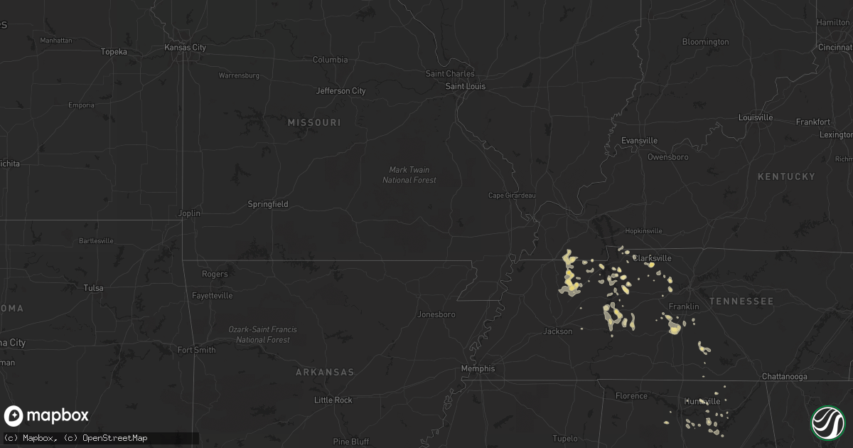
Hail Map in South Dakota on May 5, 2012
Get this storm
May 5 map
$229
one time, instant access
Download today. No call, no setup
Keep the $229
Bought the map and want the full workflow? Apply the entire $229 to a subscription within 7 days. None of it is wasted.
Every map, not just this one
This buys you this map. Subscription and you get every map we run, in the markets you choose from a few cities to whole states to nationwide. Plus real-time alerts the moment a storm fires.
Contact data
Name, contact info, occupancy, even credit band for addresses in the footprint. You go from where it hit to who to call.
Become the source they trust
Unlimited branding weather history reports on demand. You already have the documented answer ready for the property owner, and you are the one who showed up with it.
Property data and RoofTrace estimates
Pull up any address you have got, its value and the exact code rules for that jurisdiction, straight from One Click Code. Then RoofTrace estimates the squares, pitch, and roof value, priced the way you price.
Storm reports in South Dakota
South Dakota
| Date | Description |
|---|---|
| 05/05/20126:55 PM CDT | 78.2 mph measured wind gust. Large wooden posts for dot sign with 6 by 6 wooden beams snapped at interstate exit. |
| 05/05/20126:48 PM CDT | A local report indicates 65 MPH wind near 1 E MITCHELL |
| 05/05/20126:45 PM CDT | A local report indicates 1.00 inch wind near 5 W MITCHELL |
| 05/05/201210:45 AM CDT | A few quarter size and many smaller stones. Hail covered the ground. |
| 05/05/201210:40 AM CDT | A local report indicates 1.00 inch wind near 18 SSW WESSINGTON |
| 05/05/201210:35 AM CDT | A local report indicates 1.00 inch wind near 17 S WESSINGTON |
| 05/05/201210:30 AM CDT | Lots of 1 inch hail |
| 05/05/201210:15 AM CDT | A local report indicates 1.00 inch wind near 1 NW SALEM |
| 05/05/201210:12 AM CDT | A local report indicates 1.00 inch wind near 4 W SALEM |
| 05/05/201210:12 AM CDT | A local report indicates 1.25 inch wind near 5 NE SALEM |
| 05/05/201210:07 AM CDT | A local report indicates 1.00 inch wind near CHESTER |
| 05/05/201210:00 AM CDT | A local report indicates 1.00 inch wind near 4 W SALEM |
| 05/05/20129:45 AM CDT | A local report indicates 1.50 inch wind near 8 N MONTROSE |
| 05/05/20129:34 AM CDT | A local report indicates 1.00 inch wind near 5 NE SALEM |
| 05/05/20129:05 AM CDT | A local report indicates 1.75 inch wind near 2 N FARMER |
| 05/05/20128:56 AM CDT | Covered the gound up to 1 inch in diameter |
| 05/05/20128:55 AM CDT | Pea sized hail began at 645 by 715 it was 1.5 inches. Hail covered the ground. |
| 05/05/20128:41 AM CDT | Golf ball and walnut size hail |
| 05/05/20128:41 AM CDT | A local report indicates 2.50 inch wind near MITCHELL |
| 05/05/20128:40 AM CDT | Pea to quarter size hail covering the road |
| 05/05/20128:39 AM CDT | A local report indicates 2.00 inch wind near MITCHELL |
| 05/05/20128:35 AM CDT | Some damage to house siding |
| 05/05/20128:28 AM CDT | A local report indicates 1.00 inch wind near 6 W MITCHELL |
| 05/05/20128:22 AM CDT | Pea to golf ball size hail |
| 05/05/20128:20 AM CDT | A local report indicates 1.50 inch wind near MOUNT VERNON |
| 05/05/20128:10 AM CDT | A local report indicates 1.75 inch wind near CHAMBERLAIN |
| 05/05/20128:08 AM CDT | A local report indicates 1.00 inch wind near 4 NE CHAMBERLAIN |
| 05/05/20128:05 AM CDT | A local report indicates 1.00 inch wind near 4 ESE PLANKINTON |
| 05/05/20128:05 AM CDT | A local report indicates 1.00 inch wind near 1 SW PLANKINTON |
| 05/05/20127:50 AM CDT | Golf ball sized hail and estimated 60 mph winds |
| 05/05/20127:50 AM CDT | Lsr |
| 05/05/20127:30 AM CDT | A local report indicates 1.00 inch wind near 6 SSE KENNEBEC |
| 05/05/20127:08 AM CDT | A local report indicates 1.00 inch wind near 13 E IONA |
| 05/04/201211:30 PM CDT | Several branches down. Also one half inch size hail covered the ground. |
| 05/04/201211:22 PM CDT | Billboard sign with metal frame completely flattened at northwest corner of highway 34 and highway 13 across from flandreau airport |
| 05/04/201210:29 PM CDT | Numerous buildings and trees damaged in southwestern flandreau. Roofs on appartment buildings damaged. No known injuries. |
| 05/04/20129:57 PM CDT | A local report indicates 72 MPH wind near 1 S FLANDREAU |
| 05/04/20129:30 PM CDT | A local report indicates 1.25 inch wind near 13 S KIMBALL |
| 05/04/20129:30 PM CDT | Quarter sized hail quickly followed some wind gusts up to around 50 mph. |
| 05/04/20129:30 PM CDT | A local report indicates 1.25 inch wind near WILMOT |
| 05/04/20129:30 PM CDT | Steel pole shed building blown east to west across 454th ave south of madison |
| 05/04/20129:13 PM CDT | Nickel to quarter sized hail again |
| 05/04/20129:12 PM CDT | Accompanied by 60 mph wind gusts |
| 05/04/20129:10 PM CDT | A local report indicates 1.00 inch wind near 12 SSE CAVOUR |
| 05/04/20129:00 PM CDT | Hail ranged from nickel to half dollar-sized |
| 05/04/20128:50 PM CDT | Semi overturned |
| 05/04/20128:49 PM CDT | Thunderstorm wind gusts estimated at 65 to 75 mph |
| 05/04/20128:47 PM CDT | A local report indicates 1.00 inch wind near 1 S HAYTI |
| 05/04/20128:45 PM CDT | A local report indicates 1.75 inch wind near 2 W MADISON |
| 05/04/20128:43 PM CDT | A local report indicates 1.25 inch wind near 5 S STONE BRIDGE |
| 05/04/20128:42 PM CDT | Nickel to quarter sized hail and 45 mph winds |
| 05/04/20128:41 PM CDT | A local report indicates 80 MPH wind near 3 W ORLAND |
| 05/04/20128:38 PM CDT | A local report indicates 1.25 inch wind near WATERTOWN |
| 05/04/20128:31 PM CDT | A local report indicates 1.00 inch wind near 2 SE WATERTOWN |
| 05/04/20128:30 PM CDT | A local report indicates 1.75 inch wind near WATERTOWN |
| 05/04/20128:30 PM CDT | Had a range of dime to quarter-size hail |
| 05/04/20128:30 PM CDT | A local report indicates 1.75 inch wind near 3 E WATERTOWN |
| 05/04/20128:10 PM CDT | A local report indicates 1.00 inch wind near 1 SSW BADGER |
| 05/04/20128:00 PM CDT | A local report indicates 1.00 inch wind near WILLOW LAKE |
| 05/04/20127:52 PM CDT | A local report indicates 1.00 inch wind near 9 S FEDORA |
| 05/04/20127:47 PM CDT | A local report indicates 1.75 inch wind near 6 NE MITCHELL |
| 05/04/20127:21 PM CDT | A local report indicates 1.00 inch wind near 5 N FULTON |
| 05/04/20127:04 PM CDT | A local report indicates 1.75 inch wind near 8 NNE ARTESIAN |
All States Impacted by Hail Map on May 5, 2012
Cities Impacted by Hail Map on May 5, 2012
- Corning, IA
- Dix, NE
- Cunningham, TN
- Clarksville, TN
- Kimball, NE
- Brady, TX
- Menard, TX
- Glencoe, MN
- Aurora, CO
- Princeton, KY
- Dawson Springs, KY
- Woolstock, IA
- Duncombe, IA
- Blairsburg, IA
- Otho, IA
- Webster City, IA
- Lehigh, IA
- Mason City, IA
- Nora Springs, IA
- Rudd, IA
- Charles City, IA
- Marble Rock, IA
- Floyd, IA
- Rockford, IA
- Hazard, NE
- Ravenna, NE
- Danville, AL
- Villisca, IA
- Stanton, IA
- Nodaway, IA
- Gurley, AL
- Broken Bow, NE
- Iroquois, SD
- De Smet, SD
- Waverly, TN
- Jordan, MN
- New Prague, MN
- New Hampton, IA
- Ionia, IA
- Macedonia, IA
- Carson, IA
- Griswold, IA
- Oakland, IA
- Columbia, TN
- Draper, SD
- Vivian, SD
- North Platte, NE
- Pipestone, MN
- Trent, SD
- Harrisburg, NE
- Bushnell, NE
- Carpenter, WY
- Pine Bluffs, WY
- Albin, WY
- Burns, WY
- Fancy Farm, KY
- Mayfield, KY
- Emmons, MN
- Burke, SD
- Emerson, IA
- Randolph, IA
- Sidney, IA
- Imogene, IA
- Hastings, IA
- Malvern, IA
- Holladay, TN
- Council Bluffs, IA
- Kensett, IA
- Dwight, NE
- Brainard, NE
- Valparaiso, NE
- Chokio, MN
- Mason, TX
- Hext, TX
- Poplar, MT
- Benton, KY
- Gilbertsville, KY
- Thompson, IA
- Lake Mills, IA
- Leland, IA
- Watertown, SD
- Lynd, MN
- Minneota, MN
- Shelby, IA
- Avoca, IA
- Kirkman, IA
- Harlan, IA
- Munford, AL
- Joice, IA
- Fertile, IA
- Hanlontown, IA
- Long Pine, NE
- Artesian, SD
- Fedora, SD
- Lake Wilson, MN
- Chandler, MN
- Linden, TN
- Ashland City, TN
- Kennebec, SD
- Carthage, SD
- Kyle, SD
- Spring Hill, TN
- Anselmo, NE
- Stapleton, NE
- Tryon, NE
- Clarion, IA
- Potter, NE
- Bigfoot, TX
- Devine, TX
- Natalia, TX
- Poteet, TX
- McEwen, TN
- Burnet, TX
- Cavour, SD
- Yale, SD
- Dougherty, IA
- Sheffield, IA
- Taylor, NE
- Brewster, NE
- Elmore, MN
- Ledyard, IA
- Swea City, IA
- Blue Earth, MN
- Dunning, NE
- Arnold, NE
- Howard, SD
- Holabird, SD
- Lower Brule, SD
- Presho, SD
- Blunt, SD
- Fort Pierre, SD
- Pierre, SD
- Harrold, SD
- Hartley, IA
- Everly, IA
- Wood, SD
- White River, SD
- Murdo, SD
- Okaton, SD
- Long Valley, SD
- San Saba, TX
- Savage, MN
- Minneapolis, MN
- Burnsville, MN
- Jourdanton, TX
- Garden City, SD
- Clark, SD
- Wallace, SD
- Henry, SD
- Florence, SD
- Willow Lake, SD
- Carpenter, SD
- Delavan, MN
- Easton, MN
- Tow, TX
- Newport, NE
- Woodlawn, TN
- Indian Mound, TN
- Exira, IA
- Audubon, IA
- Kimballton, IA
- Saint Ansgar, IA
- Goldthwaite, TX
- Richland Springs, TX
- Voca, TX
- Fredonia, TX
- Melvin, TX
- Cherokee, TX
- London, TX
- Bassett, NE
- Brownwood, TX
- Granada, MN
- Weeping Water, NE
- Huntsville, AL
- Cadiz, KY
- Bumpus Mills, TN
- Springville, TN
- Big Sandy, TN
- Mullin, TX
- Early, TX
- Brookesmith, TX
- Blanket, TX
- Zephyr, TX
- Ord, NE
- Carrsville, VA
- Fairmont, MN
- Carver, MN
- Norwood Young America, MN
- Chaska, MN
- Cologne, MN
- Renville, MN
- Olivia, MN
- Hector, MN
- Belview, MN
- Bird Island, MN
- Redwood Falls, MN
- Danube, MN
- Castlewood, SD
- Stockholm, SD
- Hayti, SD
- Marvin, SD
- Clinton, MN
- Wilmot, SD
- Beardsley, MN
- Corona, SD
- South Shore, SD
- Twin Brooks, SD
- Roland, IA
- Story City, IA
- Ceresco, NE
- Gleason, TN
- Richlands, NC
- Maple Hill, NC
- Jacksonville, NC
- Clayton, OK
- Cumberland, IA
- Hudson, SD
- Alcester, SD
- Dukedom, TN
- Fulton, KY
- Sedalia, KY
- Flandreau, SD
- Wentworth, SD
- Winfred, SD
- Elkton, SD
- Colman, SD
- Canova, SD
- Ramona, SD
- Nunda, SD
- Madison, SD
- Ruthton, MN
- Woodville, AL
- Grant, AL
- Cotulla, TX
- Luverne, MN
- Welcome, MN
- Sugar Tree, TN
- Parsons, TN
- Rushmore, MN
- Adrian, MN
- Salem, SD
- Alexandria, SD
- Colton, SD
- Spencer, SD
- Montrose, SD
- Fulton, SD
- Mount Vernon, SD
- Mitchell, SD
- Ethan, SD
- Denver, CO
- Comstock, NE
- Wingo, KY
- Henderson, MN
- Belle Plaine, MN
- La Vista, NE
- Omaha, NE
- New Ulm, MN
- Courtland, MN
- Papillion, NE
- Bellevue, NE
- Bellingham, MN
- Milbank, SD
- Odessa, MN
- Revillo, SD
- Big Stone City, SD
- Ortonville, MN
- Labolt, SD
- Hillsborough, NC
- Pittsville, WI
- Wells, MN
- Bricelyn, MN
- Winnebago, MN
- Frost, MN
- Jackson, MN
- Palmyra, TN
- Carriere, MS
- Picayune, MS
- Ashland, NE
- Yutan, NE
- Mead, NE
- Wahoo, NE
- Ithaca, NE
- Waterloo, NE
- Marne, IA
- Atlantic, IA
- Custer, SD
- Inwood, IA
- Sinai, SD
- Volga, SD
- Arlington, SD
- Murdock, NE
- Tilden, TX
- Alexander, IA
- Wolsey, SD
- Huntingdon, TN
- Hamburg, MN
- Stewart, TN
- Buffalo Lake, MN
- Stewart, MN
- Miller, SD
- Ree Heights, SD
- Sioux Center, IA
- Orange City, IA
- Parker, CO
- Englewood, CO
- Elkhorn, NE
- Oldham, SD
- Hamlin, IA
- Elk Horn, IA
- Bennett, CO
- Strasburg, CO
- Tyler, MN
- Magnolia, MN
- Ellsworth, MN
- Bigelow, MN
- Worthington, MN
- Viborg, SD
- Charlotte, TX
- Durand, WI
- Union Grove, AL
- Irene, SD
- Kimball, SD
- Platte, SD
- Ivanhoe, MN
- Strum, WI
- Eleva, WI
- Hartselle, AL
- Somerville, AL
- Beaufort, NC
- La Fayette, KY
- Herndon, KY
- Hoffman, MN
- Herman, MN
- Donnelly, MN
- Morris, MN
- Stickney, SD
- Corsica, SD
- Harrison, SD
- White Lake, SD
- Glenville, MN
- Northwood, IA
- Villa Ridge, MO
- Wood Lake, MN
- Wanblee, SD
- Austin, MN
- Hayward, MN
- Albert Lea, MN
- Eden Valley, MN
- Paynesville, MN
- Big Rock, TN
- Cerulean, KY
- McKenzie, TN
- Anniston, AL
- Eden, TX
- Dresden, TN
- Petersburg, TN
- Shelbyville, TN
- Georgetown, SC
- Black River Falls, WI
- Merry Hill, NC
- Wessington, SD
- Virgil, SD
- Saint Lawrence, SD
- Freeman, SD
- Menno, SD
- Henry, TN
- Chester, SD
- Pukwana, SD
- Gregory, SD
- Reliance, SD
- Oacoma, SD
- Chamberlain, SD
- Harper, TX
- Mondovi, WI
- Huron, SD
- Durham, NC
- Raleigh, NC
- Morrisville, NC
- Brookings, SD
- Beaver Creek, MN
- Rosemount, MN
- Grafton, IA
- Plymouth, IA
- Kersey, CO
- Puryear, TN
- Hazel, KY
- Eva, AL
- Albertville, AL
- Guntersville, AL
- Plainfield, IA
- Latimer, IA
- Ames, IA
- Brighton, CO
- Thornton, CO
- Hartford, SD
- Ideal, SD
- Dell Rapids, SD
- Letcher, SD
- Baltic, SD
- Egan, SD
- Crooks, SD
- Lyons, SD
- Humboldt, SD
- Plankinton, SD
- Garvin, MN
- Balaton, MN
- Ceylon, MN
- Lake Preston, SD
- Avoca, NE
- Nehawka, NE
- Charlotte, TN
- Owens Cross Roads, AL
- Brownsboro, AL
- Scottsboro, AL
- Conway, SC
- Llano, TX
- Plato, MN
- Ashville, AL
- Hurdle Mills, NC
- Primm Springs, TN
- Santa Fe, TN
- Franklin, TN
- Gadsden, AL
- White, SD
- Palmersville, TN
- Bradford, TN
- Erwin, SD
- Toronto, SD
- Badger, SD
- Lake Norden, SD
- Bruce, SD
- Estelline, SD
- Elliott, IA
- Saint Clair, MO
- Beaufort, MO
- Sullivan, MO
- Santa Anna, TX
- Sidney, NE
- Waverly, VA
- Brockton, MT
- Aurora, SD
- Coleman, TX
- Canyon Lake, TX
- Spring Branch, TX
- Osage, IA
- Woonsocket, SD
- Tennessee Ridge, TN
- Davey, NE
- Raymond, NE
- Lincoln, NE
- New Auburn, MN
- Brownton, MN
- Arlington, MN
- Stigler, OK
- Clear Lake, SD
- Goodwin, SD
- Cottonwood, MN
- Vesta, MN
- Springfield, NE
- Gretna, NE
- Decatur, AL
- Trinity, AL
- Andrews, SC
- Fredericksburg, TX
- Comfort, TX
- Jasper, MN
- Garretson, SD
- Edenton, NC
- Tyner, NC
- Cary, NC
- Apex, NC
- Young America, MN
- Merrill, IA
- Le Mars, IA
- Burna, KY
- Roanoke, AL
- Davis, SD
- Hurley, SD
- Waverly, NE
- Sleepy Eye, MN
- Willmar, MN
- Sargent, NE
- Victoria, MN
- Waconia, MN
- Green Isle, MN
- Shakopee, MN
- Anita, IA
- Golden, CO
- Farmington, MN
- Vermillion, MN
- Prescott, WI
- Hampton, MN
- Saint Paul, MN
- Lakeville, MN
- Hastings, MN
- Calvert City, KY
- Clarksville, IA
- Clear Lake, IA
- Orchard, IA
- Nashua, IA
- Rock Falls, IA
- Greene, IA
- Manly, IA
- Buchanan, TN
- River Falls, WI
- Buffalo Center, IA
- Lyle, MN
- Carpenter, IA
- Dunnell, MN
- Scarville, IA
- Little Cedar, IA
- Riceville, IA
- Rake, IA
- Waverly, IA
- Lakota, IA
- Forest City, IA
- Sherburn, MN
- Stacyville, IA
- Purdum, NE
- Halsey, NE
- Merna, NE
- Stromsburg, NE
- Lesterville, SD
- Lexington, TN
- Estillfork, AL
- Thornton, IA
- Bangs, TX
- Dover, TN
- Keenesburg, CO
- Hudson, CO
- Wessington Springs, SD
- Rutland, SD
- Lake Benton, MN
- Ortley, SD
- Waubay, SD
- Summit, SD
- Madison, AL
- Walnut, IA
- Bryant, SD
- Bridgewater, IA
- Massena, IA
- Peetz, CO
- Maurice, IA
- Alton, IA
- Lohn, TX
- Fort Lupton, CO
- Lobelville, TN
- New Johnsonville, TN
- Independence, WI
- Whitehall, WI
- Hendricks, MN
- Canton, SD
- Fairview, SD
- Rock Valley, IA
- Wolf Point, MT
- Amboy, MN
- Vernon Center, MN
- Lewisville, MN
- Madelia, MN
- Byron, MN
- Trimont, MN
- Arlington, KY
- Bardwell, KY
- Gibbon, MN
- Winthrop, MN
- Lafayette, MN
- Gann Valley, SD
- Brandt, SD
- Holland, MN
- Renner, SD
- Vienna, SD
- Hazel, SD
- Fort Thompson, SD
- Hamill, SD
- Webster, SD
- Astoria, SD
- Winner, SD
- Taunton, MN
- Carter Lake, IA
- Beldenville, WI
- Ellsworth, WI
- Waucoma, IA
- Ainsworth, NE
- Sioux Rapids, IA
- Webb, IA
- Greenville, IA
- Spencer, IA
- Hemingway, SC
- Colon, NE
- Treynor, IA
- Roggen, CO
- McClelland, IA
- Brayton, IA
- Trezevant, TN
- Greenfield, TN
- Paris, TN
- Water Valley, KY
- Bandera, TX
- Humbird, WI
- Alma Center, WI
- Lometa, TX
- Fort Calhoun, NE
- Crescent, IA
- Evant, TX
- Merrillan, WI
- Ventura, IA
- Neola, IA
- Minden, IA
- Persia, IA
- Louisville, NE
- Watkins, CO
- Cheyenne, WY
- Williamsport, TN
- Fayetteville, TN
- Glenwood, IA
- Elk River, MN
- Marshall, MN
- Ghent, MN
- Echo, MN
- Clinton, KY
- Eva, TN
- Camden, TN
- Talladega, AL
- Slayton, MN
- Burwell, NE
- Elyria, NE
- Radcliffe, IA
- Nevada, IA
- Gilbert, IA
- Liberty, MS
- Truman, MN
- Nicollet, MN
- Saint Peter, MN
- Guthrie Center, IA
- Adair, IA
- Erin, TN
- Vanleer, TN
- Gillett Grove, IA
- Caledonia, MN
- Bedford, KY
- Milton, KY
- Silver City, IA
- Woodstock, MN
- Cragford, AL
- Lynch, NE
- Wagner, SD
- Fort Campbell, KY
- Hohenwald, TN
- Centerville, TN
- Commerce City, CO
- Kinta, OK
- Utica, SD
- Burgaw, NC
- Currie, NC
- Jay Em, WY
- Franklin, VA
- Suffolk, VA
- Ivor, VA
- Sedley, VA
- Zuni, VA
- Hardin, KY
- Pell City, AL
- Riverside, AL
- Ohatchee, AL
- Southside, TN
- Inver Grove Heights, MN
- Saint Paul Park, MN
- Alberta, MN
- Rochelle, TX
- Brady, NE
- Elko New Market, MN
- Northfield, MN
- Osseo, WI
- Fairchild, WI
- Eau Galle, WI
- Menomonie, WI
- Gaylord, MN
- Missouri Valley, IA
- Kanaranzi, MN
- Hixton, WI
- Medina, TX
- Hurricane Mills, TN
- Fort Gibson, OK
- Garner, IA
- Kanawha, IA
- Klemme, IA
- Goodell, IA
- Goldfield, IA
- Renwick, IA
- Hardy, IA
- College Grove, TN
- Chapel Hill, TN
- Boerne, TX
- Emery, SD
- Herrick, SD
- Cumberland Furnace, TN
- Porum, OK
- Webbers Falls, OK
- Johnsonville, SC
- Galivants Ferry, SC
- Merritt, NC
- Kingston Springs, TN
- Pegram, TN
- Elmwood, WI
- Spring Valley, WI
- Maiden Rock, WI
- Junction, TX
- Gloster, MS
- Arab, AL
- Kendalia, TX
- Stuart, NE
- Atkinson, NE
- Hubert, NC
- Camp Lejeune, NC
- New Hope, AL
- Byers, CO
- Dows, IA
- Hondo, TX
- Parkston, SD
- Mauston, WI
- Grand Rivers, KY
- Sneads Ferry, NC
- Webster, MN
- Mayer, MN
- Chanhassen, MN
- Prior Lake, MN
- Hutchinson, MN
- Eden Prairie, MN
- Lonsdale, MN
- Malmo, NE
- Underwood, IA
- Lewis, IA
- Henderson, IA
- Boys Town, NE
- Hancock, IA
- Honey Creek, IA
- Red Oak, IA
- Weston, NE
- Mineola, IA
- Fairview, TN
- Trenton, NC
- Browns Valley, MN
- Duck River, TN
- Voss, TX
- Iona, MN
- Ostrander, MN
- Elkton, MN
- Spring Valley, MN
- Le Roy, MN
- Grand Meadow, MN
- Grover, CO
- Camp Douglas, WI
- Bridgewater, SD
- Dickens, IA
- Poplarville, MS
- Logan, IA
- Worthing, SD
- Thompsons Station, TN
- Hattiesburg, MS
- Big Lake, MN
- Monticello, MN
- Becker, MN
- Fulda, MN
- Reading, MN
- Wilmont, MN
- Ulysses, NE
- Falkville, AL
- Wickliffe, KY
- Augusta, WI
- Clarinda, IA
- Carbon, IA
- Pipe Creek, TX
- Bluffton, TX
- Windom, MN
- Oxford, AL
- Austin, TX
- Le Sueur, MN
- Oriental, NC
- Steele, AL
- Vincent, IA
- Eagle Grove, IA
- Cottage Grove, MN
- Sacred Heart, MN
- Morton, MN
- Morgan, MN
- Lewisburg, TN
- Spicer, MN
- Pennock, MN
- Raymond, MN
- Anoka, MN
- Lennox, SD
- Winnabow, NC
- Southport, NC
- Montgomery, MN
- Elmwood, NE
- Orchard, CO
- La Salle, CO
- Russell, MN


