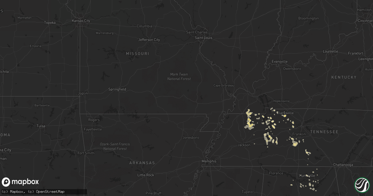
Hail Map in Iowa on May 5, 2012
Get this storm
May 5 map
$229
one time, instant access
Download today. No call, no setup
Keep the $229
Bought the map and want the full workflow? Apply the entire $229 to a subscription within 7 days. None of it is wasted.
Every map, not just this one
This buys you this map. Subscription and you get every map we run, in the markets you choose from a few cities to whole states to nationwide. Plus real-time alerts the moment a storm fires.
Contact data
Name, contact info, occupancy, even credit band for addresses in the footprint. You go from where it hit to who to call.
Become the source they trust
Unlimited branding weather history reports on demand. You already have the documented answer ready for the property owner, and you are the one who showed up with it.
Property data and RoofTrace estimates
Pull up any address you have got, its value and the exact code rules for that jurisdiction, straight from One Click Code. Then RoofTrace estimates the squares, pitch, and roof value, priced the way you price.
Storm reports in Iowa
Iowa
| Date | Description |
|---|---|
| 05/05/20124:24 PM CDT | Near fair grounds |
| 05/05/20124:13 PM CDT | A local report indicates 1.00 inch wind near FLOYD |
| 05/05/20124:00 PM CDT | A local report indicates 1.00 inch wind near 2 W RUDD |
| 05/05/20123:44 PM CDT | A local report indicates 1.00 inch wind near 5 NE MASON CITY |
| 05/05/20122:39 PM CDT | A local report indicates 1.00 inch wind near 4 NE THOMPSON |
| 05/05/20126:31 AM CDT | A few shingles blown off house. Tree branches down...size unknown. |
| 05/05/20126:30 AM CDT | Some shingles blown off roofs...about 12 to 14 one foot diameter trees snapped. Time estimated from radar. |
| 05/05/20126:27 AM CDT | Squad car being rocked by winds. Dime size hail also reported. |
| 05/05/20126:20 AM CDT | A local report indicates 1.00 inch wind near AUDUBON |
| 05/05/20126:13 AM CDT | A local report indicates 1.00 inch wind near 4 W AUDUBON AIRPORT |
| 05/05/20125:50 AM CDT | Some downed tree limbs winds estimated at 60 mph. |
| 05/05/20125:30 AM CDT | Estimated by spotter and accompanied by 1/2 inch hail. |
| 05/05/20125:22 AM CDT | Market sign blown over |
| 05/05/20122:55 AM CDT | Significant tree damage. Large cottonwood uprooted. Several campers moved off supports. |
| 05/05/20122:15 AM CDT | Damage to farm shed and some branches down |
All States Impacted by Hail Map on May 5, 2012
Cities Impacted by Hail Map on May 5, 2012
- Corning, IA
- Dix, NE
- Cunningham, TN
- Clarksville, TN
- Kimball, NE
- Brady, TX
- Menard, TX
- Glencoe, MN
- Aurora, CO
- Princeton, KY
- Dawson Springs, KY
- Woolstock, IA
- Duncombe, IA
- Blairsburg, IA
- Otho, IA
- Webster City, IA
- Lehigh, IA
- Mason City, IA
- Nora Springs, IA
- Rudd, IA
- Charles City, IA
- Marble Rock, IA
- Floyd, IA
- Rockford, IA
- Hazard, NE
- Ravenna, NE
- Danville, AL
- Villisca, IA
- Stanton, IA
- Nodaway, IA
- Gurley, AL
- Broken Bow, NE
- Iroquois, SD
- De Smet, SD
- Waverly, TN
- Jordan, MN
- New Prague, MN
- New Hampton, IA
- Ionia, IA
- Macedonia, IA
- Carson, IA
- Griswold, IA
- Oakland, IA
- Columbia, TN
- Draper, SD
- Vivian, SD
- North Platte, NE
- Pipestone, MN
- Trent, SD
- Harrisburg, NE
- Bushnell, NE
- Carpenter, WY
- Pine Bluffs, WY
- Albin, WY
- Burns, WY
- Fancy Farm, KY
- Mayfield, KY
- Emmons, MN
- Burke, SD
- Emerson, IA
- Randolph, IA
- Sidney, IA
- Imogene, IA
- Hastings, IA
- Malvern, IA
- Holladay, TN
- Council Bluffs, IA
- Kensett, IA
- Dwight, NE
- Brainard, NE
- Valparaiso, NE
- Chokio, MN
- Mason, TX
- Hext, TX
- Poplar, MT
- Benton, KY
- Gilbertsville, KY
- Thompson, IA
- Lake Mills, IA
- Leland, IA
- Watertown, SD
- Lynd, MN
- Minneota, MN
- Shelby, IA
- Avoca, IA
- Kirkman, IA
- Harlan, IA
- Munford, AL
- Joice, IA
- Fertile, IA
- Hanlontown, IA
- Long Pine, NE
- Artesian, SD
- Fedora, SD
- Lake Wilson, MN
- Chandler, MN
- Linden, TN
- Ashland City, TN
- Kennebec, SD
- Carthage, SD
- Kyle, SD
- Spring Hill, TN
- Anselmo, NE
- Stapleton, NE
- Tryon, NE
- Clarion, IA
- Potter, NE
- Bigfoot, TX
- Devine, TX
- Natalia, TX
- Poteet, TX
- McEwen, TN
- Burnet, TX
- Cavour, SD
- Yale, SD
- Dougherty, IA
- Sheffield, IA
- Taylor, NE
- Brewster, NE
- Elmore, MN
- Ledyard, IA
- Swea City, IA
- Blue Earth, MN
- Dunning, NE
- Arnold, NE
- Howard, SD
- Holabird, SD
- Lower Brule, SD
- Presho, SD
- Blunt, SD
- Fort Pierre, SD
- Pierre, SD
- Harrold, SD
- Hartley, IA
- Everly, IA
- Wood, SD
- White River, SD
- Murdo, SD
- Okaton, SD
- Long Valley, SD
- San Saba, TX
- Savage, MN
- Minneapolis, MN
- Burnsville, MN
- Jourdanton, TX
- Garden City, SD
- Clark, SD
- Wallace, SD
- Henry, SD
- Florence, SD
- Willow Lake, SD
- Carpenter, SD
- Delavan, MN
- Easton, MN
- Tow, TX
- Newport, NE
- Woodlawn, TN
- Indian Mound, TN
- Exira, IA
- Audubon, IA
- Kimballton, IA
- Saint Ansgar, IA
- Goldthwaite, TX
- Richland Springs, TX
- Voca, TX
- Fredonia, TX
- Melvin, TX
- Cherokee, TX
- London, TX
- Bassett, NE
- Brownwood, TX
- Granada, MN
- Weeping Water, NE
- Huntsville, AL
- Cadiz, KY
- Bumpus Mills, TN
- Springville, TN
- Big Sandy, TN
- Mullin, TX
- Early, TX
- Brookesmith, TX
- Blanket, TX
- Zephyr, TX
- Ord, NE
- Carrsville, VA
- Fairmont, MN
- Carver, MN
- Norwood Young America, MN
- Chaska, MN
- Cologne, MN
- Renville, MN
- Olivia, MN
- Hector, MN
- Belview, MN
- Bird Island, MN
- Redwood Falls, MN
- Danube, MN
- Castlewood, SD
- Stockholm, SD
- Hayti, SD
- Marvin, SD
- Clinton, MN
- Wilmot, SD
- Beardsley, MN
- Corona, SD
- South Shore, SD
- Twin Brooks, SD
- Roland, IA
- Story City, IA
- Ceresco, NE
- Gleason, TN
- Richlands, NC
- Maple Hill, NC
- Jacksonville, NC
- Clayton, OK
- Cumberland, IA
- Hudson, SD
- Alcester, SD
- Dukedom, TN
- Fulton, KY
- Sedalia, KY
- Flandreau, SD
- Wentworth, SD
- Winfred, SD
- Elkton, SD
- Colman, SD
- Canova, SD
- Ramona, SD
- Nunda, SD
- Madison, SD
- Ruthton, MN
- Woodville, AL
- Grant, AL
- Cotulla, TX
- Luverne, MN
- Welcome, MN
- Sugar Tree, TN
- Parsons, TN
- Rushmore, MN
- Adrian, MN
- Salem, SD
- Alexandria, SD
- Colton, SD
- Spencer, SD
- Montrose, SD
- Fulton, SD
- Mount Vernon, SD
- Mitchell, SD
- Ethan, SD
- Denver, CO
- Comstock, NE
- Wingo, KY
- Henderson, MN
- Belle Plaine, MN
- La Vista, NE
- Omaha, NE
- New Ulm, MN
- Courtland, MN
- Papillion, NE
- Bellevue, NE
- Bellingham, MN
- Milbank, SD
- Odessa, MN
- Revillo, SD
- Big Stone City, SD
- Ortonville, MN
- Labolt, SD
- Hillsborough, NC
- Pittsville, WI
- Wells, MN
- Bricelyn, MN
- Winnebago, MN
- Frost, MN
- Jackson, MN
- Palmyra, TN
- Carriere, MS
- Picayune, MS
- Ashland, NE
- Yutan, NE
- Mead, NE
- Wahoo, NE
- Ithaca, NE
- Waterloo, NE
- Marne, IA
- Atlantic, IA
- Custer, SD
- Inwood, IA
- Sinai, SD
- Volga, SD
- Arlington, SD
- Murdock, NE
- Tilden, TX
- Alexander, IA
- Wolsey, SD
- Huntingdon, TN
- Hamburg, MN
- Stewart, TN
- Buffalo Lake, MN
- Stewart, MN
- Miller, SD
- Ree Heights, SD
- Sioux Center, IA
- Orange City, IA
- Parker, CO
- Englewood, CO
- Elkhorn, NE
- Oldham, SD
- Hamlin, IA
- Elk Horn, IA
- Bennett, CO
- Strasburg, CO
- Tyler, MN
- Magnolia, MN
- Ellsworth, MN
- Bigelow, MN
- Worthington, MN
- Viborg, SD
- Charlotte, TX
- Durand, WI
- Union Grove, AL
- Irene, SD
- Kimball, SD
- Platte, SD
- Ivanhoe, MN
- Strum, WI
- Eleva, WI
- Hartselle, AL
- Somerville, AL
- Beaufort, NC
- La Fayette, KY
- Herndon, KY
- Hoffman, MN
- Herman, MN
- Donnelly, MN
- Morris, MN
- Stickney, SD
- Corsica, SD
- Harrison, SD
- White Lake, SD
- Glenville, MN
- Northwood, IA
- Villa Ridge, MO
- Wood Lake, MN
- Wanblee, SD
- Austin, MN
- Hayward, MN
- Albert Lea, MN
- Eden Valley, MN
- Paynesville, MN
- Big Rock, TN
- Cerulean, KY
- McKenzie, TN
- Anniston, AL
- Eden, TX
- Dresden, TN
- Petersburg, TN
- Shelbyville, TN
- Georgetown, SC
- Black River Falls, WI
- Merry Hill, NC
- Wessington, SD
- Virgil, SD
- Saint Lawrence, SD
- Freeman, SD
- Menno, SD
- Henry, TN
- Chester, SD
- Pukwana, SD
- Gregory, SD
- Reliance, SD
- Oacoma, SD
- Chamberlain, SD
- Harper, TX
- Mondovi, WI
- Huron, SD
- Durham, NC
- Raleigh, NC
- Morrisville, NC
- Brookings, SD
- Beaver Creek, MN
- Rosemount, MN
- Grafton, IA
- Plymouth, IA
- Kersey, CO
- Puryear, TN
- Hazel, KY
- Eva, AL
- Albertville, AL
- Guntersville, AL
- Plainfield, IA
- Latimer, IA
- Ames, IA
- Brighton, CO
- Thornton, CO
- Hartford, SD
- Ideal, SD
- Dell Rapids, SD
- Letcher, SD
- Baltic, SD
- Egan, SD
- Crooks, SD
- Lyons, SD
- Humboldt, SD
- Plankinton, SD
- Garvin, MN
- Balaton, MN
- Ceylon, MN
- Lake Preston, SD
- Avoca, NE
- Nehawka, NE
- Charlotte, TN
- Owens Cross Roads, AL
- Brownsboro, AL
- Scottsboro, AL
- Conway, SC
- Llano, TX
- Plato, MN
- Ashville, AL
- Hurdle Mills, NC
- Primm Springs, TN
- Santa Fe, TN
- Franklin, TN
- Gadsden, AL
- White, SD
- Palmersville, TN
- Bradford, TN
- Erwin, SD
- Toronto, SD
- Badger, SD
- Lake Norden, SD
- Bruce, SD
- Estelline, SD
- Elliott, IA
- Saint Clair, MO
- Beaufort, MO
- Sullivan, MO
- Santa Anna, TX
- Sidney, NE
- Waverly, VA
- Brockton, MT
- Aurora, SD
- Coleman, TX
- Canyon Lake, TX
- Spring Branch, TX
- Osage, IA
- Woonsocket, SD
- Tennessee Ridge, TN
- Davey, NE
- Raymond, NE
- Lincoln, NE
- New Auburn, MN
- Brownton, MN
- Arlington, MN
- Stigler, OK
- Clear Lake, SD
- Goodwin, SD
- Cottonwood, MN
- Vesta, MN
- Springfield, NE
- Gretna, NE
- Decatur, AL
- Trinity, AL
- Andrews, SC
- Fredericksburg, TX
- Comfort, TX
- Jasper, MN
- Garretson, SD
- Edenton, NC
- Tyner, NC
- Cary, NC
- Apex, NC
- Young America, MN
- Merrill, IA
- Le Mars, IA
- Burna, KY
- Roanoke, AL
- Davis, SD
- Hurley, SD
- Waverly, NE
- Sleepy Eye, MN
- Willmar, MN
- Sargent, NE
- Victoria, MN
- Waconia, MN
- Green Isle, MN
- Shakopee, MN
- Anita, IA
- Golden, CO
- Farmington, MN
- Vermillion, MN
- Prescott, WI
- Hampton, MN
- Saint Paul, MN
- Lakeville, MN
- Hastings, MN
- Calvert City, KY
- Clarksville, IA
- Clear Lake, IA
- Orchard, IA
- Nashua, IA
- Rock Falls, IA
- Greene, IA
- Manly, IA
- Buchanan, TN
- River Falls, WI
- Buffalo Center, IA
- Lyle, MN
- Carpenter, IA
- Dunnell, MN
- Scarville, IA
- Little Cedar, IA
- Riceville, IA
- Rake, IA
- Waverly, IA
- Lakota, IA
- Forest City, IA
- Sherburn, MN
- Stacyville, IA
- Purdum, NE
- Halsey, NE
- Merna, NE
- Stromsburg, NE
- Lesterville, SD
- Lexington, TN
- Estillfork, AL
- Thornton, IA
- Bangs, TX
- Dover, TN
- Keenesburg, CO
- Hudson, CO
- Wessington Springs, SD
- Rutland, SD
- Lake Benton, MN
- Ortley, SD
- Waubay, SD
- Summit, SD
- Madison, AL
- Walnut, IA
- Bryant, SD
- Bridgewater, IA
- Massena, IA
- Peetz, CO
- Maurice, IA
- Alton, IA
- Lohn, TX
- Fort Lupton, CO
- Lobelville, TN
- New Johnsonville, TN
- Independence, WI
- Whitehall, WI
- Hendricks, MN
- Canton, SD
- Fairview, SD
- Rock Valley, IA
- Wolf Point, MT
- Amboy, MN
- Vernon Center, MN
- Lewisville, MN
- Madelia, MN
- Byron, MN
- Trimont, MN
- Arlington, KY
- Bardwell, KY
- Gibbon, MN
- Winthrop, MN
- Lafayette, MN
- Gann Valley, SD
- Brandt, SD
- Holland, MN
- Renner, SD
- Vienna, SD
- Hazel, SD
- Fort Thompson, SD
- Hamill, SD
- Webster, SD
- Astoria, SD
- Winner, SD
- Taunton, MN
- Carter Lake, IA
- Beldenville, WI
- Ellsworth, WI
- Waucoma, IA
- Ainsworth, NE
- Sioux Rapids, IA
- Webb, IA
- Greenville, IA
- Spencer, IA
- Hemingway, SC
- Colon, NE
- Treynor, IA
- Roggen, CO
- McClelland, IA
- Brayton, IA
- Trezevant, TN
- Greenfield, TN
- Paris, TN
- Water Valley, KY
- Bandera, TX
- Humbird, WI
- Alma Center, WI
- Lometa, TX
- Fort Calhoun, NE
- Crescent, IA
- Evant, TX
- Merrillan, WI
- Ventura, IA
- Neola, IA
- Minden, IA
- Persia, IA
- Louisville, NE
- Watkins, CO
- Cheyenne, WY
- Williamsport, TN
- Fayetteville, TN
- Glenwood, IA
- Elk River, MN
- Marshall, MN
- Ghent, MN
- Echo, MN
- Clinton, KY
- Eva, TN
- Camden, TN
- Talladega, AL
- Slayton, MN
- Burwell, NE
- Elyria, NE
- Radcliffe, IA
- Nevada, IA
- Gilbert, IA
- Liberty, MS
- Truman, MN
- Nicollet, MN
- Saint Peter, MN
- Guthrie Center, IA
- Adair, IA
- Erin, TN
- Vanleer, TN
- Gillett Grove, IA
- Caledonia, MN
- Bedford, KY
- Milton, KY
- Silver City, IA
- Woodstock, MN
- Cragford, AL
- Lynch, NE
- Wagner, SD
- Fort Campbell, KY
- Hohenwald, TN
- Centerville, TN
- Commerce City, CO
- Kinta, OK
- Utica, SD
- Burgaw, NC
- Currie, NC
- Jay Em, WY
- Franklin, VA
- Suffolk, VA
- Ivor, VA
- Sedley, VA
- Zuni, VA
- Hardin, KY
- Pell City, AL
- Riverside, AL
- Ohatchee, AL
- Southside, TN
- Inver Grove Heights, MN
- Saint Paul Park, MN
- Alberta, MN
- Rochelle, TX
- Brady, NE
- Elko New Market, MN
- Northfield, MN
- Osseo, WI
- Fairchild, WI
- Eau Galle, WI
- Menomonie, WI
- Gaylord, MN
- Missouri Valley, IA
- Kanaranzi, MN
- Hixton, WI
- Medina, TX
- Hurricane Mills, TN
- Fort Gibson, OK
- Garner, IA
- Kanawha, IA
- Klemme, IA
- Goodell, IA
- Goldfield, IA
- Renwick, IA
- Hardy, IA
- College Grove, TN
- Chapel Hill, TN
- Boerne, TX
- Emery, SD
- Herrick, SD
- Cumberland Furnace, TN
- Porum, OK
- Webbers Falls, OK
- Johnsonville, SC
- Galivants Ferry, SC
- Merritt, NC
- Kingston Springs, TN
- Pegram, TN
- Elmwood, WI
- Spring Valley, WI
- Maiden Rock, WI
- Junction, TX
- Gloster, MS
- Arab, AL
- Kendalia, TX
- Stuart, NE
- Atkinson, NE
- Hubert, NC
- Camp Lejeune, NC
- New Hope, AL
- Byers, CO
- Dows, IA
- Hondo, TX
- Parkston, SD
- Mauston, WI
- Grand Rivers, KY
- Sneads Ferry, NC
- Webster, MN
- Mayer, MN
- Chanhassen, MN
- Prior Lake, MN
- Hutchinson, MN
- Eden Prairie, MN
- Lonsdale, MN
- Malmo, NE
- Underwood, IA
- Lewis, IA
- Henderson, IA
- Boys Town, NE
- Hancock, IA
- Honey Creek, IA
- Red Oak, IA
- Weston, NE
- Mineola, IA
- Fairview, TN
- Trenton, NC
- Browns Valley, MN
- Duck River, TN
- Voss, TX
- Iona, MN
- Ostrander, MN
- Elkton, MN
- Spring Valley, MN
- Le Roy, MN
- Grand Meadow, MN
- Grover, CO
- Camp Douglas, WI
- Bridgewater, SD
- Dickens, IA
- Poplarville, MS
- Logan, IA
- Worthing, SD
- Thompsons Station, TN
- Hattiesburg, MS
- Big Lake, MN
- Monticello, MN
- Becker, MN
- Fulda, MN
- Reading, MN
- Wilmont, MN
- Ulysses, NE
- Falkville, AL
- Wickliffe, KY
- Augusta, WI
- Clarinda, IA
- Carbon, IA
- Pipe Creek, TX
- Bluffton, TX
- Windom, MN
- Oxford, AL
- Austin, TX
- Le Sueur, MN
- Oriental, NC
- Steele, AL
- Vincent, IA
- Eagle Grove, IA
- Cottage Grove, MN
- Sacred Heart, MN
- Morton, MN
- Morgan, MN
- Lewisburg, TN
- Spicer, MN
- Pennock, MN
- Raymond, MN
- Anoka, MN
- Lennox, SD
- Winnabow, NC
- Southport, NC
- Montgomery, MN
- Elmwood, NE
- Orchard, CO
- La Salle, CO
- Russell, MN


