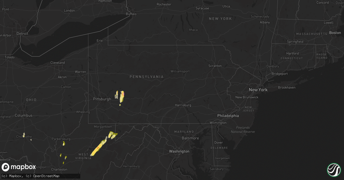
Hail Map in Pennsylvania on May 4, 2025
Get this storm
May 4 map
$229
one time, instant access
Download today. No call, no setup
Keep the $229
Bought the map and want the full workflow? Apply the entire $229 to a subscription within 7 days. None of it is wasted.
Every map, not just this one
This buys you this map. Subscription and you get every map we run, in the markets you choose from a few cities to whole states to nationwide. Plus real-time alerts the moment a storm fires.
Contact data
Name, contact info, occupancy, even credit band for addresses in the footprint. You go from where it hit to who to call.
Become the source they trust
Unlimited branding weather history reports on demand. You already have the documented answer ready for the property owner, and you are the one who showed up with it.
Property data and RoofTrace estimates
Pull up any address you have got, its value and the exact code rules for that jurisdiction, straight from One Click Code. Then RoofTrace estimates the squares, pitch, and roof value, priced the way you price.
Storm reports in Pennsylvania
Pennsylvania
| Date | Description |
|---|---|
| 05/04/20256:47 PM CDT | A local report indicates 1.50 inch wind near Indiana |
| 05/04/20256:46 PM CDT | A local report indicates 1.75 inch wind near 2 SSW Indiana |
| 05/04/20256:44 PM CDT | Report from mping: hen egg+ |
| 05/04/20256:43 PM CDT | A local report indicates 2.50 inch wind near 1 SE Indiana |
| 05/04/20256:42 PM CDT | A local report indicates 1.75 inch wind near 1 SSE Indiana |
| 05/04/20256:42 PM CDT | On iup campus. |
| 05/04/20256:41 PM CDT | A local report indicates 1.50 inch wind near 1 SE Indiana |
| 05/04/20256:36 PM CDT | A local report indicates 1.75 inch wind near Homer City |
| 05/04/20256:32 PM CDT | Report from mping: ping pong ball |
| 05/04/20256:24 PM CDT | A local report indicates 1.00 inch wind near 1 NW Black Lick |
| 05/04/20256:19 PM CDT | A local report indicates 1.00 inch wind near 2 SW Black Lick |
| 05/04/20256:18 PM CDT | A local report indicates 1.00 inch wind near 2 SW Black Lick |
| 05/04/20256:10 PM CDT | Report from mping: quarter |
| 05/04/20255:30 PM CDT | Hail at least the size of quarters. |
| 05/04/20254:57 PM CDT | [landspout] storm damage survey... Videos... And photos confirm a landspout tornado occurred in a rural area between mohrsville and shoemakersville. The tornadic circu |
| 05/04/20251:11 PM CDT | [landspout] video via social media confirms a brief landspout and/or waterspout occurred near the northern end of blue marsh lake in the blue marsh national recreation |
| 05/04/202512:33 PM CDT | A brief tornado occurred between martzall road and white oak road in east cocalico township just northeast of denver. Damage along the approximately 500 foot path lengt |
| 05/03/20258:50 PM CDT | Hail size estimated from doorbell cam video. Reported at least the size of golf balls. Considerable leaf shredding on trees from falling large hail |
| 05/03/20257:09 PM CDT | A local report indicates 1.00 inch wind near 2 NE Blairsville |
All States Impacted by Hail Map on May 4, 2025
Cities Impacted by Hail Map on May 4, 2025
- Miami, FL
- Sidney, KY
- Belfry, KY
- South Williamson, KY
- Williamson, WV
- Fort Lauderdale, FL
- Pompano Beach, FL
- Deerfield Beach, FL
- Boca Raton, FL
- Farmington, NM
- Kirtland, NM
- Waterflow, NM
- Bloomfield, NM
- Aztec, NM
- Delbarton, WV
- Wallace, NC
- Beulaville, NC
- Saint Augustine, FL
- Chinquapin, NC
- Ponte Vedra Beach, FL
- Albuquerque, NM
- Corrales, NM
- Rio Rancho, NM
- Ripley, WV
- Gay, WV
- Gandeeville, WV
- Spencer, WV
- Elkview, WV
- Kenna, WV
- Walton, WV
- Cloudcroft, NM
- Timberon, NM
- Capitan, NM
- Leadore, ID
- Salmon, ID
- Elizabeth, WV
- Ray, OH
- Walker, WV
- Mineral Wells, WV
- Maljamar, NM
- Lovington, NM
- Davisville, WV
- Delta, UT
- Londonderry, OH
- Chillicothe, OH
- Weed, NM
- Clarkton, NC
- Council, NC
- Grace, ID
- Elizabethtown, NC
- Kelly, NC
- Whiteville, NC
- Bancroft, ID
- Corona, NM
- Pinon, NM
- Chadbourn, NC
- Los Lunas, NM
- Ligonier, PA
- Yeso, NM
- Bladenboro, NC
- Peralta, NM
- Fort Sumner, NM
- Bosque Farms, NM
- Vaughn, NM
- Pyote, TX
- White Oak, NC
- Helvetia, WV
- French Creek, WV
- Kanawha Head, WV
- Crawford, WV
- Rock Cave, WV
- Hacker Valley, WV
- Cleveland, WV
- Tallmansville, WV
- Selbyville, WV
- Ireland, WV
- Derry, PA
- Tar Heel, NC
- Buckhannon, WV
- Denver City, TX
- Plains, TX
- Hope, NM
- Artesia, NM
- Blairsville, PA
- Carlsbad, NM
- Monahans, TX
- Cerro Gordo, NC
- Loving, NM
- Salt Flat, TX
- Wink, TX
- Fayetteville, NC
- Autryville, NC
- Ellamore, WV
- Fort Mcdowell, AZ
- Black Lick, PA
- Josephine, PA
- Homer City, PA
- Coral, PA
- Indiana, PA
- Lucernemines, PA
- Pecos, TX
- Stedman, NC
- Seagraves, TX
- Seminole, TX
- Belington, WV
- Volga, WV
- Philippi, WV
- Walkersville, WV
- Latrobe, PA
- Jal, NM
- Mentone, TX
- Saltsburg, PA
- Avonmore, PA
- Moatsville, WV
- Montrose, WV
- Parsons, WV
- Creekside, PA
- Tijeras, NM
- Aultman, PA
- Terra Alta, WV
- Rowlesburg, WV
- Aurora, WV
- Tunnelton, WV
- Estancia, NM
- Moriarty, NM
- Edgewood, NM
- Stanley, NM
- Sandia Park, NM
- Loris, SC
- Green Sea, SC
- Tabor City, NC
- Kingwood, WV
- Clarendon, NC
- Shelocta, PA
- Eglon, WV
- Albright, WV
- Kermit, TX
- Clarksburg, PA
- Oakland, MD
- Apollo, PA
- New Alexandria, PA
- Hallsboro, NC
- Vandergrift, PA
- Ford City, PA
- Spring Church, PA
- Sidney, MT
- Fairview, MT
- Goldsmith, TX
- Odessa, TX
- Crane, TX
- Molt, MT
- Midland, TX
- McCamey, TX
- Broadview, MT
- Midkiff, TX
- Ribera, NM
- Hagerman, NM
- Nogal, NM
- Saint Helena Island, SC
- Algodones, NM
- Picacho, NM
- Santa Fe, NM
- Tinnie, NM
- Isleta, NM
- Portales, NM
- Scotland Neck, NC
- Roxobel, NC
- Pep, NM
- Clovis, NM
- Cannon Afb, NM
- Anton, TX
- Justiceburg, TX
- Fieldton, TX


