Hail Map on May 4, 2025
Get this storm
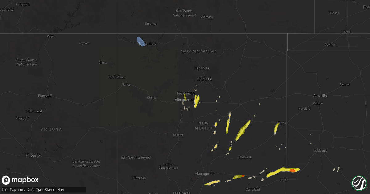
May 4 map
$229
one time, instant access
Download today. No call, no setup
Keep the $229
Bought the map and want the full workflow? Apply the entire $229 to a subscription within 7 days. None of it is wasted.
Every map, not just this one
This buys you this map. Subscription and you get every map we run, in the markets you choose from a few cities to whole states to nationwide. Plus real-time alerts the moment a storm fires.
Contact data
Name, contact info, occupancy, even credit band for addresses in the footprint. You go from where it hit to who to call.
Become the source they trust
Unlimited branding weather history reports on demand. You already have the documented answer ready for the property owner, and you are the one who showed up with it.
Property data and RoofTrace estimates
Pull up any address you have got, its value and the exact code rules for that jurisdiction, straight from One Click Code. Then RoofTrace estimates the squares, pitch, and roof value, priced the way you price.
States Impacted by Hail Map on May 4, 2025
Storm reports
Utah
| Date | Description |
|---|---|
| 05/04/20255:45 PM CDT | Bullfrog basin sensor. |
Ohio
| Date | Description |
|---|---|
| 05/04/20254:14 PM CDT | Numerous reports of pea to dime sized hail covering the ground in chillicothe. Largest hail measured at 1 inch. |
| 05/04/20254:12 PM CDT | Tree down on power lines. Transformer blew off. At north west hills drive... Parkersburg... Wv. Time estimated by radar. |
West Virginia
| Date | Description |
|---|---|
| 05/04/20256:36 PM CDT | 2 inches in diameter hail stones reported at kesling mills... Buckhannon. |
| 05/04/20256:30 PM CDT | Photo provided. |
| 05/04/20256:27 PM CDT | Golf ball size hail covering the ground between mm 18.5 us 33 hwy w. |
| 05/04/20256:18 PM CDT | Golf ball size hail covering the ground at tallmansville road. |
| 05/04/20256:00 PM CDT | Photo provided. |
| 05/04/20254:18 PM CDT | Tree and powerlines down at ashby... Ridge road parkersburg. Time estimated by radar. |
| 05/04/20254:00 PM CDT | Tree fell on power lines. Telephone pole is broken as well at 186 phoenix st... Parkesburg. No power in the area. |
| 05/04/20251:19 PM CDT | Tree down at plantation road... Ashford. |
| 05/03/20258:27 PM CDT | Trees down. |
| 05/03/20258:15 PM CDT | A local report indicates 1.00 inch wind near 7 ESE Rowlesburg |
| 05/03/20257:59 PM CDT | A local report indicates 1.25 inch wind near 1 SE Rowlesburg |
| 05/03/20257:58 PM CDT | A local report indicates 1.00 inch wind near 2 S Rowlesburg |
| 05/03/20257:06 PM CDT | Barbour county 911 center reports a tree down blocking 1 lane on meridan rd just before the apartment complex. Time estimated via radar. |
| 05/03/20257:04 PM CDT | Quarter size hail reported with some other sizes covering some spots on the ground at belington. |
Idaho
| Date | Description |
|---|---|
| 05/04/20256:45 PM CDT | Mesonet station 8419 d6 kettle butte us-20. |
| 05/04/20256:45 PM CDT | Mesonet station rov 9 ssw mud lake. |
| 05/04/20254:20 PM CDT | Multiple public reports of wind damage to roofs... Structures... And power lines. Rocky mountain power reports 366 customers without power in grace. Time estimated base |
| 05/04/20253:30 PM CDT | Mesonet station pc506 sheep creek hills. |
| 05/03/20257:30 PM CDT | Mesonet station pc371 medicine lodge. |
| 05/03/20257:20 PM CDT | Mesonet station san 12 e howe. |
| 05/03/20257:05 PM CDT | Mesonet station mon 6 n monteview. |
Wyoming
| Date | Description |
|---|---|
| 05/04/20256:27 PM CDT | Asos station kshr sheridan. |
| 05/04/20255:07 PM CDT | Asos station krwl 1 ene rawlins. |
| 05/04/20255:06 PM CDT | Mesonet station wy18 halleck ridge |
| 05/04/20254:52 PM CDT | Sustained wind 58 mph. |
| 05/04/20254:02 PM CDT | Mesonet station wy18 halleck ridge |
| 05/04/20254:00 PM CDT | Halleck ridge. |
| 05/04/20254:00 PM CDT | Halleck ridge. |
New Mexico
| Date | Description |
|---|---|
| 05/04/20256:22 PM CDT | Report from mping: golf ball |
| 05/04/20256:19 PM CDT | Report from mping: quarter |
| 05/04/20256:11 PM CDT | Report from mping: quarter |
| 05/04/20253:34 PM CDT | A local report indicates 1.00 inch wind near 1 NNW Cabezon |
| 05/04/20253:14 PM CDT | A local report indicates 1.00 inch wind near 2 WSW Rio Grande Nature |
| 05/04/20253:10 PM CDT | Video showed hailstones were mostly up to quarter size with a couple near ping pong ball around cottonwood. Report relayed via krqe. |
| 05/04/20251:24 PM CDT | Asos station kfmn farmington airport. |
| 05/04/20251:23 PM CDT | Asos station kfmn farmington airport. |
| 05/03/202510:16 PM CDT | A local report indicates 1.00 inch wind near 1 WSW Edgewood |
| 05/03/20259:33 PM CDT | A local report indicates 1.25 inch wind near 2 N Chilili |
| 05/03/20259:33 PM CDT | A local report indicates 1.25 inch wind near 2 N Chilili |
| 05/03/20259:32 PM CDT | Report from mping: quarter |
| 05/03/20259:02 PM CDT | A local report indicates 1.25 inch wind near 3 SE Sedillo |
| 05/03/20258:00 PM CDT | Report from mping: quarter |
| 05/03/20257:10 PM CDT | Report from mping: ping pong ball |
Florida
| Date | Description |
|---|---|
| 05/04/20252:35 PM CDT | Multiple trees down area-wide in st johns county spanning areas between us-1 and world golf villages. |
| 05/04/20251:45 PM CDT | An anchored pergola was lifted and thrown into the neighbors yard and a newly planted tree was uprooted along evening oaks ln. Images and video were sent via social med |
| 05/04/20251:11 PM CDT | Asos station kpmp pompano beach reported a peak wind of 51 knots. |
| 05/04/20251:03 PM CDT | Multiple 3 to 4 inch diameter black olive tree branches snapped. |
| 05/04/202512:30 PM CDT | A large tree was blown over from a thunderstorm that damage a car shield. |
| 05/04/202512:25 PM CDT | Tree on powerline relayed by media reporter in the field. |
North Carolina
| Date | Description |
|---|---|
| 05/04/20255:50 PM CDT | A local report indicates 1.50 inch wind near 2 ESE Dublin |
Montana
| Date | Description |
|---|---|
| 05/03/202511:25 PM CDT | Mesonet station tt839 quad creek at 9774 feet. |
Texas
| Date | Description |
|---|---|
| 05/04/20256:50 PM CDT | A local report indicates 1.50 inch wind near 5 N Denver City |
| 05/04/20256:50 PM CDT | Hail up to the size of golf balls reported by chaser. |
| 05/03/202510:17 PM CDT | Report from mping: quarter |
| 05/03/20258:39 PM CDT | Report from mping: ping pong ball |
| 05/03/20258:37 PM CDT | Report from mping: ping pong ball |
| 05/03/20258:31 PM CDT | Asos station kink wink. |
Pennsylvania
| Date | Description |
|---|---|
| 05/04/20256:47 PM CDT | A local report indicates 1.50 inch wind near Indiana |
| 05/04/20256:46 PM CDT | A local report indicates 1.75 inch wind near 2 SSW Indiana |
| 05/04/20256:44 PM CDT | Report from mping: hen egg+ |
| 05/04/20256:43 PM CDT | A local report indicates 2.50 inch wind near 1 SE Indiana |
| 05/04/20256:42 PM CDT | On iup campus. |
| 05/04/20256:42 PM CDT | A local report indicates 1.75 inch wind near 1 SSE Indiana |
| 05/04/20256:41 PM CDT | A local report indicates 1.50 inch wind near 1 SE Indiana |
| 05/04/20256:36 PM CDT | A local report indicates 1.75 inch wind near Homer City |
| 05/04/20256:32 PM CDT | Report from mping: ping pong ball |
| 05/04/20256:24 PM CDT | A local report indicates 1.00 inch wind near 1 NW Black Lick |
| 05/04/20256:19 PM CDT | A local report indicates 1.00 inch wind near 2 SW Black Lick |
| 05/04/20256:18 PM CDT | A local report indicates 1.00 inch wind near 2 SW Black Lick |
| 05/04/20256:10 PM CDT | Report from mping: quarter |
| 05/04/20255:30 PM CDT | Hail at least the size of quarters. |
| 05/04/20254:57 PM CDT | [landspout] storm damage survey... Videos... And photos confirm a landspout tornado occurred in a rural area between mohrsville and shoemakersville. The tornadic circu |
| 05/04/20251:11 PM CDT | [landspout] video via social media confirms a brief landspout and/or waterspout occurred near the northern end of blue marsh lake in the blue marsh national recreation |
| 05/04/202512:33 PM CDT | A brief tornado occurred between martzall road and white oak road in east cocalico township just northeast of denver. Damage along the approximately 500 foot path lengt |
| 05/03/20258:50 PM CDT | Hail size estimated from doorbell cam video. Reported at least the size of golf balls. Considerable leaf shredding on trees from falling large hail |
| 05/03/20257:09 PM CDT | A local report indicates 1.00 inch wind near 2 NE Blairsville |
Maryland
| Date | Description |
|---|---|
| 05/03/20258:30 PM CDT | A local report indicates 1.00 inch wind near 3 WSW Oakland |
Cities Impacted by Hail Map on May 4, 2025
- Miami, FL
- Sidney, KY
- Belfry, KY
- South Williamson, KY
- Williamson, WV
- Fort Lauderdale, FL
- Pompano Beach, FL
- Deerfield Beach, FL
- Boca Raton, FL
- Farmington, NM
- Kirtland, NM
- Waterflow, NM
- Bloomfield, NM
- Aztec, NM
- Delbarton, WV
- Wallace, NC
- Beulaville, NC
- Saint Augustine, FL
- Chinquapin, NC
- Ponte Vedra Beach, FL
- Albuquerque, NM
- Corrales, NM
- Rio Rancho, NM
- Ripley, WV
- Gay, WV
- Gandeeville, WV
- Spencer, WV
- Elkview, WV
- Kenna, WV
- Walton, WV
- Cloudcroft, NM
- Timberon, NM
- Capitan, NM
- Leadore, ID
- Salmon, ID
- Elizabeth, WV
- Ray, OH
- Walker, WV
- Mineral Wells, WV
- Maljamar, NM
- Lovington, NM
- Davisville, WV
- Delta, UT
- Londonderry, OH
- Chillicothe, OH
- Weed, NM
- Clarkton, NC
- Council, NC
- Grace, ID
- Elizabethtown, NC
- Kelly, NC
- Whiteville, NC
- Bancroft, ID
- Corona, NM
- Pinon, NM
- Chadbourn, NC
- Los Lunas, NM
- Ligonier, PA
- Yeso, NM
- Bladenboro, NC
- Peralta, NM
- Fort Sumner, NM
- Bosque Farms, NM
- Vaughn, NM
- Pyote, TX
- White Oak, NC
- Helvetia, WV
- French Creek, WV
- Kanawha Head, WV
- Crawford, WV
- Rock Cave, WV
- Hacker Valley, WV
- Cleveland, WV
- Tallmansville, WV
- Selbyville, WV
- Ireland, WV
- Derry, PA
- Tar Heel, NC
- Buckhannon, WV
- Denver City, TX
- Plains, TX
- Hope, NM
- Artesia, NM
- Blairsville, PA
- Carlsbad, NM
- Monahans, TX
- Cerro Gordo, NC
- Loving, NM
- Salt Flat, TX
- Wink, TX
- Fayetteville, NC
- Autryville, NC
- Ellamore, WV
- Fort Mcdowell, AZ
- Black Lick, PA
- Josephine, PA
- Homer City, PA
- Coral, PA
- Indiana, PA
- Lucernemines, PA
- Pecos, TX
- Stedman, NC
- Seagraves, TX
- Seminole, TX
- Belington, WV
- Volga, WV
- Philippi, WV
- Walkersville, WV
- Latrobe, PA
- Jal, NM
- Mentone, TX
- Saltsburg, PA
- Avonmore, PA
- Moatsville, WV
- Montrose, WV
- Parsons, WV
- Creekside, PA
- Tijeras, NM
- Aultman, PA
- Terra Alta, WV
- Rowlesburg, WV
- Aurora, WV
- Tunnelton, WV
- Estancia, NM
- Moriarty, NM
- Edgewood, NM
- Stanley, NM
- Sandia Park, NM
- Loris, SC
- Green Sea, SC
- Tabor City, NC
- Kingwood, WV
- Clarendon, NC
- Shelocta, PA
- Eglon, WV
- Albright, WV
- Kermit, TX
- Clarksburg, PA
- Oakland, MD
- Apollo, PA
- New Alexandria, PA
- Hallsboro, NC
- Vandergrift, PA
- Ford City, PA
- Spring Church, PA
- Sidney, MT
- Fairview, MT
- Goldsmith, TX
- Odessa, TX
- Crane, TX
- Molt, MT
- Midland, TX
- McCamey, TX
- Broadview, MT
- Midkiff, TX
- Ribera, NM
- Hagerman, NM
- Nogal, NM
- Saint Helena Island, SC
- Algodones, NM
- Picacho, NM
- Santa Fe, NM
- Tinnie, NM
- Isleta, NM
- Portales, NM
- Scotland Neck, NC
- Roxobel, NC
- Pep, NM
- Clovis, NM
- Cannon Afb, NM
- Anton, TX
- Justiceburg, TX
- Fieldton, TX