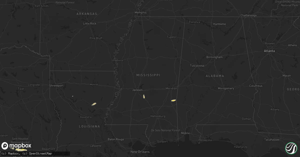
Hail Map in Mississippi on May 3, 2019
Get this storm
May 3 map
$229
one time, instant access
Download today. No call, no setup
Keep the $229
Bought the map and want the full workflow? Apply the entire $229 to a subscription within 7 days. None of it is wasted.
Every map, not just this one
This buys you this map. Subscription and you get every map we run, in the markets you choose from a few cities to whole states to nationwide. Plus real-time alerts the moment a storm fires.
Contact data
Name, contact info, occupancy, even credit band for addresses in the footprint. You go from where it hit to who to call.
Become the source they trust
Unlimited branding weather history reports on demand. You already have the documented answer ready for the property owner, and you are the one who showed up with it.
Property data and RoofTrace estimates
Pull up any address you have got, its value and the exact code rules for that jurisdiction, straight from One Click Code. Then RoofTrace estimates the squares, pitch, and roof value, priced the way you price.
Storm reports in Mississippi
Mississippi
| Date | Description |
|---|---|
| 05/03/20195:43 PM CDT | Picture from mhp of a tree across hwy 27. |
| 05/03/20191:34 AM CDT | At 634 PM CDT, a severe thunderstorm was located near Edwards, or 12 miles east of Vicksburg, moving north at 25 mph. HAZARD...60 mph wind gusts and quarter size hail. SOURCE...Radar indicated. IMPACT...Hail damage to vehicles is expected. Expect wind damage to roofs, siding, and trees. This severe thunderstorm will be near... Bovina around 645 PM CDT. Flowers around 650 PM CDT. Youngton around 700 PM CDT. Oak Ridge around 705 PM CDT. Redwood around 710 PM CDT. |
| 05/02/201911:28 PM CDT | At 428 PM CDT, a severe thunderstorm was located over Mendenhall, moving north at 15 mph. HAZARD...60 mph wind gusts and quarter size hail. SOURCE...Radar indicated. IMPACT...Hail damage to vehicles is expected. Expect wind damage to roofs, siding, and trees. This severe thunderstorm will be near... Martinville around 440 PM CDT. Cato around 505 PM CDT. Johns around 515 PM CDT.Other locations impacted by this severe thunderstorm include D'Lo andPuckett. |
All States Impacted by Hail Map on May 3, 2019
Cities Impacted by Hail Map on May 3, 2019
- Seymour, TX
- Westhoff, TX
- Smiley, TX
- Paige, TX
- Greeneville, TN
- Franklin, AL
- Sonora, TX
- Austin, TX
- Eldorado, TX
- Monahans, TX
- Coyanosa, TX
- Uvalde, TX
- Rocksprings, TX
- Goldsmith, TX
- Charleston, WV
- New Braunfels, TX
- Bulverde, TX
- Junction, TX
- Stonewall, TX
- Hye, TX
- Blanco, TX
- Hurricane, WV
- Fraziers Bottom, WV
- Lockney, TX
- Cotulla, TX
- Fowlerton, TX
- Dilley, TX
- Munday, TX
- Batesville, TX
- Pearsall, TX
- Mill Creek, PA
- Allensville, PA
- Humble, TX
- Kingwood, TX
- Shubuta, MS
- Waynesboro, MS
- Friona, TX
- Earth, TX
- Sudan, TX
- Muleshoe, TX
- Fredericksburg, TX
- Comfort, TX
- Abilene, TX
- Bellefonte, PA
- State College, PA
- Barksdale, TX
- Stephens City, VA
- Front Royal, VA
- White Post, VA
- Boyce, VA
- Middletown, VA
- Winchester, VA
- Hereford, TX
- Throckmorton, TX
- Albany, TX
- Roby, TX
- Rotan, TX
- McDade, TX
- Elgin, TX
- Coahoma, TX
- Holliday, TX
- Olney, TX
- Newcastle, TX
- D Hanis, TX
- Milton, WV
- Culloden, WV
- Winfield, WV
- Scott Depot, WV
- Hebbronville, TX
- Harper, TX
- Harpers Ferry, WV
- Gerrardstown, WV
- Shenandoah Junction, WV
- Keedysville, MD
- Martinsburg, WV
- Bunker Hill, WV
- Inwood, WV
- Clear Brook, VA
- Sharpsburg, MD
- Shepherdstown, WV
- Kearneysville, WV
- Del Rio, TX
- Quitman, MS
- Kermit, TX
- Andrews, TX
- Carrizo Springs, TX
- Brackettville, TX
- Omaha, AR
- Plains, TX
- New Enterprise, PA
- Loysburg, PA
- Bedford, PA
- La Pryor, TX
- Three Rivers, TX
- Mangum, OK
- Driftwood, TX
- Wimberley, TX
- Spring, TX
- De Leon, TX
- Gorman, TX
- Millersview, TX
- Stuart, FL
- Palm City, FL
- Crystal City, TX
- Hamilton, TX
- Hico, TX
- Carlton, TX
- Gustine, TX
- Dublin, TX
- Boerne, TX
- Gatesville, TX
- Oglesby, TX
- Clyde, TX
- Johnson City, TX
- Jayton, TX
- Girard, TX
- Snyder, TX
- Magnolia, TX
- Pinehurst, TX
- Tomball, TX
- Lexington, TX
- Paris, VA
- Upperville, VA
- Sabinal, TX
- Utopia, TX
- Blackwell, TX
- Bronte, TX
- Elkview, WV
- Ona, WV
- Barboursville, WV
- Lincoln, TX
- Giddings, TX
- Somerville, TX
- Buda, TX
- Comstock, TX
- Forest Home, AL
- Marathon, TX
- Fort Stockton, TX
- Shirleysburg, PA
- Three Springs, PA
- Cuero, TX
- Yorktown, TX
- Houston, TX
- Berryville, VA
- Seminole, TX
- Star Tannery, VA
- Dripping Springs, TX
- Stephenson, VA
- Moulton, TX
- Schulenburg, TX
- Shiner, TX
- Weimar, TX
- Hallettsville, TX
- Columbus, TX
- East Bernard, TX
- Lead Hill, AR
- Roscoe, TX
- Mosheim, TN
- Realitos, TX
- Concepcion, TX
- Big Wells, TX
- Maryneal, TX
- Lavalette, WV
- Huntington, WV
- Ralls, TX
- Summerfield, TX
- San Angelo, TX
- Walton, WV
- Nitro, WV
- Poca, WV
- Ovalo, TX
- Barstow, TX
- Pyote, TX
- Brownfield, TX
- Campbellton, TX
- Tatum, NM
- Morton, TX
- Knippa, TX
- Vernon, TX
- Raymond, MN
- Kerkhoven, MN
- Murdock, MN
- Hobbs, NM
- Lovington, NM
- West Palm Beach, FL
- Del Valle, TX
- Loraine, TX
- Woodson, TX
- Graham, TX
- Huffman, TX
- Porter, TX
- Whiteface, TX
- Belleville, PA
- McClure, PA
- Milroy, PA
- Burnham, PA
- Reedsville, PA
- McVeytown, PA
- Yeagertown, PA
- Lewistown, PA
- Boalsburg, PA
- Big Spring, TX
- Gail, TX
- Huntingdon, PA
- Saint Albans, WV
- Bellville, TX
- Taft, TX
- Portland, TX
- Alice, TX
- Valley Mills, TX
- Christoval, TX
- Caldwell, TX
- Weinert, TX
- Comanche, TX
- Camp Wood, TX
- Garden City, TX
- Georgetown, TX
- Bovina, TX
- Theriot, LA
- Jupiter, FL
- Sweetwater, TX
- Menard, TX
- Nordheim, TX
- Wayne, WV
- Boynton Beach, FL
- Moran, TX
- Little Birch, WV
- Frametown, WV
- Sutton, WV
- Gassaway, WV
- Centre Hall, PA
- Eagle Lake, TX
- Maple, TX
- Enochs, TX
- Fort White, FL
- Concan, TX
- Strasburg, VA
- Rio Frio, TX
- Leakey, TX
- Laredo, TX
- Selbyville, WV
- Hacker Valley, WV
- Pickens, WV
- Diana, WV
- Cowen, WV
- Flatwoods, WV
- Rock Cave, WV
- Goree, TX
- Mapleton Depot, PA
- Todd, PA
- Calvin, PA
- Cassville, PA
- Broad Top, PA
- Kenedy, TX
- Tilden, TX
- Trout, LA
- Jena, LA
- Olla, LA
- Gore, VA
- Cross Junction, VA
- Ozona, TX
- Mount Union, PA
- Kyle, TX
- San Marcos, TX
- Lueders, TX
- Orma, WV
- Mendenhall, MS
- Braxton, MS
- Post, TX
- Justiceburg, TX
- Center Point, TX
- Hockley, TX
- Lake Butler, FL
- Kendalia, TX
- Moore, TX
- Pipe Creek, TX
- Crosby, TX
- Garwood, TX
- Alleyton, TX
- Eagle Pass, TX
- Meridian, TX
- Cranfills Gap, TX
- Flatonia, TX
- Aspermont, TX
- Evergreen, AL
- Chillicothe, TX
- Farwell, TX
- Jonesboro, TX
- Dimmitt, TX
- Bandera, TX
- Gordon, TX
- Clifton, TX
- Petersburg, PA
- Slaton, TX
- Baytown, TX
- Hamlin, TX
- Ripley, WV
- Saline, LA
- Westbrook, TX
- Summit Point, WV
- Round Mountain, TX
- Llano, TX
- Ledbetter, TX
- Charles Town, WV
- Grove Hill, AL
- Manor, TX
- Karnes City, TX
- Wingate, TX
- Sweeny, TX
- Pecos, TX
- Colorado City, TX
- Pennsylvania Furnace, PA
- Dime Box, TX
- Dale, TX
- Manchaca, TX
- Hamlin, WV
- West Hamlin, WV
- Doole, TX
- Bastrop, TX
- Spring Branch, TX
- Alum Creek, WV
- Sod, WV
- Tornado, WV
- South Charleston, WV
- Crowell, TX
- Wink, TX
- Salt Rock, WV
- Red House, WV
- Coffeeville, AL
- Normantown, WV
- Cedarville, WV
- Rosedale, WV
- Saint Augustine, FL
- Bergheim, TX
- Afton, TN
- Howard, PA
- Bishop, TX
- Benavides, TX
- Robstown, TX
- Mathis, TX
- Oilton, TX
- Corpus Christi, TX
- Odem, TX
- Agua Dulce, TX
- Sinton, TX
- Bruni, TX
- Orange Grove, TX
- San Diego, TX
- Kingsville, TX
- Mirando City, TX


