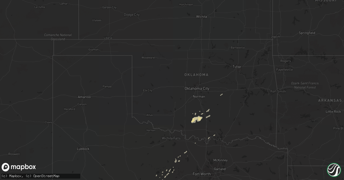
Hail Map in Oklahoma on May 3, 2018
Get this storm
May 3 map
$229
one time, instant access
Download today. No call, no setup
Keep the $229
Bought the map and want the full workflow? Apply the entire $229 to a subscription within 7 days. None of it is wasted.
Every map, not just this one
This buys you this map. Subscription and you get every map we run, in the markets you choose from a few cities to whole states to nationwide. Plus real-time alerts the moment a storm fires.
Contact data
Name, contact info, occupancy, even credit band for addresses in the footprint. You go from where it hit to who to call.
Become the source they trust
Unlimited branding weather history reports on demand. You already have the documented answer ready for the property owner, and you are the one who showed up with it.
Property data and RoofTrace estimates
Pull up any address you have got, its value and the exact code rules for that jurisdiction, straight from One Click Code. Then RoofTrace estimates the squares, pitch, and roof value, priced the way you price.
Storm reports in Oklahoma
Oklahoma
| Date | Description |
|---|---|
| 05/03/20189:42 AM CDT | Power lines down around gun club road between 330 road and 340 road north of morris. Time estimated by radar. |
| 05/03/20188:24 AM CDT | Two unoccupied trailer homes destroyed. One permanent brick home sustained siding and minimal roof damage. Time estimated. |
| 05/03/20187:59 AM CDT | At 1258 AM CDT, a severe thunderstorm was located near Sterling, moving northeast at 60 mph. HAZARD...60 mph wind gusts and nickel size hail. SOURCE...Radar indicated. IMPACT...Expect damage to roofs, siding, and trees. Locations impacted include... Lawton, Duncan, Chickasha, Newcastle, Blanchard, Anadarko, Marlow, Walters, Lindsay, Cache, Elgin, Minco, Apache, Geronimo, Maysville, Rush Springs, Bray, Fletcher, Cyril and Temple.This includes Interstate 44 between mile markers 26 and 99. |
| 05/03/20187:10 AM CDT | A local report indicates 61 MPH wind near 4 W NEWCASTLE |
| 05/03/20184:06 AM CDT | At 905 AM CDT, severe thunderstorms were located along a line extending from 4 miles northwest of Cromwell to 4 miles northwest of Yeager to 3 miles north of Atwood, moving east at 50 mph. HAZARD...60 mph wind gusts. SOURCE...Radar indicated. IMPACT...Expect damage to roofs, siding, and trees. Locations in or near the path include... Okmulgee... Okemah... Henryetta... Weleetka... Dewar... Schulter... Grayson... Hanna... Bearden... Hoffman... Castle... Clearview... Raiford... Okmulgee State Park... Pharoah... Bryant... Vernon... This includes Interstate 40 in Oklahoma between mile markers 212 and248. |
| 05/03/20183:59 AM CDT | At 859 AM CDT, severe thunderstorms were located along a line extending from 5 miles east of Little to 3 miles south of Calvin, moving northeast at 55 mph. HAZARD...70 mph wind gusts. SOURCE...Radar indicated. IMPACT...Expect considerable tree damage. Damage is likely to mobile homes, roofs, and outbuildings. Locations impacted include... Holdenville, Wewoka, Wetumka, Dustin, Calvin, Cromwell, Stuart, Lamar, Horntown, Yeager, Atwood, Little and Spaulding.This includes Interstate 40 between mile markers 201 and 213. |
| 05/03/20183:20 AM CDT | At 820 AM CDT, severe thunderstorms were located along a line extending from near Asher to 6 miles northwest of Ada, moving northeast at 40 mph. HAZARD...70 mph wind gusts. SOURCE...Radar indicated. IMPACT...Expect considerable tree damage. Damage is likely to mobile homes, roofs, and outbuildings. Locations impacted include... Ada, Seminole, Holdenville, Wewoka, Konawa, Wetumka, Byng, Maud, Allen, Bowlegs, Asher, Francis, Calvin, Cromwell, Lamar, St. Louis, Sasakwa, Horntown, Yeager and Atwood.This includes Interstate 40 between mile markers 206 and 213. |
| 05/03/20182:33 AM CDT | At 732 AM CDT, severe thunderstorms were located along a line extending from near Maysville to 3 miles southwest of Pooleville, moving east at 40 mph. HAZARD...60 mph wind gusts and quarter size hail. SOURCE...Radar indicated. IMPACT...Hail damage to vehicles is expected. Expect wind damage to roofs, siding, and trees. Locations impacted include... Pauls Valley, Sulphur, Davis, Wynnewood, Stratford, Maysville, Elmore City, Paoli, Wanette, Katie, Byars, Dougherty, Tatums, Rosedale, Graham, Pooleville, Lake Of The Arbuckles, Antioch, Turner Falls and Hennepin.This includes Interstate 35 between mile markers 44 and 85. |
| 05/03/20182:32 AM CDT | At 731 AM CDT, severe thunderstorms were located along a line extending across eastern Oklahoma City and Midwest City, moving northeast at 50 mph. HAZARD...60 mph wind gusts. SOURCE...Radar indicated. IMPACT...Expect damage to roofs, siding, and trees. Locations impacted include... Eastern Oklahoma City, Edmond, Midwest City, Del City, Choctaw, Harrah, Spencer, Jones, Nicoma Park, Luther, Arcadia, Tinker Air Force Base, Forest Park and Lake Aluma. |
| 05/03/20182:08 AM CDT | At 708 AM CDT, severe thunderstorms were located along a line extending from 7 miles south of Lindsay to 6 miles southwest of Loco, moving east at 35 mph. HAZARD...60 mph wind gusts and quarter size hail. SOURCE...Radar indicated. IMPACT...Hail damage to vehicles is expected. Expect wind damage to roofs, siding, and trees. Locations impacted include... Lindsay, Maysville, Elmore City, Wayne, Velma, Katie, Foster, Tatums, Loco, Ratliff City, Graham, Pooleville, Antioch, Hennepin, Fox, Pernell, Cox City, Whitebead and Erin Springs.This includes Interstate 35 between mile markers 76 and 86. |
| 05/03/20181:42 AM CDT | At 641 AM CDT, severe thunderstorms were located along a line extending from 3 miles south of Marlow to near Addington, moving northeast at 65 mph. HAZARD...60 mph wind gusts and quarter size hail. SOURCE...Radar indicated. IMPACT...Hail damage to vehicles is expected. Expect wind damage to roofs, siding, and trees. Locations impacted include... Duncan, Marlow, Lindsay, Comanche, Bray, Velma, Hastings, Loco, Addington, Waurika Lake, Empire City, Cox City and Erin Springs. |
| 05/03/20181:20 AM CDT | At 619 AM CDT, severe thunderstorms were located along a line extending from 11 miles east of Lawton to 3 miles east of Temple, moving northeast at 65 mph. HAZARD...60 mph wind gusts and quarter size hail. SOURCE...Radar indicated. IMPACT...Hail damage to vehicles is expected. Expect wind damage to roofs, siding, and trees. Locations impacted include... Duncan, Marlow, Comanche, Rush Springs, Bray, Temple, Sterling, Alex, Agawam, Corum, northwestern Waurika Lake, Central High, Empire City, Hulen and Acme. |
| 05/03/201812:27 AM CDT | At 527 AM CDT, a severe thunderstorm was located 4 miles west of Ravia, moving northeast at 55 mph. HAZARD...60 mph wind gusts and quarter size hail. SOURCE...Radar indicated. IMPACT...Hail damage to vehicles is expected. Expect wind damage to roofs, siding, and trees. Locations impacted include... Tishomingo, Mannsville, Ravia, Wapanucka, Bromide, Connerville, Russett, Clarita, Olney and Reagan. |
| 05/02/201811:54 PM CDT | At 453 AM CDT, severe thunderstorms were located along a line extending from near Chillicothe to near Vera, moving east at 45 mph. HAZARD...60 mph wind gusts and quarter size hail. SOURCE...Radar indicated. IMPACT...Hail damage to vehicles is expected. Expect wind damage to roofs, siding, and trees. Locations impacted include... Vernon, Seymour, Chillicothe, Red Springs, Thalia, Lockett, Lake Kemp, Mabelle, Vera, Medicine Mound, Fargo, Oklaunion, Grayback and Rayland. |
| 05/02/20188:56 PM CDT | At 155 AM CDT, a severe thunderstorm was located 9 miles northwest of Duncan, moving northeast at 50 mph. HAZARD...60 mph wind gusts and quarter size hail. SOURCE...Radar indicated. IMPACT...Hail damage to vehicles is expected. Expect wind damage to roofs, siding, and trees. Locations impacted include... Duncan, Chickasha, Marlow, Lindsay, Rush Springs, Bray, Alex, Bradley, Agawam, Central High, Ninnekah, Hulen, Acme, Cox City and Erin Springs. |
| 05/02/20188:53 PM CDT | At 153 AM CDT, a severe thunderstorm was located over western Norman, or 7 miles north of Goldsby, moving northeast at 60 mph. HAZARD...60 mph wind gusts. SOURCE...Radar indicated. IMPACT...Expect damage to roofs, siding, and trees. Locations impacted include... Oklahoma City, Norman, Edmond, Moore, Midwest City, Shawnee, Del City, Newcastle, Blanchard, Chandler, Bethany, Mustang, Choctaw, Warr Acres, The Village, Noble, Tuttle, Harrah, McLoud and Spencer.This includes the following highways... Interstate 35 between mile markers 98 and 145. Interstate 40 between mile markers 143 and 190. Interstate 44 between mile markers 95 and 168. Interstate 240 between mile markers 1 and 16. |
| 05/02/20188:33 PM CDT | At 133 AM CDT, a severe thunderstorm was located 9 miles southeast of Crowell, moving northeast at 50 mph. HAZARD...60 mph wind gusts and quarter size hail. SOURCE...Radar indicated. IMPACT...Hail damage to vehicles is expected. Expect wind damage to roofs, siding, and trees. Locations impacted include... Vernon, Crowell, Margaret, Lockett, Fargo, Thalia, Oklaunion, Harrold, Grayback, Gilliland and Rayland. |
All States Impacted by Hail Map on May 3, 2018
Cities Impacted by Hail Map on May 3, 2018
- Jacksboro, TX
- Duncan, OK
- Iredell, TX
- Hico, TX
- White City, KS
- Schuyler, NE
- Bellwood, NE
- Morse Bluff, NE
- Rogers, NE
- Linwood, NE
- Columbus, NE
- David City, NE
- North Bend, NE
- Desdemona, TX
- De Leon, TX
- Comstock, TX
- New Cambria, KS
- Victoria, KS
- Gorham, KS
- Brownwood, TX
- Evant, TX
- Zephyr, TX
- Early, TX
- Mullin, TX
- Brookesmith, TX
- Concan, TX
- Uvalde, TX
- Coleman, TX
- Sonora, TX
- Del Rio, TX
- Dryden, TX
- Rocksprings, TX
- Carrizo Springs, TX
- Asherton, TX
- Council Grove, KS
- Herington, KS
- Laredo, TX
- Elmore City, OK
- Davis, OK
- Hennepin, OK
- Tussy, OK
- Big Wells, TX
- Barksdale, TX
- Camp Wood, TX
- Arlington, NE
- Blair, NE
- Nickerson, NE
- Herman, NE
- Bennington, KS
- Solomon, KS
- Tescott, KS
- Salina, KS
- Ranger, TX
- Russell, KS
- Hays, KS
- Walker, KS
- Centralia, KS
- Vermillion, KS
- Hope, KS
- Pauls Valley, OK
- Wynnewood, OK
- Stratford, OK
- Lewiston, NE
- Burchard, NE
- Steinauer, NE
- Pleasanton, NE
- Eden, TX
- Dublin, TX
- Comanche, TX
- Hillsboro, TX
- Malone, TX
- Brackettville, TX
- Mereta, TX
- Paint Rock, TX
- Waukee, IA
- Urbandale, IA
- Grimes, IA
- West Des Moines, IA
- Cumming, IA
- Van Meter, IA
- Clive, IA
- Blanket, TX
- May, TX
- Maysville, OK
- Utopia, TX
- Leakey, TX
- Beverly, KS
- Lincoln, KS
- Stephenville, TX
- Graford, TX
- Baird, TX
- Walnut Springs, TX
- Talpa, TX
- Goldthwaite, TX
- Abilene, KS
- Ozona, TX
- Vancourt, TX
- Glen Rose, TX
- Ravenna, NE
- Gibbon, NE
- Poseyville, IN
- Christoval, TX
- Eldorado, TX
- Kingston, OK
- Lebanon, OK
- Sabinal, TX
- Junction, TX
- Riverdale, NE
- Sylvan Grove, KS
- Brookville, KS
- Breckenridge, TX
- Caddo, TX
- Hooper, NE
- Rising City, NE
- Bruno, NE
- San Angelo, TX
- Eola, TX
- Medina, TX
- Voss, TX
- Sidney, TX
- Santa Anna, TX
- Bangs, TX
- Gouldbusk, TX
- Valera, TX
- Villisca, IA
- Albion, IL
- Rockwood, TX
- Bryson, TX
- Liberty, NE
- Tecumseh, NE
- Crab Orchard, NE
- Eastland, TX
- Kearney, NE
- Cairo, NE
- Arbela, MO
- Marietta, OK
- Catarina, TX
- Ames, NE
- Fremont, NE
- Cleburne, TX
- Granbury, TX
- Rainbow, TX
- Amherst, NE
- Gatesville, TX
- Marlow, OK
- Hamilton, TX
- Foster, OK
- Burkett, TX
- Cross Plains, TX
- Chico, TX
- Saint George, KS
- Bluff Dale, TX
- Ratliff City, OK
- Westmoreland, KS
- Bowie, TX
- Moran, TX
- Cisco, TX
- Sulphur, OK
- Wewoka, OK
- Seminole, OK
- Graham, TX
- Strawn, TX
- Dodge, NE
- Rio Frio, TX
- Saint Jo, TX
- Wall, TX
- Smithville, MO
- Trimble, MO
- Plattsburg, MO
- Bone Gap, IL


