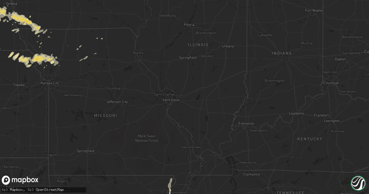
Hail Map in Nebraska on May 2, 2012
Get this storm
May 2 map
$229
one time, instant access
Download today. No call, no setup
Keep the $229
Bought the map and want the full workflow? Apply the entire $229 to a subscription within 7 days. None of it is wasted.
Every map, not just this one
This buys you this map. Subscription and you get every map we run, in the markets you choose from a few cities to whole states to nationwide. Plus real-time alerts the moment a storm fires.
Contact data
Name, contact info, occupancy, even credit band for addresses in the footprint. You go from where it hit to who to call.
Become the source they trust
Unlimited branding weather history reports on demand. You already have the documented answer ready for the property owner, and you are the one who showed up with it.
Property data and RoofTrace estimates
Pull up any address you have got, its value and the exact code rules for that jurisdiction, straight from One Click Code. Then RoofTrace estimates the squares, pitch, and roof value, priced the way you price.
Storm reports in Nebraska
Nebraska
| Date | Description |
|---|---|
| 05/02/201211:36 AM CDT | A local report indicates 1.00 inch wind near HASTINGS |
| 05/02/20125:51 AM CDT | Heavy rainfall |
| 05/02/20124:44 AM CDT | A local report indicates 1.00 inch wind near 4 S HASTINGS |
| 05/02/20124:13 AM CDT | A local report indicates 1.75 inch wind near HOLSTEIN |
| 05/02/20121:28 AM CDT | Penny to golf ball hail and heavy rain |
| 05/02/20121:16 AM CDT | Winds estimated at up to 60 mph |
| 05/02/20121:15 AM CDT | A local report indicates 1.00 inch wind near 2 SW HOOPER |
| 05/02/20121:15 AM CDT | Winds estimated at up to 60 mph |
| 05/02/20121:08 AM CDT | A local report indicates 1.00 inch wind near DEWEESE |
| 05/02/201212:28 AM CDT | A few tree limbs down blocking a few streets. |
| 05/02/201212:26 AM CDT | A local report indicates 1.00 inch wind near AYR |
| 05/02/201212:26 AM CDT | A few tree limbs down blocking a few streets. |
| 05/01/201211:58 PM CDT | Hail up to quarter size |
| 05/01/201211:48 PM CDT | Mainly dime size |
| 05/01/201211:47 PM CDT | A local report indicates 2.50 inch wind near 3 NNW HASTINGS |
| 05/01/201211:45 PM CDT | A local report indicates 1.00 inch wind near 2 ENE HUMPHREY |
| 05/01/201211:44 PM CDT | 2 inch hail measured at the nws office. |
| 05/01/201211:38 PM CDT | A local report indicates 2.00 inch wind near 1 E JUNIATA |
| 05/01/201211:37 PM CDT | A local report indicates 1.00 inch wind near HASTINGS |
| 05/01/201211:36 PM CDT | Hail reported on the west side of town near 12th and brentwood ave. |
| 05/01/201211:29 PM CDT | Hail up to quarter size |
| 05/01/201211:25 PM CDT | Hail quarter to golfball size. Mostly quarter size. 3 miles west and 1 mile south of friend. |
| 05/01/201210:50 PM CDT | A local report indicates 1.00 inch wind near 2 SW LINDSAY |
| 05/01/201210:39 PM CDT | A local report indicates 1.00 inch wind near 4 S NEWMAN GROVE |
| 05/01/201210:36 PM CDT | Just a few |
| 05/01/201210:34 PM CDT | A local report indicates 1.00 inch wind near 6 ESE CLAY CENTER |
| 05/01/201210:30 PM CDT | 14th and california |
| 05/01/201210:27 PM CDT | 12th and bellevue |
| 05/01/201210:17 PM CDT | Golf ball size hail at east 15th street and eastside boulevard. |
| 05/01/201210:15 PM CDT | At lake hastings |
| 05/01/201210:13 PM CDT | A local report indicates 1.00 inch wind near HASTINGS |
| 05/01/201210:12 PM CDT | Tornado near the county line. Damage reported to a house. Garage wall blown out and windows on south side of house blown out. |
| 05/01/201210:10 PM CDT | A local report indicates 1.00 inch wind near HASTINGS |
| 05/01/201210:03 PM CDT | Report from survey team indicates a tornado touched down approximately 2 miles northeast of davenport and lifted 3 miles northeast of davenport. The preliminary rating |
| 05/01/20129:49 PM CDT | A local report indicates 1.00 inch wind near SHICKLEY |
| 05/01/20129:05 PM CDT | A local report indicates 2.00 inch wind near 5 S GENOA |
| 05/01/20128:56 PM CDT | Law enforcement reported hail bigger than golf balls on highway 22 towards genoa. |
| 05/01/20128:50 PM CDT | Hail fell from 835pm to 850pm. |
| 05/01/20128:45 PM CDT | A local report indicates 1.25 inch wind near 3 NE FULLERTON |
| 05/01/20128:43 PM CDT | A local report indicates 1.00 inch wind near 1 W ALBION |
| 05/01/20128:38 PM CDT | A local report indicates 2.00 inch wind near 2 NNE FULLERTON |
| 05/01/20128:34 PM CDT | A local report indicates 1.75 inch wind near 3 E CLAY CENTER |
| 05/01/20128:34 PM CDT | A local report indicates 1.00 inch wind near 2 S EDGAR |
| 05/01/20128:24 PM CDT | Heavy rain |
| 05/01/20128:18 PM CDT | A local report indicates 1.50 inch wind near 2 SE CEDAR RAPIDS |
| 05/01/20128:17 PM CDT | A local report indicates 1.25 inch wind near 2 SE CEDAR RAPIDS |
| 05/01/20128:10 PM CDT | A local report indicates 1.50 inch wind near 5 W FULLERTON |
| 05/01/20128:07 PM CDT | A local report indicates 1.00 inch wind near 6 W FULLERTON |
| 05/01/20127:50 PM CDT | A local report indicates 1.75 inch wind near 7 SW BELGRADE |
| 05/01/20127:50 PM CDT | A local report indicates 1.50 inch wind near 8 SW BELGRADE |
| 05/01/20127:47 PM CDT | A local report indicates 1.00 inch wind near 1 W ST. PAUL |
All States Impacted by Hail Map on May 2, 2012
Cities Impacted by Hail Map on May 2, 2012
- Reedsburg, WI
- Fergus Falls, MN
- Park Falls, WI
- Sheffield, PA
- Lindsay, NE
- Columbus, NE
- Albion, NE
- Dodge, NE
- Saint Edward, NE
- Creston, NE
- Rogers, NE
- Scribner, NE
- North Bend, NE
- Newman Grove, NE
- Leigh, NE
- Humphrey, NE
- Schuyler, NE
- Howells, NE
- Clarkson, NE
- Platte Center, NE
- Genoa, NE
- Fullerton, NE
- Silver Creek, NE
- Cumberland, WI
- Buffalo, MN
- Newland, NC
- Banner Elk, NC
- Amherst, NE
- Riverdale, NE
- Kearney, NE
- Linville, NC
- Elk Park, NC
- Winter, WI
- Rock Port, MO
- Aberdeen, MS
- Braddyville, IA
- Clearmont, MO
- Trumann, AR
- Bay, AR
- Jonesboro, AR
- Harrisburg, AR
- South Shore, SD
- Watertown, SD
- Stockholm, SD
- Bristol, SD
- Webster, SD
- Sparta, WI
- Fairview, KS
- Sabetha, KS
- Morrill, KS
- Marietta, MN
- Cedar Rapids, NE
- Everest, KS
- Robinson, KS
- Horton, KS
- Hiawatha, KS
- Powhattan, KS
- Kulm, ND
- Cogswell, ND
- Oakes, ND
- Emily, MN
- Prairie View, KS
- Greenville, MS
- Leland, MS
- New Albany, MS
- Kenyon, MN
- Faribault, MN
- North Collins, NY
- Lawtons, NY
- Hill City, KS
- Bogue, KS
- Palco, KS
- Peru, NE
- Eagle Lake, MN
- Waseca, MN
- Warsaw, MN
- Madison Lake, MN
- Morristown, MN
- Elysian, MN
- Waterville, MN
- Janesville, MN
- Effingham, KS
- Lancaster, KS
- Glenvil, NE
- Madison, MN
- Bellingham, MN
- Rosholt, WI
- Kane, PA
- James City, PA
- Ellis, KS
- Ogallah, KS
- Miltona, MN
- Eagle Bend, MN
- Clarissa, MN
- Bertha, MN
- Parkers Prairie, MN
- Cochrane, WI
- Fountain City, WI
- Saint Paul, NE
- Cameron, MO
- Osborn, MO
- Aurora, NE
- Stuart, VA
- Gettysburg, SD
- Agar, SD
- Anoka, MN
- Atwater, MN
- Grove City, MN
- Litchfield, MN
- Oto, IA
- Moville, IA
- Hornick, IA
- Anthon, IA
- Wood River, NE
- Kenesaw, NE
- Fredonia, ND
- Ripley, MS
- Blue Mountain, MS
- Haleyville, AL
- Custer, WI
- Wolbach, NE
- Randolph, IA
- Tabor, IA
- Imogene, IA
- Sidney, IA
- Farragut, IA
- Corry, PA
- Columbus, PA
- Spring Creek, PA
- Revillo, SD
- Kerkhoven, MN
- Willmar, MN
- Montevideo, MN
- Kandiyohi, MN
- Appleton, MN
- Raymond, MN
- Dawson, MN
- Darwin, MN
- Pennock, MN
- Clara City, MN
- Murdock, MN
- Maynard, MN
- Labolt, SD
- Milbank, SD
- Watson, MN
- Lake Lillian, MN
- Dassel, MN
- Milan, MN
- Delhi, LA
- Bedford, VA
- Thaxton, VA
- Belmond, IA
- Doniphan, NE
- Ridgway, PA
- Starbuck, MN
- Benson, MN
- Hastings, NE
- Juniata, NE
- Springfield, MN
- Sanborn, MN
- Battle Lake, MN
- Arcadia, WI
- Independence, WI
- Martinsburg, WV
- Dalton, MN
- Exeter, NE
- Napoleon, ND
- Kintyre, ND
- Wishek, ND
- Wittenberg, WI
- Norfolk, NE
- Clayton, WI
- Waucoma, IA
- Lawler, IA
- Ridgeway, IA
- Decorah, IA
- Calmar, IA
- Spillville, IA
- Fort Atkinson, IA
- Sac City, IA
- Lytton, IA
- Manistee, MI
- Free Soil, MI
- Holly Springs, MS
- Mankato, MN
- Dorchester, NE
- Hancock, MN
- Shenandoah, IA
- Shepherdstown, WV
- Angola, NY
- Belden, MS
- Saltillo, MS
- Tupelo, MS
- Tolstoy, SD
- Evart, MI
- Marion, MI
- Stewartsville, MO
- Plattsburg, MO
- Sinnamahoning, PA
- Zumbrota, MN
- Wanamingo, MN
- West Concord, MN
- Osseo, WI
- Minden, NE
- Upland, NE
- Hildreth, NE
- Saulsbury, TN
- Lanesboro, MN
- Lake City, AR
- Johnsonburg, PA
- Blowing Rock, NC
- Collettsville, NC
- Red Cloud, NE
- Blue Hill, NE
- Bladen, NE
- Inavale, NE
- Itta Bena, MS
- Moorhead, MS
- Burlington Junction, MO
- Blue Ridge, VA
- Montvale, VA
- Moneta, VA
- Greenwood, NE
- Belhaven, NC
- Trenton, MO
- Galt, MO
- Youngsville, PA
- Milford, NE
- Crete, NE
- Pleasant Dale, NE
- Lime Springs, IA
- Lehr, ND
- Fremont, NE
- Friend, NE
- Avon, MN
- Albany, MN
- Ashley, ND
- De Witt, IA
- Campbell, MN
- Fulton, MS
- Nettleton, MS
- Mora, MN
- Braham, MN
- Ogilvie, MN
- Ville Platte, LA
- Springville, NY
- Falmouth, MI
- McBain, MI
- Veblen, SD
- Lake City, MN
- Owatonna, MN
- Friendship, WI
- Stockton, KS
- Nelson, NE
- Edgar, NE
- Pittsville, WI
- Snyder, TX
- Ellendale, ND
- Fullerton, ND
- Girard, TX
- Nerstrand, MN
- Lake Crystal, MN
- Dalton, WI
- Trumbull, NE
- Plainview, MN
- Saint Charles, MN
- Skidmore, MO
- Maryville, MO
- Hague, ND
- Lewis Run, PA
- Rew, PA
- Gifford, PA
- Port Allegany, PA
- Smethport, PA
- Russell, PA
- Cyclone, PA
- Bradford, PA
- Osseo, MN
- Maple Grove, MN
- Dayton, MN
- Leroy, MI
- Conrath, WI
- Ladysmith, WI
- Forman, ND
- Nebraska City, NE
- Monticello, MN
- Elgin, ND
- Eureka, SD
- Bells, TN
- Alamo, TN
- Ashville, NY
- Mayville, NY
- Scranton, NC
- Pinetown, NC
- Whitehall, WI
- Blair, WI
- Spooner, WI
- Trego, WI
- Plymouth, NC
- Plantersville, MS
- Logan, KS
- Pantego, NC
- Edgeley, ND
- Linton, ND
- Westport, PA
- Renovo, PA
- Kimball, MN
- Lathrop, MO
- Roslyn, SD
- Manawa, WI
- Rockford, MN
- Hanover, MN
- Saint Michael, MN
- Loretto, MN
- Maple Lake, MN
- Randolph, NE
- Big Lake, MN
- Corona, SD
- Ortonville, MN
- Graceville, MN
- Clinton, MN
- Clay Center, NE
- Panama, IA
- Earling, IA
- Taylor, WI
- Cherokee, AL
- Black River Falls, WI
- Rector, AR
- Marmaduke, AR
- Bonifay, FL
- Ayr, NE
- Nashua, MN
- Henderson, NE
- Hampton, NE
- Garden City, SD
- Campbell, NE
- Wisconsin Rapids, WI
- Nekoosa, WI
- Irving, NY
- Pierce, NE
- Hoskins, NE
- Carroll, NE
- Northport, AL
- Waverly, NE
- Memphis, NE
- Ashland, NE
- Ithaca, NE
- Ceresco, NE
- Wallace, SD
- Bradley, SD
- Clarinda, IA
- Essex, IA
- Coin, IA
- Union, NE
- Glenwood, IA
- Plattsmouth, NE
- Elmo, MO
- Shambaugh, IA
- College Springs, IA
- Murray, NE
- Pacific Junction, IA
- Blanchard, IA
- Bedford, IA
- Thurman, IA
- Malvern, IA
- Heth, AR
- Robinsonville, MS
- Hughes, AR
- Reads Landing, MN
- Nelson, WI
- Mazeppa, MN
- Wabasha, MN
- Goodhue, MN
- Palmer, NE
- Nauvoo, AL
- Alma, WI
- Foreston, MN
- Milaca, MN
- Swanton, NE
- Western, NE
- Wilber, NE
- Mellwood, AR
- Strum, WI
- Eleva, WI
- Dannebrog, NE
- Hankinson, ND
- Oneida, KS
- Bern, KS
- Seneca, KS
- Hooper, NE
- Water Valley, MS
- Oxford, MS
- Taylor, MS
- Hayward, WI
- Whiting, IA
- Henning, MN
- Vining, MN
- Holstein, NE
- Roscoe, SD
- Remus, MI
- Mecosta, MI
- Osmond, NE
- Stirum, ND
- Easton, MO
- Peterson, MN
- Lincoln, NE
- Gretna, NE
- Grafton, NE
- Davey, NE
- Fairfield, NE
- Lawrence, NE
- Seward, NE
- Superior, NE
- Raymond, NE
- Ong, NE
- Fairmont, NE
- Ohiowa, NE
- Saronville, NE
- Springfield, NE
- Louisville, NE
- Beaver Crossing, NE
- South Bend, NE
- Davenport, NE
- Sutton, NE
- Giltner, NE
- Eagle, NE
- Milligan, NE
- Deweese, NE
- Murdock, NE
- Denton, NE
- Elmwood, NE
- Alvo, NE
- Shickley, NE
- Oak, NE
- Yutan, NE
- Malcolm, NE
- Walton, NE
- Harvard, NE
- Wahoo, NE
- Geneva, NE
- Roseland, NE
- Inland, NE
- Meadville, MO
- Rogers, MN
- Elk River, MN
- Omaha, NE
- Blue Springs, MS
- Stanberry, MO
- Mabel, MN
- Canton, MN
- Damar, KS
- Lenora, KS
- Alliance, OH
- Sebring, OH
- Franklin, NE
- Manley, NE
- Hastings, IA
- Yorktown, IA
- Guide Rock, NE
- Waterloo, NE
- Weeping Water, NE
- Garland, NE
- Strang, NE
- Nehawka, NE
- Hopkins, MO
- Tobias, NE
- Papillion, NE
- Riverton, IA
- Westboro, MO
- Avoca, NE
- New Market, IA
- Percival, IA
- Greenway, AR
- Piggott, AR
- Fairfield, NC
- Swanquarter, NC
- Carson, ND
- Galeton, PA
- Mahaffey, PA
- Punxsutawney, PA
- Sherman, NY
- New Auburn, WI
- Cresco, IA
- Conde, SD
- Oregon, MO
- Clarksdale, MO
- Elwood, KS
- Troy, KS
- Saint Joseph, MO
- Savannah, MO
- Cosby, MO
- Bendena, KS
- Wathena, KS
- Browerville, MN
- Brandon, MN
- Evansville, MN
- Ashby, MN
- Garfield, MN
- Clitherall, MN
- Glenwood, MN
- Arbyrd, MO
- Leachville, AR
- Cardwell, MO
- Solen, ND
- Osakis, MN
- Nelson, MN
- Morris, MN
- Chokio, MN
- Somerville, TN
- Annandale, MN
- Henry, VA
- Concord, NE
- Allen, NE
- Custer, MI
- Fountain, MI
- Scottville, MI
- Ogdensburg, WI
- Talmage, NE
- Julian, NE
- Westside, IA
- Wattsburg, PA
- Clymer, NY
- Clarendon, PA
- South Haven, MN
- Clearwater, MN
- Clarksdale, MS
- Madison, NE
- Florence, SD
- Brookfield, MO
- New Boston, MO
- Persia, IA
- Logan, IA
- Homer, NE
- Hubbard, NE
- Plainville, KS
- Dumont, MN
- Pine Island, MN
- Storden, MN
- Saint Clair, MN
- Comfrey, MN
- Zumbro Falls, MN
- Merrillan, WI
- Hixton, WI
- Saint James, MN
- Cleveland, MN
- Sleepy Eye, MN
- Kasota, MN
- Millville, MN
- Medford, MN
- Kellogg, MN
- New Ulm, MN
- Neillsville, WI
- Eyota, MN
- Dover, MN
- Altura, MN
- Madelia, MN
- Hanska, MN
- Lamberton, MN
- Pepin, WI
- Mondovi, WI
- Jeffers, MN
- Denton, KS
- Camden, MS
- Stow, NY
- Bemus Point, NY
- Shell Lake, WI
- Barronett, WI
- Gower, MO
- Tustin, MI
- Breckenridge, MN
- Shannon, MS
- Sturgis, MS
- Red Oak, IA
- Oshkosh, WI
- Clontarf, MN
- Alberta, MN
- Holloway, MN
- Danvers, MN
- Belgrade, NE
- Sheridan, MO
- Harrison, MI
- Townley, AL
- Oakman, AL
- Raymond, SD
- Braddock, ND
- Hazelton, ND
- Wahpeton, ND
- Underwood, MN
- Meadow Grove, NE
- Wetmore, KS
- Tomah, WI
- Lovettsville, VA
- Andover, SD
- Sarona, WI
- Humbird, WI
- Berlin, WI
- Omro, WI
- Brimson, MN
- Poplar Grove, AR
- Lexa, AR
- Outing, MN
- Green Castle, MO
- Cairo, NE
- Gwinner, ND
- Forbes, ND
- Ferrum, VA
- Chillicothe, MO
- Paragould, AR
- Pender, NE
- Thurston, NE
- Walthill, NE
- Baraboo, WI
- Holstein, IA
- Cushing, IA
- Elma, IA
- Breda, IA
- Siren, WI
- Frederic, WI
- Latimer, IA
- Alexander, IA
- Harcourt, IA
- Laurel, NE
- Ludington, MI
- Webster, WI
- Canton, NC
- Atchison, KS
- Boone, NC
- Rice Lake, WI
- Hale, MI
- Champlin, MN
- Minneapolis, MN
- Andover, MN
- Spur, TX
- Nashua, IA
- Rockwell City, IA
- Saint Marys, PA
- Lake Providence, LA
- Lisbon, OH
- Salineville, OH
- Fairmount, ND
- Carroll, IA
- Gilman City, MO
- New Hampton, IA
- Cadillac, MI
- Harlan, IA
- Magnet, NE
- Branch, MI
- Rutland, ND
- Hodges, AL
- Glidden, IA
- Bolckow, MO
- Marienville, PA
- Cordova, NE
- Louisville, MS
- Ackerman, MS
- Monroe, NE
- Baldwin, MI
- Luther, MI
- Grand Junction, TN
- Lake City, IA
- Flasher, ND
- Lorman, MS
- Big Run, PA
- Reynoldsville, PA
- Raleigh, ND
- Shields, ND
- Beaumont, MS
- New Augusta, MS
- Winneconne, WI
- Markesan, WI
- Driftwood, PA
- Emporium, PA
- La Crosse, WI
- Faucett, MO
- Ames, NE
- Grantsburg, WI
- Two Rivers, WI
- Kinder, LA
- Guntown, MS
- Dearborn, MO
- Agency, MO
- Carbon Hill, AL
- Waupaca, WI
- Battle Creek, NE
- Cameron, WI
- Wilcox, PA
- Missouri Valley, IA
- Bolton, MS
- Shelby, IA
- Nickerson, NE
- Smithland, IA
- Onawa, IA
- Rodney, IA
- Graham, MO
- Stephens City, VA
- Barron, WI
- Elrod, AL
- Gordo, AL
- Shelton, NE
- Gibbon, NE
- Eldridge, AL
- Lynn, AL
- Tallulah, LA
- Barnard, MO
- Sauk Rapids, MN
- Mclean, NE
- Watkins, MN
- Donahue, IA
- Austin, PA
- Long Lake, SD
- Stockholm, WI
- Ettrick, WI
- Paris, VA
- Auburn, IA
- Minter City, MS
- Fifty Lakes, MN
- Westville, FL
- Willis, VA
- Meadows Of Dan, VA
- Harrisonburg, LA
- Warrens, WI
- Vail, IA
- Manson, IA
- Palmer, IA
- Gonzales, LA
- Geismar, LA
- Darrow, LA
- Alma Center, WI
- Burchard, NE
- Primrose, NE
- Frewsburg, NY
- Vinton, VA
- Lake City, MI
- Hersey, MI
- Reed City, MI
- Washington, LA
- Bunkie, LA
- Morrow, LA
- Mooreton, ND
- Rayville, LA
- Tilden, NE
- Wynne, AR
- De Kalb, MO
- Amazonia, MO
- Berry, AL
- Franklin, AL
- Whatley, AL
- Waterbury, NE
- Cambridge, MN
- Tidioute, PA
- Gladwin, MI
- Chase, MI
- Norwalk, WI
- Deer Creek, MN
- Butternut, WI
- Hilbert, WI
- Beech Creek, PA
- Red Bay, AL
- Wayne, NE
- Dennis, MS
- Portsmouth, IA
- Guin, AL
- Earle, AR
- Irons, MI
- Clarksville, IA
- Saint Landry, LA
- Phillipsburg, KS
- Moss Point, MS
- Pine City, MN
- Verona, MS
- Amity, MO
- Turney, MO
- Princeton, MN
- Benezett, PA
- Wakefield, NE
- Pittsfield, PA
- Grand Valley, PA
- Winslow, NE
- Hertel, WI
- Necedah, WI
- Hickory Flat, MS
- Becker, MN
- Palmetto, LA
- Wilmer, AL
- Lucedale, MS
- Pomeroy, IA
- Jolley, IA
- Fonda, IA
- Ionia, IA
- Brillion, WI
- Fayette, MS
- Ravenwood, MO
- Novinger, MO
- Weyauwega, WI
- Clark, SD
- Semmes, AL
- Granton, WI
- Sharpsburg, MD
- Chicora, PA
- Wisconsin Dells, WI
- Winchester, VA
- Ottertail, MN
- Pickering, MO
- Randolph, WI
- Cambria, WI
- Montello, WI
- Malone, WI
- Chilton, WI
- Merritt, MI
- Doland, SD
- Panama, NY
- Toone, TN
- Medon, TN
- Saint Libory, NE
- Eden, NY
- Martinsville, VA
- Bassett, VA
- Zeeland, ND
- Nicollet, MN
- Saint Peter, MN


