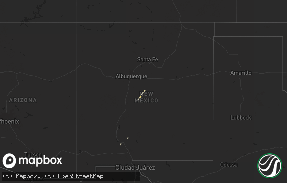
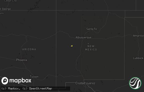
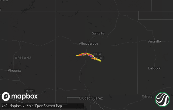
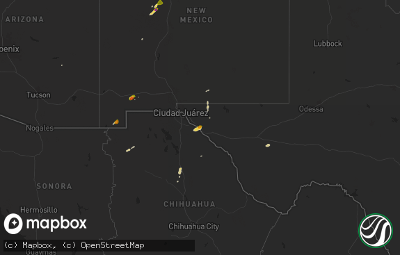
Hail Map in New Mexico on May 1, 2022
The weather event in New Mexico on May 1, 2022 includes Hail and Wind maps. 15 states and 468 cities were impacted and suffered possible damage. The total estimated number of properties impacted is 4,602.

Hail
Wind
4,602
Estimated number of impacted properties by a 1.00" hail or larger3,403
Estimated number of impacted properties by a 1.75" hail or larger3,738
Estimated number of impacted properties by a 2.50" hail or largerStorm reports in New Mexico
New Mexico
| Date | Description |
|---|---|
| 05/01/20225:26 PM CDT | A local report indicates 1.50 inch wind near 15 NE LOVINGTON |
| 05/01/20225:26 PM CDT | A local report indicates 1.50 inch wind near 9 NW HIGGINBOTHAM |
| 05/01/20224:52 PM CDT | A local report indicates 2.50 inch wind near 3 E LOVINGTON |
| 05/01/20224:37 PM CDT | A local report indicates 1.00 inch wind near LOVINGTON |
| 05/01/20224:24 PM CDT | A local report indicates 2.00 inch wind near 2 S LOVINGTON |
| 05/01/20224:16 PM CDT | A local report indicates 2.75 inch wind near 2 S LOVINGTON |
| 05/01/20221:27 AM CDT | At 627 PM MDT, a severe thunderstorm was located near Ragland, or 24 miles south of Tucumcari, moving northeast at 25 mph. HAZARD...60 mph wind gusts and quarter size hail. SOURCE...Radar indicated. IMPACT...Hail damage to vehicles is expected. Expect wind damage to roofs, siding, and trees. Locations impacted include... Quay, Grady, Ragland and Forrest. |
| 05/01/202212:25 AM CDT | At 524 PM CDT, a severe thunderstorm was located 8 miles west of Denver City, moving east at 30 mph. HAZARD...Golf ball size hail and 60 mph wind gusts. SOURCE...Radar indicated. IMPACT...People and animals outdoors will be injured. Expect hail damage to roofs, siding, windows, and vehicles. Expect wind damage to roofs, siding, and trees. Locations impacted include... Denver City and Plains. |
| 04/30/202211:56 PM CDT | At 456 PM CDT, a severe thunderstorm was located 13 miles west of Denver City, moving northeast at 25 mph. HAZARD...Golf ball size hail and 60 mph wind gusts. SOURCE...Radar indicated. IMPACT...People and animals outdoors will be injured. Expect hail damage to roofs, siding, windows, and vehicles. Expect wind damage to roofs, siding, and trees. Locations impacted include... Denver City, Plains and Bronco. |
| 04/30/202211:27 PM CDT | At 427 PM MDT, a severe thunderstorm was located near Yeso, or 24 miles west of Fort Sumner, moving northeast at 20 mph. HAZARD...60 mph wind gusts and quarter size hail. SOURCE...Radar indicated. IMPACT...Hail damage to vehicles is expected. Expect wind damage to roofs, siding, and trees. Locations impacted include... Fort Sumner, Yeso, Sumner Lake State Park and Sumner Lake. This includes Highway 60 between Mile Markers 298 and 326. |
| 04/30/202210:53 PM CDT | At 353 PM CDT/253 PM MDT/, a severe thunderstorm was located 12 miles east of Eunice, moving northeast at 40 mph. HAZARD...60 mph wind gusts and half dollar size hail. SOURCE...Radar indicated. IMPACT...Hail damage to vehicles is expected. Expect wind damage to roofs, siding, and trees. Locations impacted include... Seminole, Seagraves, Seagraves Airport, Gaines County Airport, Loop, Paynes Corner, McKenzie Lake and Gaines County Park. |
| 04/30/202210:15 PM CDT | At 315 PM MDT, a severe thunderstorm was located near Tatum, moving north at 30 mph. HAZARD...60 mph wind gusts and quarter size hail. SOURCE...Radar indicated. IMPACT...Hail damage to vehicles is expected. Expect wind damage to roofs, siding, and trees. Locations impacted include... Tatum, Crossroads, Gladiola and Tatum Airport. |
All States Impacted by Hail Map on May 1, 2022
Cities Impacted by Hail Map on May 1, 2022
- Centreville, AL
- Georgetown, LA
- Dry Prong, LA
- Tucumcari, NM
- House, NM
- Joaquin, TX
- Andrews, TX
- Dalhart, TX
- Sunray, TX
- Stratford, TX
- Wichita Falls, TX
- Muleshoe, TX
- Friona, TX
- Amarillo, TX
- Columbiana, AL
- Calera, AL
- Gaston, SC
- West Columbia, SC
- Odonnell, TX
- Stamford, TX
- Hamlin, TX
- Duncanville, TX
- Dallas, TX
- Desoto, TX
- Lake Park, GA
- Kermit, TX
- Imperial, TX
- Fort Stockton, TX
- Hereford, TX
- Albany, TX
- Abilene, TX
- Geronimo, OK
- Temple, OK
- Walters, OK
- Randlett, OK
- Levelland, TX
- Wadesboro, NC
- Ovalo, TX
- Clyde, TX
- Duck, WV
- Ivydale, WV
- Frametown, WV
- Anson, TX
- Sylvester, TX
- Ozona, TX
- Coyanosa, TX
- Iraan, TX
- Goldsmith, TX
- Reidsville, NC
- Sudan, TX
- Milton, FL
- Mcalister, NM
- Browns Summit, NC
- Gibsonville, NC
- Sanford, NC
- Pelion, SC
- Lexington, SC
- Ector, TX
- Lipan, TX
- Santo, TX
- Weatherford, TX
- Prattville, AL
- Selma, AL
- Tyler, AL
- Autaugaville, AL
- Rockingham, NC
- Wallace, SC
- Morven, NC
- Winters, TX
- Goldsboro, TX
- Lawn, TX
- Norton, TX
- Canadian, TX
- Notrees, TX
- Monahans, TX
- Jasper, TX
- Durham, OK
- Santa Anna, TX
- Brookesmith, TX
- Rochelle, TX
- Lenorah, TX
- Tarzan, TX
- Lamesa, TX
- Jena, LA
- Goodwell, OK
- Smoaks, SC
- Kinder, LA
- San Augustine, TX
- Center, TX
- Eden, NC
- Ruffin, NC
- Pelham, NC
- Erick, OK
- Gilbert, SC
- Leesville, SC
- Stinnett, TX
- Dobson, NC
- Elkin, NC
- Whitewright, TX
- Trenton, TX
- Bonham, TX
- Savoy, TX
- Leonard, TX
- Ravenna, TX
- Ville Platte, LA
- Oakdale, LA
- Rock Hill, SC
- Ralph, AL
- Buhl, AL
- Eutaw, AL
- Gordo, AL
- Fosters, AL
- Tuscaloosa, AL
- Brownfield, TX
- Yeso, NM
- Fort Sumner, NM
- Erath, LA
- Abbeville, LA
- Cisco, TX
- Strawn, TX
- Breckenridge, TX
- Eastland, TX
- Ranger, TX
- Leesville, LA
- Brownwood, TX
- Mullin, TX
- Cedar Hill, TX
- Grand Prairie, TX
- Hartley, TX
- Newington, GA
- Keeling, VA
- Enterprise, AL
- Chancellor, AL
- Plains, TX
- Denver City, TX
- Lovington, NM
- Lamar, CO
- Effie, LA
- Moultrie, GA
- Pavo, GA
- Coleman, TX
- Sutton, WV
- Little Birch, WV
- Hayneville, AL
- Hope Hull, AL
- Jonesville, LA
- Marksville, LA
- Littlefield, TX
- Hale Center, TX
- Saint Marys, WV
- Hawley, TX
- Millsap, TX
- Gordon, TX
- Sweetwater, TX
- Channing, TX
- Tokio, TX
- Lilesville, NC
- Tatum, NM
- Causey, NM
- Milnesand, NM
- Seminole, TX
- Seagraves, TX
- Morgantown, WV
- Masontown, WV
- Albright, WV
- Bruceton Mills, WV
- Canyon, TX
- Summerfield, TX
- Wildorado, TX
- Dimmitt, TX
- Logansport, LA
- Dumas, TX
- Tahoka, TX
- Loop, TX
- Meadow, TX
- Voss, TX
- Bangs, TX
- Gouldbusk, TX
- Rockwood, TX
- Brierfield, AL
- Montevallo, AL
- Graham, TX
- Woodson, TX
- Prosperity, SC
- Haw River, NC
- Hillsborough, NC
- Burlington, NC
- Efland, NC
- Mebane, NC
- Graham, NC
- Groom, TX
- White Deer, TX
- Panhandle, TX
- Cross Plains, TX
- Sheridan Lake, CO
- Holly, CO
- Eads, CO
- Marshville, NC
- Peachland, NC
- Polkton, NC
- Nebo, NC
- Marion, NC
- Gail, TX
- Hermleigh, TX
- Snyder, TX
- Ira, TX
- Masterson, TX
- Adrian, TX
- Jacksonburg, WV
- Reader, WV
- Smithfield, WV
- Coahoma, TX
- Rotan, TX
- Cairo, WV
- Ellenboro, WV
- McClave, CO
- Las Animas, CO
- Sylvania, GA
- Morganton, NC
- Batesburg, SC
- Conroe, TX
- Looneyville, WV
- Left Hand, WV
- Amma, WV
- Newton, WV
- Clendenin, WV
- Wallback, WV
- Nebo, WV
- Pine Apple, AL
- Roaring River, NC
- Traphill, NC
- Hays, NC
- Briscoe, TX
- Cactus, TX
- Morse, TX
- Pampa, TX
- Skellytown, TX
- Miami, TX
- Borger, TX
- Pecos, TX
- Erbacon, WV
- Yanceyville, NC
- Providence, NC
- Mayodan, NC
- Blanch, NC
- Stoneville, NC
- Wilsonville, AL
- Ackerly, TX
- Sundown, TX
- Denton, NC
- Tobaccoville, NC
- Pinnacle, NC
- King, NC
- Kingfisher, OK
- Monterey, LA
- Pageland, SC
- Mount Croghan, SC
- Jackson, AL
- Spring, TX
- Clayton, NM
- Texline, TX
- San Angelo, TX
- Clayton, LA
- Seibert, CO
- Valera, TX
- Paint Rock, TX
- Millersview, TX
- Moore, TX
- Pearsall, TX
- Red Level, AL
- Hennessey, OK
- Crane, TX
- Delcambre, LA
- New Iberia, LA
- Youngsville, LA
- Del Rio, TX
- Fort Stewart, GA
- Forest Hill, LA
- Jacksboro, TX
- Lecompte, LA
- Arnett, OK
- Alexandria, LA
- Pineville, LA
- Byromville, GA
- Montezuma, GA
- Elon, NC
- Ballinger, TX
- Rowena, TX
- Madison, NC
- Lancaster, SC
- Waxhaw, NC
- Crawford, OK
- Moncure, NC
- Tribune, KS
- Avoca, TX
- Trout, LA
- Pine Grove, LA
- Amite, LA
- Walker, LA
- Holden, LA
- Brent, AL
- Elkhart, KS
- Richfield, KS
- Nara Visa, NM
- Jeanerette, LA
- Elko, GA
- Lowndesboro, AL
- Evergreen, AL
- Columbia, SC
- Ludowici, GA
- Fredonia, PA
- Greenville, PA
- Wiley, CO
- Lena, LA
- Boyce, LA
- Franklin, LA
- Maple, TX
- Glennville, GA
- Hasty, CO
- Felt, OK
- Letohatchee, AL
- Webster Springs, WV
- Cowen, WV
- Pennsboro, WV
- New Hill, NC
- Fuquay Varina, NC
- Holly Springs, NC
- Wiergate, TX
- Buffalo Gap, TX
- Tuscola, TX
- Andalusia, AL
- McCaulley, TX
- Merkel, TX
- Palo Pinto, TX
- Granbury, TX
- Deer Trail, CO
- Patrick, SC
- Chesterfield, SC
- Cheraw, SC
- Morrisville, NC
- Raleigh, NC
- Roby, TX
- Flagler, CO
- Marathon, TX
- Anton, TX
- Fritch, TX
- Toxey, AL
- Thomasville, AL
- Byers, CO
- Celina, TX
- Aubrey, TX
- High Springs, FL
- Pyote, TX
- McConnells, SC
- Reeves, LA
- Baton Rouge, LA
- Texola, OK
- Mineral Wells, TX
- Moran, TX
- Mingus, TX
- Caddo, TX
- Denham Springs, LA
- Abernathy, TX
- Chester, SC
- Nacogdoches, TX
- Chireno, TX
- Pitkin, LA
- Jennings, LA
- Whitsett, NC
- Saluda, SC
- Little Mountain, SC
- Chapin, SC
- Comanche, OK
- Grand Ridge, FL
- Barstow, TX
- San Jon, NM
- Brewton, AL
- McIntosh, AL
- Andersonville, GA
- Siloam, NC
- East Bend, NC
- Coffeeville, AL
- Silas, AL
- Newcastle, TX
- McLeansville, NC
- Milton, NC
- Wingate, NC
- Monroe, NC
- Lubbock, TX
- Fort Mill, SC
- Boonville, NC
- Jonesville, NC
- Amistad, NM
- Wilkesboro, NC
- Millers Creek, NC
- Arriba, CO
- North Wilkesboro, NC
- Sorrento, LA
- Gonzales, LA
- Americus, GA
- Lawley, AL
- Randolph, AL
- Anacoco, LA
- Evangeline, LA
- Danville, VA
- Bryson, TX
- Deridder, LA
- Thurmond, NC
- Middlebourne, WV
- Alton, VA
- Semora, NC
- Shallowater, TX
- Logan, NM
- Blairs, VA
- Sylvester, GA
- Albany, GA
- Genoa, CO
- Carlisle, SC
- Claude, TX
- Marion, AL
- Morton, TX
- Quincy, FL
- Chattahoochee, FL
- Bennettsville, SC
- Laurel Hill, FL
- Rule, TX
- Ringgold, VA
- Statesboro, GA
- Meno, OK
- Hobbs, NM
- Mead, OK
- Calera, OK
- Durant, OK
- Baird, TX
- Early, TX
- Sharon, SC
- Limon, CO
- Cascade, VA
- Durham, NC
- Smyrna, SC
- Paris, TX
- Brackettville, TX
- Pottsboro, TX
- Fluvanna, TX
- Eufaula, AL
- Stoneboro, PA
- Sandy Lake, PA
- Clarks Mills, PA
- Swansea, SC
- Chapel Hill, NC
- Pittsboro, NC
- Plainview, TX
- Tullos, LA
- Sicily Island, LA
- Post, TX
- Texhoma, OK
- Granada, CO
- Lindon, CO
- Woodrow, CO
- Agate, CO
- Reedsville, WV
- Friendsville, MD
- Chloe, WV
- Hessmer, LA
- Chatham, VA
- South Boston, VA
- Vernon Hill, VA
- Halifax, VA


