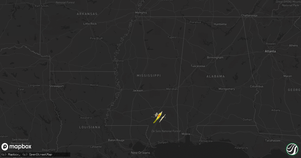
Hail Map in Mississippi on April 30, 2017
Get this storm
April 30 map
$229
one time, instant access
Download today. No call, no setup
Keep the $229
Bought the map and want the full workflow? Apply the entire $229 to a subscription within 7 days. None of it is wasted.
Every map, not just this one
This buys you this map. Subscription and you get every map we run, in the markets you choose from a few cities to whole states to nationwide. Plus real-time alerts the moment a storm fires.
Contact data
Name, contact info, occupancy, even credit band for addresses in the footprint. You go from where it hit to who to call.
Become the source they trust
Unlimited branding weather history reports on demand. You already have the documented answer ready for the property owner, and you are the one who showed up with it.
Property data and RoofTrace estimates
Pull up any address you have got, its value and the exact code rules for that jurisdiction, straight from One Click Code. Then RoofTrace estimates the squares, pitch, and roof value, priced the way you price.
Storm reports in Mississippi
Mississippi
| Date | Description |
|---|---|
| 04/30/201711:50 AM CDT | Lots of trees and power lines down and 7-8 homes damage from a possible tornado between hwy 182... Phillips hill road... Tabernacle road... Hwy 50 and gunshoot road. |
| 04/30/201711:43 AM CDT | This tornado began along highway 182 and snapped softwood and hardwood trees as it tracked to the north-northeast along phillips hill road. One large tree fell onto a h |
| 04/30/201711:38 AM CDT | Trees down in the ripley city limits. |
| 04/30/201711:38 AM CDT | Trees down near the intersection of mill and phillips hill roads. One tree was blown down on a house along phillips hill road. |
| 04/30/201711:37 AM CDT | Ef-2 with max winds of 115 mph. Path length: 1.96 miles. Max width: 440 yards. This tornado began along highway 182 and snapped softwood and hardwood trees as it tracke |
| 04/30/201711:35 AM CDT | Trees down along hwy 184. |
| 04/30/201711:28 AM CDT | Several trees down in new albany. |
| 04/30/201711:15 AM CDT | Large tree snapped with other trees uprooted in scooba. |
| 04/30/201711:15 AM CDT | 20 light poles down along star landing road. Powerlines also down along the western part of the county. Trees down countywide. |
| 04/30/201711:11 AM CDT | Trees uprooted along hwy 45. |
| 04/30/201711:10 AM CDT | Trees and powerlines down countywide. Time is radar estimated. |
| 04/30/201711:09 AM CDT | Trees uprooted along hwy 45 south of macon. |
| 04/30/201711:05 AM CDT | Two trees down |
| 04/30/201711:00 AM CDT | Several trees down in the southwest portion of the county. 4 structures were damaged along the southwest west portions of the area. |
| 04/30/201711:00 AM CDT | A couple of treens snapped or uprooted. |
| 04/30/201710:49 AM CDT | Power lines down on lott town rd. |
| 04/30/201710:47 AM CDT | Trees down on highway 310 between parks place and the city of como. Time is radar estimated. |
| 04/30/201710:43 AM CDT | Report of power line down on lott town rd. |
| 04/30/201710:40 AM CDT | Multiple trees down across the county... Roofs off of a couple of houses. |
| 04/30/201710:35 AM CDT | Roof damage near hwy 8/9 intersection. |
| 04/30/201710:30 AM CDT | Tree damage and a funnel cloud reported. Possible tornado damage. |
| 04/30/201710:28 AM CDT | Trees down in caderetta... Including 2 on homes. |
| 04/30/201710:26 AM CDT | Tornado began approximately 4 miles west of slate springs...lifting 1 mile northeast of sabougla. This tornado was rated ef1 with a path length of 2.7 miles and a maxim |
| 04/30/201710:22 AM CDT | Lots of trees and power lines down all across the county. |
| 04/30/201710:20 AM CDT | Lots of trees and power lines blown down across the county including the city of forest and sebastopol. |
| 04/30/201710:19 AM CDT | Ef-1 with 95 mph max winds. 6.75 mile path length. 650 yards max width. The tornado began along salem road and tracked to the northeast. As it did... It snapped or upro |
| 04/30/201710:18 AM CDT | Ef-1 with 110 mph max winds. 600 yards max width. 10.5 miles in length... But may have continued into calhoun co. This will be coordinated with nws memphis. This tornad |
| 04/30/201710:16 AM CDT | Ef-0 with max winds of 85 mph. Path length: 0.29 miles. Max width: 50 yards. The tornado began along russell community road where it uprooted many softwood trees. It al |
| 04/30/201710:15 AM CDT | Tree on power line on cr-505. |
| 04/30/201710:14 AM CDT | Multiple trees down and lots of roof damage to a house. Time is radar estimated. |
| 04/30/201710:13 AM CDT | Trees down in the city of grenada. |
| 04/30/201710:13 AM CDT | Ef-1 with max winds of 100 mph. Path length: 5.66 miles. Max width: 800 yards. The tornado began south of robinson-thompson road. As it tracked northeast... It snapped |
| 04/30/201710:11 AM CDT | Multiple trees down across the county. |
| 04/30/201710:11 AM CDT | This ef-1 tornado began along vaiden kilmichael rd south of kilmichael... Tracking northeastward through kilmichael... And ended four miles north of kilmichael. Estimat |
| 04/30/20179:58 AM CDT | This ef-2 tornado tracked from the south side of vaiden northeastward into montgomery county... Ending west of kilmichael. Estimated maximum winds were around 115 mph.. |
| 04/30/20179:56 AM CDT | Trees down on hwy 35 south of vaiden... Possible tornado. |
| 04/30/20179:55 AM CDT | Tree down across conehatta prospect road. |
| 04/30/20179:55 AM CDT | Mobile home and a house sustained structural damage within the city limits of vaiden. |
| 04/30/20179:53 AM CDT | Numerous trees and power lines down all across the county. |
| 04/30/20179:51 AM CDT | The tornado began near hudson creek in southern carroll county. As it tracked north northeast toward beatty... It uprooted trees and downed some powerlines along county |
| 04/30/20179:43 AM CDT | Trees and power lines down along russell community road. |
| 04/30/20179:42 AM CDT | Ef-1 with max winds of 95 mph. Path length: 3.92 miles. Max width: 600 yards. This tornado began about a half of a mile southwest of county road 3003 and tracked to the |
| 04/30/20179:42 AM CDT | Ef-1 with max winds of 100 mph. Path length: 3.04 miles. Max width: 600 yards. This tornado touched down just south of county road 69 and as it track north-northeast... |
| 04/30/20179:42 AM CDT | Ef-0 with max winds of 80 mph. Path length: 4.27 miles. Max width: 100 yards. The tornado began along russell community road where it uprooted many softwood trees. It a |
| 04/30/20179:39 AM CDT | Relayed report. No mention of damage. Time estimated from radar. |
| 04/30/20179:38 AM CDT | Mdot reports multiple trees/power lines down across hwy-51. |
| 04/30/20179:38 AM CDT | The tornado began just to the southwest of sudbeck road and downed hardwood trees in this area. It then continued northeast snapping tree limbs and uprooting a few tree |
| 04/30/20179:37 AM CDT | 71mph gust measured at greenwood-leflore airport. |
| 04/30/20179:37 AM CDT | Structural damage reported at the greenwood-leflore airport. |
| 04/30/20179:34 AM CDT | Lots of trees and power lines blown down across the county including the city of forest and sebastopol. |
| 04/30/20179:30 AM CDT | Mdot reports trees across i-55... Possible tornado. |
| 04/30/20179:30 AM CDT | Pictures of numerous trees and power lines down on the campus of holmes community college. Possible tornado. |
| 04/30/20179:26 AM CDT | *** 1 fatal *** ef-2 with 120 mph max winds. 23.44 mile path length. 2110 yards max width. This strong tornado started several miles west of pickens off highway 432 and |
| 04/30/20179:08 AM CDT | Structure damage and trees down at the intersection of berryville road and hwy 16 east. Damage also reported along scotland... Nod road... Linwood road and dover road a |
| 04/30/20179:06 AM CDT | Ef-1 tornado with 110 mph max winds. 6.94 mile path length and 1000 yard max width. It started just north of ms-16 in yazoo. It uprooted and snapped trees as it approac |
| 04/30/20178:55 AM CDT | Trees down along rankin road. |
| 04/30/20178:54 AM CDT | Ef-2 tornado with 120 mph max winds. 22.25 mile path length and 2110 yards max width. This tornado started east of bentonia near indian creek where minor tree damage wa |
| 04/30/20178:51 AM CDT | An ef-0 tornado touched down just east of us highway 49 and traveled east-northeast across mainly undeveloped land along the big black river through southern yazoo coun |
| 04/30/20178:50 AM CDT | Ef-1 tornado with 100 mph max winds. 6.05 mile path length and 400 yard max width. The tornado started just south of the kearney park community where it moved northwest |
| 04/30/20178:48 AM CDT | Trees and power lines down near the intersection of spillway road and grants ferry road. |
| 04/30/20178:47 AM CDT | Buildings damaged in flora with numerous trees and power lines down around town. Possible tornado. |
| 04/30/20178:46 AM CDT | Trees and power lines down along 1st street near downtown flora. Possible tornado. |
| 04/30/20178:46 AM CDT | Top of old water tower blown down in flora. Likely tornado. |
| 04/30/20178:40 AM CDT | There was damage to houses... Including roof damage and windows blown out. |
| 04/30/20178:40 AM CDT | Trees were blown down in whisper lake. |
| 04/30/20178:33 AM CDT | Trees down in florence. |
| 04/30/20178:28 AM CDT | This tornado touched down along st. Thomas road and peaked as it crossed i-20 on the west side of the norrell road exit. The heaviest tree damage was along both frontag |
| 04/30/20178:27 AM CDT | Numerous trees down across the county. |
| 04/30/20178:27 AM CDT | Report of trees down along us highway 80 through bolton received via twitter. |
| 04/30/20178:23 AM CDT | This weak tornado touched down along volley campbell road and moved across some personal property. A couple of trees were uprooted along with many large limbs broken in |
| 04/30/20178:23 AM CDT | This tornado started just west of the intersection of anderson road and askew road where large limbs were snapped and a few trees uprooted. The tornado crossed anderson |
| 04/30/20178:22 AM CDT | This tornado touched down south of bolton along houston road. The tornado quickly intensified as it crossed raymond- bolton rd where numerous trees were damaged. Heavy |
| 04/30/20178:22 AM CDT | Trees down along springridge road in clinton. |
| 04/30/20178:20 AM CDT | Trees down along midway road. |
| 04/30/20178:18 AM CDT | A few trees down around town including one on a house. |
| 04/30/20178:15 AM CDT | Numerous trees and power lines blown down across the county. |
| 04/30/20178:14 AM CDT | Nickel to quarter size hail along leeville road. |
| 04/30/20178:14 AM CDT | This tornado started just south of hwy 80 just to the west of edwards where large trees branches were broken and a few trees uprooted. The tornado traveled north and re |
| 04/30/20178:12 AM CDT | Tree tops taken off 15-20 trees on learned road. |
| 04/30/20178:10 AM CDT | Numerous trees and power lines blown down across the county. |
| 04/30/20178:10 AM CDT | This tornado touched down just sw of the intersection of adams station road and old adams station road. Here... Heavy tree damage was noted as dozens of trees were snap |
| 04/30/20178:10 AM CDT | A few trees down around town including one on a house. |
| 04/30/20178:05 AM CDT | Mdot reports trees down near big black bridge on hwy 27. |
| 04/30/20178:03 AM CDT | Home damaged and trees down just north of utica. |
| 04/30/20178:01 AM CDT | This tornado touched down along highway 28... Uprooting some trees and snapping large limbs. It continued northeast... Crossing dentville road and welch lane before cro |
| 04/30/20178:00 AM CDT | Damage to 5 homes and power outages reported from possible tornado near utica. |
| 04/30/20177:40 AM CDT | Trees down along hwy 61n... Possible tornado. |
| 04/30/20177:32 AM CDT | Trees down along hwy 547 by the port gibson city limits. Tornado debris signature also observed on radar. |
| 04/30/20177:32 AM CDT | Trees were blown down along the natchez trace between mile marker 35 and 45. |
| 04/30/20177:31 AM CDT | This tornado touched down on the southeast side of port gibson... Near the natchez trace. As the tornado tracked north-northeast... It snapped hardwood trees and uproot |
| 04/30/20177:26 AM CDT | Trees and power lines down with lots of power outages. Tornado debris signature observed on radar. |
| 04/30/20177:25 AM CDT | Power poles snapped along north washington street. |
| 04/30/20177:24 AM CDT | This tornado touched down just south of highway 28. A few trees were downed and snapped in this area. As it continued northeast through rural area... Numerous trees wer |
| 04/30/20177:20 AM CDT | Lots of trees and power lines down across the county with numerous power outages. |
| 04/30/20177:00 AM CDT | Numerous trees down throughout the county. |
| 04/29/201710:52 PM CDT | Tree fell on a car on highway 512...no injuries reported. |
| 04/29/20178:14 PM CDT | Nickel to quarter size hail along leeville road. |
| 04/29/20178:12 PM CDT | Golf ball size hail at exit 69 off i-59. |
| 04/29/20178:11 PM CDT | Golf ball size hail reported in petal. |
| 04/29/20178:09 PM CDT | Quarter size hail at pcs school in hattiesburg. |
| 04/29/20178:07 PM CDT | Nickel to quarter size hail near the hattiesburg zoo. |
All States Impacted by Hail Map on April 30, 2017
Cities Impacted by Hail Map on April 30, 2017
- Hattiesburg, MS
- Moselle, MS
- Seminary, MS
- New Augusta, MS
- Richton, MS
- Petal, MS
- Paw Paw, WV
- Bloomery, WV
- Augusta, WV
- Capon Bridge, WV
- Slanesville, WV
- Purvis, MS
- Ovett, MS
- Ellisville, MS
- Romney, WV
- Hollidaysburg, PA
- Williamsburg, PA
- Gore, VA
- Winchester, VA
- Delray, WV
- Shanks, WV
- Points, WV
- High View, WV
- Cross Junction, VA
- Yellow Spring, WV
- Altoona, PA
- Sumrall, MS
- Hedgesville, WV
- Gerrardstown, WV
- Glengary, WV
- Lumberton, MS
- Alexandria, PA
- Duncansville, PA
- Mill Creek, PA
- Petersburg, PA
- Huntingdon, PA


