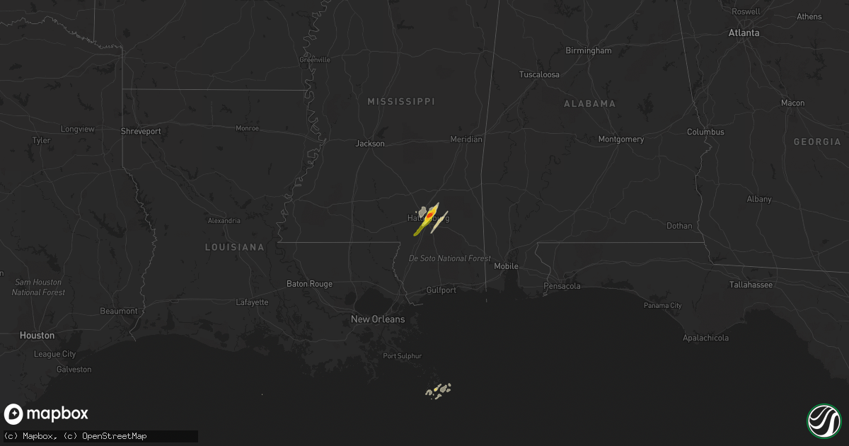
Hail Map on April 30, 2017
Get this storm
April 30 map
$229
one time, instant access
Download today. No call, no setup
Keep the $229
Bought the map and want the full workflow? Apply the entire $229 to a subscription within 7 days. None of it is wasted.
Every map, not just this one
This buys you this map. Subscription and you get every map we run, in the markets you choose from a few cities to whole states to nationwide. Plus real-time alerts the moment a storm fires.
Contact data
Name, contact info, occupancy, even credit band for addresses in the footprint. You go from where it hit to who to call.
Become the source they trust
Unlimited branding weather history reports on demand. You already have the documented answer ready for the property owner, and you are the one who showed up with it.
Property data and RoofTrace estimates
Pull up any address you have got, its value and the exact code rules for that jurisdiction, straight from One Click Code. Then RoofTrace estimates the squares, pitch, and roof value, priced the way you price.
States Impacted by Hail Map on April 30, 2017
Storm reports
Alabama
| Date | Description |
|---|---|
| 04/30/20173:55 PM CDT | A steeple was almost completely detached from the roof of a church in the stevenson community. |
| 04/30/20173:35 PM CDT | A tree was knocked down at guntersville state park campground. |
| 04/30/20173:30 PM CDT | A tree was knocked down. |
| 04/30/20173:07 PM CDT | A tree was knocked down at lazy creek circle near highway 75. |
| 04/30/20173:07 PM CDT | A tree was knocked down. |
| 04/30/20173:05 PM CDT | A tree was knocked down. |
| 04/30/20173:05 PM CDT | A tree was knocked down at guntersville state park campground. A pickup truck was damaged from a tree. |
| 04/30/20173:05 PM CDT | A tree was knocked down on baltimore avenue. |
| 04/30/20173:05 PM CDT | A tree was knocked down at 3740 bakers chapel road. |
| 04/30/20173:05 PM CDT | A tree was knocked down onto a power line at highway 431 at rockstore road. |
| 04/30/20173:05 PM CDT | A tree was knocked down on pleasant grove road. |
| 04/30/20173:00 PM CDT | A tree was knocked down. |
| 04/30/20173:00 PM CDT | Public measured a wind gust to 64 mph near i565 and bob wallace ave. |
| 04/30/20172:47 PM CDT | Tree was down across toney school road but is now cleared. |
| 04/30/20172:47 PM CDT | Tree down across macedonia road. |
| 04/30/20172:40 PM CDT | A tree was knocked down. |
| 04/30/20172:36 PM CDT | Large tree down on cedar hill rd. |
| 04/30/20172:33 PM CDT | A large tree knocked down on a car at a residence on thach road. |
| 04/30/20172:23 PM CDT | Reports of numerous trees down in the city. |
| 04/30/20172:20 PM CDT | Tree down off upper river road. |
| 04/30/20172:20 PM CDT | Tree down off of compton street. Tree snapped at base. |
| 04/30/20172:17 PM CDT | A tree was reported down at the intersection of hays mill and new garden road. |
| 04/30/20172:17 PM CDT | Structure roof damage near eva reported via social media. |
| 04/30/20172:15 PM CDT | Shingles on a home were damaged by winds. |
| 04/30/20172:15 PM CDT | A few trees were blown down and several large branches. One tree fell on a car. |
| 04/30/20172:13 PM CDT | Estimated 60-65 mph winds in decatur. |
| 04/30/20172:12 PM CDT | Nws survey team found evidence of an ef-0 tornado in the north central cullman county area. Times estimated by radar. |
| 04/30/20172:10 PM CDT | Report of pine trees snapped. Trees were about 1.5 feet thick. Personal weather station nearby measured a gust of 87mph. |
| 04/30/20172:09 PM CDT | A tree was blown down across mcclellan street in athens. |
| 04/30/20172:07 PM CDT | Tree blown down at highway 9 and highway 31. |
| 04/30/20172:03 PM CDT | A tree was blown down at a home off of brownsferry road. The tree also damaged some cars at that location. |
| 04/30/20171:57 PM CDT | Trees and power lines down near cullman. Report via social media and estimated on radar. |
| 04/30/20171:56 PM CDT | A large tree fell on a home in adamsville. |
| 04/30/20171:56 PM CDT | Trees blown down in corner near county line road. |
| 04/30/20171:52 PM CDT | A tree was reported down on power lines on cr 493. |
| 04/30/20171:46 PM CDT | Trees blown down in helicon. |
| 04/30/20171:46 PM CDT | Trees down along lock 17 road. |
| 04/30/20171:45 PM CDT | A roof was blown off of a mobile home on cr 184 in the danville community. |
| 04/30/20171:42 PM CDT | A tree was blown down on cr 584 in the elgin community. |
| 04/30/20171:37 PM CDT | Large peach tree was blown down at this location. |
| 04/30/20171:35 PM CDT | Several trees were knocked down or broken off by damaging winds along cr 18... Cr 19... Cr 21... And cr 25. |
| 04/30/20171:33 PM CDT | A tree was blown down onto a house on yarbrough avenue. |
| 04/30/20171:29 PM CDT | Trees down near curry. Some landed on vehicles and homes. |
| 04/30/20171:24 PM CDT | A few trees and power lines down near boldo. |
| 04/30/20171:21 PM CDT | Several trees blown down near lupton. |
| 04/30/20171:20 PM CDT | Trees down on holly grove road. |
| 04/30/20171:20 PM CDT | Trees blown down on highway 5 north of jasper. |
| 04/30/20171:19 PM CDT | Trees and power lines down near highway 5 and edgil road. |
| 04/30/20171:19 PM CDT | Trees down on russell dairy road. |
| 04/30/20171:18 PM CDT | Tree down in the vicinity of hermitage dr and grandview ave. |
| 04/30/20171:18 PM CDT | Trees blown down on johnsey bridge road. |
| 04/30/20171:14 PM CDT | Tree down on a house on cr 8 in florence. |
| 04/30/20171:10 PM CDT | Tree down. |
| 04/30/20171:10 PM CDT | Tree down. |
| 04/30/20171:09 PM CDT | Trees down and blocking the main intersection at highway 124 and highway 102. |
| 04/30/20171:00 PM CDT | Trees down and blocking highway 102. |
| 04/30/201712:50 PM CDT | Tree down near berry high school. |
| 04/30/201712:42 PM CDT | A tree was reported down at the intersection of cr 87 and cr 14. |
| 04/30/201712:41 PM CDT | A tree blown down on cr 88. |
| 04/30/201712:40 PM CDT | Trees were blown down along brookside road in brilliant. |
| 04/30/201712:37 PM CDT | A tree was reported down at the intersection of cr 8 and cr 133. |
| 04/30/201712:28 PM CDT | A tree blown down on cr 88. |
| 04/30/201712:20 PM CDT | Tree down on power lines at 4379 lane springs road. |
| 04/30/201712:15 PM CDT | Tree down on a house on 1st street in vernon. Several other trees blown down in and around town. |
| 04/30/201712:10 PM CDT | Several trees down along yellow creek road just east of vernon. |
| 04/30/201712:05 PM CDT | *** 1 inj *** trees fell across highway 17 and landed on a vehicle. Occupant had minor injuries and was shaken up. |
| 04/30/201712:03 PM CDT | Several trees blown down in and around vernon. |
| 04/30/201711:58 AM CDT | Building with roof damage in downtown aliceville. Some metal is on the road. |
| 04/30/201711:47 AM CDT | Trees were blown down near mormon road and highway 171. |
| 04/30/201711:29 AM CDT | A church sustained damage and plenty of small tree debris littering the ground. |
West Virginia
| Date | Description |
|---|---|
| 04/30/20173:45 PM CDT | Trees down |
| 04/30/20173:45 PM CDT | Trees down |
| 04/30/20173:41 PM CDT | Dime to quarter size hail |
| 04/30/20173:37 PM CDT | Tree down on cold stream road near allen lane. |
| 04/30/20173:36 PM CDT | Tree down on northwestern turnpike near bear garden trail. |
| 04/30/20173:36 PM CDT | Two trees down on cold stream road between capon school street and settlers lane. |
| 04/30/20173:34 PM CDT | Several reports of trees down in capon bridge. |
| 04/30/20173:34 PM CDT | Numerous trees down in multiple directions and power poles snapped on settlers lane. |
| 04/30/20173:30 PM CDT | Large tree down on power lines. Power pole snapped. |
| 04/30/20173:19 PM CDT | Silver dollar size hail |
| 04/30/20173:18 PM CDT | Tree down near the intersection of bloomery pike and hoy road. |
Ohio
| Date | Description |
|---|---|
| 04/30/20172:54 PM CDT | Widespread wind damage in boardman. Trees and powerlines down... Trailers flipped at the home depot... And roof damage to a business. |
| 04/30/20172:12 PM CDT | Multiple trees down |
| 04/30/20171:43 PM CDT | Powerlines down. |
| 04/30/20171:35 PM CDT | Tree down. |
Missouri
| Date | Description |
|---|---|
| 04/30/20174:35 PM CDT | Snapped pole and shed or carport lifted into a home in town. Much of the town is without electricity. |
Louisiana
| Date | Description |
|---|---|
| 04/30/201712:23 PM CDT | Social media images showed wind damage to church point high school baseball stadium. Damage inlcuded downed tree limb... Blown down fence structure...damaged field ligh |
| 04/30/201710:55 AM CDT | Utility pole blown down near airline dr and williams blvd |
| 04/30/20178:58 AM CDT | A few trees blown down near hwy 43 and 1045 |
| 04/30/20178:23 AM CDT | Numerous reports of downed trees and power lines. |
| 04/30/20178:23 AM CDT | Numerous reports of downed trees and power lines. |
| 04/30/20178:23 AM CDT | Numerous reports of downed trees and power lines. |
| 04/30/20178:00 AM CDT | Scattered reports of trees and power lines down in port barre. |
| 04/30/20178:00 AM CDT | Tree down in road in melville. |
| 04/30/20177:55 AM CDT | Minor damage consistent with winds of 70 mph. A few trees down. A simple framed car port was destroyed. Length 300 yards... Width 50 yards. Time estimated from radar. |
| 04/30/20177:40 AM CDT | Large tree reported down on campti bayou road. |
| 04/30/20177:38 AM CDT | Trees reported down parish wide in natchitoches parish... Tree down and power lines on hwy 494 past first church. |
| 04/30/20177:30 AM CDT | Scattered reports of downed tree branches and power line in iberia parish. |
| 04/30/20177:23 AM CDT | Reports of trees and power lines down in eunice. |
| 04/30/20177:20 AM CDT | An ef1 tornado snapped multiple trees and caused minor roof damage to a mobile home and a church in livonia. Path length 1 mile. Path width 50 yards. Estimated wind spe |
| 04/30/20177:16 AM CDT | Picture of tornado on the ground taken by law enforcement in vicksburg. Tornado debris signature also observed on radar. |
| 04/30/20177:15 AM CDT | Structural damage to a church... Possible tornado |
| 04/30/20177:14 AM CDT | This tornado began just south of interstate 20 in madison parish... Around delta. It snapped or uprooted numerous trees in this location as well as damaged a road sign |
Mississippi
| Date | Description |
|---|---|
| 04/30/201711:50 AM CDT | Lots of trees and power lines down and 7-8 homes damage from a possible tornado between hwy 182... Phillips hill road... Tabernacle road... Hwy 50 and gunshoot road. |
| 04/30/201711:43 AM CDT | This tornado began along highway 182 and snapped softwood and hardwood trees as it tracked to the north-northeast along phillips hill road. One large tree fell onto a h |
| 04/30/201711:38 AM CDT | Trees down near the intersection of mill and phillips hill roads. One tree was blown down on a house along phillips hill road. |
| 04/30/201711:38 AM CDT | Trees down in the ripley city limits. |
| 04/30/201711:37 AM CDT | Ef-2 with max winds of 115 mph. Path length: 1.96 miles. Max width: 440 yards. This tornado began along highway 182 and snapped softwood and hardwood trees as it tracke |
| 04/30/201711:35 AM CDT | Trees down along hwy 184. |
| 04/30/201711:28 AM CDT | Several trees down in new albany. |
| 04/30/201711:15 AM CDT | 20 light poles down along star landing road. Powerlines also down along the western part of the county. Trees down countywide. |
| 04/30/201711:15 AM CDT | Large tree snapped with other trees uprooted in scooba. |
| 04/30/201711:11 AM CDT | Trees uprooted along hwy 45. |
| 04/30/201711:10 AM CDT | Trees and powerlines down countywide. Time is radar estimated. |
| 04/30/201711:09 AM CDT | Trees uprooted along hwy 45 south of macon. |
| 04/30/201711:05 AM CDT | Two trees down |
| 04/30/201711:00 AM CDT | A couple of treens snapped or uprooted. |
| 04/30/201711:00 AM CDT | Several trees down in the southwest portion of the county. 4 structures were damaged along the southwest west portions of the area. |
| 04/30/201710:49 AM CDT | Power lines down on lott town rd. |
| 04/30/201710:47 AM CDT | Trees down on highway 310 between parks place and the city of como. Time is radar estimated. |
| 04/30/201710:43 AM CDT | Report of power line down on lott town rd. |
| 04/30/201710:40 AM CDT | Multiple trees down across the county... Roofs off of a couple of houses. |
| 04/30/201710:35 AM CDT | Roof damage near hwy 8/9 intersection. |
| 04/30/201710:30 AM CDT | Tree damage and a funnel cloud reported. Possible tornado damage. |
| 04/30/201710:28 AM CDT | Trees down in caderetta... Including 2 on homes. |
| 04/30/201710:26 AM CDT | Tornado began approximately 4 miles west of slate springs...lifting 1 mile northeast of sabougla. This tornado was rated ef1 with a path length of 2.7 miles and a maxim |
| 04/30/201710:22 AM CDT | Lots of trees and power lines down all across the county. |
| 04/30/201710:20 AM CDT | Lots of trees and power lines blown down across the county including the city of forest and sebastopol. |
| 04/30/201710:19 AM CDT | Ef-1 with 95 mph max winds. 6.75 mile path length. 650 yards max width. The tornado began along salem road and tracked to the northeast. As it did... It snapped or upro |
| 04/30/201710:18 AM CDT | Ef-1 with 110 mph max winds. 600 yards max width. 10.5 miles in length... But may have continued into calhoun co. This will be coordinated with nws memphis. This tornad |
| 04/30/201710:16 AM CDT | Ef-0 with max winds of 85 mph. Path length: 0.29 miles. Max width: 50 yards. The tornado began along russell community road where it uprooted many softwood trees. It al |
| 04/30/201710:15 AM CDT | Tree on power line on cr-505. |
| 04/30/201710:14 AM CDT | Multiple trees down and lots of roof damage to a house. Time is radar estimated. |
| 04/30/201710:13 AM CDT | Trees down in the city of grenada. |
| 04/30/201710:13 AM CDT | Ef-1 with max winds of 100 mph. Path length: 5.66 miles. Max width: 800 yards. The tornado began south of robinson-thompson road. As it tracked northeast... It snapped |
| 04/30/201710:11 AM CDT | This ef-1 tornado began along vaiden kilmichael rd south of kilmichael... Tracking northeastward through kilmichael... And ended four miles north of kilmichael. Estimat |
| 04/30/201710:11 AM CDT | Multiple trees down across the county. |
| 04/30/20179:58 AM CDT | This ef-2 tornado tracked from the south side of vaiden northeastward into montgomery county... Ending west of kilmichael. Estimated maximum winds were around 115 mph.. |
| 04/30/20179:56 AM CDT | Trees down on hwy 35 south of vaiden... Possible tornado. |
| 04/30/20179:55 AM CDT | Mobile home and a house sustained structural damage within the city limits of vaiden. |
| 04/30/20179:55 AM CDT | Tree down across conehatta prospect road. |
| 04/30/20179:53 AM CDT | Numerous trees and power lines down all across the county. |
| 04/30/20179:51 AM CDT | The tornado began near hudson creek in southern carroll county. As it tracked north northeast toward beatty... It uprooted trees and downed some powerlines along county |
| 04/30/20179:43 AM CDT | Trees and power lines down along russell community road. |
| 04/30/20179:42 AM CDT | Ef-1 with max winds of 95 mph. Path length: 3.92 miles. Max width: 600 yards. This tornado began about a half of a mile southwest of county road 3003 and tracked to the |
| 04/30/20179:42 AM CDT | Ef-1 with max winds of 100 mph. Path length: 3.04 miles. Max width: 600 yards. This tornado touched down just south of county road 69 and as it track north-northeast... |
| 04/30/20179:42 AM CDT | Ef-0 with max winds of 80 mph. Path length: 4.27 miles. Max width: 100 yards. The tornado began along russell community road where it uprooted many softwood trees. It a |
| 04/30/20179:39 AM CDT | Relayed report. No mention of damage. Time estimated from radar. |
| 04/30/20179:38 AM CDT | Mdot reports multiple trees/power lines down across hwy-51. |
| 04/30/20179:38 AM CDT | The tornado began just to the southwest of sudbeck road and downed hardwood trees in this area. It then continued northeast snapping tree limbs and uprooting a few tree |
| 04/30/20179:37 AM CDT | 71mph gust measured at greenwood-leflore airport. |
| 04/30/20179:37 AM CDT | Structural damage reported at the greenwood-leflore airport. |
| 04/30/20179:34 AM CDT | Lots of trees and power lines blown down across the county including the city of forest and sebastopol. |
| 04/30/20179:30 AM CDT | Mdot reports trees across i-55... Possible tornado. |
| 04/30/20179:30 AM CDT | Pictures of numerous trees and power lines down on the campus of holmes community college. Possible tornado. |
| 04/30/20179:26 AM CDT | *** 1 fatal *** ef-2 with 120 mph max winds. 23.44 mile path length. 2110 yards max width. This strong tornado started several miles west of pickens off highway 432 and |
| 04/30/20179:08 AM CDT | Structure damage and trees down at the intersection of berryville road and hwy 16 east. Damage also reported along scotland... Nod road... Linwood road and dover road a |
| 04/30/20179:06 AM CDT | Ef-1 tornado with 110 mph max winds. 6.94 mile path length and 1000 yard max width. It started just north of ms-16 in yazoo. It uprooted and snapped trees as it approac |
| 04/30/20178:55 AM CDT | Trees down along rankin road. |
| 04/30/20178:54 AM CDT | Ef-2 tornado with 120 mph max winds. 22.25 mile path length and 2110 yards max width. This tornado started east of bentonia near indian creek where minor tree damage wa |
| 04/30/20178:51 AM CDT | An ef-0 tornado touched down just east of us highway 49 and traveled east-northeast across mainly undeveloped land along the big black river through southern yazoo coun |
| 04/30/20178:50 AM CDT | Ef-1 tornado with 100 mph max winds. 6.05 mile path length and 400 yard max width. The tornado started just south of the kearney park community where it moved northwest |
| 04/30/20178:48 AM CDT | Trees and power lines down near the intersection of spillway road and grants ferry road. |
| 04/30/20178:47 AM CDT | Buildings damaged in flora with numerous trees and power lines down around town. Possible tornado. |
| 04/30/20178:46 AM CDT | Trees and power lines down along 1st street near downtown flora. Possible tornado. |
| 04/30/20178:46 AM CDT | Top of old water tower blown down in flora. Likely tornado. |
| 04/30/20178:40 AM CDT | Trees were blown down in whisper lake. |
| 04/30/20178:40 AM CDT | There was damage to houses... Including roof damage and windows blown out. |
| 04/30/20178:33 AM CDT | Trees down in florence. |
| 04/30/20178:28 AM CDT | This tornado touched down along st. Thomas road and peaked as it crossed i-20 on the west side of the norrell road exit. The heaviest tree damage was along both frontag |
| 04/30/20178:27 AM CDT | Report of trees down along us highway 80 through bolton received via twitter. |
| 04/30/20178:27 AM CDT | Numerous trees down across the county. |
| 04/30/20178:23 AM CDT | This tornado started just west of the intersection of anderson road and askew road where large limbs were snapped and a few trees uprooted. The tornado crossed anderson |
| 04/30/20178:23 AM CDT | This weak tornado touched down along volley campbell road and moved across some personal property. A couple of trees were uprooted along with many large limbs broken in |
| 04/30/20178:22 AM CDT | This tornado touched down south of bolton along houston road. The tornado quickly intensified as it crossed raymond- bolton rd where numerous trees were damaged. Heavy |
| 04/30/20178:22 AM CDT | Trees down along springridge road in clinton. |
| 04/30/20178:20 AM CDT | Trees down along midway road. |
| 04/30/20178:18 AM CDT | A few trees down around town including one on a house. |
| 04/30/20178:15 AM CDT | Numerous trees and power lines blown down across the county. |
| 04/30/20178:14 AM CDT | This tornado started just south of hwy 80 just to the west of edwards where large trees branches were broken and a few trees uprooted. The tornado traveled north and re |
| 04/30/20178:14 AM CDT | Nickel to quarter size hail along leeville road. |
| 04/30/20178:12 AM CDT | Tree tops taken off 15-20 trees on learned road. |
| 04/30/20178:10 AM CDT | This tornado touched down just sw of the intersection of adams station road and old adams station road. Here... Heavy tree damage was noted as dozens of trees were snap |
| 04/30/20178:10 AM CDT | Numerous trees and power lines blown down across the county. |
| 04/30/20178:10 AM CDT | A few trees down around town including one on a house. |
| 04/30/20178:05 AM CDT | Mdot reports trees down near big black bridge on hwy 27. |
| 04/30/20178:03 AM CDT | Home damaged and trees down just north of utica. |
| 04/30/20178:01 AM CDT | This tornado touched down along highway 28... Uprooting some trees and snapping large limbs. It continued northeast... Crossing dentville road and welch lane before cro |
| 04/30/20178:00 AM CDT | Damage to 5 homes and power outages reported from possible tornado near utica. |
| 04/30/20177:40 AM CDT | Trees down along hwy 61n... Possible tornado. |
| 04/30/20177:32 AM CDT | Trees were blown down along the natchez trace between mile marker 35 and 45. |
| 04/30/20177:32 AM CDT | Trees down along hwy 547 by the port gibson city limits. Tornado debris signature also observed on radar. |
| 04/30/20177:31 AM CDT | This tornado touched down on the southeast side of port gibson... Near the natchez trace. As the tornado tracked north-northeast... It snapped hardwood trees and uproot |
| 04/30/20177:26 AM CDT | Trees and power lines down with lots of power outages. Tornado debris signature observed on radar. |
| 04/30/20177:25 AM CDT | Power poles snapped along north washington street. |
| 04/30/20177:24 AM CDT | This tornado touched down just south of highway 28. A few trees were downed and snapped in this area. As it continued northeast through rural area... Numerous trees wer |
| 04/30/20177:20 AM CDT | Lots of trees and power lines down across the county with numerous power outages. |
| 04/30/20177:00 AM CDT | Numerous trees down throughout the county. |
| 04/29/201710:52 PM CDT | Tree fell on a car on highway 512...no injuries reported. |
| 04/29/20178:14 PM CDT | Nickel to quarter size hail along leeville road. |
| 04/29/20178:12 PM CDT | Golf ball size hail at exit 69 off i-59. |
| 04/29/20178:11 PM CDT | Golf ball size hail reported in petal. |
| 04/29/20178:09 PM CDT | Quarter size hail at pcs school in hattiesburg. |
| 04/29/20178:07 PM CDT | Nickel to quarter size hail near the hattiesburg zoo. |
Tennessee
| Date | Description |
|---|---|
| 04/30/20175:25 PM CDT | Tree down at 315 airport road |
| 04/30/20175:25 PM CDT | Tree down at 637 west 4th street and power line down at 164 goose creek lane |
| 04/30/20175:23 PM CDT | Tree down at 610 cross avenue in livingston |
| 04/30/20175:15 PM CDT | Tree fell on a carport in sparta |
| 04/30/20175:07 PM CDT | Trees were blown down on mccormick ridge road and union hill road south of moss |
| 04/30/20174:56 PM CDT | Several trees down in the southern part of the county... Between cartwright and dunlap. |
| 04/30/20174:34 PM CDT | Several trees down across marion county. |
| 04/30/20174:22 PM CDT | Tree down in the pelham community |
| 04/30/20174:18 PM CDT | Trees down in the jasper area. |
| 04/30/20174:01 PM CDT | Tspotter photo showed a large tree uprooted in pinkerton park |
| 04/30/20173:42 PM CDT | Small tree snapped on apollo drive by hobgood school |
| 04/30/20173:41 PM CDT | Large tree snapped on haynes drive |
| 04/30/20173:41 PM CDT | Historic mcfadden cemetery tree snapped at stones river battleground |
| 04/30/20173:30 PM CDT | Tree down on highway 64 east between wartrace and beech grove |
| 04/30/20173:26 PM CDT | Large tree branch down in gallatin |
| 04/30/20173:19 PM CDT | Friend of nws employee reported trees down in the college grove area |
| 04/30/20173:15 PM CDT | Tspotter photo of a large tree that fell across a power line and driveway on east drive |
| 04/30/20173:15 PM CDT | Tree down on osteen lane |
| 04/30/20173:14 PM CDT | Tree down on house on dover street |
| 04/30/20173:14 PM CDT | Large tree limb knocked down chimney of house on indian lake road in hendersonville |
| 04/30/20173:14 PM CDT | Tspotter photo showed a tree and power line down on sterling road in hendersonville |
| 04/30/20173:04 PM CDT | Large tree uprooted on teakwood drive in donelson |
| 04/30/20173:04 PM CDT | Large tree uprooted on fairway drive in donelson |
| 04/30/20173:03 PM CDT | Large tree down across essex avenue at riverside drive |
| 04/30/20173:00 PM CDT | Spotter reported two trees snapped in crieve hall on kincannon road |
| 04/30/20172:59 PM CDT | *** 1 fatal *** lincoln co. Ema and media relayed report trees down near fayetteville. One individual has died after being hit by a falling tree. |
| 04/30/20172:59 PM CDT | Tree in road on ezell pike near post office |
| 04/30/20172:57 PM CDT | Tspotter photo of large tree branch down on fence between the gulch and music row |
| 04/30/20172:56 PM CDT | Tree down across fieldcrest drive at montclair drive |
| 04/30/20172:55 PM CDT | Tree...power pole and lines down across harding place at milner drive |
| 04/30/20172:55 PM CDT | Spotter reported tree down on old hickory blvd in nippers corner northeast of brentwood |
| 04/30/20172:52 PM CDT | Delayed report. Large hackberry tree down at hill road and maxwell crossing in crieve hall. |
| 04/30/20172:49 PM CDT | Large tree uprooted on oden court |
| 04/30/20172:48 PM CDT | Tree snapped on warner road |
| 04/30/20172:47 PM CDT | Tree snapped on warner road |
| 04/30/20172:46 PM CDT | Tspotter reported a large tree uprooted along with several large branches broken on the east side of franklin rd in brentwood. |
| 04/30/20172:45 PM CDT | Tree down on old hwy 64 |
| 04/30/20172:44 PM CDT | Tree down near crooked hill south of pulaski |
| 04/30/20172:41 PM CDT | Tspotter photo showed a large tree uprooted in pinkerton park |
| 04/30/20172:41 PM CDT | Trees and power lines down on murfreesboro road between margin street and eddy lane near downtown franklin |
| 04/30/20172:39 PM CDT | Tspotter photo showed a large tree uprooted which crushed a small trailer on everbright avenue |
| 04/30/20172:35 PM CDT | Trees reportedly down on highway 43 in spring hill |
| 04/30/20172:25 PM CDT | Large tree reported down and blocking both lanes of darks mills road. |
| 04/30/20172:20 PM CDT | Large tree down blocking both lanes of darks mills road |
| 04/30/20171:53 PM CDT | Two northbound lanes of highway 43 blocked by tree across the roadway |
| 04/30/20171:51 PM CDT | 2 feet diameter oak tree snapped just south of hwy 43 and hwy 64 intersection |
| 04/30/201711:45 AM CDT | Multiple large oaks uprooted. Powerlines down. |
| 04/30/201711:40 AM CDT | Large tree uprooted on shadowlawn drive between old brownsville road and the bartlett freshman academy. |
| 04/30/201711:38 AM CDT | Large tree on vehicle and minor roof damage near ellendale road and prosperity way. |
| 04/30/201711:35 AM CDT | Large tree split house in half near memphis-arlington road and centralia. House is uninhabitable. Time is radar estimated. |
| 04/30/201711:35 AM CDT | Large trees down near old brownsville road and oak road in bartlett. |
| 04/30/201711:33 AM CDT | Large tree down on house on sweetbrier road near shady grove road. Time is radar estimated. |
| 04/30/201711:27 AM CDT | Multiple powerlines and powerpoles down at shady grove road and brierview. Time is radar estimated. |
| 04/30/201711:27 AM CDT | Large tree down on car in parking lot of owen brennans restaurant. Time is radar estimated. |
| 04/30/20179:48 AM CDT | Tree limbs down and power lines damaged in halls. |
| 04/30/20178:51 AM CDT | Large tree limbs down on anderson road. Time based on radar. |
| 04/30/20178:48 AM CDT | Tree limbs down and power lines damaged in halls. |
| 04/30/20178:48 AM CDT | Poles snapped... Power lines down... And several trees snapped with damage extending through town. Possible tornado. |
| 04/30/20178:46 AM CDT | Tornado touched down approximately 1.6 miles south of covington and moved northeast for 2.1 miles. This tornado was rated ef0 with a maximum path width of 100 yards. Da |
Pennsylvania
| Date | Description |
|---|---|
| 04/30/20176:28 PM CDT | Trees and wires down and blocking whitney creek road. |
| 04/30/20175:54 PM CDT | Trees and wires reported down. |
| 04/30/20175:40 PM CDT | Trees and wires down along route 26 north of huntingdon. |
| 04/30/20175:16 PM CDT | Numerous trees knocked down near williamsburg. |
| 04/30/20175:01 PM CDT | Trees and wires reported down. |
| 04/30/20174:06 PM CDT | Tree down on a powerline on the south side of town. Powerlines down on the north side of town. |
| 04/30/20173:43 PM CDT | Two trees down east of meadville. Time estimated from radar. |
| 04/30/20174:22 AM CDT | Tree down. |
Virginia
| Date | Description |
|---|---|
| 04/30/20173:44 PM CDT | Tree down on either side of hwy 50 just north of gore |
| 04/30/20173:38 PM CDT | Tree down in the 1600 block of carpers pike. |
| 04/30/20173:38 PM CDT | Two large trees uprooted off gold orchard rd |
| 04/30/20173:37 PM CDT | Several trees snapped and uprooted near intersection of hollow rd and parishville rd |
Kentucky
| Date | Description |
|---|---|
| 04/30/20176:59 PM CDT | Tree down on dixie highway at dry ridge bypass. |
| 04/30/20176:59 PM CDT | Tree down in williamstown. |
| 04/30/20176:39 PM CDT | Tree down blocking weisenberger mill road. |
| 04/30/20176:36 PM CDT | Tree down at 227 and suterville road. |
| 04/30/20176:33 PM CDT | Tree down on lines on wooldridge lane. |
| 04/30/20176:17 PM CDT | Tree down. |
| 04/30/20176:11 PM CDT | Tree down on i-64. |
| 04/30/20175:51 PM CDT | Tree down. |
| 04/30/20175:50 PM CDT | Power lines down. |
| 04/30/20175:49 PM CDT | Couple of trees down. |
| 04/30/20175:25 PM CDT | Tree down on highway 62 near stephen foster avenue. |
| 04/30/20175:18 PM CDT | One small tree down. |
| 04/30/20175:14 PM CDT | Couple of small trees down. |
| 04/30/20175:03 PM CDT | Tree down on hodgenville road. |
| 04/30/20175:03 PM CDT | Tree down on happyville road. |
| 04/30/20174:56 PM CDT | Tree down at lincoln parkway and campbellsville road. |
| 04/30/20174:42 PM CDT | 2 huge oak trees down. |
| 04/30/20174:40 PM CDT | A local report indicates 62 MPH wind near 2 SSW BONNIEVILLE |
| 04/30/20174:22 PM CDT | Tree on house. |
| 04/30/20174:14 PM CDT | Tree down on colesbend road. |
| 04/30/20174:02 PM CDT | Tree down on port oliver road. |
| 04/30/20173:58 PM CDT | 2 or 3 trees down on smiths grove road. |
Cities Impacted by Hail Map on April 30, 2017
- Hattiesburg, MS
- Moselle, MS
- Seminary, MS
- New Augusta, MS
- Richton, MS
- Petal, MS
- Paw Paw, WV
- Bloomery, WV
- Augusta, WV
- Capon Bridge, WV
- Slanesville, WV
- Purvis, MS
- Ovett, MS
- Ellisville, MS
- Romney, WV
- Hollidaysburg, PA
- Williamsburg, PA
- Gore, VA
- Winchester, VA
- Delray, WV
- Shanks, WV
- Points, WV
- High View, WV
- Cross Junction, VA
- Yellow Spring, WV
- Altoona, PA
- Sumrall, MS
- Hedgesville, WV
- Gerrardstown, WV
- Glengary, WV
- Lumberton, MS
- Alexandria, PA
- Duncansville, PA
- Mill Creek, PA
- Petersburg, PA
- Huntingdon, PA