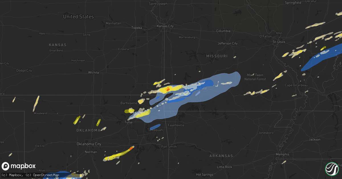
Hail Map on April 29, 2025
Get this storm
April 29 map
$229
one time, instant access
Download today. No call, no setup
Keep the $229
Bought the map and want the full workflow? Apply the entire $229 to a subscription within 7 days. None of it is wasted.
Every map, not just this one
This buys you this map. Subscription and you get every map we run, in the markets you choose from a few cities to whole states to nationwide. Plus real-time alerts the moment a storm fires.
Contact data
Name, contact info, occupancy, even credit band for addresses in the footprint. You go from where it hit to who to call.
Become the source they trust
Unlimited branding weather history reports on demand. You already have the documented answer ready for the property owner, and you are the one who showed up with it.
Property data and RoofTrace estimates
Pull up any address you have got, its value and the exact code rules for that jurisdiction, straight from One Click Code. Then RoofTrace estimates the squares, pitch, and roof value, priced the way you price.
States Impacted by Hail Map on April 29, 2025
Storm reports
Ohio
| Date | Description |
|---|---|
| 04/29/20256:59 PM CDT | Several trees downed in mount orab. Time estimated by radar. |
| 04/29/20256:31 PM CDT | Tree downed along state rte 749 north of rte 52. Time estimated by radar. |
| 04/29/20255:27 PM CDT | Line of fences down along kings island drive. Time estimated from radar. |
| 04/29/20255:18 PM CDT | Photo verified. |
| 04/29/20255:12 PM CDT | Trees downed at auto lot. Time estimated by radar. |
| 04/29/20255:07 PM CDT | Large tree branch downed. Lines were reported to have been blown down at the intersection |
| 04/29/20255:07 PM CDT | Large tree branch downed. |
| 04/29/20255:00 PM CDT | Tree downed near intersection of dover ct and governors ave. Time estimated by radar. |
| 04/29/20253:45 PM CDT | Several trees snapped or uprooted... And a large number of limbs snapped off. |
| 04/29/20253:44 PM CDT | Numerous trees down throughout the wellsville and east liverpool area. |
| 04/29/20253:44 PM CDT | Numerous trees down throughout the wellsville and east liverpool area |
| 04/29/20253:41 PM CDT | Fence blown down |
| 04/29/20253:41 PM CDT | Several large trees snapped. Possible funnel cloud. |
| 04/29/20253:41 PM CDT | Fence blown down. |
| 04/29/20253:40 PM CDT | County road 56 tree down. |
| 04/29/20253:40 PM CDT | Numerous trees down |
| 04/29/20253:40 PM CDT | Porch roof uplift and shingle loss of a home. |
| 04/29/20253:40 PM CDT | Numerous trees down. |
| 04/29/20253:39 PM CDT | Trees down. |
| 04/29/20253:39 PM CDT | Trees down |
| 04/29/20253:35 PM CDT | Multiple trees and power line |
| 04/29/20253:35 PM CDT | Multiple trees and power line. |
| 04/29/20253:33 PM CDT | Numerous power poles and lines down |
| 04/29/20253:33 PM CDT | Numerous power poles and lines down. |
| 04/29/20253:30 PM CDT | Trees and power lines down |
| 04/29/20253:30 PM CDT | Trees and power lines down. |
| 04/29/20253:25 PM CDT | Significant roof damage to dodds funeral home. |
| 04/29/20253:22 PM CDT | Numerous trees down throughout the area |
| 04/29/20253:22 PM CDT | Numerous trees down throughout the area. |
| 04/29/20253:22 PM CDT | Roof blown off of a barn. Trees also down. |
| 04/29/20253:21 PM CDT | Roof blown off of barn on avon road ne. |
| 04/29/20253:20 PM CDT | Numerous reports of trees and power lines down throughout the county. 60 roads are closed due to storm damage. |
| 04/29/20253:20 PM CDT | Multiple downed trees and power lines reported in the mcconnelsville area. Time estimated from radar. |
| 04/29/20253:20 PM CDT | Numerous reports of trees and power lines down throughout the county. 60 roads are closed due to storm damage |
| 04/29/20253:15 PM CDT | Trees down. |
| 04/29/20253:15 PM CDT | Numerous trees down. |
| 04/29/20253:15 PM CDT | Trees down |
| 04/29/20253:15 PM CDT | Numerous trees down |
| 04/29/20253:14 PM CDT | Trees down |
| 04/29/20253:14 PM CDT | Trees down. |
| 04/29/20253:11 PM CDT | Trees uprooted. |
| 04/29/20253:11 PM CDT | Trees uprooted |
| 04/29/20253:10 PM CDT | Downed tree reported on county route 15 east branch road. Time estimated from radar. |
| 04/29/20253:06 PM CDT | Trees and power lines down in numerous locations. |
| 04/29/20253:06 PM CDT | Trees and power lines down in numerous locations |
| 04/29/20253:05 PM CDT | Trees down on a house. |
| 04/29/20253:05 PM CDT | Trees down on a house |
| 04/29/20253:03 PM CDT | Shed damage on south james street. |
| 04/29/20253:03 PM CDT | Numerous trees down. |
| 04/29/20253:03 PM CDT | Numerous trees down |
| 04/29/20252:59 PM CDT | Trees down on science hill road. |
| 04/29/20252:57 PM CDT | Roof blown off of home in straight-line winds. |
| 04/29/20252:55 PM CDT | Numerous trees and power lines down. |
| 04/29/20252:55 PM CDT | Numerous trees and power lines down |
| 04/29/20252:55 PM CDT | Tree damage along old twenty one rd. |
| 04/29/20252:55 PM CDT | Trees and power lines down. |
| 04/29/20252:55 PM CDT | Trees and power lines down |
| 04/29/20252:50 PM CDT | One tree down on a house. |
| 04/29/20252:50 PM CDT | One tree down on a house |
| 04/29/20252:50 PM CDT | Tree damage resulting in over 500 customers without power. |
| 04/29/20252:49 PM CDT | A number of trees down on lookout road |
| 04/29/20252:49 PM CDT | A number of trees down on lookout road. |
| 04/29/20252:48 PM CDT | Trees snapped and some structural damage in the area. Time estimated from radar. |
| 04/29/20252:47 PM CDT | Limbs down |
| 04/29/20252:47 PM CDT | Limbs down. |
| 04/29/20252:46 PM CDT | A local report indicates 61 MPH wind near 1 SE Norwich |
| 04/29/20252:45 PM CDT | Tree damage resulting in over 400 customers without power. |
| 04/29/20252:43 PM CDT | Asos station kzzv zanesville airport |
| 04/29/20252:43 PM CDT | Asos station kzzv zanesville airport. |
| 04/29/20252:42 PM CDT | Numerous trees and limbs down across cambridge road |
| 04/29/20252:42 PM CDT | Numerous trees and limbs down across cambridge road. |
| 04/29/20252:41 PM CDT | Trees and powerlines down across southern holmes county... Including mechanic township. Time estimated via radar. |
| 04/29/20252:40 PM CDT | Numerous trees down reported throughout the county. One tree down on a house in zanesville. |
| 04/29/20252:40 PM CDT | Numerous trees down reported throughout the county. One tree down on a house in zanesville |
| 04/29/20252:40 PM CDT | Trees down on ferrell road. |
| 04/29/20252:35 PM CDT | Mesonet station cheo1 chillicothe. Time also estimated from radar. |
| 04/29/20252:34 PM CDT | Wind blew down an 180 year old oak tree along main st in trinway. |
| 04/29/20252:34 PM CDT | Tree down on power lines on dresden road. |
| 04/29/20252:32 PM CDT | Tree down. |
| 04/29/20252:32 PM CDT | Tree down |
| 04/29/20252:30 PM CDT | Trees and wires down. |
| 04/29/20252:30 PM CDT | Trees and wires down |
| 04/29/20252:27 PM CDT | Multiple trees and limbs down |
| 04/29/20252:27 PM CDT | Multiple trees and limbs down. |
| 04/29/20252:20 PM CDT | Multiple downed trees and power lines reported in the glenford area. Time estimated from radar. |
| 04/29/20252:17 PM CDT | Tree downed onto house near intersection of king street and high street. Time onondaga ny 4307 7647 trees and wires down. Time estimated from rada |
| 04/29/20252:17 PM CDT | Tree downed onto house near intersection of king street and high street. Time estimated by radar. |
| 04/29/20252:15 PM CDT | Trees and wires reported downed. |
| 04/29/20252:13 PM CDT | Klhq asos. |
| 04/29/20252:11 PM CDT | Asos station kvta newark-heath airport. |
| 04/29/20252:11 PM CDT | Multiple trees downed over road. |
| 04/29/20252:08 PM CDT | Trees and wires downed in mt vernon. |
| 04/29/20251:55 PM CDT | Awos station klck columbus rickenbacker intl airport. |
| 04/29/20251:50 PM CDT | Asos station kcmh columbus john glenn international airport. |
| 04/29/20251:49 PM CDT | Large tree split along trunk. |
| 04/29/20251:43 PM CDT | Grain silo turned over. Time estimated from radar. |
| 04/29/20251:43 PM CDT | Tree down. Time estimated from radar. |
| 04/29/20251:41 PM CDT | Trees downed and trees tangled in powerlines. |
| 04/29/20251:41 PM CDT | Tree downed over road. |
| 04/29/20251:40 PM CDT | Asos station kosu columbus ohio state university airport. |
| 04/29/20251:30 PM CDT | Grain elevator blown down. |
| 04/29/20251:17 PM CDT | Trees down... Roof damaged in brighton. Time estimated from radar. |
| 04/29/20251:08 PM CDT | Trees down throughout urbana. Time estimated from radar. |
| 04/29/202512:51 PM CDT | Trees and power poles down on hilltop road. Time estimated from radar. |
| 04/29/202512:47 PM CDT | Trees down at troy aquatic park. Time estimated from radar. |
| 04/29/202512:46 PM CDT | Power poles and lines down on main street. Time estimated from radar. |
| 04/29/202512:46 PM CDT | Large evergreen downed in troy park near adams street. Time estimated by radar. |
| 04/29/202512:46 PM CDT | 6 foot tall fence blown 30 feet into the road. Time estimated from radar. |
| 04/29/202512:44 PM CDT | Tree snapped near hathaway trail. Time estimated by radar. |
| 04/29/202512:44 PM CDT | Multiple power poles downed. |
| 04/29/202512:40 PM CDT | Trees down and power poles down. Time estimated from radar. |
| 04/29/202512:40 PM CDT | Asos station kday dayton international airport. |
| 04/29/202512:40 PM CDT | Several reports of wires down. Time estimated from radar. |
| 04/29/202512:40 PM CDT | Large tree split at trunk. |
| 04/29/202512:37 PM CDT | Numerous trees down in west milton area. Time estimated from radar. |
| 04/29/202512:37 PM CDT | Tree downed onto fence. Time estimated by radar. |
| 04/29/202512:36 PM CDT | Large tree downed onto home. |
| 04/29/202512:35 PM CDT | Trees and wires down on robert simmons drive. Time estimated from radar. |
| 04/29/202512:35 PM CDT | Trees downed along west central ave between miamisburg and west carrollton. Time estimated by radar. |
| 04/29/202512:35 PM CDT | Twelve inch tree limb downed. |
| 04/29/202512:35 PM CDT | Trees downed along west central ave between miamisburg and west carrollton. Time estimated by radar. Il 3842 8777 multiple trees down. Damage to some buildings |
| 04/29/202512:33 PM CDT | Trees and wires down. Time estimated from radar. |
| 04/29/202512:33 PM CDT | 1 1/2 inch healthy limbs down. Time estimated from radar. |
| 04/29/202512:29 PM CDT | Large tree downed across roadway. |
| 04/29/202512:27 PM CDT | Small tree snapped in arcanum. Time estimated by radar. |
| 04/29/202512:23 PM CDT | Large pine tree downed. |
| 04/29/202512:21 PM CDT | Reports of power poles and wires down. Time estimated from radar. |
| 04/28/20258:31 PM CDT | Tree down across mush run road. |
| 04/28/20258:20 PM CDT | Downed tree and lines off happy hollow road. |
| 04/28/20258:12 PM CDT | Downed tree on transformer reported on selby road. |
| 04/28/20257:16 PM CDT | Delayed report of trees down in homerville. Time estimated via radar. |
| 04/28/20257:00 PM CDT | High water reported at several locations in goshen township. Time estimated. |
Illinois
| Date | Description |
|---|---|
| 04/29/20253:47 PM CDT | Multiple trees down. Damage to some buildings due to trees. |
| 04/29/20253:45 PM CDT | Large tree blocking route 1 in 1000 block of cherry street. |
| 04/29/20253:15 PM CDT | Two large trees down across hwy 45 just south of fairfield. |
| 04/29/20252:40 PM CDT | Barn collapsed in ewing area. |
| 04/29/20252:30 PM CDT | Power lines down across route 37 near ewing road. |
| 04/29/20252:25 PM CDT | Multiple trees and power lines down throughout franklin county... From state highway 184/149 to rend lake area. |
| 04/29/20252:25 PM CDT | Tree down blocking exit ramp of i-57 at benton... Il. |
| 04/29/20252:15 PM CDT | Tree down across the road in the royalton area. |
| 04/29/20252:00 PM CDT | A local report indicates 1.25 inch wind near 1 N Beaucoup |
| 04/29/20251:43 PM CDT | Utility pole down in coulterville. Time estimated from radar. |
| 04/29/202512:02 PM CDT | Numerous branches down. |
| 04/29/20258:12 AM CDT | A local report indicates 58 MPH wind near 1 NW Salem |
| 04/29/20258:00 AM CDT | Several large tree limbs snapped. Facebook report. Time estimated from radar. |
| 04/29/20257:48 AM CDT | Damage to 2 grain silos and a handful of other farm buildings. |
Arkansas
| Date | Description |
|---|---|
| 04/29/20259:00 AM CDT | Big maple tree down. Via social media. |
| 04/29/20258:15 AM CDT | Trees uprooted and damaged. Trees limbs on vehicles. Power poles down. Viewer pictures via broadcast media on social media. |
West Virginia
| Date | Description |
|---|---|
| 04/29/20255:21 PM CDT | Trees and power lines down. |
| 04/29/20255:21 PM CDT | Trees and power lines down |
| 04/29/20254:29 PM CDT | Tree down on route 2. |
| 04/29/20254:02 PM CDT | At hlg airport. |
| 04/29/20254:02 PM CDT | At hlg airport |
| 04/29/20254:00 PM CDT | Trees down in dallas... Wv. |
| 04/29/20254:00 PM CDT | Trees down in dallas...wv. |
| 04/29/20253:56 PM CDT | Tree down in glen dale. |
| 04/29/20253:52 PM CDT | Trees uprooted. |
| 04/29/20253:46 PM CDT | Tree down on a building. |
| 04/29/20253:46 PM CDT | Tree down on a building |
| 04/29/20253:45 PM CDT | Tree down on veterans blvd. |
| 04/29/20253:45 PM CDT | *** 1 inj *** tree on a home near welsh street. A man was hit in the head and was transported to hospital. |
| 04/29/20253:44 PM CDT | Numerous trees down |
| 04/29/20253:44 PM CDT | Numerous trees down. |
| 04/29/20253:44 PM CDT | A lot of tree damage and roof damage to homes along washington pike. |
| 04/29/20253:42 PM CDT | Numerous trees down blocking roads |
| 04/29/20253:42 PM CDT | Numerous trees down blocking roads. |
| 04/29/20253:42 PM CDT | Siding removed off home on miller ave. |
| 04/29/20253:41 PM CDT | Numerous trees and power lines down. |
| 04/29/20253:40 PM CDT | Tree damage in area. Time estimated. |
| 04/28/202511:10 PM CDT | 2 trees down across allegheny highway. |
| 04/28/202511:10 PM CDT | 1 tree down across williams river road. |
| 04/28/202511:06 PM CDT | Tree down across stewart run road. |
| 04/28/202510:51 PM CDT | Tree down across cherry hill road. |
| 04/28/202510:37 PM CDT | Asos station kekn elkins airport. |
| 04/28/202510:30 PM CDT | Tree down blocking cherry hill rd. Time estimated by radar. |
| 04/28/202510:20 PM CDT | Tree down blocking both lanes of hall rd between fishing camp rd and macedonia rd outside of buckhannon. Time estimated by radar. |
| 04/28/202510:16 PM CDT | Power lines down 4000 block of alton rd. There is a small fire associated with the lines being down. Time estimated via radar. |
| 04/28/202510:16 PM CDT | Tree down blocking sauls run rd near the 1030 block. Tree is estimated to be 20 feet long. Time estimated by radar. |
| 04/28/202510:14 PM CDT | Asos station kckb clarksburg airport. |
| 04/28/202510:14 PM CDT | Upshur 911 reports a tree down on stony run rd about a half a mile from brushy fork rd. Time estimated via radar. |
| 04/28/202510:10 PM CDT | Two trees down across rt 20. |
| 04/28/20259:57 PM CDT | Tree reported down in newville. Time is estimated by radar. |
| 04/28/20259:55 PM CDT | Tree reported down in sutton. Time is estimated by radar. |
| 04/28/20259:47 PM CDT | Tree reported down in gassaway. Time is estimated by radar. |
| 04/28/20259:40 PM CDT | Large tree limb reported down on route 60. Time is estimated by radar. |
| 04/28/20259:28 PM CDT | Tree damage resulting in 143 customers without power. |
| 04/28/20259:28 PM CDT | Tree reported down blocking one lane of cannelton hollow road. Time is estimated by radar. |
| 04/28/20259:23 PM CDT | Tree down blocking one lane of cairo rd at cherokee lane near cairo... Wv. Time estimated by radar. |
| 04/28/20259:21 PM CDT | Tree down blocking the road with power lines 6300 block of auburn rd. Time estimated by radar. |
| 04/28/20259:00 PM CDT | Downed tree reported on elk river road at hayes street. Time estimated from radar. |
| 04/28/20259:00 PM CDT | Tree reported down. |
| 04/28/20259:00 PM CDT | Downed tree reported on shields hill road between long run and big run. Time estimated from radar. |
| 04/28/20259:00 PM CDT | Downed tree reported on elk river road near falling rock. Time estimated from radar. |
| 04/28/20259:00 PM CDT | Tree damage resulting in 97 customers without power. |
| 04/28/20258:59 PM CDT | Tree damage resulting in 432 customers without power. |
| 04/28/20258:57 PM CDT | Power lines down 900 block of deerwalk highway. Time estimated by radar. |
| 04/28/20258:55 PM CDT | Downed tree reported near the interstate 64 eastbound entrance ramp. |
| 04/28/20258:48 PM CDT | Downed tree reported on sunset drive. |
| 04/28/20258:44 PM CDT | Tree down on home near valley view drive. |
| 04/28/20258:41 PM CDT | Tree down blocking the entire road at 5500 block of manilla creek rd. Time estimated via radar. |
| 04/28/20258:38 PM CDT | Tree down blocking half the road in the 40 block of stuart circle in hurricane. Time estimated via radar. |
| 04/28/20258:36 PM CDT | Putnam county 911 center reports a large oak tree down on lower coach rd in hurricane and fell on a power pole causing power outage in the area. Time estimated by radar |
| 04/28/20258:30 PM CDT | Downed trees and lines reported along coal river road and strawberry road between saint albans and tornado. Time estimated from radar. |
| 04/28/20258:30 PM CDT | Downed tree reported on robin road. Time estimated from radar. |
| 04/28/20258:25 PM CDT | Downed tree reported on martins branch road. Time estimated from radar. |
| 04/28/20258:15 PM CDT | Multiple trees reported down in the area of west hamlin. |
| 04/28/20257:56 PM CDT | Tree down in the road 13800 block of route 52 south of prichard. Time estimated by radar. |
Pennsylvania
| Date | Description |
|---|---|
| 04/29/20256:58 PM CDT | Reports of a roof blowing of a structure on the 6000 block of state route 118. The roof blowing off also knocked over a 1000 gallon propane tank. |
| 04/29/20256:57 PM CDT | Multiple trees down in halifax township... Blocking roadways. |
| 04/29/20256:47 PM CDT | Numerous trees and wires down along route 15. |
| 04/29/20256:47 PM CDT | Measured wind on the route 147 bridge near the fabridam. |
| 04/29/20256:46 PM CDT | Reports of a building collapse on julia street in sunbury. |
| 04/29/20256:46 PM CDT | Trees and wires down in sunbury. |
| 04/29/20256:45 PM CDT | Multiple reports of trees and wires down in williamsport. |
| 04/29/20256:40 PM CDT | Trees down 900 block wildwood ave. |
| 04/29/20256:30 PM CDT | Trees down 2800 block rt 660... Covington township. |
| 04/29/20256:29 PM CDT | Numerous trees down across wires in beavertown. |
| 04/29/20256:26 PM CDT | Multiple trees down near the intersection of thompson road and route 35 north. |
| 04/29/20256:25 PM CDT | Trees down across and blocking route 333 near port royal. |
| 04/29/20256:23 PM CDT | High tension wires knocked down in the vicinity of whitetail trail. |
| 04/29/20256:20 PM CDT | Multiple trees down blocking the roadway on arch rock road. |
| 04/29/20256:19 PM CDT | Trees down on a barn near west valley road. |
| 04/29/20256:19 PM CDT | Multiple trees down on wires across mckinley road near honey grove. |
| 04/29/20256:15 PM CDT | Numerous trees and wires down along route 522 near alfarata. |
| 04/29/20256:11 PM CDT | Multiple trees reported down south of millheim. |
| 04/29/20256:11 PM CDT | Trees down on wires across west 3rd street in lewistown. |
| 04/29/20256:09 PM CDT | Multiple trees snapped and uprooted southeast of howard. |
| 04/29/20256:09 PM CDT | Widespread trees and wires down near lamar. |
| 04/29/20256:08 PM CDT | Reports of a barn collapse on the 1000 block of dry run road with debris from the collapse blocking the roadway. |
| 04/29/20256:03 PM CDT | Multiple trees down on ferguson valley rd. Time estimated using radar. |
| 04/29/20256:00 PM CDT | At least 9 power poles snapped with wires/poles on roadway along west college ave near cato drive and whitehall road... Ferguson township. At least two occupied vehicle |
| 04/29/20255:59 PM CDT | Trees and wires down across college avenue near pleasant gap. |
| 04/29/20255:58 PM CDT | Trees and wires down in bellefonte. |
| 04/29/20255:58 PM CDT | Tree down onto an apartment building in bellefonte. No injuries reported. |
| 04/29/20255:58 PM CDT | Reports of a tree on a residence with a tree also down in a yard near the intersection of south patterson street and south sparks street. |
| 04/29/20255:57 PM CDT | Power line down on a vehicle with multiple trees down in the vicinity of cricklewood drive and fox hollow road. |
| 04/29/20255:57 PM CDT | Large trees knocked down on hillcrest avenue near west cherry lane and orlando avenue. |
| 04/29/20255:57 PM CDT | Reports of roof and structural damage northeast of houserville. |
| 04/29/20255:56 PM CDT | A local report indicates 61 MPH wind near Zion |
| 04/29/20255:53 PM CDT | *** 1 inj *** m52 mph tstm wind gust @psu beaver stadium weatherstem lofted portable restroom into student referee causing minor injuries. Video credit: barstool penn s |
| 04/29/20255:52 PM CDT | Tree down into an apartment building. No injuries reported. |
| 04/29/20255:52 PM CDT | 65 mph wind gust at the national weather service office in state college. |
| 04/29/20255:51 PM CDT | Numerous trees and wires down along nixon road. 66 mph wind gust. Zero visibility ahead of the squall in blowing dust. |
| 04/29/20255:51 PM CDT | Trees and wires down onto a residence on east hillside avenue. No injuries reported. |
| 04/29/20255:50 PM CDT | Numerous trees down with one tree down on an outbuilding. |
| 04/29/20255:50 PM CDT | Tree knocked down onto a residence on country hills drive. No injuries reported. |
| 04/29/20255:49 PM CDT | Power poles snapped in graysdale. |
| 04/29/20255:49 PM CDT | Widepsread trees and wires down in huntingdon. Power out at 911 center. |
| 04/29/20255:49 PM CDT | Trees down with snapped power poles. |
| 04/29/20255:46 PM CDT | Numerous trees and wires down along spruce creek road. |
| 04/29/20255:45 PM CDT | Trees down on wires along route 305. |
| 04/29/20255:44 PM CDT | A local report indicates 63 MPH wind near 1 SSE Martinsburg |
| 04/29/20255:42 PM CDT | Multiple trees and wires down in grassflat. |
| 04/29/20255:38 PM CDT | Multiple trees down in roaring spring. |
| 04/29/20255:37 PM CDT | Reports of multiple trees into a residence with no injuries reported. |
| 04/29/20255:35 PM CDT | Wires and telephone poles knocked down with three barn roofs blown off. |
| 04/29/20255:35 PM CDT | Trees down on wires along decatur street west of philipsburg. |
| 04/29/20255:32 PM CDT | Trees and wires knocked down onto a residence. |
| 04/29/20255:31 PM CDT | Reports of a tree down on a residence on 7th avenue. Multiple trees and wires down across altoona. |
| 04/29/20255:31 PM CDT | Large tree with wires down near a residence and car... Blocking entrances and exits. |
| 04/29/20255:30 PM CDT | Tree fell onto a car with no injuries reported. |
| 04/29/20255:30 PM CDT | Tree down onto a residence driveway with multiple large branches snapped off of trees. |
| 04/29/20255:28 PM CDT | Trees and wires down across wopsy road near the lookout. |
| 04/29/20255:22 PM CDT | Asos station kduj dubois airport. |
| 04/29/20255:22 PM CDT | Asos station kduj dubois airport |
| 04/29/20255:18 PM CDT | Trees down on wires across lincoln drive in dubois. |
| 04/29/20255:18 PM CDT | Reports of a barn collapse on the 800 block of munster road in portage township. Animals trapped inside of the collapse. |
| 04/29/20255:16 PM CDT | Trees down across wires along glades pike road. |
| 04/29/20255:14 PM CDT | Cell tower collapsed on sunset road. |
| 04/29/20255:12 PM CDT | Tree uprooted along colver road near ebensburg. |
| 04/29/20255:12 PM CDT | Asos wind gust at kjst airport. |
| 04/29/20255:05 PM CDT | Trees down on wires with a transformer down across north sheridan street in johnstown. |
| 04/29/20255:00 PM CDT | Mesonet station at365 rochester mills. |
| 04/29/20255:00 PM CDT | Large tree limbs down. |
| 04/29/20255:00 PM CDT | Mesonet station at365 rochester mills |
| 04/29/20255:00 PM CDT | Large tree limbs down |
| 04/29/20254:56 PM CDT | Tree down on lutz school road. |
| 04/29/20254:54 PM CDT | Tree down on metz rd near route 422. |
| 04/29/20254:46 PM CDT | Multiple trees were blown down. |
| 04/29/20254:46 PM CDT | Multiple trees were blown down |
| 04/29/20254:45 PM CDT | Numerous trees down... Some on power lines. Power pole blown down... And a horse trailer was damaged by a falling tree. |
| 04/29/20254:45 PM CDT | Measured at klbe latrobe airport. |
| 04/29/20254:45 PM CDT | Measured at klbe latrobe airport |
| 04/29/20254:44 PM CDT | Trees down |
| 04/29/20254:44 PM CDT | Numerous trees uprooted. Damage to a roof. |
| 04/29/20254:44 PM CDT | Trees down. |
| 04/29/20254:43 PM CDT | Trees uprooted. One tree down on a power line. |
| 04/29/20254:42 PM CDT | Multiple trees down. |
| 04/29/20254:39 PM CDT | Five 2-foot in diameter power poles snapped and laying on the ground. |
| 04/29/20254:35 PM CDT | Tree down in yard. |
| 04/29/20254:35 PM CDT | Tree down in yard |
| 04/29/20254:33 PM CDT | Widespread damage across huntington township. |
| 04/29/20254:31 PM CDT | Numerous trees down. |
| 04/29/20254:31 PM CDT | Numerous trees down |
| 04/29/20254:27 PM CDT | Trees down. |
| 04/29/20254:25 PM CDT | 7 trees blown down |
| 04/29/20254:25 PM CDT | Tree down |
| 04/29/20254:25 PM CDT | Trees split in half and limbs down |
| 04/29/20254:25 PM CDT | Tree down. |
| 04/29/20254:25 PM CDT | Trees down in sarver area. |
| 04/29/20254:25 PM CDT | Large trees and limbs down. |
| 04/29/20254:25 PM CDT | Trees split in half and limbs down. |
| 04/29/20254:25 PM CDT | Reports of several trees snapped and uprooted near memorial park and the 56 bypass. Time estimated from radar. |
| 04/29/20254:25 PM CDT | Large trees and limbs down |
| 04/29/20254:25 PM CDT | Trees down around monroeville public library. |
| 04/29/20254:24 PM CDT | Numerous large limbs down. Shingles blown off of a roof. |
| 04/29/20254:24 PM CDT | Numerous large limbs down. Shingles blown off of a roof |
| 04/29/20254:23 PM CDT | Large oak tree uprooted and into barn. |
| 04/29/20254:23 PM CDT | Trees down on new texas rd |
| 04/29/20254:23 PM CDT | *** 1 inj *** tree fell on a car injuring occupant. |
| 04/29/20254:23 PM CDT | Trees down on new texas rd. |
| 04/29/20254:23 PM CDT | Multiple trees down in brackenridge pa. |
| 04/29/20254:23 PM CDT | Trees down. |
| 04/29/20254:23 PM CDT | Power pole down on stevenson blvd. |
| 04/29/20254:23 PM CDT | Trees down |
| 04/29/20254:23 PM CDT | Numerous trees down. |
| 04/29/20254:23 PM CDT | *** 1 inj *** tree fell on a car injuring occupant |
| 04/29/20254:22 PM CDT | Tree on a home on hazelnut drive. |
| 04/29/20254:22 PM CDT | Tree on a car on hamlet court in monroeville. |
| 04/29/20254:22 PM CDT | Tree on a car on hamlet court in monroeville |
| 04/29/20254:22 PM CDT | Car stuck in downed powerlines. |
| 04/29/20254:21 PM CDT | Tree snapped on freeport road and saxonburg road. |
| 04/29/20254:21 PM CDT | Shutters blown off of a house. Truck cover blown off. |
| 04/29/20254:21 PM CDT | Trees down on pa turnpike mp 43.8... Blocking lanes of traffic. |
| 04/29/20254:21 PM CDT | Trees down on pa turnpike mp 43.8...blocking lanes of traffic. |
| 04/29/20254:20 PM CDT | Wires down. |
| 04/29/20254:20 PM CDT | Wires down |
| 04/29/20254:19 PM CDT | Numerous trees down across the area |
| 04/29/20254:19 PM CDT | Numerous trees down across the area. |
| 04/29/20254:19 PM CDT | Tree down near the church. |
| 04/29/20254:17 PM CDT | Corrects previous tstm wnd dmg report from 3 e nixon. Numerous trees down... Some on power lines. Power pole blown down... And a horse trailer was damaged by a falling |
| 04/29/20254:17 PM CDT | Corrects previous tstm wnd dmg report from 3 e nixon. Numerous trees down...some on power lines. Power pole blown down...and a horse trailer was damaged by a falling tr |
| 04/29/20254:16 PM CDT | Trees down near thomas blvd. |
| 04/29/20254:15 PM CDT | Tree down on power lines |
| 04/29/20254:15 PM CDT | Tree down |
| 04/29/20254:15 PM CDT | Tree down. |
| 04/29/20254:15 PM CDT | Multiple trees down |
| 04/29/20254:15 PM CDT | Numerous trees uprooted and large branches down |
| 04/29/20254:15 PM CDT | Tree down in the front yard. |
| 04/29/20254:15 PM CDT | Numerous trees uprooted and large branches down. |
| 04/29/20254:15 PM CDT | Tree down on power lines. |
| 04/29/20254:15 PM CDT | Windows blown out of high rise building in downtown pittsburgh. Gates center. |
| 04/29/20254:15 PM CDT | Tree down in the front yard |
| 04/29/20254:15 PM CDT | Multiple trees down. |
| 04/29/20254:14 PM CDT | Numerous trees down |
| 04/29/20254:14 PM CDT | Numerous trees down. |
| 04/29/20254:14 PM CDT | Tree and wires down. |
| 04/29/20254:14 PM CDT | Tree and wires down |
| 04/29/20254:14 PM CDT | Trees down on beechwood blvd. |
| 04/29/20254:13 PM CDT | Trees down on eastview drive. |
| 04/29/20254:13 PM CDT | Tree down on wires |
| 04/29/20254:13 PM CDT | Large tree snapped |
| 04/29/20254:13 PM CDT | Multiple trees down. |
| 04/29/20254:13 PM CDT | Large tree snapped. |
| 04/29/20254:13 PM CDT | Tree down on wires. |
| 04/29/20254:13 PM CDT | Multiple trees down |
| 04/29/20254:13 PM CDT | Tree damage at the pittsburgh zoo. |
| 04/29/20254:13 PM CDT | Trees and power lines down on beverly road. |
| 04/29/20254:12 PM CDT | Numerous trees uprooted and snapped in schenley park. |
| 04/29/20254:11 PM CDT | Tree down on a house. Numerous trees and wires down throughout this area. |
| 04/29/20254:11 PM CDT | Uprooted trees on christler street. |
| 04/29/20254:11 PM CDT | Tree and large limbs down. Metal chimney cover also blown down. |
| 04/29/20254:11 PM CDT | Tree and large limbs down. Metal chimney cover also blown down |
| 04/29/20254:10 PM CDT | Corrects previous non-tstm wnd gst report from 1 wsw pearl. Meausred wind gust from pennsylvania mesonet sensor. |
| 04/29/20254:10 PM CDT | Numerous large trees...power lines...and power poles blown down throughout the area. Lasted approximately 10 minutes |
| 04/29/20254:10 PM CDT | Numerous large trees... Power lines... And power poles blown down throughout the area. Lasted approximately 10 minutes. |
| 04/29/20254:10 PM CDT | Large tree in the road |
| 04/29/20254:10 PM CDT | Large tree in the road. |
| 04/29/20254:10 PM CDT | A local report indicates 74 MPH wind near 1 SSE Barkeyville |
| 04/29/20254:10 PM CDT | Multiple trees down and shingles blown off of a roof. |
| 04/29/20254:10 PM CDT | A local report indicates 68 MPH wind near 1 SE Robinson Township |
| 04/29/20254:10 PM CDT | Roof blown off restaurant along west liberty ave. |
| 04/29/20254:09 PM CDT | Small limbs stripped off mature trees along 40th st. |
| 04/29/20254:09 PM CDT | Corrects previous tstm wnd dmg report from 1 ene dormont. Trees down on edgebrook ave. |
| 04/29/20254:09 PM CDT | Tree on a home on fruithurst dr. |
| 04/29/20254:09 PM CDT | 6 trees blown down. |
| 04/29/20254:09 PM CDT | Tree on a home on fruithurst dr |
| 04/29/20254:09 PM CDT | 6 trees blown down |
| 04/29/20254:09 PM CDT | Tree down. |
| 04/29/20254:08 PM CDT | Trees blown down |
| 04/29/20254:08 PM CDT | Trees and wires down |
| 04/29/20254:08 PM CDT | Several limbs down |
| 04/29/20254:08 PM CDT | Trees blown down. |
| 04/29/20254:08 PM CDT | Several limbs down. |
| 04/29/20254:08 PM CDT | Large limbs also down. |
| 04/29/20254:08 PM CDT | Trees and wires down. |
| 04/29/20254:08 PM CDT | Shutters blown off of houses. Siding also blown off. |
| 04/29/20254:08 PM CDT | Large limbs also down |
| 04/29/20254:07 PM CDT | Part of a tree on home on dewalt drive. |
| 04/29/20254:07 PM CDT | Trees down on august drive. |
| 04/29/20254:07 PM CDT | Damage to metal roofing of an industrial building. Time estimated based on radar. |
| 04/29/20254:07 PM CDT | Corrects previous tstm wnd dmg report from green tree. Tree down on iron city drive. |
| 04/29/20254:06 PM CDT | Several trees and large limbs down. |
| 04/29/20254:06 PM CDT | Several trees and large limbs down |
| 04/29/20254:06 PM CDT | Roof blown off hotties bar on west main st. |
| 04/29/20254:06 PM CDT | Trees down along chartiers creek. Awnings off of buildings and power lines also down. |
| 04/29/20254:05 PM CDT | Large tree down |
| 04/29/20254:05 PM CDT | Large tree down. |
| 04/29/20254:03 PM CDT | Numerous trees... Wires and power poles down throughout the area. |
| 04/29/20254:03 PM CDT | Numerous trees...wires and power poles down throughout the area |
| 04/29/20254:03 PM CDT | Large tree limbs also down. |
| 04/29/20254:03 PM CDT | Multiple trees were blown down on falck rd. Damage to a garage roof and deck also reported. |
| 04/29/20254:03 PM CDT | Large tree limbs also down |
| 04/29/20254:02 PM CDT | Cinderblock garage corner dislocated near south fayette schools. |
| 04/29/20254:00 PM CDT | Large tree down on a house. |
| 04/29/20254:00 PM CDT | Large tree down on a house |
| 04/29/20253:59 PM CDT | Tree down on a power line. |
| 04/29/20253:59 PM CDT | Tree down on a power line |
| 04/29/20253:58 PM CDT | Numerous trees down. |
| 04/29/20253:58 PM CDT | Numerous trees down |
| 04/29/20253:57 PM CDT | Tree blocking one lane of mill street at broadhead intersection. |
| 04/29/20253:57 PM CDT | Tree blocking one lane of mill street at broadhead intersection |
| 04/29/20253:56 PM CDT | Trees down. |
| 04/29/20253:56 PM CDT | Trees down. |
| 04/29/20253:56 PM CDT | Trees down |
| 04/29/20253:56 PM CDT | Trees down |
| 04/29/20253:56 PM CDT | Street light blown down at beaver valley mall. |
| 04/29/20253:54 PM CDT | Power pole leaning over near us-22 and pa route 18. |
| 04/29/20253:53 PM CDT | Tree down on woodlane ave. |
| 04/29/20253:53 PM CDT | Trees down on sunset blvd. |
| 04/29/20253:49 PM CDT | Trees uprooted in frankfort springs. |
| 04/29/20253:48 PM CDT | Trees down along rt 168. |
| 04/29/20253:48 PM CDT | Trees down along rt 168 |
| 04/29/20253:47 PM CDT | Large tree down on shafer road. |
| 04/29/20253:45 PM CDT | Numerous trees down. |
| 04/29/20253:40 PM CDT | Trees down on christy and hann hill road |
| 04/29/20253:40 PM CDT | Trees down on christy and hann hill road. |
| 04/29/20253:09 PM CDT | Trees down on edgebrook ave. |
| 04/29/20253:07 PM CDT | Tree down on iron city drive. |
| 04/28/20257:24 PM CDT | Railroad gate knocked over from wind. Time estimated from radar. |
| 04/28/20257:22 PM CDT | Tree down on meshoppen creek road. Time estimated from radar. |
| 04/28/20257:22 PM CDT | Tree down on demunds road. Time estimated from radar. |
| 04/28/20257:06 PM CDT | Trees and wires down along route 42 in numidia. |
| 04/28/20257:05 PM CDT | Numerous trees and wires down in valley view. |
| 04/28/20257:05 PM CDT | Trees and wires down along route 487. |
| 04/28/20257:04 PM CDT | Tree down on brocktown road. Time estimated from radar. |
Utah
| Date | Description |
|---|---|
| 04/29/20256:03 PM CDT | [landspout] public video showing apparent brief landspout near the plain city and farr west area. No damage reported. |
Kentucky
| Date | Description |
|---|---|
| 04/29/20256:53 PM CDT | Report of trees down. |
| 04/29/20256:51 PM CDT | Report of tree down. |
| 04/29/20256:48 PM CDT | Tree down on the road. |
| 04/29/20256:41 PM CDT | Trees and powerlines were reported to have been blown down in the preston community. The event time is radar estimated. |
| 04/29/20256:38 PM CDT | Trees and powerlines were reported to have been blown down in more than one location along shrout road area in the kendall springs community. The event time is radar es |
| 04/29/20256:33 PM CDT | Montgomery county dispatch reports widespread tree damage across the county from the storms this evening. Point placed at a time and place where radar velocity returns |
| 04/29/20256:31 PM CDT | Trees were reported to have been blown down and a fence damaged at a residence along oldham road in the vicinity of camargo heights. The event time and location are bot |
| 04/29/20256:28 PM CDT | Resending previous tstm wnd dmg report from 1 ssw ewington due to iris error message. Montgomery county dispatch reports downed trees blocking osborne road from the thu |
| 04/29/20256:27 PM CDT | Montgomery county dispatch reports widespread tree damage across the county from the storms this evening. Point placed at a time and place where radar velocity returns |
| 04/29/20256:18 PM CDT | Large tree uprooted in independence. Time estimated by radar. |
| 04/29/20256:17 PM CDT | Multiple trees reported down around winchester... Ky. |
| 04/29/20256:16 PM CDT | Large tree downed along independence station road. Time estimated by radar. |
| 04/29/20256:13 PM CDT | Large tree downed over wooden fencing. |
| 04/29/20256:12 PM CDT | Two trees down on stoney point rd. Time estimated from radar. |
| 04/29/20255:12 PM CDT | Twitter report shows picture of quarter size hail. |
| 04/29/20255:09 PM CDT | Large tree down across cisselville rd near loretto rd intersection. |
| 04/29/20254:56 PM CDT | Report from mping: quarter |
| 04/28/20258:25 PM CDT | Social media report of a small tree down on a barn near the end of freeman fork road in extreme sw breathitt county. Time estimated via radar. |
| 04/28/20258:22 PM CDT | Wayne county 911 reports trees downed on dugan street in monticello. Time estimated via radar. |
| 04/28/20258:10 PM CDT | Social media report of a tree down near the old vincent post office... Time estimated via radar. |
| 04/28/20258:09 PM CDT | A tree was reported to have been downed and blocking down and around road off of ky 30 and also south of exit 70 along the mountain parkway. The event time is radar est |
| 04/28/20257:52 PM CDT | 2- to 3-inch diameter tree branch blocking the northbound lane of ky highway 1812 approximately one-half mile north of the breathitt county line. Time estimated from ra |
| 04/28/20257:47 PM CDT | Social media report of a tree down on privett lane in the wolverine area of breathitt count. Time estimated via radar. |
| 04/28/20257:44 PM CDT | Jackson county 911 center reported a tree down near the 580 block of brushy ridge rd. Time estimate from radar. |
| 04/28/20257:30 PM CDT | Tree down on us 127 blocking part of the hwy near the casey county board of education. |
| 04/28/20257:17 PM CDT | Picture of power lines downed by a fallen tree in the south irvine community. Time estimated via radar. |
| 04/28/20257:02 PM CDT | Trees and powerlines were reported to have been blown down at the intersection of brown street and pettit avenue. The event time is radar estimated. |
| 04/28/20257:00 PM CDT | Trees and powerlines were reported to have been blown down at 308 clearfield hill road. The event time is radar estimated. |
| 04/28/20257:00 PM CDT | Trees and powerlines were reported to have been blown down at 926 old flemingsburg rd.... Morehead. The event time is radar estimated. |
Indiana
| Date | Description |
|---|---|
| 04/29/20254:04 PM CDT | Reported structural collapse of the front side of the town hall. |
| 04/29/20253:59 PM CDT | A local report indicates 66 MPH wind near 2 N Patoka |
| 04/29/20253:59 PM CDT | A local report indicates 60 MPH wind near 1 S Princeton |
| 04/29/20253:58 PM CDT | Tree down on hart street road. |
| 04/29/20253:58 PM CDT | Tree across enley road. |
| 04/29/202512:17 PM CDT | Large barn with exterior walls collapsed. |
| 04/29/202512:13 PM CDT | Tree downed across roadway. |
| 04/29/202512:13 PM CDT | Trees down near county road 900 north. Time estimated from radar. |
| 04/29/202512:04 PM CDT | Corrects previous tstm wnd dmg report from 3 ssw west college corner. Tree down on contreras pike. Time estimated from radar. |
| 04/29/202512:04 PM CDT | Road down on contreras pike. Time estimated from radar. |
| 04/29/202512:04 PM CDT | Tree down on state route 1 and neuman lake road. Time estimated from radar. |
| 04/29/202511:49 AM CDT | Tree down on big bear road and state route 1. Time estimated from radar. |
| 04/29/202511:47 AM CDT | Tree down on country club road. Time estimated from radar. |
| 04/29/202511:45 AM CDT | Multiple trees and power poles down. Time estimated from radar. |
| 04/29/202511:40 AM CDT | Tree down. Time approximated form radar. |
| 04/29/202511:35 AM CDT | Tree snapped onto garage. |
| 04/29/202511:30 AM CDT | 4 structures damaged between 950 east and 1000s to an area from 900n to 700 east. |
| 04/29/202511:30 AM CDT | 5 power poles and a tree down on 450 e south of 244. |
| 04/29/202511:14 AM CDT | 56kt gust recorded at kgez. |
| 04/29/202510:38 AM CDT | A local report indicates 65 MPH wind near Martinsville |
| 04/29/202510:38 AM CDT | A local report indicates 65 MPH wind near Martinsville |
| 04/29/20259:41 AM CDT | Delayed report. A horse trailer was lifted and thrown with nearby power lines and tree damage. Several other structures had damage in the area. |
| 04/29/20259:41 AM CDT | A local report indicates 1.00 inch wind near Lyons |
Oklahoma
| Date | Description |
|---|---|
| 04/29/20258:30 AM CDT | Thunderstorm wind damage reported at delaware county fairgrounds and near highway 59 & e390 road in jay. |
| 04/29/20258:29 AM CDT | A local report indicates 1.25 inch wind near 2 NE Noble |
| 04/29/20257:58 AM CDT | Power poles and trees down in miami. |
| 04/29/20257:55 AM CDT | Mesonet station miam miami. |
| 04/29/20257:47 AM CDT | A local report indicates 60 MPH wind near Chouteau |
| 04/29/20257:31 AM CDT | A local report indicates 1.00 inch wind near 1 E Claremore |
| 04/29/20257:28 AM CDT | A local report indicates 60 MPH wind near 3 S Oologah |
| 04/29/20257:15 AM CDT | Damage to power pole just north of cromwell. Time estimated by radar. |
| 04/29/20257:15 AM CDT | Large tree limbs down near e 76th st n and n 177th e ave. |
| 04/29/20257:15 AM CDT | A tree was down across e 106th st n... Near n 181st east ave. |
| 04/29/20257:15 AM CDT | Multiple large tree limbs down just east of the rogers and tulsa county lines off 76th street north. |
| 04/29/20257:06 AM CDT | A tornado uprooted several trees... Destroyed a couple outbuildings... Damaged the roofs of homes... And snapped numerous large tree limbs. The damage supported a low-e |
| 04/29/20257:05 AM CDT | Roof and tree damage reports via social media. Time and location estimated by radar. |
| 04/29/20257:01 AM CDT | Report from mping: quarter |
| 04/29/20255:51 AM CDT | Trained spotter recorded 55 to 60 mph wind gusts. |
| 04/29/20253:12 AM CDT | Power lines down on highway 53 approximately 3 mile west of comanche lake. Time estimated. |
| 04/29/20253:05 AM CDT | Large tree |
| 04/29/20252:52 AM CDT | Personal weather station measurement. |
| 04/29/20252:30 AM CDT | A local report indicates 60 MPH wind near 4 NW Walters |
| 04/29/20252:25 AM CDT | A local report indicates 60 MPH wind near 4 NW Walters |
| 04/29/20251:10 AM CDT | A local report indicates 62 MPH wind near 4 N Tahlequah |
| 04/29/202512:42 AM CDT | A local report indicates 1.00 inch wind near 2 S Hollister |
New Mexico
| Date | Description |
|---|---|
| 04/29/20252:40 AM CDT | Report from mping: quarter |
Texas
| Date | Description |
|---|---|
| 04/29/20256:45 PM CDT | Report from mping: quarter |
| 04/29/20256:45 PM CDT | Trees snapped... Power lines snapped... Roof damage to barn. |
| 04/29/20256:40 PM CDT | A local report indicates 59 MPH wind near 4 NNW Seymour |
| 04/29/20256:30 PM CDT | A local report indicates 68 MPH wind near 3 NW Knox City |
| 04/29/20256:25 PM CDT | Spotternetwork report. |
| 04/29/20256:18 PM CDT | Report from mping: quarter |
| 04/29/20256:18 PM CDT | A local report indicates 92 MPH wind near 3 NW Knox City |
| 04/29/20255:59 PM CDT | Measured at personal station. |
| 04/29/20255:52 PM CDT | Report from mping: ping pong ball |
| 04/29/20255:25 PM CDT | Media relayed public report. |
| 04/29/20255:25 PM CDT | Floydada fd. |
| 04/29/20255:05 PM CDT | Public report from mping. Corrected for location. Location estimated from radar. |
| 04/29/20254:54 PM CDT | Corrects previous hail report from 12 sse guthrie. Social media report. |
| 04/29/20254:54 PM CDT | Mc report. |
| 04/29/20254:51 PM CDT | Kent county so. |
| 04/29/20254:50 PM CDT | Roof blown off a vacant home. Time estimated from radar. |
| 04/29/20254:47 PM CDT | Report from mping: golf ball |
| 04/29/20254:41 PM CDT | Social media video shows 5 inch diameter hail found along the roadside. Time estimated from radar. |
| 04/29/20254:41 PM CDT | Corrects previous hail report from 12 sse guthrie. Social media video shows 5 inch diameter hail found along the roadside. Time estimated from radar. |
| 04/29/20254:35 PM CDT | Nssl report. |
| 04/29/20253:28 PM CDT | Garza county so. |
| 04/29/20253:26 PM CDT | Media relayed public report. Time estimated from radar. |
| 04/29/20253:11 PM CDT | Tahoka fd. |
| 04/29/20252:56 PM CDT | Report from mping: hen egg |
| 04/29/20252:55 PM CDT | Report from mping: half dollar |
| 04/29/20252:51 PM CDT | Report from mping: half dollar |
| 04/29/20252:46 PM CDT | Report from mping: quarter |
| 04/29/20252:44 PM CDT | Report from mping: quarter |
| 04/29/20252:42 PM CDT | Report from mping: golf ball |
| 04/29/20252:42 PM CDT | Tahoka fd. |
| 04/29/20252:41 PM CDT | Report from mping: quarter |
| 04/29/20252:35 PM CDT | Report from mping: quarter |
| 04/29/20252:33 PM CDT | Report from mping: half dollar |
| 04/29/20252:29 PM CDT | Corrects previous hail report from 2 wnw fort stockton. Large hail reported to emergency management. |
| 04/29/20252:29 PM CDT | Large hail reported to emergency management. |
| 04/29/20252:22 PM CDT | Via tahoka fd. |
| 04/29/20251:34 PM CDT | Golf ball sized hail reported by emergency manager. Time estimated per report. |
| 04/29/20251:34 PM CDT | Corrects previous hail report from 13 ssw imperial. Golf ball sized hail reported by emergency manager. Time estimated per report. |
| 04/29/20251:28 PM CDT | Quarter size reported by emergency manager. Time was estimated by report and radar. |
| 04/29/20251:28 PM CDT | Corrects previous hail report from 14 nne fort stockton. Quarter size reported by emergency manager. Time was estimated by report and radar. |
| 04/29/20254:09 AM CDT | A local report indicates 60 MPH wind near 2 SE Truscott |
| 04/29/20253:59 AM CDT | West texas mesonet observation. |
| 04/29/20253:30 AM CDT | Corrects previous tstm wnd gst report from 5 nw colorado city. Mesonet station 5nw colorado city. |
| 04/29/20253:30 AM CDT | Mesonet station 5nw colorado city. |
| 04/29/20252:21 AM CDT | Report from mping: quarter |
| 04/29/20251:20 AM CDT | Corrects previous hail report from 2 nw hermleigh. |
| 04/29/20251:20 AM CDT | A local report indicates 1.75 inch wind near 2 NW Hermleigh |
| 04/29/20251:06 AM CDT | Corrects previous hail report from 2 s snyder. |
| 04/29/20251:06 AM CDT | A local report indicates 1.00 inch wind near 2 S Snyder |
| 04/29/202512:07 AM CDT | Media partner reported nickel to quarter sized hail between seagraves and seminole in gaines county... Tx along us hwy 62. |
| 04/28/202511:06 PM CDT | Report of golf ball sized hail off of us hwy 87. |
| 04/28/20259:16 PM CDT | Report from mping: half dollar |
| 04/28/20259:16 PM CDT | Report from mping: hen egg |
| 04/28/20258:23 PM CDT | A local report indicates 70 MPH wind near Burkburnett |
| 04/28/20257:31 PM CDT | Report from mping: quarter |
| 04/28/20257:31 PM CDT | Report from mping: quarter |
| 04/28/20257:08 PM CDT | Winds gusted at to 58 mph or higher from 654 pm to 718 pm at west texas mesonet station. There were frequent gusts over 90 mph between 700 and 709 pm. Southwest winds g |
| 04/28/20257:08 PM CDT | A local report indicates 106 MPH wind near 3 NW Seymour |
| 04/28/20257:01 PM CDT | Report from mping: tennis ball |
| 04/28/20257:00 PM CDT | Corrects previous hail report from iraan. Picture of approximately golf ball size hail in iraan. |
| 04/28/20257:00 PM CDT | Picture of approximately golf ball size hail in iraan. |
Mississippi
| Date | Description |
|---|---|
| 04/29/20255:05 PM CDT | Quarter size hail fell near the intersection of college road and daffodil drive. |
Michigan
| Date | Description |
|---|---|
| 04/29/20252:34 PM CDT | 911 dispatch reported powerline down |
| 04/29/20252:34 PM CDT | 911 dispatch reported powerline down on meisner rd in east china township. |
| 04/29/20252:34 PM CDT | 911 dispatch reported powerline down on meisner rd |
| 04/29/20252:20 PM CDT | Large pine tree uprooted and tree limbs up to 6 inches in diameter down. Estimated 60 mph winds. |
| 04/29/20252:20 PM CDT | Measured at midot site. |
| 04/29/20252:15 PM CDT | Multiple trees and power lines down around macomb township. |
| 04/29/20252:10 PM CDT | Pine tree uprooted and a tree limb down several inches in diameter. |
| 04/29/20252:00 PM CDT | A couple trees down near avon rd and rochester rd |
| 04/29/20252:00 PM CDT | Powerlines down near hamlin rd and john r rd. |
| 04/29/20251:41 PM CDT | Multiple reports of roof partially removed from large building. |
| 04/29/202511:05 AM CDT | Social media report of downed trees and power outages due to thunderstorm winds in alpena. |
Missouri
| Date | Description |
|---|---|
| 04/29/20251:06 PM CDT | Tree down over road at state route o and highway 32. Time estimated from radar. |
| 04/29/202512:30 PM CDT | Church steeple blown over. |
| 04/29/202512:29 PM CDT | Roof blown off school. Time estimated by radar. |
| 04/29/202511:19 AM CDT | Via social media... Delayed report of tree blown across highway at hwy 119 and vv junction. Time based on radar. |
| 04/29/202510:55 AM CDT | Photos of snapped trees down on home from regional skywarn. |
| 04/29/20259:55 AM CDT | Tree over powerlines. |
| 04/29/20259:48 AM CDT | Pictures of large trees down and damage to green house. Time based on radar estimate. |
| 04/29/20259:48 AM CDT | Tree limbs of 3 inch diameter being reported snapped in fair grove area. Time based on radar estimate. |
| 04/29/20259:45 AM CDT | Trees on house... 7 outbuildings have trees or roof damage. Time based on radar estimate. |
| 04/29/20259:45 AM CDT | Facebook photo of significant roof damage to aurora church of christ. |
| 04/29/20259:42 AM CDT | Tree blocking road division and benton. |
| 04/29/20259:40 AM CDT | Facebook photo of uprooted tree. |
| 04/29/20259:40 AM CDT | Trees down in the road of u and finbrooke. |
| 04/29/20259:36 AM CDT | 2-3 trees have feel over broadway... Half the road is blocked. About 4 ft in diameter. Time based on radar. Ouse on east ave. |
| 04/29/20259:36 AM CDT | 2-3 trees have feel over broadway... Half the road is blocked. About 4 ft in diameter. Time based on radar. |
| 04/29/20259:36 AM CDT | Pictures of trees down with some on house. Time based on radar. |
| 04/29/20259:35 AM CDT | Delayed report. Branches down even some trees down. Only one critical damage spotted so far was one shed destroyed by fallen trees. |
| 04/29/20259:35 AM CDT | Branches up to 4 in down... And a large tree 5ft in diameter... In springfield. Tree was split in half... And shingles blown off of roofs in the area. Time based on rad |
| 04/29/20259:34 AM CDT | A local report indicates 90 MPH wind near 5 SSE Willard |
| 04/29/20259:34 AM CDT | A local report indicates 90 MPH wind near 5 SSE Willard |
| 04/29/20259:34 AM CDT | Spotter report of a house that has half collapsed at the golf course near scenic and sunshine. Time based on radar estimate. |
| 04/29/20259:34 AM CDT | Corrects previous tstm wnd dmg report from 3 wsw springfield. Spotter report of a house tree over the house i previously reported on came down on house and collapsed pa |
| 04/29/20259:33 AM CDT | Trees down at drury university. Time based on radar estimate. |
| 04/29/20259:33 AM CDT | Spotter reported semi truck laid over on the west bound lane of i-44 at the bridge at the 75.0 mile marker. Time based on radar estimate. |
| 04/29/20259:32 AM CDT | A local report indicates 82 MPH wind near 5 SSE Willard |
| 04/29/20259:32 AM CDT | Multiple tree branches down with hole in roof. |
| 04/29/20259:32 AM CDT | Multiple trees down. Uprooted. Multiple trees snapped. Power line down... Power poles snapped. Structural and roof damage. Time based on radar. |
| 04/29/20259:32 AM CDT | Large tree down covering road. |
| 04/29/20259:32 AM CDT | Large tree down |
| 04/29/20259:32 AM CDT | Large tree down. |
| 04/29/20259:31 AM CDT | 2700 block of north glenstone... Several utility poles and lines down across the road on the east side outer road near the steak and shake. Time based on radar. |
| 04/29/20259:31 AM CDT | Fort and harrison tree down across the power lines. Lots of tree damage at mt vernon and fort in springfield. Time based on radar estimates. |
| 04/29/20259:30 AM CDT | Tree on house. |
| 04/29/20259:30 AM CDT | Structural damage roof hwy ab and ee. |
| 04/29/20259:30 AM CDT | Large tree branches down and power lines. |
| 04/29/20259:30 AM CDT | Tree on house. |
| 04/29/20259:30 AM CDT | Roof damage on east divison about 300 to 400 yrds west from the airport... And kolor 10s studio. Time based on radar. |
| 04/29/20259:30 AM CDT | 3ft diameter trees blown into parking lots. Time based on radar estimate. |
| 04/29/20259:30 AM CDT | A local report indicates 75 MPH wind near 5 SSE Willard |
| 04/29/20259:30 AM CDT | Spotter reported tree over power lines at portland and robberson in springfield. |
| 04/29/20259:30 AM CDT | Trees down. |
| 04/29/20259:30 AM CDT | 5ft diameter tree fallen across road |
| 04/29/20259:30 AM CDT | Several tree limbs downed in north springfield. |
| 04/29/20259:30 AM CDT | A nws survey found that a brief... Weak ef-0 tornado began at 9:30 am near eaglecrest st. With maximum wind speeds of 85 mph... A path length of 0.53 miles... And a pat |
| 04/29/20259:28 AM CDT | A local report indicates 64 MPH wind near 6 SSE Willard |
| 04/29/20259:27 AM CDT | Corrects previous tstm wnd gst report from nixa. Spotter report: 87 mph winds nixa most town has no power. |
| 04/29/20259:25 AM CDT | Facebook photo of large tree uprooted that has crushed car. |
| 04/29/20259:24 AM CDT | Barn sustained damage. |
| 04/29/20259:24 AM CDT | Trees across road hw t and ee. |
| 04/29/20259:24 AM CDT | Delayed report via social media of significant wind damage to the gas station on the corner of ab and mo ee. Time based on radar. |
| 04/29/20259:24 AM CDT | Tree down on o hwy right by alder road. Time based on radar estimate. |
| 04/29/20259:24 AM CDT | Tree down on bridge. Time based on radar estimate. |
| 04/29/20259:24 AM CDT | Corrects previous tstm wnd dmg report from 2 wsw highlandville for time. Trees down blocking the highway. |
| 04/29/20259:21 AM CDT | Photos sent via facebook messenger of small outbuilding blown down... Section of chain link fence blown over. |
| 04/29/20259:20 AM CDT | Damage to signs at hoods truck stop. Time based on radar estimates. |
| 04/29/20259:19 AM CDT | Tree down across county line road covering west bound lane. Time based on radar. |
| 04/29/20259:18 AM CDT | Significant damage at elliott and hadley and aurora... Missouri. |
| 04/29/20259:18 AM CDT | Tree down. Time based on radar. |
| 04/29/20259:18 AM CDT | Tree down blocking roadway. Time based on radar. |
| 04/29/20259:17 AM CDT | Quarter size hail and debris hwy n and lawrence 2100. |
| 04/29/20259:16 AM CDT | Tree covering road hwy p between clever and republic. |
| 04/29/20259:13 AM CDT | Storm damage and debris. Time based on radar estimate. |
| 04/29/20259:13 AM CDT | Tree down. Time based on radar. |
| 04/29/20259:06 AM CDT | Mesonet station gw5516 mt vernon. |
| 04/29/20259:05 AM CDT | Vehicle wrapped up in powerlines at business 60 and 60 aurora... Missouri. |
| 04/29/20259:00 AM CDT | An nws survey found that an ef-1 tornado began at 9:00 am near highway 60 between verona and aurora and ended in southern aurora just west of highway 39. The tornado ha |
| 04/29/20259:00 AM CDT | House is gone. Time based on radar estimate. |
| 04/29/20259:00 AM CDT | Severe home damage. Time based on radar estimate. |
| 04/29/20259:00 AM CDT | Corrects previous tstm wnd dmg report from 1 s aurora for time. Facebook photo of significant roof damage to aurora church of christ. Time based on radar. |
| 04/29/20259:00 AM CDT | House damage. Time based on radar damage. |
| 04/29/20258:56 AM CDT | Tree on house off highway h monett area. |
| 04/29/20258:56 AM CDT | Report of possible tornado that passed through 8066 lawrence 2205 monett. Trees and power lines down per resident. |
| 04/29/20258:52 AM CDT | Large trees down. |
| 04/29/20258:50 AM CDT | Tree and power lines down. |
| 04/29/20258:50 AM CDT | Lots of trees down. |
| 04/29/20258:37 AM CDT | Report from mping quarter 1.00 in. |
| 04/29/20258:36 AM CDT | Heavy rain and strong wind est 50-60 mph ne of neosho. |
| 04/29/20258:36 AM CDT | Report from mping golf ball 1.75 in. |
| 04/29/20258:35 AM CDT | I went outside after the storm that passed came through and my i had 2-3 trees snapped in half and they were thick beautiful trees. Possible tornado. |
| 04/29/20258:35 AM CDT | Social media post pictures of significant wind damage to barns and out buildings. Time based on radar. Delayed report. |
| 04/29/20258:33 AM CDT | A local report indicates 1.00 inch wind near Webb City |
| 04/29/20258:29 AM CDT | Report from mping quarter 1.00 in. |
| 04/29/20258:27 AM CDT | Possible tornado damage at the 23 mm i 49 southbound south of neosho in newton county. Part of a barn is blocking the interstate with multiple trees down in a defined p |
| 04/29/20258:25 AM CDT | Report from mping... Quarter 1.00 in. |
| 04/29/20258:24 AM CDT | Large tree down. |
| 04/29/20258:22 AM CDT | Hail at webb city... Been going on about 3 minutes. |
| 04/29/20258:20 AM CDT | 1.65 inch hail. |
| 04/29/20258:15 AM CDT | A local report indicates 1.00 inch wind near 2 S Iron Gates |
| 04/29/20258:15 AM CDT | A local report indicates 1.00 inch wind near 2 S Iron Gates |
| 04/29/20258:14 AM CDT | Seeing some rotation of clouds. |
New York
| Date | Description |
|---|---|
| 04/29/20256:47 PM CDT | Trees down on hale road. Time estimated from radar. |
| 04/29/20256:47 PM CDT | Trees down on north broad street in norwich. Time estimated from radar. |
| 04/29/20256:43 PM CDT | Trees down on hammerle road. Time estimated from radar. |
| 04/29/20256:35 PM CDT | Trees down on route 41. Time estimated from radar. |
| 04/29/20256:23 PM CDT | Several reports of trees and wires down in the county. |
| 04/29/20256:21 PM CDT | Partial collapse of elmira drive in movie theater screen. |
| 04/29/20256:11 PM CDT | Trees down in cortland. Time estimated from radar. |
| 04/29/20256:05 PM CDT | Trees and wires down on morgan hill road. Time estimated from radar. |
| 04/29/20256:01 PM CDT | Trees down on searls road. Time estimated from radar. |
| 04/29/20255:59 PM CDT | Trees and wires down on hornby road. Time estimated from radar. |
| 04/29/20255:54 PM CDT | Power pole snapped on route 96 near shared border of towns of romulus and ovid. Second storm that passed through area. |
| 04/29/20255:52 PM CDT | Reports of trees down in wells. |
| 04/29/20255:50 PM CDT | Power lines down. |
| 04/29/20255:47 PM CDT | Wires down on maple street in lodi from second severe storm that passed through area. |
| 04/29/20255:45 PM CDT | Wires down with second severe storm that went through area. Reported to dispatch at 709 pm but radar-estimated time 645 pm. |
| 04/29/20255:38 PM CDT | Multiple reports of trees and wires down in cameron. Time estimated from radar. |
| 04/29/20255:38 PM CDT | Wires down at ovid restaurant-gas station from second severe storm that went through area. |
| 04/29/20255:38 PM CDT | Roof blown off unoccupied house. Wires also down. |
| 04/29/20255:33 PM CDT | Tree on road. |
| 04/29/20255:30 PM CDT | Tree down on state route 54. |
| 04/29/20255:20 PM CDT | Tree and wires down on a home on woods rd. |
| 04/29/20255:18 PM CDT | Trees and wires down on a house in the town of ohio. |
| 04/29/20255:15 PM CDT | Trees and wires down on rose valley rd. |
| 04/29/20255:15 PM CDT | Trees and wires down on rose valley rd. |
| 04/29/20255:15 PM CDT | Report of trees down on state route 8. |
| 04/29/20255:13 PM CDT | Report of trees down on barnhart road. |
| 04/29/20255:13 PM CDT | Several trees snapped and downed along short cut rd. |
| 04/29/20255:04 PM CDT | Corrects previous tstm wnd dmg report from 1 se forestport. Several trees down and snapped in half in the area of division street and river road. Em mgr also reported f |
| 04/29/20255:04 PM CDT | Multiple trees and wires down near o brien road and north lake road. Time estimated from radar. |
| 04/29/20255:04 PM CDT | Several trees down and snapped in half in the area of division street and river road. Time estimated from radar. |
| 04/29/20255:00 PM CDT | Tree on trailer... 5 people trapped in trailer. Unknown injuries. |
| 04/29/20255:00 PM CDT | At griffiss international airport. |
| 04/29/20255:00 PM CDT | Corrects previous tstm wnd dmg report from floyd. Tree fell on manufactured home... With entrapment of 5 residents. |
| 04/29/20254:58 PM CDT | Several trees and wires downed in rome. Metal roof covering peeled back for embargo street structure. Limb down causing minor damage to a business office on thomas stre |
| 04/29/20254:56 PM CDT | Tree down on wires. |
| 04/29/20254:51 PM CDT | Tree on house... Person trapped in basement. |
| 04/29/20254:50 PM CDT | Tree down on house in town of lee. Radar-estimated time. |
| 04/29/20254:43 PM CDT | Multiple trees and wires down across vienna. |
| 04/29/20254:40 PM CDT | A couple fire calls due to downed wires on houses. Radar-estimated time. |
| 04/29/20254:38 PM CDT | Metal docks thrown. Minor roof damage to house. Pictures shared on social media. |
| 04/29/20254:35 PM CDT | Tree and several powerlines down. |
| 04/29/20254:34 PM CDT | Tree down on car with wires involved. No injuries reported. |
| 04/29/20254:34 PM CDT | Tree down... Potentially hit a house as it fell. Wires also down. |
| 04/29/20254:34 PM CDT | Tree down on devaul rd. |
| 04/29/20254:33 PM CDT | Trees and powerlines down. |
| 04/29/20254:23 PM CDT | Large tree branch |
| 04/29/20254:22 PM CDT | Trees and powerlines down. |
| 04/29/20254:22 PM CDT | Trees and wires down. |
| 04/29/20254:22 PM CDT | At syracuse airport. |
| 04/29/20254:20 PM CDT | Trees and powerlines down. |
| 04/29/20254:10 PM CDT | Wires down. |
| 04/29/20254:06 PM CDT | Tree down on a house. |
| 04/29/20254:06 PM CDT | Trees and wires down. Time estimated from radar. |
| 04/29/20254:05 PM CDT | Delayed report. Multiple trees and wired down in the village of port byron and the town of mentz. |
| 04/29/20254:01 PM CDT | Trees down church street. Time estimated from radar. |
| 04/29/20254:01 PM CDT | Trees down church street. Time estimated from radar. |
| 04/29/20254:01 PM CDT | Tree down on valentine road. Time estimated from radar. |
| 04/29/20253:56 PM CDT | Tree down on church street... Corrected time. |
| 04/29/20253:55 PM CDT | Numerous reports of road hazards or downed wires from falling trees and branches including gravel road... Pucker road... Black brook road... And others in town of tyre. |
| 04/29/20253:52 PM CDT | Trees and wires down. |
| 04/29/20253:52 PM CDT | Trees and wires down on sherwood road. Time estimated from radar. |
| 04/29/20253:49 PM CDT | A few trees down on w brook road. |
| 04/29/20253:47 PM CDT | Corrects previous tstm wnd dmg report from dublin. Several road hazards or wires down reports from trees and branches in town of junius... Including dublin road... Nine |
| 04/29/20253:47 PM CDT | Tree down on wires on near the intersection of dublin road and ninefoot road. |
| 04/29/20253:45 PM CDT | Scattered wind damage in area... Including heavy damage to town highway buildings. Radar-estimated time. |
| 04/29/20253:42 PM CDT | Trees and wires down on a car. |
| 04/29/20253:42 PM CDT | Large tree down blocking all of cedar swamp rd. |
| 04/29/20253:40 PM CDT | *** 1 inj *** tree down on mobile home with significant damage. 1 occupant injured. |
| 04/29/20253:40 PM CDT | Roof damage to several barns. |
| 04/29/20253:40 PM CDT | Large tree down blocking route 88. |
| 04/29/20253:40 PM CDT | Tree down on a house with roof damage on mary ave. |
| 04/29/20253:40 PM CDT | Delayed report. Tree on a house in mcburney road in phelps. |
| 04/29/20253:40 PM CDT | Trees and powerlines down along stephens st. |
| 04/29/20253:40 PM CDT | Large tree down blocking maryland rd. |
| 04/29/20253:40 PM CDT | Tree down on mobile home. |
| 04/29/20253:38 PM CDT | Tree down on an unoccupied car. |
| 04/29/20253:37 PM CDT | Garage destroyed. |
| 04/29/20253:37 PM CDT | Tree down on a house and powerlines. |
| 04/29/20253:35 PM CDT | Power pole snapped. |
| 04/29/20253:35 PM CDT | Tree down on house on west main st. |
| 04/29/20253:34 PM CDT | Power pole down on car. |
| 04/29/20253:34 PM CDT | Tree down on h |
| 04/29/20253:34 PM CDT | Tree down on house on east ave. |
| 04/29/20253:32 PM CDT | Large tree down partially blocking route 96. |
| 04/29/20253:30 PM CDT | A local report indicates 58 MPH wind near 2 N Piffard |
| 04/29/20253:28 PM CDT | A local report indicates 1.00 inch wind near Warsaw |
| 04/29/20253:28 PM CDT | Tree down blocking roadway. |
| 04/29/20253:26 PM CDT | Large tree down blocking most of sand hill rd. |
| 04/29/20253:22 PM CDT | Tree down on house. |
| 04/29/20253:22 PM CDT | Tree down blocking victoria ln. |
| 04/29/20253:20 PM CDT | Large tree down blocking route 444. |
| 04/29/20253:19 PM CDT | Large tree down blocking county route 39. |
| 04/29/20253:16 PM CDT | Trees down in the town of webster. |
| 04/29/20253:15 PM CDT | Delayed report. Photo on social media of half dollar sized hail in honeoye falls. |
| 04/29/20253:14 PM CDT | A local report indicates 1.00 inch wind near 3 NNE Strykersville |
| 04/29/20253:10 PM CDT | Trees down in the town of irondequoit. |
| 04/29/20253:10 PM CDT | A local report indicates 60 MPH wind near 4 NW Warsaw |
| 04/29/20253:10 PM CDT | A local report indicates 1.00 inch wind near Lima |
| 04/29/20253:10 PM CDT | Numerous trees and powerlines down in most of the towns in the northern half of wyoming county. |
| 04/29/20253:04 PM CDT | Trees... Powerlines... And power poles down. |
| 04/29/20253:03 PM CDT | A local report indicates 1.00 inch wind near 2 NNE Holland |
| 04/29/20253:02 PM CDT | Large tree down on a house. |
| 04/29/20253:02 PM CDT | Large tree down on a house. 349) 2115 w 1 w pittsburgh allegheny pa 4044 8000 windows blown out of high rise building in dow |
| 04/29/20252:58 PM CDT | Delayed report... Time estimated based on radar. Trees and wires down in caledonia. |
| 04/29/20252:55 PM CDT | Delayed report. Swath of snapped power poles on route 36 north of york. |
| 04/29/20252:53 PM CDT | Trees... Powerlines... And power poles down in the town of york. |
| 04/29/20252:46 PM CDT | Delayed report. 1.25 inch hail measured in covington. |
| 04/29/20252:46 PM CDT | Delayed report. Large trees uprooted in covington. |
| 04/29/20252:37 PM CDT | Delayed report. Golf ball sized hail reported in warsaw. |
| 04/29/20252:30 PM CDT | Trees and powerlines down in several towns in the northern portion of the county. |
| 04/28/20257:22 PM CDT | Estimated. |
| 04/28/20257:20 PM CDT | Transformer on fire. |
| 04/28/20257:02 PM CDT | Trees and wires down in the area. |
Kansas
| Date | Description |
|---|---|
| 04/29/20258:10 AM CDT | 1 inch hail in galena ks. |
| 04/29/20257:30 AM CDT | Picture of a tree on a house. Time based on radar estimate. |
| 04/29/20257:21 AM CDT | 1 inch hail just north of cherokee. |
Cities Impacted by Hail Map on April 29, 2025
- McCune, KS
- Cherokee, KS
- Delaware, OK
- Coffeyville, KS
- Nowata, OK
- Lenapah, OK
- Red Bud, IL
- S Coffeyville, OK
- Baldwin, IL
- Collinsville, OK
- Ramona, OK
- Vera, OK
- Ochelata, OK
- Skiatook, OK
- Pittsburg, KS
- Sperry, OK
- Owasso, OK
- Tulsa, OK
- Claremore, OK
- Oswego, KS
- Edna, KS
- Bartlett, KS
- Girard, KS
- Vinita, OK
- Talala, OK
- Oologah, OK
- Marissa, IL
- Coulterville, IL
- Westfield, IL
- Ashmore, IL
- Casey, IL
- New Athens, IL
- Lenzburg, IL
- Weir, KS
- Welch, OK
- Chelsea, OK
- Tilden, IL
- Sparta, IL
- Adair, OK
- Pryor, OK
- Big Cabin, OK
- Chetopa, KS
- Scammon, KS
- Oakdale, IL
- Nashville, IL
- Martinsville, IL
- Marshall, IL
- Kansas, IL
- Paris, IL
- Frontenac, KS
- Mindenmines, MO
- Columbus, KS
- Ramsey, IL
- Vandalia, IL
- Addieville, IL
- Strang, OK
- Spavinaw, OK
- Brownstown, IL
- Beecher City, IL
- Saint Elmo, IL
- Dennison, IL
- Riverton, KS
- Galena, KS
- Joplin, MO
- Miami, OK
- North Miami, OK
- Commerce, OK
- Carl Junction, MO
- Asbury, MO
- Afton, OK
- Ketchum, OK
- Eucha, OK
- Jay, OK
- Grove, OK
- Wyandotte, OK
- Webb City, MO
- Oronogo, MO
- Altamont, IL
- Odin, IL
- Baxter Springs, KS
- West Terre Haute, IN
- Salem, IL
- Fairland, OK
- Sheldon, MO
- Lamar, MO
- Effingham, IL
- Shumway, IL
- Carterville, MO
- Carthage, MO
- Diamond, MO
- Duenweg, MO
- Purcell, MO
- Jasper, MO
- Neck City, MO
- Alba, MO
- Gravette, AR
- South West City, MO
- Anderson, MO
- Noel, MO
- Tiff City, MO
- Goodman, MO
- Seneca, MO
- Neosho, MO
- Pineville, MO
- Lanagan, MO
- Texico, IL
- Bluford, IL
- Kinmundy, IL
- Iuka, IL
- Xenia, IL
- Louisville, IL
- Kell, IL
- Teutopolis, IL
- Granby, MO
- Stella, MO
- Powell, MO
- Rocky Comfort, MO
- Stark City, MO
- Wheaton, MO
- Exeter, MO
- Fairview, MO
- Purdy, MO
- Pierce City, MO
- Wentworth, MO
- Reeds, MO
- Avilla, MO
- Sigel, IL
- La Russell, MO
- Sarcoxie, MO
- Golden City, MO
- Monett, MO
- Stotts City, MO
- Butterfield, MO
- Cassville, MO
- Miller, MO
- Lockwood, MO
- Verona, MO
- Mount Vernon, MO
- Freistatt, MO
- Aurora, MO
- Crane, MO
- Claremont, IL
- Dundas, IL
- Newton, IL
- Ingraham, IL
- South Greenfield, MO
- Marionville, MO
- Galena, MO
- Billings, MO
- Ash Grove, MO
- Nixa, MO
- Clever, MO
- Bois D Arc, MO
- Republic, MO
- Halltown, MO
- Everton, MO
- Inola, OK
- Chouteau, OK
- Locust Grove, OK
- Salina, OK
- Rose, OK
- Colcord, OK
- Kansas, OK
- Gentry, AR
- Maysville, AR
- Bentonville, AR
- Decatur, AR
- Rogers, AR
- Centerton, AR
- Pea Ridge, AR
- Hiwasse, AR
- Sulphur Springs, AR
- Seligman, MO
- Bella Vista, AR
- Washburn, MO
- Bridgeport, IL
- Flat Rock, IL
- Sumner, IL
- West Liberty, IL
- Willard, MO
- Brookline, MO
- Ozark, MO
- Walnut Grove, MO
- Springfield, MO
- Rogersville, MO
- Fair Grove, MO
- Oblong, IL
- Robinson, IL
- Oaktown, IN
- Palestine, IL
- Willow Hill, IL
- Lawrenceville, IL
- Carlisle, IN
- Highlandville, MO
- Cape Fair, MO
- Ponce De Leon, MO
- Reeds Spring, MO
- Spokane, MO
- Chestnutridge, MO
- Walnut Shade, MO
- Forsyth, MO
- Garrison, MO
- Oldfield, MO
- Sparta, MO
- Taneyville, MO
- Chadwick, MO
- Strafford, MO
- Marshfield, MO
- Fordland, MO
- Bruner, MO
- Pleasant Hope, MO
- Linton, IN
- Merom, IN
- Sullivan, IN
- Brighton, MO
- Elkland, MO
- Buffalo, MO
- Conway, MO
- Seymour, MO
- Niangua, MO
- Ava, MO
- Bradleyville, MO
- Mansfield, MO
- Squires, MO
- Bolivar, MO
- Lyons, IN
- Switz City, IN
- Worthington, IN
- Bloomfield, IN
- Dugger, IN
- Sandborn, IN
- Norwood, MO
- Grovespring, MO
- Phillipsburg, MO
- Macomb, MO
- Hartville, MO
- Lebanon, MO
- Louisburg, MO
- Half Way, MO
- Allen, OK
- Drury, MO
- Mountain Grove, MO
- Falcon, MO
- Lynchburg, MO
- Atwood, OK
- Laquey, MO
- Graff, MO
- Paragon, IN
- Martinsville, IN
- Morgantown, IN
- Trafalgar, IN
- Franklin, IN
- Bargersville, IN
- Plato, MO
- Huggins, MO
- Cabool, MO
- Houston, MO
- Bucyrus, MO
- Success, MO
- Roby, MO
- Licking, MO
- Waynesville, MO
- Duke, MO
- Fort Leonard Wood, MO
- Edinburgh, IN
- Needham, IN
- Shelbyville, IN
- Boggstown, IN
- Vichy, MO
- Vienna, MO
- Solo, MO
- Yukon, MO
- Raymondville, MO
- Eunice, MO
- Hartshorn, MO
- Fairland, IN
- Manilla, IN
- Morristown, IN
- Arlington, IN
- Beulah, MO
- Edgar Springs, MO
- Newburg, MO
- Salem, MO
- Lenox, MO
- Homer, IN
- Rushville, IN
- Waldron, IN
- Milroy, IN
- Seymour, IN
- Columbus, IN
- Flat Rock, IN
- Rolla, MO
- Bluejacket, OK
- Glenwood, IN
- Quapaw, OK
- Picher, OK
- Treece, KS
- Connersville, IN
- Laurel, IN
- Greensburg, IN
- Scipio, IN
- North Vernon, IN
- Butlerville, IN
- Elizabethtown, IN
- Jonesville, IN
- Birch Tree, MO
- Metamora, IN
- Liberty, IN
- Brookville, IN
- Hope, IN
- Saint Paul, IN
- Batesville, IN
- Oldenburg, IN
- Holton, IN
- Versailles, IN
- Osgood, IN
- Westport, IN
- Winona, MO
- Eminence, MO
- Boss, MO
- Goshen, KY
- Milan, IN
- Cedar Grove, IN
- New Trenton, IN
- West Harrison, IN
- Brownsville, IN
- Centerville, IN
- Richmond, IN
- Eaton, OH
- Boston, IN
- Camden, OH
- West College Corner, IN
- College Corner, OH
- Oxford, OH
- Bath, IN
- Hamilton, OH
- Okeana, OH
- Vian, OK
- La Grange, KY
- Crestwood, KY
- Van Buren, MO
- Bunch, OK
- Sallisaw, OK
- Somerville, OH
- West Alexandria, OH
- Lewisburg, OH
- Dillsboro, IN
- Moores Hill, IN
- Guilford, IN
- Aurora, IN
- Sunman, IN
- Piedmont, MO
- Ellington, MO
- Stilwell, OK
- Ellsinore, MO
- Brookville, OH
- Germantown, OH
- New Lebanon, OH
- Farmersville, OH
- Fredericktown, MO
- Mill Spring, MO
- Cleves, OH
- Cincinnati, OH
- Perryville, MO
- Patton, MO
- Patterson, MO
- Fort Stockton, TX
- Potosi, MO
- Dayton, OH
- Vandalia, OH
- Clayton, OH
- Englewood, OH
- Tipp City, OH
- Troy, OH
- New Carlisle, OH
- Medway, OH
- Springfield, OH
- Urbana, OH
- Tremont City, OH
- North Hampton, OH
- Saint Paris, OH
- West Milton, OH
- Imperial, TX
- Silva, MO
- North Bend, OH
- Greenville, MO
- Plain City, OH
- West Jefferson, OH
- Amlin, OH
- Dublin, OH
- Delaware, OH
- Powell, OH
- Hilliard, OH
- Lewis Center, OH
- Westerville, OH
- Columbus, OH
- Galloway, OH
- Galena, OH
- New Albany, OH
- Sunbury, OH
- Johnstown, OH
- Pleasureville, KY
- Bethlehem, KY
- New Castle, KY
- Smithfield, KY
- Sulphur, KY
- Pendleton, KY
- Ashley, IL
- Okawville, IL
- Eminence, KY
- Richview, IL
- Sims, IL
- Geff, IL
- Meadow, TX
- Ropesville, TX
- Wayne City, IL
- Vergennes, IL
- Campbellsburg, KY
- Keenes, IL
- Owenton, KY
- Lockport, KY
- Flora, IL
- Odonnell, TX
- Tahoka, TX
- Clay City, IL
- Noble, IL
- Perry Park, KY
- Turners Station, KY
- Cisne, IL
- Crane, TX
- Wolfforth, TX
- Lubbock, TX
- Attica, NY
- Warsaw, NY
- Olney, IL
- Varysburg, NY
- Anna, IL
- Makanda, IL
- Carbondale, IL
- Cobden, IL
- Johnsonville, IL
- Dale, NY
- Wyoming, NY
- Pavilion, NY
- Piffard, NY
- Centralia, IL
- East China, MI
- Marine City, MI
- Cannelburg, IN
- Montgomery, IN
- Strykersville, NY
- Vincennes, IN
- Pinckneyville, IL
- Hoyleton, IL
- Georgetown, KY
- Sadieville, KY
- Woodlawn, IL
- Bicknell, IN
- Ragsdale, IN
- Sikeston, MO
- Loogootee, IN
- York, NY
- Avon, NY
- Caledonia, NY
- Linwood, NY
- Ewing, IL
- Belle Rive, IL
- Ina, IL
- Elnora, IN
- Plainville, IN
- Washington, IN
- Edwardsport, IN
- Post, TX
- Crane, IN
- Cynthiana, KY
- Reynoldsburg, OH
- Millersport, OH
- Etna, OH
- Baltimore, OH
- Blacklick, OH
- Pataskala, OH
- Hebron, OH
- Heath, OH
- Kirkersville, OH
- Zanesville, OH
- Granville, OH
- Hopewell, OH
- Mount Perry, OH
- Glenford, OH
- Jacksontown, OH
- Alexandria, OH
- Buckeye Lake, OH
- Thornville, OH
- Nashport, OH
- Norwich, OH
- New Concord, OH
- Chandlersville, OH
- Newark, OH
- Frazeysburg, OH
- Saint Louisville, OH
- Adamsville, OH
- Dresden, OH
- Trinway, OH
- Cambridge, OH
- Kipling, OH
- Lore City, OH
- Byesville, OH
- Cumberland, OH
- Pleasant City, OH
- Quaker City, OH
- Salesville, OH
- Old Washington, OH
- Senecaville, OH
- Kimbolton, OH
- Java Village, NY
- North Java, NY
- Holland, NY
- Jerusalem, OH
- Barnesville, OH
- Piedmont, OH
- Freeport, OH
- Flushing, OH
- Cadiz, OH
- Bethesda, OH
- Port Washington, OH
- Smithfield, OH
- Saint Clairsville, OH
- Mingo Junction, OH
- Steubenville, OH
- Morristown, OH
- Dillonvale, OH
- Adena, OH
- Rayland, OH
- Belmont, OH
- Bloomingdale, OH
- Yorkville, OH
- Neffs, OH
- Alledonia, OH
- Glen Dale, WV
- Bridgeport, OH
- Bellaire, OH
- Moundsville, WV
- Wheeling, WV
- Windsor Heights, WV
- Brilliant, OH
- Shadyside, OH
- Beallsville, OH
- Wellsburg, WV
- Jacobsburg, OH
- Powhatan Point, OH
- Beech Bottom, WV
- Martins Ferry, OH
- Glen Easton, WV
- Mcmechen, WV
- Benwood, WV
- Mount Pleasant, OH
- Tiltonsville, OH
- Duncan Falls, OH
- Hopedale, OH
- Tippecanoe, OH
- Scio, OH
- Jewett, OH
- Richmond, OH
- Hammondsville, OH
- Amsterdam, OH
- Bergholz, OH
- Toronto, OH
- Irondale, OH
- Newell, WV
- New Cumberland, WV
- East Springfield, OH
- Wellsville, OH
- Leesville, OH
- Carrollton, OH
- Dennison, OH
- Bowerston, OH
- Midvale, OH
- Gnadenhutten, OH
- Uhrichsville, OH
- Tuscarawas, OH
- Salineville, OH
- New Philadelphia, OH
- Newcomerstown, OH
- Sherrodsville, OH
- Coshocton, OH
- Walhonding, OH
- Utica, OH
- Blissfield, OH
- Warsaw, OH
- Stone Creek, OH
- Fresno, OH
- Conesville, OH
- Plainfield, OH
- West Lafayette, OH
- Idalou, TX
- Blue Rock, OH
- White Cottage, OH
- Philo, OH
- Roseville, OH
- Sarahsville, OH
- Lewisville, OH
- Summerfield, OH
- Woodsfield, OH
- Caldwell, OH
- Cameron, WV
- Proctor, WV
- Asher, OK
- Konawa, OK
- Perry, NY
- Gail, TX
- Jayton, TX
- Aspermont, TX
- Follansbee, WV
- Colliers, WV
- Burgettstown, PA
- Weirton, WV
- Chester, WV
- Stratton, OH
- New Manchester, WV
- Hookstown, PA
- Midland, PA
- Georgetown, PA
- Empire, OH
- South Heights, PA
- Aliquippa, PA
- West Alexander, PA
- Monaca, PA
- Baden, PA
- West Liberty, WV
- Shippingport, PA
- Langeloth, PA
- Claysville, PA
- Avella, PA
- Clinton, PA
- Imperial, PA
- Valley Grove, WV
- Crescent, PA
- Industry, PA
- Dallas, WV
- Bethany, WV
- Sewickley, PA
- Bulger, PA
- Ambridge, PA
- Atlasburg, PA
- Triadelphia, WV
- Leetsdale, PA
- Joffre, PA
- Coraopolis, PA
- Slovan, PA
- Strabane, PA
- Meadow Lands, PA
- Eighty Four, PA
- Southview, PA
- Oakdale, PA
- McDonald, PA
- Canonsburg, PA
- Washington, PA
- West Finley, PA
- Hickory, PA
- Muse, PA
- Cuddy, PA
- Midway, PA
- Sturgeon, PA
- Westland, PA
- Amity, PA
- Houston, PA
- Pittsburgh, PA
- Cecil, PA
- Prosperity, PA
- Carlisle, KY
- Lorenzo, TX
- Leicester, NY
- Mount Morris, NY
- Dahlgren, IL
- Heltonville, IN
- Bedford, IN
- Newberry, IN
- Williams, IN
- Mound City, IL
- McCamey, TX
- Ozona, TX
- Odon, IN
- Calhoun, IL
- Colden, NY
- Stamping Ground, KY
- Victor, NY
- Bloomfield, NY
- Honeoye Falls, NY
- Lima, NY
- Clifton Springs, NY
- Canandaigua, NY
- Farmington, NY
- Manchester, NY
- Shortsville, NY
- Shoals, IN
- Macomb, OK
- Barnhill, IL
- Fairfield, IL
- Boston, NY
- Springville, NY
- Ozark, IL
- Stonefort, IL
- Barlow, KY
- Arcade, NY
- South Wales, NY
- Gainesville, NY
- Tecumseh, OK
- Ionia, NY
- Byars, OK
- Ada, OK
- Freelandville, IN
- Scotland, IN
- Bruceville, IN
- Westphalia, IN
- East Aurora, NY
- Eden, NY
- West Bloomfield, NY
- Cowlesville, NY
- Maud, OK
- Iraan, TX
- Lenorah, TX
- Retsof, NY
- Lamesa, TX
- Geneseo, NY
- Livonia, NY
- Lakeville, NY
- Phelps, NY
- Waterloo, NY
- Geneva, NY
- Lyons, NY
- Clyde, NY
- Seneca Falls, NY
- Weedsport, NY
- Port Byron, NY
- Montezuma, NY
- Savannah, NY
- Cayuga, NY
- Ovid, NY
- Aurora, NY
- Palmyra, NY
- Fairview, OK
- North Collins, NY
- Justiceburg, TX
- Owensburg, IN
- Springville, IN
- Dryden, TX
- Newark, NY
- Silver Springs, NY
- Java Center, NY
- Otwell, IN
- Petersburg, IN
- Shelbyville, KY
- Glenwood, NY
- Lawtons, NY
- King Ferry, NY
- Scipio Center, NY
- Nineveh, PA
- Sycamore, PA
- Bridgeville, PA
- Marianna, PA
- Scenery Hill, PA
- Graysville, PA
- Morgan, PA
- Waynesburg, PA
- Venetia, PA
- Presto, PA
- Lawrence, PA
- Fredericktown, PA
- Clarksville, PA
- Carnegie, PA
- Cokeburg, PA
- McKees Rocks, PA
- De Soto, IL
- Murphysboro, IL
- Ackerly, TX
- Cambria, IL
- Carterville, IL
- Hurst, IL
- Grand Tower, IL
- Energy, IL
- Herrin, IL
- Benton, IL
- Johnston City, IL
- Freeman Spur, IL
- Royalton, IL
- Zeigler, IL
- Mulkeytown, IL
- Orient, IL
- West Frankfort, IL
- Buckner, IL
- Elkville, IL
- Christopher, IL
- Sesser, IL
- Whittington, IL
- Macedonia, IL
- Bonnie, IL
- Thompsonville, IL
- Logan, IL
- McLeansboro, IL
- Springerton, IL
- Enfield, IL
- Mill Shoals, IL
- Burnt Prairie, IL
- Carmi, IL
- Albion, IL
- Golden Gate, IL
- Crossville, IL
- Grayville, IL
- Ellery, IL
- Griffin, IN
- Browns, IL
- Mount Carmel, IL
- Owensville, IN
- West Salem, IL
- Bellmont, IL
- Bone Gap, IL
- Princeton, IN
- Hazleton, IN
- Monroe City, IN
- Patoka, IN
- Francisco, IN
- Saint Francisville, IL
- Allendale, IL
- Decker, IN
- Wheatland, IN
- Wewoka, OK
- Brownstown, IN
- Avoca, IN
- Snyder, TX
- Natrona Heights, PA
- Dravosburg, PA
- Glenshaw, PA
- Duquesne, PA
- Mars, PA
- Russellton, PA
- Sarver, PA
- Gibsonia, PA
- Saxonburg, PA
- Springdale, PA
- Oakmont, PA
- Valencia, PA
- Bentleyville, PA
- Coal Center, PA
- Creighton, PA
- Charleroi, PA
- South Park, PA
- Bunola, PA
- Harwick, PA
- Verona, PA
- Mckeesport, PA
- Finleyville, PA
- Freedom, PA
- Tarentum, PA
- Conway, PA
- Daisytown, PA
- Bairdford, PA
- Clairton, PA
- Braddock, PA
- New Eagle, PA
- Warrendale, PA
- Allison Park, PA
- Cranberry Township, PA
- Beallsville, PA
- Elrama, PA
- Indianola, PA
- Bethel Park, PA
- Wexford, PA
- Glassport, PA
- Van Voorhis, PA
- Ellsworth, PA
- West Mifflin, PA
- Cheswick, PA
- Bradfordwoods, PA
- New Kensington, PA
- Monongahela, PA
- Turtle Creek, PA
- Bakerstown, PA
- Homestead, PA
- Richeyville, PA
- Tarrs, PA
- Smithton, PA
- Darragh, PA
- Bovard, PA
- Claridge, PA
- Brackenridge, PA
- East Pittsburgh, PA
- Belle Vernon, PA
- Monessen, PA
- Stockdale, PA
- Buena Vista, PA
- Freeport, PA
- Rillton, PA
- Donora, PA
- Everson, PA
- Latrobe, PA
- Roscoe, PA
- Brownsville, PA
- Forbes Road, PA
- Scottdale, PA
- Yukon, PA
- Saltsburg, PA
- Jeannette, PA
- Hannastown, PA
- Penn, PA
- Larimer, PA
- Sutersville, PA
- California, PA
- Grindstone, PA
- Pleasant Unity, PA
- Vanderbilt, PA
- Wyano, PA
- Star Junction, PA
- Trafford, PA
- Slickville, PA
- Connellsville, PA
- New Stanton, PA
- Export, PA
- Elco, PA
- Pitcairn, PA
- Harrison City, PA
- Hunker, PA
- New Alexandria, PA
- Leechburg, PA
- Greenock, PA
- Dunlevy, PA
- Newell, PA
- Arona, PA
- Wickhaven, PA
- Alverton, PA
- Madison, PA
- Luxor, PA
- Wilmerding, PA
- Ligonier, PA
- Webster, PA
- Westmoreland City, PA
- Greensburg, PA
- Allenport, PA
- Hostetter, PA
- Lowber, PA
- West Newton, PA
- East McKeesport, PA
- Stahlstown, PA
- Adamsburg, PA
- Ardara, PA
- Fayette City, PA
- Acme, PA
- Youngwood, PA
- North Versailles, PA
- Irwin, PA
- Perryopolis, PA
- Dawson, PA
- Murrysville, PA
- Donegal, PA
- Mount Pleasant, PA
- West Elizabeth, PA
- Manor, PA
- Monroeville, PA
- Apollo, PA
- Grapeville, PA
- Crabtree, PA
- Herminie, PA
- Ruffs Dale, PA
- Delmont, PA
- Elizabeth, PA
- Baldwinsville, NY
- Warners, NY
- Liverpool, NY
- Clay, NY
- Phoenix, NY
- Ralls, TX
- Floydada, TX
- Syracuse, NY
- Cicero, NY
- Pennellville, NY
- Brewerton, NY
- East Syracuse, NY
- Sylvan Beach, NY
- Durhamville, NY
- Cleveland, NY
- Chittenango, NY
- Bridgeport, NY
- Canastota, NY
- Kirkville, NY
- Verona Beach, NY
- Jordan, NY
- Memphis, NY
- Dickens, TX
- Paducah, TX
- Camillus, NY
- Old Glory, TX
- Moravia, NY
- Auburn, NY
- Skaneateles, NY
- Marietta, NY
- Tully, NY
- Nedrow, NY
- La Fayette, NY
- Jamesville, NY
- Fayetteville, NY
- Minoa, NY
- Holdenville, OK
- Sasakwa, OK
- Bradenville, PA
- Youngstown, PA
- Aultman, PA
- Kittanning, PA
- Clune, PA
- Rural Valley, PA
- Marion Center, PA
- East Vandergrift, PA
- Elderton, PA
- Vandergrift, PA
- Lucernemines, PA
- Spring Church, PA
- Home, PA
- Loyalhanna, PA
- Indiana, PA
- Coral, PA
- Black Lick, PA
- Hyde Park, PA
- Derry, PA
- West Lebanon, PA
- Creekside, PA
- New Derry, PA
- Homer City, PA
- Ford City, PA
- Shelocta, PA
- North Apollo, PA
- Blairsville, PA
- Clarksburg, PA
- McIntyre, PA
- Avonmore, PA
- Josephine, PA
- Mitchell, IN
- West Baden Springs, IN
- Lawrenceburg, KY
- Bardstown, KY
- Taylorsville, KY
- Blossvale, NY
- West Monroe, NY
- Central Square, NY
- North Bay, NY
- Camden, NY
- Bernhards Bay, NY
- Constantia, NY
- Ford Cliff, PA
- Cadogan, PA
- Manorville, PA
- Sagamore, PA
- Butler, PA
- McGrann, PA
- Cabot, PA
- Worthington, PA
- New Brighton, PA
- Zelienople, PA
- Callery, PA
- Beaver, PA
- Rochester, PA
- Harmony, PA
- Fombell, PA
- Evans City, PA
- Renfrew, PA
- East Liverpool, OH
- Darlington, PA
- New Galilee, PA
- Koppel, PA
- Ellwood City, PA
- Beaver Falls, PA
- Wampum, PA
- Lisbon, OH
- Mechanicstown, OH
- Rogers, OH
- Negley, OH
- East Palestine, OH
- Connoquenessing, PA
- Summitville, OH
- Dellroy, OH
- Kensington, OH
- Mineral City, OH
- Hanoverton, OH
- London, KY
- Girard, TX
- Mount Eden, KY
- Coxs Creek, KY
- Bloomfield, KY
- Spur, TX
- Waddy, KY
- Boston, KY
- New Haven, KY
- Fairfield, KY
- Bowling Green, KY
- Orleans, IN
- Dilltown, PA
- Marsteller, PA
- Johnstown, PA
- Ernest, PA
- Ebensburg, PA
- Clymer, PA
- Robinson, PA
- Dixonville, PA
- Nicktown, PA
- Hastings, PA
- Brush Valley, PA
- Emeigh, PA
- Cherry Tree, PA
- Heilwood, PA
- Rector, PA
- Commodore, PA
- Spangler, PA
- New Florence, PA
- Twin Rocks, PA
- Mentcle, PA
- Northern Cambria, PA
- Alverda, PA
- Seward, PA
- Laughlintown, PA
- Boswell, PA
- Starford, PA
- Penn Run, PA
- Armagh, PA
- Strongstown, PA
- Vintondale, PA
- Belsano, PA
- Bolivar, PA
- Carrolltown, PA
- Stoystown, PA
- Champion, PA
- Nanty Glo, PA
- Friedens, PA
- Somerset, PA
- Acosta, PA
- White, PA
- Jennerstown, PA
- Jones Mills, PA
- Quecreek, PA
- Jenners, PA
- Hollsopple, PA
- Gray, PA
- Hernando, MS
- Chaplin, KY
- Frankfort, KY
- Springfield, KY
- Nesbit, MS
- Saint Francis, KY
- New Hope, KY
- Wetumka, OK
- Versailles, KY
- Loretto, KY
- Mount Sherman, KY
- Lebanon, KY
- Seven Mile, OH
- Rome, NY
- Verona, NY
- Taberg, NY
- Whitesboro, NY
- Vernon, NY
- Westmoreland, NY
- Clinton, NY
- Oriskany, NY
- Marcy, NY
- Holland Patent, NY
- Stittville, NY
- Lee Center, NY
- Ava, NY
- Forestport, NY
- Boonville, NY
- Westernville, NY
- Woodgate, NY
- Williamstown, NY
- Remsen, NY
- Utica, NY
- Barneveld, NY
- Poland, NY
- Alder Creek, NY
- Prospect, NY
- Midway, KY
- Dustin, OK
- Saint Catharine, KY
- Franklin, OH
- Middletown, OH
- Salem, IN
- Trenton, OH
- Buffalo, KY
- Willisburg, KY
- Southaven, MS
- Berry, KY
- Glen Campbell, PA
- Gipsy, PA
- Arcadia, PA
- Mahaffey, PA
- Rochester Mills, PA
- Hillsdale, PA
- Westover, PA
- La Jose, PA
- Grampian, PA
- Burnside, PA
- Rossiter, PA
- Templeton, PA
- Punxsutawney, PA
- Smicksburg, PA
- Adrian, PA
- Hamilton, PA
- Big Run, PA
- Fenelton, PA
- Cowansville, PA
- New Bethlehem, PA
- Walston, PA
- Northpoint, PA
- Dayton, PA
- Valier, PA
- Luthersburg, PA
- Yatesboro, PA
- Seymour, TX
- Somerset, KY
- Corbin, KY
- Keavy, KY
- Miamisburg, OH
- Emlenton, PA
- Knox, PA
- Monroe, OH
- Falmouth, KY
- Scottsburg, IN
- Mammoth Cave, KY
- Sweeden, KY
- Corinth, KY
- Weleetka, OK
- Little Falls, NY
- Newport, NY
- Cold Brook, NY
- Salisbury Center, NY
- Eufaula, OK
- Hanna, OK
- Stratford, NY
- Hoffmeister, NY
- Caroga Lake, NY
- Lamar, OK
- Piseco, NY
- Lake Pleasant, NY
- Hammondsport, NY
- Dundee, NY
- Bradford, NY
- Penn Yan, NY
- Branchport, NY
- Prattsburgh, NY
- Pulteney, NY
- Keuka Park, NY
- Himrod, NY
- Lodi, NY
- Interlaken, NY
- Hector, NY
- Salix, PA
- Mineral Point, PA
- New Enterprise, PA
- Colver, PA
- New Millport, PA
- Claysburg, PA
- Hopewell, PA
- Patton, PA
- Coalport, PA
- Portage, PA
- Parkhill, PA
- Windber, PA
- Hollidaysburg, PA
- Ashville, PA
- Woodbury, PA
- Cresson, PA
- New Paris, PA
- Sproul, PA
- Davidsville, PA
- Osterburg, PA
- Loysburg, PA
- Flinton, PA
- Loretto, PA
- Central City, PA
- Irvona, PA
- Seanor, PA
- South Fork, PA
- Lilly, PA
- Saint Benedict, PA
- Elmora, PA
- Schellsburg, PA
- Elton, PA
- Queen, PA
- East Freedom, PA
- Hooversville, PA
- Saxton, PA
- Bedford, PA
- Cairnbrook, PA
- Alum Bank, PA
- Fallentimber, PA
- Gallitzin, PA
- Chest Springs, PA
- Cassandra, PA
- Altoona, PA
- Jerome, PA
- Sidman, PA
- Wilmore, PA
- Imler, PA
- Martinsburg, PA
- Everett, PA
- Roaring Spring, PA
- Six Mile Run, PA
- Fishertown, PA
- Duncansville, PA
- Newry, PA
- Saint Michael, PA
- Summerhill, PA
- Beaverdale, PA
- Curwensville, PA
- Dysart, PA
- Saint Boniface, PA
- Williamsburg, PA
- Madera, PA
- Tyrone, PA
- James Creek, PA
- Glen Hope, PA
- Blandburg, PA
- Lebanon, OH
- Munson, PA
- Karthaus, PA
- Morrisdale, PA
- Tipton, PA
- Pennsylvania Furnace, PA
- Warriors Mark, PA
- Ramey, PA
- Osceola Mills, PA
- Smithmill, PA
- Bellwood, PA
- Allport, PA
- Frenchville, PA
- Clarence, PA
- Clearfield, PA
- Sandy Ridge, PA
- Wallaceton, PA
- Alexandria, PA
- Kylertown, PA
- Spruce Creek, PA
- Brisbin, PA
- Woodland, PA
- Beccaria, PA
- Hawk Run, PA
- Julian, PA
- West Decatur, PA
- Hesston, PA
- Moshannon, PA
- Philipsburg, PA
- Olanta, PA
- Houtzdale, PA
- Mineral Springs, PA
- Glen Richey, PA
- Entriken, PA
- Snow Shoe, PA
- Hyde, PA
- Lanse, PA
- Port Matilda, PA
- Grassflat, PA
- Bigler, PA
- Drifting, PA
- Winburne, PA
- Lockney, TX
- Midkiff, TX
- Lawrenceburg, IN
- Petersburg, KY
- Benjamin, TX
- Hebron, KY
- Clarksville, TN
- Russellville, KY
- Mason, OH
- Auburn, KY
- Lewisburg, KY
- Olive Branch, MS
- Addyston, OH
- Hennessey, OK
- Waukomis, OK
- Speculator, NY
- Wells, NY
- Trumansburg, NY
- Groton, NY
- Lansing, NY
- Locke, NY
- Genoa, NY
- Ithaca, NY
- Crowell, TX
- Freeville, NY
- Dryden, NY
- Douglas, OK
- Brownsville, KY
- Smiths Grove, KY
- O'Brien, TX
- Knox City, TX
- Henryetta, OK
- Mount Olivet, KY
- Oakland, KY
- Big Lake, TX
- Bison, OK
- Drummond, OK
- Osceola, PA
- Middlebury Center, PA
- Knoxville, PA
- Westfield, PA
- Wellsboro, PA
- Lawrenceville, PA
- Nelson, PA
- Millerton, PA
- Tioga, PA
- Mansfield, PA
- Loganton, PA
- Lock Haven, PA
- University Park, PA
- Mill Hall, PA
- Fleming, PA
- Huntingdon, PA
- Orviston, PA
- Beech Creek, PA
- Rebersburg, PA
- Petersburg, PA
- Howard, PA
- Lamar, PA
- Centre Hall, PA
- Boalsburg, PA
- Madisonburg, PA
- Blanchard, PA
- Pine Grove Mills, PA
- Lemont, PA
- Bellefonte, PA
- Milesburg, PA
- State College, PA
- Spring Mills, PA
- Jersey Shore, PA
- Burnham, PA
- Belleville, PA
- Todd, PA
- McClure, PA
- Cassville, PA
- Calvin, PA
- Orbisonia, PA
- Mifflintown, PA
- Avis, PA
- Mount Union, PA
- Yeagertown, PA
- East Waterford, PA
- Granville, PA
- McVeytown, PA
- Lewistown, PA
- Mill Creek, PA
- Milroy, PA
- Millmont, PA
- Mapleton Depot, PA
- Port Royal, PA
- Aaronsburg, PA
- Millheim, PA
- Reedsville, PA
- Mifflin, PA
- Woodward, PA
- Coburn, PA
- Allensville, PA
- Honey Grove, PA
- McAlisterville, PA
- Beaver Springs, PA
- Richfield, PA
- Beavertown, PA
- Laurelton, PA
- Munday, TX
- Rochester, TX
- Weinert, TX
- Latonia, KY
- Fairmont, OK
- Fargo, OK
- Greensburg, KY
- Ft Mitchell, KY
- Covington, KY
- Checotah, OK
- Olmstead, KY
- Gillett, PA
- Wellsburg, NY
- Pine City, NY
- Columbia Cross Roads, PA
- Trout Run, PA
- Linden, PA
- Allenwood, PA
- Williamsport, PA
- Cogan Station, PA
- Mifflinburg, PA
- Enid, OK
- Lewisburg, PA
- New Columbia, PA
- Middleburg, PA
- Goree, TX
- Terrace Park, OH
- Milford, OH
- Buffalo, OK
- Newport, KY
- Silver Grove, KY
- Fort Thomas, KY
- Campbellsville, KY
- Cedar Hill, TN
- Adams, TN
- Glasgow, KY
- Waverly, NY
- Chemung, NY
- Sayre, PA
- Elmira, NY
- Athens, PA
- Haskell, TX
- Milan, PA
- Montgomery, PA
- New Berlin, PA
- Montoursville, PA
- Muncy, PA
- Winfield, PA
- West Milton, PA
- Northumberland, PA
- Milton, PA
- McEwensville, PA
- Selinsgrove, PA
- Montandon, PA
- Watsontown, PA
- Shamokin Dam, PA
- White Deer, PA
- Throckmorton, TX
- Kings Mountain, KY
- Yosemite, KY
- Middleburg, KY
- Waynesburg, KY
- Nichols, NY
- Hughesville, PA
- Sunbury, PA
- Muncy Valley, PA
- Hillsgrove, PA
- Mildred, PA
- Unityville, PA
- Eagles Mere, PA
- Bloomsburg, PA
- Laporte, PA
- Dushore, PA
- Forksville, PA
- Lairdsville, PA
- Danville, PA
- Turbotville, PA
- Millville, PA
- Catawissa, PA
- Riverside, PA
- Orangeville, PA
- Benton, PA
- Paxinos, PA
- Elysburg, PA
- Park City, KY
- Hartshorne, OK
- Scottsville, KY
- Vernon, TX
- Berwick, PA
- Shickshinny, PA
- Stillwater, PA
- Hunlock Creek, PA
- Mehoopany, PA
- Lopez, PA
- Harveys Lake, PA
- Mifflinville, PA
- Huntington Mills, PA
- Tunkhannock, PA
- Dallas, PA
- Noxen, PA
- Sweet Valley, PA
- Shavertown, PA
- Nanticoke, PA
- Wapwallopen, PA
- Plymouth, PA
- Mountain Top, PA
- Wilkes Barre, PA
- Glen Lyon, PA
- Nescopeck, PA
- Drums, PA
- Sugarloaf, PA
- Dalmatia, PA
- Herndon, PA
- Mount Pleasant Mills, PA
- Freeburg, PA
- Shamokin, PA
- Dornsife, PA
- Port Trevorton, PA
- Cocolamus, PA
- Liverpool, PA
- Oakland Mills, PA
- Thompsontown, PA
- Millerstown, PA
- Leck Kill, PA
- Ashland, PA
- Klingerstown, PA
- Wilburton, PA
- Marion Heights, PA
- Hazleton, PA
- Zion Grove, PA
- Trevorton, PA
- Shenandoah, PA
- Coal Township, PA
- Mount Carmel, PA
- Ringtown, PA
- Locust Gap, PA
- Sheppton, PA
- Rebuck, PA
- Kulpmont, PA
- Conyngham, PA
- Pitman, PA
- Nuremberg, PA
- Rock Glen, PA
- Clarks Summit, PA
- Factoryville, PA
- Harleigh, PA
- Nicholson, PA
- Pittston, PA
- Falls, PA
- Luzerne, PA
- Wyoming, PA
- Dalton, PA
- Kingston, PA
- Weatherly, PA
- Moosic, PA
- Freeland, PA
- Bear Creek, PA
- Moscow, PA
- Taylor, PA
- White Haven, PA
- Blakeslee, PA
- Gouldsboro, PA
- Beaver Meadows, PA
- Lake Harmony, PA
- Old Forge, PA
- Duryea, PA
- Scranton, PA
- Jamestown, KY
- Mcalester, OK
- Haileyville, OK
- Chillicothe, TX
- Columbia, KY
- Breeding, KY
- Rankin, TX
- Holliday, TX
- Olney, TX
- Stillwater, OK
- Coyle, OK
- Russell Springs, KY
- Orlando, KY
- Mount Vernon, KY
- Burkesville, KY
- Beaver, OK
- Bliss, NY
- Eubank, KY
- Rule, TX
- Newcastle, TX
- Electra, TX
- Iowa Park, TX
- Livingston, KY
- Mount Gilead, OH
- Bellville, OH
- Forgan, OK
- Perkins, OK
- Carney, OK
- Tryon, OK
- Windthorst, TX
- Wichita Falls, TX
- Archer City, TX
- Nancy, KY
- Wayne, WV
- Prichard, WV
- Lavalette, WV
- Huntington, WV
- Barboursville, WV
- East Lynn, WV
- Culloden, WV
- Branchland, WV
- Salt Rock, WV
- Milton, WV
- West Hamlin, WV
- Hamlin, WV
- Hurricane, WV
- Yawkey, WV
- Myra, WV
- Sod, WV
- Griffithsville, WV
- Scotland, TX
- Henrietta, TX
- Devol, OK
- Burkburnett, TX
- Walters, OK
- Randlett, OK
- Sheppard Afb, TX
- Grandfield, OK
- Bronston, KY
- Monticello, KY
- Ripley, OK
- Agra, OK
- Cushing, OK
- Mertzon, TX
- Barnhart, TX
- Saint Albans, WV
- Poca, WV
- Tornado, WV
- Winfield, WV
- Nitro, WV
- Scott Depot, WV
- Alum Creek, WV
- Charleston, WV
- Sumerco, WV
- South Charleston, WV
- Jacksboro, TX
- Loving, TX
- Petrolia, TX
- Dunbar, WV
- Albany, KY
- Anadarko, OK
- Belle, WV
- Temple, OK
- Byers, TX
- Geronimo, OK
- Bowie, TX
- Bellevue, TX
- Nocona, TX
- Waurika, OK
- Ryan, OK
- Hastings, OK
- Ringgold, TX
- Terral, OK
- Elkview, WV
- Gandeeville, WV
- Walton, WV
- Tad, WV
- Comanche, OK
- Duncan, OK
- Lawton, OK
- Rush, NY
- Mendon, NY
- Montague, TX
- Texarkana, TX
- Marlow, OK
- Lueders, TX
- Abilene, TX
- Stamford, TX
- Ashdown, AR
- Albany, TX
- Saint Jo, TX
- Ratliff City, OK
- Graham, OK
- Leon, OK
- Muenster, TX
- Burneyville, OK
- Wilson, OK
- Pickens, WV
- Mabie, WV
- Helvetia, WV
- French Creek, WV
- Tallmansville, WV
- Buckhannon, WV
- Mill Creek, WV
- Ellamore, WV
- Kanawha Head, WV
- Rock Cave, WV
- Crawford, WV
- Garden City, TX
- Ireland, WV
- Adrian, WV
- Cleveland, WV
- Selbyville, WV
- Beverly, WV
- Coalton, WV
- Valley Bend, WV
- Elkins, WV
- Glady, WV
- Whitmer, WV
- Norton, WV
- Harman, WV
- Seneca Rocks, WV
- Belington, WV
- Dryfork, WV
- Bowden, WV
- Clarksburg, WV
- West Milford, WV
- Lost Creek, WV
- New Milton, WV
- Salem, WV
- Mount Clare, WV
- Jane Lew, WV
- Camden, WV
- Weston, WV
- Bridgeport, WV
- Grafton, WV
- Flemington, WV
- Anmoore, WV
- Philippi, WV
- Overbrook, OK
- Big Spring, TX
- Loraine, TX
- Hobbs, NM
- Gainesville, TX
- Marietta, OK
- Westbrook, TX
- Colorado City, TX
- Barnsdall, OK
- Bartlesville, OK
- Dewey, OK
- Wann, OK
- Quanah, TX
- Seminole, TX
- Hollis, OK
- Roscoe, TX
- Sweetwater, TX
- Mclean, TX
- Seagraves, TX
- Gould, OK
- Harrold, TX
- Andrews, TX
- Coahoma, TX
- Frederick, OK
- Loveland, OK
- Rattan, OK
- Trent, TX
- Davidson, OK
- Brownfield, TX
- Hollister, OK
- Merkel, TX
- Valliant, OK
- Loop, TX
- Welch, TX
- Ira, TX
- Thackerville, OK
- Wilson, TX
- Hawley, TX
- Anson, TX
- Hermleigh, TX
- Hulbert, OK
- Tahlequah, OK
- Proctor, OK
- Westville, OK
- Tarzan, TX
- Dodson, TX
- Sheffield, TX
- Stanton, TX
- Rotan, TX
- Slaton, TX
- Oklaunion, TX
- Waldron, AR
- Crosbyton, TX
- Chattanooga, OK
- Knott, TX
- Monument, NM
- Faxon, OK
- Fluvanna, TX
- Denver City, TX
- Plains, TX
- Roby, TX
- McCaulley, TX
- Sylvester, TX
- Hamlin, TX
- Tussy, OK
- Elmore City, OK
- Foster, OK
- Tipton, OK
- Elmer, OK
- Indiahoma, OK
- Fremont, MO
- Liberty, KY
- Avoca, TX
- Cache, OK
- Woodson, TX