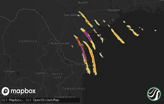
Hail Map in Texas on April 29, 2018
The weather event in Texas on April 29, 2018 includes Hail map. 5 states and 36 cities were impacted and suffered possible damage. The total estimated number of properties impacted is 3,317.

Hail
3,317
Estimated number of impacted properties by a 1.00" hail or larger933
Estimated number of impacted properties by a 1.75" hail or larger0
Estimated number of impacted properties by a 2.50" hail or largerStorm reports in Texas
Texas
| Date | Description |
|---|---|
| 04/29/20186:55 PM CDT | At the gage hotel in marathon |
| 04/29/20186:05 PM CDT | A local report indicates 1.75 inch wind near MARATHON |
| 04/29/20185:55 PM CDT | A local report indicates 1.00 inch wind near 5 WNW BOVINA |
| 04/29/20184:06 AM CDT | At 905 PM CDT, a severe thunderstorm was located near Bledsoe, or 16 miles southwest of Morton, moving east at 20 mph. HAZARD...60 mph wind gusts and quarter size hail. SOURCE...Radar indicated. IMPACT...Hail damage to vehicles is expected. Expect wind damage to roofs, siding, and trees. Locations impacted include... Bledsoe, Lehman and Whiteface. |
| 04/29/20182:48 AM CDT | At 748 PM CDT, a severe thunderstorm was located near Muleshoe, moving northeast at 25 mph. HAZARD...60 mph wind gusts and quarter size hail. SOURCE...Radar indicated. IMPACT...Hail damage to vehicles is expected. Expect wind damage to roofs, siding, and trees. Locations impacted include... Muleshoe, Earth, Lazbuddie, Progress and Springlake. |
| 04/29/20182:43 AM CDT | At 743 PM CDT, a severe thunderstorm was located near Alpine, moving east at 15 mph. HAZARD...60 mph wind gusts and quarter size hail. SOURCE...Radar indicated. IMPACT...Hail damage to vehicles is expected. Expect wind damage to roofs, siding, and trees. Locations impacted include... Alpine. |
| 04/29/20182:39 AM CDT | At 739 PM CDT, a severe thunderstorm was located over Muleshoe Wildlife Refuge, or 13 miles north of Morton, moving northeast at 20 mph. HAZARD...60 mph wind gusts and quarter size hail. SOURCE...Radar indicated. IMPACT...Hail damage to vehicles is expected. Expect wind damage to roofs, siding, and trees. Locations impacted include... Sudan, Amherst, Needmore, Enochs, Muleshoe Wildlife Refuge and Bula. |
| 04/29/20181:57 AM CDT | At 657 PM CDT, a severe thunderstorm was located near Marathon, or 29 miles southeast of Alpine, moving east at 15 mph. HAZARD...70 mph wind gusts and ping pong ball size hail. SOURCE...Public. IMPACT...People and animals outdoors will be injured. Expect hail damage to roofs, siding, windows, and vehicles. Expect considerable tree damage. Wind damage is also likely to mobile homes, roofs, and outbuildings. Locations impacted include... Marathon. |
| 04/29/20181:44 AM CDT | At 643 PM CDT, severe thunderstorms were located along a line extending from near Bovina to near West Camp, moving northeast at 20 mph. HAZARD...60 mph wind gusts and quarter size hail. SOURCE...Radar indicated. IMPACT...Hail damage to vehicles is expected. Expect wind damage to roofs, siding, and trees. Locations impacted include... Muleshoe, Friona, Bovina, Farwell, Lazbuddie, Progress, Oklahoma Lane, Lariat, West Camp and Black. |
| 04/29/20181:11 AM CDT | At 611 PM CDT, a severe thunderstorm was located over Marathon, or 27 miles east of Alpine, moving southeast at 10 mph. HAZARD...Tennis ball size hail and 70 mph wind gusts. SOURCE...Radar indicated. IMPACT...People and animals outdoors will be injured. Expect hail damage to roofs, siding, windows, and vehicles. Expect considerable tree damage. Wind damage is also likely to mobile homes, roofs, and outbuildings. Locations impacted include... Marathon. |
| 04/29/201812:48 AM CDT | At 548 PM MDT, a severe thunderstorm was located 7 miles northeast of Milnesand, or 26 miles west of Morton, moving northeast at 10 mph. HAZARD...60 mph wind gusts and half dollar size hail. SOURCE...Radar indicated. IMPACT...Hail damage to vehicles is expected. Expect wind damage to roofs, siding, and trees. Locations impacted include... Causey, Milnesand and Lingo. |
| 04/29/201812:45 AM CDT | At 544 PM CDT, a severe thunderstorm was located near Bovina, or 15 miles northeast of Clovis, moving northeast at 20 mph. HAZARD...60 mph wind gusts and half dollar size hail. SOURCE...Radar indicated. IMPACT...Hail damage to vehicles is expected. Expect wind damage to roofs, siding, and trees. Locations impacted include... Friona, Bovina, Farwell, Oklahoma Lane and Rhea. |
| 04/29/201812:33 AM CDT | At 532 PM CDT, a cluster of severe thunderstorms were located 9 miles north of Marathon, or 21 miles east of Alpine, moving southeast at 10 mph. HAZARD...60 mph wind gusts and quarter size hail. SOURCE...Radar indicated. IMPACT...Hail damage to vehicles is expected. Expect wind damage to roofs, siding, and trees. Locations impacted include... Alpine, Alpine-Casparis Municipal Airport and Marathon. |
| 04/28/201811:49 PM CDT | At 448 PM CDT, a severe thunderstorm was located near Farwell, or 11 miles northeast of Clovis, moving northeast at 20 mph. HAZARD...60 mph wind gusts and quarter size hail. SOURCE...Radar indicated. IMPACT...Hail damage to vehicles is expected. Expect wind damage to roofs, siding, and trees. Locations impacted include... Friona, Bovina, Farwell, Oklahoma Lane and Rhea. |
| 04/28/201811:41 PM CDT | At 440 PM CDT, a severe thunderstorm was located 5 miles south of Bellview, or 21 miles west of Friona, moving northeast at 20 mph. HAZARD...60 mph wind gusts and half dollar size hail. SOURCE...Radar indicated. IMPACT...Minor damage to roofs, siding, and trees is possible. Hail damage to vehicles is expected. Locations impacted include... Bootleg. |
| 04/28/201811:19 PM CDT | At 418 PM CDT, a cluster of severe thunderstorms were located 25 miles north of Marathon, or 26 miles northeast of Alpine, moving east at 10 mph. HAZARD...60 mph wind gusts and quarter size hail. SOURCE...Radar indicated. IMPACT...Hail damage to vehicles is expected. Expect wind damage to roofs, siding, and trees. This severe thunderstorm will remain over mainly rural areas of west central Pecos and northwestern Brewster Counties. |
| 04/28/201810:56 PM CDT | At 356 PM MDT, a severe thunderstorm was located 7 miles northeast of Clovis, moving northeast at 10 mph. HAZARD...Ping pong ball size hail and 60 mph wind gusts. SOURCE...Public. IMPACT...People and animals outdoors will be injured. Expect hail damage to roofs, siding, windows, and vehicles. Expect wind damage to roofs, siding, and trees. Locations impacted include... Clovis, Farwell, Texico and Pleasant Hill. |
| 04/28/201810:44 PM CDT | At 343 PM MDT, a severe thunderstorm was located near Bellview, or 23 miles west of Friona, moving northeast at 15 mph. HAZARD...Golf ball size hail and 60 mph wind gusts. SOURCE...Radar indicated. IMPACT...People and animals outdoors will be injured. Expect hail damage to roofs, siding, windows, and vehicles. Expect wind damage to roofs, siding, and trees. Locations impacted include... Broadview and Bellview. |
| 04/28/20189:57 PM CDT | At 257 PM MDT, a severe thunderstorm was located 8 miles south of Broadview, or 19 miles north of Clovis, moving northeast at 15 mph. HAZARD...60 mph wind gusts and quarter size hail. SOURCE...Radar indicated. IMPACT...Hail damage to vehicles is expected. Expect wind damage to roofs, siding, and trees. Locations impacted include... Broadview and Bellview. |
| 04/28/20188:50 PM CDT | A local report indicates 59 MPH wind near 2 NE DIMMITT |
| 04/28/20187:45 PM CDT | A local report indicates 1.75 inch wind near 2 NNE ALPINE |
| 04/28/20187:45 PM CDT | A local report indicates 1.00 inch wind near MULESHOE |
| 04/28/20187:35 PM CDT | A local report indicates 1.50 inch wind near 1 NE ALPINE |
All States Impacted by Hail Map on April 29, 2018
Cities Impacted by Hail Map on April 29, 2018
- Clovis, NM
- Fort Davis, TX
- Goodland, KS
- Johnson, KS
- Ulysses, KS
- Tatum, NM
- Texico, NM
- Farwell, TX
- Alpine, TX
- Amherst, TX
- Marathon, TX
- Earth, TX
- Muleshoe, TX
- Lame Deer, MT
- Ashland, MT
- Otter, MT
- Broadus, MT
- Volborg, MT
- Olive, MT
- Enochs, TX
- Bovina, TX
- Fieldton, TX
- Lakin, KS
- Fallon, MT
- Sudan, TX
- Broadview, NM
- Whiteface, TX
- Custer, SD
- Buffalo Gap, SD
- Tucumcari, NM
- Fairburn, SD
- Pringle, SD
- Hot Springs, SD
- Friona, TX
- Grady, NM
- Forsyth, MT


