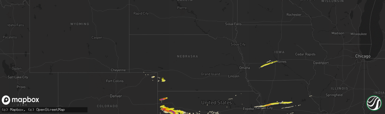
Hail Map in Nebraska on April 28, 2019
The weather event in Nebraska on April 28, 2019 includes Hail map. 6 states and 244 cities were impacted and suffered possible damage. The total estimated number of properties impacted is 279.
Want more than just the map?
Turn this storm into a full workflow.
- Owner + property data so you know who to knock
- OnDemand branded weather history reports to win the "did we even have hail?" argument
- RoofTrace estimate so reps stop guessing numbers at the door
Bought this map? Upgrade within 7 days and we'll credit the $230. (10-15 min setup call)
Hail
279
Estimated number of impacted properties by a 1.00" hail or larger0
Estimated number of impacted properties by a 1.75" hail or larger0
Estimated number of impacted properties by a 2.50" hail or largerStorm reports in Nebraska
Nebraska
| Date | Description |
|---|---|
| 04/28/20195:30 PM CDT | A local report indicates 1.00 inch wind near 1 NW IMPERIAL |
| 04/28/20195:28 PM CDT | A local report indicates 1.00 inch wind near 4 N IMPERIAL |
| 04/28/20195:24 PM CDT | Two exhaust fans were torn off the roof of a business in imperial. |
| 04/28/20195:24 PM CDT | Estimated wind gust of 60-70 mph. Reports 1 inch hail also. |
| 04/28/20195:24 PM CDT | Eight to 10 power poles were snapped off and 2 center pivots were overturned from thunderstorm wind gusts. |
| 04/28/20195:22 PM CDT | A local report indicates 1.00 inch wind near 6 NW IMPERIAL |
| 04/28/201912:22 AM CDT | At 522 PM CDT/422 PM MDT/, a severe thunderstorm was located 7 miles north of Imperial, moving east at 35 mph. HAZARD...60 mph wind gusts and quarter size hail. SOURCE...Radar indicated. IMPACT...Hail damage to vehicles is expected. Expect wind damage to roofs, siding, and trees. Locations impacted include... Imperial, Wauneta, Enders, Enders Reservoir State Recreation Area, Champion, Center Dam Campground, Wanamaker State Wildfire Management Area, Area A Campground and Church Grove Campground.This includes Highway 61 between mile markers 28 and 56. |
| 04/27/201911:02 PM CDT | At 402 PM MDT, a severe thunderstorm was located 8 miles north of Eckley, or 14 miles northwest of Wray, moving east at 20 mph. HAZARD...60 mph wind gusts and half dollar size hail. SOURCE...Radar indicated. IMPACT...Hail damage to vehicles is expected. Expect wind damage to roofs, siding, and trees. Locations impacted include... Alvin and Wauneta. This includes Highway 385 between mile markers 249 and 266. |
| 04/27/201910:48 PM CDT | At 348 PM MDT, a severe thunderstorm was located near Venango, or 16 miles southwest of Grant, moving east at 30 mph. HAZARD...60 mph wind gusts and penny size hail. SOURCE...Radar indicated. IMPACT...Expect damage to roofs, siding, and trees. Locations impacted include... Imperial, Venango, Lamar, Champion, Chase, Brandon and Wanamaker State Wildfire Management Area.This includes Highway 61 between mile markers 41 and 60. |
| 04/27/201910:11 PM CDT | At 309 PM MDT, a severe thunderstorm was located near Sixteen-Mile Corner, or 13 miles north of Holyoke, moving east southeast at 20 mph. HAZARD...60 mph wind gusts and nickel size hail. SOURCE...Radar indicated. IMPACT...Expect damage to roofs, siding, and trees. Locations impacted include... Holyoke, Paoli, Amherst, Pleasant Valley and Sixteen-Mile Corner. |
Cities Impacted by Hail Map on April 28, 2019
- Ness City, KS
- Park, KS
- Gove, KS
- Quinter, KS
- Rush Center, KS
- Topeka, KS
- Maple Hill, KS
- Whitewater, KS
- Newton, KS
- Halstead, KS
- Hillsboro, KS
- Bushton, KS
- Scott City, KS
- Healy, KS
- Roxbury, KS
- Canton, KS
- Galva, KS
- Gypsum, KS
- Cedar Point, KS
- Elmdale, KS
- Cottonwood Falls, KS
- Norborne, MO
- Burrton, KS
- Sedgwick, KS
- Hutchinson, KS
- Bazine, KS
- La Crosse, KS
- Alexander, KS
- Cheney, KS
- Sterling, KS
- Stafford, KS
- Dighton, KS
- Ellinwood, KS
- Brownell, KS
- McCracken, KS
- Rozel, KS
- Alden, KS
- Nickerson, KS
- Great Bend, KS
- Bentley, KS
- Ransom, KS
- Albert, KS
- Otis, KS
- Haven, KS
- South Hutchinson, KS
- Pretty Prairie, KS
- Hudson, KS
- Abbyville, KS
- Raymond, KS
- Beeler, KS
- Colwich, KS
- Mount Hope, KS
- Maize, KS
- Sylvia, KS
- Mcpherson, KS
- Arnold, KS
- Larned, KS
- Partridge, KS
- Pawnee Rock, KS
- Nekoma, KS
- Utica, KS
- Buhler, KS
- Plevna, KS
- St John, KS
- Inman, KS
- Andale, KS
- Carrollton, MO
- Salisbury, MO
- Keytesville, MO
- Clifton Hill, MO
- Brunswick, MO
- Slater, MO
- Dalton, MO
- De Witt, MO
- Miami, MO
- Imperial, NE
- Strong City, KS
- Fayette, MO
- Edson, KS
- Saint Francis, KS
- Goodland, KS
- Sharon Springs, KS
- Liberty, MO
- Hardin, MO
- Richmond, MO
- Kansas City, MO
- Riverside, MO
- Excelsior Springs, MO
- Rayville, MO
- Orrick, MO
- Kansas City, KS
- Missouri City, MO
- Independence, MO
- Winona, KS
- Grinnell, KS
- Crook, CO
- Venango, NE
- Burdick, KS
- Bird City, KS
- Wilson, KS
- Sylvan Grove, KS
- Hays, KS
- Durham, KS
- Lehigh, KS
- Tampa, KS
- Lindsborg, KS
- Marquette, KS
- Fontanelle, IA
- Earlham, IA
- Bridgewater, IA
- Stuart, IA
- Casey, IA
- Menlo, IA
- Anita, IA
- Dexter, IA
- Massena, IA
- Greenfield, IA
- Monument, KS
- Hull, IL
- Basehor, KS
- Tonganoxie, KS
- Leavenworth, KS
- McLouth, KS
- Burdett, KS
- Jamestown, MO
- Marion, KS
- Madison, KS
- Collyer, KS
- Florence, KS
- Wilsey, KS
- Walton, KS
- Hartford, KS
- Little River, KS
- Arlington, KS
- Council Grove, KS
- Elbing, KS
- Kechi, KS
- North Newton, KS
- Windom, KS
- Americus, KS
- Moundridge, KS
- Peabody, KS
- Burns, KS
- Goessel, KS
- Valley Center, KS
- Hesston, KS
- Matfield Green, KS
- Wichita, KS
- Lyons, KS
- Oakley, KS
- Olpe, KS
- Turon, KS
- Wallace, KS
- Emporia, KS
- Sturgeon, MO
- Clark, MO
- West Des Moines, IA
- Waukee, IA
- Claflin, KS
- Hoisington, KS
- Ellsworth, KS
- Otterville, MO
- Bunceton, MO
- Dorrance, KS
- Brookville, KS
- Baileyville, KS
- Wakefield, KS
- Abilene, KS
- Longford, KS
- Julesburg, CO
- Sedgwick, CO
- Haxtun, CO
- Holyoke, CO
- Ovid, CO
- Champion, NE
- Geneseo, KS
- Kanopolis, KS
- Chase, KS
- Lorraine, KS
- Holyrood, KS
- Winterset, IA
- Van Meter, IA
- De Soto, IA
- Adel, IA
- Prairie Home, MO
- Centralia, MO
- Russell, KS
- Ellis, KS
- McDonald, KS
- Hannibal, MO
- Weskan, KS
- Garden Plain, KS
- Redfield, IA
- Shawnee, KS
- Marshall, MO
- Victoria, KS
- Pfeifer, KS
- Smithton, MO
- Sedalia, MO
- Lucas, KS
- Lincoln, KS
- Princeton, KS
- Ottawa, KS
- Rantoul, KS
- Hope, KS
- Herington, KS
- Barnes, KS
- Wakeeney, KS
- Ogallah, KS
- Lincolnville, KS
- Lost Springs, KS
- Cumberland, IA
- El Dorado, KS
- Glasgow, MO
- Nelson, MO
- Franklin, MO
- Gorham, KS
- Saint Marys, KS
- Emmett, KS
- Adair, IA
- Bison, KS
- Salina, KS
- Bosworth, MO
- Olmitz, KS
- Hamilton, KS
- Sweet Springs, MO
- Palmer, KS
- Enders, NE
- Huntsville, MO
- Potwin, KS
- Sidney, NE
- Greenleaf, KS
- Green, KS
- Marysville, KS
- Home, KS
- Cassoday, KS
- Grant, NE
- Jetmore, KS
- Cimarron, KS
- Hanston, KS
- Clive, IA
- Windsor Heights, IA
- Urbandale, IA
- Des Moines, IA


