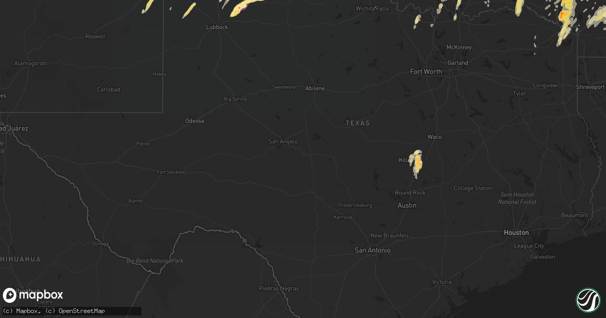
Hail Map in Texas on April 28, 2016
Get this storm
April 28 map
$229
one time, instant access
Download today. No call, no setup
Keep the $229
Bought the map and want the full workflow? Apply the entire $229 to a subscription within 7 days. None of it is wasted.
Every map, not just this one
This buys you this map. Subscription and you get every map we run, in the markets you choose from a few cities to whole states to nationwide. Plus real-time alerts the moment a storm fires.
Contact data
Name, contact info, occupancy, even credit band for addresses in the footprint. You go from where it hit to who to call.
Become the source they trust
Unlimited branding weather history reports on demand. You already have the documented answer ready for the property owner, and you are the one who showed up with it.
Property data and RoofTrace estimates
Pull up any address you have got, its value and the exact code rules for that jurisdiction, straight from One Click Code. Then RoofTrace estimates the squares, pitch, and roof value, priced the way you price.
Storm reports in Texas
Texas
| Date | Description |
|---|---|
| 04/28/20166:36 PM CDT | Ping pong ball size hail just south of sunray with hail accumulating on roadways. |
| 04/28/20166:25 PM CDT | Lots of tree limbs down... Wind gusts estimated to be around 60 mph. |
| 04/28/20166:25 PM CDT | A local report indicates 1.00 inch wind near 3 S ESTELLINE |
| 04/28/20166:20 PM CDT | Snapped power poles at fm1060 and county road i |
| 04/28/20166:19 PM CDT | Golf ball size hail reported just south of dumas with significantly reduced visibility and strong winds. |
| 04/28/20165:51 PM CDT | A local report indicates 2.00 inch wind near 3 E FLOYDADA |
| 04/28/20165:47 PM CDT | A local report indicates 1.50 inch wind near 2 E FLOYDADA |
| 04/28/20165:45 PM CDT | A local report indicates 1.75 inch wind near 7 SSW FLOYDADA |
| 04/28/20165:43 PM CDT | A local report indicates 1.75 inch wind near 5 S FLOYDADA |
| 04/28/20165:32 PM CDT | A local report indicates 2.00 inch wind near 6 SSW FLOYDADA |
| 04/28/20165:30 PM CDT | Lots of broken windows... Windshields... Lots of broken tree limbs |
| 04/28/20165:30 PM CDT | Lots of broken windows... Windshields... Lots of broken tree limbs |
| 04/28/20165:24 PM CDT | A local report indicates 1.00 inch wind near TURKEY |
| 04/28/20165:23 PM CDT | Lots of hail from pea size up to golf ball size hail reported on highway 385. |
| 04/28/20165:16 PM CDT | A local report indicates 1.75 inch wind near CAPROCK CANYON SP |
| 04/28/20165:15 PM CDT | Lasted for 20 minutes |
| 04/28/20165:14 PM CDT | A local report indicates 2.00 inch wind near 3 N CONE |
| 04/28/20165:10 PM CDT | Dents in equipment... Minor damage |
| 04/28/20165:08 PM CDT | A local report indicates 1.75 inch wind near QUITAQUE |
| 04/28/20164:40 PM CDT | Media storm chaser - report near south plains |
| 04/28/20164:25 PM CDT | A local report indicates 1.50 inch wind near N LOCKNEY |
| 04/28/20164:24 PM CDT | Dime to quarter-sized hail falling in lockney |
| 04/28/20162:28 AM CDT | Quarter size hail reported at red river army dept fire dept. |
| 04/28/20162:10 AM CDT | Quarter size hail in st. Jo |
| 04/28/20161:16 AM CDT | A local report indicates 1.00 inch wind near TEXHOMA |
| 04/28/201612:54 AM CDT | Power poles blown down |
| 04/28/201612:49 AM CDT | Also half inch hail. No damage observed |
| 04/27/20169:52 PM CDT | A local report indicates 61 MPH wind near 7 ESE LORA |
| 04/27/20169:39 PM CDT | Half dollar size hail on s kiowa street near hwy 60 in miami. |
| 04/27/20169:34 PM CDT | Hail up to golf ball on highway 60 in miami. |
| 04/27/20169:15 PM CDT | Golfball size hail reported west of belton high school. |
| 04/27/20169:10 PM CDT | Half dollar size hail reported 2 miles sw of belton. |
| 04/27/20169:01 PM CDT | Quarter size hail reported in morgan's point resort. |
| 04/27/20168:52 PM CDT | 2 inch size hail reported west of belton near stillhouse hollow lake. |
| 04/27/20168:49 PM CDT | Half dollar size hail reported in belton |
| 04/27/20168:42 PM CDT | Quarter size hail reported in south side of belton... Half a mile north of expo center |
| 04/27/20168:34 PM CDT | 4 inch branches brought down. |
| 04/27/20168:30 PM CDT | A local report indicates 1.75 inch wind near 2 E BORGER |
| 04/27/20168:29 PM CDT | Two inch hail busted windshield on highway 70 south of perryton. |
| 04/27/20168:28 PM CDT | A local report indicates 1.00 inch wind near 3 NE BORGER |
| 04/27/20168:20 PM CDT | A local report indicates 1.00 inch wind near 2 W BORGER |
| 04/27/20168:09 PM CDT | In buena vista |
| 04/27/20168:08 PM CDT | A local report indicates 1.75 inch wind near FRITCH |
| 04/27/20168:05 PM CDT | 4 inch diameter tree branch broken due to thunderstorm wind and fell on power line and is causing sparks |
| 04/27/20168:03 PM CDT | Dime to quarter size hail beginning to cover road in fritch with moderate rain. No flooding noticed at this time with it being more hail than rain. |
| 04/27/20168:01 PM CDT | Quarter size hail reported south of fritch. Report relayed by broadcast media. |
| 04/27/20167:59 PM CDT | A local report indicates 1.25 inch wind near FRITCH |
| 04/27/20167:58 PM CDT | At lake meredith harbor |
| 04/27/20167:55 PM CDT | A local report indicates 1.00 inch wind near 1 S FRITCH |
| 04/27/20167:51 PM CDT | At double diamond |
| 04/27/20167:37 PM CDT | A local report indicates 1.75 inch wind near STINNETT |
| 04/27/20167:33 PM CDT | A local report indicates 1.75 inch wind near 4 N STINNETT |
| 04/27/20167:30 PM CDT | A local report indicates 1.00 inch wind near CEE VEE |
| 04/27/20167:13 PM CDT | Half dollar size hail reported south of masterson. |
All States Impacted by Hail Map on April 28, 2016
Cities Impacted by Hail Map on April 28, 2016
- Amarillo, TX
- Mount Olive, NC
- Newton Grove, NC
- Four Oaks, NC
- Raton, NM
- Porum, OK
- Plains, KS
- Belhaven, NC
- Scranton, NC
- Clayton, NM
- Fritch, TX
- Borger, TX
- Turkey, TX
- Quitaque, TX
- Lockney, TX
- Childress, TX
- Silverton, TX
- Dumas, TX
- Sunray, TX
- Channing, TX
- Stinnett, TX
- Spearman, TX
- Rattan, OK
- Fort Towson, OK
- Long Bottom, OH
- Reedsville, OH
- Belleville, WV
- Ravenswood, WV
- Washington, AR
- Fulton, AR
- Hope, AR
- Chatham, VA
- Blairs, VA
- Mebane, NC
- Burlington, NC
- Liberty, NC
- Pittsboro, NC
- Snow Camp, NC
- Whitsett, NC
- Chapel Hill, NC
- Graham, NC
- Julian, NC
- Germanton, NC
- Pinnacle, NC
- King, NC
- Rushville, IN
- Palestine, WV
- Elizabeth, WV
- Alton, VA
- Mcalester, OK
- Faison, NC
- Clinton, NC
- Comanche, OK
- Roy, NM
- Idabel, OK
- Haworth, OK
- Gibsonville, NC
- Greensboro, NC
- Browns Summit, NC
- McLeansville, NC
- Denison, TX
- Sherman, TX
- Pottsboro, TX
- Belton, TX
- Rockbridge, OH
- Logan, OH
- Spring Hope, NC
- Louisburg, NC
- Elida, NM
- Flemington, WV
- Grafton, WV
- Bridgeport, WV
- Jackson, AL
- Hollis, OK
- Gould, OK
- Hereford, TX
- Ocean Springs, MS
- Perryton, TX
- Hope Mills, NC
- Fayetteville, NC
- Lawsonville, NC
- Danbury, NC
- Westfield, NC
- Sandy Ridge, NC
- Lockesburg, AR
- Miami, TX
- South Bloomingville, OH
- Texhoma, OK
- Stratford, TX
- Dodson, TX
- Mangum, OK
- Memphis, TX
- Duke, OK
- Marlow, OK
- Stratford, OK
- Ada, OK
- Roff, OK
- Farwell, TX
- South Salem, OH
- Bainbridge, OH
- Greenfield, OH
- Calypso, NC
- Dunn, NC
- Walnut Cove, NC
- Madison, NC
- Claudville, VA
- Mount Airy, NC
- Rogers, NM
- Portales, NM
- Pep, NM
- Clovis, NM
- Texico, NM
- Moatsville, WV
- Gainesville, TX
- Summerfield, NC
- Stewart, OH
- Athens, OH
- Amesville, OH
- Millfield, OH
- Beverly, WV
- Mabie, WV
- Morse, TX
- Dalhart, TX
- Waynesboro, GA
- Girard, GA
- Summerville, SC
- North Charleston, SC
- Charleston, SC
- Ravenel, SC
- Johns Island, SC
- Tarboro, NC
- Grove Hill, AL
- Leroy, AL
- Whatley, AL
- Gainestown, AL
- Franklin, AL
- Gate, OK
- Rosston, OK
- Rosston, AR
- Buckner, AR
- Brooklyn, MS
- Beaver, OK
- Laverne, OK
- Forgan, OK
- Cary, NC
- Raleigh, NC
- Leesburg, OH
- Wilmington, OH
- Jamestown, OH
- Xenia, OH
- Caney, OK
- Atoka, OK
- Pilot Mountain, NC
- Battleboro, NC
- Whitakers, NC
- Felt, OK
- Marietta, OH
- Prescott, AR
- Walker, WV
- Winfield, WV
- Hurricane, WV
- Suffolk, VA
- Paducah, TX
- Cee Vee, TX
- Godwin, NC
- Wade, NC
- Autryville, NC
- Sulphur, OK
- Mount Ida, AR
- Bonnerdale, AR
- Norman, AR
- Glenwood, AR
- Caddo Gap, AR
- Langley, AR
- Apex, NC
- Holly Springs, NC
- South Boston, VA
- Olin, NC
- Mena, AR
- De Queen, AR
- Dierks, AR
- Horatio, AR
- Umpire, AR
- Newhope, AR
- Guymon, OK
- Tallmansville, WV
- Buckhannon, WV
- Coalton, WV
- Vernon Hill, VA
- Sutherlin, VA
- Ringgold, VA
- Keeling, VA
- Halifax, VA
- Dillwyn, VA
- Buckingham, VA
- Cumberland, VA
- Farmville, VA
- Linden, NC
- Lillington, NC
- Bunnlevel, NC
- Spring Lake, NC
- Erwin, NC
- Homer, IN
- Glenwood, IN
- Manilla, IN
- Arlington, IN
- Matador, TX
- Statesville, NC
- Mocksville, NC
- Harmony, NC
- Penhook, VA
- Danville, VA
- Glade Hill, VA
- Roxboro, NC
- Callands, VA
- Rocky Mount, VA
- Virgilina, VA
- Dry Fork, VA
- Marietta, OK
- Whitesboro, TX
- Georgetown, SC
- Jamestown, SC
- Amistad, NM
- Mosquero, NM
- Duncan, OK
- Saint Jo, TX
- Gatesville, TX
- Davisville, WV
- Parkersburg, WV
- Mineral Wells, WV
- Glouster, OH
- Buchtel, OH
- Union Furnace, OH
- Cutler, OH
- Laurelville, OH
- Nelsonville, OH
- Haydenville, OH
- Fort Hood, TX
- Temple, TX
- Friona, TX
- Panhandle, TX
- Masterson, TX
- Hartley, TX
- Canadian, TX
- Vega, TX
- Skellytown, TX
- Pampa, TX
- Floydada, TX
- Murfreesboro, AR
- Middlesex, NC
- Bailey, NC
- Okolona, AR
- Gurdon, AR
- Blevins, AR
- Emmet, AR
- Kenly, NC
- Soper, OK
- Antlers, OK
- Turpin, OK
- Balko, OK
- Smithville, OK
- Hatfield, AR
- Stringtown, OK
- Daisy, OK
- Petroleum, WV
- Nashoba, OK
- Broken Bow, OK
- Eagletown, OK
- Allen, OK
- Calvin, OK
- Wildorado, TX
- New Hill, NC
- Wake Forest, NC
- Youngsville, NC
- Pleasant Garden, NC
- Climax, NC
- Garner, NC
- Fuquay Varina, NC
- Morrisville, NC
- Bunn, NC
- Rolesville, NC
- Wendell, NC
- Willow Spring, NC
- Moncure, NC
- Zebulon, NC
- Lane, OK
- Lorenzo, TX
- Moody, TX
- Forestburg, TX
- Plainview, TX
- Hale Center, TX
- Clayton, NC
- Benson, NC
- Washington, WV
- Macfarlan, WV
- Little Hocking, OH
- Munday, WV
- Boise City, OK
- Lamar, OK
- Sanford, NC
- Enfield, NC
- Montrose, WV
- Williamston, NC
- Glady, WV
- Canyon, TX
- Bluff City, AR
- Chidester, AR
- Smithfield, NC
- Semora, NC
- Lexington, NC
- Fairfield, NC
- Coolville, OH
- Brohard, WV
- Smithville, WV
- Vincent, OH
- Belpre, OH
- Booker, TX
- Ralls, TX
- Tuskahoma, OK
- Clayton, OK
- Happy, TX
- Claude, TX
- Holdenville, OK
- Texline, TX
- Mill Creek, OK
- Madill, OK
- Tishomingo, OK
- Mannsville, OK
- Atwood, OK
- Creswell, NC
- Watson, OK
- Le Roy, WV
- Pittsburg, TX
- Pauls Valley, OK
- Fowler, KS
- Meade, KS
- Reidsville, NC
- Milburn, OK
- Coleman, OK
- New Boston, TX
- Ashdown, AR
- Hooks, TX
- Stuart, OK
- Andrews, SC
- Elon, NC
- Winthrop, AR
- Foreman, AR
- Grady, AL
- Vidalia, GA
- Maud, TX
- Milton, NC
- Paoli, OK
- Jetersville, VA
- Amelia Court House, VA
- Salado, TX
- Chesapeake, VA
- Portsmouth, VA
- Highland Home, AL
- Lapine, AL
- Goodwell, OK
- Gruver, TX
- Texhoma, TX
- Goose Creek, SC
- Ladson, SC
- Selma, NC
- Hennepin, OK
- Elmore City, OK
- Tussy, OK
- Bennington, OK
- Cove, AR
- Blossom, TX
- Snow, OK
- Sawyer, OK
- Detroit, TX
- Arthur City, TX
- Paris, TX
- Hugo, OK
- Knightdale, NC
- Boswell, OK
- Nashville, NC
- Bartlett, TX
- Vandervoort, AR
- Pine Hall, NC
- Nolanville, TX
- Killeen, TX
- Harker Heights, TX
- Picayune, MS
- Perkinston, MS
- Eufaula, OK
- Kernersville, NC
- Walkertown, NC
- Stokesdale, NC
- Belews Creek, NC
- Hanna, OK
- Dustin, OK
- Littlefield, TX
- Amherst, TX
- Bovina, TX
- Tulia, TX
- Thornton, WV
- Tunnelton, WV
- Angier, NC
- Ardmore, OK
- Konawa, OK
- Swanquarter, NC
- Big Springs, WV
- Shinnston, WV
- Salemburg, NC
- Roseboro, NC
- Sedan, NM
- Texarkana, TX
- Kirby, AR
- Naples, TX
- Douglassville, TX
- Alleene, AR
- Marietta, TX
- Royal, AR
- Gillham, AR
- Nashville, AR
- Wilton, AR
- Simms, TX
- Amity, AR
- Grantsville, WV
- Arnoldsburg, WV
- Mount Zion, WV
- Creston, WV
- Fort Bragg, NC
- Orlando, FL
- Coats, NC
- Sanderson, FL
- Kress, TX
- New Plymouth, OH
- Guysville, OH
- Kissimmee, FL
- Mead, OK
- Kingston, OK
- Mineral Springs, AR
- Creola, OH
- Jarrell, TX
- Kenefic, OK
- Durant, OK
- Lavaca, AR
- Kismet, KS
- Arkadelphia, AR
- Creedmoor, NC
- Mount Pleasant, TX
- Lelia Lake, TX
- Hedley, TX
- Spring Valley, OH
- Dayton, OH
- Bellbrook, OH
- Oxford, NC
- Texarkana, AR
- Carriere, MS
- Durham, NC
- Saint Cloud, FL
- Ararat, NC
- Circleville, OH
- Chesterhill, OH
- Amanda, OH
- Big Bend, WV
- Spencer, WV
- Green Pond, SC
- Roper, NC
- New Augusta, MS
- Henderson, NV
- Saint Martinville, LA
- Ozan, AR
- McCaskill, AR
- Elm City, NC
- Wilson, NC
- Broadway, NC
- Cameron, NC
- Troy, AL
- Byars, OK
- Holly, CO
- Sudan, TX
- Foster, OK
- Lindsay, OK
- Long Beach, MS
- Alma, GA
- Hazlehurst, GA
- Taylorsville, NC
- Moravian Falls, NC
- Pep, TX
- Stonewall, OK
- Levelland, TX
- King William, VA
- Manquin, VA
- Rockport, WV
- Rocky Mount, NC
- Grant, OK
- Sabina, OH
- Port William, OH
- Lyons, GA
- Haw River, NC
- Sandyville, WV
- Virginia Beach, VA
- Lumberport, WV
- Middlebourne, WV
- Opelousas, LA
- Como, NC
- Gates, NC
- Stuart, VA
- Muenster, TX
- Goldsboro, NC
- Java, VA
- Gretna, VA
- Sasakwa, OK
- Greenville, NC
- Fountain, NC
- Macclesfield, NC
- Petersburg, TX
- Henderson, NC
- Norfolk, VA
- Granada, CO
- Gulfport, MS
- Ogden, AR
- Caddo, OK
- Talco, TX
- Summerfield, TX
- Muleshoe, TX
- Castalia, NC
- Theriot, LA
- Reedy, WV
- Raeford, NC
- Wichita Falls, TX
- Waverly, WV
- Elkins, WV
- Friendly, WV
- Harrisville, WV
- Union Hall, VA
- Ararat, VA


