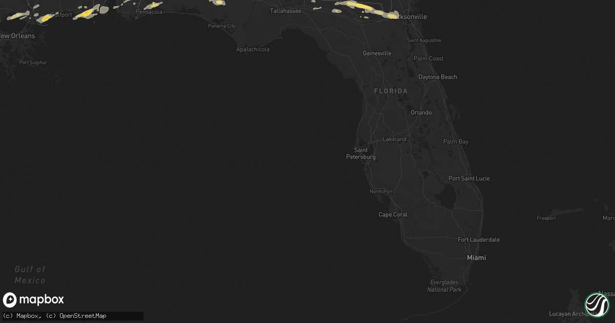
Hail Map in Florida on April 25, 2015
Get this storm
April 25 map
$229
one time, instant access
Download today. No call, no setup
Keep the $229
Bought the map and want the full workflow? Apply the entire $229 to a subscription within 7 days. None of it is wasted.
Every map, not just this one
This buys you this map. Subscription and you get every map we run, in the markets you choose from a few cities to whole states to nationwide. Plus real-time alerts the moment a storm fires.
Contact data
Name, contact info, occupancy, even credit band for addresses in the footprint. You go from where it hit to who to call.
Become the source they trust
Unlimited branding weather history reports on demand. You already have the documented answer ready for the property owner, and you are the one who showed up with it.
Property data and RoofTrace estimates
Pull up any address you have got, its value and the exact code rules for that jurisdiction, straight from One Click Code. Then RoofTrace estimates the squares, pitch, and roof value, priced the way you price.
Storm reports in Florida
Florida
| Date | Description |
|---|---|
| 04/25/20155:06 PM CDT | Part of gas station awning torn off. Numerous large trees down. |
| 04/25/20155:05 PM CDT | Estimated 70 mph wind gust along hodges blvd north of butler blvd. Numerous large tree limbs down. |
| 04/25/20155:03 PM CDT | Numerous trees down. Patio roof ripped off in southside jacksonville. |
| 04/25/20155:00 PM CDT | In the area around king lake road...pittman road...and paxton...there are 5 large oak trees down...1 pecan tree down...and 4 power poles snapped. Time estimated. |
| 04/25/20155:00 PM CDT | Couple of trees down near caryville |
| 04/25/20154:57 PM CDT | Media reporting trees and transformers down near san jose blvd. And emerson. |
| 04/25/20154:52 PM CDT | An ef-1 tornado with maximum winds of 104 mph and a path width of 300 yards developed along the eastern shore of the st. Johns river and moved ese through the southside |
| 04/25/20154:46 PM CDT | Trees down and quarter size hail reported on normandy blvd. |
| 04/25/20154:46 PM CDT | Trees downed blocking south bound traffic on hwy 331 near pittman road. |
| 04/25/20154:42 PM CDT | Large tree down on pipers landing road at kings lake blvd. |
| 04/25/20154:24 PM CDT | Tree down on power line at deer creek lane and cr23a. |
| 04/25/20154:24 PM CDT | Tree down on bob burnsed road. |
| 04/25/20154:24 PM CDT | Tree down on cr 250. |
| 04/25/20154:24 PM CDT | Carport blown on to power lines on frenda rd. |
| 04/25/20154:13 PM CDT | Asos a whiting field naval air station recorded a wind gust of 58mph. |
| 04/25/20154:05 PM CDT | Pensacola asos recorded a 61mph wind gust. |
| 04/25/201511:40 AM CDT | Delayed report from april 25th storm of 10 to 15 trees down laying in a ditch off of i-10 in eastern madison county |
| 04/25/20158:20 AM CDT | Tree down on basswood road around a mile away from hwy 71 north. |
| 04/25/20157:58 AM CDT | Trees down on hwy 77 s of the interstate at peel rd and at orange hill rd and hays lane. |
| 04/25/20157:17 AM CDT | Power lines down on road in de funiak springs with traffic being re-routed. Relayed by wmbb-tv meteorologist. |
All States Impacted by Hail Map on April 25, 2015
Cities Impacted by Hail Map on April 25, 2015
- Linefork, KY
- Hallie, KY
- Greenville, FL
- Diamondhead, MS
- Waveland, MS
- Bay Saint Louis, MS
- Bryceville, FL
- Jacksonville, FL
- Lake City, FL
- White Springs, FL
- Jasper, FL
- Knoxville, TN
- Fort Gaines, GA
- Eufaula, AL
- Abbeville, AL
- Georgetown, GA
- Morris, GA
- Oelrichs, SD
- Chadron, NE
- Fairhope, AL
- Coal City, WV
- Princewick, WV
- McKee, KY
- Mount Vernon, KY
- Lancaster, KY
- Harrodsburg, KY
- Sandgap, KY
- Danville, KY
- Perryville, KY
- Stanford, KY
- Paint Lick, KY
- Berea, KY
- Brodhead, KY
- Crab Orchard, KY
- Lisco, NE
- Cochran, GA
- Dry Branch, GA
- Moss Point, MS
- Gautier, MS
- Bardstown, KY
- Bloomfield, KY
- Springfield, KY
- Willisburg, KY
- Dudley, GA
- Dublin, GA
- Rentz, GA
- Dexter, GA
- Equality, IL
- Raleigh, IL
- Ridgway, IL
- Eldorado, IL
- Sebree, KY
- Robards, KY
- Partridge, KY
- Whitesburg, KY
- Ocean Springs, MS
- Pascagoula, MS
- Milledgeville, GA
- Sparta, GA
- Hilton Head Island, SC
- Bluffton, SC
- Clio, AL
- Louisville, AL
- Clayton, AL
- Sweeny, TX
- Van Vleck, TX
- Coden, AL
- Bayou La Batre, AL
- Theodore, AL
- Irvington, AL
- Edna, TX
- East Dublin, GA
- Utica, KY
- Calhoun, KY
- Owensboro, KY
- Ponchatoula, LA
- Saint Amant, LA
- Maurepas, LA
- Springfield, LA
- Metter, GA
- Claxton, GA
- Register, GA
- Wooton, KY
- Fort Knox, KY
- Happy, KY
- Letcher, KY
- Mackville, KY
- Tyner, KY
- Sassafras, KY
- Busy, KY
- Burgin, KY
- Bonnyman, KY
- Eolia, KY
- Gays Creek, KY
- Buckhorn, KY
- Thousandsticks, KY
- Shepherdsville, KY
- Guston, KY
- Mistletoe, KY
- Vincent, KY
- Scuddy, KY
- Smilax, KY
- Viper, KY
- Boston, KY
- Vicco, KY
- Richmond, KY
- Chavies, KY
- Ekron, KY
- Coxs Creek, KY
- Bulan, KY
- Clermont, KY
- Ricetown, KY
- West Point, KY
- Combs, KY
- Cornettsville, KY
- Brandenburg, KY
- Lebanon Junction, KY
- Oneida, KY
- Hazard, KY
- Orlando, KY
- Irvine, KY
- Muldraugh, KY
- Krypton, KY
- Blackey, KY
- Roxana, KY
- Jeff, KY
- Booneville, KY
- Appalachia, VA
- Laconia, IN
- Big Creek, KY
- Hyden, KY
- Pembroke, GA
- Wise, VA
- Norton, VA
- Loretto, KY
- Lebanon, KY
- Bell City, LA
- Lake Arthur, LA
- Lacassine, LA
- Cameron, LA
- Iowa, LA
- Lake Charles, LA
- Welsh, LA
- Mauk, GA
- Junction City, GA
- Fort Valley, GA
- Reynolds, GA
- Butler, GA
- Simpsonville, KY
- Shelbyville, KY
- Blessing, TX
- Louise, TX
- Midfield, TX
- Bay City, TX
- Markham, TX
- Ellabell, GA
- Hitchcock, TX
- Knoxville, GA
- Macon, GA
- Byron, GA
- Roberta, GA
- Lizella, GA
- Cleveland, VA
- Honaker, VA
- Galatia, IL
- Pledger, TX
- Boling, TX
- Wharton, TX
- West Columbia, TX
- El Campo, TX
- Damon, TX
- Banks, AL
- Troy, AL
- Midway, AL
- Brenton, WV
- Pineville, WV
- Harrison, NE
- Chester, GA
- Danville, GA
- Swainsboro, GA
- Perry, GA
- Warner Robins, GA
- Bonaire, GA
- Lyons, GA
- Rockledge, GA
- Tarrytown, GA
- Soperton, GA
- Cobbtown, GA
- Kathleen, GA
- Montrose, GA
- Box Springs, GA
- Collins, GA
- Marshallville, GA
- Talbotton, GA
- Vidalia, GA
- Jeffersonville, GA
- Daphne, AL
- Silverhill, AL
- Loxley, AL
- Lebanon, VA
- Rosedale, VA
- Saltville, VA
- Little River, AL
- Jackson, AL
- Macedonia, IL
- Uniontown, KY
- Harrisburg, IL
- Junction, IL
- Omaha, IL
- Thompsonville, IL
- Morganfield, KY
- Shawneetown, IL
- Waverly, KY
- Louisville, KY
- Lolita, TX
- Grand Bay, AL
- Glen Fork, WV
- Cedar Bluff, VA
- Sidney, NE
- Lodgepole, NE
- Kaplan, LA
- Hardeeville, SC
- Golconda, IL
- Eddyville, IL
- Simpson, IL
- Cuthbert, GA
- Shellman, GA
- Fredonia, KY
- Princeton, KY
- Nortonville, KY
- Crofton, KY
- Dawson Springs, KY
- Saint Charles, KY
- Marion, KY
- North Spring, WV
- Iaeger, WV
- Hanover, WV
- La Marque, TX
- Texas City, TX
- Galveston, TX
- Leesburg, GA
- Slidell, LA
- Minter, AL
- Egan, LA
- Morse, LA
- Meadowview, VA
- Peetz, CO
- Mandeville, LA
- Pearlington, MS
- Pass Christian, MS
- Lee, FL
- Macclenny, FL
- Saint George, GA
- Hampton, KY
- Salem, KY
- Burna, KY
- Iliff, CO
- Crook, CO
- Fitzgerald, GA
- Clintwood, VA
- Coeburn, VA
- Marion, VA
- McClure, VA
- Dante, VA
- Nora, VA
- Clinchco, VA
- Davenport, VA
- Castlewood, VA
- Pound, VA
- Glade Spring, VA
- Cordele, GA
- De Soto, GA
- Leslie, GA
- Jackson, KY
- Whick, KY
- Milton, FL
- Irvington, KY
- Rayne, LA
- Crowley, LA
- Crandall, IN
- Georgetown, IN
- Corydon, IN
- Richmond, TX
- Needville, TX
- Abbeville, LA
- White Castle, LA
- Slab Fork, WV
- Rhodell, WV
- Lost Creek, KY
- Iota, LA
- Branch, LA
- Lacombe, LA
- Pearl River, LA
- Uriah, AL
- Brush, CO
- Manchester, KY
- Angleton, TX
- Boston, GA
- Maceo, KY
- Philpot, KY
- Lewisport, KY
- Missouri City, TX
- Rosharon, TX
- La Place, LA
- Shorterville, AL
- Leakesville, MS
- Vernon, FL
- Chipley, FL
- Santa Fe, TX
- Port Bolivar, TX
- Oakfield, GA
- Pensacola, FL
- Ashburn, GA
- Smithland, KY
- McIntosh, AL
- Glen Saint Mary, FL
- Sanderson, FL
- Vinegar Bend, AL
- Sedgwick, CO
- Fleming, CO
- Hay Springs, NE
- Rushville, NE
- Shady Spring, WV
- Cool Ridge, WV
- Clopton, AL
- Hurtsboro, AL
- Union Springs, AL
- Hatchechubbee, AL
- Pittsview, AL
- Brundidge, AL
- Saint Gabriel, LA
- Geismar, LA
- Donaldsonville, LA
- Carville, LA
- Billingsley, AL
- Pleasant Hill, IL
- Holt, FL
- Baker, FL
- Clinton, TN
- Powell, TN
- Heiskell, TN
- Cumberland, KY
- Murphysboro, IL
- Ava, IL
- Smithville, GA
- Crestview, FL
- Ganado, TX
- Arabi, GA
- Albany, GA
- Dawson, GA
- Bronwood, GA
- Atmore, AL
- Bay Minette, AL
- Perdido, AL
- Richland, GA
- Lumpkin, GA
- Pitts, GA
- Mobile, AL
- Vancleave, MS
- Jennings, FL
- Port Wentworth, GA
- Long Beach, MS
- Plaquemine, LA
- Deer Park, AL
- Neely, MS
- Atlanta, LA
- Dry Prong, LA
- Colfax, LA
- Brantley, AL
- Luverne, AL
- Gonzales, LA
- Hemphill, TX
- Carriere, MS
- Picayune, MS
- Rincon, GA
- Grantsburg, IL
- Brazoria, TX
- Saulsville, WV
- Simon, WV
- Ikes Fork, WV
- Davy, WV
- Stonefort, IL
- Irwinton, GA
- Ponce De Leon, FL
- Caryville, FL
- Delphia, KY
- Slemp, KY
- Yeaddiss, KY
- Gordon, KY
- Eight Mile, AL
- Montevallo, AL
- Seale, AL
- Littcarr, KY
- Mallie, KY
- Pine Top, KY
- Oliver Springs, TN
- Wartburg, TN
- Robertsdale, AL
- Stennis Space Center, MS
- Mermentau, LA
- Evangeline, LA
- Jennings, LA
- Estherwood, LA
- Alvin, TX
- Liverpool, TX
- Jenkins, KY
- Beasley, TX
- Oak Ridge, TN
- McRae Helena, GA
- Broughton, IL
- Johnston City, IL
- Corydon, KY
- Sturgis, KY
- West Frankfort, IL
- Benton, IL
- Pittsburg, IL
- Marion, IL
- Ellsworth, NE
- Americus, GA
- Du Quoin, IL
- Freeport, TX
- Saint Paul, VA
- Thomasville, GA
- Samson, AL
- Padroni, CO
- Coleman, GA
- Live Oak, FL
- Elizabethtown, KY
- Mayking, KY
- Premium, KY
- Beattyville, KY
- Jeremiah, KY
- Webster, KY


