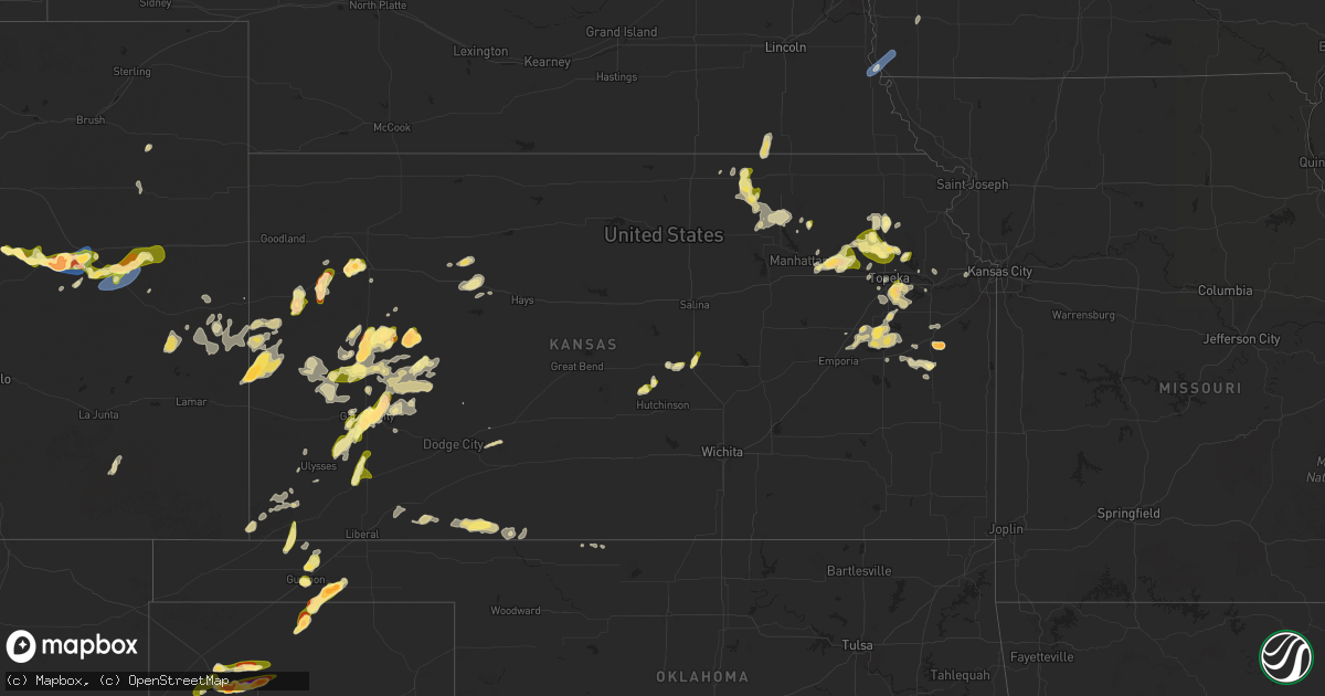
Hail Map in Kansas on April 23, 2025
Get this storm
April 23 map
$229
one time, instant access
Download today. No call, no setup
Keep the $229
Bought the map and want the full workflow? Apply the entire $229 to a subscription within 7 days. None of it is wasted.
Every map, not just this one
This buys you this map. Subscription and you get every map we run, in the markets you choose from a few cities to whole states to nationwide. Plus real-time alerts the moment a storm fires.
Contact data
Name, contact info, occupancy, even credit band for addresses in the footprint. You go from where it hit to who to call.
Become the source they trust
Unlimited branding weather history reports on demand. You already have the documented answer ready for the property owner, and you are the one who showed up with it.
Property data and RoofTrace estimates
Pull up any address you have got, its value and the exact code rules for that jurisdiction, straight from One Click Code. Then RoofTrace estimates the squares, pitch, and roof value, priced the way you price.
Storm reports in Kansas
Kansas
| Date | Description |
|---|---|
| 04/23/20256:40 PM CDT | Social media picture showing quarter size hail. |
| 04/23/20256:15 PM CDT | Pictures from social media show 2 inch hail in garden city. |
| 04/23/20256:15 PM CDT | Video showing at least quarter-sized hail sent via social media. |
| 04/23/20256:12 PM CDT | Report from mping: half dollar |
| 04/23/20256:11 PM CDT | A local report indicates 1.00 inch wind near 3 NW Manning |
| 04/23/20256:08 PM CDT | A local report indicates 1.00 inch wind near Healy |
| 04/23/20255:46 PM CDT | A local report indicates 1.00 inch wind near 1 WSW Osage City |
| 04/23/20255:45 PM CDT | Social media report of penny to quarter size hail 2 miles southwest of downtown garden city. |
| 04/23/20255:27 PM CDT | A local report indicates 1.00 inch wind near 4 NNE Berryton |
| 04/23/20255:25 PM CDT | A local report indicates 1.00 inch wind near 2 NE Berryton |
| 04/23/20255:25 PM CDT | A local report indicates 1.00 inch wind near Winona |
| 04/23/20255:12 PM CDT | M ping report. |
| 04/23/20255:10 PM CDT | Greeley county dispatch relayed a report of golf ball sized hail near the kansas/ colorado border. Estimated time of occurrence 4:10 pm mdt |
| 04/23/20255:10 PM CDT | A local report indicates 1.00 inch wind near 4 WSW Plymell |
| 04/23/20255:08 PM CDT | Report from mping: golf ball |
| 04/23/20255:05 PM CDT | Hail up to 2 inches in diameter covering the ground. |
| 04/23/20255:05 PM CDT | A local report indicates 2.00 inch wind near Scott City |
| 04/23/20255:04 PM CDT | Just slightly over golf ball. |
| 04/23/20255:00 PM CDT | A local report indicates 60 MPH wind near 3 NW Perry |
| 04/23/20255:00 PM CDT | Just over 2 inches. |
| 04/23/20254:56 PM CDT | Off-duty nws employee reported half-dollar sized hail 2 miles south of scott city. |
| 04/23/20254:54 PM CDT | Winds blew windows out of garage. |
| 04/23/20254:53 PM CDT | A local report indicates 1.25 inch wind near Hoyt |
| 04/23/20254:52 PM CDT | A local report indicates 1.25 inch wind near 2 SW Shields |
| 04/23/20254:52 PM CDT | Picture of quarter-sized hail sent to us via slack from county emergency manager. |
| 04/23/20254:43 PM CDT | Spotter estimated pea to quarter size hail at 3:43 pm mdt. |
| 04/23/20254:30 PM CDT | Delayed report of golf ball sized hail at the junction between highway 40 and highway 25 north at 3:30 pm mdt. |
| 04/23/20252:59 PM CDT | Report from mping: quarter |
| 04/23/20252:52 PM CDT | A local report indicates 1.00 inch wind near 6 SSE Saint George |
| 04/23/20252:18 PM CDT | A local report indicates 1.00 inch wind near 2 E Holton |
| 04/23/202511:22 AM CDT | Quarter size hail covering the ground. |
| 04/23/202510:30 AM CDT | . |
| 04/22/20259:30 PM CDT | Pws-kksholco17. |
| 04/22/20258:37 PM CDT | Delayed report from social media of 2 inch diameter hail. |
| 04/22/20257:08 PM CDT | A local report indicates 1.50 inch wind near Healy |
| 04/22/20257:03 PM CDT | A local report indicates 1.00 inch wind near Garden City |
All States Impacted by Hail Map on April 23, 2025
Cities Impacted by Hail Map on April 23, 2025
- Sinton, TX
- Taft, TX
- Portland, TX
- Aransas Pass, TX
- Ingleside, TX
- Port Aransas, TX
- Morland, KS
- Spearville, KS
- Offerle, KS
- Wakeeney, KS
- Ellis, KS
- Sterling, KS
- Nickerson, KS
- Lyons, KS
- Ogallah, KS
- Hutchinson, KS
- Windom, KS
- Hill City, KS
- Mcpherson, KS
- Randolph, KS
- Lauderdale, MS
- Green, KS
- Winnabow, NC
- Blue Rapids, KS
- Louisville, GA
- Midville, GA
- Wrightsville, GA
- Waynesboro, GA
- Waterville, KS
- Clay Center, KS
- Leonardville, KS
- Meridian, MS
- East Dublin, GA
- Leland, NC
- Wilmington, NC
- Westmoreland, KS
- Dodson, LA
- Scooba, MS
- Fairfax, SC
- Barnes, KS
- Shuqualak, MS
- Olsburg, KS
- Millen, GA
- Holton, KS
- Lagrange, GA
- Brunson, SC
- Twin City, GA
- Mayetta, KS
- Jonesboro, LA
- Hazlehurst, MS
- Georgetown, MS
- Hampton, SC
- Swainsboro, GA
- Hogansville, GA
- Centralia, KS
- Hollenberg, KS
- Circleville, KS
- Tennille, GA
- Garfield, GA
- Odell, NE
- Diller, NE
- Amite, LA
- Hanover, KS
- Steele City, NE
- Birmingham, AL
- Greenleaf, KS
- Linn, KS
- Wymore, NE
- New Bern, NC
- Richlands, NC
- Maple Hill, NC
- Macon, MS
- Starkville, MS
- Palmer, KS
- Conway, SC
- Beulaville, NC
- Chinquapin, NC
- Beatrice, NE
- Blue Springs, NE
- Hughes, AR
- Brooksville, MS
- Mount Olive, AL
- Saint George, KS
- Cedarbluff, MS
- Washington, KS
- Morrowville, KS
- Virginia, NE
- White Plains, GA
- Berry, AL
- Andrews, SC
- Myrtle Beach, SC
- Sparta, GA
- Mantee, MS
- Woodland, MS
- Wamego, KS
- Brookside, AL
- Graysville, AL
- Gardendale, AL
- Proctor, AR
- Murrells Inlet, SC
- Haddam, KS
- Sylvania, GA
- Greensboro, GA
- Farmerville, LA
- Jasper, AL
- Cordova, AL
- Monteagle, TN
- Filley, NE
- Crab Orchard, NE
- Islandton, SC
- Somerville, AL
- Hartselle, AL
- West Monroe, LA
- Varnville, SC
- Hemingway, SC
- Georgetown, SC
- Ehrhardt, SC
- Carrollton, AL
- Jacksonville, NC
- Tellico Plains, TN
- Trenton, NC
- Warrior, AL
- Cottageville, SC
- Tryon, NE
- Stockton, MO
- Endicott, NE
- Carbon Hill, AL
- Tecumseh, NE
- Adams, NE
- Falkville, AL
- Sterling, NE
- Waynesboro, MS
- Kim, CO
- Soldier, KS
- Mahaska, KS
- Delia, KS
- Emmett, KS
- Saint Marys, KS
- El Dorado Springs, MO
- Delhi, LA
- Alma, KS
- Burr, NE
- Manhattan, KS
- Rayville, LA
- Paxico, KS
- Belvue, KS
- Oakley, KS
- Monument, KS
- Nebraska City, NE
- Holly, CO
- Union Point, GA
- Maple Hill, KS
- Dighton, KS
- Topeka, KS
- Moulton, AL
- Danville, AL
- Tribune, KS
- Washington, GA
- Winona, KS
- Cook, NE
- Hoyt, KS
- Hohenwald, TN
- Satanta, KS
- Sheridan Lake, CO
- Scott City, KS
- Eagle, NE
- Palmyra, NE
- Sharon Springs, KS
- Linden, TN
- Brooklet, GA
- Luray, SC
- Silver Lake, KS
- Rossville, KS
- Colby, KS
- Wallace, KS
- Syracuse, KS
- Arab, AL
- Thedford, NE
- Ulysses, KS
- Fort Stockton, TX
- Garnett, SC
- Tillman, SC
- Elmwood, NE
- Smithville, MS
- Carbondale, KS
- Tignall, GA
- Athens, TN
- Clyo, GA
- Pecos, TX
- Rayle, GA
- Percival, IA
- Wakarusa, KS
- Berryton, KS
- Garden City, KS
- Hodgen, OK
- Heavener, OK
- Taylorsville, GA
- Woodbury, TN
- Meriden, KS
- Overbrook, KS
- Fulton, MS
- Batesville, MS
- Marienthal, KS
- Pineland, SC
- Rome, GA
- Port Gibson, MS
- Hallsboro, NC
- Etowah, TN
- Englewood, TN
- Barstow, TX
- Pyote, TX
- Lake Waccamaw, NC
- Gruver, TX
- Ozawkie, KS
- Goodwell, OK
- Nevada, MO
- Emerson, IA
- Winder, GA
- Auburn, GA
- Leoti, KS
- Guymon, OK
- Auburn, KS
- Tecumseh, KS
- Rolla, KS
- Osage City, KS
- Courtland, MS
- Water Valley, MS
- Bolton, NC
- Oxford, MS
- Taylor, MS
- Council, NC
- Hereford, TX
- Kingston, GA
- Mentone, TX
- Lyndon, KS
- Wink, TX
- Kermit, TX
- Emporia, KS
- Audubon, IA
- Reading, KS
- Atlantic, IA
- Statesboro, GA
- Baxley, GA
- Scranton, KS
- Hamlin, IA
- Exira, IA
- Guthrie Center, IA
- Marne, IA
- Brayton, IA
- Adair, IA
- Spearman, TX
- Elmer, LA
- Buford, GA
- Lecompton, KS
- Perry, KS
- Dimmitt, TX
- Healy, KS
- Elizabeth, CO
- Franktown, CO
- Leighton, AL
- Cobbtown, GA
- Collins, GA
- Elbert, CO
- Jal, NM
- Marathon, TX
- Poteau, OK
- Melbourne, IA
- Rhodes, IA
- Lawrence, KS
- Melvern, KS
- Burlingame, KS
- Franklin, TN
- Marshalltown, IA
- Kiowa, CO
- Clutier, IA
- Traer, IA
- Dysart, IA
- Laurel, IA
- Newton, IA
- Hardesty, OK
- Ashland, MS
- Lebo, KS
- Newberry, SC
- Tama, IA
- Alpine, TX
- Channing, TX
- Hartley, TX
- Anita, IA
- Happy, TX
- Lakin, KS
- Sublette, KS
- Casey, IA
- Lyons, GA
- Hackett, AR
- Silverstreet, SC
- Holcomb, KS
- Calhan, CO
- Ramah, CO
- Garwin, IA
- Gladbrook, IA
- Simla, CO
- Kimballton, IA
- Greenwood, AR
- Huntington, AR
- Arapahoe, CO
- Hart, TX
- Quenemo, KS
- Muleshoe, TX
- Rockwell City, IA
- Eunice, NM
- Andrews, TX
- Agate, CO
- Carrollton, MS
- Admire, KS
- Bonner Springs, KS
- Sac City, IA
- Canyon, TX
- Garrison, IA
- Nazareth, TX
- Surrency, GA
- Nashville, TN
- Coon Rapids, IA
- Early, IA
- Cheyenne Wells, CO
- Tulia, TX
- Kinards, SC
- Moorland, IA
- Fort Dodge, IA
- Barnum, IA
- Clare, IA
- Somers, IA
- Matheson, CO
- Lake View, IA
- Afton, TX
- Deerfield, KS
- Seminole, TX
- Gove, KS
- Greenwood, MS
- Callender, IA
- Lytton, IA
- Auburn, IA
- Dalhart, TX
- Kit Carson, CO
- Scranton, IA
- Prosperity, SC
- Pomaria, SC
- Lake City, IA
- Limon, CO
- Farnhamville, IA
- Dumas, TX
- Bradford, IA
- Duncombe, IA
- Gowrie, IA
- Dickens, TX
- Winters, TX
- Seagraves, TX
- Edison, NE
- Roaring Springs, TX
- Pope, MS
- Garnett, KS
- Williamsburg, KS
- Waverly, KS
- Arapahoe, NE
- Oxford, NE
- Geneva, IA
- Hampton, IA
- Ackley, IA
- Iowa Falls, IA
- Hugo, CO
- Vincent, IA
- Plains, TX
- Denver City, TX
- Ottawa, KS
- Princeton, KS
- Wingate, TX
- Bristow, IA
- Richmond, KS
- Hooker, OK
- Rantoul, KS
- Ovalo, TX
- Allison, IA
- Ballinger, TX
- Sylvester, GA
- Walsh, CO
- Wellsburg, IA
- Blackwell, TX
- Tuscola, TX
- Grinnell, KS
- Paton, IA
- Cimarron, KS
- Coffeeville, MS
- Webster City, IA
- Sudan, TX
- Aplington, IA
- Arriba, CO
- Shell Rock, IA
- Beeler, KS
- New Hartford, IA
- Janesville, IA
- Cedar Falls, IA
- Sunray, TX
- Kress, TX
- Silverton, TX
- Elkhart, KS
- Cope, CO
- Karval, CO
- Flagler, CO
- Oelwein, IA
- Earth, TX
- Mcadoo, TX
- Lockney, TX
- Richfield, KS
- Ness City, KS
- Seibert, CO
- Johnson, KS
- Dryden, TX
- Ingalls, KS
- Quitaque, TX
- Clarendon, TX
- Turkey, TX
- Le Grand, IA
- Otis, CO
- Akron, CO
- Claude, TX
- Amarillo, TX
- Childress, TX
- Glen Haven, WI
- Cassville, WI
- Springlake, TX
- Spur, TX
- Flomot, TX
- Matador, TX
- Lancaster, WI
- Bloomington, WI
- Lakeview, TX
- Memphis, TX
- Plainview, TX
- Reliance, TN
- Dumont, IA
- Bagley, WI
- Eads, CO
- Weskan, KS
- Paducah, TX
- Jetmore, KS
- Ozona, TX
- Tell, TX
- Quanah, TX
- Hollis, OK
- Dodson, TX
- Girard, TX
- Wellington, TX
- Gould, OK
- Eldorado, OK
- Duke, OK
- Mangum, OK
- Sayre, OK
- Elk City, OK
- Toledo, IA
- Carter, OK
- Butler, OK
- Sonora, TX
- Crowell, TX
- Plains, KS
- Seymour, TX
- Meade, KS
- Cuba, KS
- Frederick, OK
- Tipton, OK
- Snyder, OK
- Ashland, KS
- Englewood, KS
- Fowler, KS
- Norton, TX
- Bronte, TX
- Munday, TX
- Goree, TX
- Chelsea, IA
- Brock, NE
- Elberon, IA
- Protection, KS
- Electra, TX
- Throckmorton, TX
- Voss, TX
- Valera, TX
- Coleman, TX
- Gouldbusk, TX
- Rocky Ford, GA
- Coldwater, KS
- Lodge, SC
- Barnwell, SC
- Uvalda, GA
- London, TX
- Santa Anna, TX
- Abilene, TX
- Mason, TX
- Brownwood, TX
- Early, TX
- Rising Star, TX
- Zephyr, TX
- Talmage, NE
- Sidney, IA
- Thurman, IA
- Hamburg, IA
- Avoca, TX
- Panora, IA
- Yale, IA
- Bagley, IA
- Bayard, IA
- Jamaica, IA
- Pierceville, KS
- Goldthwaite, TX
- San Saba, TX
- Alva, OK
- Breckenridge, TX
- Graham, TX
- Priddy, TX
- Mullin, TX
- Woodson, TX
- Pottsville, TX
- Hamilton, TX
- Gustine, TX
- Comanche, TX
- Little Mountain, SC
- Whitmire, SC
- Blair, SC
- Chapin, SC
- Greenwood, SC
- Pomona, KS
- Wellsville, KS
- Osawatomie, KS


