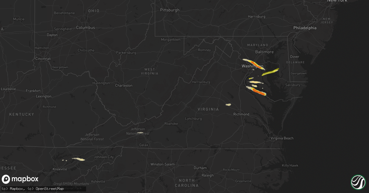
Hail Map in Virginia on April 21, 2017
Get this storm
April 21 map
$229
one time, instant access
Download today. No call, no setup
Keep the $229
Bought the map and want the full workflow? Apply the entire $229 to a subscription within 7 days. None of it is wasted.
Every map, not just this one
This buys you this map. Subscription and you get every map we run, in the markets you choose from a few cities to whole states to nationwide. Plus real-time alerts the moment a storm fires.
Contact data
Name, contact info, occupancy, even credit band for addresses in the footprint. You go from where it hit to who to call.
Become the source they trust
Unlimited branding weather history reports on demand. You already have the documented answer ready for the property owner, and you are the one who showed up with it.
Property data and RoofTrace estimates
Pull up any address you have got, its value and the exact code rules for that jurisdiction, straight from One Click Code. Then RoofTrace estimates the squares, pitch, and roof value, priced the way you price.
Storm reports in Virginia
Virginia
| Date | Description |
|---|---|
| 04/21/20176:36 PM CDT | Significant wind damage at monroe campground near colonial beach. |
| 04/21/20176:35 PM CDT | Half dollar sized hail and one to two foot diameter tree snapped. Neighbor's tree was uprooted. |
| 04/21/20176:26 PM CDT | A local report indicates 1.00 inch wind near COLONIAL BEACH |
| 04/21/20176:25 PM CDT | Several large trees and power lines downed along va-205 |
| 04/21/20176:24 PM CDT | Several trees down and campers damaged at monroe bay campground near colonial beach. |
| 04/21/20176:22 PM CDT | A local report indicates 1.00 inch wind near COLONIAL BEACH |
| 04/21/20176:20 PM CDT | Half dollar sized hail and one to two foot diameter tree snapped. Neighbor's tree was uprooted. |
| 04/21/20176:20 PM CDT | Several large trees and power lines downed along va-205 |
| 04/21/20176:17 PM CDT | Two trees down near intersection of va 205 and va 218 near gitiess |
| 04/21/20176:10 PM CDT | Tree down at round hill rd and round hill estate dr |
| 04/21/20176:07 PM CDT | Us 301 is closed to semi trucks between near va 205 due to low hanging power lines |
| 04/21/20176:07 PM CDT | Two trees down near intersection of md 205 and md 218 near gitiess |
| 04/21/20176:06 PM CDT | Trees and power lines down near intersection of lakeview drive and va 205 |
| 04/21/20176:05 PM CDT | Tractor trailer blown over |
| 04/21/20176:05 PM CDT | 20 tall trees down... Tree fell on minivan... Tree fell on back deck... 2 sheds damaged... Holes in house siding |
| 04/21/20176:05 PM CDT | Trees through multiple trailers. One trailer appears to have blown off foundation. Multiple power lines down in trailer park |
| 04/21/20176:05 PM CDT | Roof blown off shed and multiple trees adn power lines down |
| 04/21/20176:03 PM CDT | Trees through trailors |
| 04/21/20175:30 PM CDT | Tree down and dime size hail. |
| 04/21/20175:30 PM CDT | Tree down. |
| 04/20/20177:15 PM CDT | Numerous trees down around sandy point. |
| 04/20/20177:09 PM CDT | Numerous large trees down on skyview drive. Patio furniture and trampoline have also been blown away. |
| 04/20/20177:09 PM CDT | One inch diameter hail and small trees down on federal farm road. Caller may have seen a brief tornado or funnel cloud while giving report [looking toward mount holly]. |
All States Impacted by Hail Map on April 21, 2017
Cities Impacted by Hail Map on April 21, 2017
- Daisy, OK
- Sapulpa, OK
- Jenks, OK
- Kellyville, OK
- Bristow, OK
- Tecumseh, OK
- Shawnee, OK
- Mineral Springs, AR
- Lockesburg, AR
- Winthrop, AR
- Horatio, AR
- Saratoga, AR
- Cushing, OK
- Addison, TX
- Garland, TX
- Sunset, TX
- Dallas, TX
- Krum, TX
- Denton, TX
- Argyle, TX
- Richardson, TX
- Lake Dallas, TX
- The Colony, TX
- Lewisville, TX
- Alvord, TX
- Plano, TX
- Carrollton, TX
- Decatur, TX
- Justin, TX
- Bowie, TX
- Ponder, TX
- Newburg, MD
- Edmond, OK
- Wylie, TX
- Ringgold, TX
- Saint Jo, TX
- Muenster, TX
- Ryan, OK
- Nocona, TX
- Luttrell, TN
- Blaine, TN
- Mount Pleasant, TX
- Mount Vernon, TX
- Bagwell, TX
- Rattan, OK
- Nashoba, OK
- Snow, OK
- Wills Point, TX
- Terrell, TX
- Morris, OK
- Henryetta, OK
- Okmulgee, OK
- Kenefic, OK
- Coleman, OK
- Stuttgart, AR
- Carlisle, AR
- Weatherford, TX
- Charlotte Hall, MD
- La Plata, MD
- Paris, TX
- Blossom, TX
- Edgewood, TX
- Canton, TX
- Grand Saline, TX
- Chevy Chase, MD
- Bethesda, MD
- Takoma Park, MD
- Silver Spring, MD
- Kensington, MD
- Washington, DC
- Nacogdoches, TX
- Fort Towson, OK
- Sawyer, OK
- Sumner, TX
- Bokchito, OK
- Telephone, TX
- Honey Grove, TX
- Ivanhoe, TX
- Hendrix, OK
- Bennington, OK
- Caney, OK
- Caddo, OK
- Chesapeake Beach, MD
- Huntingtown, MD
- Sunderland, MD
- Owings, MD
- Dublin, TX
- Stephenville, TX
- Hague, VA
- Kinsale, VA
- King George, VA
- Colonial Beach, VA
- Montross, VA
- Pilot Point, TX
- Upper Marlboro, MD
- Mount Rainier, MD
- Bladensburg, MD
- Capitol Heights, MD
- Brentwood, MD
- Rockville, MD
- Hyattsville, MD
- District Heights, MD
- Kaufman, TX
- Ben Wheeler, TX
- Fruitvale, TX
- Humnoke, AR
- Rutledge, TN
- Beech Grove, AR
- Paragould, AR
- Walnut Ridge, AR
- Bono, AR
- Desdemona, TX
- Hico, TX
- Princeton, TX
- Ranger, TX
- Welcome, MD
- Faulkner, MD
- Bel Alton, MD
- Port Tobacco, MD
- Mechanicsville, MD
- Frisco, TX
- Celina, TX
- Prosper, TX
- Mckinney, TX
- Allen, TX
- Agra, OK
- Stroud, OK
- Mineral, VA
- Gum Spring, VA
- Sandy Hook, VA
- Bumpass, VA
- Beechgrove, TN
- Bell Buckle, TN
- Bradyville, TN
- Shelbyville, TN
- Readyville, TN
- Christiana, TN
- Calvin, OK
- Allen, OK
- Potomac, MD
- Gaithersburg, MD
- Mesquite, TX
- Forney, TX
- Sunnyvale, TX
- Nanjemoy, MD
- Pottsboro, TX
- Heavener, OK
- Breckenridge, TX
- Booneville, MS
- Maynardville, TN
- Haworth, OK
- Foreman, AR
- Norman, OK
- Oklahoma City, OK
- Marietta, OK
- Gainesville, TX
- Nevada, TX
- Caddo Mills, TX
- Royse City, TX
- Farmersville, TX
- Columbus, AR
- Poolesville, MD
- Germantown, MD
- Riverdale, MD
- Bowie, MD
- Lothian, MD
- Garrett Park, MD
- Lindsay, TX
- Valley View, TX
- Gunter, TX
- Anna, TX
- Celeste, TX
- Van Alstyne, TX
- Leonard, TX
- Collinsville, TX
- Blue Ridge, TX
- Tioga, TX
- Max Meadows, VA
- Wytheville, VA
- Tuttle, OK
- Issue, MD
- Little Elm, TX
- Murfreesboro, TN
- Coalgate, OK
- Muskogee, OK
- Blanchard, OK
- Amber, OK
- Tishomingo, OK
- Mill Creek, OK
- Alleene, AR
- Ashdown, AR
- Wilton, AR
- Norman, AR
- Boswell, OK
- Hartman, AR
- Sanger, TX
- Lavon, TX
- Quinlan, TX
- Greenville, TX
- Saint Joe, AR
- Yellville, AR
- Seminole, OK
- Cookson, OK
- Park Hill, OK
- Kingston, OK
- Cartwright, OK
- Calera, OK
- Mena, AR
- Bixby, OK
- Tulsa, OK
- Broken Arrow, OK
- Washington, OK
- Calico Rock, AR
- Madill, OK
- Clayton, OK
- Wartrace, TN
- Braggs, OK
- Welling, OK
- Sidney, AR
- Mountain View, AR
- Big Flat, AR
- Melbourne, AR
- Horseshoe Bend, AR
- Sage, AR
- Harriet, AR
- Flippin, AR
- Russellville, TN
- Whitesburg, TN
- Bulls Gap, TN
- Mohawk, TN
- Morristown, TN
- Bean Station, TN
- Cushing, TX
- Soper, OK
- Hugo, OK
- Era, TX
- Sparks, OK
- Chandler, OK
- Depew, OK
- Mineral Wells, TX
- Neavitt, MD
- Easton, MD
- Bozman, MD
- Sherwood, MD
- Saint Michaels, MD
- Royal Oak, MD
- Rosston, TX
- Detroit, TX
- Woodbury, TN
- Newalla, OK
- Bath Springs, TN
- Decaturville, TN
- Linden, TN
- Milburn, OK
- Fulton, AR
- Hope, AR
- Mcloud, OK
- England, AR
- Brookston, TX
- Vandervoort, AR
- Cove, AR
- Montague, TX
- Forestburg, TX
- Glenpool, OK
- Tryon, OK
- Atoka, OK
- Sulphur, OK
- Antlers, OK
- Ardmore, OK
- Valliant, OK
- Grant, OK
- Lane, OK
- Wapanucka, OK
- Idabel, OK
- Garvin, OK
- Centrahoma, OK
- Mounds, OK
- Gordonville, TX
- Corsicana, TX
- Leonardtown, MD
- Colbert, OK
- Lanham, MD
- Harwood, MD
- Washington, AR
- Ozan, AR
- Okemah, OK
- Durant, OK
- Tracys Landing, MD
- Sterling, VA
- College Park, MD
- Deale, MD
- Dunkirk, MD
- Okarche, OK
- Piedmont, OK
- Sadler, TX
- Ringold, OK
- Rockwall, TX
- Rowlett, TX
- Clarksville, TX
- Boynton, OK
- Stuart, OK
- Leola, AR
- Caddo, TX
- Harleton, TX
- Tilghman, MD
- Brandywine, MD
- Tishomingo, MS
- Everton, AR
- Bunch, OK
- Parsons, TN
- Sachse, TX
- Poughkeepsie, AR
- Evening Shade, AR
- De Leon, TX
- Jonesboro, AR
- Dahlgren, VA
- El Paso, AR
- Beebe, AR
- Mosheim, TN
- Mount Ida, AR
- Talihina, OK
- Watson, OK
- Henrietta, TX
- Burneyville, OK
- Wright City, OK
- Cisco, TX
- Pindall, AR
- Mount Pleasant, AR
- Marshall, AR
- Fifty Six, AR
- Valley Springs, AR
- Tupelo, OK
- Stonewall, OK
- Aubrey, TX
- Sheridan, AR
- Waurika, OK
- Prague, OK
- Indian Head, MD
- Fort Washington, MD
- Oxon Hill, MD
- Terral, OK
- Petrolia, TX
- Byers, TX
- Waldorf, MD
- Minco, OK
- Union City, OK
- Stillwater, OK
- Pomfret, MD
- Asher, OK
- Paden, OK
- Newcastle, OK
- Whitesboro, TX
- Grapevine, AR
- Millsap, TX
- Aledo, TX
- Melissa, TX
- Flower Mound, TX
- Powderly, TX
- Annona, TX
- Ravenna, TX
- Ada, OK
- Marbury, MD
- North Beach, MD


