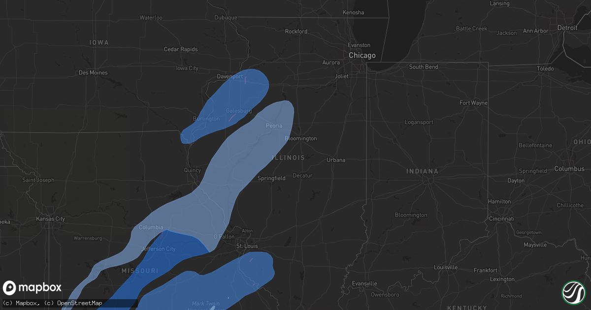
Hail Map in Illinois on April 20, 2025
Get this storm
April 20 map
$229
one time, instant access
Download today. No call, no setup
Keep the $229
Bought the map and want the full workflow? Apply the entire $229 to a subscription within 7 days. None of it is wasted.
Every map, not just this one
This buys you this map. Subscription and you get every map we run, in the markets you choose from a few cities to whole states to nationwide. Plus real-time alerts the moment a storm fires.
Contact data
Name, contact info, occupancy, even credit band for addresses in the footprint. You go from where it hit to who to call.
Become the source they trust
Unlimited branding weather history reports on demand. You already have the documented answer ready for the property owner, and you are the one who showed up with it.
Property data and RoofTrace estimates
Pull up any address you have got, its value and the exact code rules for that jurisdiction, straight from One Click Code. Then RoofTrace estimates the squares, pitch, and roof value, priced the way you price.
Storm reports in Illinois
Illinois
| Date | Description |
|---|---|
| 04/20/20256:53 PM CDT | Barn destroyed per em. |
| 04/20/20256:51 PM CDT | Several trees snapped or uprooted. |
| 04/20/20256:50 PM CDT | Power poles down along il-57 in near hull... Il. |
| 04/19/202510:22 PM CDT | Tree down blocking old highway 50 at country club road. |
| 04/19/20259:12 PM CDT | 6 inch diameter tree branches down. Time estimated from radar data. |
| 04/19/20259:10 PM CDT | Tornado sighted crossing wolf road. Trees snapped and over the road... Power lines down. |
| 04/19/20259:09 PM CDT | Trees down over train tracks. Probable tornado damage. |
| 04/19/20258:59 PM CDT | Soffit came loose on a house. |
| 04/19/20258:58 PM CDT | Top of a grain bin blown off near the intersection of washington and robinson roads. |
| 04/19/20258:57 PM CDT | 6 inch diameter tree limbs down... And about a 70 foot section of a barn wall was blown out. |
| 04/19/20258:55 PM CDT | The tornado affected mainly rural areas of tazewell county where it produced ef-1 damage to trees... Outbuildings and power poles... With peak winds of 90 mph. It reach |
| 04/19/20258:50 PM CDT | Pine tree top blown off. Time estimated from radar data. |
| 04/19/20258:36 PM CDT | Spotter has an anemometer reading of 65 mph with a 4 inch tree limb down. |
| 04/19/20258:30 PM CDT | Downed trees crossing il-15. |
| 04/19/20258:25 PM CDT | Tree down on a power line along county road 750n. |
| 04/19/20258:14 PM CDT | An nws survey team found ef0 tornado damage near schwab road southeast of millstadt... Il. This tornado briefly touched down and lifted at 8:14pm with a path length of |
| 04/19/20258:14 PM CDT | Collapsed shed... Power lines down. Time estimated from radar. |
| 04/19/20258:13 PM CDT | An nws survey team found ef1 tornado damage near gilmore lake southeast of columbia... Il. This tornado touched down and lifted at 8:13pm and had a path length of under |
| 04/19/20258:12 PM CDT | Near-zero visibility also reported. |
| 04/19/20258:11 PM CDT | Power poles down. |
| 04/19/20258:10 PM CDT | 60-65 mph wind gusts reported. |
| 04/19/20258:05 PM CDT | Power poles down. |
| 04/19/20258:02 PM CDT | Sheriff deputies reporting visual sighting of a tornado near greenbush... Il. |
| 04/19/20258:00 PM CDT | Metal in power lines on lrc rd. |
| 04/19/20258:00 PM CDT | Tree over vogel school road just north of floraville... Il. |
| 04/19/20258:00 PM CDT | An nws survey team found ef1 tornado damage on a path extending from east of madonnaville to waterloo... Il. This tornado was on the ground from 8pm until 8:07pm and ha |
| 04/19/20257:50 PM CDT | Several shingles lost from roof of house. Time estimated by radar. |
| 04/19/20257:46 PM CDT | Large tree blown down over roof of house with siding damage. |
| 04/19/20257:41 PM CDT | Large tree down across n county 2 hwy north of e workman rd. |
| 04/19/20257:36 PM CDT | 70 mph measured wind gust and small branches 1 inch in diameter broken. Time estimated by radar. |
| 04/19/20257:32 PM CDT | Trees down in town. |
| 04/19/20257:13 PM CDT | Relayed by 911. Damage to a roof. Time of the event estimated using radar. |
| 04/19/20257:05 PM CDT | Picture received of a tree snapped and blown over. |
| 04/19/20257:00 PM CDT | Damage to an old school gym roof. |
All States Impacted by Hail Map on April 20, 2025
Cities Impacted by Hail Map on April 20, 2025
- New Bloomfield, MO
- Fulton, MO
- Miami, OK
- Baxter Springs, KS
- Commerce, OK
- North Miami, OK
- Picher, OK
- Treece, KS
- Quapaw, OK
- Galena, KS
- Riverton, KS
- Carl Junction, MO
- Asbury, MO
- Joplin, MO
- Webb City, MO
- Oronogo, MO
- Neck City, MO
- Purcell, MO
- Jasper, MO
- Alba, MO
- Carthage, MO
- Jay, OK
- Gravette, AR
- South West City, MO
- Tiff City, MO
- Wyandotte, OK
- Anderson, MO
- Grove, OK
- Neosho, MO
- Seneca, MO
- Noel, MO
- Sulphur Springs, AR
- Goodman, MO
- Pineville, MO
- Lanagan, MO
- Lamar, MO
- Sheldon, MO
- Jerico Springs, MO
- Granby, MO
- Sarcoxie, MO
- Pierce City, MO
- Reeds, MO
- Stark City, MO
- Stella, MO
- Wheaton, MO
- Rocky Comfort, MO
- Fairview, MO
- Exeter, MO
- Monett, MO
- Wentworth, MO
- Purdy, MO
- El Dorado Springs, MO
- Milo, MO
- Stockton, MO
- La Russell, MO
- Stotts City, MO
- Miller, MO
- Mount Vernon, MO
- Osceola, MO
- Lowry City, MO
- Collins, MO
- Freistatt, MO
- Verona, MO
- Ash Grove, MO
- Marionville, MO
- Everton, MO
- Aurora, MO
- Salisbury, MO
- Springfield, MO
- Willard, MO
- Halltown, MO
- Bois D Arc, MO
- Republic, MO
- Billings, MO
- Clinton, MO
- Deepwater, MO
- Warsaw, MO
- Omaha, AR
- Alpena, AR
- Jessieville, AR
- Glenwood, AR
- Walnut Grove, MO
- South Greenfield, MO
- Morrisville, MO
- Aldrich, MO
- Bolivar, MO
- Louisburg, MO
- Urbana, MO
- Pleasant Hope, MO
- Buffalo, MO
- Brighton, MO
- Half Way, MO
- Strafford, MO
- Fair Grove, MO
- Marshfield, MO
- Elkland, MO
- Long Lane, MO
- Bonnerdale, AR
- Royal, AR
- Amity, AR
- Rueter, MO
- Cedarcreek, MO
- Kirbyville, MO
- Sunrise Beach, MO
- Osage Beach, MO
- Lebanon, MO
- Linn Creek, MO
- Camdenton, MO
- Macks Creek, MO
- Eldridge, MO
- Tunas, MO
- Windyville, MO
- Conway, MO
- Roach, MO
- Phillipsburg, MO
- Lake Ozark, MO
- Eldon, MO
- Montreal, MO
- Brumley, MO
- Stoutland, MO
- Tuscumbia, MO
- Kaiser, MO
- Bradleyville, MO
- Ava, MO
- Bismarck, AR
- Pearcy, AR
- Hot Springs National Park, AR
- Branson, MO
- Hollister, MO
- Rockaway Beach, MO
- Walnut Shade, MO
- Powersite, MO
- Forsyth, MO
- Oldfield, MO
- Seymour, MO
- Chadwick, MO
- Sparta, MO
- Garrison, MO
- Taneyville, MO
- Kissee Mills, MO
- Bruner, MO
- Fordland, MO
- Hartville, MO
- Grovespring, MO
- Mansfield, MO
- Niangua, MO
- Rogersville, MO
- Mountain Grove, MO
- Falcon, MO
- Norwood, MO
- Macomb, MO
- Drury, MO
- Lincoln, MO
- Cole Camp, MO
- Stover, MO
- Barnett, MO
- Versailles, MO
- Edwards, MO
- Syracuse, MO
- Tipton, MO
- Florence, MO
- Bunceton, MO
- Fortuna, MO
- Latham, MO
- Boonville, MO
- Clarksburg, MO
- Russellville, MO
- California, MO
- Prairie Home, MO
- Wooldridge, MO
- Jamestown, MO
- New Franklin, MO
- Fayette, MO
- Rocheport, MO
- Columbia, MO
- Ashland, MO
- Harrisburg, MO
- Hartsburg, MO
- Centertown, MO
- Lynchburg, MO
- Graff, MO
- Laquey, MO
- Richland, MO
- Waynesville, MO
- Crocker, MO
- Fort Leonard Wood, MO
- Plato, MO
- Dixon, MO
- Saint Robert, MO
- Huggins, MO
- Cabool, MO
- Bucyrus, MO
- Mountain View, MO
- Yukon, MO
- Newburg, MO
- Edgar Springs, MO
- Solo, MO
- Duke, MO
- Devils Elbow, MO
- Licking, MO
- Houston, MO
- Success, MO
- Summersville, MO
- Raymondville, MO
- Elk Creek, MO
- Willow Springs, MO
- Roby, MO
- Vanzant, MO
- Dora, MO
- Brixey, MO
- Wasola, MO
- Thornfield, MO
- Squires, MO
- Noble, MO
- Ulman, MO
- Eugene, MO
- Olean, MO
- Lohman, MO
- Jefferson City, MO
- Henley, MO
- Iberia, MO
- Holts Summit, MO
- Vienna, MO
- Saint Thomas, MO
- Saint Elizabeth, MO
- Bonnots Mill, MO
- Koeltztown, MO
- Westphalia, MO
- Linn, MO
- Freeburg, MO
- Meta, MO
- Loose Creek, MO
- Belle, MO
- Argyle, MO
- Brinktown, MO
- Tebbetts, MO
- Sturgeon, MO
- Hallsville, MO
- Benton City, MO
- Mexico, MO
- Kingdom City, MO
- Auxvasse, MO
- Thompson, MO
- Centralia, MO
- Martinsburg, MO
- Clark, MO
- Mokane, MO
- Chamois, MO
- Bland, MO
- Steedman, MO
- Malvern, AR
- Beulah, MO
- Vichy, MO
- Rolla, MO
- Lenox, MO
- Salem, MO
- Saint James, MO
- Jerome, MO
- Eunice, MO
- Eminence, MO
- Cuba, MO
- Jadwin, MO
- Hartshorn, MO
- Cook Sta, MO
- Paris, MO
- Center, MO
- Farber, MO
- Santa Fe, MO
- Rush Hill, MO
- Laddonia, MO
- New London, MO
- Perry, MO
- Vandalia, MO
- Wright City, MO
- Wellsville, MO
- High Hill, MO
- Warrenton, MO
- Bellflower, MO
- Montgomery City, MO
- Truesdale, MO
- Jonesburg, MO
- Middletown, MO
- New Florence, MO
- Curryville, MO
- Silex, MO
- Hawk Point, MO
- Frankford, MO
- Truxton, MO
- Bowling Green, MO
- Hermann, MO
- Rhineland, MO
- Williamsburg, MO
- Morrison, MO
- Mount Sterling, MO
- Portland, MO
- Berger, MO
- Marthasville, MO
- Owensville, MO
- Harrison, AR
- Green Forest, AR
- Benton, AR
- Steelville, MO
- Bourbon, MO
- Wesco, MO
- Cherryville, MO
- Leasburg, MO
- Boss, MO
- Bunker, MO
- Davisville, MO
- Viburnum, MO
- Ellington, MO
- Bixby, MO
- Louisiana, MO
- Troy, MO
- Eolia, MO
- New Canton, IL
- Kinderhook, IL
- Ashburn, MO
- Washington, MO
- Barry, IL
- New Haven, MO
- Leslie, MO
- Gerald, MO
- Rosebud, MO
- Salem, AR
- Rose Bud, AR
- Alton, MO
- Thayer, MO
- Koshkonong, MO
- Mammoth Spring, AR
- Jacksonville, AR
- Cabot, AR
- Vilonia, AR
- Austin, AR
- Potosi, MO
- Black, MO
- Centerville, MO
- Belleview, MO
- Hannibal, MO
- Plainville, IL
- Hull, IL
- Camp Point, IL
- Liberty, IL
- Golden, IL
- Pittsfield, IL
- Clayton, IL
- Rockport, IL
- Clarksville, MO
- Baylis, IL
- Pleasant Hill, IL
- New Salem, IL
- Elsberry, MO
- La Prairie, IL
- Timewell, IL
- Huntsville, IL
- Augusta, IL
- Foristell, MO
- Defiance, MO
- Carrollton, IL
- Hillview, IL
- Old Monroe, MO
- Lake Saint Louis, MO
- Batchtown, IL
- Winchester, IL
- Hardin, IL
- O'Fallon, MO
- Versailles, IL
- Milton, IL
- Winfield, MO
- Wentzville, MO
- Plymouth, IL
- Pearl, IL
- Hamburg, IL
- Augusta, MO
- Griggsville, IL
- White Hall, IL
- Kampsville, IL
- Moscow Mills, MO
- Camden, IL
- Brussels, IL
- Annada, MO
- Mount Sterling, IL
- Chambersburg, IL
- Fieldon, IL
- Patterson, IL
- Perry, IL
- Eldred, IL
- Nebo, IL
- Bluffs, IL
- Foley, MO
- Meredosia, IL
- Donnellson, IA
- Farmington, IA
- Wayland, MO
- Kahoka, MO
- Argyle, IA
- Fort Madison, IA
- West Point, IA
- Montrose, IA
- Nauvoo, IL
- Hamilton, IL
- Keokuk, IA
- Niota, IL
- Denmark, IA
- Wever, IA
- Middletown, IA
- West Burlington, IA
- Burlington, IA
- Sperry, IA
- Danville, IA
- Mediapolis, IA
- Carman, IL
- Lomax, IL
- Carthage, IL
- Dallas City, IL
- Couch, MO
- Fremont, MO
- Van Buren, MO
- Tenaha, TX
- Doniphan, MO
- Keithville, LA
- Bismarck, MO
- Concord, IL
- Industry, IL
- Littleton, IL
- Colchester, IL
- Vermont, IL
- Marietta, IL
- Adair, IL
- Astoria, IL
- Smithfield, IL
- Ipava, IL
- Chapin, IL
- Avon, IL
- Macomb, IL
- Frederick, IL
- Rushville, IL
- Roodhouse, IL
- Jacksonville, IL
- Bushnell, IL
- Arenzville, IL
- Table Grove, IL
- Browning, IL
- Beardstown, IL
- Ellisville, IL
- Bardolph, IL
- Prairie City, IL
- Bath, IL
- Pleasant Plains, IL
- Havana, IL
- Lewistown, IL
- Virginia, IL
- Chandlerville, IL
- Cuba, IL
- Murrayville, IL
- Alexander, IL
- Ashland, IL
- Sainte Genevieve, MO
- Berwick, IL
- Monmouth, IL
- Cameron, IL
- Oakville, IA
- Stronghurst, IL
- Oquawka, IL
- Gladstone, IL
- Smithville, AR
- Stonewall, LA
- Shreveport, LA
- Waterloo, IL
- Columbia, IL
- Millstadt, IL
- Belgrade, MO
- Dittmer, MO
- Fletcher, MO
- Caledonia, MO
- Blackwell, MO
- Richwoods, MO
- Lonedell, MO
- Grubville, MO
- Cadet, MO
- Sullivan, MO
- Lesterville, MO
- De Soto, MO
- Cedar Hill, MO
- Saint Louis, MO
- Hillsboro, MO
- Bonne Terre, MO
- Irondale, MO
- Barnhart, MO
- Festus, MO
- House Springs, MO
- Imperial, MO
- Pevely, MO
- Mineral Point, MO
- Arnold, MO
- Crystal City, MO
- Park Hills, MO
- East Carondelet, IL
- Herculaneum, MO
- Valmeyer, IL
- Chester, IL
- Saint Mary, MO
- Bloomsdale, MO
- Smithton, IL
- Arcadia, MO
- Baldwin, IL
- Evansville, IL
- Ironton, MO
- Ellis Grove, IL
- Red Bud, IL
- Middle Brook, MO
- New Athens, IL
- French Village, MO
- Prairie Du Rocher, IL
- Fredericktown, MO
- Modoc, IL
- Walsh, IL
- Leadwood, MO
- Farmington, MO
- Doe Run, MO
- Hecker, IL
- Valles Mines, MO
- Fults, IL
- Pilot Knob, MO
- Sparta, IL
- Annapolis, MO
- Redford, MO
- Alicia, AR
- Hoxie, AR
- Walnut Ridge, AR
- Lonoke, AR
- Carlisle, AR
- Des Arc, AR
- Hazen, AR
- Belleville, IL
- Freeburg, IL
- Lenzburg, IL
- Marissa, IL
- Tilden, IL
- Mascoutah, IL
- Coulterville, IL
- New Baden, IL
- Oakdale, IL
- Saint Libory, IL
- Okawville, IL
- Addieville, IL
- Cutler, IL
- Steeleville, IL
- Percy, IL
- Maquon, IL
- Oakford, IL
- Yates City, IL
- Petersburg, IL
- Farmington, IL
- Williamsfield, IL
- Kilbourne, IL
- Tallula, IL
- Easton, IL
- Brimfield, IL
- Liverpool, IL
- Saint David, IL
- Bryant, IL
- Elmwood, IL
- London Mills, IL
- Topeka, IL
- Fairview, IL
- Canton, IL
- Norris, IL
- Hanna City, IL
- Speer, IL
- Dunlap, IL
- Manito, IL
- Glasford, IL
- Wyoming, IL
- Mapleton, IL
- Laura, IL
- Forest City, IL
- Trivoli, IL
- Princeville, IL
- Edwards, IL
- Kingston Mines, IL
- Peoria, IL
- Bradford, IL
- San Jose, IL
- Groveland, IL
- Mason City, IL
- New Holland, IL
- Armington, IL
- Hopedale, IL
- Delavan, IL
- Deer Creek, IL
- Peoria Heights, IL
- Minier, IL
- Greenview, IL
- Creve Coeur, IL
- East Peoria, IL
- South Pekin, IL
- Mossville, IL
- Emden, IL
- Washington, IL
- Tremont, IL
- Chillicothe, IL
- Metamora, IL
- Mackinaw, IL
- Morton, IL
- Edelstein, IL
- Hartsburg, IL
- Green Valley, IL
- Sparland, IL
- Pekin, IL
- Stanford, IL
- Washburn, IL
- Henry, IL
- Eureka, IL
- Lacon, IL
- Lowpoint, IL
- Roanoke, IL
- Danvers, IL
- Goodfield, IL
- Varna, IL
- Congerville, IL
- Aledo, IL
- Wapello, IA
- Joy, IL
- Keithsburg, IL
- New Boston, IL
- Reynolds, IL
- Seaton, IL
- Taylor Ridge, IL
- Milan, IL
- Rock Island, IL
- Pleasant Valley, IA
- Coal Valley, IL
- Hampton, IL
- Moline, IL
- Le Claire, IA
- Silvis, IL
- East Moline, IL
- Bettendorf, IA
- Little York, IL
- Sherrard, IL
- Raritan, IL
- Victoria, IL
- Port Byron, IL
- Bishop Hill, IL
- Hillsdale, IL
- Altona, IL
- Orion, IL
- East Galesburg, IL
- Knoxville, IL
- Annawan, IL
- Galva, IL
- Biggsville, IL
- Dahinda, IL
- Woodhull, IL
- Media, IL
- New Windsor, IL
- Kirkwood, IL
- Andover, IL
- Carbon Cliff, IL
- Toulon, IL
- Rapids City, IL
- Matherville, IL
- Abingdon, IL
- Henderson, IL
- Atkinson, IL
- Alexis, IL
- Wataga, IL
- Rio, IL
- Roseville, IL
- La Fayette, IL
- Galesburg, IL
- Kewanee, IL
- Geneseo, IL
- Alpha, IL
- Osco, IL
- Gerlaw, IL
- Neponset, IL
- Lynn Center, IL
- Cambridge, IL
- Smithshire, IL
- Viola, IL
- Ophiem, IL
- Colona, IL
- La Harpe, IL
- North Henderson, IL
- Oneida, IL
- Gilson, IL
- Blandinsville, IL
- Sciota, IL
- Saint Augustine, IL
- Erie, IL
- Prophetstown, IL
- Sheffield, IL
- Mineral, IL
- Hooppole, IL
- Buda, IL
- Tampico, IL
- Knobel, AR
- Paragould, AR
- Lafe, AR
- Delaplaine, AR
- Rector, AR
- Piggott, AR
- Corning, AR
- Haynesville, LA
- Zalma, MO
- Pine Bluff, AR
- Toluca, IL
- La Rose, IL
- Magnolia, IL
- Benson, IL
- Minonk, IL
- Secor, IL
- Wappapello, MO
- Gipsy, MO
- McGee, MO
- Marble Hill, MO
- Leopold, MO
- Burfordville, MO
- Whitewater, MO
- Jackson, MO
- Cape Girardeau, MO
- Emerson, AR
- Brinkley, AR
- Moro, AR
- Birch Tree, MO
- Fayetteville, AR


