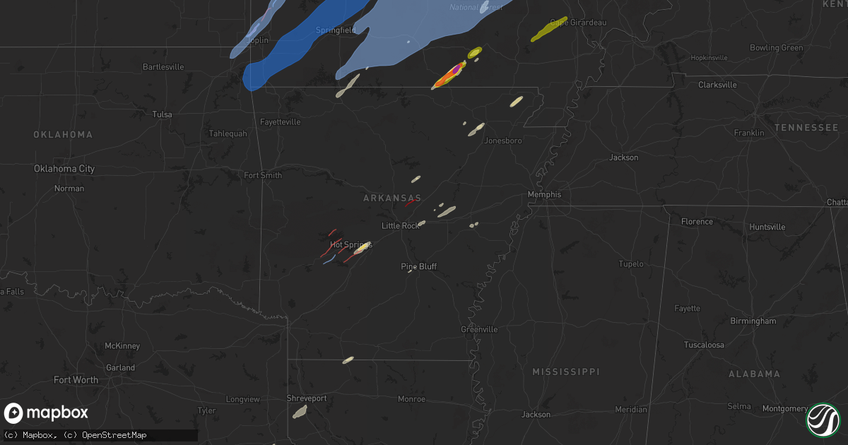
Hail Map in Arkansas on April 20, 2025
Get this storm
April 20 map
$229
one time, instant access
Download today. No call, no setup
Keep the $229
Bought the map and want the full workflow? Apply the entire $229 to a subscription within 7 days. None of it is wasted.
Every map, not just this one
This buys you this map. Subscription and you get every map we run, in the markets you choose from a few cities to whole states to nationwide. Plus real-time alerts the moment a storm fires.
Contact data
Name, contact info, occupancy, even credit band for addresses in the footprint. You go from where it hit to who to call.
Become the source they trust
Unlimited branding weather history reports on demand. You already have the documented answer ready for the property owner, and you are the one who showed up with it.
Property data and RoofTrace estimates
Pull up any address you have got, its value and the exact code rules for that jurisdiction, straight from One Click Code. Then RoofTrace estimates the squares, pitch, and roof value, priced the way you price.
Storm reports in Arkansas
Arkansas
| Date | Description |
|---|---|
| 04/20/20256:59 PM CDT | Ham radio report of tornado that damaged a house near the intersection of ar-highway 319 and indian lakes road. Spotter had view of tornado as it approached their locat |
| 04/20/20255:35 PM CDT | Large tree reported to be blown down and covering roadway. |
| 04/20/20252:55 PM CDT | Large tree limb downed onto a vehicle. Time estimated by radar. |
| 04/20/20252:45 PM CDT | Tree limbs downed that also took down a power line. Pic from a viewer shared with us via broadcast media. Time estimated from radar. |
| 04/20/20252:37 PM CDT | Several homes damaged; time estimated from radar. |
| 04/20/20252:37 PM CDT | A local report indicates a tornado near 2 SE Wheeler |
| 04/19/20258:32 PM CDT | Power lines reported down along ar-state highway 34 near the intersection with us highway 67 to the northeast of the center of walnut ridge. |
| 04/19/20257:13 PM CDT | Trees reported blown down. Report relayed by ham radio. |
| 04/19/20257:01 PM CDT | Tornado reported via ham radio. |
All States Impacted by Hail Map on April 20, 2025
Cities Impacted by Hail Map on April 20, 2025
- New Bloomfield, MO
- Fulton, MO
- Miami, OK
- Baxter Springs, KS
- Commerce, OK
- North Miami, OK
- Picher, OK
- Treece, KS
- Quapaw, OK
- Galena, KS
- Riverton, KS
- Carl Junction, MO
- Asbury, MO
- Joplin, MO
- Webb City, MO
- Oronogo, MO
- Neck City, MO
- Purcell, MO
- Jasper, MO
- Alba, MO
- Carthage, MO
- Jay, OK
- Gravette, AR
- South West City, MO
- Tiff City, MO
- Wyandotte, OK
- Anderson, MO
- Grove, OK
- Neosho, MO
- Seneca, MO
- Noel, MO
- Sulphur Springs, AR
- Goodman, MO
- Pineville, MO
- Lanagan, MO
- Lamar, MO
- Sheldon, MO
- Jerico Springs, MO
- Granby, MO
- Sarcoxie, MO
- Pierce City, MO
- Reeds, MO
- Stark City, MO
- Stella, MO
- Wheaton, MO
- Rocky Comfort, MO
- Fairview, MO
- Exeter, MO
- Monett, MO
- Wentworth, MO
- Purdy, MO
- El Dorado Springs, MO
- Milo, MO
- Stockton, MO
- La Russell, MO
- Stotts City, MO
- Miller, MO
- Mount Vernon, MO
- Osceola, MO
- Lowry City, MO
- Collins, MO
- Freistatt, MO
- Verona, MO
- Ash Grove, MO
- Marionville, MO
- Everton, MO
- Aurora, MO
- Salisbury, MO
- Springfield, MO
- Willard, MO
- Halltown, MO
- Bois D Arc, MO
- Republic, MO
- Billings, MO
- Clinton, MO
- Deepwater, MO
- Warsaw, MO
- Omaha, AR
- Alpena, AR
- Jessieville, AR
- Glenwood, AR
- Walnut Grove, MO
- South Greenfield, MO
- Morrisville, MO
- Aldrich, MO
- Bolivar, MO
- Louisburg, MO
- Urbana, MO
- Pleasant Hope, MO
- Buffalo, MO
- Brighton, MO
- Half Way, MO
- Strafford, MO
- Fair Grove, MO
- Marshfield, MO
- Elkland, MO
- Long Lane, MO
- Bonnerdale, AR
- Royal, AR
- Amity, AR
- Rueter, MO
- Cedarcreek, MO
- Kirbyville, MO
- Sunrise Beach, MO
- Osage Beach, MO
- Lebanon, MO
- Linn Creek, MO
- Camdenton, MO
- Macks Creek, MO
- Eldridge, MO
- Tunas, MO
- Windyville, MO
- Conway, MO
- Roach, MO
- Phillipsburg, MO
- Lake Ozark, MO
- Eldon, MO
- Montreal, MO
- Brumley, MO
- Stoutland, MO
- Tuscumbia, MO
- Kaiser, MO
- Bradleyville, MO
- Ava, MO
- Bismarck, AR
- Pearcy, AR
- Hot Springs National Park, AR
- Branson, MO
- Hollister, MO
- Rockaway Beach, MO
- Walnut Shade, MO
- Powersite, MO
- Forsyth, MO
- Oldfield, MO
- Seymour, MO
- Chadwick, MO
- Sparta, MO
- Garrison, MO
- Taneyville, MO
- Kissee Mills, MO
- Bruner, MO
- Fordland, MO
- Hartville, MO
- Grovespring, MO
- Mansfield, MO
- Niangua, MO
- Rogersville, MO
- Mountain Grove, MO
- Falcon, MO
- Norwood, MO
- Macomb, MO
- Drury, MO
- Lincoln, MO
- Cole Camp, MO
- Stover, MO
- Barnett, MO
- Versailles, MO
- Edwards, MO
- Syracuse, MO
- Tipton, MO
- Florence, MO
- Bunceton, MO
- Fortuna, MO
- Latham, MO
- Boonville, MO
- Clarksburg, MO
- Russellville, MO
- California, MO
- Prairie Home, MO
- Wooldridge, MO
- Jamestown, MO
- New Franklin, MO
- Fayette, MO
- Rocheport, MO
- Columbia, MO
- Ashland, MO
- Harrisburg, MO
- Hartsburg, MO
- Centertown, MO
- Lynchburg, MO
- Graff, MO
- Laquey, MO
- Richland, MO
- Waynesville, MO
- Crocker, MO
- Fort Leonard Wood, MO
- Plato, MO
- Dixon, MO
- Saint Robert, MO
- Huggins, MO
- Cabool, MO
- Bucyrus, MO
- Mountain View, MO
- Yukon, MO
- Newburg, MO
- Edgar Springs, MO
- Solo, MO
- Duke, MO
- Devils Elbow, MO
- Licking, MO
- Houston, MO
- Success, MO
- Summersville, MO
- Raymondville, MO
- Elk Creek, MO
- Willow Springs, MO
- Roby, MO
- Vanzant, MO
- Dora, MO
- Brixey, MO
- Wasola, MO
- Thornfield, MO
- Squires, MO
- Noble, MO
- Ulman, MO
- Eugene, MO
- Olean, MO
- Lohman, MO
- Jefferson City, MO
- Henley, MO
- Iberia, MO
- Holts Summit, MO
- Vienna, MO
- Saint Thomas, MO
- Saint Elizabeth, MO
- Bonnots Mill, MO
- Koeltztown, MO
- Westphalia, MO
- Linn, MO
- Freeburg, MO
- Meta, MO
- Loose Creek, MO
- Belle, MO
- Argyle, MO
- Brinktown, MO
- Tebbetts, MO
- Sturgeon, MO
- Hallsville, MO
- Benton City, MO
- Mexico, MO
- Kingdom City, MO
- Auxvasse, MO
- Thompson, MO
- Centralia, MO
- Martinsburg, MO
- Clark, MO
- Mokane, MO
- Chamois, MO
- Bland, MO
- Steedman, MO
- Malvern, AR
- Beulah, MO
- Vichy, MO
- Rolla, MO
- Lenox, MO
- Salem, MO
- Saint James, MO
- Jerome, MO
- Eunice, MO
- Eminence, MO
- Cuba, MO
- Jadwin, MO
- Hartshorn, MO
- Cook Sta, MO
- Paris, MO
- Center, MO
- Farber, MO
- Santa Fe, MO
- Rush Hill, MO
- Laddonia, MO
- New London, MO
- Perry, MO
- Vandalia, MO
- Wright City, MO
- Wellsville, MO
- High Hill, MO
- Warrenton, MO
- Bellflower, MO
- Montgomery City, MO
- Truesdale, MO
- Jonesburg, MO
- Middletown, MO
- New Florence, MO
- Curryville, MO
- Silex, MO
- Hawk Point, MO
- Frankford, MO
- Truxton, MO
- Bowling Green, MO
- Hermann, MO
- Rhineland, MO
- Williamsburg, MO
- Morrison, MO
- Mount Sterling, MO
- Portland, MO
- Berger, MO
- Marthasville, MO
- Owensville, MO
- Harrison, AR
- Green Forest, AR
- Benton, AR
- Steelville, MO
- Bourbon, MO
- Wesco, MO
- Cherryville, MO
- Leasburg, MO
- Boss, MO
- Bunker, MO
- Davisville, MO
- Viburnum, MO
- Ellington, MO
- Bixby, MO
- Louisiana, MO
- Troy, MO
- Eolia, MO
- New Canton, IL
- Kinderhook, IL
- Ashburn, MO
- Washington, MO
- Barry, IL
- New Haven, MO
- Leslie, MO
- Gerald, MO
- Rosebud, MO
- Salem, AR
- Rose Bud, AR
- Alton, MO
- Thayer, MO
- Koshkonong, MO
- Mammoth Spring, AR
- Jacksonville, AR
- Cabot, AR
- Vilonia, AR
- Austin, AR
- Potosi, MO
- Black, MO
- Centerville, MO
- Belleview, MO
- Hannibal, MO
- Plainville, IL
- Hull, IL
- Camp Point, IL
- Liberty, IL
- Golden, IL
- Pittsfield, IL
- Clayton, IL
- Rockport, IL
- Clarksville, MO
- Baylis, IL
- Pleasant Hill, IL
- New Salem, IL
- Elsberry, MO
- La Prairie, IL
- Timewell, IL
- Huntsville, IL
- Augusta, IL
- Foristell, MO
- Defiance, MO
- Carrollton, IL
- Hillview, IL
- Old Monroe, MO
- Lake Saint Louis, MO
- Batchtown, IL
- Winchester, IL
- Hardin, IL
- O'Fallon, MO
- Versailles, IL
- Milton, IL
- Winfield, MO
- Wentzville, MO
- Plymouth, IL
- Pearl, IL
- Hamburg, IL
- Augusta, MO
- Griggsville, IL
- White Hall, IL
- Kampsville, IL
- Moscow Mills, MO
- Camden, IL
- Brussels, IL
- Annada, MO
- Mount Sterling, IL
- Chambersburg, IL
- Fieldon, IL
- Patterson, IL
- Perry, IL
- Eldred, IL
- Nebo, IL
- Bluffs, IL
- Foley, MO
- Meredosia, IL
- Donnellson, IA
- Farmington, IA
- Wayland, MO
- Kahoka, MO
- Argyle, IA
- Fort Madison, IA
- West Point, IA
- Montrose, IA
- Nauvoo, IL
- Hamilton, IL
- Keokuk, IA
- Niota, IL
- Denmark, IA
- Wever, IA
- Middletown, IA
- West Burlington, IA
- Burlington, IA
- Sperry, IA
- Danville, IA
- Mediapolis, IA
- Carman, IL
- Lomax, IL
- Carthage, IL
- Dallas City, IL
- Couch, MO
- Fremont, MO
- Van Buren, MO
- Tenaha, TX
- Doniphan, MO
- Keithville, LA
- Bismarck, MO
- Concord, IL
- Industry, IL
- Littleton, IL
- Colchester, IL
- Vermont, IL
- Marietta, IL
- Adair, IL
- Astoria, IL
- Smithfield, IL
- Ipava, IL
- Chapin, IL
- Avon, IL
- Macomb, IL
- Frederick, IL
- Rushville, IL
- Roodhouse, IL
- Jacksonville, IL
- Bushnell, IL
- Arenzville, IL
- Table Grove, IL
- Browning, IL
- Beardstown, IL
- Ellisville, IL
- Bardolph, IL
- Prairie City, IL
- Bath, IL
- Pleasant Plains, IL
- Havana, IL
- Lewistown, IL
- Virginia, IL
- Chandlerville, IL
- Cuba, IL
- Murrayville, IL
- Alexander, IL
- Ashland, IL
- Sainte Genevieve, MO
- Berwick, IL
- Monmouth, IL
- Cameron, IL
- Oakville, IA
- Stronghurst, IL
- Oquawka, IL
- Gladstone, IL
- Smithville, AR
- Stonewall, LA
- Shreveport, LA
- Waterloo, IL
- Columbia, IL
- Millstadt, IL
- Belgrade, MO
- Dittmer, MO
- Fletcher, MO
- Caledonia, MO
- Blackwell, MO
- Richwoods, MO
- Lonedell, MO
- Grubville, MO
- Cadet, MO
- Sullivan, MO
- Lesterville, MO
- De Soto, MO
- Cedar Hill, MO
- Saint Louis, MO
- Hillsboro, MO
- Bonne Terre, MO
- Irondale, MO
- Barnhart, MO
- Festus, MO
- House Springs, MO
- Imperial, MO
- Pevely, MO
- Mineral Point, MO
- Arnold, MO
- Crystal City, MO
- Park Hills, MO
- East Carondelet, IL
- Herculaneum, MO
- Valmeyer, IL
- Chester, IL
- Saint Mary, MO
- Bloomsdale, MO
- Smithton, IL
- Arcadia, MO
- Baldwin, IL
- Evansville, IL
- Ironton, MO
- Ellis Grove, IL
- Red Bud, IL
- Middle Brook, MO
- New Athens, IL
- French Village, MO
- Prairie Du Rocher, IL
- Fredericktown, MO
- Modoc, IL
- Walsh, IL
- Leadwood, MO
- Farmington, MO
- Doe Run, MO
- Hecker, IL
- Valles Mines, MO
- Fults, IL
- Pilot Knob, MO
- Sparta, IL
- Annapolis, MO
- Redford, MO
- Alicia, AR
- Hoxie, AR
- Walnut Ridge, AR
- Lonoke, AR
- Carlisle, AR
- Des Arc, AR
- Hazen, AR
- Belleville, IL
- Freeburg, IL
- Lenzburg, IL
- Marissa, IL
- Tilden, IL
- Mascoutah, IL
- Coulterville, IL
- New Baden, IL
- Oakdale, IL
- Saint Libory, IL
- Okawville, IL
- Addieville, IL
- Cutler, IL
- Steeleville, IL
- Percy, IL
- Maquon, IL
- Oakford, IL
- Yates City, IL
- Petersburg, IL
- Farmington, IL
- Williamsfield, IL
- Kilbourne, IL
- Tallula, IL
- Easton, IL
- Brimfield, IL
- Liverpool, IL
- Saint David, IL
- Bryant, IL
- Elmwood, IL
- London Mills, IL
- Topeka, IL
- Fairview, IL
- Canton, IL
- Norris, IL
- Hanna City, IL
- Speer, IL
- Dunlap, IL
- Manito, IL
- Glasford, IL
- Wyoming, IL
- Mapleton, IL
- Laura, IL
- Forest City, IL
- Trivoli, IL
- Princeville, IL
- Edwards, IL
- Kingston Mines, IL
- Peoria, IL
- Bradford, IL
- San Jose, IL
- Groveland, IL
- Mason City, IL
- New Holland, IL
- Armington, IL
- Hopedale, IL
- Delavan, IL
- Deer Creek, IL
- Peoria Heights, IL
- Minier, IL
- Greenview, IL
- Creve Coeur, IL
- East Peoria, IL
- South Pekin, IL
- Mossville, IL
- Emden, IL
- Washington, IL
- Tremont, IL
- Chillicothe, IL
- Metamora, IL
- Mackinaw, IL
- Morton, IL
- Edelstein, IL
- Hartsburg, IL
- Green Valley, IL
- Sparland, IL
- Pekin, IL
- Stanford, IL
- Washburn, IL
- Henry, IL
- Eureka, IL
- Lacon, IL
- Lowpoint, IL
- Roanoke, IL
- Danvers, IL
- Goodfield, IL
- Varna, IL
- Congerville, IL
- Aledo, IL
- Wapello, IA
- Joy, IL
- Keithsburg, IL
- New Boston, IL
- Reynolds, IL
- Seaton, IL
- Taylor Ridge, IL
- Milan, IL
- Rock Island, IL
- Pleasant Valley, IA
- Coal Valley, IL
- Hampton, IL
- Moline, IL
- Le Claire, IA
- Silvis, IL
- East Moline, IL
- Bettendorf, IA
- Little York, IL
- Sherrard, IL
- Raritan, IL
- Victoria, IL
- Port Byron, IL
- Bishop Hill, IL
- Hillsdale, IL
- Altona, IL
- Orion, IL
- East Galesburg, IL
- Knoxville, IL
- Annawan, IL
- Galva, IL
- Biggsville, IL
- Dahinda, IL
- Woodhull, IL
- Media, IL
- New Windsor, IL
- Kirkwood, IL
- Andover, IL
- Carbon Cliff, IL
- Toulon, IL
- Rapids City, IL
- Matherville, IL
- Abingdon, IL
- Henderson, IL
- Atkinson, IL
- Alexis, IL
- Wataga, IL
- Rio, IL
- Roseville, IL
- La Fayette, IL
- Galesburg, IL
- Kewanee, IL
- Geneseo, IL
- Alpha, IL
- Osco, IL
- Gerlaw, IL
- Neponset, IL
- Lynn Center, IL
- Cambridge, IL
- Smithshire, IL
- Viola, IL
- Ophiem, IL
- Colona, IL
- La Harpe, IL
- North Henderson, IL
- Oneida, IL
- Gilson, IL
- Blandinsville, IL
- Sciota, IL
- Saint Augustine, IL
- Erie, IL
- Prophetstown, IL
- Sheffield, IL
- Mineral, IL
- Hooppole, IL
- Buda, IL
- Tampico, IL
- Knobel, AR
- Paragould, AR
- Lafe, AR
- Delaplaine, AR
- Rector, AR
- Piggott, AR
- Corning, AR
- Haynesville, LA
- Zalma, MO
- Pine Bluff, AR
- Toluca, IL
- La Rose, IL
- Magnolia, IL
- Benson, IL
- Minonk, IL
- Secor, IL
- Wappapello, MO
- Gipsy, MO
- McGee, MO
- Marble Hill, MO
- Leopold, MO
- Burfordville, MO
- Whitewater, MO
- Jackson, MO
- Cape Girardeau, MO
- Emerson, AR
- Brinkley, AR
- Moro, AR
- Birch Tree, MO
- Fayetteville, AR


