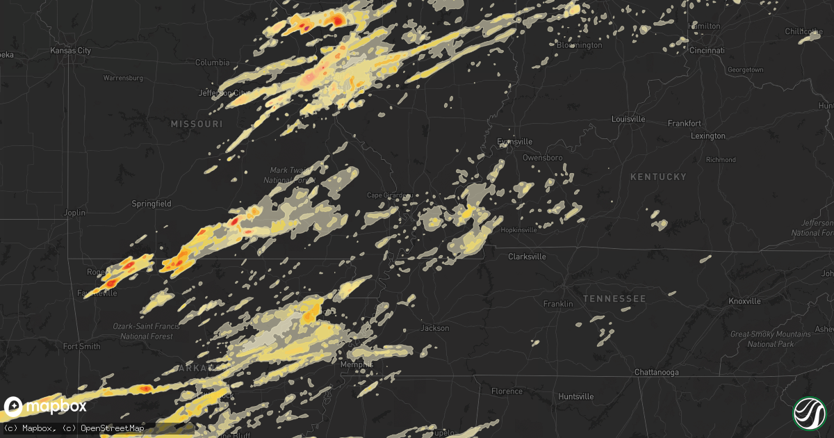
Hail Map in Indiana on April 19, 2011
Get this storm
April 19 map
$229
one time, instant access
Download today. No call, no setup
Keep the $229
Bought the map and want the full workflow? Apply the entire $229 to a subscription within 7 days. None of it is wasted.
Every map, not just this one
This buys you this map. Subscription and you get every map we run, in the markets you choose from a few cities to whole states to nationwide. Plus real-time alerts the moment a storm fires.
Contact data
Name, contact info, occupancy, even credit band for addresses in the footprint. You go from where it hit to who to call.
Become the source they trust
Unlimited branding weather history reports on demand. You already have the documented answer ready for the property owner, and you are the one who showed up with it.
Property data and RoofTrace estimates
Pull up any address you have got, its value and the exact code rules for that jurisdiction, straight from One Click Code. Then RoofTrace estimates the squares, pitch, and roof value, priced the way you price.
Storm reports in Indiana
Indiana
| Date | Description |
|---|---|
| 04/19/201112:06 PM CDT | A local report indicates 1.75 inch wind near ARCADIA |
| 04/19/201111:44 AM CDT | A local report indicates 1.00 inch wind near CARMEL |
| 04/19/201111:37 AM CDT | A local report indicates 1.00 inch wind near LEBANON |
| 04/19/201111:17 AM CDT | A local report indicates 1.00 inch wind near NORTH SALEM |
| 04/19/201111:13 AM CDT | A local report indicates 1.75 inch wind near CRAWFORDSVILLE |
| 04/19/201110:43 AM CDT | A local report indicates 1.00 inch wind near 6 NNE BRAZIL |
| 04/19/201112:32 AM CDT | Large branches broken |
| 04/19/201112:11 AM CDT | Large limbs down |
| 04/19/201112:10 AM CDT | Trees down in the aurora and lawrenceburg areas. |
| 04/19/201112:07 AM CDT | Two trees downed. |
| 04/19/201112:07 AM CDT | Roof blown off garage...barn knocked down and destroyed...and tree snapped. Relayed by wlwt. |
| 04/19/201112:04 AM CDT | A local report indicates 1.00 inch wind near 6 N BROOKVILLE |
| 04/19/201112:04 AM CDT | Survey confirmed ef1 tornado. 2 mile path length began near sr 250 and antioch road and extended northeast toward north branch road. Three barns destroyed and two roofs |
| 04/19/201112:04 AM CDT | At least 3 barns destroyed and 2 homes with roofs blown off near sr 250 and antioch rd. Relayed by wlwt. |
| 04/19/201112:03 AM CDT | Damage survey concluded straight line winds of 80 mph that extended 0.75 mile. Mobile home collapsed on bryants creek road. |
| 04/18/201111:55 PM CDT | A local report indicates 1.25 inch wind near BRIGHT |
| 04/18/201111:55 PM CDT | Three homes with extensive roof damage. Trees and powerlines down. |
| 04/18/201111:53 PM CDT | Tree blown down on a camper at browning campground. |
| 04/18/201111:36 PM CDT | Trees down between deputy and lancaster |
| 04/18/201111:35 PM CDT | Tree down at the intersection of allison lane and middle road. |
| 04/18/201111:34 PM CDT | Widespread structural and tree damage around deputy... Lancaster... And madison... Especially on deputy pike... 933w... 800w... And blake road |
| 04/18/201111:30 PM CDT | Power lines down |
| 04/18/201111:30 PM CDT | Power lines are down on columbus road |
| 04/18/201111:30 PM CDT | Trees down in and around commiskey from 500 s to sr 250 |
| 04/18/201111:29 PM CDT | A local report indicates 62 MPH wind near AUSTIN |
| 04/18/201111:29 PM CDT | Trees downed countywide...some blocking roads. |
| 04/18/201111:28 PM CDT | Damage to a barn and garage near state road 3 in deputy. Trees and power lines were downed county wide in jefferson county. |
| 04/18/201111:28 PM CDT | Ef-0 tornado with wind speeds estimated at 70-75 mph. Path length was 0.1 miles with width of 75 yards. Tornado snapped trees and damaged a shed as well as shingles. To |
| 04/18/201111:28 PM CDT | Ef-1 tornado with wind speeds of 80-90 mph. Path length 1.2 miles and width between 100 and 200 yards. Tornado started in sunset trailer park where multiple trailers we |
| 04/18/201111:27 PM CDT | Power transformers reported blowing. |
| 04/18/201111:26 PM CDT | A local report indicates 65 MPH wind near EDWARDSVILLE |
| 04/18/201111:25 PM CDT | Power transformers blowing west of the city |
| 04/18/201111:23 PM CDT | A local report indicates 59 MPH wind near 4 NE COLUMBUS |
| 04/18/201111:23 PM CDT | Straight-lined wind damage with speeds estimated at 60-65 mph over a path length of 0.4 miles and width of 390 yards. Most intense damage was at a car wash at the junct |
| 04/18/201111:22 PM CDT | Wind damage to road construction signs. |
| 04/18/201111:20 PM CDT | House on sharon dr. Had tree down. |
| 04/18/201111:20 PM CDT | Roof of barn and large garage damaged. |
| 04/18/201111:20 PM CDT | Barn damaged and fencing uprooted |
| 04/18/201111:20 PM CDT | Trees down |
| 04/18/201111:19 PM CDT | Ef-0 tornado with wind speeds of 65-80 mph. Path length 5.2 miles and width 50 to 100 yards. Hotel near i-65 was damaged on east side of second floor. Several nearby ho |
| 04/18/201111:19 PM CDT | Ef-0 tornado with wind speeds of 65-80 mph. Path length 12.3 miles and width 50 to 100 yards. Hotel near i-65 was damaged on east side of second floor. Several nearby h |
| 04/18/201111:18 PM CDT | Traffic light has been damaged at k street and 15. Various debris on elm street. Tree limb down at 12 and m streets...about 4 inches thick and 8 feet long. |
| 04/18/201111:17 PM CDT | Tree down on garage on south lake road. |
| 04/18/201111:15 PM CDT | Trees down |
| 04/18/201111:15 PM CDT | Power lines and tree limbs down. Limbs are 12 inches or larger in diameter. |
| 04/18/201111:15 PM CDT | A local report indicates 60 MPH wind near 2 S SPEARSVILLE |
| 04/18/201111:15 PM CDT | Roof off a house in eastern new albany on vincennes. |
| 04/18/201111:15 PM CDT | At least 4-inch diameter tree limbs down |
| 04/18/201111:14 PM CDT | Ef-0 tornado snapped and uprooted trees...damaged a roof of a house near north rutherford hollow road. Estimated winds of 65-80 mph |
| 04/18/201111:14 PM CDT | Several trees down in city...some twisted. Sheet metal from a barn off washington street wrapped around fencing. Winds estimated at least at 60 mph. |
| 04/18/201111:14 PM CDT | Trees and power lines down |
| 04/18/201111:10 PM CDT | Trees and power lines down |
| 04/18/201111:09 PM CDT | Trees down |
| 04/18/201111:09 PM CDT | Ef-0 tornado with wind speeds estimated at 65 mph. Path length was 0.3 miles with width of 50 yards. Numerous hardwood and softwood trees were either snapped or uproote |
| 04/18/201111:05 PM CDT | A local report indicates 60 MPH wind near BLOOMINGTON |
| 04/18/201111:05 PM CDT | 12-inch live tree limb down |
| 04/18/201111:03 PM CDT | Trees down |
| 04/18/201111:02 PM CDT | A local report indicates 63 MPH wind near ROME |
| 04/18/201111:01 PM CDT | Construction trailer by mcdonalds flipped over. Tree nearby blown down. |
| 04/18/201111:01 PM CDT | A local report indicates 70 MPH wind near BEDFORD |
| 04/18/201111:00 PM CDT | Tree downed at 29th and illinois. |
| 04/18/201110:59 PM CDT | Sporadic straight line wind damage across south crawford and west central harrison counties. Numerous trees were damaged...eaves on two houses were blown off in additio |
| 04/18/201110:58 PM CDT | A local report indicates 65 MPH wind near LEAVENWORTH |
| 04/18/201110:56 PM CDT | Signs have been blown down near the arbys and mcdonalds |
| 04/18/201110:54 PM CDT | 3-foot diameter tree blew down |
| 04/18/201110:54 PM CDT | Garage moved off its foundation. Time is radar estimated. |
| 04/18/201110:51 PM CDT | A local report indicates 65 MPH wind near ENGLISH |
| 04/18/201110:51 PM CDT | Multiple cars and trucks blown off the road. Approx location. Report came between mile markers 147 and 152 on interstate 65. |
| 04/18/201110:50 PM CDT | Late report. Large trees down and uprooted along hwy 57. Some trees blocking roads countywide. |
| 04/18/201110:50 PM CDT | A local report indicates 60 MPH wind near PAOLI |
| 04/18/201110:50 PM CDT | A local report indicates 68 MPH wind near 3 SE ODON |
| 04/18/201110:50 PM CDT | A local report indicates 63 MPH wind near ORLEANS |
| 04/18/201110:49 PM CDT | 90 mph winds uprooted trees and blew half of a metal roof off of a house |
| 04/18/201110:49 PM CDT | Trees and power lines down across the city. |
| 04/18/201110:47 PM CDT | Ef0 tornado uprooted trees and peeled a metal roof off of a small outbuilding |
| 04/18/201110:45 PM CDT | Six to eight tree limbs were blown down about 6 to 8 inches. |
| 04/18/201110:45 PM CDT | A local report indicates 1.75 inch wind near LITTLE POINT |
| 04/18/201110:40 PM CDT | Ef1 tornado 5.6 miles south of french lick. Tree and structural damage. |
| 04/18/201110:40 PM CDT | Ef1 tornado 7.7 miles south of french lick. Tree and structural damage at and near tonys marina |
| 04/18/201110:39 PM CDT | Ef2 tornado. Structural and tree damage from roland to one mile east of roland |
| 04/18/201110:38 PM CDT | A local report indicates 65 MPH wind near TASWELL |
| 04/18/201110:35 PM CDT | Straight line winds destroying barn and trees down. |
| 04/18/201110:35 PM CDT | Overturned mobile homes reported in the city of jasper. |
| 04/18/201110:34 PM CDT | Numerous trees and power lines down across the city. |
| 04/18/201110:29 PM CDT | Utility lines are down. Power out in town. |
| 04/18/201110:26 PM CDT | Ef-1 tornado with wind speeds at 95 mph. Path length of 0.4 miles and width 100 yards. Hardwood trees snapped and uprooted. Also...structural damage to a residence nort |
| 04/18/201110:26 PM CDT | A nws storm survey determined that an ef-0 tornado began 1.5 miles west of haysville...tracked for two miles...then lifted 0.5 miles east of haysville. The tornado trac |
| 04/18/201110:26 PM CDT | Ef-2 tornado with wind speeds of 115-120 mph. Path length was 3.3 miles and width 300 yards. Tornado initiated north of bretzville and tracked to the northeast ending n |
| 04/18/201110:26 PM CDT | Numerous trees down in the seven curves area of highway 257. Trees also down at cr 500 s and hwy 257. |
| 04/18/201110:25 PM CDT | Measured at jasper middle school |
| 04/18/201110:25 PM CDT | Ef-0 tornado confirmed near haysville. It damaged mostly trees along its 2 mile path. The most intense damage was found east of haysville right before the tornado lifte |
| 04/18/201110:25 PM CDT | A local report indicates 1.00 inch wind near BRAZIL |
| 04/18/201110:22 PM CDT | Ef-1 tornado with wind speeds estimated at 100-105 mph. Path length was 3.1 miles and width 100-200 yards. A well-constructed 75 foot tall grain silo had the top 40 ft |
| 04/18/201110:22 PM CDT | Ef-0 tornado with wind speeds of 80 mph. Path length was 0.3 miles and width 200 yards. Large swath of hardwood trees snapped and uprooted. Additionally straight-line w |
| 04/18/201110:17 PM CDT | Numerous trees and power lines down across the county |
| 04/18/201110:17 PM CDT | 3 power poles snapped. Us 27 closed between 400 n and 500 n. Power flashes were reported. |
| 04/18/201110:16 PM CDT | The national weather service has confirmed an ef1 torando in jay county. The tornado skipped along a path of almost 7 miles with a max width of 50 yards. The tornado be |
| 04/18/201110:15 PM CDT | A 60 by 80 foot pole barn was demolished by high winds a mile west of il route 33. |
| 04/18/201110:15 PM CDT | Roofs off outbuildings. Chicken coop blow over. Time estimated from radar. Debris in road. |
| 04/18/201110:15 PM CDT | Late report. Power lines down. Telephone poles snapped along old state hwy 65. |
| 04/18/201110:15 PM CDT | Roof blown off structure on camp arthur rd |
| 04/18/201110:14 PM CDT | A local report indicates 60 MPH wind near VINCENNES |
| 04/18/201110:08 PM CDT | 2 1/2 foot diameter tree limb down at 4625 100 north |
| 04/18/201110:08 PM CDT | Quarter size hail reported. |
| 04/18/201110:03 PM CDT | 60 by 100 foot building blown away on s wabash river road. High tension lines downed. Windows blown in other structure. |
| 04/18/201110:00 PM CDT | Large tree on trailer |
| 04/18/201110:00 PM CDT | In the town of greenwood...shed flattened and barn roof destroyed with additional damage to patio awning. Roof off a machinery building. Another shed was blown onto a p |
| 04/18/20119:59 PM CDT | A local report indicates 76 MPH wind near EVANSVILLE |
| 04/18/20119:58 PM CDT | Large branches down...barn damaged |
| 04/18/20119:58 PM CDT | A local report indicates 59 MPH wind near FORT BRANCH |
| 04/18/20119:54 PM CDT | Barn blown off foundation |
| 04/18/20119:51 PM CDT | Numerous power lines down on road 1050 south |
| 04/18/20119:50 PM CDT | 32 foot travel trailer rolled twice and destroyed. Roof of milkhouse blown off and concrete brick wall blown down. Insulation and skirting from mobile home blown about. |
| 04/18/20119:50 PM CDT | Power out at southport and madison. |
| 04/18/20119:48 PM CDT | The national weather service has confirmed a low end ef1 tornado in grant county indiana. This tornado began approximately 3 miles sw of upland and ended just wnw of up |
| 04/18/20119:41 PM CDT | The national weather service has confirmed an ef1 tornado in grant county indiana. This tornado began approximately 3.5 miles sw of fairmount and ended approximately 2. |
| 04/18/20119:40 PM CDT | Full barn blown into a house. Time estimated from radar. |
| 04/18/20119:40 PM CDT | 3 residential damage reports of roof damage to house...wind damage to a house...and roof removed from house. All reports to the sw and w of fairmount. |
| 04/18/20119:38 PM CDT | Several large trees down in the city limits |
| 04/18/20119:38 PM CDT | Late report. Wind damage reported west of town. |
| 04/18/20119:37 PM CDT | A local report indicates 65 MPH wind near AVON |
| 04/18/20119:35 PM CDT | Barn blown down on 1942 n sr13 |
| 04/18/20119:31 PM CDT | Hail at mile marker 27 eastbound on i-70 1 mile southeast of asherville indiana |
| 04/18/20119:30 PM CDT | Grain bins blown over |
| 04/18/20119:28 PM CDT | Tree down across sr 16...estimated time by radar. |
| 04/18/20119:25 PM CDT | Multiple utility lines are down on south side of city by measured 56 mph. |
| 04/18/20119:24 PM CDT | Barn down at 150 s and 500 e. Power lines and trees down across the county. |
| 04/18/20119:20 PM CDT | The national weather service confirmed a low end ef0 tornado in cass county indiana. This tornado briefly touched down 1 mile east of twelve mile. The tornado had an ap |
| 04/18/20119:20 PM CDT | Four trees snapped or uprooted at howard regional hospital |
| 04/18/20119:20 PM CDT | Large tree down across roadway at 300 n just west of us31. Time estimated from radar. |
| 04/18/20119:20 PM CDT | Tree down at 400 s and 300 e. Another tree down on sr35 just north of sr10...time estimated from radar. |
| 04/18/20119:20 PM CDT | Roof damage to a house at 1838e 100n. |
| 04/18/20119:20 PM CDT | Tv antenna by house bent down. Roof off garage. |
| 04/18/20119:19 PM CDT | The national weather service confirmed a low end ef0 tornado in cass county indiana. The tornado briefly touched down 2 miles nne of adamsboro. The tornado had an appro |
| 04/18/20119:18 PM CDT | Approximately 20 vehicles at the miami county correctional facility had damage to vehicles...windows blown out. Several vehicles at residences around the facility have |
| 04/18/20119:16 PM CDT | Roof flipped off a strip mall building at 6656 st joe rd. |
| 04/18/20119:15 PM CDT | Barn damage and trees down |
| 04/18/20119:15 PM CDT | Several very large trees down...some trees were snapped in half...others were uprooted |
| 04/18/20119:12 PM CDT | A local report indicates 70 MPH wind near WHITESTOWN |
| 04/18/20119:06 PM CDT | Trees downed. Estimated 80 mph wind gust. |
| 04/18/20119:05 PM CDT | Pole building destroyed. Time estimated from radar. |
| 04/18/20119:05 PM CDT | Roof damage to multiple structures. Time is estimated. |
| 04/18/20119:05 PM CDT | Roof damage to multiple structures. Time is estimated. |
| 04/18/20119:05 PM CDT | Roof damage to multiple structures in terhune. Time is estimated. Correction to being reported in sheridan. |
| 04/18/20119:00 PM CDT | Grain elevator destoryed. Part of a building blown in . Home damaged. Time estimated from radar. |
| 04/18/20119:00 PM CDT | Widespread structural damage to grain elevators and outside buildings with multiple large trees down. |
| 04/18/20119:00 PM CDT | Barn destroyed near interstate 65 and sr 47. Time estimated from radar. |
| 04/18/20118:58 PM CDT | Two trees down and 1 power pole down |
| 04/18/20118:55 PM CDT | A local report indicates 60 MPH wind near 10 WSW FRANKFORT |
| 04/18/20118:55 PM CDT | Trees downed. |
| 04/18/20118:50 PM CDT | Trees downed on south side of town. |
| 04/18/20118:48 PM CDT | Large tree down across road in far northeast newton county. |
| 04/18/20118:48 PM CDT | Measured on state route 225 in prophetstown |
| 04/18/20118:43 PM CDT | Large tree down across south county road 1200w by iroquois river. Time estimated. |
| 04/18/20118:34 PM CDT | Large tree down across road in far southeast newton county. |
| 04/18/20118:30 PM CDT | Several telephone poles down. |
| 04/18/20118:30 PM CDT | 80 foot section of metal roof blown off of hog farm. |
| 04/18/20118:30 PM CDT | Metal shed torn up. |
| 04/18/20118:30 PM CDT | Public report relayed by the emergency manager. |
| 04/18/20118:30 PM CDT | Tool shed and grain bin blow down with shingles blown off several houses. |
| 04/18/20118:25 PM CDT | A local report indicates 1.00 inch wind near KINGMAN |
| 04/18/20118:08 PM CDT | Multiple trees and power lines down. Siding and shingles ripped off home. |
| 04/18/20117:35 PM CDT | Tree limbs down. Winds reported at 60 mph. Marble size hail also reported. |
| 04/18/20117:35 PM CDT | A local report indicates 60 MPH wind near CLINTON |
All States Impacted by Hail Map on April 19, 2011
Cities Impacted by Hail Map on April 19, 2011
- Eldred, IL
- Carrollton, IL
- Henning, TN
- Ripley, TN
- Olive Branch, MS
- Byhalia, MS
- Hernando, MS
- Marshall, AR
- Leslie, AR
- Carthage, AR
- Chardon, OH
- Montville, OH
- Pomona, MO
- Willow Springs, MO
- Haworth, OK
- Foreman, AR
- Roodhouse, IL
- White Hall, IL
- Hillview, IL
- Patterson, IL
- Greenfield, IL
- Annapolis, MO
- Des Arc, MO
- Holcomb, MS
- Scobey, MS
- Grenada, MS
- Coffeeville, MS
- Cascilla, MS
- Sturgis, MS
- Ackerman, MS
- Maben, MS
- Starkville, MS
- Mathiston, MS
- Orlando, FL
- Bauxite, AR
- Bryant, AR
- Benton, AR
- Jacksonville, AR
- North Little Rock, AR
- Sherwood, AR
- Scott, AR
- Lonsdale, AR
- Little Rock, AR
- Mabelvale, AR
- Alexander, AR
- Traskwood, AR
- Carlinville, IL
- Modesto, IL
- Hettick, IL
- Waverly, IL
- Virden, IL
- Girard, IL
- Franklin, IL
- Palmyra, IL
- East Carondelet, IL
- Columbia, IL
- Glen Carbon, IL
- Edwardsville, IL
- Collinsville, IL
- Saint Jacob, IL
- East Saint Louis, IL
- Troy, IL
- Dupo, IL
- Millstadt, IL
- Saint Louis, MO
- Granite City, IL
- Maryville, IL
- Caseyville, IL
- Madison, IL
- Hooks, TX
- New Boston, TX
- Gilson, IL
- Dahinda, IL
- Williamsfield, IL
- Atoka, OK
- Coalgate, OK
- Talihina, OK
- Honobia, OK
- Nashoba, OK
- Jonesboro, AR
- Eldon, IA
- Shawneetown, IL
- Ridgway, IL
- Junction, IL
- Hampton, AR
- New Haven, IN
- Woodburn, IN
- Arlington, TX
- Bedford, TX
- Euless, TX
- North Richland Hills, TX
- Hurst, TX
- Fort Worth, TX
- Martinsville, IL
- Dennison, IL
- Marshall, IL
- Casey, IL
- Kansas, IL
- Paris, IL
- West Terre Haute, IN
- Westfield, IL
- Warrenton, MO
- Marquand, MO
- Fredericktown, MO
- Hampton, KY
- Marion, KY
- Salem, KY
- Colt, AR
- McCrory, AR
- Cotton Plant, AR
- New Haven, MO
- Chamois, MO
- Freeburg, MO
- Westphalia, MO
- Berger, MO
- Hermann, MO
- Loose Creek, MO
- Linn, MO
- Morrison, MO
- Bonnots Mill, MO
- Eureka Springs, AR
- Huntsville, AR
- Berryville, AR
- Frankford, MO
- Curryville, MO
- Bowling Green, MO
- Spencer, IN
- Bowling Green, IN
- Crawfordsville, IN
- Stringtown, OK
- Comstock Park, MI
- Gates Mills, OH
- Cleveland, OH
- Lancaster, OH
- Sugar Grove, OH
- Bremen, OH
- Hopkinsville, KY
- Crofton, KY
- Millport, AL
- Kennedy, AL
- Vernon, AL
- Morgantown, KY
- Lewisburg, KY
- West Alexandria, OH
- Camden, OH
- Martin, TN
- Dresden, TN
- Bennington, OK
- Boswell, OK
- Arcadia, FL
- Trumann, AR
- Harrisburg, AR
- Marked Tree, AR
- Alligator, MS
- Duncan, MS
- Clarksdale, MS
- Ashdown, AR
- Wilton, AR
- Dierks, AR
- Richfield, OH
- Hinckley, OH
- Medina, OH
- New Florence, MO
- Eureka, MO
- House Springs, MO
- State University, AR
- Grapevine, TX
- Southlake, TX
- Dixon, MO
- Devils Elbow, MO
- Rolla, MO
- Vichy, MO
- Saint James, MO
- Newburg, MO
- Jerome, MO
- Hartford, KY
- Cadiz, KY
- Rosebud, MO
- Gerald, MO
- Harrell, AR
- Alvarado, TX
- Keene, TX
- Godley, TX
- Joshua, TX
- Cleburne, TX
- Burleson, TX
- Grandview, TX
- Hillsboro, TX
- Covington, TX
- Itasca, TX
- Milford, TX
- Mountain View, MO
- Saint Joseph, IL
- Section, AL
- Mason, TN
- Arlington, TN
- Gibson City, IL
- Foosland, IL
- Rogers, AR
- Elkton, KY
- Sharon Grove, KY
- Black Rock, AR
- Caledonia, MS
- Philipp, MS
- Minter City, MS
- Pulaski, IL
- Olmsted, IL
- Villa Ridge, IL
- Knobel, AR
- Corning, AR
- Marvell, AR
- Lexa, AR
- Poplar Grove, AR
- Lakeland, FL
- Plant City, FL
- Terre Haute, IN
- Rosedale, IN
- Higginson, AR
- Clarksville, TX
- Bowling Green, KY
- Wappapello, MO
- McGee, MO
- Pleasant Plains, AR
- Bradford, AR
- Camden, AR
- Pontotoc, MS
- Shannon, MS
- Wolfe City, TX
- Ladonia, TX
- Golden Eagle, IL
- Brussels, IL
- Saint Charles, MO
- O'Fallon, MO
- Hot Springs National Park, AR
- Bismarck, AR
- Gillespie, IL
- Raymond, IL
- Fieldon, IL
- Earth City, MO
- Cedar Hill, MO
- Pocahontas, IL
- Winchester, IL
- Elsah, IL
- Pearl, IL
- Greenville, IL
- Piasa, IL
- Altamont, IL
- Grafton, IL
- Loami, IL
- Alton, IL
- Valmeyer, IL
- Hillsboro, IL
- Pleasant Hill, IL
- Bingham, IL
- New Douglas, IL
- Litchfield, IL
- Mount Olive, IL
- West Alton, MO
- Rockport, IL
- Stewardson, IL
- Bland, MO
- Saint Peters, MO
- Valley Park, MO
- O'Fallon, IL
- Wright City, MO
- Clarksville, MO
- Shipman, IL
- Fenton, MO
- Ballwin, MO
- Florissant, MO
- Catawissa, MO
- Alexander, IL
- Hamel, IL
- Saint Clair, MO
- Mulberry Grove, IL
- Neoga, IL
- Beecher City, IL
- Nebo, IL
- Fairview Heights, IL
- Imperial, MO
- Portage Des Sioux, MO
- Bethalto, IL
- Saint Ann, MO
- Trilla, IL
- Brownstown, IL
- Godfrey, IL
- Murrayville, IL
- Coffeen, IL
- Owensville, MO
- High Ridge, MO
- Brighton, IL
- Taylor Springs, IL
- Panama, IL
- Augusta, MO
- Beaufort, MO
- Lerna, IL
- Maryland Heights, MO
- Hartford, IL
- Jefferson City, MO
- Donnellson, IL
- Effingham, IL
- Leslie, MO
- Marine, IL
- Dow, IL
- Worden, IL
- Pacific, MO
- Alhambra, IL
- Union, MO
- Jerseyville, IL
- Wildwood, MO
- Hazelwood, MO
- Dittmer, MO
- Bunker Hill, IL
- Fidelity, IL
- Cowden, IL
- Lake Saint Louis, MO
- Medora, IL
- Staunton, IL
- Defiance, MO
- Bridgeton, MO
- Chesterfield, IL
- Dorsey, IL
- Jacksonville, IL
- Toledo, IL
- Belleville, IL
- Foristell, MO
- Roxana, IL
- Lonedell, MO
- Lebanon, IL
- Fillmore, IL
- Livingston, IL
- Sigel, IL
- Old Monroe, MO
- Chesterfield, MO
- Shumway, IL
- Robertsville, MO
- Pittsfield, IL
- Moro, IL
- Waggoner, IL
- Wentzville, MO
- Highland, IL
- Sorento, IL
- Kane, IL
- Cottage Hills, IL
- Walshville, IL
- Washington, MO
- East Alton, IL
- Belle, MO
- Marthasville, MO
- Louisiana, MO
- Arnold, MO
- Ramsey, IL
- Wood River, IL
- Nilwood, IL
- Kampsville, IL
- Thebes, IL
- Benton, MO
- Advance, MO
- Oran, MO
- Bell City, MO
- Scott City, MO
- Madisonville, KY
- Sacramento, KY
- Vernon, IL
- Kinmundy, IL
- Alma, IL
- Patoka, IL
- Lead Hill, AR
- Harrison, AR
- Lane, OK
- Saint Augustine, IL
- Avon, IL
- Decatur, IL
- Oreana, IL
- Calhoun City, MS
- Frisco, TX
- Little Elm, TX
- Rushville, IL
- Mount Sterling, IL
- Frederick, IL
- Wellsville, MO
- Vandalia, MO
- Middletown, MO
- Vilonia, AR
- Romance, AR
- Enola, AR
- Mount Vernon, AR
- Denton, TX
- Pine Bluff, AR
- Rison, AR
- Houston, MS
- Mayflower, AR
- Squires, MO
- Wasola, MO
- Noble, MO
- Ava, MO
- Powderly, TX
- Dekalb, IL
- Painesville, OH
- Saint Louisville, OH
- Utica, OH
- Quitman, AR
- Aberdeen, MS
- Okolona, MS
- McCarley, MS
- Duck Hill, MS
- Avery, TX
- Annona, TX
- De Kalb, TX
- Jewett, IL
- Farina, IL
- Hidalgo, IL
- Mason, IL
- Wheeler, IL
- Carlyle, IL
- Dieterich, IL
- Vandalia, IL
- Saint Peter, IL
- Greenup, IL
- West Union, IL
- Yale, IL
- Montrose, IL
- Newton, IL
- Watson, IL
- Edgewood, IL
- Shobonier, IL
- Inverness, MS
- Belzoni, MS
- Greenville, MS
- Isola, MS
- Leland, MS
- Hollandale, MS
- Indianola, MS
- Violet Hill, AR
- Franklin, AR
- Saint Michael, PA
- Sidman, PA
- Claysburg, PA
- Johnstown, PA
- Portage, PA
- Beaverdale, PA
- South Fork, PA
- Summerhill, PA
- East Freedom, PA
- Salix, PA
- Roaring Spring, PA
- Sherman, TX
- Tamms, IL
- Ullin, IL
- Lockesburg, AR
- Clayton, IL
- Timewell, IL
- Camden, IL
- Guilford, IN
- Sunman, IN
- Lawrenceburg, IN
- Harrison, OH
- West Harrison, IN
- Morganfield, KY
- Waverly, KY
- Muse, OK
- Smithville, OK
- Whitesboro, OK
- Hodgen, OK
- Grand Rivers, KY
- Calvert City, KY
- Brighton, IA
- Lockridge, IA
- Mount Pleasant, IA
- Fairfield, IA
- Wayland, IA
- Paris, MS
- Water Valley, MS
- Oxford, MS
- Crowley, TX
- Waterloo, IL
- White Hall, AR
- Springdale, AR
- Fayetteville, AR
- Hindsville, AR
- Peel, AR
- Yellville, AR
- Northbrook, IL
- Peoria, IL
- East Peoria, IL
- Creve Coeur, IL
- Somerville, TN
- Rushville, IN
- Brookville, IN
- Laurel, IN
- Oldenburg, IN
- Greensburg, IN
- Metamora, IN
- New Madrid, MO
- Catron, MO
- Matthews, MO
- Bertrand, MO
- East Prairie, MO
- Brownsville, TN
- Tillar, AR
- Evansville, IN
- Centertown, KY
- Sinclairville, NY
- Fort Leonard Wood, MO
- Dexter, KY
- Almo, KY
- Murray, KY
- Palestine, AR
- Roland, AR
- Silva, MO
- Malvern, AR
- Blue Eye, MO
- Lampe, MO
- Rome, OH
- Orwell, OH
- Russellville, KY
- Friendship, TN
- Trenton, TN
- Halls, TN
- Dyersburg, TN
- Montverde, FL
- Salem, MO
- Divernon, IL
- Dover, OH
- New Philadelphia, OH
- Bismarck, IL
- Danville, IL
- Oakwood, IL
- Hendrix, OK
- Savoy, TX
- Bells, TX
- Ravenna, TX
- Denison, TX
- Londonderry, OH
- Chillicothe, OH
- Elizabethtown, IL
- Joiner, AR
- Batesville, AR
- Floral, AR
- Kensett, AR
- Searcy, AR
- Judsonia, AR
- Casa, AR
- Kennett, MO
- Hornersville, MO
- Cardwell, MO
- Senath, MO
- Arbyrd, MO
- Heavener, OK
- Mena, AR
- Morgantown, IN
- Ravenden, AR
- Ravenden Springs, AR
- Waynesville, MO
- La Center, KY
- Obion, TN
- Hornbeak, TN
- Lake Village, AR
- Argyle, TX
- Ponder, TX
- Justin, TX
- Krum, TX
- Arkadelphia, AR
- Fulton, AR
- Stephens, AR
- Leola, AR
- Ivanhoe, TX
- Gurdon, AR
- Washington, AR
- Arthur City, TX
- Thornton, AR
- Rosston, AR
- Fordyce, AR
- Paris, TX
- Mineral Springs, AR
- Friendship, AR
- Bluff City, AR
- Chidester, AR
- Emmet, AR
- Sheridan, AR
- Idabel, OK
- Okolona, AR
- Winthrop, AR
- Jersey, AR
- Donaldson, AR
- De Queen, AR
- Amity, AR
- Howe, TX
- Bonham, TX
- Kingsland, AR
- Detroit, TX
- Delight, AR
- Banks, AR
- Sumner, TX
- Eagletown, OK
- Sparkman, AR
- Hope, AR
- Alleene, AR
- Saratoga, AR
- Horatio, AR
- Honey Grove, TX
- Bagwell, TX
- Brookston, TX
- Murfreesboro, AR
- Poyen, AR
- Prescott, AR
- Antoine, AR
- Bearden, AR
- Warren, AR
- Telephone, TX
- Blevins, AR
- Nashville, AR
- New Edinburg, AR
- Blossom, TX
- McCaskill, AR
- Granbury, TX
- Rio Vista, TX
- Vardaman, MS
- Pittsboro, MS
- Houlka, MS
- Jefferson, OH
- Ashtabula, OH
- Munroe Falls, OH
- Akron, OH
- Tallmadge, OH
- Stow, OH
- Kent, OH
- Oak Brook, IL
- Dallas, TX
- Pangburn, AR
- Lowell, AR
- Tremont, MS
- Colleyville, TX
- Gilbertsville, KY
- Hickory Ridge, AR
- Cherry Valley, AR
- Wynne, AR
- Argenta, IL
- Cisco, IL
- Norman, AR
- Mount Ida, AR
- Mt Zion, IL
- Dalton City, IL
- Dudley, MO
- Dexter, MO
- Schlater, MS
- West Plains, MO
- Birch Tree, MO
- Peace Valley, MO
- Princeton, KY
- Eddyville, KY
- Springfield, AR
- Greenbrier, AR
- Damascus, AR
- Lewisville, TX
- The Colony, TX
- Camp, AR
- Glencoe, AR
- Quincy, IN
- Stilesville, IN
- Monrovia, IN
- Cloverdale, IN
- Clayton, IN
- Greencastle, IN
- Fillmore, IN
- Coatesville, IN
- Martinsville, IN
- Shelbyville, IN
- Alpena, AR
- Green Forest, AR
- Oconee, IL
- Grapevine, AR
- Princeville, IL
- Dunlap, IL
- Edelstein, IL
- Speer, IL
- Plainview, AR
- Moores Hill, IN
- Milan, IN
- Aurora, IN
- Ellsinore, MO
- Grandin, MO
- Williamsville, MO
- Poplar Bluff, MO
- Saint David, IL
- Bryant, IL
- Elmwood, IL
- Hanna City, IL
- Cuba, IL
- Canton, IL
- Glasford, IL
- Wyoming, IL
- Trivoli, IL
- Farmington, IL
- Norris, IL
- Sparland, IL
- Lewistown, IL
- Brimfield, IL
- Mapleton, IL
- Falconer, NY
- Kennedy, NY
- Duke, MO
- Bradyville, TN
- Morrison, TN
- Klondike, TX
- Sulphur Springs, TX
- Cooper, TX
- Commerce, TX
- Dike, TX
- Pecan Gap, TX
- Colbert, OK
- Monroeville, IN
- Roann, IN
- Denver, IN
- Macy, IN
- Pollard, AR
- Piggott, AR
- Manchester, TN
- Wartrace, TN
- Beechgrove, TN
- De Soto, MO
- Brickeys, AR
- Marianna, AR
- Smithland, KY
- Tiline, KY
- Commerce Township, MI
- White Lake, MI
- Prairie Grove, AR
- Golden, MO
- Hollister, MO
- Elkins, AR
- Garfield, AR
- Oak Grove, AR
- Eagle Rock, MO
- Shell Knob, MO
- Farmington, AR
- Ridgedale, MO
- Omaha, AR
- Patton, MO
- Perryville, MO
- Waldron, AR
- Protem, MO
- Gosport, IN
- Bloomington, IN
- Ellettsville, IN
- Houston, MO
- Eudora, AR
- Itta Bena, MS
- Moorhead, MS
- Piedmont, MO
- Van Buren, MO
- Swifton, AR
- Tuckerman, AR
- Parthenon, AR
- Jasper, AR
- Deer, AR
- Hasty, AR
- Vendor, AR
- Benton, KY
- Ingraham, IL
- Tyronza, AR
- Wilmar, AR
- Pearcy, AR
- Tucker, AR
- Moyers, OK
- Hunter, AR
- Letona, AR
- Desha, AR
- Star City, AR
- Amagon, AR
- Walnut Ridge, AR
- Gilmore, AR
- Heber Springs, AR
- Alicia, AR
- Oil Trough, AR
- Beebe, AR
- Bald Knob, AR
- Burlison, TN
- Des Arc, AR
- Newark, AR
- Cartwright, OK
- Newhope, AR
- Clayton, OK
- Bokchito, OK
- Hot Springs Village, AR
- Wabbaseka, AR
- Fairfield Bay, AR
- Sherrill, AR
- Harvey, AR
- Paron, AR
- England, AR
- De Valls Bluff, AR
- Crawfordsville, AR
- Fisher, AR
- Rosie, AR
- Russell, AR
- Hensley, AR
- Snow, OK
- Brookland, AR
- Whitewright, TX
- El Paso, AR
- Yorktown, AR
- Ida, AR
- Boles, AR
- Wilson, AR
- Prim, AR
- Altheimer, AR
- Wilburn, AR
- Turrell, AR
- Humnoke, AR
- Griffithville, AR
- Conway, AR
- McRae, AR
- Bee Branch, AR
- Shirley, AR
- Maumelle, AR
- Tumbling Shoals, AR
- Concord, AR
- Prattsville, AR
- Drummonds, TN
- Parks, AR
- Grady, AR
- Augusta, AR
- Little Rock Air Force Base, AR
- Dyess, AR
- Bassett, AR
- Hazen, AR
- Thida, AR
- Parkin, AR
- Antlers, OK
- Earle, AR
- Austin, AR
- Sulphur Rock, AR
- Ozan, AR
- Wapanucka, OK
- Mountain View, AR
- Weiner, AR
- Rattan, OK
- Charlotte, AR
- Edgemont, AR
- Bono, AR
- Lepanto, AR
- Gillham, AR
- Osceola, AR
- Ulm, AR
- Stuttgart, AR
- Garner, AR
- Locust Grove, AR
- Umpire, AR
- Frenchmans Bayou, AR
- Albion, OK
- Rose Bud, AR
- Hermitage, AR
- Bigelow, AR
- Drasco, AR
- Calera, OK
- Magness, AR
- Brighton, TN
- Redfield, AR
- Carlisle, AR
- Beedeville, AR
- Perryville, AR
- Booneville, AR
- Newport, AR
- Daisy, OK
- Marcella, AR
- Higden, AR
- Jefferson, AR
- Roe, AR
- Durant, OK
- Tupelo, OK
- Kirby, AR
- Paragould, AR
- Cabot, AR
- Cord, AR
- Cash, AR
- Columbia, KY
- Springfield, IL
- Sherman, IL
- Elkhart, IL
- Lincoln, IL
- Middletown, IL
- Richland, MO
- Westport, IN
- Hartsville, IN
- Centertown, MO
- Punta Gorda, FL
- Tupelo, MS
- Amory, MS
- Plantersville, MS
- Nettleton, MS
- Fulton, MS
- Smithville, MS
- Sullivan, MO
- Tichnor, AR
- Oakland, TN
- Toulon, IL
- Hickman, KY
- Union City, TN
- Herrick, IL
- Rosamond, IL
- Pana, IL
- Tower Hill, IL
- Nokomis, IL
- Addieville, IL
- Moscow, TN
- Keller, TX
- Irving, TX
- Coppell, TX
- Grand Prairie, TX
- Plano, TX
- Flower Mound, TX
- Carrollton, TX
- Haltom City, TX
- Roanoke, TX
- Moscow Mills, MO
- Troy, MO
- Bourbon, MO
- Lambert, MS
- Cecil, OH
- Saint Francisville, IL
- Ona, FL
- Myakka City, FL
- Dunmor, KY
- Belton, KY
- Rochester, KY
- Woodland, MS
- Prairie, MS
- Wadsworth, OH
- Barberton, OH
- Camp Point, IL
- Equality, IL
- Herod, IL
- Harrisburg, IL
- Rockbridge, IL
- Oneida, TN
- Winfield, TN
- Jamestown, KY
- Eaton, OH
- Montgomery City, MO
- Millington, TN
- Memphis, TN
- Gunnison, MS
- Mellwood, AR
- Snow Lake, AR
- Crumrod, AR
- Gillett, AR
- Benton Harbor, MI
- Hamburg, IL
- Batchtown, IL
- Elsberry, MO
- Morrilton, AR
- Ola, AR
- Brazil, IN
- Rockville, IN
- Laura, IL
- Doddsville, MS
- Thornfield, MO
- Cambridge Springs, PA
- Streetsboro, OH
- Mantua, OH
- Chagrin Falls, OH
- Hudson, OH
- Aurora, OH
- Chippewa Lake, OH
- Seville, OH
- Logansport, IN
- Williamsville, IL
- Campbell, MO
- Doe Run, MO
- Burton, OH
- Corydon, KY
- Mount Carroll, IL
- Howard, OH
- Danville, OH
- Mount Vernon, OH
- Gambier, OH
- Saint Paul, IN
- Flat Rock, IN
- Mansfield, TX
- Blum, TX
- Kennedale, TX
- Mayfield, KY
- Farmington, KY
- Steedman, MO
- Dewittville, NY
- Stockton, NY
- Charleston, IL
- Oakland, IL
- Licking, MO
- Big Creek, MS
- Bruce, MS
- Hillsboro, MO
- Gould, AR
- Brixey, MO
- Gainesville, MO
- Eminence, MO
- Summersville, MO
- Pawnee, IL
- Rochester, IL
- Edinburg, IL
- Blue Springs, MS
- Belden, MS
- Winona, MS
- Stewart, MS
- Kilmichael, MS
- Greenwood, MS
- Carrollton, MS
- Gore Springs, MS
- Eupora, MS
- North Carrollton, MS
- Whitesville, KY
- Fordsville, KY
- Dundee, KY
- Reynolds Station, KY
- Owensboro, KY
- Horse Cave, KY
- Jonesburg, MO
- Truxton, MO
- Hawk Point, MO
- Waterford, MI
- West Bloomfield, MI
- Hennepin, IL
- Hope, IN
- Laquey, MO
- Falcon, MO
- Fayette, AL
- Leesburg, FL
- Mascotte, FL
- Groveland, FL
- Allendale, MI
- Jenison, MI
- Marne, MI
- Hudsonville, MI
- Grand Rapids, MI
- Warm Springs, AR
- Couch, MO
- Pocahontas, AR
- Lynnville, TN
- Mount Pleasant, TN
- Summertown, TN
- Bedford, OH
- Twinsburg, OH
- Solon, OH
- Northfield, OH
- Macedonia, OH
- Peninsula, OH
- Brecksville, OH
- Bradford, IL
- Freedom, IN
- Worthington, IN
- Scott Air Force Base, IL
- Mascoutah, IL
- Clubb, MO
- Arcadia, MO
- Greenville, MO
- Hamilton, MS
- Cunningham, KY
- Kevil, KY
- Wickliffe, KY
- Paducah, KY
- West Paducah, KY
- Melber, KY
- Bardwell, KY
- Alton, MO
- Columbia Station, OH
- Olmsted Falls, OH
- Lonoke, AR
- Winona, MO
- Fremont, MO
- Theodosia, MO
- Richwoods, MO
- Leasburg, MO
- Fredonia, KY
- Rector, AR
- Waverly, OH
- Wilsonville, IL
- Benld, IL
- Waveland, IN
- Dermott, AR
- Arcadia, IN
- Cicero, IN
- Ellisville, IL
- Vina, AL
- Golden, MS
- Knox, IN
- Culver, IN
- Columbus Junction, IA
- Winfield, IA
- Wapello, IA
- Morning Sun, IA
- Tillatoba, MS
- Coila, MS
- Ashmore, IL
- Oblong, IL
- Willow Hill, IL
- Texarkana, TX
- Atlanta, IN
- Garland, TX
- Addison, TX
- Richardson, TX
- Elgin, IL
- Hoffman Estates, IL
- Clay, KY
- Moody, MO
- Foley, MO
- Winfield, MO
- Ellington, MO
- Sawyerville, IL
- Cape Fair, MO
- Galena, MO
- Reeds Spring, MO
- Waynetown, IN
- Dayton, OH
- Bolivar, TN
- Batavia, IA
- Libertyville, IA
- Attica, IN
- Bainbridge, IN
- Ash Flat, AR
- Forney, TX
- Knoxville, IL
- Maquon, IL
- Pottersville, MO
- Vanzant, MO
- Fairview, IL
- Ipava, IL
- Chillicothe, IL
- Brighton, MI
- Meadville, PA
- Defiance, OH
- Center Ridge, AR
- Vaiden, MS
- Brinkley, AR
- Holly Grove, AR
- Clarendon, AR
- Drury, MO
- Doniphan, MO
- Connersville, IN
- Geneva, OH
- Bragg City, MO
- Mound Bayou, MS
- Auburn, IL
- Thayer, IL
- Thayer, MO
- Windsor, IL
- Strasburg, IL
- New Berlin, IL
- Pleasant Plains, IL
- Melbourne, AR
- Arthur, IL
- Arcola, IL
- Hardin, KY
- Geneva, IL
- Saint Charles, IL
- Elburn, IL
- Madison, OH
- Perry, OH
- Centerville, MO
- Conneautville, PA
- Saegertown, PA
- Bridgeport, IL
- Hanson, KY
- Earlington, KY
- Island, KY
- Manitou, KY
- Sturdivant, MO
- Zalma, MO
- Puxico, MO
- Timbo, AR
- Onia, AR
- Vermont, IL
- La Fayette, IL
- Galva, IL
- Victoria, IL
- Altona, IL
- Cherokee Village, AR
- Hardy, AR
- New Lebanon, OH
- Vance, MS
- Angola, NY
- Irving, NY
- New London, MO
- Fisk, MO
- Holland, NY
- Franklin Park, IL
- Bensenville, IL
- Wood Dale, IL
- Winnetka, IL
- Niles, IL
- Park Ridge, IL
- Wilmette, IL
- Des Plaines, IL
- Morton Grove, IL
- Glenview, IL
- Golf, IL
- Kenilworth, IL
- Fredericktown, OH
- Oakland, AR
- Norwood, MO
- Pontiac, MO
- Zanoni, MO
- Dora, MO
- Isabella, MO
- Cedarcreek, MO
- Caulfield, MO
- Tecumseh, MO
- Whiteville, TN
- Mentor, OH
- Rockwall, TX
- Royse City, TX
- Troy, TN
- Casscoe, AR
- De Witt, AR
- Vulcan, MO
- Mount Pleasant, AR
- Guion, AR
- Unionville, IA
- East Aurora, NY
- Tutwiler, MS
- Enid, MS
- Batesville, MS
- Aubrey, AR
- Monroe, MI
- Dundee, MI
- Fort Wayne, IN
- Carbon, IN
- West College Corner, IN
- Liberty, IN
- Metropolis, IL
- Belknap, IL
- Saint Joe, AR
- Marble Falls, AR
- Western Grove, AR
- Ponca, AR
- Everton, AR
- Springfield, OH
- New Ross, IN
- Ladoga, IN
- Caraway, AR
- Rhineland, MO
- Hartsburg, MO
- Fulton, MO
- High Hill, MO
- Williamsburg, MO
- Mokane, MO
- Tebbetts, MO
- Holts Summit, MO
- Portland, MO
- New Bloomfield, MO
- Cabool, MO
- Cerro Gordo, IL
- Somerset, OH
- Junction City, OH
- Kinderhook, IL
- Bartow, FL
- Mooresville, IN
- Plainfield, IN
- Chandlerville, IL
- Humphrey, AR
- Spruce Pine, AL
- Hodges, AL
- Phil Campbell, AL
- Centrahoma, OK
- Winter Garden, FL
- Petersburg, MI
- Riga, MI
- Deerfield, MI
- Blissfield, MI
- Riley, IN
- Hazel, KY
- Sturgis, KY
- Leslie, MI
- Onondaga, MI
- Andover, OH
- Gays, IL
- Mattoon, IL
- Golconda, IL
- Whiteland, IN
- Bargersville, IN
- Franklin, IN
- Brookport, IL
- Boaz, KY
- Barlow, KY
- Fancy Farm, KY
- Hickory, KY
- Watson, AR
- Toone, TN
- Morrisonville, IL
- Eldorado, IL
- Clinton, KY
- Sidney, AR
- Smithville, TN
- Mcminnville, TN
- Patterson, MO
- Barry, IL
- Hull, IL
- Bridgeton, IN
- New Concord, KY
- Cottage Grove, TN
- Palmersville, TN
- Burna, KY
- Kuttawa, KY
- Providence, KY
- Ledbetter, KY
- Kirksey, KY
- Dukedom, TN
- Symsonia, KY
- Puryear, TN
- Sedalia, KY
- Koshkonong, MO
- Monticello, AR
- Lovington, IL
- Shelby, MS
- Coloma, MI
- Watervliet, MI
- Rensselaer, IN
- Greenville, KY
- Chadwick, MO
- Steens, MS
- Bethany, IL
- Mounds, IL
- Butler, OH
- Auburn, KY
- Noblesville, IN
- Saint Joseph, MI
- La Fontaine, IN
- Marion, IN
- Fifty Six, AR
- Tilly, AR
- Jerusalem, AR
- Hector, AR
- Dennard, AR
- Zeeland, MI
- Smithville, AR
- Strawberry, AR
- Bliss, NY
- Brooklyn, MI
- Manchester, MI
- Cherry Creek, NY
- Onarga, IL
- Gilman, IL
- Crescent City, IL
- Chaffee, MO
- Holly Springs, MS
- Lamar, MS
- Rossville, TN
- Red Banks, MS
- Lawtons, NY
- North Collins, NY
- Sainte Genevieve, MO
- Farmington, MO
- Bonne Terre, MO
- Lake City, AR
- Monette, AR
- Leachville, AR
- Columbus, MS
- Gray Summit, MO
- Villa Ridge, MO
- Erie, PA
- Arlington, IL
- Macon, IL
- Steelville, MO
- Adona, AR
- Industry, IL
- Eads, TN
- Marion, AR
- Rueter, MO
- Sidney, IL
- Ogden, IL
- Philo, IL
- Homer, IL
- Moro, AR
- Southaven, MS
- Nesbit, MS
- Cincinnati, OH
- Alamo, TN
- Arlington Heights, IL
- Prospect Heights, IL
- Wheeling, IL
- Mount Prospect, IL
- Rock Creek, OH
- Thompson, OH
- Aubrey, TX
- Sanger, TX
- Sugar Grove, IL
- Riverton, IL
- Dawson, IL
- Buffalo, IL
- Jeffersonville, OH
- Middlefield, OH
- Charleston, MO
- Sachse, TX
- Duncanville, TX
- Mesquite, TX
- Rowlett, TX
- Terrell, TX
- Balch Springs, TX
- Wylie, TX
- Loudonville, OH
- Covington, IN
- Westville, IL
- Williamsport, IN
- Tilton, IL
- Lehigh Acres, FL
- Kingman, IN
- Hillsboro, IN
- Wingate, IN
- New Richmond, IN
- Veedersburg, IN
- Bloomfield, MO
- Sikeston, MO
- Essex, MO
- Belleview, MO
- Ironton, MO
- Lesterville, MO
- Woodville, AL
- Hoyleton, IL
- Centralia, IL
- Okawville, IL
- Nashville, IL
- Hoffman, IL
- Redford, MO
- Hardenville, MO
- Bunker, MO
- Black, MO
- Elk Creek, MO
- Bismarck, MO
- Middle Brook, MO
- Mill Spring, MO
- Park Hills, MO
- Dumas, AR
- Quincy, MI
- Tekonsha, MI
- Homer, MI
- Manila, AR
- Pavilion, NY
- Cypress, IL
- Bay, AR
- Umatilla, FL
- Wheatfield, IN
- Cayuga, IN
- Linden, IN
- Perrysville, IN
- Colfax, IN
- Darlington, IN
- Nebo, KY
- Dawson Springs, KY
- Etowah, AR
- Beulah, MS
- Benoit, MS
- Wideman, AR
- Oxford, AR
- Portland, AR
- Parkdale, AR
- Bowerston, OH
- Catlin, IL
- Fairmount, IL
- College Corner, OH
- Manilla, IN
- French Camp, MS
- New Hope, AL
- Monon, IN
- Beaver Dam, KY
- Olaton, KY
- Rosine, KY
- Horse Branch, KY
- Clinton, AR
- Illiopolis, IL
- Success, MO
- Oakland, MS
- Xenia, OH
- Alpha, OH
- Bellbrook, OH
- Hamilton, AL
- North East, PA
- Lewisburg, OH
- Mount Pulaski, IL
- Hamburg, NY
- Orchard Park, NY
- Peru, IN
- Aurora, IL
- North Aurora, IL
- Astoria, IL
- Colchester, IL
- Henry, IL
- Smithfield, IL
- Table Grove, IL
- Adair, IL
- Macomb, IL
- Plymouth, IL
- Edwards, IL
- Black Oak, AR
- Eugene, MO
- Henley, MO
- Cave In Rock, IL
- Champaign, IL
- Savoy, IL
- Tolono, IL
- Bloomfield, IA
- Freeburg, IL
- Novelty, OH
- Chesterland, OH
- Moweaqua, IL
- Tuscola, IL
- Humboldt, IL
- Sullivan, IL
- Poland, IN
- Edinburgh, IN
- Sandborn, IN
- Huntington, IN
- Andrews, IN
- Wabash, IN
- Rush Hill, MO
- Laddonia, MO
- Bells, TN
- Gadsden, TN
- Derby, NY
- Eden, NY
- Lake Cormorant, MS
- Somerdale, OH
- Mineral City, OH
- Stonington, IL
- Dorset, OH
- Mount Vernon, IN
- Novi, MI
- Northville, MI
- Randolph, MS
- Hoagland, IN
- Crossville, TN
- Uhrichsville, OH
- Tippecanoe, OH
- Scio, OH
- Arlington, KY
- Sandwich, IL
- Somonauk, IL
- Jamestown, OH
- Fountaintown, IN
- Coal City, IN
- Auxvasse, MO
- Ward, AR
- New Haven, IL
- Henderson, TN
- Dellroy, OH
- Carrollton, OH
- Aviston, IL
- Breese, IL
- Rosiclare, IL
- Ethridge, TN
- Paragon, IN
- Johnsonville, IL
- Tiptonville, TN
- Ecru, MS
- Pickens, AR
- New Canton, IL
- Sims, IL
- Guntersville, AL
- Arab, AL
- Centerpoint, IN
- Reelsville, IN
- Amo, IN
- Danville, IN
- Labadie, MO
- Willoughby, OH
- Fulton, KY
- Cambridge, OH
- Maynard, AR
- Pesotum, IL
- Claypool, IN
- Frazeysburg, OH
- Walhonding, OH
- Bath, IL
- Bloomfield, IN
- Silver Lake, IN
- Williford, AR
- Poughkeepsie, AR
- Drakesville, IA
- Brookville, OH
- Saffell, AR
- Wingo, KY
- Water Valley, KY
- Russellville, MO
- Lohman, MO
- Newbury, OH
- Center, MO
- New Hudson, MI
- South Lyon, MI
- Wixom, MI
- Milford, MI
- Havana, IL
- Hamilton, OH
- Coldwater, MS
- Fairland, IN
- Tullahoma, TN
- Smithton, IL
- Allegan, MI
- Grand Junction, MI
- Pullman, MI
- Edinboro, PA
- Kirbyville, MO
- Powersite, MO
- Oneida, IL
- Galesburg, IL
- Lockbourne, OH
- Ashville, OH
- Grand Chain, IL
- Saltillo, MS
- Columbus, IN
- Lyon, MS
- Pope, MS
- Charleston, MS
- Drew, MS
- West Chicago, IL
- Plainfield, IL
- Romeoville, IL
- Bolingbrook, IL
- Twelve Mile, IN
- Crawford, MS
- Medon, TN
- Cordova, TN
- Stanton, TN
- Atoka, TN
- Germantown, TN
- Unionville, TN
- Christiana, TN
- Bell Buckle, TN
- Rockvale, TN
- Thawville, IL
- Roberts, IL
- Loda, IL
- Buckley, IL
- Nortonville, KY
- Chestnutridge, MO
- Winchester, AR
- Celeste, TX
- Rohwer, AR
- Caledonia, NY
- Le Roy, NY
- Fennville, MI
- Falls Of Rough, KY
- Rosedale, MS
- Bement, IL
- Fithian, IL
- Oxford, OH
- Okeana, OH
- Odin, IL
- Sandoval, IL
- Hinckley, IL
- Maple Park, IL
- De Land, IL
- Abingdon, IL
- West, MS
- Greenwood Springs, MS
- Red Bay, AL
- Perrysville, OH
- Collierville, TN
- Prairie Du Rocher, IL
- Forrest City, AR
- Haynes, AR
- Owens Cross Roads, AL
- Brownsboro, AL
- Readyville, TN
- Horton, MI
- Kingston, OK
- Madill, OK
- Delta, OH
- Marshall, IN
- Bloomingdale, IN
- Pilot Point, TX
- Centerville, IN
- Brownsville, IN
- Saint Elmo, IL
- Winfield, IL
- Villa Park, IL
- Lombard, IL
- Glen Ellyn, IL
- Addison, IL
- Wheaton, IL
- Warrenville, IL
- Naperville, IL
- Plano, IL
- Grafton, OH
- Lagrange, OH
- Winamac, IN
- North Judson, IN
- Medaryville, IN
- Antwerp, OH
- Bloomingburg, OH
- Brookston, IN
- Delphi, IN
- Battle Ground, IN
- Saint Thomas, MO
- Woodbury, TN
- Murfreesboro, TN
- Linesville, PA
- Wheatley, AR
- Littleton, IL
- Georgetown, IL
- Indianola, IL
- Allerton, IL
- Sidell, IL
- Ridge Farm, IL
- Smithboro, IL
- Nashville, IN
- Huntsburg, OH
- Harlan, IN
- Gurley, AL
- Wayne, IL
- Roselle, IL
- Elk Grove Village, IL
- Bartlett, IL
- Carol Stream, IL
- Hanover Park, IL
- Schaumburg, IL
- Bloomingdale, IL
- Mammoth Spring, AR
- Horseshoe Bend, AR
- Union City, PA
- Lilbourn, MO
- Portageville, MO
- Marston, MO
- Independence, OH
- Sturkie, AR
- Salem, AR
- Donovan, IL
- Brook, IN
- Kentland, IN
- Sheldon, IL
- Iroquois, IL
- Morocco, IN
- Potosi, MO
- Crocker, MO
- Normandy, TN
- McCool, MS
- Farmington, MI
- Southfield, MI
- Livonia, MI
- Farmersburg, IN
- Parma, MO
- Malden, MO
- Owaneco, IL
- Flippin, AR
- Pittsford, MI
- North Adams, MI
- Munford, TN
- Ethel, MS
- Hutsonville, IL
- Annapolis, IL
- Robinson, IL
- Farber, MO
- Glenwood, AR
- Bonnerdale, AR
- Lyons, IN
- Tiskilwa, IL
- Princeton, IL
- Bureau, IL
- Watseka, IL
- Washington, IL
- Harriet, AR
- Big Flat, AR
- Ethelsville, AL
- Witt, IL
- Lakewood, IL
- Powhatan, AR
- Portia, AR
- Hoxie, AR
- Lynn, AR
- Hammond, IL
- Milmine, IL
- Barnhart, MO
- Pevely, MO
- Eastview, KY
- Fletcher, MO
- Sadorus, IL
- Urbana, IL
- Atwood, IL
- Ivesdale, IL
- Keenes, IL
- Imboden, AR
- Monterey, IN
- Mississippi State, MS
- Laceys Spring, AL
- Somerville, AL
- Valhermoso Springs, AL
- Russell Springs, KY
- Burkesville, KY
- Glens Fork, KY
- Albany, KY
- Breeding, KY
- Sumner, MS
- Cleveland, MS
- Keiser, AR
- Delevan, NY
- Arcade, NY
- Rochester, IN
- Farmersville, OH
- South Fulton, TN
- Dorr, MI
- Byron Center, MI
- Noble, IL
- Ravenna, OH
- Pierpont, OH
- Fox, AR
- London Mills, IL
- Bellevue, MI
- Nashville, MI
- Central City, KY
- Glenarm, IL
- Rocky River, OH
- Lakewood, OH
- Thaxton, MS
- Yates City, IL
- Dana, IN
- Taylorsville, IN
- Helenwood, TN
- Crocketts Bluff, AR
- Almyra, AR
- Shaw, MS
- Belmont, NY
- Jeromesville, OH
- Rankin, IL
- Cissna Park, IL
- Blue Mound, IL
- Saint Robert, MO
- Venice, IL
- Martinsburg, MO
- Harvel, IL
- New Goshen, IN
- South Roxana, IL
- Butler, IL
- Woodson, IL
- Teutopolis, IL
- Milton, IL
- Chatham, IL
- Wrights, IL
- Trenton, IL
- West York, IL
- Farmersville, IL
- Hardin, IL
- Staunton, IN
- Knightsville, IN
- Harmony, IN
- Cape Girardeau, MO
- Plumerville, AR
- Austinburg, OH
- Fair Oaks, IN
- Calhoun, KY
- Utica, KY
- Scottsboro, AL
- Mount Hope, AL
- Brocton, IL
- White Plains, KY
- La Place, IL
- Mantee, MS
- Rockfield, KY
- Marissa, IL
- Lenzburg, IL
- Coulterville, IL
- Oakdale, IL
- Mendon, MI
- Shelbyville, IL
- Williamsfield, OH
- Warsaw, OH
- Langley, AR
- Putnam, IL
- Browder, KY
- Drakesboro, KY
- Valley City, OH
- Rittman, OH
- Germantown, OH
- Liverpool, IL
- Mecca, IN
- Montezuma, IN
- Hillsdale, IN
- Clinton, IN
- Washington Court House, OH
- North Manchester, IN
- Frankfort, IN
- Clarks Hill, IN
- Lafayette, IN
- Versailles, IL
- Saint Elizabeth, MO
- Metamora, OH
- Ottawa Lake, MI
- Berkey, OH
- Bynum, TX
- Abbott, TX
- Lillian, TX
- Princeton, TX
- Lake Dallas, TX
- Allen, TX
- Sunnyvale, TX


