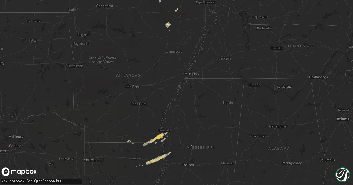
Hail Map in Arkansas on April 18, 2013
Get this storm
April 18 map
$229
one time, instant access
Download today. No call, no setup
Keep the $229
Bought the map and want the full workflow? Apply the entire $229 to a subscription within 7 days. None of it is wasted.
Every map, not just this one
This buys you this map. Subscription and you get every map we run, in the markets you choose from a few cities to whole states to nationwide. Plus real-time alerts the moment a storm fires.
Contact data
Name, contact info, occupancy, even credit band for addresses in the footprint. You go from where it hit to who to call.
Become the source they trust
Unlimited branding weather history reports on demand. You already have the documented answer ready for the property owner, and you are the one who showed up with it.
Property data and RoofTrace estimates
Pull up any address you have got, its value and the exact code rules for that jurisdiction, straight from One Click Code. Then RoofTrace estimates the squares, pitch, and roof value, priced the way you price.
Storm reports in Arkansas
Arkansas
| Date | Description |
|---|---|
| 04/18/20134:41 PM CDT | Reports of a few trees down on grand lake loop. |
| 04/18/20134:38 PM CDT | This tornado was photographed briefly touching down in an open field se of eudora...along hwy 65. No damage occurred as the tornado kicked up dust as it moved ene. Rati |
| 04/18/20134:38 PM CDT | Reports of a few trees down on grand lake loop. |
| 04/18/20134:32 PM CDT | Few trees down along hwy 159 |
| 04/18/20134:29 PM CDT | A few trees down on ball rd. |
| 04/18/20134:20 PM CDT | A few trees down off hwy 65. |
| 04/18/20134:15 PM CDT | Reports of golfball size hail in chicot junction. |
| 04/18/20133:45 PM CDT | Reported along us highway 165 |
| 04/18/20133:42 PM CDT | Reports of a tree down in wilmot. |
| 04/18/20133:21 PM CDT | A few trees down on us highway 425 near hamburg |
| 04/18/20133:20 PM CDT | Tree down on us highway 425 near hamburg |
| 04/18/20133:17 PM CDT | Reports of a tree down on highway 133 north. |
| 04/18/20133:15 PM CDT | Trees downed along highway 82 near crossett. Exact location unknown |
| 04/18/20133:13 PM CDT | Reports of a tree down on cedar street in crossett. |
| 04/18/20133:08 PM CDT | Tornado downed trees along hwy 133 and along its path from 6 miles south of crossett to 4 miles southeast of crossett. Tornado was rated ef1 and path length was 4 miles |
| 04/18/20133:07 PM CDT | Trees downed along ar highway 133 |
| 04/18/20133:06 PM CDT | A tree was downed on a house along sycamore circle |
| 04/18/20132:16 PM CDT | Numerous trees down... Tree on library and tree on home |
| 04/18/201310:30 AM CDT | Winds were estimated near 60 mph between amity and alpine. |
| 04/18/201310:10 AM CDT | Downed tree limbs caused minor power outages. |
| 04/18/20138:48 AM CDT | Trees were reported to be blown down. |
| 04/18/20138:39 AM CDT | A local report indicates 60 MPH wind near 4 E TILLY |
All States Impacted by Hail Map on April 18, 2013
Cities Impacted by Hail Map on April 18, 2013
- Parkdale, AR
- Wilmot, AR
- Eudora, AR
- Lake Village, AR
- Salem, MO
- Oak Grove, LA
- Highland, IL
- Pocahontas, IL
- Doniphan, MO
- Red Bud, IL
- New Athens, IL
- Belleville, IL
- Waterloo, IL
- Marissa, IL
- Baldwin, IL
- Evansville, IL
- Smithton, IL
- Columbia, IL
- Hecker, IL
- Millstadt, IL
- Oak Ridge, MO
- Maynard, AR
- Saint Mary, MO
- Sainte Genevieve, MO
- Greenville, MO
- Fredericktown, MO
- Farmington, MO
- Baskin, LA
- Rayville, LA
- Mayersville, MS
- Vicksburg, MS
- Tallulah, LA
- Sondheimer, LA
- Delhi, LA
- Valley Park, MS
- Rolling Fork, MS
- Hollandale, MS
- Belgrade, MO
- Friedheim, MO
- Daisy, MO
- Perryville, MO
- Millersville, MO
- Leland, MS
- Greenville, MS
- Pickens, MS
- Columbia, LA
- Saint Gabriel, LA
- Mill Spring, MO
- Caledonia, MO
- Irondale, MO
- Bismarck, MO
- Oakdale, IL
- Pinckneyville, IL
- Coulterville, IL
- Nashville, IL
- Silva, MO
- Glen Allan, MS
- Chatham, MS
- Breese, IL
- Rockwood, IL
- Strong, AR
- Potosi, MO
- Percy, IL
- Campbell Hill, IL
- Ava, IL
- Vernon, IL
- Vandalia, IL
- Mangham, LA
- Clubb, MO
- Huttig, AR
- Patoka, IL
- Mineral Point, MO
- Jones, LA
- Bastrop, LA
- Marion, LA
- Trenton, IL
- Aviston, IL
- Carlyle, IL
- Farina, IL
- Kinmundy, IL
- Saint Peter, IL
- Holden, LA
- Albany, LA
- Belleview, MO
- Walnut Hill, IL
- Dix, IL
- Centralia, IL


