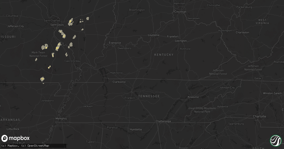
Hail Map on April 18, 2013
Get this storm
April 18 map
$229
one time, instant access
Download today. No call, no setup
Keep the $229
Bought the map and want the full workflow? Apply the entire $229 to a subscription within 7 days. None of it is wasted.
Every map, not just this one
This buys you this map. Subscription and you get every map we run, in the markets you choose from a few cities to whole states to nationwide. Plus real-time alerts the moment a storm fires.
Contact data
Name, contact info, occupancy, even credit band for addresses in the footprint. You go from where it hit to who to call.
Become the source they trust
Unlimited branding weather history reports on demand. You already have the documented answer ready for the property owner, and you are the one who showed up with it.
Property data and RoofTrace estimates
Pull up any address you have got, its value and the exact code rules for that jurisdiction, straight from One Click Code. Then RoofTrace estimates the squares, pitch, and roof value, priced the way you price.
States Impacted by Hail Map on April 18, 2013
Storm reports
Kentucky
| Date | Description |
|---|---|
| 04/17/20139:00 PM CDT | A local report indicates 60 MPH wind near SHARPE |
| 04/17/20138:50 PM CDT | Downed trees reported along county highway 1124 along the graves and calloway county line. |
| 04/17/20138:35 PM CDT | Power outages reported in the water valley and pilot oak areas. |
Louisiana
| Date | Description |
|---|---|
| 04/18/20135:25 PM CDT | A grain silo was blown across us highway 65 and power poles were downed. Possible tornado. |
| 04/18/20135:23 PM CDT | This brief tornado touched down in an open field along the north side of willow bayou road. A picture was taken of the tornado kicking up dust as it moved ene. No damag |
| 04/18/20135:19 PM CDT | This tornado started just w of hwy 65. As it crossed hwy 65...a large farm building was destroyed and power poles were downed. As it moved ne...a large tree was snapped |
| 04/18/20134:52 PM CDT | Several trees down and some tin taken off a farm outbuilding. |
| 04/18/20133:15 PM CDT | Reports of a tree down on bonner ferry road. |
Tennessee
| Date | Description |
|---|---|
| 04/18/20134:07 AM CDT | Tree down on buck mountain road. Power was also out in the area. |
| 04/18/20133:19 AM CDT | A few trees reported down around gruetli-laager |
| 04/18/20132:39 AM CDT | Tree down on asbury road in manchester |
| 04/18/20132:32 AM CDT | A tree was blown down on row gap road. |
| 04/18/20132:32 AM CDT | A tree was blown down on 4th avenue in decherd. |
| 04/18/20132:30 AM CDT | A tree was reported down on mckinney street. |
| 04/18/20132:29 AM CDT | A tree was blown down at the intersection of owl road and belvidere road. |
| 04/18/20132:15 AM CDT | Trees and powerlines reported down on bakertown road. |
| 04/18/20132:15 AM CDT | Trees and powerlines reported down on bullrun road. |
| 04/18/20132:15 AM CDT | Trees and powerlines reported down on bullrun road. |
| 04/18/20132:13 AM CDT | Trees...power poles and powerlines reported down at the intersection of highway 50 and lois ridge road. |
| 04/18/20132:12 AM CDT | Louse creek road completely blocked by downed trees. |
| 04/18/20132:03 AM CDT | A tornado touched down just south of state highway 50 near crystal ridge road causing minor damage to a barn and snapping trees along mulberry creek. The tornado moved |
| 04/18/201312:56 AM CDT | Tree across roadway |
| 04/18/201312:38 AM CDT | A tree was reported blown down at brook hollow and georgetown rd. |
Mississippi
| Date | Description |
|---|---|
| 04/18/20136:35 PM CDT | Reports of a tree down on highland drive and pineland drive. |
| 04/18/20135:30 PM CDT | Nws storm survey found an ef-0 tornado with maximum winds of 75 mph...path length of 0.2 miles and maximum width of 25 yards wide. This brief tornado touched down on de |
| 04/18/20135:23 PM CDT | This brief tornado touched down in an open field and crossed highway 61 near nitta yuma. The tornado was captured on video as it crossed highway 61. No damage occurred. |
| 04/18/20135:22 PM CDT | Brief tornado crossed us highway 61 |
| 04/18/20135:21 PM CDT | This brief tornado touched down in an open field and crossed highway 61 near nitta yuma. The tornado was captured on video as it crossed highway 61. No damage occurred. |
| 04/18/20135:15 PM CDT | A few power lines down near grace along with many large limbs. |
| 04/18/20135:09 PM CDT | This tornado was photographed in an open field near the tribbett community. It remained over open rural areas and caused no damage. Rated ef0 with a path length of 0.4 |
| 04/18/20135:04 PM CDT | Nws storm survey found an ef-1 tornado with maximum winds of 88 mph...path length of 2.0 miles and width of 50 yards wide. This brief tornado touched down near levee ro |
| 04/18/20135:04 PM CDT | Nws storm survey found an ef-1 tornado with maximum winds of 88 mph...path length of 2.0 miles and width of 50 yards wide. This brief tornado touched down near levee ro |
| 04/18/20134:32 PM CDT | Reported near the mississippi river bridge |
| 04/18/20133:21 PM CDT | Tree down on us highway 425 near hamburg |
| 04/17/20139:00 PM CDT | Scattered trees down on powerlines in western part of county. |
Michigan
| Date | Description |
|---|---|
| 04/18/20134:28 PM CDT | 2 inch diameter tree and a 1 inch diameter tree down |
| 04/18/20134:28 PM CDT | 4 trees down between nws office and andersonville rd. |
| 04/18/20132:49 PM CDT | Trees down |
| 04/18/20132:49 PM CDT | Trees down in clyde township |
| 04/18/20132:22 PM CDT | Scattered trees and powerlines down |
| 04/18/20132:13 PM CDT | Scattered trees and powerlines down |
| 04/18/20132:00 PM CDT | Cross gate down at train crossing near saginaw rd and m21...power lines down. |
| 04/18/20132:00 PM CDT | One 2 inch diameter tree down on highland road. |
| 04/18/20131:51 PM CDT | Large tree down duquette rd and gardner line rd. |
| 04/18/20131:50 PM CDT | 2 trees down...one 1 inch diameter tree....one 6 inch diameter tree snapped in half. |
| 04/18/20131:50 PM CDT | A local report indicates 65 MPH wind near SHELBY TOWNSHIP |
| 04/18/20131:43 PM CDT | Large tree down |
| 04/18/20131:38 PM CDT | Shingles blown off roof in residential areas. |
| 04/18/20131:30 PM CDT | 2 trees down...one 1 inch diameter tree....one 6 inch diameter tree snapped in half. |
| 04/18/20131:30 PM CDT | 2 inch diameter tree and a 1 inch diameter tree down |
| 04/18/20131:30 PM CDT | Power lines downs at park and calhoun |
| 04/18/20131:19 PM CDT | 4 trees down between nws office and andersonville rd. |
| 04/18/20131:10 PM CDT | 2.5 foot diameter tree down. Reports of chimneys down. |
| 04/18/20131:08 PM CDT | One 2 inch diameter tree down on highland road. |
| 04/18/20131:06 PM CDT | Large tree down white lake rd north of ormond. |
Indiana
| Date | Description |
|---|---|
| 04/18/20139:24 AM CDT | Semi blown over on us 30 at s 300 w. Report relayed by abc57 |
| 04/18/20139:20 AM CDT | Semi blown over at us 6 and us 421 s. Report relayed by abc57 |
| 04/18/20139:20 AM CDT | Several power poles blown down onto cr200s betweem meridan rd andd 100w in newton county. Winds est at 60 mph. |
| 04/18/20139:10 AM CDT | A local report indicates 64 MPH wind near 5 WSW DUNNS BRIDGE |
| 04/18/20138:45 AM CDT | A local report indicates 58 MPH wind near 2 SSW LOWELL |
Illinois
| Date | Description |
|---|---|
| 04/18/20131:52 PM CDT | Emergency manager relayed a public report of a funnel cloud that briefly touched down. No damage information relayed at this time. |
| 04/18/20139:05 AM CDT | Trees and power lines down in watseka |
| 04/18/20138:45 AM CDT | Thunderstorm winds bent and destroyed a machine shed steel door. A couple of small trees uprooted. Spotter number...1316-04 |
| 04/18/20138:37 AM CDT | Reports of front porch detached from house...roof damage to 2 houses...large shed with doors blown in...and trees down. |
| 04/18/20137:50 AM CDT | 15 power poles down on us route 136. |
| 04/18/20137:20 AM CDT | Barn down near 775 east rt 9. 2 animals deceased. 6 power lines down. Debris field 3.5 miles. |
Arkansas
| Date | Description |
|---|---|
| 04/18/20134:41 PM CDT | Reports of a few trees down on grand lake loop. |
| 04/18/20134:38 PM CDT | Reports of a few trees down on grand lake loop. |
| 04/18/20134:38 PM CDT | This tornado was photographed briefly touching down in an open field se of eudora...along hwy 65. No damage occurred as the tornado kicked up dust as it moved ene. Rati |
| 04/18/20134:32 PM CDT | Few trees down along hwy 159 |
| 04/18/20134:29 PM CDT | A few trees down on ball rd. |
| 04/18/20134:20 PM CDT | A few trees down off hwy 65. |
| 04/18/20134:15 PM CDT | Reports of golfball size hail in chicot junction. |
| 04/18/20133:45 PM CDT | Reported along us highway 165 |
| 04/18/20133:42 PM CDT | Reports of a tree down in wilmot. |
| 04/18/20133:21 PM CDT | A few trees down on us highway 425 near hamburg |
| 04/18/20133:20 PM CDT | Tree down on us highway 425 near hamburg |
| 04/18/20133:17 PM CDT | Reports of a tree down on highway 133 north. |
| 04/18/20133:15 PM CDT | Trees downed along highway 82 near crossett. Exact location unknown |
| 04/18/20133:13 PM CDT | Reports of a tree down on cedar street in crossett. |
| 04/18/20133:08 PM CDT | Tornado downed trees along hwy 133 and along its path from 6 miles south of crossett to 4 miles southeast of crossett. Tornado was rated ef1 and path length was 4 miles |
| 04/18/20133:07 PM CDT | Trees downed along ar highway 133 |
| 04/18/20133:06 PM CDT | A tree was downed on a house along sycamore circle |
| 04/18/20132:16 PM CDT | Numerous trees down... Tree on library and tree on home |
| 04/18/201310:30 AM CDT | Winds were estimated near 60 mph between amity and alpine. |
| 04/18/201310:10 AM CDT | Downed tree limbs caused minor power outages. |
| 04/18/20138:48 AM CDT | Trees were reported to be blown down. |
| 04/18/20138:39 AM CDT | A local report indicates 60 MPH wind near 4 E TILLY |
Georgia
| Date | Description |
|---|---|
| 04/18/20135:03 AM CDT | One tree down across hwy 48 near back berryton rd |
| 04/18/20134:45 AM CDT | One tree down across hwy 48 near ridge st |
| 04/18/201312:10 AM CDT | Several reports of damage...homes moved off their foundation...power poles down. |
North Carolina
| Date | Description |
|---|---|
| 04/18/20133:18 PM CDT | Trees down on country home road. |
| 04/18/20133:18 PM CDT | Trees down on blanch road. |
| 04/18/20132:58 PM CDT | Trees down around cherry grove. |
Missouri
| Date | Description |
|---|---|
| 04/18/20139:46 AM CDT | Large limbs blown down. Person estimated up to 60 mph wind gusts |
| 04/18/20139:18 AM CDT | Tree reported down along highway t near the intersection with highway j. |
Alabama
| Date | Description |
|---|---|
| 04/18/20132:20 AM CDT | A tree was reported down on shoal creek road. |
| 04/18/20131:52 AM CDT | Two trees reported down in the gold ridge area on cr 1422 and cr 1605. |
| 04/18/20131:52 AM CDT | A tree was blown down in the gold ridge area on cr 778. |
| 04/18/20131:42 AM CDT | 30 foot high hollow aluminum flagpole was snapped off near its base. |
| 04/18/20131:38 AM CDT | A tree was blown down on the 7000 block of highway 91. |
| 04/18/20131:28 AM CDT | A tree was blown down in the 9600 block of 278 w. |
| 04/18/20131:28 AM CDT | Two trees reported down on cr 222 and cr 8. |
| 04/18/20131:14 AM CDT | A tree was blown down over the road on nuclear plant road just west of hatchet ridge road. |
| 04/18/20131:14 AM CDT | Maintenance building destroyed in wilson morgan park south of decatur. The roof was blown off a garage building on the property also. Time estimated from radar. |
Cities Impacted by Hail Map on April 18, 2013
- Parkdale, AR
- Wilmot, AR
- Eudora, AR
- Lake Village, AR
- Salem, MO
- Oak Grove, LA
- Highland, IL
- Pocahontas, IL
- Doniphan, MO
- Red Bud, IL
- New Athens, IL
- Belleville, IL
- Waterloo, IL
- Marissa, IL
- Baldwin, IL
- Evansville, IL
- Smithton, IL
- Columbia, IL
- Hecker, IL
- Millstadt, IL
- Oak Ridge, MO
- Maynard, AR
- Saint Mary, MO
- Sainte Genevieve, MO
- Greenville, MO
- Fredericktown, MO
- Farmington, MO
- Baskin, LA
- Rayville, LA
- Mayersville, MS
- Vicksburg, MS
- Tallulah, LA
- Sondheimer, LA
- Delhi, LA
- Valley Park, MS
- Rolling Fork, MS
- Hollandale, MS
- Belgrade, MO
- Friedheim, MO
- Daisy, MO
- Perryville, MO
- Millersville, MO
- Leland, MS
- Greenville, MS
- Pickens, MS
- Columbia, LA
- Saint Gabriel, LA
- Mill Spring, MO
- Caledonia, MO
- Irondale, MO
- Bismarck, MO
- Oakdale, IL
- Pinckneyville, IL
- Coulterville, IL
- Nashville, IL
- Silva, MO
- Glen Allan, MS
- Chatham, MS
- Breese, IL
- Rockwood, IL
- Strong, AR
- Potosi, MO
- Percy, IL
- Campbell Hill, IL
- Ava, IL
- Vernon, IL
- Vandalia, IL
- Mangham, LA
- Clubb, MO
- Huttig, AR
- Patoka, IL
- Mineral Point, MO
- Jones, LA
- Bastrop, LA
- Marion, LA
- Trenton, IL
- Aviston, IL
- Carlyle, IL
- Farina, IL
- Kinmundy, IL
- Saint Peter, IL
- Holden, LA
- Albany, LA
- Belleview, MO
- Walnut Hill, IL
- Dix, IL
- Centralia, IL