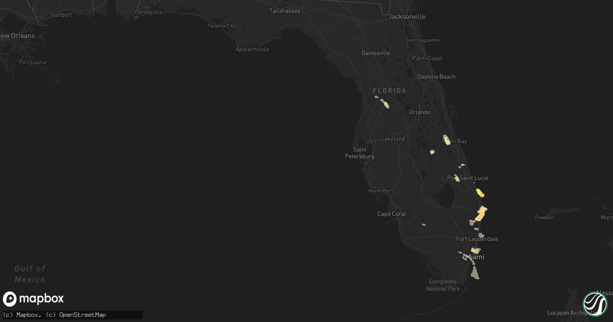
Hail Map in Florida on April 15, 2016
Get this storm
April 15 map
$229
one time, instant access
Download today. No call, no setup
Keep the $229
Bought the map and want the full workflow? Apply the entire $229 to a subscription within 7 days. None of it is wasted.
Every map, not just this one
This buys you this map. Subscription and you get every map we run, in the markets you choose from a few cities to whole states to nationwide. Plus real-time alerts the moment a storm fires.
Contact data
Name, contact info, occupancy, even credit band for addresses in the footprint. You go from where it hit to who to call.
Become the source they trust
Unlimited branding weather history reports on demand. You already have the documented answer ready for the property owner, and you are the one who showed up with it.
Property data and RoofTrace estimates
Pull up any address you have got, its value and the exact code rules for that jurisdiction, straight from One Click Code. Then RoofTrace estimates the squares, pitch, and roof value, priced the way you price.
Storm reports in Florida
Florida
| Date | Description |
|---|---|
| 04/15/20165:25 PM CDT | A trained spotter called to report half dollar size hail in west delray beach at 625pm |
| 04/15/20165:20 PM CDT | A trained spotter reported via twitter golf ball size hail in west boynton beach at 620pm |
| 04/15/20165:15 PM CDT | Quarter size hail reported... Along with large tree limbs broken off by strong wind estimated at least 50 mph. |
| 04/15/20165:11 PM CDT | A trained spotter called to report quarter inch hail in boynton beach at 611pm |
| 04/15/20165:05 PM CDT | Video obtained via broadcast media of hail slightly larger than golf ball size in lantana near federal highway and hypoluxo road. |
| 04/15/20164:57 PM CDT | A trained spotter called to report quarter inch size hail in lake worth at 557pm |
| 04/15/20164:48 PM CDT | A trained spotter called in a report of quarter size hail in lake worth florida at 537pm |
| 04/15/20164:45 PM CDT | Near i-95 and 10th avenue |
| 04/15/20164:35 PM CDT | Media reported ping pong size hail near forest hill blvd and s flager drive at 535pm |
| 04/15/20164:00 PM CDT | A local report indicates 1.50 inch wind near 4 N JUPITER |
All States Impacted by Hail Map on April 15, 2016
Cities Impacted by Hail Map on April 15, 2016
- Beaver, OK
- Springfield, CO
- Walsh, CO
- Campo, CO
- Keyes, OK
- Boise City, OK
- Kit Carson, CO
- Haswell, CO
- Eads, CO
- Burlington, CO
- Lake Worth, FL
- Boynton Beach, FL
- Stratford, TX
- Dumas, TX
- Bethune, CO
- Stratton, CO
- Sumterville, FL
- Webster, FL
- Bushnell, FL
- Kenansville, FL
- Amarillo, TX
- Boca Raton, FL
- Delray Beach, FL
- Dalhart, TX
- Miami Beach, FL
- Miami, FL
- Miami Gardens, FL
- North Miami Beach, FL
- Opa Locka, FL
- Oshkosh, NE
- Goodwell, OK
- Texline, TX
- Ulysses, KS
- Inverness, FL
- Channing, TX
- Hartley, TX
- Adrian, TX
- Floral City, FL
- Center Hill, FL
- Fort Pierce, FL
- Jupiter, FL
- Hobe Sound, FL
- Earth, TX
- Springlake, TX
- Olton, TX
- Felt, OK
- Hugoton, KS
- Rolla, KS
- Texhoma, OK
- Elkhart, KS
- Johnson, KS
- Richfield, KS
- Moscow, KS
- Hasty, CO
- McClave, CO
- Miami, TX
- Perryton, TX
- Kenton, OK
- Deerfield Beach, FL
- Pompano Beach, FL
- Homestead, FL
- Hereford, TX
- Wildorado, TX
- Clayton, NM
- Nara Visa, NM
- Logan, NM
- Port Saint Lucie, FL
- Saint Francis, KS
- Muleshoe, TX
- Palm Beach, FL
- Lake Worth Beach, FL
- West Palm Beach, FL
- Sedan, NM
- Wallace, NE
- Sunray, TX
- Pritchett, CO
- Las Animas, CO
- Idalia, CO
- Satanta, KS
- Palm Bay, FL
- Imperial, NE
- Grenville, NM
- Wauneta, NE
- Wray, CO
- Ashby, NE
- Lewellen, NE
- Stuart, FL
- Champion, NE
- Fort Lauderdale, FL
- Lamar, CO
- Parks, NE
- Kim, CO
- Immokalee, FL


