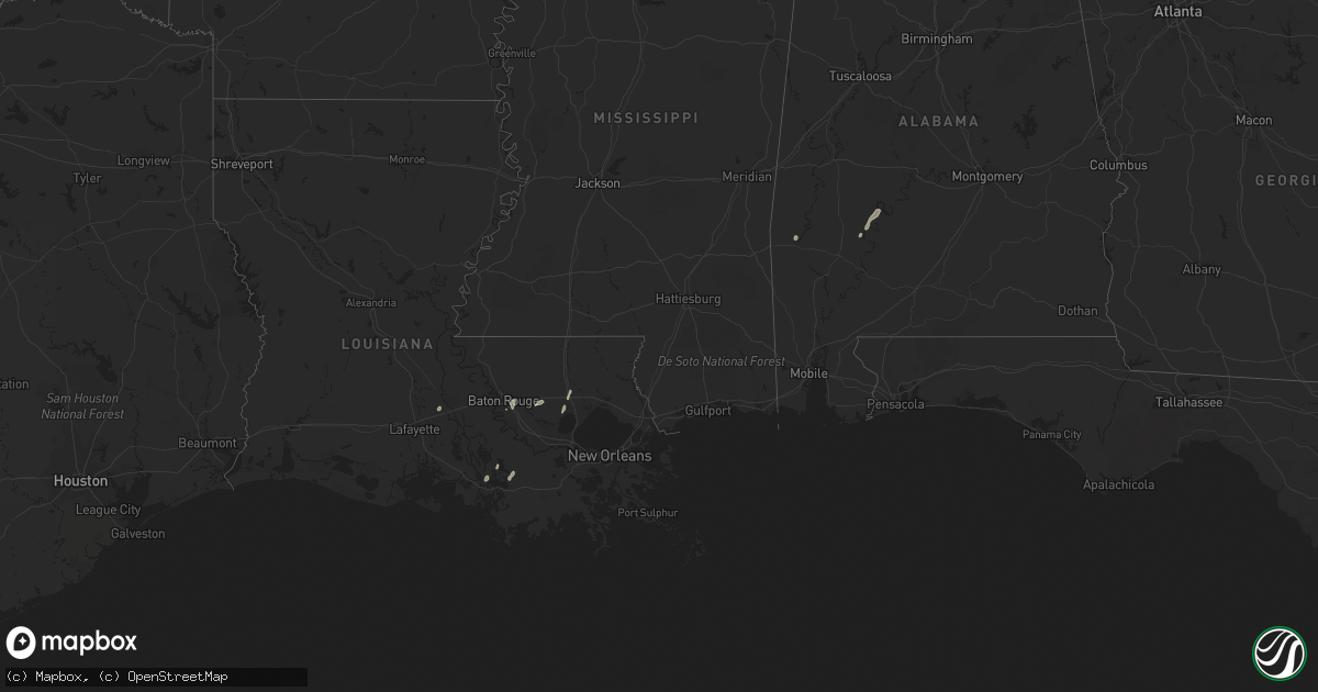
Hail Map in Louisiana on April 14, 2018
Get this storm
April 14 map
$229
one time, instant access
Download today. No call, no setup
Keep the $229
Bought the map and want the full workflow? Apply the entire $229 to a subscription within 7 days. None of it is wasted.
Every map, not just this one
This buys you this map. Subscription and you get every map we run, in the markets you choose from a few cities to whole states to nationwide. Plus real-time alerts the moment a storm fires.
Contact data
Name, contact info, occupancy, even credit band for addresses in the footprint. You go from where it hit to who to call.
Become the source they trust
Unlimited branding weather history reports on demand. You already have the documented answer ready for the property owner, and you are the one who showed up with it.
Property data and RoofTrace estimates
Pull up any address you have got, its value and the exact code rules for that jurisdiction, straight from One Click Code. Then RoofTrace estimates the squares, pitch, and roof value, priced the way you price.
Storm reports in Louisiana
Louisiana
| Date | Description |
|---|---|
| 04/14/201811:15 AM CDT | Trees down in palm lake area... On west hall... And on front street. Time estimated by radar. |
| 04/14/20189:13 AM CDT | A weak tornado briefly touched down near the plantation hotel... Uplifting a large section of the roof and breaking multiple room windows. The tornado continued southea |
| 04/14/20189:13 AM CDT | Eop posted on social media and reported roof damage to the plantaion inn as well as multiple homes in bayou vista. |
| 04/14/20189:01 AM CDT | Corrects previous report from 10 n bastrop. A couple trees were uprooted in the beekman community. |
| 04/14/20188:55 AM CDT | Large trees down near intersection of hwy 444 and hwy 63 |
| 04/14/20188:40 AM CDT | Em estimated over 100 trees down around arcola along with minor shingle damage. Possible tornado. |
| 04/14/20188:38 AM CDT | A narrow but linear track was detected at i-55/arcola exit... Then on side roads off highway 1048... Minor tree damage to small diameter pine trees... Lifting near russ |
| 04/14/20188:35 AM CDT | Survey determined a track starting in st helena parish at the intersection of la 441 and la 1048... Proceeding east along la 1048 into tangipahoa parish... Lifting near |
| 04/14/20188:35 AM CDT | Em reports trees down in montpelier. Time estimated from radar. |
| 04/14/20188:25 AM CDT | Trees down south of greensburg along hwy 43. Also along hwy 1045 near the tangipahoa river. Time estimated from radar. |
| 04/14/20188:20 AM CDT | Storm survey determined a very short-lived touch down in on cullen harell road. Two large oak trees uprooted. Another oak tree snapped and twisted. Estimated winds 75 m |
| 04/14/20188:13 AM CDT | Damage reported in parking lots near the industriplex area. Possible tornado. Time estimated by radar. Date corrected. |
| 04/14/20188:13 AM CDT | A weak tornado touched down in the industriplex area and moved east southeast on a intermittent path to just northeast east of intersection of stumberg lane and airline |
| 04/14/20188:11 AM CDT | Approximatley 10 trees and a number of large branches were blown down in a residential area...generally in vicinty of jefferson terrace park. Several trees fell on hous |
| 04/14/20188:05 AM CDT | Report of tree on a home near oneal rd and antioch rd. Time estimated from radar. Date corrected. |
| 04/14/20187:41 AM CDT | Public posted to social media a photo of a snapped tree in grand marais. Time estimated from radar. |
| 04/14/20187:40 AM CDT | Around a dozen trees down in the vicinity of clinton. A few rural roads blocked. Time estimated from radar |
| 04/14/20187:34 AM CDT | Video from public depicted wind damage that included downed tree limbs and a roof blown off of a barn near branch...la. |
| 04/14/20187:30 AM CDT | Lafayette 911 reported that a citizen called reporting wind damage at home. Roof was lifted off. Home as on ottoville rd in carencro...la. Off of la 1252 |
| 04/14/20187:00 AM CDT | A couple large trees down near hwy 421 in wakefield. Time estimated from radar. |
| 04/14/20186:37 AM CDT | At 1136 AM CDT, severe thunderstorms were located along a line extending from 8 miles east of Varnado to near Mcneil to near Stennis Space Center, moving northeast at 45 mph. HAZARD...60 mph wind gusts. SOURCE...Law enforcement. IMPACT...Expect damage to roofs, siding, and trees. Locations impacted include... Poplarville and Stennis Space Center. |
| 04/14/20185:26 AM CDT | At 1024 AM CDT, severe thunderstorms were located along a line extending from Killona to 13 miles west of Dulac, moving east at 30 mph. HAZARD...60 mph wind gusts and nickel size hail. SOURCE...Radar indicated. IMPACT...Expect damage to roofs, siding, and trees. Severe thunderstorms will be near... Hahnville, Taft, Montz and Killona around 1030 AM CDT. Norco, New Sarpy, Luling and Boutte around 1035 AM CDT. Destrehan around 1040 AM CDT. St. Rose around 1045 AM CDT. Dulac and Ama around 1050 AM CDT. River Ridge and Waggaman around 1055 AM CDT. Avondale, Jefferson, Harahan, Elmwood and Bridge City around 1100 AM CDT. Westwego and Chauvin around 1105 AM CDT.Other locations impacted by these severe thunderstorms include NewOrleans Armstrong Airport and Lakefront Airport. |
| 04/14/20184:44 AM CDT | At 943 AM CDT, severe thunderstorms were located along a line extending from 8 miles south of Ponchatoula to 21 miles southeast of Burns Point, moving east at 15 mph. HAZARD...60 mph wind gusts. SOURCE...Radar indicated. IMPACT...Expect damage to roofs, siding, and trees. Locations impacted include... Houma, Thibodaux, Reserve, Hahnville, Laplace, Gramercy, Lutcher, Schriever, Montz, Garyville, Raceland, Chackbay, Destrehan, Bayou Cane, Killona, Norco, Paradis, Gray, Edgard and South Vacherie. |
| 04/14/20184:22 AM CDT | At 921 AM CDT, severe thunderstorms were located along a line extending from near Belle River to 11 miles southwest of Amelia to 28 miles south of Burns Point, moving east at 25 mph. HAZARD...60 mph wind gusts. SOURCE...Radar indicated. IMPACT...Expect damage to roofs, siding, and trees. Locations impacted include... Thibodaux, Schriever, Supreme, Gray, Labadieville and Chackbay. |
| 04/14/20184:07 AM CDT | At 907 AM CDT, a severe thunderstorm was located near Salem, or near Kokomo, moving east at 30 mph. HAZARD...60 mph wind gusts. SOURCE...Radar indicated. IMPACT...Expect damage to roofs, siding, and trees. This severe thunderstorm will be near... Holly Springs around 920 AM CDT. Morgantown around 925 AM CDT. Goss around 930 AM CDT. Columbia around 935 AM CDT. Bunker Hill around 945 AM CDT. Improve around 955 AM CDT. |
| 04/14/20184:00 AM CDT | At 900 AM CDT, severe thunderstorms were located along a line extending from near Natalbany to near Lutcher to near Napoleonville, moving east at 45 mph. HAZARD...60 mph wind gusts. SOURCE...Radar indicated. IMPACT...Expect damage to roofs, siding, and trees. Locations impacted include... Hammond, Covington, Napoleonville, Reserve, Hahnville, Laplace, Ponchatoula, Gramercy, Lutcher, Abita Springs, Madisonville, Springfield, Montz, Garyville, Chackbay, Robert, Killona, Norco, Edgard and South Vacherie. |
| 04/14/20183:41 AM CDT | At 840 AM CDT, severe thunderstorms were located along a line extending from 6 miles west of Pierre Part to 8 miles east of Burns Point, moving east at 50 mph. HAZARD...60 mph wind gusts and quarter size hail. SOURCE...Radar indicated. IMPACT...Hail damage to vehicles is expected. Expect wind damage to roofs, siding, and trees. Locations impacted include... Morgan City, Franklin, Patterson, Jeanerette, Berwick, Bayou Vista, Stephensville, Burns Point, Baldwin, Ellerslie, Patterson Memorial Airport, Charenton, Amelia and Centerville. |
| 04/14/20183:30 AM CDT | At 830 AM CDT, severe thunderstorms were located along a line extending from near Easleyville to near Montpelier to near Watson, moving east at 15 mph. HAZARD...60 mph wind gusts. SOURCE...Radar indicated. IMPACT...Expect damage to roofs, siding, and trees. Locations impacted include... Greensburg, Amite, Amite City, Kentwood, Independence, Roseland, Osyka, Montpelier, Watson, Wilmer, Easleyville, Natalbany, Tangipahoa and Tickfaw. |
| 04/14/20183:01 AM CDT | At 800 AM CDT, severe thunderstorms were located along a line extending from Port Allen to 7 miles west of Belle River, moving east at 25 mph. HAZARD...60 mph wind gusts. SOURCE...Radar indicated. IMPACT...Expect damage to roofs, siding, and trees. Locations impacted include... Baton Rouge, Thibodaux, Denham Springs, Gonzales, Donaldsonville, Plaquemine, Port Allen, Napoleonville, Oak Hills Place, St. Gabriel, Walker, Gramercy, Addis, Lutcher, Brusly, White Castle, Livingston, Sorrento, French Settlement and Albany. |
| 04/14/20182:59 AM CDT | At 759 AM CDT, severe thunderstorms were located along a line extending from near Smithdale to 7 miles west of Gillsberg, moving east at 35 mph. HAZARD...60 mph wind gusts. SOURCE...Radar indicated. IMPACT...Expect damage to roofs, siding, and trees. Locations impacted include... Mccomb, Liberty, Magnolia, Summit, Osyka, Smithdale, Gillsberg and Mccomb Airport. |
| 04/14/20182:55 AM CDT | At 755 AM CDT, a severe thunderstorm was located over Darlington, or 8 miles west of Greensburg, moving east at 50 mph. HAZARD...60 mph wind gusts. SOURCE...Radar indicated. IMPACT...Expect damage to roofs, siding, and trees. Locations impacted include... Greensburg, Amite, Amite City, Kentwood, Roseland, Osyka, Darlington, Easleyville, Wilmer and Tangipahoa. |
| 04/14/20182:51 AM CDT | At 751 AM CDT, severe thunderstorms were located along a line extending from 6 miles west of Bayou Sorrel to near Cote Blanche Island, moving east at 45 mph. HAZARD...60 mph wind gusts and quarter size hail. SOURCE...Radar indicated. IMPACT...Hail damage to vehicles is expected. Expect wind damage to roofs, siding, and trees. Locations impacted include... New Iberia, Morgan City, Catahoula, Franklin, St. Martinville, Patterson, Jeanerette, Berwick, Burns Point, Belle River, Bayou Vista, Stephensville, Avery Island, Cypremort Point, Baldwin, Loreauville, Ellerslie, Patterson Memorial Airport, Butte La Rose and Lydia. |
| 04/14/20182:22 AM CDT | At 722 AM CDT, severe thunderstorms were located along a line extending from Dolorosa to near Delcambre, moving northeast at 65 mph. HAZARD...60 mph wind gusts and quarter size hail. SOURCE...Radar indicated. IMPACT...Hail damage to vehicles is expected. Expect wind damage to roofs, siding, and trees. Locations impacted include... New Iberia, Catahoula, St. Martinville, Loreauville, Butte La Rose, Lake Pelba and Atchafalaya National Wildlife Refuge. |
| 04/14/20182:05 AM CDT | At 705 AM CDT, severe thunderstorms were located along a line extending from near Youngsville to near Freshwater City, moving east at 25 mph. HAZARD...60 mph wind gusts and quarter size hail. SOURCE...Radar indicated. IMPACT...Hail damage to vehicles is expected. Expect wind damage to roofs, siding, and trees. Locations impacted include... New Iberia, Abbeville, Jeanerette, Kaplan, Freshwater City, Cypremort Point, Forked Island, Avery Island, Intracoastal City, Erath, Delcambre, Meaux, Glencoe, Esther, Lydia, Acadiana Regional Airport, Jefferson Island, Sorrel, Cote Blanche Island and Lake Fausse Pointe. |
| 04/14/20181:44 AM CDT | At 644 AM CDT, a severe thunderstorm was located over Dolorosa, or 15 miles south of Natchez, moving northeast at 50 mph. HAZARD...60 mph wind gusts. SOURCE...Radar indicated. IMPACT...Expect damage to roofs, siding, and trees. This severe thunderstorm will be near... Kingston around 655 AM CDT. Garden City around 700 AM CDT. Cranfield around 705 AM CDT. Hamburg, Kirby and Stampley around 715 AM CDT. Mcnair around 720 AM CDT. Union Church and Blue Hill around 735 AM CDT. Mcbride around 740 AM CDT. Other locations impacted by this severe thunderstorm include Roxieand Meadville. |
| 04/14/20181:09 AM CDT | At 609 AM CDT, a severe thunderstorm was located over Grand Prairie, or 8 miles east of Ville Platte, moving northeast at 55 mph. HAZARD...60 mph wind gusts and quarter size hail. SOURCE...Radar indicated. IMPACT...Hail damage to vehicles is expected. Expect wind damage to roofs, siding, and trees. Locations impacted include... Opelousas, Ville Platte, Simmesport, Melville, Palmetto, Bayou Current, Morrow, Port Barre, Washington, Goudeau, Prairie Ronde, Lawtell, Whiteville, Big Cane, Dupont, Grand Prairie and Lebeau. |
| 04/13/201811:59 PM CDT | At 458 AM CDT, a severe thunderstorm was located 7 miles southwest of Ragley, moving northeast at 50 mph. HAZARD...60 mph wind gusts and quarter size hail. SOURCE...Radar indicated. IMPACT...Hail damage to vehicles is expected. Expect wind damage to roofs, siding, and trees. Locations impacted include... Lake Charles, Sulphur, Kinder, Reeves, Dry Creek, Singer, Moss Bluff, Sugartown, De Quincy, Mittie, Ragley, Grant, Dequincy, Longville, Buller, Buhler, Harmony, Topsy, Gillis and Tulla. |
| 04/13/201811:46 PM CDT | At 446 AM CDT, a severe thunderstorm was located near Hackberry, or 7 miles northeast of Sabine National Wildlife, moving northeast at 50 mph. HAZARD...60 mph wind gusts and quarter size hail. SOURCE...Radar indicated. IMPACT...Hail damage to vehicles is expected. Expect wind damage to roofs, siding, and trees. Locations impacted include... Lake Charles, Sulphur, Westlake, Grand Lake, Lake Charles Regional Airport, Moss Bluff, Sabine National Wildlife, Johnsons Bayou, Carlyss, Hacketts Corner, Heberts Marina, Hackberry, Sweet Lake, Gibbstown, Holmwood and Constance Beach. |
| 04/13/201811:26 PM CDT | At 426 AM CDT, a severe thunderstorm was located over Deweyville, moving northeast at 45 mph. HAZARD...60 mph wind gusts and quarter size hail. SOURCE...Radar indicated. IMPACT...Hail damage to vehicles is expected. Expect wind damage to roofs, siding, and trees. Locations impacted include... Lake Charles, Fields, Deweyville, De Quincy, Starks, Dequincy, Lunita, Buhler, Hartburg and Oretta. |
| 04/13/20189:32 PM CDT | At 231 AM CDT, severe thunderstorms were located along a line extending from 7 miles northeast of Lapile to Huttig to 12 miles northeast of Farmerville, moving east at 45 mph. HAZARD...60 mph wind gusts. SOURCE...Radar indicated. IMPACT...Expect damage to roofs, siding, and trees. Severe thunderstorms will be near... West Crossett around 245 AM CDT. Crossett around 250 AM CDT. North Crossett, Old Milo and Beekman around 255 AM CDT. Hamburg and Fountain Hill around 300 AM CDT. Berlin around 310 AM CDT. Snyder and Jones around 315 AM CDT. Wilmot around 320 AM CDT. Portland and Parkdale around 325 AM CDT. Other locations impacted by these severe thunderstorms includeBlanchton and Bonita. |
| 04/13/20188:45 PM CDT | At 144 AM CDT, severe thunderstorms were located along a line extending from near Wesson to Junction City to near Cooley to 8 miles southwest of Bernice to near Arcadia to 12 miles southeast of Gibsland to 16 miles west of Jonesboro to 16 miles southeast of Ringgold, moving east at 50 mph. HAZARD...60 mph wind gusts and penny size hail. SOURCE...Radar indicated. IMPACT...Expect damage to roofs, siding, and trees. Locations impacted include... Monroe, Ruston, El Dorado, Claiborne, West Monroe, Grambling, Jonesboro, Smackover, Norphlet, Huttig, Swartz, Brownsville-Bawcom, Brownsville-Bawcomville, Farmerville, Richwood, Arcadia, Bernice, Sterlington, Strong and Calion. |


