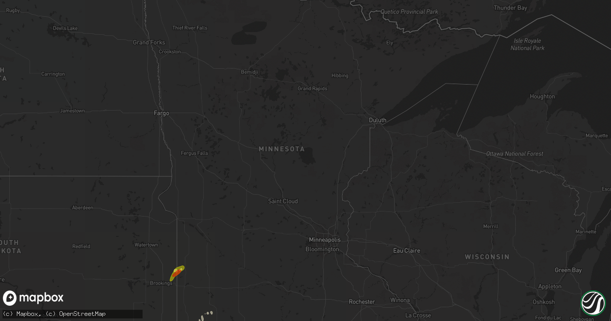
Hail Map in Minnesota on April 13, 2018
Get this storm
April 13 map
$229
one time, instant access
Download today. No call, no setup
Keep the $229
Bought the map and want the full workflow? Apply the entire $229 to a subscription within 7 days. None of it is wasted.
Every map, not just this one
This buys you this map. Subscription and you get every map we run, in the markets you choose from a few cities to whole states to nationwide. Plus real-time alerts the moment a storm fires.
Contact data
Name, contact info, occupancy, even credit band for addresses in the footprint. You go from where it hit to who to call.
Become the source they trust
Unlimited branding weather history reports on demand. You already have the documented answer ready for the property owner, and you are the one who showed up with it.
Property data and RoofTrace estimates
Pull up any address you have got, its value and the exact code rules for that jurisdiction, straight from One Click Code. Then RoofTrace estimates the squares, pitch, and roof value, priced the way you price.
Storm reports in Minnesota
Minnesota
| Date | Description |
|---|---|
| 04/13/20186:25 PM CDT | A local report indicates 1.00 inch wind near 3 NE BIGELOW |
| 04/13/201812:30 PM CDT | A local report indicates 1.00 inch wind near HENDRICKS |
| 04/13/20188:00 AM CDT | Damage to machine shed. Piece of farm equipment was pushed into power pole. |
| 04/13/20187:52 AM CDT | Measured by mndot rwis. |
| 04/13/20187:16 AM CDT | Reports of numerous power poles down along i-90 near magnolia exit. |
| 04/13/20183:20 AM CDT | At 818 AM CDT, severe thunderstorms were located along a line extending from near Lake Shetek State Park to near Fulda to near Worthington, moving east at 25 mph. HAZARD...70 mph wind gusts. SOURCE...Radar indicated. At 8 AM CDT 70 mph winds were reported 2 miles east of Wilmont IMPACT...Expect considerable tree damage. Damage is likely to mobile homes, roofs, and outbuildings. Severe thunderstorms will be near, Brewster around 830 AM CDT. Heron Lake around 840 AM CDT. Windom, Lakefield and Bingham Lake around 900 AM CDT. Other locations impacted by these severe thunderstorms include Delft,Alpha, Kinbrae, Wilder, Dundee, Okabena and Avoca. |
| 04/13/20181:44 AM CDT | At 644 PM CDT, a severe thunderstorm was located near Madelia, or 21 miles south of New Ulm, moving north at 35 mph. HAZARD...Quarter size hail. SOURCE...Radar indicated. IMPACT...Damage to vehicles is expected. This severe thunderstorm will be near, Madelia around 650 PM CDT. Hanska around 700 PM CDT. Courtland around 715 PM CDT. Other locations impacted by this severe thunderstorm include New UlmAirport, St James Airport, Grogan, Searles and La Salle.This includes U.S. Highway 14 between mile markers 100 and 103. |
All States Impacted by Hail Map on April 13, 2018
Cities Impacted by Hail Map on April 13, 2018
- Fredericksburg, TX
- Mason, TX
- Doss, TX
- Shawnee, KS
- Olathe, KS
- Lenexa, KS
- Gardner, KS
- Aubrey, TX
- Denton, TX
- Schertz, TX
- Cibolo, TX
- Seguin, TX
- Marion, TX
- Jennings, OK
- Yale, OK
- Cushing, OK
- Oak Grove, AR
- Green Forest, AR
- Kirbyville, MO
- Powersite, MO
- Ridgedale, MO
- Kissee Mills, MO
- Taneyville, MO
- Hollister, MO
- Omaha, AR
- Branson, MO
- Forsyth, MO
- Blue Eye, MO
- Cedarcreek, MO
- Mullin, TX
- Goldthwaite, TX
- Tyler, TX
- Jonesboro, TX
- Leonard, TX
- Kingston, OK
- Iowa Falls, IA
- Alden, IA
- Dows, IA
- Leawood, KS
- Overland Park, KS
- Spring Hill, KS
- Williamsburg, KS
- Pomona, KS
- Burlington, KS
- Gridley, KS
- Waverly, KS
- Walnut, IA
- Cleburne, TX
- Essex, IA
- Shenandoah, IA
- Leslie, AR
- Charleston, AR
- Kansas City, MO
- Wilsey, KS
- Council Grove, KS
- Strong City, KS
- Sabinal, TX
- Seminole, OK
- Piedmont, KS
- Cambridge, KS
- Eureka, KS
- Latham, KS
- Virgil, KS
- Hamilton, KS
- Azle, TX
- Horatio, AR
- Lockesburg, AR
- Dierks, AR
- Coolidge, TX
- Jefferson, IA
- Gowrie, IA
- Paton, IA
- Delaware, OK
- Treynor, IA
- Silver City, IA
- Aquilla, TX
- Sherman, TX
- Howe, TX
- Colbert, OK
- Hendrix, OK
- Denison, TX
- Whitesboro, TX
- Mckinney, TX
- Onaga, KS
- Westmoreland, KS
- Mount Calm, TX
- Seneca, KS
- Sabetha, KS
- Oneida, KS
- Bern, KS
- Okmulgee, OK
- Eastman, WI
- Muscoda, WI
- Lansing, IA
- Merrimac, WI
- Hillpoint, WI
- Portage, WI
- Plain, WI
- Blue River, WI
- Postville, IA
- Gays Mills, WI
- Cazenovia, WI
- Waukon, IA
- North Freedom, WI
- Rock Springs, WI
- Ferryville, WI
- Richland Center, WI
- Castalia, IA
- Baraboo, WI
- Poynette, WI
- Soldiers Grove, WI
- Reedsburg, WI
- Ossian, IA
- Harpers Ferry, IA
- Decorah, IA
- Waterville, IA
- Loganville, WI
- Pardeeville, WI
- Rayville, LA
- Hominy, OK
- Barnsdall, OK
- Frisco, TX
- Worthington, MN
- Geuda Springs, KS
- Prosper, TX
- Booneville, AR
- Pearsall, TX
- Celina, TX
- Tullos, LA
- Olla, LA
- Churdan, IA
- Van Alstyne, TX
- Hubbard, TX
- Dawson, TX
- Iredell, TX
- Hico, TX
- Alta Vista, KS
- Villisca, IA
- Axtell, TX
- Mart, TX
- Waco, TX
- Massena, IA
- Stanton, IA
- Grant, IA
- Elliott, IA
- Griswold, IA
- Cumberland, IA
- Clarinda, IA
- Atoka, OK
- Hamilton, TX
- Bastrop, LA
- Oak Ridge, LA
- Mer Rouge, LA
- Bells, TX
- Whitewright, TX
- Savoy, TX
- Bonham, TX
- Rio Vista, TX
- Grandview, TX
- Kopperl, TX
- Blum, TX
- Henderson, IA
- Emerson, IA
- Red Oak, IA
- Carson, IA
- Georgetown, TX
- Lead Hill, AR
- Stillwater, OK
- Wynnewood, OK
- Elmore City, OK
- Pauls Valley, OK
- Crawford, TX
- Valley Mills, TX
- Coalgate, OK
- Harrison, AR
- Lawson, MO
- Polo, MO
- Trenton, TX
- Florence, TX
- Bertram, TX
- Briggs, TX
- Dilley, TX
- Crystal City, TX
- Scranton, IA
- Harcourt, IA
- Otho, IA
- Coon Rapids, IA
- Lehigh, IA
- Fort Dodge, IA
- Callender, IA
- Kerens, TX
- Kemp, TX
- Fort Hood, TX
- Glencoe, OK
- Wellston, OK
- Godley, TX
- Kansas City, KS
- Lometa, TX
- Gainesville, TX
- Muenster, TX
- Exira, IA
- Macedonia, IA
- Glenwood, IA
- Hamlin, IA
- Avoca, IA
- Harlan, IA
- Mineola, IA
- Hancock, IA
- Marne, IA
- Audubon, IA
- Elk Horn, IA
- Council Bluffs, IA
- Hastings, IA
- Minden, IA
- Shelby, IA
- Oakland, IA
- Mulberry, AR
- Lavaca, AR
- Garnett, KS
- Le Roy, KS
- Westphalia, KS
- Maud, OK
- Whitney, TX
- Coleman, OK
- Caddo, OK
- Caney, OK
- Durant, OK
- Milburn, OK
- Madill, OK
- Kenefic, OK
- Richmond, KS
- Princeton, KS
- Bonner Springs, KS
- Eudora, KS
- De Soto, KS
- Independence, MO
- Wellsville, KS
- Prairie Village, KS
- Ottawa, KS
- Paola, KS
- Baldwin City, KS
- Rantoul, KS
- Edgerton, KS
- Latimer, IA
- Hampton, IA
- Boley, OK
- Wewoka, OK
- Earlsboro, OK
- Macomb, OK
- Tecumseh, OK
- Okemah, OK
- Paden, OK
- Asher, OK
- Castle, OK
- Bristow, OK
- San Antonio, TX
- Universal City, TX
- Jbsa Randolph, TX
- Converse, TX
- Cleveland, OK
- Terlton, OK
- Grenola, KS
- Howard, KS
- Severy, KS
- Ozone, AR
- Clarksville, AR
- Star, TX
- Elm Mott, TX
- Meridian, TX
- Penelope, TX
- Oglesby, TX
- Riesel, TX
- Purmela, TX
- West, TX
- Clifton, TX
- Bynum, TX
- Lampasas, TX
- Morgan, TX
- Trinidad, TX
- Kempner, TX
- Powell, TX
- Wortham, TX
- Malone, TX
- Hillsboro, TX
- China Spring, TX
- Evant, TX
- Prairie Hill, TX
- Cranfills Gap, TX
- Rice, TX
- Mertens, TX
- Eustace, TX
- Abbott, TX
- Van, TX
- Mexia, TX
- Ben Wheeler, TX
- Athens, TX
- Purdon, TX
- Gatesville, TX
- Mabank, TX
- Corsicana, TX
- Blooming Grove, TX
- Canton, TX
- San Saba, TX
- Barry, TX
- Copperas Cove, TX
- Murchison, TX
- Frost, TX
- Mayville, WI
- Horicon, WI
- Delmont, SD
- Wagner, SD
- Bokchito, OK
- Cowgill, MO
- Centralia, KS
- Willow City, TX
- Ravenna, TX
- Ivanhoe, TX
- Telephone, TX
- Tom Bean, TX
- Ector, TX
- Tishomingo, OK
- Burnett, WI
- Beaver Dam, WI
- Anna, TX
- Brock, NE
- Auburn, NE
- New Hampton, IA
- Elma, IA
- Ionia, IA
- Hamburg, IA
- Percival, IA
- Tabor, IA
- Sidney, IA
- Thurman, IA
- Mill Creek, OK
- Dayton, IA
- Pilot Mound, IA
- Westboro, MO
- Coin, IA
- Mound City, MO
- Craig, MO
- Falls City, NE
- Northboro, IA
- Blanchard, IA
- Fairfax, MO
- Rulo, NE
- Tarkio, MO
- Covington, TX
- Itasca, TX
- Wamego, KS
- Justin, TX
- Rhome, TX
- Rock, KS
- Udall, KS
- Jbsa Ft Sam Houston, TX
- Saint Hedwig, TX
- White, SD
- Collinsville, TX
- Wolfe City, TX
- Ladonia, TX
- Foreman, AR
- Haworth, OK
- Winthrop, AR
- Hamilton, MO
- Excelsior Springs, MO
- Kingston, MO
- Winona, TX
- Flint, TX
- Whitehouse, TX
- Arp, TX
- Natalia, TX
- Lytle, TX
- Parkston, SD
- Bartlesville, OK
- Ochelata, OK
- Ramona, OK
- Nebraska City, NE
- Mena, AR
- Sanger, TX
- Krum, TX
- Cecil, AR
- Fort Smith, AR
- Alma, AR
- Nemaha, NE
- Verdon, NE
- Shubert, NE
- Salem, NE
- Dawson, NE
- Johnson, NE
- Peru, NE
- Pacific Junction, IA
- Humboldt, NE
- Malvern, IA
- Julian, NE
- Smithville, OK
- Steuben, WI
- Monona, IA
- Luana, IA
- Burleson, TX
- Alvarado, TX
- Clayton, OK
- Snow, OK
- Nashoba, OK
- Blue Ridge, TX
- Wisconsin Dells, WI
- Yates Center, KS
- Asherton, TX
- Big Wells, TX
- Hackett, AR
- Huntington, AR
- Greenwood, AR
- Ozark, AR
- Cameron, OK
- Van Buren, AR
- Barling, AR
- Boone, IA
- Stratford, IA
- Stanhope, IA
- Weatherford, TX
- Argyle, TX
- Belmond, IA
- Kanawha, IA
- Lenox, IA
- Braddyville, IA
- Sharpsburg, IA
- Bedford, IA
- Clearmont, MO
- Gravity, IA
- New Market, IA
- Burlington Junction, MO
- Skidmore, MO
- Berryville, AR
- Troup, TX
- Rockford, IA
- Marble Rock, IA
- Ripley, OK
- Fairfax, SD
- Spencer, NE
- Melissa, TX
- Little Elm, TX
- Moore, TX
- Fort Worth, TX
- Stonewall, OK
- Iona, MN
- Fulda, MN
- Rattan, OK
- Antlers, OK
- Hugo, OK
- Campbellsport, WI
- Kewaskum, WI
- Lomira, WI
- Charles City, IA
- D Hanis, TX
- Leon, KS
- Atlanta, KS
- Wilmont, MN
- Joshua, TX
- Nemo, TX
- Glen Rose, TX
- Muldrow, OK
- Roland, OK
- Belvue, KS
- Nowata, OK
- Downsville, LA
- Lampe, MO
- Colfax, LA
- Atlanta, LA
- Farnhamville, IA
- Corning, KS
- Hendricks, MN
- Klemme, IA
- Goodell, IA
- Gordonville, TX
- Mead, OK
- Rutland, SD
- Volga, SD
- Nunda, SD
- Lawrence, KS
- Wanette, OK
- Streetman, TX
- Richland, TX
- Oak Grove, LA
- Theresa, WI
- Brownsville, WI
- Waldron, AR
- Mcalester, OK
- Kiowa, OK
- Roff, OK
- Wardville, OK
- Stuart, OK
- Springer, OK
- Sulphur, OK
- Savanna, OK
- Centrahoma, OK
- Ardmore, OK
- Blanco, OK
- Davis, OK
- Tupelo, OK
- Como, TX
- Yantis, TX
- Sulphur Springs, TX
- Stringtown, OK
- Daisy, OK
- Pittsburg, OK
- De Kalb, TX
- Burnet, TX
- Jarrell, TX
- Salado, TX
- Killeen, TX
- Devine, TX
- Bennington, OK
- Boswell, OK
- Soper, OK
- Bigfoot, TX
- Paxico, KS
- Pocola, OK
- Perkins, OK
- Carney, OK
- Kearney, MO
- Ogden, IA
- Oark, AR
- Ponder, TX
- Pilot Point, TX
- Choudrant, LA
- Calhoun, LA
- De Queen, AR
- Collinston, LA
- Jones, LA
- Llano, TX
- Platte City, MO
- Weston, MO
- Burnside, IA
- Round Mountain, TX
- Tioga, TX
- Gunter, TX
- Thackerville, OK
- Sheboygan Falls, WI
- Adell, WI
- Waldo, WI
- Random Lake, WI
- Cedar Grove, WI
- Oostburg, WI
- Rosalia, KS
- Burden, KS
- Beaumont, KS
- Kilgore, TX
- Overton, TX
- Dalton, WI
- Bigelow, MN
- Sibley, IA
- Emmett, KS
- Saint Marys, KS
- Decatur, TX
- Bailey, TX
- Flower Mound, TX
- Roanoke, TX
- Lake Dallas, TX
- Dodd City, TX
- Lewisville, TX
- The Colony, TX
- Haslet, TX
- Boyd, TX
- Newark, TX
- Marble Falls, TX
- Mansfield, TX
- Lillian, TX
- Grand Junction, IA
- Dana, IA
- Warren, AR
- Horseshoe Bay, TX
- Spicewood, TX
- Fairfield, TX
- Geneva, IA
- Ackley, IA
- Dwight, KS
- Lane, OK
- Valley View, TX
- Rio, WI
- Cambria, WI
- Hulbert, OK
- Tahlequah, OK
- Fort Gibson, OK
- Magazine, AR
- Marion, LA
- Bradleyville, MO
- Lismore, MN
- Tonganoxie, KS
- Linwood, KS
- Hillsboro, WI
- La Valle, WI
- Shawnee, OK
- Beggs, OK
- Allenton, WI
- Circleville, KS
- Soldier, KS
- Holton, KS
- Georgetown, LA
- Lenapah, OK
- McClelland, IA
- Kimballton, IA
- Kirkman, IA
- Altus, AR
- Wonewoc, WI
- Prairie Du Sac, WI
- Randolph, WI
- Temple, TX
- Pawnee, OK
- Forestburg, TX
- Viola, WI
- Spiro, OK
- Finley, OK
- Moyers, OK
- Columbia, LA
- Wetmore, KS
- Atlantic, IA
- Glenwood, AR
- Caddo Gap, AR
- Bonnerdale, AR
- Bullard, TX
- Belgium, WI
- Cotulla, TX
- Mcloud, OK
- Maramec, OK
- Hartman, AR
- Nebo, IL
- Oxford, KS
- Pearl, IL
- Hartford, AR
- Spencer, SD
- Emory, TX
- McLouth, KS
- Mounds, OK
- Venus, TX
- Fall River, WI
- Columbus, WI
- Boles, AR
- Tow, TX
- Glidden, IA
- Lexington, OK
- Noble, OK
- Jewell, IA
- Ellsworth, IA
- Alexandria, SD
- Radcliffe, IA
- Nashua, IA
- Madison, SD
- Ramona, SD
- Brownsboro, TX
- Emery, SD
- Goff, KS
- Vermillion, KS
- Bluffton, TX
- Burdick, KS
- Winfield, KS
- Bremond, TX
- Rock Port, MO
- Ringling, OK
- Wilson, OK
- Lone Grove, OK
- Tryon, OK
- Tuskahoma, OK
- Irwin, IA
- Brayton, IA
- Kamrar, IA
- Story City, IA
- Washburn, MO
- Exeter, MO
- Seligman, MO
- Cassville, MO
- Garrison, MO
- Oldfield, MO
- Rueter, MO
- Ava, MO
- Rainbow, TX
- Celeste, TX
- Fort Atkinson, IA
- Lodi, WI
- Boscobel, WI
- Calmar, IA
- Juneau, WI
- Cresco, IA
- Lake Andes, SD
- Tripp, SD
- Armour, SD
- Ivanhoe, MN
- Astoria, SD
- Elkton, SD
- Ocheyedan, IA
- Manhattan, KS
- Alma, KS
- Mission, KS
- Riverside, MO
- Smithville, MO


