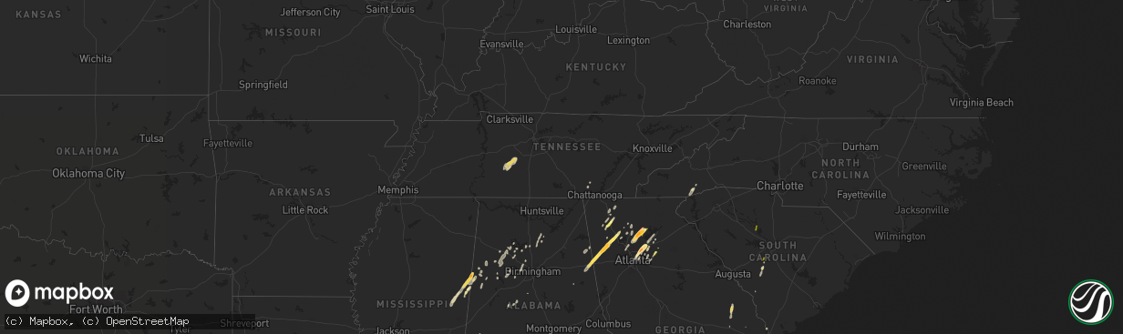
Hail Map in Tennessee on April 11, 2013
The weather event in Tennessee on April 11, 2013 includes Hail map. 8 states and 159 cities were impacted and suffered possible damage. The total estimated number of properties impacted is 0.
Want more than just the map?
Turn this storm into a full workflow.
- Owner + property data so you know who to knock
- OnDemand branded weather history reports to win the "did we even have hail?" argument
- RoofTrace estimate so reps stop guessing numbers at the door
Bought this map? Upgrade within 7 days and we'll credit the $230. (10-15 min setup call)
Hail
0
Estimated number of impacted properties by a 1.00" hail or larger0
Estimated number of impacted properties by a 1.75" hail or larger0
Estimated number of impacted properties by a 2.50" hail or largerStorm reports in Tennessee
Tennessee
| Date | Description |
|---|---|
| 04/11/20136:39 PM CDT | One tree down on signal mountain. |
| 04/11/20136:20 PM CDT | 1 tree down. |
| 04/11/20136:10 PM CDT | Several trees down. |
| 04/11/20133:13 PM CDT | Trees and power lines down in northwest jackson county. |
| 04/10/201311:20 PM CDT | Several trees down around the piney flats area. |
| 04/10/20138:05 PM CDT | Trees down across county. |
| 04/10/20137:30 PM CDT | Around 1400 people without power. Likely due to gusty winds. |
| 04/10/20137:10 PM CDT | 1 tree down. |
All States Impacted by Hail Map on April 11, 2013
Cities Impacted by Hail Map on April 11, 2013
- Chatsworth, GA
- Ethelsville, AL
- Columbus, MS
- Macon, MS
- Brooksville, MS
- Blackville, SC
- Springfield, SC
- Dunlap, TN
- Garfield, GA
- Millen, GA
- Twin City, GA
- Portal, GA
- Carrollton, AL
- Aliceville, AL
- Tallapoosa, GA
- Peachtree Corners, GA
- Decatur, GA
- Lawrenceville, GA
- Tucker, GA
- Duluth, GA
- Suwanee, GA
- Norcross, GA
- Lilburn, GA
- Atlanta, GA
- Piedmont, AL
- Loganville, GA
- Woodstock, GA
- Canton, GA
- Ball Ground, GA
- Dawsonville, GA
- Cumming, GA
- Alpharetta, GA
- Salley, SC
- North, SC
- Neeses, SC
- Northport, AL
- Rockmart, GA
- Muscadine, AL
- Buchanan, GA
- Brent, AL
- Lake Toxaway, NC
- Sapphire, NC
- Shuqualak, MS
- De Kalb, MS
- Preston, MS
- Rincon, GA
- Cedartown, GA
- Stone Mountain, GA
- Clarkston, GA
- Pine Lake, GA
- Marietta, GA
- Columbia, MS
- Balsam Grove, NC
- Santa Fe, TN
- Hohenwald, TN
- Williamsport, TN
- Mount Pleasant, TN
- Duck River, TN
- Hampshire, TN
- Centerville, TN
- Flowery Branch, GA
- Gainesville, GA
- Oakwood, GA
- Buford, GA
- Bremen, AL
- Taylorsville, GA
- Rome, GA
- Kingston, GA
- Letohatchee, AL
- Fort Deposit, AL
- White, GA
- Millport, AL
- Reform, AL
- Calhoun, GA
- Blountsville, AL
- Hanceville, AL
- Holly Pond, AL
- Baileyton, AL
- Hayden, AL
- Cullman, AL
- Brooklet, GA
- Ward, AL
- Pennington, AL
- Butler, AL
- Jasper, AL
- Roswell, GA
- Berry, AL
- Nauvoo, AL
- Townley, AL
- Carbon Hill, AL
- Arley, AL
- Double Springs, AL
- Houston, AL
- Ashland, AL
- Aragon, GA
- Montevallo, AL
- Winder, GA
- Dalton, GA
- Gordo, AL
- Covington, LA
- Madisonville, LA
- Plainville, GA
- Resaca, GA
- Adairsville, GA
- Sugar Valley, GA
- Heflin, AL
- Cartersville, GA
- Swansea, SC
- Pelion, SC
- Golden Meadow, LA
- Adger, AL
- Bessemer, AL
- Whitwell, TN
- Fruithurst, AL
- Jasper, GA
- Greenville, AL
- Braselton, GA
- Hoschton, GA
- Conyers, GA
- Gardendale, AL
- Graysville, AL
- Dora, AL
- Bankston, AL
- Fayette, AL
- Mulga, AL
- Quinton, AL
- Adamsville, AL
- Monroe, GA
- Dacula, GA
- Waleska, GA
- Foxworth, MS
- Sandy Hook, MS
- Snellville, GA
- Brookwood, AL
- Tuscaloosa, AL
- Martin, SC
- Kennedy, AL
- Parrish, AL
- Franklin, AL
- Ponchatoula, LA
- Metter, GA
- Marion, AL
- Pomaria, SC
- Blair, SC
- Lakeview, TX
- Childress, TX
- Memphis, TX
- Silverton, TX
- Quitaque, TX
- Tulia, TX
- Clarendon, TX
- Happy, TX
- Plainview, TX
- Hale Center, TX
- Matador, TX
- Turkey, TX
- Cee Vee, TX
- Paducah, TX
- Quanah, TX


