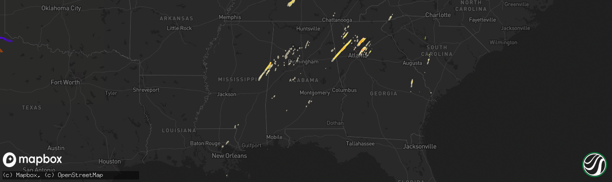
Hail Map in Alabama on April 11, 2013
The weather event in Alabama on April 11, 2013 includes Hail map. 8 states and 159 cities were impacted and suffered possible damage. The total estimated number of properties impacted is 159.
Want more than just the map?
Turn this storm into a full workflow.
- Owner + property data so you know who to knock
- OnDemand branded weather history reports to win the "did we even have hail?" argument
- RoofTrace estimate so reps stop guessing numbers at the door
Bought this map? Upgrade within 7 days and we'll credit the $230. (10-15 min setup call)
Hail
159
Estimated number of impacted properties by a 1.00" hail or larger0
Estimated number of impacted properties by a 1.75" hail or larger0
Estimated number of impacted properties by a 2.50" hail or largerStorm reports in Alabama
Alabama
| Date | Description |
|---|---|
| 04/11/20135:51 PM CDT | E30+ trees down. Several snapped off above ground. At water treatment plant. |
| 04/11/20135:30 PM CDT | Multiple warehouses sustained roof damage. |
| 04/11/20135:15 PM CDT | A small outbuilding was destroyed due to fallen tree in the 18000 block of county road 49. |
| 04/11/20135:15 PM CDT | A tree was blown down along county road 37. Time estimated from radar. |
| 04/11/20135:15 PM CDT | Multiple trees were knocked down on county road 155 between county road 200 and county road 18 in montevallo. At least 10 trees blocked the roadway. |
| 04/11/20135:12 PM CDT | Pea size hail was reported. |
| 04/11/20135:00 PM CDT | A tree was knocked down along county road 10 near county road 41. |
| 04/11/20134:55 PM CDT | At least a dozen trees were blown down across a one mile area near timberline golf course along and near the intersection of highway 25 and interstate 65. Single tree d |
| 04/11/20134:51 PM CDT | Two to three dozen trees were blown down. Several were snapped off above ground at water treatment plant. |
| 04/11/20134:48 PM CDT | Several trees were blown down near the intersection of state highway 155 and county road 200. Winds were estimated at 50 mph. |
| 04/11/20134:48 PM CDT | Tree reported down on house. |
| 04/11/20134:45 PM CDT | Trees and powerlines reported down. |
| 04/11/20134:38 PM CDT | A building at marshall space flight center reported wind damage. |
| 04/11/20134:37 PM CDT | A tree was blown down on valley view drive. |
| 04/11/20134:37 PM CDT | Multiple large trees reported down at the intersection of hickory hill road and four mile post road. |
| 04/11/20134:34 PM CDT | Trees...multiple powerlines...and downed power poles at the north end of the intersection of whitesburg drive and lily flagg road. |
| 04/11/20134:32 PM CDT | A brief ef-1 tornado touched down along dug hill road near cheval blvd where large cedar trees were snapped and twisted along with several snapped wooden power poles. A |
| 04/11/20134:30 PM CDT | Roof damage to a barn was reported. |
| 04/11/20134:29 PM CDT | Damage was reported to a mini-store at the intersection of lily flagg road and whitesburg drive. |
| 04/11/20134:27 PM CDT | Trees were blown down along highway 82 near mile marker 93. The eastbound lanes were blocked for a short period of time. |
| 04/11/20134:25 PM CDT | A brief ef-1 tornado touched down on the west side of memorial parkway near the 9000 block of craigmont drive causing several large trees to be uprooted and snapped. It |
| 04/11/20134:22 PM CDT | More than a dozen trees snapped along state highway 219 a few miles south of centreville. The road was blocked for a short time. Time estimated from radar. Trees were a |
| 04/11/20134:18 PM CDT | Numerous trees were snapped off and uprooted along a 20 mile path from se of harrisburg to se of brierfield. One home suffered minor siding damage. |
| 04/11/20133:59 PM CDT | Power lines were blown down on peters road off highway 77. |
| 04/11/20133:30 PM CDT | Trees down across the road on cr 1051 in the sardis community. |
| 04/11/20133:30 PM CDT | A tree was reported blown down on cr 351. |
| 04/11/20133:26 PM CDT | *** 1 inj *** a brief tornado touched down near the intersection of county road 45 and county road 3734. This location is east southest of addison. Many trees were snap |
| 04/11/20133:26 PM CDT | *** 1 inj *** a brief tornado touched down near cr 6 and cr 3734. This location is east southest of addison. Many trees were snapped off or were uprooted along the shor |
| 04/11/20133:25 PM CDT | *** 1 inj *** unknown structural damage along county road 45 near countyroad 3734. At least one man was injured. Time estimated from radar. |
| 04/11/20133:11 PM CDT | A tornado touched down near the winston county airport. The tornado snapped off and uprooted numerous trees. Several homes were damaged by fallen trees. A few boathouse |
| 04/11/20133:10 PM CDT | A tornado touched down near the winston county airport. The tornado snapped off and uprooted numerous trees. Several homes were damaged by fallen trees. A few boathouse |
| 04/11/20133:03 PM CDT | Em reports trees down 1 w of pennington on hwy 156. |
| 04/11/20132:57 PM CDT | A tornado touched down near county road 21 and traveled northeast. It lifted just east of highway 195. Several trees were snapped off and uprooted along the path. At le |
| 04/11/20132:45 PM CDT | Time and lat/long corrected. Trees were blown down and blocked road near intersection of nauvoo and nix roads. Structure damage was also reported in this area. Time est |
| 04/11/20132:45 PM CDT | A tornado touched down near dogtown road and traveled northeast. The tornado lifted as it crossed slick lizzard road. Numerous trees were snapped or uprooted and a few |
| 04/11/20132:43 PM CDT | Trees were blwon down and blocked road near intersection of nauvoo and nix roads. Structure damage was also reported in this area. Time estimated from radar. |
| 04/11/20132:30 PM CDT | Several trees down along county road 35. One tree fell on a house. There was also roof damage to a barn and a small outbuilding was destroyed at the same residence. No |
| 04/11/20132:03 PM CDT | A tree and power pole blown were blown down on 7th street se. |
| 04/11/20132:00 PM CDT | A few trees and power lines were blown down along 7th street ne and also across from walmart. Time estimated from radar. |
| 04/11/20131:35 PM CDT | Trees were blown down along county road 49 south of kennedy. Time estimated from radar. |
| 04/11/201312:57 PM CDT | Trees and power lines were blown down along pine grove road near the pine grove community. State police report damage to multiple homes. Numerous trees were also blown |
| 04/10/201310:05 PM CDT | Numerous trees and powerlines reported down around dothan and northern houston county. |
| 04/10/201310:02 PM CDT | Tree down west of abbeville on highway 10. |
| 04/10/20139:32 PM CDT | A few trees were blown down along county road 89. |
| 04/10/20139:30 PM CDT | Tree down across the highway near ozark. Caused a vehicle accident. No injuries. |
| 04/10/20139:29 PM CDT | Tree down on a mobile home west of slocomb. |
| 04/10/20138:47 PM CDT | Several powerlines reported down near samson on cr 54. |
| 04/10/20138:44 PM CDT | *** 1 inj *** around one dozen structures were damaged or destroyed and hundreds of trees were blown down along the path.one person was injured by flying glass in a hom |
| 04/10/20138:42 PM CDT | Possible tornado. Unconfirmed- highway patrol reporting structural damage between notasulga and liberty city. Rescue is enroute. |
| 04/10/20138:34 PM CDT | *** 1 inj *** around one dozen structures were damaged or destroyed and hundreds of trees were blown down along the path.one person was injured by flying glass in a hom |
| 04/10/20137:28 PM CDT | A large tree were blown down and blocked the road near the intersection of mcinnis road and patterson road. Time estimated from radar. |
| 04/10/20137:20 PM CDT | Multiple trees were snapped and uprooted just off highway 331 behind sportsman deer processing. Time estimated from radar. |
All States Impacted by Hail Map on April 11, 2013
Cities Impacted by Hail Map on April 11, 2013
- Chatsworth, GA
- Ethelsville, AL
- Columbus, MS
- Macon, MS
- Brooksville, MS
- Blackville, SC
- Springfield, SC
- Dunlap, TN
- Garfield, GA
- Millen, GA
- Twin City, GA
- Portal, GA
- Carrollton, AL
- Aliceville, AL
- Tallapoosa, GA
- Peachtree Corners, GA
- Decatur, GA
- Lawrenceville, GA
- Tucker, GA
- Duluth, GA
- Suwanee, GA
- Norcross, GA
- Lilburn, GA
- Atlanta, GA
- Piedmont, AL
- Loganville, GA
- Woodstock, GA
- Canton, GA
- Ball Ground, GA
- Dawsonville, GA
- Cumming, GA
- Alpharetta, GA
- Salley, SC
- North, SC
- Neeses, SC
- Northport, AL
- Rockmart, GA
- Muscadine, AL
- Buchanan, GA
- Brent, AL
- Lake Toxaway, NC
- Sapphire, NC
- Shuqualak, MS
- De Kalb, MS
- Preston, MS
- Rincon, GA
- Cedartown, GA
- Stone Mountain, GA
- Clarkston, GA
- Pine Lake, GA
- Marietta, GA
- Columbia, MS
- Balsam Grove, NC
- Santa Fe, TN
- Hohenwald, TN
- Williamsport, TN
- Mount Pleasant, TN
- Duck River, TN
- Hampshire, TN
- Centerville, TN
- Flowery Branch, GA
- Gainesville, GA
- Oakwood, GA
- Buford, GA
- Bremen, AL
- Taylorsville, GA
- Rome, GA
- Kingston, GA
- Letohatchee, AL
- Fort Deposit, AL
- White, GA
- Millport, AL
- Reform, AL
- Calhoun, GA
- Blountsville, AL
- Hanceville, AL
- Holly Pond, AL
- Baileyton, AL
- Hayden, AL
- Cullman, AL
- Brooklet, GA
- Ward, AL
- Pennington, AL
- Butler, AL
- Jasper, AL
- Roswell, GA
- Berry, AL
- Nauvoo, AL
- Townley, AL
- Carbon Hill, AL
- Arley, AL
- Double Springs, AL
- Houston, AL
- Ashland, AL
- Aragon, GA
- Montevallo, AL
- Winder, GA
- Dalton, GA
- Gordo, AL
- Covington, LA
- Madisonville, LA
- Plainville, GA
- Resaca, GA
- Adairsville, GA
- Sugar Valley, GA
- Heflin, AL
- Cartersville, GA
- Swansea, SC
- Pelion, SC
- Golden Meadow, LA
- Adger, AL
- Bessemer, AL
- Whitwell, TN
- Fruithurst, AL
- Jasper, GA
- Greenville, AL
- Braselton, GA
- Hoschton, GA
- Conyers, GA
- Gardendale, AL
- Graysville, AL
- Dora, AL
- Bankston, AL
- Fayette, AL
- Mulga, AL
- Quinton, AL
- Adamsville, AL
- Monroe, GA
- Dacula, GA
- Waleska, GA
- Foxworth, MS
- Sandy Hook, MS
- Snellville, GA
- Brookwood, AL
- Tuscaloosa, AL
- Martin, SC
- Kennedy, AL
- Parrish, AL
- Franklin, AL
- Ponchatoula, LA
- Metter, GA
- Marion, AL
- Pomaria, SC
- Blair, SC
- Lakeview, TX
- Childress, TX
- Memphis, TX
- Silverton, TX
- Quitaque, TX
- Tulia, TX
- Clarendon, TX
- Happy, TX
- Plainview, TX
- Hale Center, TX
- Matador, TX
- Turkey, TX
- Cee Vee, TX
- Paducah, TX
- Quanah, TX


