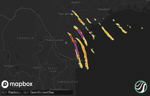
Hail Map in Texas on April 10, 2016
The weather event in Texas on April 10, 2016 includes Hail map. 7 states and 361 cities were impacted and suffered possible damage. The total estimated number of properties impacted is 9,855.

Hail
9,855
Estimated number of impacted properties by a 1.00" hail or larger3,370
Estimated number of impacted properties by a 1.75" hail or larger1,188
Estimated number of impacted properties by a 2.50" hail or largerStorm reports in Texas
Texas
| Date | Description |
|---|---|
| 04/10/20166:40 PM CDT | Scattered hail as large as golf balls |
| 04/10/20166:32 PM CDT | Few larger stones at least the size of quarters |
| 04/10/20166:31 PM CDT | Hail size estimated from social media image |
| 04/10/20166:30 PM CDT | Extensive hail damage to cars. |
| 04/10/20166:25 PM CDT | A local report indicates 2.00 inch wind near DICKENS |
| 04/10/20166:20 PM CDT | A local report indicates 2.50 inch wind near DICKENS |
| 04/10/20166:17 PM CDT | A local report indicates 1.75 inch wind near DICKENS |
| 04/10/20165:30 PM CDT | A local report indicates 65 MPH wind near 5 S VERNON |
| 04/10/20165:17 PM CDT | A local report indicates 1.00 inch wind near LOCKETT |
| 04/10/20165:10 PM CDT | Hail observed on the ground at fm 40 about 2 miles east of hwy 207. Time of hail fall is estimated. |
| 04/10/20165:02 PM CDT | Received via socail media. Time and hail size estimated. |
| 04/10/20165:01 PM CDT | A local report indicates 1.25 inch wind near 9 S RALLS |
| 04/10/20164:31 PM CDT | A local report indicates 1.00 inch wind near 2 NNE TRUSCOTT |
| 04/10/20164:25 PM CDT | Hail found approximately 20 minutes after it fell. |
| 04/10/20164:22 PM CDT | Hail size estimated from photo on facebook. Time of hail estimated from radar. |
| 04/10/20164:15 PM CDT | A local report indicates 1.75 inch wind near 3 S CROWELL |
| 04/09/201610:55 PM CDT | A local report indicates 59 MPH wind near 26 NW MIAMI |
| 04/09/201610:35 PM CDT | Motorist reported 1.0 inch hail on i44 w of sheppard afb. |
| 04/09/201610:07 PM CDT | A local report indicates 61 MPH wind near 1 SSW PANHANDLE |
| 04/09/201610:05 PM CDT | Motorist reported 1.0 inch hail on i44 w of sheppard afb. |
| 04/09/20169:56 PM CDT | A local report indicates 58 MPH wind near 1 W AMARILLO |
| 04/09/20169:56 PM CDT | A local report indicates 58 MPH wind near 14 N AMARILLO |
| 04/09/20169:44 PM CDT | Several reports of power lines down. |
| 04/09/20169:40 PM CDT | A local report indicates 58 MPH wind near 10 ESE VALLEY DE ORO |
| 04/09/20169:39 PM CDT | A local report indicates 68 MPH wind near 6 ENE AMARILLO |
| 04/09/20169:37 PM CDT | Rolling hills elementary school |
| 04/09/20169:35 PM CDT | A local report indicates 60 MPH wind near 3 NE WALL |
| 04/09/20169:35 PM CDT | A local report indicates 1.00 inch wind near 3 NE WALL |
| 04/09/20169:29 PM CDT | At wonderland park |
| 04/09/20169:29 PM CDT | A local report indicates 59 MPH wind near 3 NW AMARILLO |
| 04/09/20169:28 PM CDT | A local report indicates 62 MPH wind near 7 W AMARILLO |
| 04/09/20169:28 PM CDT | A local report indicates 62 MPH wind near 6 WNW AMARILLO |
| 04/09/20169:26 PM CDT | A local report indicates 61 MPH wind near 6 WNW AMARILLO |
| 04/09/20169:20 PM CDT | A local report indicates 62 MPH wind near 3 E BUSHLAND |
| 04/09/20169:02 PM CDT | Hen egg sized hail reported approximately 3 miles west of maryneal. Back and drivers side windows...and drivers side mirror broken out of pickup truck. |
| 04/09/20169:00 PM CDT | Time estimated |
| 04/09/20168:38 PM CDT | Several nickel to quarter size hail reports. Hail is 1.5 inches deep on highway 83 north of wellington. |
| 04/09/20168:30 PM CDT | Time estimated from radar. |
| 04/09/20168:11 PM CDT | A local report indicates 2.50 inch wind near 2 N TRUSCOTT |
| 04/09/20168:10 PM CDT | A local report indicates 1.00 inch wind near HEDLEY |
| 04/09/20168:07 PM CDT | From social media |
| 04/09/20167:56 PM CDT | A local report indicates 1.25 inch wind near HART |
| 04/09/20167:26 PM CDT | A local report indicates 2.50 inch wind near 5 N GUTHRIE |
| 04/09/20167:05 PM CDT | Time estimated from radar. |
Cities Impacted by Hail Map on April 10, 2016
- Lawton, OK
- Dickens, TX
- Arkansas City, KS
- Nash, OK
- Mountain View, OK
- Byers, TX
- Wichita Falls, TX
- Faxon, OK
- Electra, TX
- Frederick, OK
- Waurika, OK
- Hobart, OK
- Ringling, OK
- Wilson, OK
- Randlett, OK
- Paducah, TX
- Davidson, OK
- Burkburnett, TX
- Duncan, OK
- Tipton, OK
- Walters, OK
- Holliday, TX
- Altus, OK
- Devol, OK
- Elmer, OK
- Ardmore, OK
- Fort Cobb, OK
- Healdton, OK
- Anadarko, OK
- Lone Grove, OK
- Snyder, OK
- Seymour, TX
- Grandfield, OK
- Sheppard Afb, TX
- Gotebo, OK
- Iowa Park, TX
- Roosevelt, OK
- Apache, OK
- Lone Wolf, OK
- Petrolia, TX
- Hollister, OK
- Olustee, OK
- Crowell, TX
- Cache, OK
- Temple, OK
- Duke, OK
- Headrick, OK
- Mangum, OK
- Weinert, TX
- Granite, OK
- Indiahoma, OK
- Marlow, OK
- Geronimo, OK
- Quanah, TX
- Carnegie, OK
- Ryan, OK
- Harrold, TX
- Oklaunion, TX
- Loco, OK
- Comanche, OK
- Loveland, OK
- Gould, OK
- Hastings, OK
- Blair, OK
- Mountain Park, OK
- Chattanooga, OK
- Henrietta, TX
- Eldorado, OK
- Throckmorton, TX
- Vernon, TX
- Tipton, MO
- Clarksburg, MO
- Ionia, MO
- Mora, MO
- Cole Camp, MO
- Versailles, MO
- Stover, MO
- Syracuse, MO
- Fortuna, MO
- Florence, MO
- Lincoln, MO
- San Tan Valley, AZ
- Florence, AZ
- Crocker, MO
- Vienna, MO
- Dixon, MO
- Iberia, MO
- Newburg, MO
- Hart, TX
- Elgin, OK
- Fletcher, OK
- Cement, OK
- Medicine Park, OK
- Chickasha, OK
- Cyril, OK
- Ninnekah, OK
- Quemado, TX
- La Pryor, TX
- San Angelo, TX
- Maryneal, TX
- Vinson, OK
- Wellington, TX
- Ralls, TX
- Crosbyton, TX
- Lorenzo, TX
- Lubbock, TX
- Slaton, TX
- Tulia, TX
- Copan, OK
- Wann, OK
- Earth, TX
- Olton, TX
- Dimmitt, TX
- Muleshoe, TX
- Batesville, TX
- Pearsall, TX
- Childress, TX
- Cherokee, OK
- Helena, OK
- Jet, OK
- Pittsburg, OK
- Drummond, OK
- Independence, KS
- Waynoka, OK
- Aline, OK
- Guthrie, OK
- Edmond, OK
- Braman, OK
- Waukomis, OK
- Turkey, TX
- Brackettville, TX
- California, MO
- Idaho Falls, ID
- Memphis, TX
- Butler, MO
- Plainview, TX
- Kress, TX
- Girard, KS
- Sterling City, TX
- Rush Springs, OK
- Lindsay, OK
- Medford, OK
- Quitaque, TX
- Silverton, TX
- Pawhuska, OK
- Enid, OK
- Mulvane, KS
- Derby, KS
- Savonburg, KS
- Roscoe, TX
- Blackwell, TX
- Robert Lee, TX
- Loraine, TX
- Sweetwater, TX
- Coyle, OK
- Meridian, OK
- Eldon, MO
- Tuscumbia, MO
- Montreal, MO
- Kaiser, MO
- Lake Ozark, MO
- Linn Creek, MO
- Sunrise Beach, MO
- Brumley, MO
- Meta, MO
- Osage Beach, MO
- Saint Elizabeth, MO
- Ulman, MO
- Lakeview, TX
- Springer, OK
- Newkirk, OK
- Oswego, KS
- Columbus, KS
- Dewey, OK
- Bartlesville, OK
- Billings, OK
- Red Rock, OK
- Hume, MO
- Rich Hill, MO
- Happy, TX
- Hale Center, TX
- Graham, OK
- Hennepin, OK
- Ratliff City, OK
- Edna, KS
- Bartlett, KS
- Jasper, MO
- Oronogo, MO
- Deepwater, MO
- Appleton City, MO
- Osceola, MO
- Lowry City, MO
- Mound Valley, KS
- Cherryvale, KS
- Elk City, KS
- Liberty, KS
- Sedan, KS
- Perrin, TX
- Mineral Wells, TX
- Poolville, TX
- Springtown, TX
- Weatherford, TX
- Dunnegan, MO
- Bolivar, MO
- Palo Pinto, TX
- Strawn, TX
- Graford, TX
- Havana, KS
- El Reno, OK
- Calumet, OK
- Chillicothe, TX
- Odell, TX
- Fairmont, OK
- Maud, OK
- Deer Creek, OK
- Archer City, TX
- Douglass, KS
- Rose Hill, KS
- Newcastle, TX
- Peck, KS
- Moore, ID
- Windsor, MO
- Clinton, MO
- Calhoun, MO
- Warsaw, MO
- Fitzhugh, OK
- Roff, OK
- Stonewall, OK
- McCune, KS
- Wynona, OK
- Macomb, OK
- Wanette, OK
- Nazareth, TX
- Pocasset, OK
- Hollis, OK
- Niotaze, KS
- Minco, OK
- Climax Springs, MO
- Edwards, MO
- Macks Creek, MO
- Garber, OK
- Caney, KS
- Peru, KS
- Union City, OK
- Carrier, OK
- Tahoka, TX
- Willow, OK
- Altus Afb, OK
- Cordell, OK
- Wilson, TX
- Quail, TX
- Redfield, KS
- Uniontown, KS
- Deerfield, MO
- Fort Scott, KS
- Richards, MO
- Stamford, TX
- Wewoka, OK
- Warrensburg, MO
- Erie, KS
- Walnut, KS
- Saint Paul, KS
- Cedar Vale, KS
- Yukon, OK
- Otterville, MO
- Gracemont, OK
- Lexington, OK
- Roach, MO
- Camdenton, MO
- Richland, MO
- Sulphur, OK
- Hedley, TX
- Brinktown, MO
- Rolla, MO
- Geuda Springs, KS
- South Haven, KS
- Thayer, KS
- Smithton, MO
- Rogers, NM
- Canyon, TX
- Boonville, MO
- Coffeyville, KS
- Montrose, MO
- Latham, MO
- Maple City, KS
- Purcell, OK
- Washington, OK
- Blanchard, OK
- Scammon, KS
- Weir, KS
- Bland, MO
- Saint James, MO
- Seiling, OK
- Uvalde, TX
- Wayside, TX
- Springlake, TX
- Noble, OK
- Harwood, MO
- Winfield, KS
- Dexter, KS
- Ponca City, OK
- Kaw City, OK
- Miles, TX
- Neodesha, KS
- Green Ridge, MO
- Isabella, OK
- Eldridge, MO
- Lebanon, MO
- Maysville, OK
- Longdale, OK
- Fairview, OK
- Elmore City, OK
- Wakita, OK
- Mooreland, OK
- Oklahoma City, OK
- Mannsville, OK
- Bunceton, MO
- Asher, OK
- Lockwood, MO
- Verden, OK
- Ames, OK
- Dearing, KS
- Stringtown, OK
- Pond Creek, OK
- Arma, KS
- Scotland, TX
- Matador, TX
- Clarendon, TX
- Lenapah, OK
- Shamrock, TX
- Nevada, MO
- Urich, MO
- S Coffeyville, OK
- Talihina, OK
- Perkins, OK
- Post, TX
- Creighton, MO
- Chanute, KS
- Altamont, KS
- Longton, KS
- Parsons, KS
- Walker, MO
- Mason, TX
- Laquey, MO
- Waynesville, MO
- Hughesville, MO
- Sedalia, MO
- Rockville, MO
- Barnett, MO
- Vichy, MO
- Belle, MO
- Pauls Valley, OK
- Wynnewood, OK
- Tuttle, OK
- Humboldt, KS
- Snyder, TX
- Davis, OK
- Wayne, OK
- Alva, OK
- Dacoma, OK
- Spur, TX


