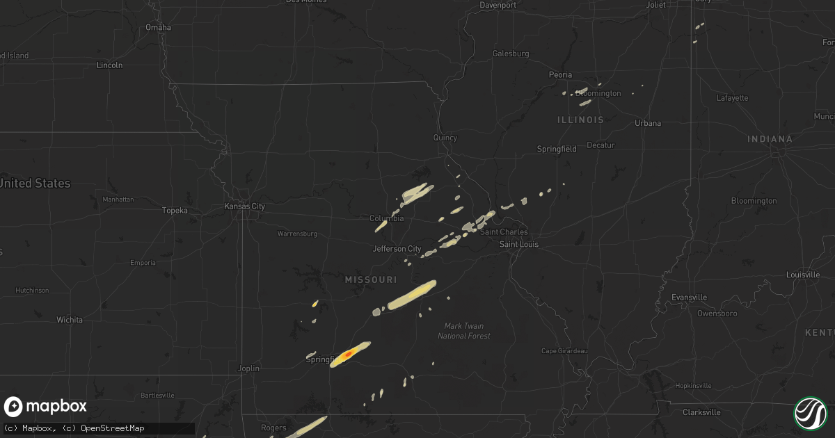
Hail Map in Wisconsin on April 10, 2011
Get this storm
April 10 map
$229
one time, instant access
Download today. No call, no setup
Keep the $229
Bought the map and want the full workflow? Apply the entire $229 to a subscription within 7 days. None of it is wasted.
Every map, not just this one
This buys you this map. Subscription and you get every map we run, in the markets you choose from a few cities to whole states to nationwide. Plus real-time alerts the moment a storm fires.
Contact data
Name, contact info, occupancy, even credit band for addresses in the footprint. You go from where it hit to who to call.
Become the source they trust
Unlimited branding weather history reports on demand. You already have the documented answer ready for the property owner, and you are the one who showed up with it.
Property data and RoofTrace estimates
Pull up any address you have got, its value and the exact code rules for that jurisdiction, straight from One Click Code. Then RoofTrace estimates the squares, pitch, and roof value, priced the way you price.
Storm reports in Wisconsin
Wisconsin
| Date | Description |
|---|---|
| 04/10/20116:54 PM CDT | Two trees knocked down |
| 04/10/20116:54 PM CDT | 12 inch diameter trees down....possible tornado |
| 04/10/20116:53 PM CDT | Rotating wall cloud |
| 04/10/20116:53 PM CDT | Large trees 12 inch diameter over road...possible tornado. |
| 04/10/20116:51 PM CDT | Near interstate 39 |
| 04/10/20116:45 PM CDT | Damage to a house on county j road from a possible tornado. |
| 04/10/20116:40 PM CDT | A local report indicates 1.00 inch wind near 4 W PARK FALLS |
| 04/10/20116:30 PM CDT | Reported by spotter |
| 04/10/20116:30 PM CDT | Ef1 |
| 04/10/20116:25 PM CDT | Trees down. |
| 04/10/20116:23 PM CDT | A local report indicates 1.00 inch wind near BIG FLATS |
| 04/10/20116:19 PM CDT | A local report indicates 1.00 inch wind near 8 S NEKOOSA |
| 04/10/20116:18 PM CDT | A local report indicates 1.75 inch wind near 5 ENE MEDFORD |
| 04/10/20116:18 PM CDT | A local report indicates 1.25 inch wind near 1 E NECEDAH |
| 04/10/20116:18 PM CDT | A local report indicates 1.25 inch wind near 3 SE NECEDAH |
| 04/10/20116:17 PM CDT | Some trees down.... |
| 04/10/20116:16 PM CDT | Highway 51 lincoln marathon county line |
| 04/10/20116:16 PM CDT | Trees and power lines down |
| 04/10/20116:15 PM CDT | Two or three homes and a barn damaged. Possibly a tornado. |
| 04/10/20116:14 PM CDT | Tornado track was 4.5 miles with max width of 150 yds. The path began at paradise lane and 25th st sw and ended in the wisconsin river northeast of the intersection of |
| 04/10/20116:12 PM CDT | Ef2. 17 mile length. 1/2 mile max width. From just west of arkdale to cottonwood to county rd g. |
| 04/10/20116:11 PM CDT | A local report indicates 1.75 inch wind near ODANAH |
| 04/10/20116:10 PM CDT | Funnel cloud with trees down. |
| 04/10/20116:10 PM CDT | Possible tornado reported by public. Considerable tree damage. |
| 04/10/20116:10 PM CDT | Lots of trees down near highway ff near little chicago |
| 04/10/20116:08 PM CDT | 8 to 10 inch pine trees uprooted and a garage down. Winds estimated 60 mph. |
| 04/10/20116:07 PM CDT | A local report indicates 1.25 inch wind near ODANAH |
| 04/10/20116:04 PM CDT | Relayed report from media...estimated time based on radar image... |
| 04/10/20115:57 PM CDT | Golf balls if not bigger. |
| 04/10/20115:42 PM CDT | A local report indicates 1.00 inch wind near 4 SW STETSONVILLE |
| 04/10/20115:40 PM CDT | Hail measurements between golf ball and tennis ball size. Wind gusts also estimated around 70 mph. |
| 04/10/20115:40 PM CDT | A local report indicates 1.00 inch wind near W PARK FALLS |
| 04/10/20115:38 PM CDT | A local report indicates 1.00 inch wind near WARRENS |
| 04/10/20115:35 PM CDT | A few large poplar trees blown down with some half inch diameter hail. Time approximated by radar images and the person who reported the damage. Delayed report. |
| 04/10/20115:30 PM CDT | A local report indicates 1.25 inch wind near 1 N TOMAH |
| 04/10/20115:30 PM CDT | A local report indicates 1.00 inch wind near MEDFORD |
| 04/10/20115:25 PM CDT | At hwy 16 and cth a |
| 04/10/20115:16 PM CDT | At i-90 exit 25 |
| 04/10/20115:10 PM CDT | Powerlines down on mound ridge rd |
| 04/10/20115:09 PM CDT | A local report indicates 1.00 inch wind near AUGUSTA |
| 04/10/20115:09 PM CDT | Estimated from sheriff. |
| 04/10/20115:05 PM CDT | Ef1 tornado with maximum wind speeds of 90 to 100 mph. Path length approx three quarters of a mile...path width approx 150 yards...on the ground for approx 1 minute. Tr |
| 04/10/20115:05 PM CDT | Hwy 40 and county rd d |
| 04/10/20115:05 PM CDT | Measured at raws site. |
| 04/10/20115:00 PM CDT | Roofs off 2 mobile homes. |
| 04/10/20115:00 PM CDT | Lots of windows broken and cars dented from what appears to be wind blown debris. |
| 04/10/20115:00 PM CDT | Trees down...barn damage...and snapped power poles on the north side of augusta. |
| 04/10/20115:00 PM CDT | A local report indicates 1.00 inch wind near FALL CREEK |
| 04/10/20115:00 PM CDT | Ef1 tornado with maximum wind speed of 95 to 105 mph. Path length approx 1.5 miles...path width approx 200 yards...on the ground for approx 2 minutes. 2 farmsteads were |
| 04/10/20114:59 PM CDT | Also 40 mph wind |
| 04/10/20114:55 PM CDT | At hwy 14 and cth mm |
| 04/10/20114:54 PM CDT | South side |
| 04/10/20114:54 PM CDT | A local report indicates 1.75 inch wind near 5 S OSSEO |
| 04/10/20114:54 PM CDT | At nws office |
| 04/10/20114:53 PM CDT | Extensive hail damage on the south side of la crosse near wal mart. Windows broken and siding damaged to an estimated 10 to 15 homes. Several vehicles also damaged with |
| 04/10/20114:53 PM CDT | At southern bluffs school |
| 04/10/20114:52 PM CDT | On ward avenue in south la crosse |
| 04/10/20114:51 PM CDT | A local report indicates 60 MPH wind near 2 S LA CROSSE |
| 04/10/20114:51 PM CDT | Half dollar size hail |
| 04/10/20114:45 PM CDT | A local report indicates 1.75 inch wind near 1 W NEW AUBURN |
| 04/10/20114:42 PM CDT | A local report indicates 1.25 inch wind near ARCADIA |
| 04/10/20114:36 PM CDT | A local report indicates 1.00 inch wind near 3 NNW BLOOMER |
| 04/10/20114:35 PM CDT | A local report indicates 1.25 inch wind near 5 E FOUNTAIN CITY |
| 04/10/20114:34 PM CDT | Multiple reports of hail around quarter size |
| 04/10/20114:32 PM CDT | Covering the ground. |
| 04/10/20114:22 PM CDT | North of 29 on hwy 40 |
| 04/10/20114:22 PM CDT | A local report indicates 2.00 inch wind near 2 W ELK MOUND |
| 04/10/20114:20 PM CDT | I-94/hwy 29 exit ramp area. |
| 04/10/20114:12 PM CDT | A local report indicates 1.75 inch wind near 8 NNE DURAND |
| 04/10/20113:50 PM CDT | A local report indicates 1.00 inch wind near NELSON |
| 04/10/20113:30 PM CDT | Time was estimated. |
| 04/09/201110:45 PM CDT | A local report indicates 65 MPH wind near 2 W MILWAUKEE INTERNATI |
| 04/09/201110:36 PM CDT | Report noted by dialing into awos at 1038pm. Ob was 26026g50kt |
| 04/09/20119:57 PM CDT | Trees down |
| 04/09/20119:38 PM CDT | A local report indicates 65 MPH wind near MANITOWOC |
| 04/09/20119:15 PM CDT | Trees down |
| 04/09/20119:10 PM CDT | Roof torn off building |
| 04/09/20119:06 PM CDT | Report from a local school |
| 04/09/20118:55 PM CDT | A few homes damaged - roof blown off a garage |
| 04/09/20118:50 PM CDT | 70 to 80 mph |
| 04/09/20118:50 PM CDT | 70-80 mph |
| 04/09/20118:48 PM CDT | Building damaged on county hwy d |
| 04/09/20118:46 PM CDT | A local report indicates 60 MPH wind near 2 N DARBOY |
| 04/09/20118:43 PM CDT | Garage damaged...roofs damaged...car moved and trees down from the middle to south side of kaukauna |
| 04/09/20118:30 PM CDT | Roof damage at motormart gas station. Power lines down. |
| 04/09/20118:11 PM CDT | On county hwy m |
| 04/09/20118:08 PM CDT | House and garage destroyed. |
| 04/09/20118:05 PM CDT | Widespread debris including highway signs down. |
| 04/09/20117:55 PM CDT | Buildings damaged in poy sippi |
| 04/09/20117:54 PM CDT | A local report indicates 1.00 inch wind near PINE RIVER |
| 04/09/20117:50 PM CDT | A local report indicates 1.75 inch wind near 2 E WILD ROSE |
| 04/09/20117:37 PM CDT | Large trees down |
| 04/09/20117:35 PM CDT | A local report indicates 2.00 inch wind near 2 S CRANDON |
| 04/09/20117:35 PM CDT | A local report indicates 1.75 inch wind near WAUTOMA |
| 04/09/20117:35 PM CDT | A local report indicates 1.75 inch wind near ARGONNE |
| 04/09/20117:34 PM CDT | Large barn corner 20 by 120 ft ripped off. |
| 04/09/20117:30 PM CDT | Trees and power lines down. Also 1 to 1.5 inch hail. |
| 04/09/20117:24 PM CDT | Homes and barns damaged in the fremont and readfield areas in southeast waupaca county. Also trees/power lines down. |
| 04/09/20117:00 PM CDT | Many trees down along highway 73...some blocking the road. |
| 04/09/20117:00 PM CDT | 100 year old oak tree knocked down by strong winds. |
All States Impacted by Hail Map on April 10, 2011
Cities Impacted by Hail Map on April 10, 2011
- New London, WI
- Hortonville, WI
- Doss, TX
- Del Rio, TX
- Ozona, TX
- Eldorado, TX
- High Bridge, WI
- Deer River, MN
- Christoval, TX
- Mason, TX
- Melvin, TX
- Voca, TX
- Menard, TX
- Hext, TX
- Brady, TX
- Hatfield, AR
- Mena, AR
- Friendship, WI
- Adams, WI
- Aubrey, TX
- Fort Worth, TX
- Celina, TX
- Whitewright, TX
- Roanoke, TX
- Azle, TX
- Pilot Point, TX
- Savoy, TX
- Ravenna, TX
- Frisco, TX
- Ector, TX
- Justin, TX
- Little Elm, TX
- Argyle, TX
- Mckinney, TX
- Denton, TX
- Dodd City, TX
- Anna, TX
- Newark, TX
- Ivanhoe, TX
- Van Alstyne, TX
- Bonham, TX
- Haslet, TX
- Lake Dallas, TX
- Prosper, TX
- Telephone, TX
- Hamilton, TX
- Fayetteville, AR
- Prairie Grove, AR
- Warner, OK
- Winslow, AR
- Canehill, AR
- Evansville, AR
- Eufaula, OK
- Uniontown, AR
- Porum, OK
- West Fork, AR
- Chester, AR
- Natural Dam, AR
- Elkins, AR
- Vian, OK
- Webbers Falls, OK
- Gore, OK
- Bunch, OK
- Stilwell, OK
- Checotah, OK
- Sallisaw, OK
- Ontonagon, MI
- Caddo, OK
- Gainesville, TX
- Muenster, TX
- Carlinville, IL
- Brixey, MO
- Graford, TX
- Palo Pinto, TX
- Mineral Wells, TX
- Perrin, TX
- Elizabeth, IL
- Stockton, IL
- Caney, OK
- Elk Mound, WI
- Durand, WI
- Menomonie, WI
- Colfax, WI
- Chippewa Falls, WI
- Mondovi, WI
- Bloomer, WI
- Reedsburg, WI
- La Valle, WI
- Lyndon Station, WI
- Mauston, WI
- Watson, OK
- Santa Anna, TX
- Cranfills Gap, TX
- Brownwood, TX
- Comanche, TX
- Early, TX
- Priddy, TX
- Lohn, TX
- Jonesboro, TX
- Iredell, TX
- Pottsville, TX
- Voss, TX
- Morgan, TX
- Brookesmith, TX
- Clifton, TX
- Carlton, TX
- Millersview, TX
- Doole, TX
- Mullin, TX
- Zephyr, TX
- Richland Springs, TX
- Meridian, TX
- Goldthwaite, TX
- Rochelle, TX
- Rockwood, TX
- Gustine, TX
- Eden, TX
- Hico, TX
- Gouldbusk, TX
- Lime Springs, IA
- Cresco, IA
- Ashland, WI
- Millsap, TX
- Weatherford, TX
- Wautoma, WI
- Dublin, TX
- Wright City, MO
- Spring Lake, MN
- Talmoon, MN
- Junction, TX
- Ardmore, OK
- Sonora, TX
- Spruce, MI
- Lincoln, MI
- Barton City, MI
- Ponca, AR
- Comins, MI
- Lewiston, MI
- De Leon, TX
- Gorman, TX
- Arcadia, WI
- Rocksprings, TX
- Muldrow, OK
- Bay City, WI
- Hager City, WI
- Red Wing, MN
- Empire, MI
- Weyerhaeuser, WI
- New Auburn, WI
- Chetek, WI
- Itasca, TX
- Whitney, TX
- Hillsboro, TX
- Hilbert, WI
- Rogersville, MO
- Seymour, MO
- Hartville, MO
- Grovespring, MO
- Fordland, MO
- Niangua, MO
- Ozark, MO
- Marshfield, MO
- Strafford, MO
- Springfield, MO
- Wickes, AR
- Cove, AR
- Plano, TX
- Rising Star, TX
- Carbon, TX
- Cross Plains, TX
- Houston, MN
- Hubbard Lake, MI
- Curran, MI
- Black River, MI
- Lachine, MI
- Harrisville, MI
- Westville, OK
- Oark, AR
- San Saba, TX
- Jim Falls, WI
- Vichy, MO
- Rolla, MO
- Stonewall, OK
- Grand Prairie, TX
- Cookson, OK
- Wesley, AR
- Stigler, OK
- Cedarville, AR
- Osseo, WI
- Jamestown, MO
- Columbia, MO
- Paradise, TX
- Boyd, TX
- Springtown, TX
- Caledonia, MN
- Bad Axe, MI
- Elkton, MI
- Harbor Beach, MI
- Filion, MI
- Port Hope, MI
- Old Monroe, MO
- Brussels, IL
- Batchtown, IL
- Winfield, MO
- Foley, MO
- Arlington, TX
- Kennedale, TX
- Mansfield, TX
- San Angelo, TX
- Vancourt, TX
- Holcombe, WI
- Ladysmith, WI
- Bruce, WI
- Wheeler, WI
- Ridgeland, WI
- Locust Grove, AR
- Concord, AR
- Floral, AR
- Batesville, AR
- Mexico, MO
- Centralia, MO
- Thompson, MO
- Tremont, IL
- Eagletown, OK
- Broken Bow, OK
- Berger, MO
- Chilton, TX
- Ada, OK
- La Crescent, MN
- West Salem, WI
- La Crosse, WI
- Hokah, MN
- Brownsville, MN
- Boyceville, WI
- Cornell, WI
- Eau Galle, WI
- Willow Springs, MO
- Port Austin, MI
- Merkel, TX
- Gordon, TX
- Ranger, TX
- Lipan, TX
- Mingus, TX
- Santo, TX
- Bluff Dale, TX
- Aledo, TX
- Rock Falls, IL
- Winona, MN
- Fountain City, WI
- Dodge, WI
- Decatur, TX
- Tuscola, TX
- Ruth, MI
- Owendale, MI
- Pigeon, MI
- Sebewaing, MI
- Bay Port, MI
- Laona, WI
- Crandon, WI
- Argonne, WI
- Thackerville, OK
- Whitesboro, TX
- Gordonville, TX
- Lindsay, TX
- Locust Grove, OK
- Grand Portage, MN
- Hovland, MN
- Wilburton, OK
- Red Oak, OK
- Cashton, WI
- Coon Valley, WI
- Westby, WI
- Marcell, MN
- Bigfork, MN
- Hayward, WI
- Tomah, WI
- Cook, MN
- May, TX
- Coleman, TX
- Burkett, TX
- Holdenville, OK
- Round Rock, TX
- Bowie, TX
- Sunset, TX
- Butternut, WI
- Osseo, MI
- South Range, WI
- Superior, WI
- Potter, WI
- Reedsville, WI
- Brillion, WI
- Ely, MN
- Farmington, AR
- Lincoln, AR
- Proctor, OK
- Park Hill, OK
- Summers, AR
- Welling, OK
- Springdale, AR
- Marietta, OK
- Overbrook, OK
- Honey Grove, TX
- Valley Spring, TX
- Llano, TX
- Elmwood, WI
- Ellsworth, WI
- Foristell, MO
- Dorchester, WI
- Menasha, WI
- Appleton, WI
- Neenah, WI
- Alvord, TX
- Burleson, TX
- Cedar Hill, TX
- Trenton, TX
- Crowley, TX
- Tolar, TX
- Castell, TX
- Naval Air Station Jrb, TX
- Montague, TX
- Art, TX
- Tioga, TX
- Cleburne, TX
- Sumner, TX
- Granbury, TX
- Whitt, TX
- London, TX
- Desdemona, TX
- Boswell, OK
- Blanket, TX
- Dallas, TX
- Cisco, TX
- Lewisville, TX
- Gunter, TX
- Godley, TX
- Bells, TX
- Ponder, TX
- Saint Jo, TX
- Tom Bean, TX
- Desoto, TX
- Denison, TX
- Chico, TX
- Sherman, TX
- Lillian, TX
- Fort McKavett, TX
- Eastland, TX
- Stephenville, TX
- Cresson, TX
- Jacksboro, TX
- Blum, TX
- Joshua, TX
- Bridgeport, TX
- Hugo, OK
- Valera, TX
- Soper, OK
- Venus, TX
- Strawn, TX
- Bennington, OK
- Alvarado, TX
- Evant, TX
- Paint Rock, TX
- Duncanville, TX
- Krum, TX
- Flower Mound, TX
- Talpa, TX
- Rhome, TX
- Forestburg, TX
- Howe, TX
- Midlothian, TX
- Collinsville, TX
- Nocona, TX
- Sadler, TX
- Pottsboro, TX
- Austin, TX
- Onalaska, WI
- Hermann, MO
- Mill Creek, OK
- Mannsville, OK
- Valley Mills, TX
- Collins, WI
- Chilton, WI
- Georgetown, TX
- Roff, OK
- Fitzhugh, OK
- Ladonia, TX
- Kewaunee, WI
- Denmark, WI
- Wild Rose, WI
- Kalkaska, MI
- New London, MO
- Chouteau, OK
- Grayling, MI
- Two Rivers, WI
- Mishicot, WI
- Newton, WI
- Manitowoc, WI
- Sasakwa, OK
- Atwood, OK
- Wewoka, OK
- Marthasville, MO
- Warrenton, MO
- Harper, TX
- Mountain Home, TX
- Oshkosh, WI
- Allen, OK
- Hanna, OK
- Maud, OK
- Lamar, OK
- Konawa, OK
- Wetumka, OK
- Calvin, OK
- Dustin, OK
- Stuart, OK
- Asher, OK
- Mcalester, OK
- Burnet, TX
- Lampasas, TX
- Tahlequah, OK
- Rogers, AR
- Berryville, AR
- Braggs, OK
- Huntsville, AR
- Green Forest, AR
- Muskogee, OK
- Omaha, AR
- Hindsville, AR
- Eureka Springs, AR
- Ontario, WI
- Rhinelander, WI
- Pelican Lake, WI
- Okemah, OK
- Casco, WI
- Algoma, WI
- Alpena, MI
- South Branch, MI
- Fairview, MI
- Herron, MI
- Nemo, TX
- Kopperl, TX
- Maiden Rock, WI
- Spring Valley, WI
- Jerseyville, IL
- Fremont, WI
- Larsen, WI
- Medford, WI
- Fife Lake, MI
- Harmony, MN
- Linn, MO
- Perry, MO
- Laddonia, MO
- Santa Fe, MO
- Warrens, WI
- Athens, WI
- Seymour, TX
- Max, MN
- Whitehall, WI
- Almond, WI
- Winneconne, WI
- Greenville, WI
- Bangor, WI
- Redgranite, WI
- Kendall, WI
- Coloma, WI
- Weyauwega, WI
- Rockland, WI
- Kimberly, WI
- Poy Sippi, WI
- Genoa, WI
- Viroqua, WI
- Plainfield, WI
- Pine River, WI
- Necedah, WI
- Waupaca, WI
- Arkdale, WI
- Sparta, WI
- Stoddard, WI
- Nekoosa, WI
- Canton, MN
- Chaseburg, WI
- Camp Douglas, WI
- Decorah, IA
- Bancroft, WI
- Wilton, WI
- New Lisbon, WI
- Mabel, MN
- Grand Marsh, WI
- Spring Grove, MN
- Hancock, WI
- Norwalk, WI
- Shiocton, WI
- Cape Vincent, NY
- Blanco, OK
- Pittsburg, OK
- Rush Hill, MO
- Troy, MO
- Truesdale, MO
- Wentzville, MO
- Edgar, WI
- Colby, WI
- Abbotsford, WI
- Maribel, WI
- Saint James, MO
- Owensville, MO
- Waynesville, MO
- Richland, MO
- Jerome, MO
- Dixon, MO
- Bland, MO
- Belle, MO
- Newburg, MO
- Crocker, MO
- Saint Robert, MO
- Irma, WI
- Merrill, WI
- Sulphur, OK
- Weaubleau, MO
- Wheatland, MO
- Mellen, WI
- New Florence, MO
- Montgomery City, MO
- Stringtown, OK
- Daisy, OK
- Hartshorne, OK
- Tuskahoma, OK
- Hallsville, MO
- Stanley, WI
- Augusta, WI
- Cadott, WI
- Boyd, WI
- Fall Creek, WI
- Sturgeon Bay, WI
- Thornfield, MO
- Noble, MO
- Wasola, MO
- Park Falls, WI
- Johannesburg, MI
- Gaylord, MI
- Atlanta, MI
- Homer, MI
- Elcho, WI
- Gleason, WI
- Boynton, OK
- Hendrix, OK
- Colbert, OK
- Luxemburg, WI
- Nilwood, IL
- Maypearl, TX
- Grandview, TX
- Fredericksburg, TX
- Rib Lake, WI
- Mounds, OK
- Leon, OK
- Green Lake, WI
- Hutto, TX
- Stoutland, MO
- Covington, TX
- Rio Vista, TX
- Peterson, MN
- Francis Creek, WI
- Pittsfield, IL
- Taylor, TX
- Winters, TX
- Rushford, MN
- New Haven, MO
- South Boardman, MI
- Burneyville, OK
- Downing, WI
- Knapp, WI
- Bellflower, MO
- Silex, MO
- Truxton, MO
- Wakefield, MI
- Hopedale, IL
- Pettigrew, AR
- Honor, MI
- De Pere, WI
- Greenleaf, WI
- Green Bay, WI
- Grafton, IL
- Fieldon, IL
- Bena, MN
- Liberty Hill, TX
- Beulah, MI
- Richland Center, WI
- Ash Grove, MO
- Willard, MO
- Bois D Arc, MO
- Stanford, IL
- Mackinaw, IL
- Minier, IL
- Danvers, IL
- Westphalia, MO
- Bowling Green, MO
- Middletown, MO
- Hillman, MI
- Kempner, TX
- Eau Claire, WI
- Wonewoc, WI
- Tekonsha, MI
- Lebanon, MO
- Clam Lake, WI
- Orr, MN
- Keene, TX
- Pickett, WI
- Windom, TX
- Drury, MO
- Gans, OK
- Turner, MI
- Omer, MI
- Standish, MI
- Au Gres, MI
- Freeburg, MO
- Koeltztown, MO
- Rattan, OK
- Mccurtain, OK
- Shady Point, OK
- Bokoshe, OK
- Colon, MI
- Sherwood, MI
- Cedar Park, TX
- Vandalia, MO
- Marengo, WI
- Mason, WI
- Whitelaw, WI
- Hillsdale, MI
- Kiel, WI
- Bokchito, OK
- Gilman, WI
- Chamois, MO
- Morrison, MO
- Keota, OK
- Cazenovia, WI
- Melvin, IL
- Glen Rose, TX
- Dorchester, IA
- Eitzen, MN
- Neshkoro, WI
- Bristow, OK
- Calmar, IA
- La Pointe, WI
- Granger, TX
- Mountainburg, AR
- Gibson City, IL
- Freeport, IL
- Eleva, WI
- Massena, NY
- Byers, TX
- Greenville, TX
- Atoka, OK
- Kenefic, OK
- Charles City, IA
- Alta Vista, IA
- Sidney, TX
- Tomahawk, WI
- Nelson, WI
- Wilson, WI
- Alma, AR
- Mulberry, AR
- Owen, WI
- Thorp, WI
- Withee, WI
- Curtiss, WI
- Fifield, WI
- Phillips, WI
- Lake Village, IN
- Alma, WI
- Roxton, TX
- Fairchild, WI
- Leander, TX
- Lowell, IN
- Saxon, WI
- Dripping Springs, TX
- Sulphur Springs, TX
- Bear Lake, MI
- Benzonia, MI
- Thompsonville, MI
- Ballinger, TX
- Garland, TX
- Spiro, OK
- Horseshoe Bay, TX
- Willow City, TX
- Round Mountain, TX
- Wagoner, OK
- Moscow Mills, MO
- O'Fallon, MO
- Princeton, WI
- Desha, AR
- Frankford, MO
- Louisiana, MO
- Mancelona, MI
- Frederic, MI
- Theodosia, MO
- Strum, WI
- Lublin, WI
- Stetsonville, WI
- Steelville, MO
- Roosevelt, TX
- Kellogg, MN
- Ozark, AR
- Wilson, OK
- Sanger, TX
- Manton, MI
- Kingsley, MI
- Mukwonago, WI
- Durant, OK
- Blair, WI
- Independence, WI
- New Berlin, WI
- Waukesha, WI
- Eagle, WI
- Marble Falls, TX
- Bayfield, WI
- Mendon, MI
- Hawkins, WI
- Wabasha, MN
- Rock City, IL
- Pearl City, IL
- Ridott, IL
- Dakota, IL
- Royse City, TX
- Harvel, IL
- Dryden, TX
- Ironwood, MI
- Burlington, MI
- Stamford, TX
- Camden, MI
- Smithville, OK
- Wichita Falls, TX
- Buchanan Dam, TX
- Bangs, TX
- Medora, IL
- Piasa, IL
- Fidelity, IL
- Campbell, TX
- Ringling, OK
- Winter, WI
- Hillsboro, WI
- Hudson, IL
- Twining, MI
- Lewiston, MN
- Mio, MI
- Roscommon, MI
- Hillpoint, WI
- Loganville, WI
- Brussels, WI
- Melissa, TX
- Rudy, AR
- Southlake, TX
- Altoona, WI
- Reads Landing, MN
- Unity, WI
- McLean, IL
- Armington, IL
- Rosston, TX
- Elma, IA
- Edgar Springs, MO
- Montello, WI
- Hawk Point, MO
- Eminence, MO
- Black Creek, WI
- Little Chute, WI
- Omro, WI
- Berlin, WI
- Ridgeway, IA
- Walnut Springs, TX
- Ironton, MO
- Fredericktown, MO
- Arcadia, MO
- Sharon, WI
- Fair Play, MO
- Beggs, OK
- Tower, MN
- Angora, MN
- Bartlett, TX
- Quinlan, TX
- Dunnegan, MO
- Bolivar, MO


