Hail Map in La Crosse, WI on April 10, 2011
Get this storm
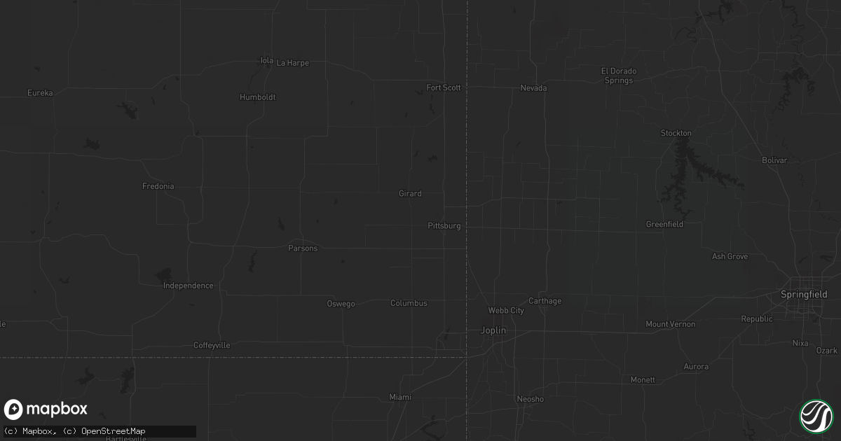
April 10 map
$229
one time, instant access
Download today. No call, no setup
Keep the $229
Bought the map and want the full workflow? Apply the entire $229 to a subscription within 7 days. None of it is wasted.
Every map, not just this one
This buys you this map. Subscription and you get every map we run, in the markets you choose from a few cities to whole states to nationwide. Plus real-time alerts the moment a storm fires.
Contact data
Name, contact info, occupancy, even credit band for addresses in the footprint. You go from where it hit to who to call.
Become the source they trust
Unlimited branding weather history reports on demand. You already have the documented answer ready for the property owner, and you are the one who showed up with it.
Property data and RoofTrace estimates
Pull up any address you have got, its value and the exact code rules for that jurisdiction, straight from One Click Code. Then RoofTrace estimates the squares, pitch, and roof value, priced the way you price.
Storm reports in La Crosse, WI
La Crosse, WI
| Date | Description |
|---|---|
| 04/10/20114:55 PM CDT | At hwy 14 and cth mm |
| 04/10/20114:54 PM CDT | South side |
| 04/10/20114:54 PM CDT | At nws office |
| 04/10/20114:53 PM CDT | Extensive hail damage on the south side of la crosse near wal mart. Windows broken and siding damaged to an estimated 10 to 15 homes. Several vehicles also damaged with |
| 04/10/20114:53 PM CDT | At southern bluffs school |
| 04/10/20114:52 PM CDT | On ward avenue in south la crosse |
| 04/10/20114:51 PM CDT | A local report indicates 60 MPH wind near 2 S LA CROSSE |
| 04/10/20114:51 PM CDT | Half dollar size hail |
All States Impacted by Hail Map on April 10, 2011
All Cities Impacted by Hail Map on April 10, 2011
- New London, WI
- Hortonville, WI
- Doss, TX
- Del Rio, TX
- Ozona, TX
- Eldorado, TX
- High Bridge, WI
- Deer River, MN
- Christoval, TX
- Mason, TX
- Melvin, TX
- Voca, TX
- Menard, TX
- Hext, TX
- Brady, TX
- Hatfield, AR
- Mena, AR
- Friendship, WI
- Adams, WI
- Aubrey, TX
- Fort Worth, TX
- Celina, TX
- Whitewright, TX
- Roanoke, TX
- Azle, TX
- Pilot Point, TX
- Savoy, TX
- Ravenna, TX
- Frisco, TX
- Ector, TX
- Justin, TX
- Little Elm, TX
- Argyle, TX
- Mckinney, TX
- Denton, TX
- Dodd City, TX
- Anna, TX
- Newark, TX
- Ivanhoe, TX
- Van Alstyne, TX
- Bonham, TX
- Haslet, TX
- Lake Dallas, TX
- Prosper, TX
- Telephone, TX
- Hamilton, TX
- Fayetteville, AR
- Prairie Grove, AR
- Warner, OK
- Winslow, AR
- Canehill, AR
- Evansville, AR
- Eufaula, OK
- Uniontown, AR
- Porum, OK
- West Fork, AR
- Chester, AR
- Natural Dam, AR
- Elkins, AR
- Vian, OK
- Webbers Falls, OK
- Gore, OK
- Bunch, OK
- Stilwell, OK
- Checotah, OK
- Sallisaw, OK
- Ontonagon, MI
- Caddo, OK
- Gainesville, TX
- Muenster, TX
- Carlinville, IL
- Brixey, MO
- Graford, TX
- Palo Pinto, TX
- Mineral Wells, TX
- Perrin, TX
- Elizabeth, IL
- Stockton, IL
- Caney, OK
- Elk Mound, WI
- Durand, WI
- Menomonie, WI
- Colfax, WI
- Chippewa Falls, WI
- Mondovi, WI
- Bloomer, WI
- Reedsburg, WI
- La Valle, WI
- Lyndon Station, WI
- Mauston, WI
- Watson, OK
- Santa Anna, TX
- Cranfills Gap, TX
- Brownwood, TX
- Comanche, TX
- Early, TX
- Priddy, TX
- Lohn, TX
- Jonesboro, TX
- Iredell, TX
- Pottsville, TX
- Voss, TX
- Morgan, TX
- Brookesmith, TX
- Clifton, TX
- Carlton, TX
- Millersview, TX
- Doole, TX
- Mullin, TX
- Zephyr, TX
- Richland Springs, TX
- Meridian, TX
- Goldthwaite, TX
- Rochelle, TX
- Rockwood, TX
- Gustine, TX
- Eden, TX
- Hico, TX
- Gouldbusk, TX
- Lime Springs, IA
- Cresco, IA
- Ashland, WI
- Millsap, TX
- Weatherford, TX
- Wautoma, WI
- Dublin, TX
- Wright City, MO
- Spring Lake, MN
- Talmoon, MN
- Junction, TX
- Ardmore, OK
- Sonora, TX
- Spruce, MI
- Lincoln, MI
- Barton City, MI
- Ponca, AR
- Comins, MI
- Lewiston, MI
- De Leon, TX
- Gorman, TX
- Arcadia, WI
- Rocksprings, TX
- Muldrow, OK
- Bay City, WI
- Hager City, WI
- Red Wing, MN
- Empire, MI
- Weyerhaeuser, WI
- New Auburn, WI
- Chetek, WI
- Itasca, TX
- Whitney, TX
- Hillsboro, TX
- Hilbert, WI
- Rogersville, MO
- Seymour, MO
- Hartville, MO
- Grovespring, MO
- Fordland, MO
- Niangua, MO
- Ozark, MO
- Marshfield, MO
- Strafford, MO
- Springfield, MO
- Wickes, AR
- Cove, AR
- Plano, TX
- Rising Star, TX
- Carbon, TX
- Cross Plains, TX
- Houston, MN
- Hubbard Lake, MI
- Curran, MI
- Black River, MI
- Lachine, MI
- Harrisville, MI
- Westville, OK
- Oark, AR
- San Saba, TX
- Jim Falls, WI
- Vichy, MO
- Rolla, MO
- Stonewall, OK
- Grand Prairie, TX
- Cookson, OK
- Wesley, AR
- Stigler, OK
- Cedarville, AR
- Osseo, WI
- Jamestown, MO
- Columbia, MO
- Paradise, TX
- Boyd, TX
- Springtown, TX
- Caledonia, MN
- Bad Axe, MI
- Elkton, MI
- Harbor Beach, MI
- Filion, MI
- Port Hope, MI
- Old Monroe, MO
- Brussels, IL
- Batchtown, IL
- Winfield, MO
- Foley, MO
- Arlington, TX
- Kennedale, TX
- Mansfield, TX
- San Angelo, TX
- Vancourt, TX
- Holcombe, WI
- Ladysmith, WI
- Bruce, WI
- Wheeler, WI
- Ridgeland, WI
- Locust Grove, AR
- Concord, AR
- Floral, AR
- Batesville, AR
- Mexico, MO
- Centralia, MO
- Thompson, MO
- Tremont, IL
- Eagletown, OK
- Broken Bow, OK
- Berger, MO
- Chilton, TX
- Ada, OK
- La Crescent, MN
- West Salem, WI
- La Crosse, WI
- Hokah, MN
- Brownsville, MN
- Boyceville, WI
- Cornell, WI
- Eau Galle, WI
- Willow Springs, MO
- Port Austin, MI
- Merkel, TX
- Gordon, TX
- Ranger, TX
- Lipan, TX
- Mingus, TX
- Santo, TX
- Bluff Dale, TX
- Aledo, TX
- Rock Falls, IL
- Winona, MN
- Fountain City, WI
- Dodge, WI
- Decatur, TX
- Tuscola, TX
- Ruth, MI
- Owendale, MI
- Pigeon, MI
- Sebewaing, MI
- Bay Port, MI
- Laona, WI
- Crandon, WI
- Argonne, WI
- Thackerville, OK
- Whitesboro, TX
- Gordonville, TX
- Lindsay, TX
- Locust Grove, OK
- Grand Portage, MN
- Hovland, MN
- Wilburton, OK
- Red Oak, OK
- Cashton, WI
- Coon Valley, WI
- Westby, WI
- Marcell, MN
- Bigfork, MN
- Hayward, WI
- Tomah, WI
- Cook, MN
- May, TX
- Coleman, TX
- Burkett, TX
- Holdenville, OK
- Round Rock, TX
- Bowie, TX
- Sunset, TX
- Butternut, WI
- Osseo, MI
- South Range, WI
- Superior, WI
- Potter, WI
- Reedsville, WI
- Brillion, WI
- Ely, MN
- Farmington, AR
- Lincoln, AR
- Proctor, OK
- Park Hill, OK
- Summers, AR
- Welling, OK
- Springdale, AR
- Marietta, OK
- Overbrook, OK
- Honey Grove, TX
- Valley Spring, TX
- Llano, TX
- Elmwood, WI
- Ellsworth, WI
- Foristell, MO
- Dorchester, WI
- Menasha, WI
- Appleton, WI
- Neenah, WI
- Alvord, TX
- Burleson, TX
- Cedar Hill, TX
- Trenton, TX
- Crowley, TX
- Tolar, TX
- Castell, TX
- Naval Air Station Jrb, TX
- Montague, TX
- Art, TX
- Tioga, TX
- Cleburne, TX
- Sumner, TX
- Granbury, TX
- Whitt, TX
- London, TX
- Desdemona, TX
- Boswell, OK
- Blanket, TX
- Dallas, TX
- Cisco, TX
- Lewisville, TX
- Gunter, TX
- Godley, TX
- Bells, TX
- Ponder, TX
- Saint Jo, TX
- Tom Bean, TX
- Desoto, TX
- Denison, TX
- Chico, TX
- Sherman, TX
- Lillian, TX
- Fort McKavett, TX
- Eastland, TX
- Stephenville, TX
- Cresson, TX
- Jacksboro, TX
- Blum, TX
- Joshua, TX
- Bridgeport, TX
- Hugo, OK
- Valera, TX
- Soper, OK
- Venus, TX
- Strawn, TX
- Bennington, OK
- Alvarado, TX
- Evant, TX
- Paint Rock, TX
- Duncanville, TX
- Krum, TX
- Flower Mound, TX
- Talpa, TX
- Rhome, TX
- Forestburg, TX
- Howe, TX
- Midlothian, TX
- Collinsville, TX
- Nocona, TX
- Sadler, TX
- Pottsboro, TX
- Austin, TX
- Onalaska, WI
- Hermann, MO
- Mill Creek, OK
- Mannsville, OK
- Valley Mills, TX
- Collins, WI
- Chilton, WI
- Georgetown, TX
- Roff, OK
- Fitzhugh, OK
- Ladonia, TX
- Kewaunee, WI
- Denmark, WI
- Wild Rose, WI
- Kalkaska, MI
- New London, MO
- Chouteau, OK
- Grayling, MI
- Two Rivers, WI
- Mishicot, WI
- Newton, WI
- Manitowoc, WI
- Sasakwa, OK
- Atwood, OK
- Wewoka, OK
- Marthasville, MO
- Warrenton, MO
- Harper, TX
- Mountain Home, TX
- Oshkosh, WI
- Allen, OK
- Hanna, OK
- Maud, OK
- Lamar, OK
- Konawa, OK
- Wetumka, OK
- Calvin, OK
- Dustin, OK
- Stuart, OK
- Asher, OK
- Mcalester, OK
- Burnet, TX
- Lampasas, TX
- Tahlequah, OK
- Rogers, AR
- Berryville, AR
- Braggs, OK
- Huntsville, AR
- Green Forest, AR
- Muskogee, OK
- Omaha, AR
- Hindsville, AR
- Eureka Springs, AR
- Ontario, WI
- Rhinelander, WI
- Pelican Lake, WI
- Okemah, OK
- Casco, WI
- Algoma, WI
- Alpena, MI
- South Branch, MI
- Fairview, MI
- Herron, MI
- Nemo, TX
- Kopperl, TX
- Maiden Rock, WI
- Spring Valley, WI
- Jerseyville, IL
- Fremont, WI
- Larsen, WI
- Medford, WI
- Fife Lake, MI
- Harmony, MN
- Linn, MO
- Perry, MO
- Laddonia, MO
- Santa Fe, MO
- Warrens, WI
- Athens, WI
- Seymour, TX
- Max, MN
- Whitehall, WI
- Almond, WI
- Winneconne, WI
- Greenville, WI
- Bangor, WI
- Redgranite, WI
- Kendall, WI
- Coloma, WI
- Weyauwega, WI
- Rockland, WI
- Kimberly, WI
- Poy Sippi, WI
- Genoa, WI
- Viroqua, WI
- Plainfield, WI
- Pine River, WI
- Necedah, WI
- Waupaca, WI
- Arkdale, WI
- Sparta, WI
- Stoddard, WI
- Nekoosa, WI
- Canton, MN
- Chaseburg, WI
- Camp Douglas, WI
- Decorah, IA
- Bancroft, WI
- Wilton, WI
- New Lisbon, WI
- Mabel, MN
- Grand Marsh, WI
- Spring Grove, MN
- Hancock, WI
- Norwalk, WI
- Shiocton, WI
- Cape Vincent, NY
- Blanco, OK
- Pittsburg, OK
- Rush Hill, MO
- Troy, MO
- Truesdale, MO
- Wentzville, MO
- Edgar, WI
- Colby, WI
- Abbotsford, WI
- Maribel, WI
- Saint James, MO
- Owensville, MO
- Waynesville, MO
- Richland, MO
- Jerome, MO
- Dixon, MO
- Bland, MO
- Belle, MO
- Newburg, MO
- Crocker, MO
- Saint Robert, MO
- Irma, WI
- Merrill, WI
- Sulphur, OK
- Weaubleau, MO
- Wheatland, MO
- Mellen, WI
- New Florence, MO
- Montgomery City, MO
- Stringtown, OK
- Daisy, OK
- Hartshorne, OK
- Tuskahoma, OK
- Hallsville, MO
- Stanley, WI
- Augusta, WI
- Cadott, WI
- Boyd, WI
- Fall Creek, WI
- Sturgeon Bay, WI
- Thornfield, MO
- Noble, MO
- Wasola, MO
- Park Falls, WI
- Johannesburg, MI
- Gaylord, MI
- Atlanta, MI
- Homer, MI
- Elcho, WI
- Gleason, WI
- Boynton, OK
- Hendrix, OK
- Colbert, OK
- Luxemburg, WI
- Nilwood, IL
- Maypearl, TX
- Grandview, TX
- Fredericksburg, TX
- Rib Lake, WI
- Mounds, OK
- Leon, OK
- Green Lake, WI
- Hutto, TX
- Stoutland, MO
- Covington, TX
- Rio Vista, TX
- Peterson, MN
- Francis Creek, WI
- Pittsfield, IL
- Taylor, TX
- Winters, TX
- Rushford, MN
- New Haven, MO
- South Boardman, MI
- Burneyville, OK
- Downing, WI
- Knapp, WI
- Bellflower, MO
- Silex, MO
- Truxton, MO
- Wakefield, MI
- Hopedale, IL
- Pettigrew, AR
- Honor, MI
- De Pere, WI
- Greenleaf, WI
- Green Bay, WI
- Grafton, IL
- Fieldon, IL
- Bena, MN
- Liberty Hill, TX
- Beulah, MI
- Richland Center, WI
- Ash Grove, MO
- Willard, MO
- Bois D Arc, MO
- Stanford, IL
- Mackinaw, IL
- Minier, IL
- Danvers, IL
- Westphalia, MO
- Bowling Green, MO
- Middletown, MO
- Hillman, MI
- Kempner, TX
- Eau Claire, WI
- Wonewoc, WI
- Tekonsha, MI
- Lebanon, MO
- Clam Lake, WI
- Orr, MN
- Keene, TX
- Pickett, WI
- Windom, TX
- Drury, MO
- Gans, OK
- Turner, MI
- Omer, MI
- Standish, MI
- Au Gres, MI
- Freeburg, MO
- Koeltztown, MO
- Rattan, OK
- Mccurtain, OK
- Shady Point, OK
- Bokoshe, OK
- Colon, MI
- Sherwood, MI
- Cedar Park, TX
- Vandalia, MO
- Marengo, WI
- Mason, WI
- Whitelaw, WI
- Hillsdale, MI
- Kiel, WI
- Bokchito, OK
- Gilman, WI
- Chamois, MO
- Morrison, MO
- Keota, OK
- Cazenovia, WI
- Melvin, IL
- Glen Rose, TX
- Dorchester, IA
- Eitzen, MN
- Neshkoro, WI
- Bristow, OK
- Calmar, IA
- La Pointe, WI
- Granger, TX
- Mountainburg, AR
- Gibson City, IL
- Freeport, IL
- Eleva, WI
- Massena, NY
- Byers, TX
- Greenville, TX
- Atoka, OK
- Kenefic, OK
- Charles City, IA
- Alta Vista, IA
- Sidney, TX
- Tomahawk, WI
- Nelson, WI
- Wilson, WI
- Alma, AR
- Mulberry, AR
- Owen, WI
- Thorp, WI
- Withee, WI
- Curtiss, WI
- Fifield, WI
- Phillips, WI
- Lake Village, IN
- Alma, WI
- Roxton, TX
- Fairchild, WI
- Leander, TX
- Lowell, IN
- Saxon, WI
- Dripping Springs, TX
- Sulphur Springs, TX
- Bear Lake, MI
- Benzonia, MI
- Thompsonville, MI
- Ballinger, TX
- Garland, TX
- Spiro, OK
- Horseshoe Bay, TX
- Willow City, TX
- Round Mountain, TX
- Wagoner, OK
- Moscow Mills, MO
- O'Fallon, MO
- Princeton, WI
- Desha, AR
- Frankford, MO
- Louisiana, MO
- Mancelona, MI
- Frederic, MI
- Theodosia, MO
- Strum, WI
- Lublin, WI
- Stetsonville, WI
- Steelville, MO
- Roosevelt, TX
- Kellogg, MN
- Ozark, AR
- Wilson, OK
- Sanger, TX
- Manton, MI
- Kingsley, MI
- Mukwonago, WI
- Durant, OK
- Blair, WI
- Independence, WI
- New Berlin, WI
- Waukesha, WI
- Eagle, WI
- Marble Falls, TX
- Bayfield, WI
- Mendon, MI
- Hawkins, WI
- Wabasha, MN
- Rock City, IL
- Pearl City, IL
- Ridott, IL
- Dakota, IL
- Royse City, TX
- Harvel, IL
- Dryden, TX
- Ironwood, MI
- Burlington, MI
- Stamford, TX
- Camden, MI
- Smithville, OK
- Wichita Falls, TX
- Buchanan Dam, TX
- Bangs, TX
- Medora, IL
- Piasa, IL
- Fidelity, IL
- Campbell, TX
- Ringling, OK
- Winter, WI
- Hillsboro, WI
- Hudson, IL
- Twining, MI
- Lewiston, MN
- Mio, MI
- Roscommon, MI
- Hillpoint, WI
- Loganville, WI
- Brussels, WI
- Melissa, TX
- Rudy, AR
- Southlake, TX
- Altoona, WI
- Reads Landing, MN
- Unity, WI
- McLean, IL
- Armington, IL
- Rosston, TX
- Elma, IA
- Edgar Springs, MO
- Montello, WI
- Hawk Point, MO
- Eminence, MO
- Black Creek, WI
- Little Chute, WI
- Omro, WI
- Berlin, WI
- Ridgeway, IA
- Walnut Springs, TX
- Ironton, MO
- Fredericktown, MO
- Arcadia, MO
- Sharon, WI
- Fair Play, MO
- Beggs, OK
- Tower, MN
- Angora, MN
- Bartlett, TX
- Quinlan, TX
- Dunnegan, MO
- Bolivar, MO


