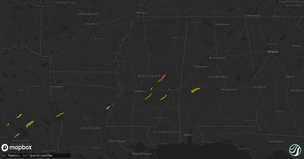
Hail Map in Mississippi on April 6, 2014
Get this storm
April 6 map
$229
one time, instant access
Download today. No call, no setup
Keep the $229
Bought the map and want the full workflow? Apply the entire $229 to a subscription within 7 days. None of it is wasted.
Every map, not just this one
This buys you this map. Subscription and you get every map we run, in the markets you choose from a few cities to whole states to nationwide. Plus real-time alerts the moment a storm fires.
Contact data
Name, contact info, occupancy, even credit band for addresses in the footprint. You go from where it hit to who to call.
Become the source they trust
Unlimited branding weather history reports on demand. You already have the documented answer ready for the property owner, and you are the one who showed up with it.
Property data and RoofTrace estimates
Pull up any address you have got, its value and the exact code rules for that jurisdiction, straight from One Click Code. Then RoofTrace estimates the squares, pitch, and roof value, priced the way you price.
Storm reports in Mississippi
Mississippi
| Date | Description |
|---|---|
| 04/06/20146:50 PM CDT | Occurred on baker rd |
| 04/06/20142:10 AM CDT | Reports of downed trees and debris blocking gilmer road. |
| 04/06/20142:10 AM CDT | Reports of damaged homes around the 700 william warren river road. Time estimated based upon radar. |
| 04/06/20142:10 AM CDT | Report that bash blackwell road is completely blocked by debris. |
| 04/06/20142:10 AM CDT | Report that new hopewell church has been heavily damaged on new hopewell church road. |
| 04/06/20142:10 AM CDT | Reports of roads blocked by trees and powerlines on vester pickering road and theodore crosby road. Damage to numerous houses and mobile homes. Confirmed injuries on ve |
| 04/06/20142:10 AM CDT | Report of trees down on salem school road and salem church road. |
| 04/06/20142:06 AM CDT | Reports of powerlines down on jerry drive near sunset road. |
| 04/06/20142:06 AM CDT | Reports of debris on rock hill road northwest of collins. |
| 04/06/20142:06 AM CDT | Reports of trees and debris down on highway 49 northwest of collins. Time based on radar. |
| 04/06/20142:02 AM CDT | *** 8 inj *** this tornado touched down just w of sunset williamsburg rd and tracked ne across n covingtog co into far nw jones co before dissipating. Hundreds of trees |
| 04/06/20141:48 AM CDT | Reports of powerlines down on highway 13 south in prentiss. |
| 04/06/20141:45 AM CDT | 4 homes along timberlane rd. Were damaged. Shingles missing and one unoccupied house had a large tree fall on it. |
| 04/06/20141:30 AM CDT | Reports of powerlines down on highway 13 south in prentiss. |
| 04/05/20149:05 PM CDT | A few trees uprooted. |
| 04/05/20148:40 PM CDT | Quarter size hail in southern noxubee county. Wind/hail caused damage to a mobile home. |
| 04/05/20148:37 PM CDT | Trees and power lines down along hwy 14. Chicken barns were also damaged. |
| 04/05/20148:10 PM CDT | Trees down in the area as well. |
| 04/05/20148:08 PM CDT | A local report indicates 1.00 inch wind near PULASKI |
| 04/05/20148:06 PM CDT | Trees down in the preston area near highways 21 and 397. |
| 04/05/20147:53 PM CDT | A local report indicates 1.00 inch wind near POLKVILLE |
| 04/05/20147:45 PM CDT | A local report indicates 1.00 inch wind near ROSE HILL |
| 04/05/20147:43 PM CDT | A local report indicates 1.00 inch wind near PUCKETT |
| 04/05/20147:41 PM CDT | This tornado first touched down along county road 610...tracked across county road 743 and lifted east of county road 761. A roof was torn off a single family home...th |
| 04/05/20147:40 PM CDT | Occurred on fork rd |
| 04/05/20147:35 PM CDT | Some mobile homes were blown off of blocks. Roof was blown off of a house with roof damage to other houses. |
| 04/05/20147:33 PM CDT | A local report indicates 1.75 inch wind near BRAXTON |
| 04/05/20147:30 PM CDT | A local report indicates 1.75 inch wind near PHILADELPHIA |
All States Impacted by Hail Map on April 6, 2014
Cities Impacted by Hail Map on April 6, 2014
- Ferriday, LA
- Clayton, LA
- Fisher, LA
- Florien, LA
- Many, LA
- Hemphill, TX
- Madisonville, TX
- Midway, TX
- Crockett, TX
- Grapeland, TX
- Clifton, TX
- Valley Mills, TX
- Aquilla, TX
- Whitney, TX
- Hillsboro, TX
- Gallion, AL
- Sweet Water, AL
- Demopolis, AL
- Faunsdale, AL
- Linden, AL
- Uniontown, AL
- Philadelphia, MS
- Walnut Grove, MS
- Carthage, MS
- Louin, MS
- Bay Springs, MS
- Rose Hill, MS
- Braxton, MS
- Mendenhall, MS
- Brandon, MS
- Morton, MS
- Big Lake, TX
- Barnhart, TX
- Diboll, TX
- Corrigan, TX
- Groveton, TX
- New Waverly, TX
- Huntsville, TX
- Northport, AL
- Coker, AL
- Fayette, MS
- Thomaston, AL
- Pennington, AL
- Hamilton, TX
- Gustine, TX
- Prentiss, MS
- Apple Springs, TX
- Moscow, TX
- Pollok, TX
- Lufkin, TX
- Huntington, TX
- Etoile, TX
- Spicewood, TX
- Horseshoe Bay, TX
- Marble Falls, TX
- Round Mountain, TX
- Call, TX
- Buna, TX
- Gonzales, LA
- Geismar, LA
- Marlin, TX
- Denham Springs, LA
- Ozona, TX
- Georgetown, TX
- Baton Rouge, LA
- Walker, LA
- Greenwell Springs, LA
- Addis, LA
- Liberty, MS
- Pelahatchie, MS
- San Augustine, TX
- Chireno, TX
- Winona, TX
- Gladewater, TX
- Jackson, LA
- Eastland, TX
- Mertzon, TX
- Zachary, LA
- Pride, LA
- Baker, LA
- Pelican, LA
- Pleasant Hill, LA
- Coushatta, LA
- Plaquemine, LA
- Sunshine, LA
- Fort Deposit, AL
- Honoraville, AL
- Greenville, AL
- Florence, MS
- Harrisville, MS
- Pinola, MS
- Columbia, LA
- Groesbeck, TX
- Welsh, LA
- Ville Platte, LA
- Saint Landry, LA
- Bunkie, LA
- Coahoma, TX
- Gail, TX
- Canton, TX
- Mabank, TX
- Kemp, TX
- Macon, MS
- Lapine, AL
- Buhl, AL
- Kentwood, LA
- Jeanerette, LA
- New Iberia, LA
- Rayville, LA
- Mangham, LA
- Flint, TX
- Tyler, TX
- Paulding, MS
- Quitman, LA
- Jonesboro, LA
- Saint Martinville, LA
- Round Rock, TX
- Leander, TX
- Union, MS
- Coleman, TX
- Erath, LA
- Saint Amant, LA
- Livingston, LA
- French Settlement, LA
- Prairieville, LA
- Kaplan, LA
- Abbeville, LA
- Loreauville, LA
- Franklin, LA
- Gueydan, LA
- Saint Gabriel, LA
- Roseland, LA
- Cisco, TX
- Holden, LA
- Amite, LA
- Montalba, TX
- Athens, TX
- Gordo, AL
- Echola, AL
- Elrod, AL
- Conehatta, MS
- Forest, MS
- Cross Plains, TX
- Fluker, LA
- Chandler, TX
- Raleigh, MS
- Georgetown, MS
- Pulaski, MS
- Newhebron, MS
- Lorman, MS
- Union Church, MS
- Little River, AL
- Jackson, AL
- Mount Vernon, AL
- Pitkin, LA
- Broussard, LA
- Donaldsonville, LA
- Darrow, LA
- Forest Home, AL
- Newton, MS
- Gloster, MS
- Centreville, MS
- Monroeville, AL
- Peterman, AL
- Shelbyville, TX
- Center, TX
- Brusly, LA
- Independence, LA
- Grosse Tete, LA
- Granger, TX
- Port Allen, LA
- Bon Wier, TX
- Silsbee, TX
- Noxapater, MS
- Belmont, LA
- Zwolle, LA
- Castor, LA
- Ashland, LA
- Bartlett, TX
- Chunchula, AL
- Albany, LA
- Hammond, LA
- Springfield, LA
- Saline, LA
- Bienville, LA
- Lake, MS
- Kilgore, TX
- Whitehouse, TX
- Palestine, TX
- Pine Grove, LA
- Stockton, AL
- White Castle, LA
- Carville, LA
- Vancleave, MS
- Coden, AL
- Theodore, AL
- Brooksville, MS
- Larue, TX
- Hornbeck, LA
- Smithdale, MS
- Mccomb, MS
- Tylertown, MS
- Marion Junction, AL
- Odonnell, TX
- Ethel, LA
- Jarreau, LA
- Saint Francisville, LA
- Glynn, LA
- Ventress, LA
- Jennings, LA
- Elton, LA
- Kinder, LA
- Mamou, LA
- Norwood, LA
- Johnson City, TX
- Pine Apple, AL
- Milam, TX
- Lott, TX
- Bertram, TX
- Burnet, TX


