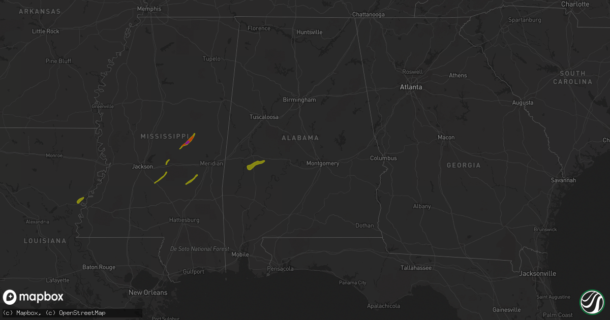
Hail Map in Alabama on April 6, 2014
Get this storm
April 6 map
$229
one time, instant access
Download today. No call, no setup
Keep the $229
Bought the map and want the full workflow? Apply the entire $229 to a subscription within 7 days. None of it is wasted.
Every map, not just this one
This buys you this map. Subscription and you get every map we run, in the markets you choose from a few cities to whole states to nationwide. Plus real-time alerts the moment a storm fires.
Contact data
Name, contact info, occupancy, even credit band for addresses in the footprint. You go from where it hit to who to call.
Become the source they trust
Unlimited branding weather history reports on demand. You already have the documented answer ready for the property owner, and you are the one who showed up with it.
Property data and RoofTrace estimates
Pull up any address you have got, its value and the exact code rules for that jurisdiction, straight from One Click Code. Then RoofTrace estimates the squares, pitch, and roof value, priced the way you price.
Storm reports in Alabama
Alabama
| Date | Description |
|---|---|
| 04/06/20145:38 PM CDT | Large trees reporte down in the hugo community southeast of linden on highway 43. |
| 04/06/20149:25 AM CDT | Approximately 50 trees uprooted and/or snapped on lake lurleen and upper columbus road. |
| 04/06/20146:50 AM CDT | Roof damage to hospital. Approximately one square mile area with trees down/uprooted. |
| 04/06/20146:47 AM CDT | Tree down in the sandcut community in castleberry. Power lines down. |
| 04/06/20146:25 AM CDT | Large tree blown down in whispering pines community of daphne. |
| 04/06/20146:24 AM CDT | Trees and powerlines down. |
| 04/06/20146:11 AM CDT | Tree fell on vehicles. |
| 04/06/20145:29 AM CDT | A few trees were blown down near fort deposit. |
| 04/05/20149:30 PM CDT | Trees down on state road 171 near mile post 40 at tom montgomery road. |
| 04/05/20149:25 PM CDT | Approximately 50 trees uprooted and/or snapped on lake lurleen and upper columbus road. |
| 04/05/20149:24 PM CDT | Trees and power line down all along us 82 near buhl. Also a tree fell on a mobile home just off hwy 140. |
| 04/05/20149:20 PM CDT | Trees down on state road 6 at shelly hughes road. |
| 04/05/20149:14 PM CDT | One chicken house was destroyed and another one was damaged. One barn was damaged. This occurred in the kirk community. |
| 04/05/20148:55 PM CDT | Strong winds downed several large trees along the road from aliceville to carrolton. Beginning time based on radar. |
All States Impacted by Hail Map on April 6, 2014
Cities Impacted by Hail Map on April 6, 2014
- Ferriday, LA
- Clayton, LA
- Fisher, LA
- Florien, LA
- Many, LA
- Hemphill, TX
- Madisonville, TX
- Midway, TX
- Crockett, TX
- Grapeland, TX
- Clifton, TX
- Valley Mills, TX
- Aquilla, TX
- Whitney, TX
- Hillsboro, TX
- Gallion, AL
- Sweet Water, AL
- Demopolis, AL
- Faunsdale, AL
- Linden, AL
- Uniontown, AL
- Philadelphia, MS
- Walnut Grove, MS
- Carthage, MS
- Louin, MS
- Bay Springs, MS
- Rose Hill, MS
- Braxton, MS
- Mendenhall, MS
- Brandon, MS
- Morton, MS
- Big Lake, TX
- Barnhart, TX
- Diboll, TX
- Corrigan, TX
- Groveton, TX
- New Waverly, TX
- Huntsville, TX
- Northport, AL
- Coker, AL
- Fayette, MS
- Thomaston, AL
- Pennington, AL
- Hamilton, TX
- Gustine, TX
- Prentiss, MS
- Apple Springs, TX
- Moscow, TX
- Pollok, TX
- Lufkin, TX
- Huntington, TX
- Etoile, TX
- Spicewood, TX
- Horseshoe Bay, TX
- Marble Falls, TX
- Round Mountain, TX
- Call, TX
- Buna, TX
- Gonzales, LA
- Geismar, LA
- Marlin, TX
- Denham Springs, LA
- Ozona, TX
- Georgetown, TX
- Baton Rouge, LA
- Walker, LA
- Greenwell Springs, LA
- Addis, LA
- Liberty, MS
- Pelahatchie, MS
- San Augustine, TX
- Chireno, TX
- Winona, TX
- Gladewater, TX
- Jackson, LA
- Eastland, TX
- Mertzon, TX
- Zachary, LA
- Pride, LA
- Baker, LA
- Pelican, LA
- Pleasant Hill, LA
- Coushatta, LA
- Plaquemine, LA
- Sunshine, LA
- Fort Deposit, AL
- Honoraville, AL
- Greenville, AL
- Florence, MS
- Harrisville, MS
- Pinola, MS
- Columbia, LA
- Groesbeck, TX
- Welsh, LA
- Ville Platte, LA
- Saint Landry, LA
- Bunkie, LA
- Coahoma, TX
- Gail, TX
- Canton, TX
- Mabank, TX
- Kemp, TX
- Macon, MS
- Lapine, AL
- Buhl, AL
- Kentwood, LA
- Jeanerette, LA
- New Iberia, LA
- Rayville, LA
- Mangham, LA
- Flint, TX
- Tyler, TX
- Paulding, MS
- Quitman, LA
- Jonesboro, LA
- Saint Martinville, LA
- Round Rock, TX
- Leander, TX
- Union, MS
- Coleman, TX
- Erath, LA
- Saint Amant, LA
- Livingston, LA
- French Settlement, LA
- Prairieville, LA
- Kaplan, LA
- Abbeville, LA
- Loreauville, LA
- Franklin, LA
- Gueydan, LA
- Saint Gabriel, LA
- Roseland, LA
- Cisco, TX
- Holden, LA
- Amite, LA
- Montalba, TX
- Athens, TX
- Gordo, AL
- Echola, AL
- Elrod, AL
- Conehatta, MS
- Forest, MS
- Cross Plains, TX
- Fluker, LA
- Chandler, TX
- Raleigh, MS
- Georgetown, MS
- Pulaski, MS
- Newhebron, MS
- Lorman, MS
- Union Church, MS
- Little River, AL
- Jackson, AL
- Mount Vernon, AL
- Pitkin, LA
- Broussard, LA
- Donaldsonville, LA
- Darrow, LA
- Forest Home, AL
- Newton, MS
- Gloster, MS
- Centreville, MS
- Monroeville, AL
- Peterman, AL
- Shelbyville, TX
- Center, TX
- Brusly, LA
- Independence, LA
- Grosse Tete, LA
- Granger, TX
- Port Allen, LA
- Bon Wier, TX
- Silsbee, TX
- Noxapater, MS
- Belmont, LA
- Zwolle, LA
- Castor, LA
- Ashland, LA
- Bartlett, TX
- Chunchula, AL
- Albany, LA
- Hammond, LA
- Springfield, LA
- Saline, LA
- Bienville, LA
- Lake, MS
- Kilgore, TX
- Whitehouse, TX
- Palestine, TX
- Pine Grove, LA
- Stockton, AL
- White Castle, LA
- Carville, LA
- Vancleave, MS
- Coden, AL
- Theodore, AL
- Brooksville, MS
- Larue, TX
- Hornbeck, LA
- Smithdale, MS
- Mccomb, MS
- Tylertown, MS
- Marion Junction, AL
- Odonnell, TX
- Ethel, LA
- Jarreau, LA
- Saint Francisville, LA
- Glynn, LA
- Ventress, LA
- Jennings, LA
- Elton, LA
- Kinder, LA
- Mamou, LA
- Norwood, LA
- Johnson City, TX
- Pine Apple, AL
- Milam, TX
- Lott, TX
- Bertram, TX
- Burnet, TX


