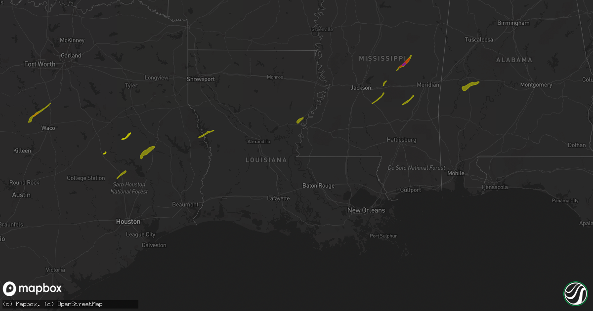
Hail Map in Louisiana on April 6, 2014
Get this storm
April 6 map
$229
one time, instant access
Download today. No call, no setup
Keep the $229
Bought the map and want the full workflow? Apply the entire $229 to a subscription within 7 days. None of it is wasted.
Every map, not just this one
This buys you this map. Subscription and you get every map we run, in the markets you choose from a few cities to whole states to nationwide. Plus real-time alerts the moment a storm fires.
Contact data
Name, contact info, occupancy, even credit band for addresses in the footprint. You go from where it hit to who to call.
Become the source they trust
Unlimited branding weather history reports on demand. You already have the documented answer ready for the property owner, and you are the one who showed up with it.
Property data and RoofTrace estimates
Pull up any address you have got, its value and the exact code rules for that jurisdiction, straight from One Click Code. Then RoofTrace estimates the squares, pitch, and roof value, priced the way you price.
Storm reports in Louisiana
Louisiana
| Date | Description |
|---|---|
| 04/06/20147:32 AM CDT | A local report indicates 1.00 inch wind near 7 E FLORIEN |
| 04/06/20143:15 AM CDT | Over 20 trees were snapped and uprooted along east domiano lane. A storm survey was conducted by nws employees and damage was determined to be from straight line winds. |
| 04/06/201412:40 AM CDT | Roofing of a shed was torn off due to strong thunderstorm winds. |
| 04/05/201411:54 PM CDT | Report from facebook of nickel to quarter sized hail in new iberia |
| 04/05/201411:40 PM CDT | Relayed via social media. |
| 04/05/201411:38 PM CDT | Relayed via social media. |
| 04/05/201411:38 PM CDT | Quarter to golf ball size hail reported in watson. |
| 04/05/201411:33 PM CDT | A local report indicates 1.75 inch wind near 4 S GREENWELL SPRINGS |
| 04/05/201411:30 PM CDT | Tree reported down and quarter size hail at intersection of jefferson highway and sevenoaks avenue. |
| 04/05/201411:28 PM CDT | A local report indicates 1.00 inch wind near BATON ROUGE |
| 04/05/201411:28 PM CDT | Golf ball size hail estimated from pictures in central. Relayed via social media. |
| 04/05/201411:27 PM CDT | Roof off of apartment complex at little john and florida. |
| 04/05/201411:27 PM CDT | Quarter size hail in sherwood. |
| 04/05/201411:27 PM CDT | Winds estimated around 65 to 75 mph around the sherwood forest subdivision. |
| 04/05/201411:26 PM CDT | Quarter size hail in broadmoor subdivision. Relayed via social media. |
| 04/05/201411:26 PM CDT | A local report indicates 1.00 inch wind near 10 E BATON ROUGE |
| 04/05/201411:26 PM CDT | Relayed via social media. |
| 04/05/201411:25 PM CDT | Golf ball size hail near old hammond hwy and jefferson hwy. Relayed via social media. |
All States Impacted by Hail Map on April 6, 2014
Cities Impacted by Hail Map on April 6, 2014
- Ferriday, LA
- Clayton, LA
- Fisher, LA
- Florien, LA
- Many, LA
- Hemphill, TX
- Madisonville, TX
- Midway, TX
- Crockett, TX
- Grapeland, TX
- Clifton, TX
- Valley Mills, TX
- Aquilla, TX
- Whitney, TX
- Hillsboro, TX
- Gallion, AL
- Sweet Water, AL
- Demopolis, AL
- Faunsdale, AL
- Linden, AL
- Uniontown, AL
- Philadelphia, MS
- Walnut Grove, MS
- Carthage, MS
- Louin, MS
- Bay Springs, MS
- Rose Hill, MS
- Braxton, MS
- Mendenhall, MS
- Brandon, MS
- Morton, MS
- Big Lake, TX
- Barnhart, TX
- Diboll, TX
- Corrigan, TX
- Groveton, TX
- New Waverly, TX
- Huntsville, TX
- Northport, AL
- Coker, AL
- Fayette, MS
- Thomaston, AL
- Pennington, AL
- Hamilton, TX
- Gustine, TX
- Prentiss, MS
- Apple Springs, TX
- Moscow, TX
- Pollok, TX
- Lufkin, TX
- Huntington, TX
- Etoile, TX
- Spicewood, TX
- Horseshoe Bay, TX
- Marble Falls, TX
- Round Mountain, TX
- Call, TX
- Buna, TX
- Gonzales, LA
- Geismar, LA
- Marlin, TX
- Denham Springs, LA
- Ozona, TX
- Georgetown, TX
- Baton Rouge, LA
- Walker, LA
- Greenwell Springs, LA
- Addis, LA
- Liberty, MS
- Pelahatchie, MS
- San Augustine, TX
- Chireno, TX
- Winona, TX
- Gladewater, TX
- Jackson, LA
- Eastland, TX
- Mertzon, TX
- Zachary, LA
- Pride, LA
- Baker, LA
- Pelican, LA
- Pleasant Hill, LA
- Coushatta, LA
- Plaquemine, LA
- Sunshine, LA
- Fort Deposit, AL
- Honoraville, AL
- Greenville, AL
- Florence, MS
- Harrisville, MS
- Pinola, MS
- Columbia, LA
- Groesbeck, TX
- Welsh, LA
- Ville Platte, LA
- Saint Landry, LA
- Bunkie, LA
- Coahoma, TX
- Gail, TX
- Canton, TX
- Mabank, TX
- Kemp, TX
- Macon, MS
- Lapine, AL
- Buhl, AL
- Kentwood, LA
- Jeanerette, LA
- New Iberia, LA
- Rayville, LA
- Mangham, LA
- Flint, TX
- Tyler, TX
- Paulding, MS
- Quitman, LA
- Jonesboro, LA
- Saint Martinville, LA
- Round Rock, TX
- Leander, TX
- Union, MS
- Coleman, TX
- Erath, LA
- Saint Amant, LA
- Livingston, LA
- French Settlement, LA
- Prairieville, LA
- Kaplan, LA
- Abbeville, LA
- Loreauville, LA
- Franklin, LA
- Gueydan, LA
- Saint Gabriel, LA
- Roseland, LA
- Cisco, TX
- Holden, LA
- Amite, LA
- Montalba, TX
- Athens, TX
- Gordo, AL
- Echola, AL
- Elrod, AL
- Conehatta, MS
- Forest, MS
- Cross Plains, TX
- Fluker, LA
- Chandler, TX
- Raleigh, MS
- Georgetown, MS
- Pulaski, MS
- Newhebron, MS
- Lorman, MS
- Union Church, MS
- Little River, AL
- Jackson, AL
- Mount Vernon, AL
- Pitkin, LA
- Broussard, LA
- Donaldsonville, LA
- Darrow, LA
- Forest Home, AL
- Newton, MS
- Gloster, MS
- Centreville, MS
- Monroeville, AL
- Peterman, AL
- Shelbyville, TX
- Center, TX
- Brusly, LA
- Independence, LA
- Grosse Tete, LA
- Granger, TX
- Port Allen, LA
- Bon Wier, TX
- Silsbee, TX
- Noxapater, MS
- Belmont, LA
- Zwolle, LA
- Castor, LA
- Ashland, LA
- Bartlett, TX
- Chunchula, AL
- Albany, LA
- Hammond, LA
- Springfield, LA
- Saline, LA
- Bienville, LA
- Lake, MS
- Kilgore, TX
- Whitehouse, TX
- Palestine, TX
- Pine Grove, LA
- Stockton, AL
- White Castle, LA
- Carville, LA
- Vancleave, MS
- Coden, AL
- Theodore, AL
- Brooksville, MS
- Larue, TX
- Hornbeck, LA
- Smithdale, MS
- Mccomb, MS
- Tylertown, MS
- Marion Junction, AL
- Odonnell, TX
- Ethel, LA
- Jarreau, LA
- Saint Francisville, LA
- Glynn, LA
- Ventress, LA
- Jennings, LA
- Elton, LA
- Kinder, LA
- Mamou, LA
- Norwood, LA
- Johnson City, TX
- Pine Apple, AL
- Milam, TX
- Lott, TX
- Bertram, TX
- Burnet, TX


